| Sagarmatha National Park Sagarmatha National Park | |
 | |
Location 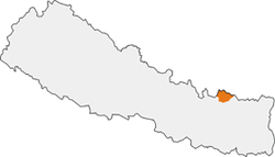 | |
| Area type | National Park |
|---|---|
| State | Nepal |
| Region | Nepalese Himalayas |
| Surface | 1,148 km² |
| Foundation year | 1976 |
| [link not working]Institutional website | |
Sagarmatha National Park (sagaramāthā rāṣṭriya nikuñja, Sagarmatha in Nepali language means "the one whose forehead touches the sky") is a protected area located in Nepal.
To know
It is the most famous nature reserve in Nepal and in 1979 it was declared by theUNESCO World Heritage Site.
Geographical notes
The park is located in eastern Nepal and contains within it a part of theHimalaya, including the southern part ofEverest.
It ranges in altitude from 2,700 meters above sea level Lukla to 2,800 meters of Jorsal to the 8,850 of the summit of Everest.
Flora and fauna

Birch, juniper, pine, bamboo and rhododendron grow in the forest area. Above there are shrubs and other small plants. As the altitude increases, the vegetation becomes composed of mosses and lichens, up to a height of about 5,750 meters, the line of perennial snow in the Himalayas.
Above 3,500 meters, the fir trees thin out, giving way to birches, rhododendrons and junipers. The forests provide habitat for at least 118 bird species, including Himalayan pheasants, bloody pheasants, coral choughs and alpine choughs. Sagarmatha National Park is also home to rare species such as flies, yaks, snow leopards, Himalayan brown bears, and lesser pandas. Other life forms in the park include deer, monkeys, hares, mountain foxes and Himalayan wolves. These animals are present in a few specimens, so they are not always able to be observed.
Oxygen decreases with increasing altitude. The animals that inhabit the park have adapted to the lack of oxygen and low temperatures. They have a thick coat that retains body heat. Bears hibernate during the winter when no food is found.
When to go
In late spring or early autumn; towards its end, it is still possible to go as far as without problems Tengboche. The maximum temperature is 11 ° C in the Khumbu region. The hot season runs from April to early June.
How to get

There are no roads that give access to the area, only footpaths.
By plane
- Airport of Lukla, by flight or helicopter from Katmandu, then one to two days of trekking to reach Namche Bazar (3,440 m). Especially at the end of the season there are long waiting lists at Lukla airport.
- Airport of Tengboche
By bus
From Katmandu to Jiri, the easternmost terminus, by bus; 184km, travel time 6 to 8 hours due to the winding roads. So the walking trail to Lukla takes seven or eight days. Many Everest expeditions have passed through Jiri, called "Gateway to Mt. Everest".
Permits / Rates

The visitor center is located on the top of a hill in Namche Bazar, together with a company of the Nepalese Army which has the task of defending the park. The southern entrance is located a few hundred meters north of Mondzo, at 2,835 meters, one day's travel from Lukla.
At the entrance it is necessary to show the trekking permit and, paying a sum of 1,000 Nepalese rupees (NPR) (about 10 dollars), you receive the entry permit along with instructions and rules that must be respected, including taking any waste out of the Park and respecting wild flora and fauna.
How to get around
Exclusively on foot.
What see

What to do
- 1 Namche Bazar market. Every Saturday morning above the main path of the town of Namche Bazar, the Sherpas of the surrounding valleys sell their agricultural products and electronic products from Katmandu. While the goods themselves may not be of interest to tourists the market itself certainly is. Also worth seeing is the Yak "parking area" above the market.
Shopping
Local handicrafts: wooden or metal figurines, bowls, bronze Tibetan bells, silver bracelets and bangles. Always bargain. Wide choice of clothing and mountain equipment.
Where to eat
Refer to the facilities in the village of Namche Bazar.
Where stay
Refer to the facilities in the village of Namche Bazar.
Safety
The altitude sickness it also affects young and healthy people and is a real problem in the area. If you feel dizzy, have palpitations or have severe headaches, it is necessary immediately return to a lower altitude. Don't take altitude sickness lightly - it can cause death too!
How to keep in touch
Telephony
Italian cell phones work quite well, but voice and data traffic is expensive. Recommended to buy a local sim or make phone calls in the phone center, which have an affordable price, or with Skype in Internet point.
Internet
The village of Namche Bazar has some internet cafes, making it one of the few places in this area of Nepal where you can have internet access. Paid Wi-Fi in many lodges.
Around

Itineraries
Other projects
 Wikipedia contains an entry concerning Sagarmatha National Park
 Commons contains images or other files on Sagarmatha National Park