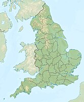
The Peak District is a national park in England. The national park consists of two very different areas: the Dark Peak and the White Peak. The Dark Peak in the north is dominated by high moors and partly rugged sandstone cliffs. The White Peak in the south, on the other hand, is an agricultural region with hills, limestone predominates here. The industrial cities are located around the Peak District Manchester, Sheffield, Nottingham, Derby and Stoke-on-Trent. Most of the park is in Derbyshire, smaller in Cheshire, Greater Manchester, Staffordshire,South Yorkshire and West Yorkshire.

background
| location | ||
| ||
The Peak District is framed by the major industrial cities of Northern England and the East and West Midlands. This means that around half of England's population lives around the national park. This makes it a popular recreation area for many city dwellers, annually around 22 million day visitors. At the beginning of the 1950s, the landscape of the Peak District was endangered by the expansion of the cities and the ever-increasing limestone quarries. In 1951 the 555 mi² / 888 km² national park was established, the first in Great Britain.
history
Traces of human settlement go back to the Neolithic, e.g. the henge (a moat wall construction) with the Arbor Low stone circle and many burial mounds on the peaks have been preserved. Excavations revealed evidence that 4,000 years ago farmers lived on the barren, windy land of Big Moor, Hallam Moor and Beeley Moor.
The first settlers known by name were the Saxon tribe "Pecsaetan", the name means "People of the Peak". This tribe was largely independent of the Kingdom of Mercia, which expanded into the north of England.
Celtic pagan rituals can still be seen in the Peak District today. In many villages there is what is known as “well dressing”, where in summer wells and sometimes springs are decorated with pictures of flowers. Today these pictures have a Christian character. Castelton hosts the Garlanding Ceremony on May 29th, likely a celebration of the return of spring.
The land of the Peak District was owned by a few nobles for many centuries. In the early 1900s, a new movement developed: the walkers. The first clubs were founded and workers from the surrounding towns began to spend the weekends in the countryside. The landowners felt disturbed - after all, they use the land during the pheasant hunt (about 3 weeks a year) and as pasture for their flocks of sheep. In 1932 there were disputes between the owners and the hikers. On April 24th, during the so-called “Children's Mass Trespass”, there were fights between the rangers and hikers. Due to the pressure exerted by the surrounding cities, the decision was finally made to create the national park.
landscape

White Peak
The White Peak consists of an approx. 300 m high plateau with hilly pastureland into which steep-walled valleys have been cut. Clear rivers flow through these valleys, including the Dove, Lathkill, Monifold and Wye. Most of these river valleys can only be reached on foot; they are protected as nature reserves. The White Peak encloses the Dark Peak like a horseshoe.
Dark Peak
The Dark Peak consists of the moors in the north, east and west of the national park. In the barren highlands there are isolated, steep-walled, rocky valleys, rocks formed by the elements (“gate”) and elongated, vertical cliffs (“edge”). The Kinder Scout, a plateau, is 636 m (2,087 ft) above sea level. is the highest point in the Peak District. Together with the Bleaklow (633 m) and Black Hill, it forms the largest contiguous area of England, which is over 610 m high. Overgrazing, acid rain, and natural erosion have caused the earth to disappear, leaving only peat. The peat areas are criss-crossed by natural so-called “groughs” that drain them. In the deeper layers, the subsoil consists of gray sandstone.
National Trust regeneration project
To prevent further damage to moors and heather and to reverse any damage that had already occurred, the National Trust started a 50-year project in 2013. In doing so, the drainage measures are to be removed and the vegetation renewed, for example on the Kinder Scout, around the summit of which the ground has already been severely eroded. Cotton grass, blueberries, cloudberries, crowberries, heather and peat moss were also planted. Furthermore, forests are to be reforested in the steep-walled valleys that lead up to the moor. In addition, these measures are intended to make the black grouse, which disappeared from the Peak District in the 1990s, home again. In total, the project covers an area of around 64 km².
Flora and fauna

The Peak District is the most northerly habitat of many southern species, such as the tree hawk and the nettle-leaved bellflower. On the other hand, the park is the southernmost home of some northern species, including mountain hares and cloudberries. The landscape is particularly beautiful in late July / early August. The land is then covered with a carpet of flowering heather.
White Peak
The grassy landscape and the ash forests form the habitat for many insects, animals and plants. Purple orchids and cowslips bloom in spring. Nodding celibate, spring cinquefoil and blue barrage (heavenly ladder) are rare. In the forests of Lathkill and Dove Dale, various smaller plants grow in the shade of maples and ash trees, including forest ringel, white spice, lily of the valley and primroses. A distinctive feature of the White Peak flora is those that thrive in man-made habitats near the lead mines. In the vicinity of the Magpie Mine (near Sheldon) there is a lot of chickweed.
On the slopes to the west or south, the butterflies Great Blue Sunflower and Sunflower Green Ram can be found.
Birds that breed here include redstart, wood warbler and pied flycatcher.
The dams of the disused railway lines are now a habitat for badgers, foxes and hares who dig their structures into the ground. Weasels find shelter in the cracks of the dry stone walls.
Dark Peak
A completely contrasting landscape can be found in Dark Peak, where the barren upland moors dominate. The birds that live here include the red grouse, curlews and golden plovers, as well as birds of prey such as marsh owls, hen harriers, peregrine falcons and pygmy falcons.
The red grouse is also the reason for the well-tended heather. Every spring a few old areas are burned down to make room for new plants. The birds need the older, woody plants as a place to sleep and nest and younger ones as a source of food.
The mammals living here include mountain hares, badgers and foxes as well as the water voles (genus vole), which are often confused with rats because of their size.
climate
The weather in the Peak District is no different from the rest of England, with the exception of winters in the High Peak: mild winters and cool summers. Because of the altitude, it rains a little more often. The maximum temperatures reach around 20 ° C in summer. The driest month is May.
Winter can be very cold in the High Peak moors, heavy snowfalls are not uncommon, and the snow occasionally lingers through May. The A 57, which runs over Snake Pass and connects Manchester to Sheffield, will then be closed. This also applies to the alternative route (A628) over Woodhead Pass.
places

1 Ashford in the Water: one of the most visited places in the Peak District. Lots of beautiful buildings and the Sheepwash Bridge.
2 Bakewell: the largest place in the Peak District and good for shopping. Lots of old buildings. Many interesting sights (including Chatsworth, Haddon Hall or Lathkill Dale) nearby.
3 Baslowl: consists of three parts. Bridge with customs house from the 17th century.
4 Castleton: pretty place, which is towered over by a castle ruin. Good starting point for hikes, e.g. to Mam Tor. Several stalactite caves in the vicinity.
5 Edensor: a planned village on the site of Chatsworth House
6 Eyam: the village went down in history as a "plague village" because of a self-imposed quarantine. Lots of pretty cottages, Eyam Hall is well worth seeing.
7 Hathersage: one of the larger places in the national park. The grave of Little John, Robin Hood's companion, is in the cemetery of St Michael’s Church. North Lees Hall (on the outskirts) is the model of Thornfield Hall in the novel "Jane Eyre" by Charlotte Bronte.
8 Tideswell: with approx. 2,000 inhabitants the second largest place in the national park. The Church of St. John the Baptist is also called the "Cathedral of the Peaks".
9 Winster: small village with many listed buildings, including the Market Hall.
Tourist information
There are a total of 4 Visitor Centers (NPC) in the Peak District:
getting there
By plane
- Birmingham Airport


 in the Wikidata database") (IATA: BHX) - Distances: Bakewell approx. 110 km, Castleton approx. 130 km.}}
(IATA: BHX) - Distances: Bakewell approx. 110 km, Castleton approx. 130 km.}}


- Manchester Airport
 (IATA: MAN)

In the street
Due to its location in the middle of England, the Peak District is easily accessible from all directions. The M6 Toll (a relief for the old M6) in the Birmingham metropolitan area is subject to toll.
By train
Hope Valley Line running from Northern Rail will operate runs from Manchester Piccadilly to Sheffield. There are train stations in Hope and Heathersage, among others.
By bus
National ExpressBakewell: 440 - Route Leicester, Derby, London
By boat
- Kingston upon Hull with P&O Ferries from Rotterdam and Zeebrugge. Distances: Bakewell approx. 145 km, Castleton approx. 135 km.
- Tynemouth with DFDS from Amsterdam. Distances: Bakewell approx. 260 km, Castleton approx. 240 km.
- Dover with DFDS,P&O and My Ferry Link to Calais as well as with DFDS to Dunkerque. Distances: Bakewell approx. 385 km, Castleton approx. 405 km.
Fees / permits
The national park is freely accessible. Most of the parking spaces within the towns are chargeable.
mobility

By car
The roads within the national park are normal country roads, some of which are very narrow and steep (20 to 25%). Some of the country roads are lined with dry stone walls. Sheep are to be expected on the street.
The road that runs past the reservoirs in the Upper Derwent Valley is closed on weekends in summer and Bank Holiday Mondays and on Sundays in winter from Fairholmes. A minibus then drives at these times.
On foot
- For information on the use of hiking trails, see England (Mobility)
- The public footpaths in the Peak District are well signposted, but it is still handy to have a hiking map with you. Some popular ways are paved with stone slabs to prevent erosion.
Tourist Attractions
Manor houses and castles

10 Chatsworth House: imposing mansion with an extensive collection of paintings and sculptures as well as the State Apartments. The house is in the middle of a landscape park. Several villages belong to the property (Beeley, Edensor, Pilsley).
11 Eyam Hall: small mansion in the middle of town. It was built in 1671 and has been preserved almost unchanged. A small garden is attached to the house.
12 Haddon Hall: Manor house, the oldest parts of which date from the 12th century, rooms worth seeing e.g. the Great Hall or the Long Gallery, medieval frescoes have been preserved in the chapel. The house is surrounded by a garden that is laid out on terraces.
13 Lyme Park: Large mansion surrounded by a spacious garden and park. The house dates from the 16th century and is laid out around an inner courtyard.
14 Peveril Castle: The ruins of the Norman castle (built around 1075) stand high above Castleton on a rock and offer a beautiful panoramic view of the landscape.
Prehistoric sites

15 Arbor Low (near Youlgreave): The henge, a moat wall construction, dates from the Neolithic. Inside the earth walls there is a stone circle whose stones have overturned. Wall and moat are interrupted for the opposite entrances. Nearby is the Gib Hill burial mound.
16 Carl Wark Hillfort (Hathersage Moor): Iron Age hill fortress (possibly even older), which stands on a rock that slopes steeply on three sides, the fourth slowly runs out. The flat side is protected by a prehistoric wall.
17 Mam Tor Hillfort (near Castleton): the hill fortress dates from the late Bronze or early Iron Age. It includes the summit of the 517 m high mountain Mam Tor.
18 Nine Ladies Stone Circle (in Stanton Moor): beautifully situated stone circle on the edge of the forest. The Nine Ladies consist of 10 low stones that are laid out as an oval. The circle dates from the Bronze Age, the tenth stone was not rediscovered until the 1970s. The so-called King Stone is a bit off.
landscape

19 Cave Dale: the steep, dry valley is on the outskirts of Castleton. Peveril Castle sits enthroned on the almost vertical limestone cliffs.
20 Lathkill Dale: Initially (from Monyash) a dry valley with steep limestone walls, later a densely forested river valley with the remains of a few lead mines. Orchids and Jacob's ladder bloom here in spring.
21 Robin Hood's Stride: a rock formation made of sandstone. A small plateau is bounded by the Weasel Pinnacle and Inaccessible Pinnacle. The grooves on one of the rocks were probably caused by running water. Nearby are the small stone circle The Nine Stones (not accessible) and Hermit’s Cave in the forest.
22 Stanage Edge: an approx. 6 km long sandstone drop with bizarre rocks, a cave and a great view over the Peak District. The highest point is High Neb (458 m above sea level), the cliff itself is about 30 m high. At the foot of the demolition there are finished millstones that have never been removed.
23 Stanton Moor: small plateau (280 to 320 meters above sea level) with heather and woods above the Derwent and Wye valleys. In the middle is the Nine Ladies Stone Circle. Some rocks formed by weathering like the Cork Stone or Andle Stone.
24 Upper Derwent Valley: there are three reservoirs in the valley (Ladybower, Derwent and Howden Reservoir). If you have left the wooded slopes behind you, you reach the lonely moors of the High Peak with some striking rock formations.
caves
- Buxton: Poole's Cavern
- Castleton: Blue John Cavern, Peak Cavern, Speedwell Cavern, Treak Cliff Cavern
Just outside the national park
Derwent Valley Mills
The UNESCO World Heritage Site (since 2001) stretches 15 miles from Maltlock Bath to downtown Derby. From the 17th century onwards, water-powered factories were built along the Derwent River, which housed the cotton spinning technique invented by Richard Arkwright. Since the area was rural up to then, housing developments and facilities for the workers were also built.
Buxton
The roots of the city go back to the time of the Roman occupation. They used the warm healing water. The Duke of Devonshire and the architect John Carr are largely responsible for the current appearance of the city. They created The Square, Hall Bank, St. John's Church, and the Grade I listed Crescent in the 1780s. The two different areas within the city make it easy to find your way around. Higher Buxton is the older part with lots of historic buildings. Lower Buxton is on the River Wye.
Matlock Bath & Heights of Abraham
Matlock Bath went from being an insignificant village to a health resort after hot springs were discovered around 1700. The place on the busy A 6 is on the Derwent River and is framed by steep cliffs. Matlock Bath is a popular tourist spot, attractions include the Heights of Abraham, the Peak District Mining Museum, the Life in a Lens Museum of Photography & Old Times and an aquarium, and the Heights of Abraham can be reached by cable car from Matlock Bath to reach. There are walking paths on the hill, you can visit the Masson Cavern and Rutland Cavern, and there is an adventure playground.
activities
Hiking routes and destinations
With the exception of the Moneyash - Bakewell hike through Lathkill Dale, the routes are also suitable for (smaller) children.

- Ladybower Reservoir (approx. 6.5 km). Parking: on the parking lane on the A57 east of the bridge. Ashopton - Whinstone Lee Fields - Cutthroat Bridge - Ladybower Wood - Ashopton. Sights en route: view of the reservoirs and mountains. In August the bog is colored purple by the blooming heather.
- Lathkill Dale: Monyash to Bakewell, approx. 13 km, return by bus. Sights on the way: varied landscape in the valley, steep cliffs, small waterfall and the remains of lead mines (e.g. Bateman’s House). Shorter variant: Park in Over Haddon, take the bus to Moneyash, hike through the valley back to Over Haddon, approx. 6.5 km
- Robin Hood’s Stride & Cratcliff Tor (approx. 4.5 km). Start in Birchover at the Druid Inn. Sights en route: the rocks on Robin Hood’s Stride
- Shutlingsloe, start at the Clough House car park (approx. 5 km). Sights on the way: panoramic view from the summit
- Stanage Edge & Higger Tor (approx. 5 km). Start: Upper Burbage Bridge car park. Sights en route: Robin Hood’s Cave, view over the Peak District. From the Higger Tor you can extend the circuit to the Carl Wark Hillfort and below the Burbage Rocks back to the parking lot.
- Stanton Moor (circular route from the parking lot at the quarry near Birchover, approx. 3 km) Sights on the way: Cork Stone, Nine Ladies Stone Circle, King’s Stone
Long-distance hiking trails
- Derwent Valley Heritage Way 55 mi / 88 km along the River Derwent. The trail begins at Ladybower Reservoir and ends at the River Trent in Shardlow.
- Limestone Way, 74 km / 46 mi, from Castleton, Derbyshire to Rocester, Staffordshire. The path is suitable for hikers, cyclists and horse riders
- Pennine Way, 430 km / 269 mi, from Edale, Derbyshire to Kirk Yetholm (near Kelso) in Scotland
Cycling and walking

Routes on former railway lines
- Monsal Trail, length 8.5 mi / approx. 14 km. Starts at Bakewell and ends about 3 miles east of Buxton, the trail runs through the valley of the Wye
- Tissington Trail, length 13 mi / 21 km, runs from Parsley Hay to Ashbourne
Bike rental
Climb
- At the Stanage Edge
Paragliding
- At the Mam gate
For children
- Adventure playground and farmyard (paid) on the grounds of Chatsworth House Bakewell
- Playground at Ashford in the Water
- Chestnut Center (small zoo specializing in otters and owls) and caves Castleton
- Stainsby Water Mill (Hardwick Estate, near Chesterfield), working, historic mill.
- The National Trust offers so-called “Children's Trail” at some attractions (e.g. in Eyam Hall). The children are given a sheet of paper on which several things (detail from the tapestry or painting, sword hilt, carpet knocker, etc.) that can be seen in the house are depicted. These must be searched for and ticked, there is then a stamp in the shop.
- trip to Birmingham to Sea Life and ride a "Narrow Boat" on the canal
shop
The best option for shopping is within the national park Bakewell, there are among other things outdoor shops, 2 larger supermarkets and a drugstore. Other supermarkets are in Hope and Tideswell.
A special souvenir is jewelry with the semi-precious stone Blue John, which can be found in 2 mines near by Castleton is dismantled.
kitchen
accommodation
The Peak District is well developed for tourism, there are many B & B’s, hotels and holiday homes. See also in the local articles Bakewell, Castleton and Eyam
Hotels and hostels
camping
Camping is expressly forbidden on most of the Access Lands; permission may be obtained from the landowner.
security
- The Peak District is a safe region and mostly quiet. But on weekends it can also get busy, e.g. in Bakewell or at Stanage Edge. As everywhere, it is important to take care of your valuables.
- Particular care should be taken in the High Peak moors. After heavy rainfall, the peat is full of water and becomes boggy, so that you can sink in.
important phone number
999 is the emergency number for the police, fire brigade, ambulance and mountain and cave rescue. Rescue teams can also be reached at 112.
trips
- Birmingham: There are several museums and galleries here (including the Birmingham Museum & Art Gallery), and the city offers many shopping opportunities (including the futuristic Selfridge). The redeveloped Brinleyplace district with its pubs and restaurants on the canal is very popular with locals and visitors.
- Lichfield: The small market town goes back to a settlement from the time of the Romans. There are many listed buildings from different eras. The cathedral with the three towers was built between 1195 and 1249. The building that houses the Tudor Café (Bore Street) dates from 1510.
- Manchester: Once one of the most important cities for the cotton trade, later decried as an ugly industrial city for a long time. In 1996 part of the city center was destroyed by an IRA bomb attack. After the reconstruction, a modern city emerged, in which there are also historical buildings to be discovered. The Gothic cathedral, the neo-Gothic Town Hall, the Corn Exchange (1897, now a shopping center) and the renovated former warehouses along the canals are all worth seeing.
Hardwick Hall, Hardwick Old Hall and Stainsby Mill (Doe Lea, near Chesterfield)
- The Elizabethan mansion Hardwick Hall (built 1590-97) is considered an architectural masterpiece. This is the first time that a building has been erected with so many large windows. Inside, rooms furnished in a contemporary style can be viewed. An extensive garden borders the house.
- Hardwick Old Hall is diagonally across from the "new" house. The old house was given up in favor of the new one. Parts of the elaborate stucco work in the rooms are still preserved. The ruin is accessible, great view from the top floor.
- Stainsby Mill (on the edge of the property): The historic water mill is fully functional
literature
cards
The following maps, suitable for hiking and biking, cover the Peak District. The scale of the maps is 1: 50,000. Sights are listed, as well as pubs, hotels and campsites in rural areas as well as parking spaces. Older editions are sometimes offered on the Internet and in bookstores; the most recent ones are available directly from the publisher. Cost: approx £ 7.00 per sheet.
- Sheffield & Huddersfield (Glossop & Holmfirth), Ordnance Survey Landranger, Sheet 110, ISBN 978-0-319-23187-6
- Buxton & Matlock (Chesterfield, Bakewell & Dove Dale), Ordnance Survey Landranger, Sheet 119, ISBN 978-0-319-23189-0
If you want maps on a scale of 1: 25,000, you need the corresponding Ordnance Survey Explorer sheets, approx. £ 8.00
Hiking literature
- : The Peak District. Crimson Publishing, ISBN 978-1854585257 ; 112 pages. 20 hikes (2.5 km to 7 km), language: English, approx. £ 8.00
- : Kiddiwalks in the Peak District. Countryside Books, ISBN 978 1 84674 136 4 ; 96 pages. 20 hikes (1.5 km to 8 km), language: English, approx. £ 8.00
- 50 Walks in the Peak District. AA Publishing, ISBN 978-0-7495-7443-7 ; 175 pages. Length of hike between 2 and 16 km, language: English, £ 12.00