| Upper Nile (province) | |
 | |
Location 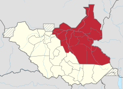 | |
| State | Southern Sudan |
|---|---|
| Surface | 236,208 km² |
| Inhabitants | 2.908.756 (2008) |
Upper Nile is a region of Southern Sudan which corresponds to a Mudiriya (historical province).
To know
It owes its name to the White Nile, a tributary of the Nile.
Geographical notes
It borders to the north with the Sudan, to the east with theEthiopia, to the south with the province of Equatoria and to the west with the province of Bahr al-Ghazal.
Territories and tourist destinations
The province is politically divided into 3 Governorates (in Arabic Wilāyāt, also sometimes referred to as states):
- Upper Nile (governorate)
- Unit (governorate)
- Jonglei
Urban centers
- Bentiu - Capital of the Sudanese state of Unity and located on the southern banks of the Bahr el Ghazal river.
- Bor - Capital of the state of Jonglei and is located off the east bank of the Nile River.
- Fashoda
- Maban
- Maiwut
- Malakal - Capital of the South Sudanese state of the Upper Nile, located on the banks of the White Nile.
- Melut - Located near the border with Sudan.
- Renk - In the northeastern tip of the country on the border with Sudan.
Other destinations
- Boma National Park - Located in a plateau with reliefs that reach over 1,000 m.
How to get
How to get around
What see
What to do
At the table
Safety
Other projects
 Wikipedia contains an entry concerning Upper Nile (province)
 Commons contains images or other files on Upper Nile (province)