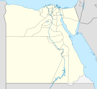
The Bahr Yusuf, also Bahr Yussuf / Yussef / Youssouf, Arabic:بحر يوسف, Baḥr Yūsuf, „Josef Canal“, Is a natural branch of the Nils, which runs on its west side and the drainless Qarun Lake in the el-Faiyūm feeds. The Baḥr Yūsuf is the reason that the agriculturally usable area on the west bank of the Nile is much wider than on the east bank and reaches a width of up to 15 kilometers.
background

The canal has been following since the Middle Ages Joseph, the son of Jacob. Joseph is both in the Bible, gene 37.1 ff. , as well as in the 12th sura des Koran treated.
In addition to the Nile, the Baḥr Yūsuf was important for the irrigation of the fields, which extend up to about 15 kilometers wide on the west side of the Nile, and the annual flooding of the Nile for their fertilization. The supply and prosperity of the population depended and depends on it. In particular, good water management, especially in times of need, is repeatedly addressed by the guest princes in ancient Egyptian times.
Originally the canal branched at Manqabād north of Asyūṭ from the Nile. Since 1870 the canal begins at the weir in Deirūṭ, where the Ibrāhīmīya Channel, which begins in Asyū,, is divided into several irrigation channels. The Baḥr Yūsuf runs west of the Ibrāhīmīya Canal. At el-Lāhūn the channel divides again. The Gīza Canal remains in the Nile Valley, while the Baḥr Yūsuf supplies the Faiyūm with water. The Baḥr Yūsuf is about 330 kilometers long.
The biggest problem at all times has been that of Baḥr Yūsuf too much Water leads. Already in Pharaonic times, in the 12th dynasty, the king let Amenemhet II Carry out renovation work so that parts of the Faiyūm could be reclaimed. In Ptolemaic times, retention basins were at el-Malāʾ, a 15 kilometer long depression in the south of the el-Faiyūm, which lowered the water level of the Qārūn Lake and the agricultural area could be increased again.
getting there
Arrival is usually only possible by car or taxi, on site also on foot. There are slopes in some places on both sides of the canal.
Places on Baḥr Yūsuf
- 1 Deirūṭ, ديروط- County town.
- 2 el-Bahnasā, البهنسا(Oxyrhynchus).
- 3 Ihnāsyā el-Madīna, إهناسيا المدينة- District town and place, the ancient Herakleopolis Magna.
- 4 el-Lāhūn, اللاهون- village. Nearby is the Pyramid Sesostris ’II.
- 5 Hawara, هوارة
- 6 Madīnat el-Faiyūm, مدينة الفيوم- Governorate capital.
Tourist Attractions
- 7 Deirūṭ weir (قناطر ديروط, Qanāṭir Dairūṭ). The weir, built in 1870 and about 170 meters long, divides the Ibrāhīmīya Canal, which flows into Asyūṭ begins, over six individual weirs, including in the Baḥr Yūsuf and the Ibrāhīmīya Channel on. It is the most technically demanding weir along the Ibrāhīmīya Canal.(27 ° 33 '32 "N.30 ° 48 ′ 41 ″ E)
- 8 El-Lāhūn weir (Illahun weir). The weir was built at the time of the sultan Baibars I. (around 1223–1277) and is located on the Nilometer Cairo Nile Island er-Rōḍa the second oldest preserved public building from the Islamic period. The weir has three 2.80 m wide and about 5.30 m high flow openings. Between the openings there are two pyramid-shaped buttresses on the north side. 1241 AH, 1825 AD, for now Muḥammad ʿAlīs, the weir was widened to the south by nine meters.[1] This interface can - theoretically - be made out in the openings. A modern weir is in front of the historic weir.(29 ° 12 '24 "N.30 ° 58 ′ 17 ″ E)
- 9 Qarun Lake (بركة قارون, Birkat Qarun). With a length of 40 kilometers and a width of 5 kilometers, the lake is the largest inland lake Egypt and a Nature reserve.(29 ° 28 ′ 20 ″ N.30 ° 36 '51 "E.)


kitchen
Restaurants can be found in the neighboring provincial capitals, and food stalls in the villages in between.
accommodation
Accommodation is available in the neighboring provincial capitals.
literature
- Weir of el-Lāhūn:
- : The Muslim Architecture of Egypt; 2: Ayyūbids and Early Baḥrite Mamlūks; A.D. 1171-1326. Oxford: Oxford Univ. Press, 1959, P. 173 f., Plate 54.a – c. Reprinted New York: Hacker Art Books, 1978.
Individual evidence
- ↑Further sources at Creswell, K.A.C., The Muslim Architecture of Egypt; 2.


_02.jpg/283px-Relieve_tumba_Satbahetep_(M.A.N._Inv.1976-114-A-2080)_02.jpg)


