 | ||
| Camburg | ||
| federal state | Thuringia | |
|---|---|---|
| Residents | 2.846 (2007) | |
| height | 127 m | |
| no tourist info on Wikidata: | ||
| location | ||
| ||
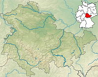
Camburg lies on both sides of the river in the Saale valley north of Jena in the section marked as Thuringian Tuscany referred to as. The valley is cut deep here, the place is dominated by the castle of the same name.

background
Camburg was once the capital of a county that belonged to the Margraves of Lusatia in the 11th century and passed to Bosso Vitzthum v. Eckstädt came. After the castle was destroyed in the Saxon fratricidal war around 1450, the Vitzthum also lost the county, which was now part of Thuringia and when it was divided under Ernsts des Pious Sons, it came to Eisenberg in 1682, but to Gotha in 1707 and was united with Altenburg. From 1826 it belonged to Sachsen-Meiningen.
getting there
By train
Camburg is out with regional trains every hour Nuremberg, Jena, Hall and Leipzig reachable. The 1 Camburg train station is located in the district on the left of the Saale.
In the street
You travel by motor vehicle from the direction of Jena and Naumburg via the B 88.
By bicycle
- The Saaleradweg runs along the Saale and thus right through the village.
- Bike path on the old Zeitz-Camburg railway line; Connection to the Saale Cycle Path is still missing in 2018
mobility
Tourist Attractions

Above the city, on the right side of the hall, rises the 1 Camburg Castle![]()
![]()
![]() , probably from the 12th century. Only the round, Romanesque keep is still original, the rest was destroyed in the Saxon civil war.
, probably from the 12th century. Only the round, Romanesque keep is still original, the rest was destroyed in the Saxon civil war.

In the city itself you can find:
- the 2 late Gothic parish church


 in the Wikidata database") and
and - the 3 Local museum.

If you drive or walk north on the left side of the hall, you will reach the after 1.5 km 4 Ruins of the Cyriakskirche![]()
![]()
![]() . It is a former monastery church from the 11th century, which was abandoned in 1539 after the Reformation. After being used as a quarry for a while, it was rediscovered in 1885 and some restorations were carried out. The Cyriakskirche is one of the few remaining Ottonian buildings.
. It is a former monastery church from the 11th century, which was abandoned in 1539 after the Reformation. After being used as a quarry for a while, it was rediscovered in 1885 and some restorations were carried out. The Cyriakskirche is one of the few remaining Ottonian buildings.

trips
- Dornburg (9 km south, B 88) - 5 Dornburg castles.
- Bad Kosen (11 km north) - Rudelsburg and Saaleck Castle.
- Bad Sulza (11 km northwest) - Toskana Therme.
- Naumburg (14 km northeast, B 88) - Cathedral with donor figures; historic tram.
- Apolda (16 km to the west) - Bell foundry town.

literature
- Johannes Herzog, Margrit Herzog, Camburg an der Saale. Pictures of a small town in Thuringia, Horb am Neckar 1992
- Gotthard Neumann, report on the archaeological investigation of the building site of the youth castle Camburg. In: Jugendburg Camburg, Weimar o.J. 1936 15-20, plate 2; 5-6.
Web links
- http://dornburg-camburg.de/ - Official website of Camburg