
The GR-249 is a circular route with a length of over 650 km and is called "Gran Senda de Málaga". The signage was completed in 2015.
Its route is also followed by a variety of other hiking trails Spain ( E4, GR-242, GR-92, etc.) with molded.
preparation
In addition to the important things (enough water, sturdy shoes), a towel should be taken with you for any river bed crossings. In addition, the tours should not be taken during the warmest season.
getting there
There are many entry points for hiking on the GR-249 and therefore a general description of how to get there is hardly possible.
For the tourist, however, the airport in is certainly a starting point Málaga.
Stages
The following division of stages is based on the GPS tracks provided by the Diputación de Málaga. First of all, it should be pointed out that some of the accommodations mentioned in the official documents are unsuitable for hikers who want to walk several stages. The distances to get there are sometimes longer than the stages themselves and therefore difficult to reach.
The route documentation runs "counterclockwise".
Stage 1 Malaga - Rincón de la Victoria
See also for the time being GR-92
Stage 2 Rincón de la Victoria - Vélez Málaga
Stage 3 Vélez Málaga - Torrox
On the eastern outskirts of Velez Malaga you can find the entry into the 3rd stage in the direction of Torrox1 ; near the sports complex Polideportivo Municipal Fernando Ruiz. The path leads to the Rio Seco and crosses its riverbed to then cross under the highway. The golf course is now on the right-hand side Baviera Golf. It continues to the connecting road Algarrobo Costa - Algarrobo which is then followed in a southerly direction to the beach promenade. From here it goes for the next few kilometers in an easterly direction Mezquitilla and Lagos to El Morche. Between Mezquitilla and Lagos In recent years, a footpath has been laid out next to the N-340A so that you can safely walk along the coast here.

At the beginning of El Morche the course changes to the beach and then to the Paseo Maritimo de Ferrara to Torrox Costa to continue. There are enough opportunities to strengthen yourself. The promenade ends at the viewing platform Balcon del Mediterráneo, right next to the lighthouse that can be seen from afar Faro de Torrox. If you are interested in history, you will find some excavations here.
From here it goes down to the beach again and then the river bed of the Rio Torrox in a northerly direction to Torrox to follow. This stage ends at the southern edge of the old town center of Torrox.
Route length: approx. 19 km - Duration: approx. ?? Hours
Stage 4 Torrox - Nerja
This stage begins 2 on the access road to the old town center, which is built over the edge of the slope. From there the path leads down into the gorge of the El Torrox and up again on the other side - directly under the motorway. On the southern side of the motorway, the path continues towards Nerja. Above the tunnel Túnel Torrox this is crossed and leads to the ridge. The view of the bay of Nerja opens up in front of you. It goes downhill again until you get to the Rio Seco II and this time the motorway is crossed under there. On the other side of the river, the path rises again - but continues further north of the motorway until the side (tunnel) is changed again after 500m. It now goes on to the connecting road Nerja-Frigilianathat a few years ago in Avenida Alcalde Antonio Villasclaras Rosas was renamed.
If you pay attention to visiting the place, you should leave the GR-249 here and follow the streets into the place.
On the other side of the roundabout, the path leads through a depression to a steep slope on the northwestern outskirts of Nerja. A road leads up this slope.3
Route length: approx. 9 km - duration: approx. 3.5 hours
- Official stage description
- detailed hiking trail descriptions with GPS data are available in the blog blog.tappenbeck.net described (German).
Stage 5 Nerja - Frigiliana
After stage 4 there was no official definition of the route Nerja there is the starting point for the next stage at the entrance gate to the Hell of Nerja (Cuevas de Nerja).
To the north you follow a well-paved path (approx. 4km) to the north to the picnic area El Pinarillo4 . Here you can also replenish your drinking water supplies. The path continues northwards through a slight depression and then changes to a westerly direction. You also follow this path for about 2 km before you follow a path that turns left into the valley 5 . After another kilometer you come to the river bed of the Rio Chillar At the crossing of which the path markings have to be searched for a bit 6 . From there the path leads uphill again in a westerly direction, on the mountain flanks and ridges. If you stand on the last ridge and Frigiliana lies in front of you, then you have to go back to the valley of the Rio Higueron be descended. Here you have to follow the course of the river for a while before going up into the village.
Route length: approx. 15 km - duration: approx. 5 hours
- Official stage description
- detailed hiking trail descriptions with GPS data are in the blog blog.tappenbeck.net described (German).
- A description and photos of the route can also be found on the blog hikeminded.blog (English)
Stage 6 Frigiliana - Cómpeta
Stage 7 Cómpeta - Canillas de Aceituno
Stage 8 Canillas de Aceituno - Periana
Stage 9 Periana - Pulgarín Alto
- Official stage description
- Short description and photos of the route on the blog hikeminded.blog (English)
Stage 10 Pulgarín Alto - Alfarnate
- Official stage description
- Short description and photos of the route on the blog hikeminded.blog (English)
Stage 11 Alfarnate - Villanueva del Rosario
Stage 12 Villanueva del Rosario - Archidona
Stage 13 Archidona - Villanueva de Tapia
Stage 14 Villanueva de Tapia - Villanueva de Algaidas
Stage 15 Villanueva de Algaidas - Cuevas Bajas
Stage 16 Cuevas Bajas - Alameda
Stage 17 Alameda - Fuente Piedra
- Official stage description
- Short description and photos of the route on the blog hikeminded.blog (English)
Stage 18 Fuente de Piedra - Campillos
- Official stage description
- Short description and photos of the route on the blog hikeminded.blog (English)
Stage 19 Campillos - Embalses del Guadalhorce
Stage 20 Embalses del Guadalhorce - Estación del Chorro
Stage 21 Estación del Chorro - Ardales
- Official stage description
- Short description and photos of the route on the blog hikeminded.blog (English)
Stage 22 Ardales - El Burgo
Stage 23 El Burgo - Ronda
Stage 24 Ronda - Estación de Benaoján
Stage 25 Estación de Benaoján - Jimera de Líbar
Stage 26 Jimera de Líbar - Benalauría
Stage 27 Benalauría - Genalguacil
Stage 28 Genalguacil - Casares
Stage 29 Casares - Estepona
Stage 30 Estepona - Marbella
Stage 31 Marbella - Ojén
Stage 32 Ojén - Mijas
Stage 33 Mijas - Benalmádena
Stage 34 Benalmádena - Alhaurín de la Torre
Stage 35 Alhaurín de la Torre - Málaga
...
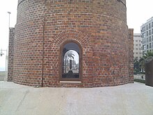
On the last section of the GR-249, reference is made again to the old chimney on the promenade of Málaga. There's a in this chimney Foucault's pendulum hung and can be observed through a pane of glass. 7
...
Web links
Official website for the GR-249
Complete Description of the trail in English including detailed information on all stages