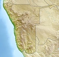
Kavango (less often too Okavango) is one of the 13 regions of Namibia and is located in the northeast of the country. The region is named after the Kavangos, an ethnic group of Namibia known for their wood carvings. The regional capital Rundu is after Windhoek the second largest city Namibia.
| location | ||
| ||
Regions
places
- Rundu, Capital of Kavango
- Andara,
- Nkurenkuru,
- Mpungu
Other goals
- Kavango Museum
- Khaudom National Park
- Popa Falls near Bagani
- Mahango wildlife park
background
The region is largely determined by the river Okavango and its wide floodplain, which forms a natural border between Namibia and over the entire northern border and a length of around 400 kilometers Angola forms.
The Kavangos are a river people who until today secured their survival mostly with fishing from the Okavango and, to a lesser extent, agriculture. The river is the lifeline for the region. To date, Kavango also consists of the five Kingdoms Mbunza, Kwangali, Shambyu, Mbukushu and Gciriku - each of which has a king (Hompa) as the traditional leader.
Missionaries opened up Kavango relatively late. Apart from a few missions (1910 Nyangana, 1914 Andara, 1927 Tondoro, 1929 Bunya, 1930 Shambyu) the Kavangos had almost no part in the often bloody colonial time for many Hereros and Nama. Compared to other regions of Namibia, Kavango opens up an often untouched and certainly more African impression.
Since the Kavangos settled on both sides of the Okavango, Rundu (and the villages along the Okavango / border with Angola) only became regularly military during the Angolan-supported Namibian War of Independence (1966 to 1988) and at the same time during the civil war in Angola (1975 to 2002) Raids against relatives from Angola hit.
Today the region is still one of the poorest regions in Namibia. Since the completion of the Trans-Caprivi trunk road to after Zambia especially experiences Rundu an economic upswing and even greater immigration.
language
The Kavangos speak RuKwangali (a Bantu language), and in many places English or Afrikaans. In Rundu you can occasionally get through in German, but mostly only in the lodges.
getting there
- Rundu airport, scheduled flights with Air Namibia Windhoek or charter flights
- National road B8 Tsumeb (250 km from Grootfontein to Rundu) or from the Caprivi Strip (500 km from Katima Mulilo to Rundu)
mobility
There are tarred roads (apart from the B8) only in Rundu. The gravel roads and slopes can, however, be conveniently used by car.
Tourist Attractions
- Street markets and market halls in Rundu, carvings and other African handicrafts
- Andara is an old mission from 1912 and owns a Roman Catholic brick church
- Nkurenkuru is the ancient capital of the Kavango and seat of the Uukwangali kings. On the opposite side of the river is Cuangar (former fort Kuangar of the Portuguese)
activities
- In Rundu and the individual river lodges, river and canoe trips are offered on the Okavango.
- Safaris in the savannah
kitchen
nightlife
security
climate
Kavango is part of the northern foothills of the Kalahari Basin, a high plateau at an altitude of about 1000 m. Just like all of northern Namibia, Kavango belongs to the tropics, which makes the region significantly greener than Central- and South Namibia. Malaria and other vaccinations are advisable. The south of Kavango is mostly steppe or savannah in which safaris sometimes take place.