The Tarapacá region is in the north of Chile. It is shaped by the Atacama Desert. It has not been the northernmost region of the country since 2007, since this year the Región de Arica y Parinacota was split off from her.
Regions

Map of the Tarapacá region
places
Outside the metropolitan area of the capital Iquique, the region is only very sparsely populated.
- 1 Iquique


 in the Wikidata database") (150,000 inhabitants), important port city on the Atlantic coast
(150,000 inhabitants), important port city on the Atlantic coast - 2 Pozo Almonte (7,000 inhabitants) in the south
- 3 Pica (3,000 inhabitants)
- 4 Huara
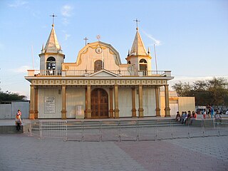
- 5 La Tirana, (1,000 inhabitants), place of pilgrimage in an oasis of the Atacama Desert. Known for its city festival in mid-July, where traditional dances with devil costumes (Diabladas) are listed. The Fiesta de La Tirana is the most famous traditional city festival in Chile and attracts between 100,000 and 200,000 visitors per year


Other goals

background
language
getting there
mobility
Tourist Attractions
- Iquique old town
- 2 Humberstone and Santa Laura (Oficinas salitreras de Humberstone y Santa Laura).19th century salt extraction complex. Today a UNESCO World Heritage Site.


activities
kitchen
nightlife
security
climate
The climate is subtropical and very dry, on the coast the heat is dampened by frequent fog and the sea breeze.