The Dinkelberg is in the southwest of Baden-Wuerttemberg.

Map of the Dinkelberg region
Regions
The small region Dinkelberg bordered in the south by the Rhine and the Switzerland, in the west it extends to Lörrach, in the east to Weir, in the north this forms Wiesental the border.
places
- 1 Maulburg


 in the Wikidata database")
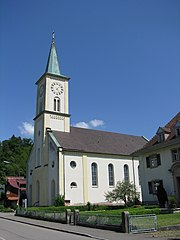
- 2 Schopfheim
- 3 Weir
- 4 Schwörstadt
- 5 Rheinfelden
- 6 Inzlingen
- 7 Grenzach-Wyhlen
- 8 Loerrach
- 9 Stones


_Blick_auf.jpg/350px-Wehr_(Baden)_Blick_auf.jpg)


Other goals

Erdmannshöhle
background
The Dinkelberg is a geological peculiarity because it cannot be counted either in the Black Forest or in the Jura Mountains of Switzerland. It shows characteristics of a karst area, so the 1 Tschamberhöhle![]()
![]()
![]() and the 2 Erdmannshöhle
and the 2 Erdmannshöhle![]()
![]()
![]() and some sinkholes.
and some sinkholes.


language
getting there
In the street:
- Of the
 Motorway exit
  68 Because on the Rhine goes the
  across the region to the Hochhrein triangle, from where the
  to Rheinfelden and the Swiss border.
 - The
 leads on the southern edge of the region from Grenzach-Wyhlen to Säckingen.
 - The
 goes on the northern edge of the region through the Wiesental from Weil to Schopfheim
mobility

Map of Dinkelberg
Tourist Attractions
- The highest elevation is that 3 High Flum at 535 m above sea level NN.
- The 4 Hirzenleck is 523 m high, there is an observation tower on its summit
- The 5 St. Chrischona - the third highest mountain at 522 m. Local mountain of Basel.

