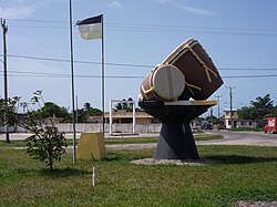
| Stann Creek District | |
 | |
Location  | |
| State | Belize |
|---|---|
| Capital | Dangriga |
| Surface | 2,176 km² |
| Inhabitants | 24.548 (2000 census) |
| Institutional website | |
Stann Creek District is a region of Belize.
To know
Southern Belize (understood as the set of districts of Stann Creek and Toledo) absorbs fewer visitors and in many ways constitutes a classic destination off the beaten path despite the government's efforts to increase the number in exchange for often high prices. The land connection is ensured by the state road that starts at Belmopan and stops at Punta Gorda. From here it is possible to access the neighboring area Guatemala only by sea through a somewhat random ferry service.
The tourist interest of southern Belize lies in the villages along the coast between mangrove forests and mainly inhabited by the Garifuna, descendants of slaves Africans who rebelled against the English and then mingled with the Arawaks and other native peoples of the gods Caribbean. The mountainous hinterland is instead scattered with villages inhabited by Mayan peoples in whose surroundings there are ruins of modest importance.
Territories and tourist destinations
Urban centers
- Dangriga - District capital, formerly known as Stann Creek Town. It is a commercial port from where you board for the southern cays.
- Big Creek - Main port of the district.
- Hopkins - Garifuna fishing village 16 km south of Dangriga which has recently started a promising career as a seaside resort.
- Placencia - Seaside resort in the extreme south of the district between the lagoon and the open sea.
- Seine Bight (Maya Beach) - Tiny fishing village just north of Placencia on the estuary of the river of the same name.
- Sittee River - Village near the estuary of the homonymous river.
Other destinations
- Cockscomb Basin Protected Natural Area - Also known as the jaguar reserve, it can be reached via a track that branches off from the Southern Highway at the Maya Center village.
- Davis Falls - Other waterfalls that flow over smooth and shiny granite boulders and then form a natural pool where you can take a swim. They are among the highest in the Belize. To see them you have to walk a rather challenging path that branches off from the Hummingbird Highway, as well as fording a number of streams, although some volunteers are building small bridges. If you are lucky you can get on a wagon used to transport the tropical fruit collected in the area.
- Five Blues Lake National Park - A small lake in the middle of the tropical forest. Its surface takes on different colors of blue depending on the time, hence the name. Numerous orchids and bird species live there but also felines, tapirs, armadillos and peccaries, the latter similar to our wild boar. The park is located near the village of St. Margaret and is administered by the local community which also runs the nearby campsite and a few B & Bs. It is located on the Hummingbird Highway bordering the Cayo District.
- Mayflower Bocawina National Park - An idyllic spot near Dangriga with 3 twin waterfalls.

Southern Cayes
Tiny and typically difficult to reach, the southern Cayes are far less crowded than their northern sisters.
- Glover's Reef - It is the name of one of the three coral atolls located off the coast of Belize.
- Sapodilla Cayes - Farther than the mainland, east of the Snake Cayes, are part of a protected marine reserve, designated byUNESCO "World Heritage".
- Snake Cayes - 4 uninhabited islets off the coast between Monkey River Town is Punta Gorda.
- Southwater Caye - Islet which includes the South Water Caye Marine Reserve[1][link not working].
- Tobacco Caye - Islet 10 miles east of Dangriga.
How to get
How to get around
What see
What to do
At the table
Safety
Other projects
 Wikipedia contains an entry concerning Stann Creek District
 Commons contains images or other files on Stann Creek District
