| Evere | |
 | |
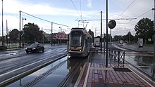
| Photorama of Evere | |
| Information | |
| Country | |
|---|---|
| Region | Brussels-Capital |
| Watercourse | Kerkebeek |
| Altitude | Between 16 and82 m |
| Area | 5,02 km² |
| Population | 43 018 hab. () |
| Density | 8 569,32 inhab./km² |
| Nice | Everois |
| Postal code | 1140 |
| Telephone prefix | 32 2 |
| Location | |
 50 ° 52 ′ 9 ″ N 4 ° 24 ′ 19 ″ E | |
| Official site | |
Evere (pronounced [evɛɹ]) is a municipality of Brussels-Capital Region. It is the last municipality in the region, with Haren, to have urbanized. The vast majority of buildings date from the second half of the XXe century. The built space is only 46% and the population density is close to 7,600 inhab./km2. Public parks and private gardens are legion there and the latter are often interspersed with alleys where it is good to stroll, on foot or by bike, summer and winter. The main tourist attraction is the haven of peace represented by 38 hectares from Brussels cemetery, the largest in the Brussels region and listed as part of the real estate heritage of this region.
Understand
Evere is above all characterized by the qualitative lifestyle and the social and cultural mix of its population composed mainly of low-income people, the middle class and civil servants employed in the territory of the neighboring municipality of Haren (often confused with Evere ) either toNATO either to Eurocontrol. The fact that, in the Brussels Region, it is the 8e common out of 19 in terms of living space per inhabitant and that nature is present everywhere are no strangers to this quality of life either.
It is also the fifth Belgian municipality and the only one in the Brussels-Capital Region to have received the certificate Cittaslow which labels, throughout the world, administrative entities favoring new urban planning and having a program intended to slow down the pace of life of their citizens.
- Cittaslow – The philosophy Cittaslow.
Geography
Evere is located at 4,6 km north-east of the "little belt" of the city of brussels, To 38,8 km south ofAntwerp, To 86,4 km West of Cork and, for lovers of unusual walks, at 32,7 km north-west of 1 geographical center of Belgium .
Located east of Brussels-Capital Region, it borders on three other municipalities of this one (city of brussels by Haren, Schaerbeek and Woluwe-Saint-Lambert) and a municipality of Flemish region (Zaventem by Woluwe-Saint-Etienne).
Topography
With an area of 5,02 km2, the town has only a small sub-tributary of the Senne, the Kerkebeek. Its general relief is that of an eroded plateau, the Loo plateau, which is surrounded by the valley of the Senne to the north, the valley of Maelbeek to the west and that of Woluwe to the east. The lowest altitude is 16 meters on the banks of the Kerkebeek during its 2 entry into the town of Schaerbeek and the highest altitude is 82 meters away on the3 avenue Léonard Mommaerts .
Weather
The climate is oceanic with a temperate summer. The table of meteorological records can be consulted in the section "Weather »Of the article devoted to Brussels-Capital Region. The Royal Meteorological Institute of Belgium (IRM), where these readings come from, is located at 9 kilometers great circle to the south-southwest of central Evere and is also on a plateau. The meteorological readings which are carried out there are similar to those which could be carried out in Evere.
Toponymy
The oldest written document in which appears, for the first time, the name Everna (otherwise noted Euerna) is an act of donation, dated 1120, in which the Bishop of Cambrai donates the altars of Scarenbecca (Schaerbeek) and D'Everna (Evere) in the chapter of Soignies, then Everne (otherwise noted Euerne) around 1185. The current spelling appears for the first time in a document from 1491.
The origin of the toponym Evere is obscure. According to some, Everna would go back to celtic * abrona "Passage, ford", the ancient via publica Roman enters Kortrijk and Tongeren also crossed the Senne at this point. Another hypothesis sees in Everna a collective noun, that is to say a term in the singular designating a plural such as, for example, "crowd", based on the original word of Old Bas Francique * evora-, hence the overall meaning of "place of wild boars", that is to say a name resulting from the lower Franc hever which means "goat".
Story

Until the end of the First World War, Evere was a town with an essentially agricultural vocation. Cereal crops, carrots and turnips (the latter is renowned throughout Europe) dominated until the introduction of the potato in the second half of the crop. XVIIIe century. In the last quarter of XIXe century, following the massive importation into Europe of wheat from the United States and the Russian Empire, Everois farmers retrained in market gardening and especially in the production of witloof ("White sheet" in Brabant dialect) that the Belgians call "chicon" and the French "endive".
From 1919, a certain industrialization based on aeronautical construction settled thanks to the presence of the first national aerodrome built straddling the town and that of Haren and, consecutively, at the aircraft manufacturer's plant Alfred Renard.
After the Second World War, the explosion of demography and the scarcity of free dwellings or free building plots in the Brussels region accelerated the disappearance of agricultural land in favor of urbanization. This increased further, from 1968, with the arrival on Haren of the'NATO on the disused site of the old airfield. This establishment also leads to the arrival of a number of companies from the tertiary sector for which the 4 Da Vinci Research Park , also nicknamed the Silicone valley from Brussels, between Evere and Haren.
The "History" section is taken from the detailed French Wikipedia article entitled "History of the municipality of Evere » (see the list of authors).
Bibliography
- Pieter Cnops, Evere, Vroeger - Formerly, t. I, Nieuwkerken-Was, Éditions Het Streekboek, 1977, 214 p. (ISBN2-66077-300-9), KBR code 9 B / 1998/461) - Bilingual Dutch-French book.
- Pieter Cnops, Evere in old postcards, Zaltbommel, Europese Bibliotheek, 1972, 80 p. (OCLC 37806934) - Bilingual Dutch-French book.
- Pierre-Jean Tribot and Paul Defawe, Evere, Brussels, CFC-Éditions, 2006, 71 p. (ISBN978-2-930018-62-1), OCLC 800180427, KBR code 69_1583095).
- Marie Resseler, Evere à la carte, Brussels, P. Crahay, 2011, 30 cm × 15 cm, 42 p. (read online) (KBR code BRO 2012 218) - Bilingual French-Dutch book.
To go
By plane
Evere is served by theBrussels-National airport. It is, moreover, the first municipality of the Brussels-Capital Region crossing coming from this airport.
Taxis, equipped with a license that can be identified by the blue and yellow emblem of this license, remain permanently available in front of the arrivals hall (level 0).
The buses are also on level 0. Line 272 and express line 471 of the De Lijn company connect the airport to the Brussels-North station, via the NOT21 (Chaussée de Haecht). The buses 21 (Between 20 h and 0 h as well as Saturdays and Sundays) and 12 of the STIB connect the airport to the city of Brussels via Evere.
Six international car rental agencies have desks in the Arrivals Hall.
- Rental car at the airport (level 0 (arrivals hall))
By train
Evere has two stations:
- 1 Evere station Godefroid Kurth Street
 Ticket distributor with Bancontact / credit card / Proton / Mobib functions. –
  The station is served by the Omnibus (L) and Rush Hour (P) trains of line 26 between Hal and Vilvoorde.
 - 2 Bordet station Avenue Jules Bordet Ticket distributor with Bancontact / credit card / Proton / Mobib functions. – The station is served by the Omnibus (L) and Rush hour (P) trains of line 26 between Hal and Vilvoorde.
By car
From Brussels

Departing from R20 (« small belt "), Take the" Madou "exit towards the NOT2 (Chaussée de Louvain) to Place Meizer. To the east of Evere, continue straight on the Chaussée de Louvain; for the west, turn left on R21 (Boulevard Général Wahis) to NOT22 (boulevard Léopold III), turn right.
From the east
From Leuven, Cork, etc. over there E40, take the exit 19 (Evere-Woluwe). Take on the right the NOT294 (avenue des Communities) and, at the first crossroads, continue opposite on avenue Cicéron except for the south of the town where it is necessary to take, on the left, the NOT2 (Chaussée de Louvain).
From other directions
Join the motorway ring road R0, at the “Sint-Stevens-Woluwe” motorway junction take the direction “E40 Brussel ”then refer to the“ From the East ”section above.
Distances, times and routes
| Routes via Evere |
| Brussels (Pentagon) ← Schaerbeek ← | O | → Woluwe-Saint-Etienne → Dutch border (Maastricht) |
| Brussels (Pentagon) ← Schaerbeek ← | O | → Haren → Betekom (NOT21B) |
| End ← R21 ← | O | → A201 → End |
| Leuven ← Haren ← | NOT | → Meiser → Hal |
| Mechelen ← Haren ← | NOT | → Meiser → Brussels-Luxembourg |
| Essen ← Vilvoorde ← | NOT | → Meiser → Delta |
Circulate
By public transport

- STIB (Brussels intercommunal transport company) ,
 32 70 232000 application for real-time timetables to download.
- trams:
- 32 Dogenbos-Château ↔ Da Vinci
- 55 Rogier (metro lines 2 and 6) ↔ Da Vinci
- 62 (own site) Jette cemetery ↔ Eurocontrol
- bus:
- 21 Brussels-Luxembourg SNCB station ↔ NATO. Between 20 h and 0 h as well as Saturday and Sunday, extension until theBrussels-National airport following special pricing.
- 45St. Vincent ↔ Roodebeek metro station (metro line 1)
- 59 Etterbeek-Ixelles Hospital ↔ Bordet SNCB station
- 63 De Brouckère (metro lines 1 and 5) ↔ Brussels cemetery
- 64 Porte de Namur (metro lines 2 and 6) ↔ Machelen
- 65 Brussels-Central SNCB station (metro lines 1 and 5) ↔ Bourget
- 66 De Brouckère (metro lines 1 and 5) ↔ Toll
- 69Schaerbeek SNCB station ↔ Jules Bordet
- 79 Schuman (metro lines 1 and 5) ↔ Kraainem (metro line 1)
- 80 Porte de Namur (metro lines 2 and 6) ↔ Maes
- 12 (express line with special pricing) Brussels-Luxembourg SNCB station ↔ Brussels-National Airport,
- NOT04 (night bus that runs from 0 h 20 - 3 h the nights from Friday to Saturday and from Saturday to Sunday) Bourse ↔ Brussels cemetery
- trams:
- From Lijn , 32 70 220200
- buses 318, 351 358 and the express line 410, terminus at the Brussels-North Station via the NOT2 (Chaussée de Louvain)
- bus 270, 271, 272 and the express line 471, terminus at the Brussels-North Station via the NOT21 (Chaussée de Haecht)
By bike

The municipality has a network of approximately 42 kilometers cycle lanes in very good condition, either on own site cycle lanes or on road lanes. 70% of one-way roads are two-way cyclable.
Many gentle traffic lanes, that is to say reserved for pedestrians and cyclists, cross the town and more particularly the part to the south of the NOT22 (boulevard Léopold III).
The shared bicycle service company Villo! has set up thirteen stations in Evere and one station on the border with Schaerbeek ("RTL" station):
| No. | Last name | Location |
|---|---|---|
| 260 | 1 Triton | Veterans Avenue |
| 261 | 2 Consciousness | Avenue Henri Conscience, 83 |
| 262 | 3 Peace | Peace Square, 24 |
| 263 | 4 Communal house | Square Servaes Hoedemaekers |
| 264 | 5 Our Lady | Avenue Notre-Dame, 53 to 61 |
| 265 | 6 Evere Shopping | Leisure Avenue |
| 266 | 7 Bordet station | Chaussée de Haecht, 1147 |
| 267 | 8 Geneva | Rue de Genève, 12 |
| 268 | 9 Dunant | Avenue Henri Dunant (crossroads with Avenue des Anciens Combattants) |
| 269 | 10 Cicero | Chaussée de Louvain, 1166 |
| 270 | 11 From Paduwa | Avenue des Anciens Combattants, 1 |
| 310 | 12 St. Vincent | Stroobants Street, 53 to 60 |
| 323 | 13 Hull | Avenue Léon Grosjean (crossroads with rue Colonel Bourg) |
| 143 | 14 RTL | Chaussée de Louvain, 771 (Schaerbeek) |
- Villo! – Application to download to find a station, the number of bikes available and the number of free attachment points.
Walk
Getting around on foot in Evere is easy. The sidewalks are wide and in good condition, and the many gentle lanes offer appreciable shortcuts in the middle of city blocks.
By car
The maximum authorized speed is everywhere limited to 50 km / h except around schools where it is limited to 30 km / h and in residential areas where it is limited to 20 km / h.
Five motor vehicle parking authorization systems exist:
- red zones (high turnover), limited to shopping areas and services leading to a very high demand for short-term parking. Parking is limited in time and is payable by everyone by removing a ticket from the parking meter. Parking is limited in time and is chargeable for everyone, even for holders of a resident's card. The first quarter of an hour is free provided you have taken a ticket from the parking meter and placed it visibly in your vehicle. Valid from 9 h - 18 h Monday to Saturday.
- orange zones (intermediate rotation), where the activity is more local than regional. Parking is limited in time and is chargeable for everyone, even for holders of a resident's card. The rate at the parking meter is different vis-à-vis a red zone. The first quarter of an hour is free provided you have taken a ticket from the parking meter and placed it visibly in your vehicle. Valid from 9 h - 18 h Monday to Saturday ;
- green areas (limited rotation), where there is less demand for short-term parking. Parking is limited in time and is chargeable for everyone; people with a resident's card can park freely. The first quarter of an hour is free provided you have taken a ticket from the parking meter and placed it visibly in your vehicle. Valid from 9 h - 18 h Monday to Saturday ;
- blue areas (gentle rotation), where parking pressure increases due to the proximity to areas where parking is regulated and due to the presence of many businesses and other socio-economic activities. Parking is authorized by means of the blue disc (maximum two hours), the resident's card or, failing that, the payment of the “half-day” parking ticket. Valid from 9 h - 18 h Monday to Saturday ;
- neutral zones, zones accessible to all without tariffs or time limits.
- Motor vehicle parking – Map of the parking lot at the bottom of the web page.
To see


- 1 Brussels cemetery Avenue du Cimetière de Bruxelles (bus 636680, stop "Cimetière de Bruxelles"), 32 2 7029180 from Tuesday to Sunday from 8 h 30 - 16 h.
 free. –
  38 hectares. Inaugurated in 1877 on the territory of the municipality of Evere, it is the largest cemetery in the Brussels-Capital Region. It takes the form of a landscaped park with wide avenues, many trees and flowerbeds. It includes various memorial necropolises including that of the fighters of the Belgian Revolution, of the battle of Waterloo, the two world wars and, in another genre, the fire at the Innovation store. Among the personalities buried there, in addition to the mayors of the city of Brussels, we find the French painter Jacques-Louis David, the football coach Raymond Goethals, the founder of SABCA and first director of Sabena Georges nelis, the creator of the body mass index Adolphe Quetelet, the composer of the Belgian national anthem Francois Van Campenhout, the Minister of State Paul Vanden Boeynants, the architect, among others, of the Royal Military Academy of Brussels Henri Van Dievoet, the founder of the Free University of Brussels Theodore Verhaegen, etc. In addition to the site, 38 burials, including that of the painter Jacques Louis David, are separately classified as the protected heritage of the Brussels-Capital Region.
 - 2 Schaerbeek cemetery Rue d'Evere, 4 (bus 6980, “Jules Bordet” stop) from Tuesday to Sunday from 8 h 30 - 16 h. free. – 25 hectares. Inaugurated in 1953 on the territory of the municipality of Evere, this cemetery houses, among other things, the remains of the surrealist painter René Magritte and his wife Georgette, that of the resistant, and co-founder of the Comète network, Andree De Jongh as well as that of the former Belgian Prime Minister and Minister of State Henri jaspar.
- 3 Church of St. Joseph Place Jean De Paduwa (bus 456680, stop "Paduwa") every day of 9 h - 18 h. free. –
 (3 steps at the entrance). Inaugurated in 1906, among the remarkable objects there is a composite tribune organ dating from the 1920s, the work of the maker Théo Boeckx, the stained glass windows of the choir and the baptismal font.
 - 4 Sculpture Parallel Universes Square of the Parallel Universes (tram 62 bus 2165, “Lekaerts” stop - bus 45, stop "Permeke") – Monumental sculpture in polished steel by Fabienne Defrance in honor of the artistic concept of parallel universes invented by sculptor Vincent Strebell.

- 5 Brussels Museum of the Mill and Food Rue du Moulin à Vent, 25-27 (bus 6465, “Notre-Dame” stop), 32 2 2453779, fax : 32 2 2452702, e-mail : [email protected] Wednesday and Friday from 10 h - 17 h, Saturday and Sunday from 13 h - 17 h 30 - Calendar of exhibitions and activities. (2015) adults: 3,5 €, seniors, students, PMR : 2 €, under 12: free (updated full rates). – Presentation of objects relating to the history of the mill and the milling in an old windmill built in 1841, as well as, each year, a temporary exhibition on a theme linked to food. Guided tours, gourmet tours, culinary workshops for groups or individuals, children's courses, courses for children.
- 6 Municipal history museum Rue Édouard Stuckens, 11-13 (trams 3255, stop "Tilleul"), 32 2 2453779 Wednesday: from 13 h - 17 h, last Sunday of the month: from 14 h - 17 h. free. – Small museum, open since 1994, housed in a house from the end of XIXe century, which traces the history of the town through various objects of daily life and paintings by local artists.
- 7 't Hoeveke Rue de la Marne, 3 (trams 3255, stop "Tilleul" or "Paix" - bus 64 stop "Peace") the exterior and the courtyard are permanently accessible. free. – (only on the ground floor) Small farmhouse, ’T hoeveke, in Brabant dialect, means "the farmhouse", built in 1638 which constitutes the oldest rural heritage of the town. Now owned by the municipality of Evere, it has been completely restored and transformed into a party room.
- 8 Doolegt educational park Marne Street (bus 5969, “Picardy” stop) permanently open. free. – 2.5 hectares. The town has built an artificial pond there 200 m2. The set allows children of municipal primary education to become aware of the protection of nature and the importance of biodiversity.

- 9 Saint-Vincent Church Place Saint-Vincent (bus 45596469, “Saint-Vincent” stop) open saturday and sunday. free. – (3 steps at the entrance). Entirely in the Superior Romanesque style, the church is built on a site that already occupied a tower dating back to at least XIIIe century, which makes it the oldest building in the town, and which was integrated into the new building. Among the most remarkable objects, there is a polychrome wooden statue, The Blessed Virgin and Child, dated the second half of XVIe century; an oil painting on canvas, The Risen Christ, produced ca 1600; a rare sculptural group in polychrome oak from the XVIIe century representing saint vincent and his two sons; furniture dating from the second half of the XVIIe century; a tribune organ, romantic style, dating from 1872. Standing to the right of the nave, the centenary tree, also classified as a regional heritage, which is a large-leaved lime tree and which was planted in 1930 in the occasion of the centenary of the independence of Belgium

- 10 Moeraske (Moeraske means "small marsh" in the Brabant dialect) Carli Street (bus 5969, stop "Carli"), 32 2 2425043 (to find out about the terms and conditions of the guided tours) permanently open. free guided tour every second Sunday of the month at 10 h. –
 Natural area of 7.7 hectares, listed as a listed heritage of the Region, crossed by the Kerkebeek stream which feeds a marshy area, ponds and a wet meadow. The herpetofauna present includes several species of newts and frogs while the site offers shelter to more than sixty species of birds, a third of which are nesting. The wild rabbit is also present (Oryctolagus cuniculus), the European polecat (Mustela putorius putorius) and the European weasel (mustela nivalis) as well as the Red Fox (Vulpes vulpes).
 - 11 “Risks of war” mural Rue Walckiers, 44 (bus 5969, “Chaumontel” stop) – Advertisement painted on the gable end of a house dating back to shortly before the Wehrmacht invaded Belgium at the start of World War II. The RGT insurance company was the sponsor of this advertisement boasting a policy insuring the signatories against damage due to war. In 1940, it was visible from trains passing below. Unfortunately, given the scale of the destruction and the huge amounts of compensation, the company went bankrupt. The fresco is classified as part of the real estate heritage of the Region.
Depending on your date of stay, you will have the opportunity to attend certain cultural events.
- 12 L'Entrela Rue de Paris, 43, 32 2 2411583, e-mail : [email protected] agenda. – Evere cultural center with a 65-seat performance hall.
- 13 Toots Space Rue Édouard Stuckens, 125, 32 2 2411583 agenda. – 180-seat performance hall belonging to the cultural center L'Entrela.
- Evere in celebration (around the communal house), 32 2 2476331 Saturday 19 June 2021. – Flea market, sports demonstrations, cultural performances, dancing evening, fireworks.
Do
- 1 "Triton" swimming pool Avenue des Anciens Combattants, 260 (bus 2145, "Loisirs" stop), 32 2 2476320 Monday to Wednesday and Friday: from 8 h - 19 h, Thursday: from 8 h - 21 h, Saturday and Sunday: from 9 h - 18 h. Closed between 13 h and 14 h in july august. (2015) front swimmers 9 h : 1,25 €, swimmers after 9 h : 3,5 €, seniors after 9 h : 2,5 €, under 4 years old: free (updated full rates). – Indoor swimming pool (30 ° C) with access to a lawn in summer, sauna, steam bath, jacuzzi, tanner, sunbeds, bathroom fitness, table tennis, badminton, tennis (8 outdoor courts and 2 indoor courts), archery. Large free parking area.
- 2 Basic-Fit Chaussée de Louvain, 1000 (bus 45, "de Lombaerde" stop), 32 2 7267814, e-mail : [email protected] Monday to Friday: from 8 h - 22 h 30, Saturday and Sunday: from 9 h - 16 h, closed on public holidays. (2015) 19,99 € for a month with access to all sports (price details).. – Room fitness.
- Green walk – Evere is crossed by the 3e stage of this long circuit of more than 60 kilometers for pedestrians and cyclists circling the Brussels-Capital Region passing through various natural points of interest such as parks, marshes, protected natural areas, country landscapes but also picturesque industrial areas.
To buy
Every Friday afternoon there is a craft public market.
- 1 Craft market Avenue du Cimetière de Bruxelles (cemetery parking lot) Friday from 12 h - 20 h. – sale of artisanal and local products.
Eat
Brasserie cuisine
- 1 The Belgian Lion Chaussée de Louvain, 1002, 32 2 7058317, e-mail : [email protected] open 7 days out of 7. map. – Brasserie cuisine. Terrace
- 2 Dupont Cafe Avenue du Cimetière de Bruxelles, 151, 32 2 7262901, e-mail : [email protected] Monday to Friday from 12 h - 14 h 30 and18 h - 22 h, the Saturday of 18 h - 22 h 30. map. – Brasserie cuisine.
- 3 Rustic Brasseries Avenue du Cimetière de Bruxelles, 155, 32 2 7261648, e-mail : [email protected] every day of 12 h - 15 h and18 h 30 - 22 h 30 (Friday and Saturday until 22 h. map, menus at 25 and 35 €. – Brasserie cuisine. Garden terrace at the back. Possibility to park your bike on the esplanade in front of the establishment.
- Zinc Bar & Brasserie Avenue of the Olympiad, 6 (in the Courtyard Marriott), 32 2 3370800 open every day. map. – French, international and fusion cuisine. Garden terrace. Public parking area.
Cambodian cuisine
- 4 Cambodiana Chaussée de Louvain, 904, 32 2 7266445 less of 25 €. – Cambodian and Southeast Asian cuisine.
Greek cuisine
- 5 At Anesti Chaussée de Louvain, 922, 32 2 7265600, e-mail : [email protected] Tuesday to Thursday: from 12 h - 15 h and18 h - 22 h, Friday and Saturday: from 12 h - 15 h and18 h - 23 h, Sunday: non stop from 12 h - 22 h. less of 25 €. – Greek cuisine, take away meals.
Indian food
- 6 Paradise of India Rue Godefroid Kurth, 85, 32 2 2412679, e-mail : [email protected] every day: from 11 h 30 - 14 h 30 and18 h - 22 h 30, closed on Saturday noon. map. – Indian and vegetarian cuisine.
Italian food
- 7 Pastamobiel Veterans Avenue, 32 483 529170 (cellphone), e-mail : [email protected] Monday to Friday: from 11 h - 14 h. map. – Itinerant restaurant in a van. Fresh pasta and homemade sauces, all cooked on site and sold in cones (like fries). To be enjoyed on the small terrace or to take away. Easy parking.
- 8 Europa Chaussée de Haecht, 1157, 32 2 2452772, e-mail : [email protected] from Mon.- Fri. : 11 h 45 - 14 h 30 and of 18 h - 22 h 30. map. – Italian cuisine, specialty of pizzas cooked over a wood fire.
- 9 The Piazzetta Peace Square, 20, 32 2 2150177 Monday to Friday: from 12 h - 14 h and19 h - 22 h, Saturday of 19 h - 22 h. budget less than 25 €. – Italian cuisine, specialty pizzas. Possibility to park your bike on the Place de la Paix.
Local cuisine

- 10 A taste of home Leekaerts Street, 29 (behind the town hall), 32 484 109834 (cellphone), e-mail : [email protected] Tuesday to Friday: from 12 h - 14 h and18 h 30 - 22 h, Saturday: from 18 h 30 - 22 h. map, menus at 22 and 28 €. –
 Restaurant affiliated with the “Slow Food” movement. Specialty of tapas made with fresh local products and focused on Belgian cuisine. Drink menu with aperitifs and beers "made in Belgium". Possibility to park your bike on the property of the establishment.
Housing
This constitutes the entire Evere hotel park. The hotels are classified according to their geographical location (from the north to the south of the town).
- 1 Irises Chaussée de Haecht, 1214, 32 2 2426330, e-mail : [email protected] open all year. prices. – 1 studio for 1 person and 1 studio for 2 people in a guest house. Type service bed and breakfast.
- 2 Airport Apartments Avenue Jules Bordet, 40, 32 2 7243800, 32 473 931686 (cellphone), e-mail : [email protected] room available from 14 h, to be released before 12 h. – free. Furnished and furnished apartments for rent from one week. Private parking.
- 3 Mercure hotel Avenue Jules Bordet, 74, 32 2 6200480 – 120 rooms (single, double, studio and en suite) and 2 bedrooms for PMR. Indoor private parking, fitness center, 5 conference rooms. Regional and French cuisine restaurant, terrace and winter garden.
- 4 Courtyard Marriott Avenue des Olympiades, 6, 32 2 3370808 – (free for clients who are members of the Marriott group). Single, double and en suite rooms. Fitness center, conference rooms, indoor parking, free shuttle to and from the airport. Restaurant-brasserie
- 5 Gresham Belson Avenue des Anciens Combattants, 1, 32 2 7083100, e-mail : [email protected] – free. Single, double and en suite rooms. Conference room. Indoor garage (17 €/24 h). Restaurant with brasserie cuisine.
- 6 Evergreen Avenue du V-Day, 1-3 (corner of avenue Léon Grosjean and avenue du V-Day), 32 2 7267015, e-mail : [email protected] – paying. (4 €/time). Single, double and quadruple rooms. Restaurant with brasserie cuisine. Possibility to park your bike in the courtyard of the establishment.
Communicate
- 5 Post Office (bpost) Chaussée de Haecht, 1031J (bus 4564, stop "Oud Kapelleke"), 32 2 2012345 Monday to Thursday: from 9 h - 13 h and14 h - 17 h, Friday: from 10 h - 13 h and14 h - 17 h, Saturday: from 9 h - 12 h 30. – All postal products and services, banking products, automatic teller machine (accessible from 6 h - 23 h every day).
Manage the day-to-day
Intelligence services
To find the contact details of a person, a professional, a company or an administration such as, for example, a general practitioner, a dental surgeon, a pharmacist, an optician, a veterinarian, etc. in Evere, it is necessary to refer to the section "Intelligence services »Of the article on Belgium.
Administration

- 6 Communal house Square Servaes Hoedemaekers, 10 (bus 4565, “Hoedemaekers” stop - bus 64, stop "Oud Kapelleke"), 32 2 2476250 Monday to Friday: from 8 h - 12 h 45, Thursday: also from 17 h - 19 h 45. –
Bank
Fifteen bank branches are located in the municipal territory, nine of which have at least one automated teller machine. For the operation of automatic teller machines, refer to the section "Cash dispensers »Of the article on Belgium.
The places where to find such a counter are: in the district "De Paduwa" (7 Belfius, ING and BNP Parisbas-Fortis ), in the “Loisirs” district (8 ING ), in the “Notre-Dame” district (9 Axa and 10 Belfius ), in the “Tilleul” district (11 BNP Parisbas-Fortis ), in the district in the district "Plaine d'aviation" (12 The post office ) and in the “Peace” district (13 BNP Parisbas-Fortis ).
- MasterCard – Location of ATMs for bank cards with “MasterCard” function in Evere.
Health
The town has 45 general practitioner practices, 1 interdisciplinary medical center, 1 medical dispensary, 1 dental practice and 11 pharmacies. And, for those traveling with a pet, six veterinary doctors have set up their practice in Evere.
- 14 Tilleul medical center Avenue des Anciens Combattants, 63 (bus 4566, stop "Guillaume"), 32 2 7269200 every day: from 7 h 30 - 16 h 30. – Interdisciplinary medical center.
- 15 Polyclinic L'Oasis Square Servaes Hoedemaekers, 15 (bus 4565, “Hoedemaekers” stop - bus 64, stop "Oud Kapelleke"), 32 2 2429191 – Medical and social dispensary.
- 16 Dental O.D.R. Avenue Notre-Dame, 134 (bus 64, stop "Hoedemaekers" or "Notre-Dame" - 64, “Notre-Dame” stop), 32 2 2155162 – Dental clinic.
- Pharmacies on duty (Pharmacy.be) , 32 903 99000 shot of a call:1,5 € the minute. – Addresses of pharmacies on duty in Evere and the immediate surroundings.
Worship
- 17 Church of St. Joseph Place Jean De Paduwa (bus 456680, stop "Paduwa"), 32 2 7267141 mass on Friday at 9 h and Saturday at 17 h 30. – Catholic worship.
- 18 Church of Our Lady Immaculate Avenue Henri Conscience, 156 (bus 6465, “Notre-Dame” stop), 32 2 2158757 mass on Wednesday at 9 h and Saturday at 17 h 30. – Catholic worship.
- 19 Saint-Vincent Church Place Saint-Vincent, 1 (bus 45596469, “Saint-Vincent” stop), 32 2 2158757 mass on 1er Sunday of the month at 9 h 30. – Catholic worship.
- 20 Evangelical Protestant Church Rue Godefroid Kurth, (bus 66, stop "Conscience"), 32 477 983133 – Protestant worship.
- 21 Arab Evangelical Church Avenue du Cimetière de Bruxelles, 25 (bus 456680, stop "Paduwa") – Protestant worship.
- 22 Evangelical Baptist Church Chaussée de Haecht, 982 (trams 3255, “Peace” or “Tilleul” stops), 32 2 2422473 – Protestant Baptist worship.
- 23 Attaouba Mosque Rue Pierre Van Obberghen, 1 (trams 3255 and bus 64, stop "Peace"), 32 2 2459880 prayer times. – Muslim worship.
Security
- 24 Local police (Polbruno, police station 5) Square Servaes Hoedemaekers, 9 (bus 4565, stop "Hoedemaekers"), 32 2 2492200 open 7 days out of 7, 24 h out of 24.
Around
- 1 Enclosure of the executed – Small cemetery at Schaerbeek which has 365 graves of resistance fighters from the two world wars. Located on the former site of the National Tir where, among others, were shot Edith Cavell, Gabrielle Petit and Youra Livchitz.
- 2 Josaphat Park – Very hilly English public park of 20 Ha To Schaerbeek. There is, among other things, a mini golf course, the communal greenhouses, a large playground and archery lawn, a dairy and a small zoo.
- 3 NATO – Headquarters of the North Atlantic Treaty Organization in Haren. Note that this head office will move in 2017 to the other side of Boulevard Léopold III when the construction of the new buildings is completed.

