
The Middle Swabian Alb located in Baden-Wuerttemberg.
Regions
Between the Middle Alb foreland with the Teck in the north, the Laucherttal and the Blaubeurer Alb in the southeast and the Zollernalb in the southwest is the area of the Middle Swabian Alb. The north-west of the region is traversed by the Echaz, it comes from the Reutlinger Alb and flows through the edge zone of the Calf calf to the Neckar. In the northwest, the Erms flows through the Uracher Alb, which is divided into the Vordere and Hintere Alb. The southern part of the region includes the Zwiefalter Alb and the Münsinger Alb with the valley of the Große Lauter in between.
places

Upstream in the Echaz valley are:


Lying on the Reutlinger Alb
- 4 Engstingen


 in the Wikidata database") and 5 Sonnenbühl
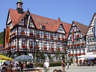
and 5 Sonnenbühl - 6 Mössingen on the western edge


In the valley of the Erms lie upstream


On the Vorderen Alb lies
- 10 Roman stone

On the Hinterer Alb

In the valley of the great Lauter
- 12 Gomadingen,
- 13 Hayingen
- 14 Lauterach at the Große Lauter
- 15 Obermarchtal at the Donau


At the Münsinger Alb
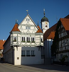
- 16 Münsingen (Württemberg) and the Münsinger Alb
.jpg/350px-Münsingen_(Württemberg).jpg)
At the Zwiefalter Alb
- 17 Double folds

Other goals
background
The region east of Münsingen was a military training area from 1895 to 2005. Today this area is the centerpiece of the Biosphere Reserve Alb, most of the towns and municipalities in the Middle Swabian Alb have a share in this area.
language
getting there
The northern, densely populated part is very well developed in terms of traffic. It is only a few kilometers away from the state capital Stuttgart and theirs Airport. The motorway connection is also good A8 is easily accessible via various federal highways, as well as the A81. The rail connections are also quite satisfactory, as the Stuttgart-Ulm railway line and the Stuttgart-Tübingen line are easily accessible. The situation is different with the southern part facing the Danube, it is less populated and more rural in structure.
mobility
The public transport is in the area from Naldo, Verkehrsverbund Neckar-Alb-Donau organized.
Tourist Attractions
- Lichtenstein Castle
- Fog cave
- Bear cave
- Valley of the Great Lauter