| Yellowstone National Park Yellowstone National Park | |
.jpg/250px-Old_Faithful_Geyser_(Vecchio_geyser_fedele).jpg) | |
Location  | |
| Area type | National Park |
|---|---|
| State | United States of America |
| Federated state | Wyoming, Montana, Idaho |
| Region | Northwestern Wyoming, Yellowstone Region, Eastern Idaho |
| Surface | 8,983.18 km² |
| Foundation year | 1872 |
| Institutional website | |
Yellowstone National Park it's a'protected area of the United States of America, located in the State of Wyoming.
To know
UNESCO World Heritage since 1978, it has been the world's first national park established in 1872 to preserve the vast number of geysers, hot springs and other hot springs, as well as to protect the area's incredible wildlife and rugged beauty. The park contains 8,990 km2, mostly in the northwest corner of Wyoming, but with portions that also extend into the states of Idaho is Montana.
Landscape
With half of the earth's geothermal features, Yellowstone is home to the planet's most diverse and intact collection of geysers, hot springs, muds, and fumaroles. Its more than 300 geysers make up two thirds of all those found on earth. Combine Yellowstone with more than 10,000 spa features made up of brightly colored hot springs, bubbling mud and steaming fumaroles, and you've got a place like no other.
The hydrothermal features of Yellowstone would not exist without the underlying magma body releasing enormous heat. They are also dependent on water sources, such as the mountains that surround the Yellowstone Plateau. There, snow and rain slowly seep through layers of permeable rock riddled with cracks. Part of this cold water meets the hot brine heated directly by the surface magma body. The water temperature rises well above the boiling point but the water remains liquid due to the great pressure and weight of the water above. The result is superheated water with temperatures above 200 ° C.
Superheated water is less dense than the colder, heavier water that sinks around it. This creates convection currents that allow lighter, more buoyant, superheated water to begin its journey back to the surface following cracks and weak areas through rhyolithic lava flows. This uphill path is the natural "hydraulic" system of the park's hydrothermal characteristics. Once it reaches the surface, the various colors of the pools are due to different types of bacteria that grow at different temperatures.
Flora and fauna
The park is the heart of the Greater Yellowstone Ecosystem, as well as one of the largest intact temperate zone ecosystems left on the planet and, as a result, an exceptional area for wildlife viewing.
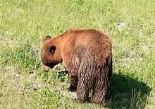
Yellowstone is home to the largest concentration of mammals in the lower 48 states. Sixty-seven different mammals live here, including grizzly bears and black bears. Gray wolves were hunted to extinction in 1926 but reintroduced from Canada in 1995 and more than 100 live in the park now, making it one of the best places to see them in the wild. Additionally, the park is also home to thriving populations of coyotes and red foxes. The wolverine and lynx, which require large expanses of undisturbed habitat, are also found in the Yellowstone ecosystem. Seven native ungulate species live here: elk, mule deer, bison, elk, bighorn sheep, pronghorn, and white-tailed deer. Non-native mountain goats have colonized the northern parts of the park, and numerous small mammals, including beavers, are found throughout the park.
Records of bird sightings have been preserved in Yellowstone since its establishment in 1872; these records document 330 bird species to date, of which around 148 species nest in the park. The variation in elevation and the wide range of habitat types found within the park contribute to the relatively high diversity of the region.
Glacial activity and the current cool, dry conditions are likely responsible for the relatively small number of reptiles and amphibians found in the park.
Yellowstone is home to more than 1,350 species of vascular plants, 218 of which are non-native.
When to go
The weather in Yellowstone National Park can change very quickly from sunny and warm to cold and rainy, so it's important to bring weather-appropriate clothing that can be used as needed. Snow can fall in Yellowstone at any time of the year.
- Summer: Daytime temperatures often remain around 25 ° C and occasionally around 30 ° C at lower altitudes. Nights are generally cool and temperatures can drop below freezing at higher altitudes. Thunderstorms are common in the afternoon.
- Winter: Temperatures often range from -20 ° C to -5 ° C during the day. Sub-zero temperatures at night are common. The record minimum temperature is -54 ° C. Snowfalls are highly variable. Although the average is 3,800 mm per year, it is not uncommon for double this amount to be obtained at higher altitudes.
- Spring and Autumn: Daytime temperatures range from 0 ° C to 20 ° C with night lows ranging from -5 ° C to -20 ° C. Snow is common in spring and autumn with regular accumulations of 12 mm in one day. At any time of the year you need to be prepared for sudden changes. Weather unpredictability is common in Yellowstone. You must always be equipped with a wide range of suitable clothing and also make sure to bring a warm jacket and rainwear, even in summer.
Background
On March 1, 1872, Yellowstone became the first National Park reserve declared worldwide by President Ulysses S. Grant. In 1978 it was designated a World Heritage Site. Although it is commonly assumed that the park was named for the yellow rocks seen in the Grand Canyon of the Yellowstone, the name of the park derives from the namesake river that runs through it, which in turn is named after the sandstone cliffs located further down the river. its course which is located in eastern Montana.
Long before any recorded human history in Yellowstone, a massive volcanic eruption released an immense volume of ash that covered all of the western United States, much of the Midwest, parts of the east coast of the United States, Northern Mexico and some areas of the Canada. The eruption formed a caldera of about 55x72 km (see the entry "Volcanoes"for more information.) Yellowstone is classified as a supervolcano and its last eruption is thought to have been a VEI-8 event with over 1000 km3 of ejections, a thousand times more powerful than the 1980 eruption of Mount Saint Helens. The Yellowstone super volcano is believed to erupt every 600,000-900,000 years with the last event occurring 640,000 years ago. Its eruptions are among the largest ever to occur on Earth, subsequently producing drastic climate changes.
How to get
By plane
The main airport serving Yellowstone is Jackson-Hole (IATA: JAC). Located in Grand Teton National Park, near Jackson, is the largest airport in the Wyoming. Here United and Delta serve Jackson-Hole year-round, respectively from Denver is Salt Lake City. These airlines, in addition to American and Frontier, provide seasonal flights from those cities and eight others in the United States.
Other active airports are those of:
- Billings (IATA: BIL), in Montana, with connections from numerous cities.
- Bozeman (IATA: BZN), in Montana, with connections from eight cities active all year round plus others active seasonally.
- Cody (IATA: COD), in Wyoming, with links from Salt Lake City is Denver.
- Idaho Falls (IATA: IDA), in Idaho, with connections from six cities.
- Salt Lake City (IATA: SLC), in the Utah. It is a 6-hour drive away, but is still the closest major airport to the park, with flights from major US cities and international flights.
- West Yellowstone (IATA: WYS), in Montana, with the connection from Salt Lake City running from June to September.
By car
The park has 5 entrances:
- 1 North entrance - Access from Gardiner via US Route 89, 90 km from Livingston. This entrance is open year round and leads to Mammoth Hot Springs, 5 miles inside the park boundary. The iconic Roosevelt Arch is located in this entrance.
- 2 Northeast entrance - Access from Cooke City via US Route 212 (Beartooth Highway). The entrance and road to Cooke City are open all year, but Route 212 after Cooke City is closed in the winter (mid-October to late May).
- 3 East entrance - Access from Cody, 85 km, via US Routes 14, 16 and 20. This entrance is closed in winter (early November to early May).
- 4 South entrance - Access from Grand Teton National Park via US Routes 89, 191, and 287. This entrance is closed in the winter (early November through mid-May).
- 5 West entrance - Access from West Yellowstone via US Routes 20, 191 and 287, 60 miles from Ashton, in Idaho. This entrance is closed in winter (early November to late April).
On foot
There are a number of trails that allow you to walk in from all sides of the park, including the Continental Divide Trail, 5000 km long.
Permits / Rates
All vehicles and people entering the park must pay an entrance ticket valid for seven days. The rates for 2020 are as follows:
- $ 20: Entrance on foot, by bike, etc.
- $ 30: motorcycles and snowmobiles.
- $ 35: automobiles (private and non-commercial vehicles).
- $ 70: Annual Yellowstone National Park Pass, which allows you to enter the park for one year by private vehicle.
While in the past, admission tickets to Yellowstone also included tickets to enter the Grand Teton National Park, visitors planning to visit both parks will now have to pay separate entrance fees for each.
Exist several passes for groups traveling together in a private vehicle or for people entering on foot and / or by bicycle which provide free admission to Yellowstone National Park and all national parks, as well as some National Monuments, National Wildlife Refuges and national forests:
- The $ 80 annual pass (valid for twelve months from the date of issue) can be purchased by anyone. Military personnel can obtain a free pass by showing a Common Access Card (CAC) or military ID.
- The $ 80 Senior Pass (valid for life of the holder) is available to US citizens or permanent residents aged 62 and over. Applicants must provide documentation of citizenship and age. This pass also offers a 50% discount on some park services. Seniors can also get a $ 20 annual membership.
- The Access Pass (valid for the life of the holder) is free and is available to US citizens or permanent residents with permanent disabilities. Applicants must provide documentation of citizenship and permanent disability. This pass also offers a 50% discount on some park services.
- The Volunteer Pass, also free, is available to people who have volunteered for 250 hours or more with federal agencies participating in the Interagency Pass program.
- The free annual fourth-grade pass (valid from September to August for the fourth-grade school year) allows entry to the bearer and any accompanying passengers in a private non-commercial vehicle. Registration on the website of Every Kid Outdoors.
The National Park Service offers free admission to all national parks five days a year:
- Martin Luther King Jr. Day: third Monday in January
- The first day of the National Park Week: third Saturday in April
- National Park Service Birthday: August 25th
- National day of public lands: fourth Saturday in September
- Veterans Day: November 11th
How to get around

A useful way to orient yourself is to visualize the streets within Yellowstone as a "figure-8" shape. The lower circuit, the "West Thumb - Old Faithful - Madison - Norris - Canyon - Lake Village - West Thumb", is about 140km around. The upper ring, the "Norris - Mammoth - Tower-Roosevelt - Canyon - Norris", is about 110 km around. The park is large.
By car
Most visitors use private vehicles to get around Yellowstone National Park. The streets can get very busy whenever people stop to see wildlife; be respectful of other drivers to avoid bear jams. Roads may be closed when snow falls, and during the winter months many park roads close throughout the season.
By bus
There is no public transport available inside the park. Xanterra Resorts offers bus tours inside the park during the summer season. The Lower Loop Tour only departs from locations in the southern part of the Park. The Upper Loop Tour departs from Lake Hotel, Fishing Bridge RV Park and Canyon Lodge to visit only the northern part of the park. The Grand Loop Tour departs from Gardiner and Mammoth Hot Springs Hotel to visit the entire park in one day. During the winter season, snowmobile tours are organized from various locations. Call 1 307344-7311 for information or reservations.
In addition, during the summer season, commercial activities offer tours departing from many towns and cities in the area. During the winter season, some companies offer snowmobile tours most of the park's roads or bus transportation from Mammoth Hot Springs to Cooke City Road.
By bike
Go cycling in the park can be a very rewarding experience, but due to the large distances in the park additional planning is required to ensure that accommodation is available every night. The park reserves a number of campgrounds for cyclists, but during the busy summer season it's best to book sites in advance where possible.
By snowmobile
Winter is perhaps the quietest time to visit the park when there are fewer visitors. The winter season for snowmobile travel starts in mid-December and ends in mid-March. Actual opening or closing dates for excessive snow travel vary by entry and will be determined by appropriate snow cover and plowing times. Visitors wishing to visit the park by snowmobile must travel with commercial snowmobiles or accompany a commercial guide on snowmobiles (access to private snowmobiles is prohibited) which are available at most entrances. You need the best technology available for snowmobiles and there is a daily limit on snowmobile entrances. Off-piste with snowmobiles are prohibited.
What see
Yellowstone is world famous for its natural heritage and beauty, and for the fact that it holds half of the world's geothermal features, with more than 10,000 examples. Yellowstone travelers can see more than 300 geysers (such as "Old Faithful"), boiling mud pools and an amazing assemblage of wildlife, such as grizzly bears, wolves, bison and moose, all while on the surface of the Earth. . the largest known "super-volcano".
The park can be divided into about eight main areas, which are organized below as they would be encountered by those who walk the park clockwise, starting from the east.
Bridge Bay, Fishing Bridge & Lake
- 1 Yellostone Lake. With an area of 340 square kilometers, Yellowstone Lake is the largest high-altitude lake (more than 2,000 meters) in North America. It is a natural lake, located at 2,357 m above sea level. It is about 32 km long and 24 km wide with 227 km of coastline. It is frozen almost half of the year. It freezes in late December or early January and thaws in late May or early June.


- Valleys of Hayden and Pelican. Hayden Valley is 6 miles north of Fishing Bridge Junction. The Pelican Valley is 3 miles east of Fishing Bridge. These two vast valleys include some of the best habitats in the lower 48 states for grizzly bears, bison, moose, and other wildlife.
- 2 Natural Bridge (Just south of Bridge Bay Campground). This rock formation is accessible via an easy 1.6km walk, and there is also a bike path leading to the bridge. The Natural Bridge was formed by the erosion of a rhyolite outcrop from Bridge Creek. The upper part of the bridge is located about 16m above the stream. A short winding path leads to the top, although it is now forbidden to cross the bridge to protect this feature.
- 3 LeHardy Rapids (3 miles north of Fishing Bridge). The LeHardy Rapids are the falls of the Yellowstone River. Geomorphologically, this is thought to be the actual point where the lake ends and the river continues its northward flow. In spring, many ruthless trout can be seen here, resting in the shallow pools before expending bursts of energy to jump as they breed under the Fishing Bridge. A walkway, built in 1984, provides access to the area, although it is closed during the spring nesting season to protect this sensitive bird habitat.
- 4 Mud volcano. This was once a hilltop thermal feature that would throw mud on nearby trees during eruptions, but a particularly large eruption blew up the mud volcano, leaving a pool of hot, bubbling mud at the base of the river. hill. Access to the area is via a short loop from the car park past the Dragon's Mouth and the mud volcano which is accessible to the handicapped, forms an 800m upper loop route through Lake Sour and the Black Dragon Cauldron which is relatively steep. The rhythmic eruption of steam and the flashing tongue of water give the Dragon's Mouth Spring its name, although its activity has declined considerably since December 1994. The Black Dragon Cauldron exploded into the landscape in 1948, blowing trees away from the their roots and covering their surroundings. forest with mud. In January 1995, a new element on the south bank of the Mud Geyser became extremely active, covering an area of 6.1m × 2.4m and consisting of fumaroles, small pools and pan-type elements. The most spectacular features of the mud volcano area, including the huge bubbling mud pot known as the "Gumper", are only open to the public via ranger-led walks off the lakefront
- 5 Sulfur cauldron (Sulfur Caldron). The sulfur cauldron area can be viewed from a rest area just north of the mud volcano. The turbulent yellow waters of this place are among the most acidic in the park with a pH of 1.3. Other features that can be seen from this point of view are the Turbulent Pool and the crater of a large pot of activated mud.
The historical and educational attractions in this area are:
- 6 Fishing Bridge. The original bridge was built in 1902 as a rough-hewn corduroy log bridge with a slightly different alignment than the current bridge. The existing bridge was built in 1937. The Fishing Bridge has historically been an extremely popular place to fish. Angling from the deck was pretty good, as it was a major spawning area for cutthroat trout. However, due to the disappearance of trout (partly due to this practice), the bridge was closed to fishing in 1973. Since that time, it has become a popular place to watch fish.
- 7 Fishing Bridge Museum and Visitor Center. The Fishing Bridge Museum was completed in 1931 and would eventually become a prototype of rustic architecture in parks across the nation. It was declared a National Historic Landmark in 1987. When automobiles replaced stagecoaches as the primary means of transportation through the park, people were no longer accompanied by a guide, so the museum was built as a "Trailside Museum", allowing visitors get information on Yellowstone for themselves.
- 8 Lake Yellowstone Hotel. The Lake Yellowstone Hotel opened in 1891 on a site that has long been known as a meeting place for Indians, hunters and mountain men. At the time, it wasn't particularly distinctive, it resembled any other rail hotel funded by the Northern Pacific Railroad. It was renovated in 1903, with further changes made in 1929. In the 1970s, the Hotel had fallen into serious disrepair. In 1981, the National Park Service and the park concessionaire, TW Recreational Services, embarked on a ten-year project to restore the Lake Hotel to its 1920s glory days. The works were completed for the hotel's centennial celebration in 1991. The hotel was listed on the National Register of Historic Places that year.
- 9 Lake Ranger Station. After a decade of military administration in Yellowstone, Congress created the National Park Service in 1916. Ranger stations began to replace soldier stations throughout the park. The Lake Ranger station was completed in 1923. The National Park Service's first director, Steven Mather, suggested that the station should blend with its natural and cultural environment. A local lumberjack used pioneering construction techniques to give the station its "trapper hut" style. With the park architects, Superintendent Horace Albright designed a large octagonal "common room" with a central stone fireplace. This rustic room served an information function by day and, in the evening, became the scene of a popular gathering around the fire.
- 10 Lake Lodge. The advent of the car in the park in 1915 created a large influx of visitors. The need arose for an intermediate style of accommodation between the luxury of the Hotel on the lake and the rustic accommodations of the tented camps. In 1926 the Lake Lodge (also a Robert Reamer design) was completed, one of four lodges in the park. The park was no longer accessible primarily to wealthy "dudes" or generous "sagebrushers".
West Thumb and Grant Village

These two villages are located on the western side of Yellowstone Lake and offer boating, fishing and some interesting spa features, including the "Fishing Cone", a hot spring that flows directly into the lake. The name of the area comes from the fact that with a little imagination, Lake Yellowstone looks like a left hand reaching south, and this area would be the "thumb" of that hand.
The thermal baths and natural attractions of this area are:
- 11 Yellowstone Lake. Like Lake Village and Fishing Village, this area provides access to North America's largest high altitude lake. The upper layers of the lake rarely exceed 19 ° C and the lower layers are much colder; due to the extremely cold water, swimming is not recommended.
- 12 West Thumb Geyser Basin. This geyser basin is located along the shore for a distance of 3.2 km, from it it extends for about 460 m and in the lake perhaps up to many meters. There are several hundred springs here, ranging in size from miniature fountains to pools or wells 23m in diameter and great depth. Also there is a small group of mud springs. Of particular note, the Abyss Pool offers an optical illusion that makes it seem bottomless, and Fishing Cone is an offshore pool that was once popular as a place to cook freshly caught fish by immersing it in this partially submerged hot spring. cooking today is no longer allowed).
- 13 Heart Lake. Located in the Snake River watershed west of Lewis Lake and south of Yellowstone Lake, Heart Lake was named after Hart Hunney, one of the earliest hunters.
- 14 Isa lake. This lake is located along the Continental Divide at Craig Pass. Lake Isa is noteworthy as it is probably the only lake on earth that naturally drains to two oceans backwards, the east side draining to the Pacific and the west side to the Atlantic.
- 15 Red Mountains (Red Mountains). This small mountain range, just west of Heart Lake, is completely contained within the boundaries of Yellowstone National Park. The name of the chain derives from the color of the volcanic rocks that compose it. There are 12 peaks in range, with 3,142m for Mount Sheridan being the highest.
- Shoshone Lake. This lake is the second largest lake in the park and is located at the end of the Lewis River southwest of West Thumb. Lake Shoshone is 62m at its maximum depth and has an area of 32.6 square kilometers. Lake Shoshone was devoid of fish due to the waterfalls on the Lewis River, but today it contains lake trout, brown trout and Utah chub. The US Fish and Wildlife Service believes Lake Shoshone may be the largest lake in the lower 48 states that cannot be reached by road. No motorboats are allowed on the lake.
The only historical and educational attraction in this area is:
- 16 West Thumb Ranger Station. Built in 1925, with the breezeway opened and closed in 1966, West Thumb Ranger Station is an excellent example of the historic architecture associated with ranger stations in Yellowstone.
Old Faithful

Old Faithful is what people think of when they think of Yellowstone, and the geyser erupts regularly (check the visitor center for estimated eruption times). This area is also home to the iconic and historic Old Faithful Inn, as well as a vast number of geysers and hot springs that are easily accessible via boardwalks.
The thermal baths and natural attractions of this area are:
- 17 Upper Geyser Basin. Yellowstone as a whole possesses nearly sixty percent of the world's geysers and the Geyser Basin is home to the largest number of this fragile feature found in the park, including the iconic "Old Faithful" geyser. The latter, most famous geyser in the world, has large eruptions that occur on average about once every eighty minutes, although the time between each eruption varies by an hour and is increasing over the years. Rangers are able to predict geyser eruptions within ten minutes, provided the duration of the previous eruption is known. In addition to Old Faithful, this basin contains another 150 geysers within an area of 0.65 km2; of this remarkable number, the eruptions of Castle, Grand, Daisy, Riverside and Old Faithful are regularly predicted by the naturalist staff. In addition to the geysers, the area is home to numerous hot springs. The walkways allow access to the most interesting areas. Don't leave the paths; the surface here is thin and unstable and has a real chance of settling into a boiling pool of water if you walk where you shouldn't.
- 18 Lower Geyser Basin. This vast area of hydrothermal activity can be seen by walking along the lakeside trail at Fountain Paint Pots and by car along Firehole Lake Drive for 3 miles. The latter is a one-way journey where you will find the sixth geyser planned by the Old Faithful staff: Great Fountain. Its thunderous eruptions send jets of diamond droplets that explode 30-60 meters into the air as waves of water rush down the raised terraces. Patience is a virtue with this twice-daily geyser, as the forecast allows for a 2-hour window of opportunity (plus or minus). Fountain Flats Drive starts on the Grand Loop Road just south of the Nez Perce picnic area and follows along the Firehole River to a trail 1.5 miles away. From there, the Fountain Freight Road hiking / biking trail continues along the old roadbed giving hikers access to the Sentinel Meadows Trail and Fairy Falls Trail. Also along this trail is the only wheelchair accessible backcountry site in the Old Faithful district of Goose Lake.
- 19 Central Geyser Basin. This geyser basin sits on a hill overlooking the Firehole River. Smaller than the other geyser basins in the area, the runoff from its thermal features flows into the river, leaving behind it smoldering and colorful trails. In particular, Excelsior Geyser reveals a 60 m × 90 m open crater with a constant discharge of over 15,000 liters of water per minute into the Firehole River; this geyser once exploded so violently that it may in fact have exploded on its own, and no eruptions have occurred since. Also in this amazing basin is Yellowstone's largest hot spring, the beautifully colored Grand Prismatic Spring. This feature has a diameter of 110m and is 50m deep. The start of the Fairy Falls trail provides access to a viewing platform on the hill behind the spring that allows for an elevated view of the entire basin.
- 20 Lone Star Geyser Basin. This backcountry geyser basin is easily accessible on a 8.0km round trip hike that follows an old road now closed off the trail south of Old Faithful. Lone Star Geyser erupts approximately every three hours. There is a log, in a cache near the geyser, for observations of the times of the geysers and the types of eruptions. Bikes can come almost to Lone Star.
- 21 Shoshone Geyser Basin. The Shoshone Geyser Basin can be reached on a 27 km round trip hike that crosses the Continental Divide at Grant's Pass. This basin has no walkways and extreme caution should be exercised when traveling through it. The paths in the basin must be used. Remote spa areas, such as this one, should be approached with respect, knowledge and care. Be sure to emphasize personal safety and asset protection when entering a backcountry dock.
- 22 Firehole River. The river takes its name from the steam (which they thought was smoke from the fires) witnessed by the first hunters in the area. Their term for a mountain valley was "hole" and the designation was born. The Firehole River boasts a world-renowned reputation for challenging fly fishing. Brown trout, rainbow and brook trout give the angler a wary target in this creek.
- 23 Kepler waterfall. This is the most easily accessible waterfall in the district. A marked retreat just south of Old Faithful that a short walk from the car gives the visitor easy access to see this 38-meter waterfall.
- 24 Morning Glory Pool. It takes its name from the flower "morning glory" ("Convolutus"), which the swimming pool resembles. The color of the pool is due to the bacteria that populate the water. The pool rarely erupts. Lately the color has changed due to blockages, caused by tourists throwing objects into the pit.
The historical and educational attractions in this area are:
- 25 Old Faithful Inn. Built during the winter of 1903-04, the Old Faithful Inn is one of the few remaining wooden hotels in the United States. It is a masterpiece of rustic architecture in its stylized design and exquisite craftsmanship. Its influence on American architecture, particularly park architecture, was immeasurable. The building is a rustic structure of wood and logs with gigantic proportions: almost 210 m in length and seven floors in height. The hotel lobby features a 20m ceiling, a huge rhyolite fireplace and twisted pine railings. The visitor can stand in the center of the hall and look at the structure on display, or climb a gnarled log staircase to one of the balconies and look up, down, or across. Le ali furono aggiunte all'hotel nel 1915 e 1927 e oggi ci sono 327 camere a disposizione degli ospiti in questo monumento storico nazionale.
- 26 Lower Hamilton Store. Costruita nel 1897, questa è la struttura più antica dell'area di Old Faithful ancora in uso. Il portico "pino nodoso" è un popolare luogo di riposo per i visitatori, che offre una splendida vista di Geyser Hill (l'edificio più antico di Old Faithful è stato costruito come studio fotografico nel 1897 per F. Jay Haynes. Si trovava a 210 m a sud-ovest di Beehive Geyser e a circa 110 m a nord-ovest della parte anteriore dell'Old Faithful Inn, ma ora si trova vicino all'intersezione tra Grand Loop Road e la corsia dei vigili del fuoco, vicino al passaggio pedonale).
Madison
Madison si trova a metà strada tra Old Faithful e il bacino del Norris Geyser e offre una serie di caratteristiche termali.
- 27 Artists Paintpots. Artists Paintpots è una piccola ma graziosa area termale appena a sud di Norris Junction. Un percorso di 1,6 km di andata e ritorno porta i visitatori a sorgenti termali colorate, due grandi pozze di fango e attraverso una sezione di foresta bruciata nel 1988. Adiacente a questa zona ci sono altre tre aree termali fuori pista e fuoripista: Sylvan Springs, Gibbon Hill Geyser Basin e l'area termale di Geyser Creek. Queste aree sono fragili, pericolose e difficili da raggiungere; quindi viaggiate con personale esperto.
- 28 Cascate di Gibbon. Questa cascata di 26 m cade sui resti del bordo della Caldera di Yellowstone ed è facilmente accessibile tramite un pullover sulla strada del parco. La parete rocciosa situata sul lato opposto della strada rispetto alla cascata è il bordo interno della caldera.
- 29 Monumento Geyser Basin. Questo piccolo bacino quasi dormiente si trova in cima a un sentiero molto ripido di 1,6 km. I punti salienti dell'area includono coni geyser a forma di bottiglia termica che sono i resti di un tempo molto più attivo, diverse strutture in travertino intriganti e alcuni splendidi panorami.
- 30 Fiume Madison. Il fiume Madison si forma all'incrocio dei fiumi Gibbon e Firehole, da cui Madison Junction. Il Madison si unisce ai fiumi Jefferson e Gallatin a Three Forks, nel Montana, per formare il fiume Missouri. Il Madison è un fiume di pesca a mosca con nastro azzurro con stock sani di trota fario e arcobaleno e coregone di montagna. Il canyon creato dal fiume è costituito da ripide pareti rocciose ricoperte di alberi su ciascun lato.
- 31 Terrace Springs. Piccola area termale appena a nord di Madison Junction. Questa zona offre al visitatore un breve tour sulla passerella delle sorgenti termali.
- 32 Firehole Canyon Drive e cascate di Firehole. Firehole Canyon Drive, una strada laterale, segue il fiume Firehole a monte da Madison Junction fino a poco sopra la cascata di Firehole. Il viaggio porta i turisti oltre i flussi di lava spessi 240 m. Firehole è una cascata di 12 m. Una zona balneabile priva di personale molto popolare nella stagione estiva. Tuffarsi dalla scogliera è illegale.
- 33 National Park Mountain. La montagna fa parte delle colate laviche che circondano l'area di Madison Junction. Vicino a questo sito, nel 1870, si dice che la spedizione Washburn-Langford-Doane si sia accampata e abbia discusso del futuro della regione che stavano esplorando. La leggenda narra che fosse qui che si discusse l'idea del parco nazionale, ma non ci sono prove che la conversazione abbia mai avuto luogo, e non ci sono certamente prove che dimostrino che sia stata discussa l'idea di un parco nazionale.
Norris

A sud di Mammoth, l'area di Norris ospita una vasta gamma di strutture termali, tra cui Steamboat Geyser, il più grande del mondo. L'area è stata intitolata a Philetus W. Norris, il secondo sovrintendente di Yellowstone, che ha fornito le prime informazioni dettagliate sulle caratteristiche termali.
Le terme e le attrazioni naturali di questa zona sono:
- 34 Norris Geyser Basin. Norris Geyser Basin è la più calda, antica e dinamica delle aree termali di Yellowstone. La temperatura più alta mai registrata in qualsiasi area geotermica di Yellowstone è stata misurata in una perforazione scientifica a Norris: 237° C a soli 331 m sotto la superficie, e ci sono pochissime caratteristiche termiche a Norris sotto il punto di ebollizione (93° C a questo punto di elevazione). Norris mostra prove di aver avuto caratteristiche termiche per almeno 115.000 anni. Le caratteristiche del bacino cambiano quotidianamente, con frequenti disturbi da attività sismica e fluttuazioni dell'acqua. Steamboat Geyser, il geyser più alto del mondo (da 90 a 120 metri) e Echinus Geyser (pH 3.5 o giù di lì) sono le caratteristiche più popolari. Il bacino è costituito da tre aree: Bacino di porcellana, Bacino posteriore e Pianura delle cento sorgenti. Il bacino di porcellana è sterile di alberi e fornisce un'esperienza sensoriale nel suono, nel colore e nell'olfatto; un sentiero sterrato e passerella di 1,2 km accede a questa zona. Back Basin è più pesantemente boscoso con caratteristiche sparse in tutta l'area; un sentiero di 2,4 km di passerella e sterrato circonda questa parte del bacino. One Hundred Springs Plain è una sezione fuori pista del Norris Geyser Basin che è molto acida, vuota e pericolosa. Il viaggio è sconsigliato senza una giuda esperta.
- 35 Roaring Mountain. Accanto alla strada del parco appena a nord di Norris sulla sezione Norris-Mammoth della Grand Loop Road, Roaring Mountain è una vasta area termale acida (solfatara) che contiene molte fumarole che emettono rumori che vanno da un sussurro quasi impercettibile a un ruggito che può essere sentito a km di distanza. Tra la fine del 1800 e l'inizio del 1900, il numero, le dimensioni e la potenza delle fumarole erano molto maggiori di quelle odierne.
- 36 Fiume Gibbon. Il fiume Gibbon scorre dal lago Wolf attraverso l'area di Norris e incontra il fiume Firehole a Madison Junction per formare il fiume Madison. Sia le sorgenti fredde che quelle calde sono responsabili della maggior parte del flusso del Gibbon. Sono presenti la trota di fiume, la trota fario, il temolo e la trota arcobaleno. Il fiume Gibbon pesca con al volo solo sotto alla cascata di Gibbon.
- 37 Cascata Virginia. Un tratto di 4,8 km della vecchia strada conduce i visitatori oltre la cascata Virginia alta 18 m. Questa cascata è formata dal piccolissimo (in quel punto) fiume Gibbon.
- Norris-Canyon Blowdown. Questa è una fascia di 35 km di pino lodgepole abbattuto dall'azione del wind-shear nel 1984. Fu poi bruciato durante l'incendio di North Fork nel 1988. Questo è il sito in cui un famoso conduttore di notizie disse: "Stasera, questo è tutto di Yellowstone". Una mostra lungo la strada racconta la storia.
Le attrazioni storiche ed educative in questa zona sono:
- 38 Stazione dei soldati di Norris (Norris Soldier Station). La Stazione dei Soldati di Norris (Museo del Parco Nazionale dei Ranger) era una stazione periferica per i soldati che pattugliavano e sorvegliavano il Norris Geyser Basin. Era tra le stazioni occupate più a lungo del parco. Una struttura precedente fu costruita nel 1886, sostituita dopo un incendio nel 1897 e modificata nel 1908. Dopo gli anni dell'esercito, l'edificio fu utilizzato come stazione e residenza dei Ranger fino a quando il terremoto del 1959 causò danni strutturali. L'edificio è stato ristrutturato nel 1991.
- 39 Museo di Norris Geyser Baisn (Norris Geyser Basin Museum). Il Museo di Norris Geyser Basin è uno dei musei originali lungo il sentiero del parco costruiti nel 1929-30. È un eccezionale esempio di architettura in pietra e tronchi.
Mammoth

Mammoth ospita la sede del parco e le imponenti terrazze di calcite di Mammoth Hot Springs. Questa zona ha numerosi servizi ed è un posto sorprendentemente buono per vedere gli alci pascolare sui prati ben curati che circondano gli edifici amministrativi del parco.
Le terme e le attrazioni naturali di questa zona sono:
- 40 Mammoth Hot Springs. Queste formazioni rocciose gigantesche sono l'attrazione principale del Mammoth District e sono accessibili tramite passerella. Queste caratteristiche sono molto diverse dalle aree termali presenti in altre parti del parco poiché le formazioni di travertino crescono molto più rapidamente delle formazioni di sinterizzazione a causa della natura più morbida del calcare. Quando l'acqua calda sale attraverso il calcare, grandi quantità di roccia vengono sciolte dall'acqua calda e un minerale bianco gessoso si deposita sulla superficie. Le formazioni qui cambiano rapidamente e, sebbene una sorgente preferita possa sembrare essere "morta", è importante rendersi conto che la posizione delle sorgenti e la velocità del flusso cambiano ogni giorno e che il volume complessivo dell'acqua scaricata da tutte le sorgenti fluttua poco.
- 41 Fiume Gardner e Canyon del fiume Gardner. La North Entrance Road da Gardiner (MT) a Mammoth Hot Springs (WY), passa lungo il fiume Gardner. La strada si snoda nel parco, su per il canyon, oltre pareti fatiscenti di arenaria e antiche colate di fango. La vegetazione è molto più fitta sia nel canyon che nella prateria aperta in basso, gli alberi comuni sono il ginepro delle Rocky Mountains, il pioppo e l'abete Douglas. Anche i salici a bassa crescita affollano il bordo del fiume nelle sezioni pianeggianti e soggette a inondazioni del canyon. Osservate la fauna selvatica durante la stagione: aquile, falchi pescatori, merlo acquaioli e martin pescatori lungo il fiume e le pecore bighorn nelle parti più ripide del canyon.
- 42 45th Ponte Parallelo e fiume bollente (45th Parallel Bridge and Boiling River). Un segno a nord del punto in cui la strada attraversa il fiume Gardner segna il 45° parallelo di latitudine. A poca distanza a sud del cartello, un parcheggio sul lato est della strada è utilizzato dai bagnanti nel "fiume bollente", uno dei pochissimi punti del parco dove i visitatori possono immergersi in acqua riscaldata naturalmente. I bagnanti devono risalire il torrente per circa 800 m dal parcheggio fino al punto in cui il sentiero raggiunge il fiume. Questo punto è anche segnato da grandi nuvole di vapore, soprattutto quando fa freddo. Qui, il deflusso dell'acqua calda dalle Mammoth Terraces, entra nel fiume Gardner. L'acqua calda e l'acqua fredda si mescolano nelle pozze lungo il bordo del fiume. I bagnanti sono ammessi nel fiume solo durante le ore diurne. Sono necessari costumi da bagno e non sono ammesse bevande alcoliche. Il fiume Boiling è chiuso in primavera a causa dell'acqua alta pericolosa e spesso non riapre fino a metà estate. Tende ad essere molto affollato, quindi cercate di visitarlo molto presto la mattina durante l'alta stagione.
- 43 Monte Everts (Mt. Everts). Il monte Everts prese il nome dall'esploratore Truman Everts della spedizione di Washburn del 1870 che si separò dai suoi compagni di campeggio, perse gli occhiali e il suo cavallo e trascorse i successivi 37 giorni affamati, congelati e allucinati mentre si faceva strada attraverso il non tracciato e deserto inospitale. Dopo il salvataggio, secondo i suoi soccorritori, era a poche ore dalla morte. Everts non è mai arrivato fino al monte omonimo. È stato trovato vicino a un canale lungo Blacktail Plateau Drive ed è stato scambiato per un orso nero e quasi colpito. La sua storia, che in seguito pubblicò su "Scribner's Monthly Magazine", rimane una delle storie più conosciute e sperdute di Yellowstone. È stato anche pubblicato in forma di libro, curato dall'archivista di Yellowstone Lee Whittlesey con il nome Lost in the Yellowstone. Il Monte Everts è costituito da arenarie e scisti stratificati distintamente, rocce sedimentarie depositate quando quest'area era coperta da un mare interno poco profondo, da 70 a 140 milioni di anni fa.
- 44 Bunsen Peak. Bunsen Peak e il becco Bunsen furono entrambi chiamati così dal fisico tedesco Robert Wilhelm Bunsen. È stato coinvolto nella ricerca pionieristica sui geyser e un becco Bunsen ha la somiglianza di un geyser. La sua teoria sui geyser è stata pubblicata nel 1800 e si ritiene ancora che sia accurata. Bunsen Peak è alta 2.610 m e può essere scalata tramite un sentiero che parte dal Golden Gate. Un altro sentiero, la vecchia strada del Bunsen Peak, costeggia il fianco della vetta dal campo YCC al Golden Gate. Questa vecchia strada può essere utilizzata da escursionisti, appassionati di mountain bike e sciatori in inverno. La vetta si affaccia sulla vecchia Ft. Yellowstone area ed è solo una graduale salita. Portate acqua e snack (e portate le campane se pensate che funzionino).
Le attrazioni storiche ed educative in questa zona includono:
- 45 Forte Yellowstone. Tutti gli edifici con i tetti rossi e molti camini nell'area di Mammoth fanno parte dello storico Fort Yellowstone. A partire dal 1886, dopo 14 anni di cattiva gestione civile del parco, la Cavalleria fu chiamata a gestire le risorse e i visitatori del parco. Poiché la Cavalleria si aspettava di essere qui solo per poco tempo, costruirono un posto temporaneo vicino alla base delle Terrazze chiamato Camp Sheridan. Dopo cinque inverni freddi e rigidi, si sono resi conto che la loro permanenza nel parco sarebbe stata più lunga del previsto, così hanno costruito Fort Yellowstone. Nel 1891, il primo edificio ad essere costruito fu il corpo di guardia perché coincideva direttamente con la missione della Cavalleria: protezione e gestione. Nel 1916 fu istituito il National Park Service e la Cavalleria restituì il controllo di Yellowstone ai civili. Da quel momento, lo storico Fort Yellowstone è stato il quartier generale di Yellowstone.
- 46 Arco di Roosevelt (Roosevelt Arch). La prima grande entrata per Yellowstone era al confine nord. Robert Reamer, un famoso architetto di Yellowstone, ha progettato l'immenso arco in pietra per consentire agli autobus di attraversare il percorso nel parco. Al momento della costruzione dell'arco, il presidente Theodore Roosevelt stava visitando il parco. Di conseguenza pose la pietra angolare per l'arco, che poi prese il suo nome. La parte superiore dell'Arco di Roosevelt è incisa con la scritta "For the benefit and enjoyment of the people" (Per il bene e il godimento delle persone), che proviene dall'Organic Act del 1916.
- Cimitero di Kite Hill. Risalente al 1880, questo cimitero contiene tombe di primi coloni e dipendenti.
- 47 Archivi di Yellowstone (Presso l'Heritage and Research Center. Uscite dall'ingresso nord (arco di Roosevelt), svoltate a sinistra ed entrate a Gardiner, poi superate la scuola superiore locale (a destra); la strada rientrerà nei confini del Parco in prossimità dell'Heritage and Research Center). Spesso trascurati perché non sono ben pubblicizzati ai visitatori del parco, gli archivi detengono documenti e materiali che fanno parte degli archivi nazionali, ma in questo caso la posizione è gestita da NPS. Gli archivi sono generalmente aperti al pubblico da maggio a settembre, ma gli appuntamenti anticipati sono obbligatori (principalmente a causa della limitazione del personale). Negli archivi si possono trovare fotografie originali, riviste e mappe utilizzate dalle spedizioni europee originali nell'area, insieme a più di un secolo di documenti, registri, foto e altro materiale a partire dai primi giorni del Parco. Solo una minuscola frazione di questi materiali è rappresentata nei vari luoghi interpretativi del Parco. L'unico pericolo per voi qui è il tempo; è facile perdersi nella storia.
Tower-Roosevelt
L'area di Tower è una delle regioni più aspre del parco ed è un buon posto per avvistare la fauna selvatica. La valle di Lamar, a est di Tower, ospita uno dei branchi di lupi più accessibili del parco, nonché alci, bighorn e altri grandi animali.
Le terme e le attrazioni naturali di questa zona sono:
- 48 Albero pietrificato (Petrified Tree). L'albero pietricato, vicino al sentiero Lost Lake, è un eccellente esempio di un'antica sequoia, simile a molte trovate lungo Specimen Ridge, che è facilmente accessibile ai visitatori del parco.
- 49 Specimen Ridge. Lungo la Northeast Entrance Road a est di Tower Junction, quest'area contiene la più grande concentrazione di alberi pietrificati al mondo. Ci sono anche ottimi campioni di impronte di foglie pietrificate, aghi di conifere e polline microscopico di numerose specie che non crescono più nel parco.
- 50 Cascata di Tower. Questa cascata di 40 metri è facilmente accessibile dalla strada principale del parco ed è incorniciata da pinnacoli vulcanici erosi.
- 51 Calcite Springs. Questo raggruppamento di sorgenti termali lungo il fiume Yellowstone segnala l'estremità a valle del Grand Canyon di Yellowstone. Le ripide scogliere di basalto colonnari sul lato opposto del fiume dal punto di vista sono i resti di un antico flusso di lava, fornendo una finestra sulle forze vulcaniche del passato che hanno modellato gran parte del paesaggio di Yellowstone. La gola e le scogliere forniscono l'habitat per numerose specie di fauna selvatica tra cui pecore bighorn, falchi dalla coda rossa e falchi pescatore.
Le attrazioni storiche ed educative in questa zona sono:
- 52 Lamar Buffalo Ranch. Il Lamar Buffalo Ranch è stato costruito nella prima parte del secolo nel tentativo di aumentare le dimensioni della mandria dei pochi bisonti rimasti a Yellowstone, prevenendo la temuta estinzione della specie. Le operazioni di allevamento di bufali continuarono a Lamar fino agli anni '50. La valle era irrigata per i pascoli da fieno e in tutta l'area erano sparsi recinti. Quattro edifici rimanenti dal complesso del ranch originale sono contenuti all'interno del Lamar Buffalo Ranch Historic District (due residenze, il dormitorio e il fienile) e sono nel registro nazionale dei luoghi storici. I visitatori possono guidare per vedere lo storico ranch di bufali, tuttavia, non ci sono strutture aperte al pubblico in questo luogo.
- 53 Tower Ranger Station e Distretto Storico Nazionale di Roosevelt (Tower Ranger Station & Roosevelt National Historic District). La Tower Ranger Station, sebbene non sia inclusa nel National Register of Historic Places, è una ricostruzione rimodellata della seconda Tower Soldier Station, costruita nel 1907. La Roosevelt Lodge è stata costruita nel 1920 ed è stata dichiarata idonea per il National Register of Historic Posti. Il Roosevelt National Historic District comprende anche le cabine Roosevelt.
- 54 Stazione dei ranger dell'ingresso nord-est (Northeast Entrance Ranger Station). La stazione dei ranger dell'ingresso nord-est fu costruita nel 1934-35 ed è un punto di riferimento storico nazionale. La sua costruzione rustica in tronchi è caratteristica della "parkitecture" comune nei parchi nazionali dell'ovest durante quel periodo.
Canyon

Il villaggio del Canyon prende il nome dal Grand Canyon di Yellowstone e offre l'accesso a questo impressionante paesaggio naturale. Le opportunità ricreative includono escursioni e osservazione della fauna selvatica: l'area di Hayden Valley è probabilmente il posto migliore nel parco per vedere i bisonti.
Le terme e le attrazioni naturali di questa zona sono:
- 55 Gran Canyon dello Yellowstone. Il Grand Canyon di Yellowstone è la principale caratteristica geologica del Canyon District. È lungo circa 32 km, misurato dalla cascata di Upper all'area della cascata di Tower. La profondità è compresa tra 240 e 370 m; la larghezza è da 460 a 430 m. L'attuale canyon non ha più di 10.000-14.000 anni, anche se probabilmente c'è stato un canyon in questa località per un periodo molto più lungo. I processi chimici nel tempo hanno lasciato strisce e chiazze di diversi colori nella roccia di questo canyon. I sentieri conducono lungo i bordi nord e sud del canyon, ma mentre è possibile percorrere l'intero sentiero in un giorno, è una giornata lunga e faticosa. Meglio fare due escursioni giornaliere più brevi (massimo di 3 ore). Se siete appassionati di foto, pianificate le vostre passeggiate in modo che il sole illumini il lato opposto per ottenere splendide foto.
- 56 Cascate dello Yellowstone. Le cascate superiori sono alte 33 metri e possono essere viste dal Brink of the Upper Falls Trail e dallo Uncle Tom's Trail. Le cascate inferiori invece sono alte 94 metri e possono essere viste da Lookout Point, Red Rock Point, Artist Point, Brink of the Lower Falls Trail e da vari punti del South Rim Trail. Le cascate inferiori sono spesso descritte come più del doppio delle dimensioni del Niagara, anche se questo si riferisce solo alla sua altezza e non al volume d'acqua che scorre su di esso. Una terza cascata si trova nel canyon tra le cascate superiori e inferiori. Crystal Falls è lo sbocco di Cascade Creek nel canyon. Può essere visto dal South Rim Trail appena ad est dell'area dello zio Tom.
- 57 Valle di Hayden (Hayden Valley). La valle di Hayden è uno dei posti migliori nel parco per vedere un'ampia varietà di fauna selvatica. È un posto eccellente per cercare gli orsi grizzly, in particolare in primavera e all'inizio dell'estate, quando potrebbero essere predatori di bisonti appena nati e vitelli alci. Grandi mandrie di bisonti possono essere osservate in primavera, all'inizio dell'estate e durante la carreggiata autunnale, che di solito inizia dalla fine di luglio all'inizio di agosto. I coyote possono essere visti quasi sempre nella valle. La vita degli uccelli è abbondante dentro e lungo il fiume. Una varietà di uccelli costieri può essere vista nelle distese di fango di Alum Creek. Un paio di gru sandhill di solito nidificano all'estremità sud della valle. Anatre, oche e pellicani bianchi americani attraversano il fiume. La valle è anche un luogo eccellente per cercare aquile calve e albanelle settentrionali.
- 58 Monte Washburn (Mt. Washburn). Monte Washburn è la vetta principale della Catena di Washburn, che sorge a 3.122 m sopra il lato ovest del canyon. È il residuo dell'attività vulcanica che ha avuto luogo molto prima della formazione dell'attuale canyon. Il Monte Washburn è stato chiamato così dal generale Henry Dana Washburn, leader della spedizione 1870 Washburn-Langford-Doane. Uno dei posti migliori nel parco per avvistare le pecore bighorn e anche un ottimo posto per i fiori selvatici, un sentiero conduce sulla montagna fino a una torre di avvistamento vicino alla vetta alta 3.122 m. L'altitudine può influenzare alcuni escursionisti, quindi è meglio essere acclimatati all'altitudine più alta prima di tentare questa escursione. Inoltre, portatevi strati extra, anche in estate, poiché la parte superiore può essere ventosa e fredda.
L'unica attrazione storica ed educativa in questa zona è:
- 59 Canyon Village. Il complesso Canyon Village fa parte del progetto Mission 66 nel parco. Il centro visitatori è stato completato nel 1957 e il nuovo lodge è stato aperto per le attività nello stesso anno. Sebbene alcune persone considerino lo sviluppo rappresentativo dell'architettura del tempo, nessuno degli edifici presenti nel complesso può essere considerato storico. Tuttavia, ci sono ancora i resti del vecchio hotel, della loggia e delle relative strutture.
What to do

Molti visitatori credono di poter visitare tutti gli 8.000-9.000 km2 di Yellowstone in 1-2 giorni, viaggiando nella propria auto o in un bus turistico. Per apprezzare veramente questo vasto parco, allontanatevi dalle strade del parco e dai sentieri turistici asfaltati.
Programmi del parco
- Settimana senz'auto. Yellowstone apre le sue strade a ciclisti ed escursionisti una settimana prima che il traffico automobilistico riprenda ogni primavera (di solito ad aprile). Questa settimana è una rara opportunità per vedere i luoghi e la fauna selvatica di Yellowstone senza la folla e il traffico. Diverse aziende di West Yellowstone noleggiano biciclette.
- Programmi guidati dai ranger. I programmi guidati dai ranger sono offerti tutto l'anno e offrono l'opportunità di visitare una parte del parco in un ambiente di piccoli gruppi con un ranger che fornirà informazioni sui luoghi lungo il percorso. La maggior parte dei programmi dei ranger prevede una breve escursione.
- Programma Junior Ranger. Il programma Junior Ranger offre ai bambini dai 5 ai 12 anni l'opportunità di ottenere una toppa Junior Ranger. I bambini dai 5 ai 7 possono ottenere la toppa del lupo mentre quelli dagli 8 ai 12 possono ottenere la toppa dell'orso. Per ottenere tutto ciò, un libretto di attività di 12 pagine deve essere risposto correttamente e controllato da un ranger. Un opuscolo delle attività costa $ 3.
- Giovane scienziato. Gli studenti dai 5 anni in su possono conoscere le caratteristiche geotermiche di Yellowstone. Agli studenti viene fornito un kit di strumenti per scienziati, tra cui un termometro a infrarossi, cronometro, lente d'ingrandimento e altri attrezzi. Una volta terminato, potete scegliere tra una toppa o un portachiavi.
Attività
- Wildlife observation. C'è una grande varietà di fauna selvatica da vedere entro i limiti del parco. Uccelli (falco pescatore, aquile calve e molte, molte altre specie) bisonti, grandi felini, cervi, lupi, coyote, volpi, orsi, pecore dalle grandi corna, alci e altri animali possono essere visti all'interno del parco in breve tempo. Più tempo trascorrete nel parco, più animali selvatici vedrete. Alcuni animali, come lupi, orsi e pecore dalle grandi corna, generalmente non sono visibili dalle strade del parco. Le preferenze dell'habitat e i cicli stagionali di movimento determinano, in senso generale, dove può trovarsi un particolare animale in un determinato momento. Le prime ore del mattino e della sera sono quelle in cui gli animali tendono a nutrirsi e quindi sono più facilmente visibili. Gli animali selvatici, in particolare le femmine con i piccoli, sono imprevedibili e pericolosi. Mantenete una distanza di sicurezza da tutta la fauna selvatica. Ogni anno un certo numero di visitatori del parco viene ferito dalla fauna selvatica se si avvicina troppo. Avvicinarsi a piedi entro 91 m da orsi o lupi o entro 23 m da altri animali selvatici è estremamente pericoloso e severamente vietato. Si prega di utilizzare i ritiri lungo la strada durante la visualizzazione della fauna selvatica. Gli spazi all'interno del parco sono grandiosi, quindi assicuratevi di portare un binocolo e/o un cannocchiale per osservare gli animali in sicurezza ed evitare di disturbarli. Essendo sensibile ai suoi bisogni, vedrete più comportamenti e attività naturali di un animale. Se fate muovere un animale vuol dire che siete troppo vicini! È illegale rimanere intenzionalmente vicino o avvicinarsi alla fauna selvatica, compresi gli uccelli, entro QUALSIASI distanza che disturba o sposta l'animale.
- Passeggiate a cavallo. Xanterra Parks & Resorts offre passeggiate a cavallo della durata di una e due ore disponibili a Mammoth, Tower-Roosevelt e Canyon. Si consiglia la prenotazione anticipata. Sono offerte anche passeggiate a cavallo o in carro che portano i visitatori a un sito di grigliate per una cena a base di bistecche. È richiesta la prenotazione anticipata ai numeri 1-307344-7311 o 1-866-439-7375. Il servizio TDD (Telecommunications Device for the Deaf) è disponibile al numero 1-307-344-5395. Le prenotazioni online non sono disponibili in questo momento. È possibile organizzare viaggi guidati di bestiame nell'entroterra (cavallo o lama) con uno dei fornitori di bestiame autorizzati ad operare a Yellowstone. Stock privato può essere portato nel parco. L'uso notturno delle scorte non è consentito prima del 1° luglio, a causa della disponibilità di autonomia e/o delle condizioni del sentiero bagnato. I cavalli non sono ammessi nei campeggi di frontcountry, ma sono ammessi in alcuni campeggi di backcountry.
- Zaino in spalla nella natura selvaggia. Yellowstone ha un sistema designato di campeggio in backcountry e un permesso per l'uso in backcountry è richiesto per tutti i pernottamenti. Ogni campeggio designato ha un limite massimo per il numero di persone e di scorte consentite per notte. La permanenza massima per campeggio varia da 1 a 3 notti per viaggio. I fuochi da campo sono consentiti solo nelle fosse ben stabilite. I fuochi non sono ammessi in alcuni campeggi in backcountry. Un palo per la conservazione del cibo è fornito nella maggior parte dei campeggi designati in modo che il cibo eviti di attirare gli orsi. Vedere la sezione Backcountry per ulteriori dettagli.
- Fotografie. Yellowstone offre opportunità fotografiche senza precedenti con ambienti naturali, bellissime caratteristiche idrotermali e animali che si trovano in tutto il parco. I colori delle sorgenti termali vanno dal bianco insipido (per il molto caldo) al giallo e al blu, al verde e all'arancio. Alcune delle funzionalità sono molto ampie e la sfida può essere trovare un modo per inserirle nell'inquadratura. Siate creativi! Sono state scattate molte foto a Yellowstone e molte altre sono ancora in attesa di essere scattate.
- Pescare. I permessi sono richiesti per la pesca e non tutte le zone sono aperte alla pesca; verificate assieme ai ranger. Le specie autoctone includono il temolo artico, la trota spietata di Westslope e la trota spietata di Yellowstone. Le specie non autoctone includono la trota di fiume, la trota fario, la trota di lago e la trota iridea. Verificate le linee guida e i regolamenti di pesca del parco per poter pescare.
- Nuotare. Il nuoto è consentito (ma non consigliato) nell'area balneabile di Firehole Cascades, una sezione del fiume Firehole riscaldata da sorgenti termali. Questa zona, accessibile tramite Firehole Canyon Drive, dispone di servizi igienici ma non è sorvegliata e non dispone di molti parcheggi. È possibile nuotare anche nel fiume Boiling vicino a Mammoth. Nuotare nel lago Yellowstone è consentito ma non raccomandato a causa delle temperature che raramente superano i 19° C.
- Boating. È richiesto un permesso per tutte le imbarcazioni (motorizzate e non, compresi i tubi galleggianti) e deve essere ottenuto di persona in uno dei seguenti luoghi: ingresso sud, Lewis Lake Campground, Grant Village Backcountry Office e Bridge Bay Ranger Station. I permessi di navigazione non motorizzati sono disponibili all'ingresso ovest, ingresso nord-est, Mammoth Backcountry Office, Old Faithful Backcountry Office, Canyon Backcountry Office, Bechler Ranger Station, West Contact Station, West Yellowstone Chamber of Commerce e luoghi in cui vengono venduti permessi motorizzati. La tariffa è di $ 20 (annuale) o $ 10 (7 giorni) per le imbarcazioni a motore e $ 10 (annuale) o $ 5 (7 giorni) per le imbarcazioni non motorizzate. Per ogni persona in barca è necessario un dispositivo di galleggiamento personale indossabile approvato dalla Guardia Costiera. I permessi di imbarco emessi nel Grand Teton National Park sono onorati a Yellowstone, ma i proprietari devono registrare la loro imbarcazione a Yellowstone e ottenere un adesivo di convalida gratuito da una stazione di rilascio dei permessi. Moto d'acqua, airboat, sommergibili e imbarcazioni simili sono vietate nel Parco Nazionale di Yellowstone. Tutte le imbarcazioni sono vietate sui fiumi e sui torrenti del parco, ad eccezione del canale tra Lewis e Shoshone Lakes, dove sono consentite solo imbarcazioni a propulsione manuale. Fuoribordo e barche a remi possono essere noleggiati da Xanterra Parks & Resorts a Bridge Bay Marina sul lago Yellowstone. Xanterra fornisce anche barche da pesca guidate che possono essere prenotate in anticipo chiamando i numeri 1-307-344-7311 o 1-866-GEYSERLAND (439-7375).
- Andare in Mountain Bike. La maggior parte dei sentieri nel parco sono chiusi alle mountain bike, tuttavia diverse strade sterrate sono aperte sia al traffico ciclistico che automobilistico. Old Gardiner Road e Blacktail Plateau Drive consentono il traffico ciclistico a doppio senso e il traffico automobilistico a senso unico. Queste strade sono più adatte per le mountain bike e di solito sono chiuse alle auto offrendo così un altro modo per vivere il parco.
Excursions
Ci sono diverse escursioni giornaliere disponibili nel parco e poiché molti visitatori viaggiano solo verso i bacini di geyser più famosi, questi sentieri possono offrire l'opportunità di vedere il parco in un ambiente più naturale.
Bridge Bay, Lago e ponte di Fishing Bridge
- 1 Ponte Naturale (Natural Bridge) (Inizia dal parcheggio di Bridge Bay Marina vicino alla strada di ingresso del campeggio. Sono 4,8 km andata e ritorno). Questo facile sentiero conduce a un ponte naturale che è una scogliera di 16 m di roccia riolite tagliata da Bridge Creek. Il sentiero escursionistico si snoda nel bosco per 400 m. Si unisce quindi a una strada di servizio e prosegue verso destra (ovest) per 1,6 km fino al Ponte Naturale. Il breve ma ripido sentiero a tornanti fino alla cima del ponte inizia di fronte alla mostra interpretativa. Sopra il ponte naturale, il sentiero attraversa il torrente attraverso uno stretto burrone e poi prosegue lungo la scogliera prima di ricongiungersi alla strada. Questo sentiero è chiuso dall'autunno all'inizio dell'estate, periodo nel quale gli orsi si nutrono di trote riproduttive a Bridge Creek.
- Pelican Creek (Inizia all'estremità occidentale del Pelican Creek Bridge, a 1,6 km a est del Fishing Bridge Visitor Center. Sono 2,1 km andata e ritorno). Questo sentiero facile è un sentiero breve ma vario che attraversa la foresta fino alla riva del lago prima di tornare indietro attraverso la palude lungo Pelican Creek fino all'inizio del sentiero. È un'introduzione panoramica a una varietà di habitat di Yellowstone ed è un buon posto per il birdwatching.
- Storm Point (Partenza da Indian Pond, a 4,8 km a est del Fishing Bridge Visitor Center. Sono 3,7 km andata e ritorno). Questo facile sentiero inizia nei prati aperti che si affacciano su Indian Pond e il lago Yellowstone. Passate accanto allo stagno prima di svoltare a destra (ovest) nella foresta. Il sentiero prosegue tra gli alberi fino al panoramico Storm Point spazzato dal vento. La zona rocciosa vicino alla punta ospita una grande colonia di marmotte con ventre giallo. Seguendo la costa a ovest, il sentiero alla fine torna indietro attraverso la foresta di lodgepole e ritorna a Indian Pond. Il sentiero è spesso chiuso in tarda primavera e all'inizio dell'estate a causa dell'attività dell'orso; informarsi presso il Fishing Bridge Visitor Center sulle chiusure dei sentieri prima dell'escursione.
- Elephant Back Mountain (Partenza a 1,6 km a sud della Fishing Bridge Junction. Sono 5,8 km andata e ritorno.). Questo sentiero moderatamente faticoso sale per 240 m in 2,4 km attraverso la fitta foresta di lodgepole. Dopo 1,6 km, il sentiero si divide in un anello. Il bivio di sinistra è il percorso più breve per raggiungere la cima, sebbene entrambi si uniscano di nuovo al belvedere. La vista offre una vista panoramica ampia del lago Yellowstone e dell'area circostante.
- Howard Eaton (Parcheggio sul lato est del Fishing Bridge. Sono 11 km andata e ritorno). Questo facile sentiero segue il fiume Yellowstone per un breve tratto prima di essere parallelo alla strada di servizio. Dopo aver lasciato la strada, i primi 3,2 km si snodano attraverso prati, boschi e pianure di salvia con frequenti vedute del fiume. Gli ultimi 1,6 km attraversano una fitta pineta di lodgepole prima di salire gradualmente verso una panoramica di LeHardys Rapids. Chi desidera un'escursione più lunga può continuare fino alla Artist Point Road a Canyon, a 19 km di distanza, ma quella parte del sentiero non è ben tenuta, richiede un'intera giornata e il noleggio di una navetta. Il sentiero è spesso chiuso a causa dell'attività dell'orso; informarsi presso il Centro visitatori di Fishing Bridge prima dell'escursione.
- 2 Pelican Valley (Svoltare sulla strada sterrata di fronte a Indian Pond, 4,8 km a est del centro visitatori di Fishing Bridge e parcheggiare alla fine della strada. Sono 10,9 km andata e ritorno). Questo sentiero moderatamente facile attraversa alcune delle migliori zone dove ci sono orsi grizzly nei 48 stati inferiori, ed è anche l'habitat principale per bisonti e altri animali della prateria. Il sentiero si dirige verso nord, attraversa alcuni ponti attraverso un prato, quindi si addentra nel bosco. Dopo aver lasciato la foresta, sale su una piccola collina fino a un bel panorama della valle, con il torrente sottostante e le montagne Absaroka a est. Da qui il sentiero piega leggermente a destra (est) e attraversa una piccola area idrotermale. Rimanete sul sentiero attraverso questa zona fragile e pericolosa. Presto il sentiero svolta a nord (a sinistra), attraversa un piccolo ruscello e si arrampica su un argine. Questo è un buon posto per riposare e godersi le belle vedute di Pelican Creek. 1,6 km più avanti, il sentiero raggiunge un ponte sbiadito, poi, il sentiero prosegue nel vasto entroterra di Yellowstone. L'escursione diurna si ferma qui; ritorno per lo stesso percorso. Molte restrizioni si applicano a questo sentiero perché si trova nell'habitat privilegiato degli orsi grizzly: il sentiero è chiuso fino al 4 luglio, è aperto dalle 9:00 alle 19:00, è consigliato per gruppi di quattro o più escursionisti e fuori pista è vietato viaggiare sui primi 4,0 km. Osservate tutte le precauzioni relative all'orso; state attenti, fate rumore alle curve cieche e alle colline lungo il sentiero e portate con voi uno spray urticante per orsi.
- Avalanche Peak (A 31 km a est di Fishing Bridge Junction (13 km a ovest di East Entrance), dall'altra parte della strada rispetto al ritiro all'estremità ovest di Eleanor Lake. Sono 6,4 km andata e ritorno). Questo sentiero estremamente faticoso e ad alta quota è spesso coperto di neve fino a luglio, quindi controllate le condizioni attuali del sentiero presso il Fishing Bridge Visitor Center. Dall'altra parte della strada rispetto all'area di parcheggio e a destra del torrente, il sentiero entra nella foresta e inizia la sua ripida salita, 640 m per 3,2 km. In poco più di 1,6 km, arrivate alla base della grande conca di Avalanche Peak, quindi continuate a sinistra e tornate indietro su ampi pendii astragali fino a un'area pianeggiante sotto la vetta. Seguite il sentiero stabilito fino alla stretta cresta e attraversatelo con estrema cautela. Coloro che effettueranno questa ardua escursione saranno ricompensati con viste mozzafiato su alcune delle vette alpine più alte e remote del parco. Ritorno per lo stesso percorso. Gli orsi grizzly frequentano questa zona in autunno, alla ricerca dei pinoli di corteccia bianca. L'escursionismo su questo sentiero è sconsigliato a settembre e ottobre. Fate attenzione ai fulmini sopra il limite del bosco e anche nelle calde giornate estive portate indumenti da pioggia, cappelli di lana e guanti. Gli alberi bruciati possono cadere senza preavviso.
West Thumb e Grant Village
- West Thumb Geyser Basin (L'area di parcheggio di West Thumb Geyser Basin, si trova a 400 m a nord di West Thumb Junction. Sono 640 m andata e ritorno). Un facile sentiero sul lungolago accessibile in sedia a rotelle con assistenza sulle piste. Il sentiero offre una passeggiata attraverso un bacino di geyser di sorgenti termali colorate e geyser dormienti sulla riva del lago situati sulle rive panoramiche del lago Yellowstone.
- Lake Overlook (Si trova a destra entrando nel parcheggio del West Thumb Geyser Basin. Sono 3,2 km andata e ritorno). Il sentiero è moderatamente faticoso con un dislivello di 120 m in prossimità del belvedere. Fate un'escursione su un prato di alta montagna per una vista imponente del West Thumb del Lago Yellowstone e delle lontane montagne di Absaroka. Il sentiero ad anello sale ripidamente, superando le caratteristiche termali dell'entroterra, quindi scende gradualmente attraverso prati e boschi.
- Duck Lake (Si trova alla fine del parcheggio di West Thumb Geyser Basin, sulla destra. Sono 1,6 km andata e ritorno). Un sentiero moderatamente faticoso che si inerpica su una piccola collina per ammirare i laghi Duck e Yellowstone e la distesa degli incendi del 1988 che hanno spazzato questa zona. Il sentiero scende alla riva del lago delle anatre.
- Shoshone Lake (via DeLacy Creek) (Si trova a 14,2 km a ovest di West Thumb Junction. Sono 9,7 km andata e ritorno). Una facile escursione lungo i margini di una foresta e attraverso prati aperti fino alle rive del più grande lago backcountry di Yellowstone. Look for sandhill cranes in the meadows, moose near the shore, and waterfowl above and near the lake. The trail then continues into the vast hinterland of Yellowstone. The day trip stops here; return by the same route.
- Riddle Lake (Approximately 3 miles south of the Grant Village intersection, just south of the Continental Divide sign. It is 7.7 km there and back). An easy hike that crosses the Continental Divide and crosses small mountain meadows and woods to the banks of a picturesque pond. Look for moose in the meadows and birds near the lake. The trail is located in a bear management area and is closed until July 15; after July 15th, groups of four or more are recommended but not mandatory.
- Lewis River Channel / Dogshead Loop (Approximately 8.0km south of the Grant Village intersection, just north of Lake Lewis on the west side of the road. It is 11.3 or 17.5 km there and back). A moderately strenuous trail that will give you an insight into the Yellowstone backcountry. Hike through the forest to the colorful waters of the Lewis River Channel. Look for eagles and osprey that fish for trout in the shallow waters. Turn here for the shorter trip or continue on a loop trail that takes you to Shoshone Lake and return to the wooded Dogshead Trail. The trail then continues into the vast hinterland of Yellowstone. The daytime excursion stops here; return by the same route.
Old Faithfull

- Observation Point (1.6km or 2.3km round trip (does not include the Upper Geyser Basin boardwalks portion). Walk counterclockwise along the Old Faithful boardwalk; turn right at the sign for Geyser Hill. The trail is on the right after the bridge over the Firehole River, approximately 480m from the visitor center). This moderately strenuous trail gains 49m of elevation gain with switchbacks leading up the hill for 800m to commanding views of the Upper Geyser Basin. Go back the same way or continue west to the Solitary Geyser, which erupts frequently, then to the Geyser Hill lakeside. The longest route is 2.3 km.
- Mallard Lake (On the southeast side of the Old Faithful Lodge cabins, near the Firehole River. Take the first right turn as you enter the Lodge area and continue along the road to the start of the trail. It's 10.9 km there and back). This moderately strenuous trail crosses the Firehole River, passes Pipeline Hot Springs, and climbs rolling hills of partially burned lodgepole pine and open rocky areas to the lake. Go back the same way, or go back via the Mallard Creek Trail, for a total of 19 km.
- Howard Eaton (Park near Old Faithful Ranger Station, then follow the paved path through the Grand Loop Road. Turn left at the first intersection, then turn left again and follow the orange signposts to the start of the path. It is 9.3 km there and back). A medium difficulty trail that climbs a burnt hill, continues through a spruce forest, then descends to Lone Star Geyser. Go back the same way.
- Lone Star (5.71km south of Old Faithful Junction, just past the Kepler Falls parking lot. It is 7.7 km there and back). A pleasant, easy and partially paved trail that follows an old service road beside the Firehole River to the geyser. Cyclists have to dismount at the end of the asphalt and walk the last few hundred meters. The Lone Star geyser blows up to 14m from a 3.7m cone approximately every three hours.
- Divide (10.9km south of Old Faithful Junction, look for a starting point on the right. It is 5.5 km there and back). This moderately strenuous trail crosses Spring Creek and climbs 224m through mixed coniferous forest to the Continental Divide. You can see Shoshone Lake from the middle of the trail.
- Mystic Falls (Mystic Falls) (Behind the Biscuit Basin lakefront, 2 miles north of Old Faithful Junction. You can also start 400m south of Biscuit Basin; park on both sides of the road. It is 4.0 km there and back). A moderately strenuous trail that follows a beautiful stream through a mixed forest of conifers to the 21m waterfalls, over which the Little Firehole River descends from the Madison Plateau. Turn here or go up the switchbacks to a viewpoint of the Upper Geyser Basin, then head back to the main trail. The trail passes through a bear management area and is closed until Saturday of the Memorial Day weekend.
- Mallard Creek (Approximately 6.1km north of Old Faithful Junction, towards Madison; look for a starting point of the path on the right. It is 14.8 km there and back). A strenuous course that was designed as a winter ski slope. The route follows hilly terrain through heavily burned forest to Mallard Lake. Go back the same way or, if you have arranged a shuttle, follow the Mallard Lake Trail to the Old Faithful area.
- Fairy Falls (Fairy Falls) (Short Walk: Park 1.5km south of the Midway Geyser Basin, cross the steel bridge and walk 1.5km to the trailhead. Long Route: Park at the end of Fountain Flat Dr. and walk 2.82km to the start of the trail). This easy trail crosses a young forest for 2.6km to 61m waterfalls. Continue for 1.05km past the falls through a wetland area to Imperial Geyser, which has frequent minor blows. The trail passes through a bear management area and is closed until Saturday of the Memorial Day weekend.
- Sentinel Meadows & Queen's Laundry (10 miles north of Old Faithful, turn left onto Fountain Flat Drive. Park at the end of the road and cross the footbridge over the Firehole River to the trailhead. It's 3 miles round trip or 4 miles if you go to Queen's Laundry). A path of medium difficulty, very wet in spring and dry in summer. The trail follows the Firehole River for a short distance, then turns towards the meadows. Look out for the large mounds of sintered hot springs and the remains of the incomplete old bathhouse at Queen's Laundry, 1.9 miles from the trail. Begun in 1881, construction was abandoned due to the change in park administrations and priorities. The minerals from the hot springs have preserved the structure, which was the first building built by the government for public use in a national park. Queen's Laundry is a National Historic Site.
Madison
- Purple Mountain (400m North of Madison Junction on Madison-Norris Road, limited parking. It is 9.7 km there and back). This medium difficulty trail climbs 460m through an intermittently burnt lodgepole pine forest and ends with a beautiful view of the Firehole Valley and lower Gibbon Valley; Some views of the Madison Junction area are also visible.
- Harlequin Lake (1.5 miles west of Madison Campground on West Entrance Road. It's 1.6 km there and back). This is a gentle climb through burnt lodgepole pines to a small swampy lake frequented by mosquitoes and waterfowl (but not harlequin ducks). Nice quick hike to escape the road for a while.
- Two Ribbons Trail (Approximately 8.0 km east of the west entrance, no signposted path, continue along the road beside the lakefront. It is 2.4 km there and back). This is a fully pedestrian walkway that winds its way through burnt pine trees, shrubs and shrubs near the Madison River. Good examples of fire recovery and regrowth as well as buffalo wallows. There are no interpretative signs or brochures other than the exhibits along the road at the start of the trail.
- Gallatin Area. There are many excursion possibilities in the Gallatin area. Most of these, however, are longer and steeper than the average day trip. They include Daily Creek, Sky Rim, Black Butte, Specimen Creek, Crescent Lake / High Lake, Sportsman Lake, Bighorn Pass, and Fawn Pass. For more information, consult a Visitor Center or one of the hiking trail guides available from the Yellowstone Association.
Norris

- Grizzly Lake (Grizzly Lake) (1km south of Beaver Lake on the Mammoth-Norris road. It is 6.4 km there and back). This medium-difficulty trail crosses a forest of pines perched twice (1976 and 1988) and crosses beautiful meadows. The lake is long, narrow and heavily wooded. It can be difficult to access beyond the end of the lake path. Swamp and mosquitoes can make travel difficult early in the season. The lake is popular with fishermen due to the presence of small brook trout. A log junction is required to continue past Grizzly Lake.
- Solfatara Creek (Start of Circuit C at Camp Norris, 1.21km south of the Beaver Lake picnic area on the Mammoth-Norris road. It is 21 km there and back). Easy to moderate trail with an ascent and descent of approximately 120m. The trail follows Solfatara Creek for a short distance to the junction with Ice Lake Trail, then parallels a power line for most of the way to Whiterock Springs. It climbs a short distance to Lake of the Woods (difficult to find as it is a little off-piste) and passes Amphitheater Springs and Lemonade Creek. These are small, but lovely spa areas in the otherwise non-descript lodgepole pine forest. The path then continues to meet the road. There are no connections to the campsite, except the way you came. It is desirable to park a car at both ends. This is a good place to send people who don't want to see other hikers, but it can be subject to bear restrictions, so check with the rangers before you leave.
- Ice Lake Trail (direct route) (5.6 km east of Norris on the Norris-Canyon road. It is 0.48 km there and back). This easy and accessible path for the handicapped leads to a pretty lake nestled in the dense pine forest of lodgepole. Part of the area was heavily burned in 1988. Hikers can continue from Ice Lake to Wolf Lake, Grebe Lake and Cascade Lake, and then to the Canyon.
- Wolf Lake trail interrupted (Wolf Lake Cut-off Trail) (Depart approximately 400m east of Ice Lake Trailhead along Canyon-Norris Road. There is no trail start sign due to the lack of regular maintenance on the trail, but the orange markings can be seen once hikers cross the road from the trail's starting point. It is 9.7 km there and back; 1.6km to the intersection with Wolf Lake Trail, then over 3km to Wolf Lake). This path is of medium difficulty due to the crossings and descents of the stream; the trail can be difficult to find at times. The route follows the Gibbon River for at least 1km, passing the Little Gibbon Falls. The dense, partially burnt lodgepole pine forest is your main companion for the rest of the way to Wolf Lake.
- Cygnet Lakes Trail (Cygnet Lakes Trail) (Depart from the south side of the Norris-Canyon road approximately 8.9 km west of Canyon Junction. It's 13 km there and back). This easy trail runs through the intermittently burnt lodgepole pine forest and several small ephemeral marshy ponds to the lush meadows surrounding the Cygnet lakes (small and marshy). Accessible only during the day! Unmaintained trail past Cygnet Lakes.
- Artist Paint Pots (7.2km south of Norris on the Norris-Madison road. It's 1.6 km there and back). This easy trail is one of Yellowstone's neglected but wonderful short hikes. The trail winds its way through a wet meadow by the lakeside, then enters a partially burnt lodgepole pine forest. The spa area within the short loop at the end of the trail contains some of the most colorful hot springs and small geysers in the area. Two mudpots at the top of the hill allow for closer access than Fountain Paint Pots. Beware of mud! Remind people to stay on the trail throughout the area. The trail has a steep ascent / descent and erodes easily, so it may be furrowed after rains.
- Geyser Basin Monument (Monument Geyser Basin) (8.0km south of Norris Junction on the Norris-Madison road, just past the Gibbon River bridge. It is 3.2 km there and back). This path is deceptively easy, but then difficult. It winds up a gentle slope following the Gibbon River, then turns sharply uphill and climbs 150m up to 800m to get to the top of the mountain! The basis is on the erosion of geyserite and rhyolite, which is somewhat reminiscent of ball bearings. The geyser basin is a very interesting collection of dormant cones of various sizes. One looks like a thermal bottle! Most of the activity here has dried up; hikers looking for exciting spa activities will be disappointed, but those looking for adventure will find it. Remind people to stay on the path!
Mammoth
- Beaver Ponds Loop (Located between Liberty Cap and the stone house next to Mammoth Terraces. It is 8.0 km there and back). This moderately strenuous trail begins just north of Liberty Cap and the Mammoth Terraces, and begins with a 110m climb up and above Clematis Gulch. At the junction with Sepulcher Mountain Trail, go right. Shortly after, the trail levels out and winds through meadows and poplar woods to a series of beaver ponds. Look out for elk, mule deer, pronghorn, elk, beaver dams and lodges, the occasional beaver and waterfowl. Beware of the bears: both black and grizzly bears are present in this area. Beyond the ponds, the trail passes through forests and grasslands to Mammoth.
- Bunsen Peak (5.0 miles south of Mammoth on Mammoth-Norris Road, opposite the start of the Glen Creek Trail. It is 6.8 km there and back). This moderately strenuous trail climbs 400m through woods and meadows to the top of Bunsen Peak, which offers panoramic views of the Black Tail Plateau, Swan Lake, Gallatin Mountain Range, and Yellowstone River Valley. (You will also see the communications equipment, which supplies the mammoths and neighboring communities.) Go back along the same path.
- Osprey Falls (Osprey Falls) (5.0 miles south of Mammoth on Mammoth-Norris Road, opposite the start of the Glen Creek Trail. It's 13 km there and back). A strenuous trail that follows Bunsen Peak Road (hiking / cycling only) through burnt meadows and forests 4.0km to Osprey Falls Trail (no bicycles allowed). Descend 210m into Sheepeater Canyon, one of Yellowstone's deepest canyons. Osprey Falls, on the Gardner River, plummet 46m over the edge of a lava flow.
- Lava Creek (Across the street from the Lava Creek picnic area along Mammoth-Tower Road. It's 5.6 km one way). A moderately strenuous trail that follows Lava Creek downstream past Undine Falls (18m), gradually descending. Lava Creek meets the Gardner River further downstream. The trail crosses the river along a boardwalk to a final steep climb, which ends near the Mammoth Campground.
- Rescue Creek (11km east of Mammoth along Mammoth-Tower Road; ends 1 mile south of the North Entrance Station. It is 13 km one way). A moderately strenuous trail that follows the Blacktail Deer Creek Trail past the eastern end of Blacktail Pond to the top of a short hill, then turn left onto the Rescue Creek Trail. Gradually ascend through poplars and meadows, then descend through the forests to the mugwort plains that lead to a footbridge over the Gardner River.
- Blacktail Deer Creek / Yellowstone River (11km east of Mammoth along Mammoth-Tower Road. It is 19 km one way). A moderately strenuous trail that follows Blacktail Deer Creek as it descends 340m through rolling grassy hills and Douglas fir forest to the Yellowstone River. Cross the river via a steel suspension bridge, then join the Yellowstone River Trail, which continues downstream, past Knowles Falls and over barren terrain before ending at Gardiner, in Montana. There is a very narrow short section near Gardiner which is slippery when wet.
- Sepulcher Mountain (Located between Liberty Cap and the stone house next to Mammoth Terraces. It's 18 km there and back). This strenuous trail follows the Beaver Ponds Trail to the Sepulcher Mountain Trail junction, then climbs 1,000m through woods and meadows to the 2,942m-high summit. The loop trail continues along the opposite side of the mountain through an open slope to the Snow Pass Trail junction, which descends to the Howard Eaton Trail, which goes north to Mammoth Terraces and the trailhead.
Tower-Roosevelt
- Lost Lake (Lost Lake) (It is located behind Roosevelt Lodge. It is 6.4 km there and back). A medium difficulty trail that offers views of the Lost Lake, waterfowl, wet meadows, mugwort tops, wild flowers, possibly beavers and very often black bears. This trail starts behind Roosevelt Lodge and climbs 91m. Here it joins the Roosevelt horse trail and continues west to Lost Lake. From there the trail continues around the hill to the Petrified Tree parking area, crosses the parking lot and continues up the hill. It then continues behind Tower Ranger Station, crosses the stream and returns to the lodge. Warning: if you encounter any horses, move to the downhill side of the trail and stand still until they have passed.
- Garnet Hill (Approximately 45.7m north of Tower Junction on Northeast Entrance Road (park in the large parking lot east of the service station in Tower Junction). It's 12.1 km there and back). Path of medium difficulty that follows a dirt road for about 2.4 km to the cookout refuge. Continue north along Elk Creek until you almost reach the Yellowstone River. Here the trail splits, with the west fork joining the Hellroaring Trail and the east fork continuing around Garnet Hill and back towards Tower. Close to the road, the trail joins a horseback trail that leads to Northeast Entrance Road. Walk along the road for approximately 400m to the parking area.
- Hellroaring (3.5 miles west of Tower Junction. It is 6.4 km there and back). A strenuous trail that begins with a steep descent to the suspension bridge over the Yellowstone River. The trail crosses an artemisia plateau and then descends to Hellroaring Creek. Both the Yellowstone River and Hellroaring Creek are popular fishing areas. Bring water with you as this trail can be hot and dry during the summer. Also, watch your footsteps on the boulders near the river and be aware that other backcountry trails branch off from this, so watch out for trail signs. An alternate route starts at Garnet Hill and continues west on the Hellroaring Trail; return by the Garnet Hill trail (distance 16 km).
- Yellowstone River picnic area (Yellowstone River Picnic Area) (It is located 2.01km northeast of Tower Junction on Northeast Entrance Road. It's 6.0 km there and back). A medium difficulty trail that climbs steeply to the east edge of the Narrows of the Yellowstone and then follows the edge. Look for peregrine falcons and osprey, which nest in the canyon, and bighorn sheep along the rim. See the Overhanging Cliff area, the towers of Tower Fall (the waterfall is not visible), the basalt columns and the historic Bannock Ford. The path heads north-east; at the next crossroads, turn left and go down the road. (The strenuous and poorly signposted Specimen Ridge Trail continues northeast.) Walk west along the road for 0.7 miles to the Yellowstone River picnic area.
- Slough Creek (Along the dirt road towards Slough Creek Campground; park your car next to the toilet. First meadow: 3.2 km, Second meadow: 7.2 km one way). Moderately demanding trail for the first 2.4 km; therefore easy. This long-distance trail follows a historic chariot ride in the Absaroka-Beartooth Wilderness beyond Yellowstone. It starts with a steep climb then goes down to the first meadow. Stop and relax here or continue to the second lawn. Watch out for bears and moose and if you come across horses, move to the downhill side of the trail and stand still until they pass.
- Mount Washburn (Mt. Washburn) (Depart at the Chittenden Road parking area, 14.0km south of Tower Junction, or at the Dunraven Pass parking area, 21.9km south of Tower Junction along Tower-Canyon Road. More parking is available instead at the beginning of the north path; The park's bicycles and vehicles also use this route. Departure from Dunraven Pass, 5.0 km or Chittenden Road (the latter is 4.0 km one way)). A tiring path that climbs to an altitude of 430 m. Both trails go up Mount Washburn along a wide trail with spectacular views. Look for bighorn sheep and wildflowers. Stay on the trail to avoid destroying the fragile alpine vegetation. At the top, enjoy the view and interpretive exhibits inside the shelter based on the fire lookout. This is a high-altitude trail: thunderstorms are common; bring rain gear, wool hats and gloves.
Canyon

- Howard Eaton Trail (Depart 400m west of Canyon Junction along Norris-Canyon Road. It is 4 or 19.3 km one way, depending on the destination). This moderately easy trail has very little elevation gain and offers hikers the option to choose their destination on a trail through woods, meadows and marshes: Cascade Lake (4.0 km), Grebe Lake (6.84 km), Wolf Lake ( 10.06 km), Ice Lake (13.28 km) and Norris Campground (19 km). The trail can be wet and muddy until July with many stinging insects.
- Observation Peak (2.01km north of Canyon Junction along Tower-Canyon Road. It's 18 km there and back). This strenuous trail has an elevation gain of 430m by 4.8km and heads towards a sheer mountain that offers exceptional views of the Yellowstone wilderness. The trail crosses open meadows to Cascade Lake. Beyond the lake, you climb 430 m for 4.8 km through a white bark pine forest. Past Cascade Lake, no water is available.
- Cascade Lake (Cascade Lake) (Depart 400m west of Canyon Junction along Norris-Canyon Road or Cascade Lake Trailhead, 2.01km north of Canyon Junction along Tower-Canyon Road. It is 8.0 km there and back). This easy walk allows people with limited time to enjoy open meadows where wild flowers abound and wildlife is often seen. The trail can be wet and muddy until July with many stinging insects.
- Grebe Lake (Grebe Lake) (3.5 miles west of Canyon Junction along Norris-Canyon Road. It is 9.7 km there and back). This moderately easy trail has little vertical climb as it follows an old fire road through meadows and woods, some of which burned down in 1988. At the lake you can connect with the Howard Eaton Trail or go back where you came from.
- Seven Mile Hole (Departure from the Glacial Boulder on the way to Inspiration Point. It's 18 km there and back). A strenuous trail that follows the edge of the canyon for the first 2.4km, offering views of the Silver Cord waterfall through the canyon. For another 800m the trail joins the Washburn Spur Trail; after another 3 miles turn right onto the trail to Seven Mile Hole, which drops over 300m for 2.4km. Pay special attention to where the trail passes as there are both dormant hot springs and active hot springs.
- Mount Washburn (Mt. Washburn) (Dunraven Pass is 4.5 miles north of Canyon Junction; Chittenden Road is located 16.6 km north of Canyon Junction. It is 5km one way from the Dunraven Pass; 4 km one way instead from Chittenden Road). This tiring path climbs to an altitude of 430 m. Starting at either trailhead, climb Mount Washburn along a wide trail with spectacular views. Look for bighorn sheep (keep your distance) and wildflowers. Stay on the trail to avoid destroying the fragile alpine vegetation. At the top, enjoy the view and interpretive exhibits from inside the shelter at the base of the fire lookout. Warning: storms are common; bring rain gear, wool hats and gloves.
- Washburn Spur Trail (It's 18-18.5km one way, depending on which Mount Washburn trail you choose). A strenuous path that climbs to 610 m of altitude for 4.0 km. After climbing Mount Washburn, the spur trail begins from the east side of the fire lookout. The trail drops very steeply over rough terrain for 6.0km to Washburn Hot Springs. Warning: stay on the path in this hydrothermal area. Continue south, pass the intersection for Seven Mile Hole and then finish at Glacial Boulder along the road to Inspiration Point. The trail is in poor condition.
Shopping
Each village located within the park offers food, camping supplies, and souvenirs for sale, although these shops close during the winter months.
Car and petrol services are available in the following locations:
- Canyon.
 Open from the end of April to the beginning of November. Petrol, diesel and auto repair.
 - Fishing Bridge. Open from mid-May to the end of September. Petrol, diesel, propane and auto repair.
- Grant Village. Open from mid-April to mid-October. Petrol, diesel, propane and auto repair.
- Mammoth. Open from early May to mid-October. Petrol and diesel.
- Old Faithful (Lower). Open from mid-April to early November. Petrol and diesel.
- Old Faithful (Superior). Open from the end of May to the end of September. Petrol and auto repair.
- Tower Junction. Open from the beginning of June to the beginning of September. Petrol.
Night clubs
Cocktails can be bought in restaurants and lighter drinks in snack bars.
- 1 Seven Stool Saloon (Grant Village dining room). As the name suggests, don't expect a large seating area.
- 2 Bear Pit Lounge (Old Faithful Inn). It features etched glass panels inspired by the original wooden bear pit murals and offers a variety of wines, beers and cocktails.
Where to eat
Most of the villages sell groceries and can offer snack bars. The following restaurants and cafes are also available:
- 1 Canyon Lodge dining room (Canyon Lodge Dining Room).
 $ 15- $ 25 per person for dinner. Open from June to September. Breakfast: 7: 00-10: 00; lunch 11: 30-14: 30; dinner 17: 00-22: 00. It offers a buffet breakfast, a la carte lunch and a luxury dinner. Dress code is casual and reservations are not accepted. Dinner entrees include prime rib, stuffed trout, and a decent wine list.
 - 2 Canyon Lodge Cafeteria (Canyon Lodge Cafeteria). $ 5 breakfast, $ 7 sandwiches and wraps. Open from June to September. Breakfast: from 6: 30-11: 00; lunch and dinner: 11: 30-21: 30. A good option for budget meals, with a decent variety of breakfast dishes, sandwiches, wraps and soups.
- 3 Canyon Lodge Deli. $ 5 sandwiches. Open from June to September. Until September: 7: 30-21: 30; at the end of September: 7: 30-19: 00. Sandwiches, sandwiches, drinks and ice cream.
- 4 Grant Village dining room (Grant Village Dining Room), ☎ 1-866-439-7375. $ 20- $ 30 per person for dinner. Open from the end of May to September. Breakfast: 6: 30-10: 00; lunch 11: 30-14: 30; dinner 17: 00-22: 00. Luxury dining in Grant Village, with options like bison sirloin and wild Alaskan salmon. It also offers a breakfast buffet for $ 12 and lunch options like burgers and wraps for about $ 10. Reservations are required for dinner, dress code is casual.
- 5 Grant Village Lakehouse Restaurant. $ 10-15 per person. Open from the end of May to September. Only breakfast and dinner. With an excellent view of the lake, the restaurant offers casual dishes such as burgers, sandwiches and salads. A selection of wines and beers is also available.
- 6 Lake Lodge Coffee Shop (Lake Lodge Cafeteria). $ 6- $ 12 per person. Open from June to September. Cafeteria lunch with standard breakfast options, sandwiches, salads and soups.
- 7 Restaurant room of the Lake Yellowstone Hotel (Lake Yellowstone Hotel Dining Room), ☎ 1-866-439-7375. Open from the beginning of May to the end of September. Breakfast: 6: 30-10: 30; lunch 11: 30-14: 30; dinner 17: 00-22: 00. Luxurious dining in the lake area. Continental breakfast and buffet breakfast are available daily, lunch options include specialty sandwiches and burgers. Dinner options include lobster ravioli and rack of lamb. About seventy wines are available on the wine list. Reservations are recommended for dinner, the dress code is informal.
- Lake Deli. $ 6- $ 10 per person. Open from the end of May to the end of September. Breakfast: 6: 30-10: 30, sandwiches: 10: 30-20: 30. Gourmet sandwiches, soups, soft drinks and cookies.
- 8 Mammoth Hotel restaurant room (Mammoth Hotel Dining Room), ☎ 1-866-439-7375. $ 15- $ 25 per person. Open from the beginning of May to the beginning of October and from the end of December to the beginning of March. Breakfast: 6: 30-10: 00; lunch: 11: 30-14: 30; dinner: 17: 00-22: 00. Luxurious dining with options like bison sirloin and stuffed chicken breast. A decent wine list is also available. Reservations are recommended during the winter season.
- 9 Mammoth Terrace Grill. Open from the end of April to mid-October. The breakfast menu includes sandwiches, cereals, juices and coffee. The deli menu includes burgers, chicken sandwiches, salads, inexpensive meals, and dipping ice cream.
- 10 Old Faithful Inn Bear Paw Deli. $ 7- $ 10 per person. Aperto da metà maggio a metà ottobre dalle 6:00 alle 20:00. Panini gastronomici, colazione continentale, bevande analcoliche, birre e vino.
- 11 Sala ristorante dell'Old Faithful Inn (Old Faithful Inn Dining Room), ☎ 1-866-439-7375. $20-$30 a persona. Aperto da metà maggio a metà ottobre. Colazione: 6:30-10:00; pranzo: 11:30-14:30; cena: 17:00-22:00. Colazione a buffet $ 12 a persona, pranzo a buffet "occidentale" $ 14 a persona e cena a buffet $ 26 a persona. In alternativa, un menu standard è disponibile per ogni pasto con opzioni di lusso. È disponibile una discreta lista di vini. Si consiglia di prenotare la cena, il codice di abbigliamento è informale.
- 12 Panetteria e caffetteria dell'Old Faithful Lodge (Old Faithful Lodge Cafeteria and Bake Shop). $7-$12 a persona. Aperta da inizio maggio a inizio ottobre. Offre pranzo e cena da varie stazioni di servizio tra cui panini, polpettone, tacchino, insalate, ecc. Fuori dalla caffetteria si trova il negozio di snack, che offre muffin appena sfornati, bagel, panini e gelati soft-service.
- 13 Sala ristorante dell'Old Faithful Snow Lodge Obsidian (Old Faithful Snow Lodge Obsidian Dining Room). $20-$30 a persona. Aperta da inizio maggio a fine ottobre (colazione e cena) e in inverno da metà dicembre a inizio marzo (colazione, pranzo e cena). Pranzo di lusso tra cui costolette di bisonte e salmone selvaggio dell'Alaska. I posti a sedere sono i primi arrivati, primi serviti per tutti i pasti. La colazione è à la carte. Prenotazione cena obbligatoria in inverno.
- 14 Old Faithful Snow Lodge Geyser Grill. $6-$9. Aperto da fine aprile a inizio novembre e in inverno da metà dicembre a metà marzo. Un ristorante da asporto che offre colazione, pranzo e cena ed è specializzato in hamburger, sandwich di pollo, pasti economici, panini gastronomici, insalate e altro ancora. Il soffitto del ristorante presenta stravaganti sculture di personaggi. Viene inoltre servita una piccola selezione di birre e vini.
- 15 Sala ristorante del Roosevelt Lodge (Roosevelt Lodge Dining Room). $20-$25 a persona. Aperta da inizio giugno a inizio settembre. Colazione: 7:00-10:00; pranzo 11:30-16:30; cena: 16:30-21:30. Pranzo in stile "cowboy" del vecchio West che include piatti come il "controfiletto superiore di Teddy" e pollo affumicato al mesquite. Il "dopo cena libagioni" comprende un'ampia selezione di birre, vini e cocktail.
- Roosevelt Old West Dinner Cookout. $ 57 in carro, $ 75 per un'ora a cavallo, $ 84 per due ore a cavallo. Aperto da inizio giugno a inizio settembre. Dopo un giro in carrozza o a cavallo fino al luogo di ristoro, gli ospiti ricevono una bistecca e contorni a volontà. L'intrattenimento è fornito durante la grigliata, di solito da un cantante cowboy.
Where stay

Sebbene ci sia un'abbondanza di hotel e campeggi all'interno del parco, questi si riempiono rapidamente in estate, quindi i visitatori potrebbero anche prendere in considerazione le opzioni di alloggio nelle città di West Yellowstone is Gardiner.
Accommodations
Gli alloggi nel parco si riempiono rapidamente e devono essere prenotati in anticipo. Le cancellazioni sono comuni, quindi se una particolare opzione di alloggio non è disponibile, è una buona idea ricontrollare frequentemente per vedere se diventa disponibile. Le prenotazioni per tutti gli alloggi e le cabine presenti nel parco possono essere effettuate tramite Xanterra Parks & Resorts o chiamando il numero 1 307-344-7311. Tutti gli alloggi nel parco sono non fumatori e, nel rispetto dell'ambiente naturale di Yellowstone, televisori, radio, aria condizionata e collegamenti Internet non sono disponibili. Durante l'inverno gli unici alloggi in funzione all'interno del parco sono l'Old Faithful Snow Lodge e il Mammoth Hotel.
Gli alloggi presenti sono i seguenti:
- 1 Canyon Lodge and Cabins, 41 Clover Ln, ☎ 1-866-439-7375. Camera Lodge: $ 178; cabine occidentali: $ 183; cabina Frontier: $ 98 (tariffe 2012). Le camere lodge si trovano nel Cascade e nel Dunraven Lodges, entrambi costruiti negli anni '90, mentre le cabine sono state tutte costruite negli anni '50 e '60. Tutti gli alloggi includono bagno privato. Aperto da inizio giugno a fine settembre.
- 2 Grant Village, ☎ 1-866-439-7375. $155 (tariffe 2012). Le opzioni di alloggio del Grant Village consistono in due edifici di sei piani contenenti 50 camere ciascuno. Questo complesso alberghiero offre i servizi di base senza il fascino dell'Old Faithful Inn ma a prezzi un po' più bassi e il Grant Village potrebbe avere una maggiore disponibilità a causa del numero di camere disponibili. C'è un ufficio postale nelle vicinanze, nonché una caffetteria, una tavola calda e una paninoteca nel complesso, nonché un ristorante attivo solo su prenotazione che serve piatti locali. Anche se decidete di non mangiare al ristorante, entrate per dare un'occhiata alla vasta gamma di bellissime fotografie scattate da uno dei responsabili della manutenzione di Yellowstone di lunga data, che è anche uno dei fotografi del parco. Open from the end of May to the end of September.
- 3 Lake Lodge Cabins, ☎ 1-866-439-7375. Cabina Western: $ 183; Cabine Frontier: $ 109; Cabine Pioneer: $ 75 (tariffe 2012). Tutte le unità includono bagno privato con doccia. Le cabine occidentali sono le più moderne, le cabine di frontiera sono state costruite negli anni '20 ma sono state ristrutturate a Berna e le cabine pioniere sono state costruite negli anni '20 e non sono state rinnovate. Aperto da metà giugno a fine settembre.
- 4 Lake Yellowstone Hotel & Cabins, ☎ 1-866-439-7375. Suite: $ 549; Camera d'albergo con vista lago: $ 223; Camera d'albergo: $ 207; Camera standard: $ 149; Cabina di frontiera: $ 135 (tariffe 2012). Questo hotel è elencato nel registro dei luoghi storici e si trova sul Lago Yellowstone (c'è un molo per le barche e un ristorante proprio sul bordo del lago). Il Lake Yellowstone Hotel and Cabins offre un'esperienza rustica che probabilmente non entusiasmerà un viaggiatore di lusso, ma il personale fornisce le basi: camere decenti, cibo ragionevolmente buono e viste mozzafiato sul lago e sui suoi dintorni. Fate attenzione alle zanzare soprattutto quando camminate vicino al lago la mattina e il pomeriggio in estate, escono a sciami. Portatevi un repellente per zanzare per tenerle lontane. Aperto da metà maggio a fine settembre.
- 5 Mammoth Hot Springs Hotel & Cabins, ☎ 1-866-439-7375. Suite: $ 449; Camera d'albergo: $ 120; Camera d'albergo con bagno condiviso: $ 87 (tariffe 2012). L'unico alloggio in parco aperto tutto l'anno. L'hotel dispone di camere sia con bagno privato che con bagno in comune. Un'altra opzione è quella di soggiornare nelle numerose cabine adiacenti all'hotel (solo in estate), anche con bagno privato o condiviso; sono disponibili anche cabine con vasca idromassaggio a un prezzo premium. Per gli escursionisti che cercano solo di ripulire, le docce sono disponibili al costo di $ 3,25 (informarsi e pagare la tariffa in anticipo alla reception).
- 6 Old Faithful Inn, ☎ 1-866-439-7375. Suite: $ 499; semi-suite: $ 399; East Wing Geyserside: $ 237; East Wing Standard: $ 210; West Wing Frontside: $ 221; West Wing Standard: $ 157; Old House Room: $ 132; Old House Room con bagno in comune: $ 98; Old House Bilocale con bagno in comune: $ 183; unità bilocale Old House: $ 224 (tariffe 2012). Sito storico nazionale, questo hotel rustico è stato costruito interamente con tronchi durante l'inverno del 1903. Le 120 camere originali sono state ampliate con l'aggiunta dell'ala est nel 1913 e l'ala ovest è stata aggiunta nel 1927. Dal 2004 al 2008 sono stati effettuati importanti lavori di ristrutturazione per migliorare le infrastrutture e sostenere i supporti dell'edificio, ripristinando anche alcune modifiche passate per avvicinare la locanda al suo design originale. Oggi è il più grande hotel di tronchi al mondo e la vasta hall incorpora grandi tronchi d'albero come pilastri e un camino in pietra. Le sistemazioni vanno da camere con bagni e docce in comune nelle vicinanze alle suite con bagno privato e frigorifero. Aperto da metà maggio a metà ottobre.
- 7 Old Faithful Lodge Cabins, ☎ 1-866-439-7375. Cabine Frontier: $ 113; Cabine economiche: $ 69 (tariffe 2012). Le cabine Frontier offrono bagno privato (doccia inclusa) mentre le cabine economiche offrono docce comuni nel lodge con servizi igienici e lavandino vicino alle cabine. Le grandi finestre nella hall si affacciano sull'Old Faithful Geyser. Sono presenti un negozio di articoli da regalo, ristoranti e una panetteria. Aperto da metà maggio a fine settembre.
- 8 Old Faithful Snow Lodge, ☎ 1-866-439-7375. Camere Lodge Room con 2 regine: $ 219; Camere Lodge con un re: $ 229; Cabine Western: $ 152; Cabine Frontier: $ 96 (tariffe 2012). Questo lodge è una delle uniche due opzioni di alloggio invernale all'interno del parco. Tutte le opzioni di alloggio hanno bagno privato con doccia. Le cabine occidentali sono state costruite nel 1989 mentre le cabine di frontiera sono più semplici. Aperto da dicembre a marzo e da maggio a ottobre.
- 9 Roosevelt Lodge Cabins, ☎ 1-866-439-7375. Cabine Frontier: $ 114; Cabine Roughrider: $ 69 (tariffe 2012). Le cabine Frontier offrono due letti matrimoniali e bagno privato con doccia. Le cabine Roughrider sono scarsamente arredate e riscaldate con stufe a legna (vengono forniti due tronchi) e offrono docce comuni e bagni condivisi. Aperto da metà giugno a inizio settembre.
Campsites

I campeggi possono riempirsi la mattina presto, soprattutto durante l'alta stagione (inizio luglio - fine agosto). I veicoli ricreativi di altezza superiore a 9,1 m devono effettuare la prenotazione poiché a Yellowstone è disponibile un numero limitato di siti per camper. Grandi siti per camper sono a Flag Ranch, Fishing Bridge RV Park e West Yellowstone. Le prenotazioni devono essere effettuate con largo anticipo e / oi campeggi devono essere assicurati il più presto possibile durante la giornata.
- Xanterra Parks & Resorts, ☎ 1 307-344-7901 (Prenotazioni in giornata), 1 307-344-7311 (Prenotazioni future). Gestisce campeggi a Bridge Bay, Canyon, Fishing Bridge, Grant Village e Madison. Le prenotazioni future possono essere effettuate scrivendo: Yellowstone National Park Lodges, PO Box 165, Yellowstone National Park, WY 82190.
Indian Creek, Lewis Lake, Mammoth, Norris, Pebble Creek, Slough Creek e Tower Fall sono gestiti dal National Park Service e non accettano prenotazioni; in tutti i siti sarete i primi arrivati e i primi serviti.
- 10 Bridge Bay Campground (Sulla Grand Loop Road a pochi km a sud-ovest di Lake Village e vicino al Bridge Bay Marina). $ 27 per sito (tariffe 2020). Aperto dal 27 maggio al 18 settembre. 432 posti, sciacquone, stazione di scarico camper. Il Bridge Bay Campground si trova a un'altitudine di 2377 m vicino al lago Yellowstone. I campeggiatori a Bridge Bay godranno di una vista spettacolare del lago e della catena montuosa di Absaroka che si eleva sopra la sponda orientale del lago.
- 11 Canyon Campground (Al largo della Grand Loop Road vicino a Canyon Village). $ 32 per sito (tariffe 2020). Aperto dal 6 giugno all'11 settembre. 273 posti, docce, sciacquoni. Canyon Campground si trova a un'altitudine di 2408 m in una foresta di pini lodgepole a Canyon Village.
- 12 Fishing Bridge RV Park (Questo campeggio è raggiungibile dalla Grand Loop Road ed è vicino all'incrocio tra Lake e la strada dell'ingresso est.). $ 79 per sito (tariffe 2020). Aoerto dal 20 maggio al 2 ottobre. 310 posti, docce, sciacquone, stazione fognaria per camper. Poiché gli orsi grizzly frequentano la zona, non sono ammesse tende o camper. Situato a un'altitudine di 2377 m vicino al fiume Yellowstone. Questo è l'unico campeggio di Yellowstone a offrire acqua, fognature e collegamenti elettrici per i camper. I fuochi da campo sono vietati nel Fishing Bridge RV Park, compreso l'uso di pozzi antincendio portatili.
- 13 Grant Village Campground (A sud di West Thumb sulla South Entrance Road). $ 32 per sito (tariffe 2020). Aperto dal 21 giugno al 02 ottobre. 430 posti, docce, sciacquone, stazione di scarico camper. Grant Campground si trova a un'altitudine di 2377 m nel Grant Village, appena fuori dalla Grand Loop Road all'estremità sud del Lago Yellowstone. È uno dei campeggi più grandi del parco con 430 siti. Sono disponibili siti accessibili ai gruppi e alle sedie a rotelle.
- 14 Indian Creek Campground (Sulla Grand Loop Road tra Mammoth Hot Springs e Norris). $ 15 per sito (tariffe 2020). Aperto dal 10 giugno al 19 settembre. 70 posti, servizi igienici in fossa. Indian Creek Campground si trova a un'altitudine di 2225 m vicino alla base delle montagne Gallatin e offre una vista mozzafiato di Electric Peak. Il campeggio è lontano dalla strada principale e offre un'esperienza più tranquilla rispetto a molte altre località.
- 15 Lewis Lake Campground (sulla strada tra l'ingresso sud e West Thumb). $ 15 per sito (tariffe 2020). Aperto dal 17 giugno al 06 novembre. 84 siti, servizi igienici fossa. Il Lewis Lake Campground si trova a un'altitudine di 2377 m, a pochi passi dalla sponda sud-est del lago Lewis.
- 16 Madison Campground (Questo campeggio è raggiungibile dalla Grand Loop Road ed è vicino all'incrocio della strada che porta all'ingresso ovest. Si trova a 22 km a est dell'ingresso ovest e a 25 km a nord di Old Faithful.). $ 27 per sito (tariffe 2020). Aperto dal 6 maggio al 30 ottobre. 278 posti, servizi igienici con sciacquone, stazione di scarico per camper. Uno dei campeggi più popolari del parco grazie alla sua posizione centrale e alla lunga stagione, il Madison Campground si trova a un'altitudine di 2073 m. In primavera e all'inizio dell'estate, i prati vicini pullulano di fiori selvatici e bisonti al pascolo. A settembre e a inizio ottobre, potete spesso sentire la tromba degli alci.
- 17 Mammoth Campground (a Mammoth Hot Springs, 8 km a sud dell'ingresso nord). $ 20 per sito (tariffe 2020). 85 posti, sciacquone. L'unico campeggio del parco aperto tutto l'anno, il Mammoth Campground si trova a un'altitudine di 1890 m vicino all'ingresso nord del parco. Situato in un'alta steppa di artemisia, ginepri sparsi e abeti di Douglas che forniscono ombra durante i caldi mesi estivi. Grandi opportunità di osservazione della fauna selvatica con l'abbondare di alci e bisonti che occasionalmente passano attraverso il campeggio.
- 18 Norris Campground (Situato in una foresta di lodgepole vicino al Norris Geyser Basin e a 1,3 km a nord di Norris Junction). $ 20 per sito (tariffe 2020). Aperto dal 20 maggio al 26 settembre. 111 posti, sciacquone. Il Norris Campground si trova a un'altitudine di 2286 m ed è una destinazione popolare grazie alla sua posizione centrale nel parco.
- 19 Pebble Creek Campground (Si trova sullo sfondo drammatico delle montagne Absaroka vicino all'ingresso nord-est del parco). $ 15 per sito (tariffe 2020). Aperto dal 3 giugno al 26 settembre. 27 siti, servizi igienici. Il campeggio Pebble Creek si trova a un'altitudine di 2103 m e offre un'esperienza di campeggio più isolata.
- 20 Slough Creek Campground (8,8 km a est di Tower-Roosevelt Junction, 3 km lungo una strada sterrata). $ 15 per sito (tariffe 2020). Aperto dal 27 maggio al 31 ottobre. 16 siti, servizi igienici. Il campeggio Slough Creek si trova a un'altitudine di 1905 m nella valle di Lamar, vicino ad alcune delle migliori opportunità di osservazione della fauna selvatica nel parco. Questo campeggio è più adatto per tende e piccoli camper. La notte offre una vista tranquilla e senza ostacoli nel poter vedere le stelle e la possibilità di sentire ululare i lupi.
- 21 Tower Fall Campground (Sulla strada tra Tower Fall e Canyon, a nord di Dunraven Pass, a 5,6 km a sud di Tower-Roosevelt Junction). $ 15 per sito (tariffe 2020). Aperto dal 20 maggio al 26 settembre. 31 siti, servizi igienici. Il Tower Fall Campground si trova a un'altitudine di 2012 m sul lato nord della ripida e tortuosa strada per Dunraven Pass.
Backcountry
I permessi sono richiesti per tutti i campeggi fuoripista e le quote sono assegnate al numero di persone che possono utilizzare un'area in un dato momento. La permanenza massima per un campeggio dell'entroterra varia da 1 a 3 notti per viaggio. I fuochi da campo sono consentiti solo in pozzi antincendio stabiliti e i fuochi non sono consentiti da nessuna parte. Un punto per la conservazione del cibo è fornito nella maggior parte dei campeggi designati in modo da non attirare gli orsi. Né la caccia né le armi da fuoco sono consentite nel backcountry di Yellowstone.
I permessi possono essere ottenuti solo di persona e non più di 48 ore prima del viaggio, sebbene i siti backcountry possano essere prenotati tramite posta con largo anticipo per una tariffa di prenotazione non rimborsabile di $ 20. Per prenotare un sito, scaricate il modulo di prenotazione dal Backcountry Trip Planner, chiamate il numero 1 307 344-2160, o scrivete a: Backcountry Office, PO Box 168, Yellowstone National Park, WY 82190.
Durante la stagione estiva (giugno-agosto), i permessi sono disponibili 7 giorni su 7 dalle 8:00 alle 16:30 nei seguenti luoghi:
- Bechler Ranger Station
- Canyon Ranger Station / Visitor Center
- Grant Village Visitor Center
- Stazione di Lake Ranger
- Mammoth Ranger Station / Visitor Center
- Old Faithful Ranger Station
- Stazione dei ranger dell'entrata sud del parco
- Stazione Tower Ranger
- Stazione forestale dell'entrata ovest
Inoltre, a volte è possibile ottenere i permessi dai ranger in servizio all'ingresso est e alla stazione dei ranger di Bridge Bay. Tuttavia, questi ranger hanno altri compiti e potrebbero non essere disponibili a fornire assistenza in ogni momento.
Durante le stagioni primaverili, autunnali e invernali, le stazioni dei ranger e i centri visitatori non hanno orari fissi. Per ottenere un permesso per l'uso in backcountry durante queste stagioni, controllate gli orari di ufficio affissi nella stazione dei ranger o nel centro visitatori più vicino.
Safety
Il Parco nazionale di Yellowstone presenta alcuni rischi legati all'attività vulcanica. Esistono inoltre anche pericoli derivanti dalla presenza di animali pericolosi.
Wildlife
Sebbene molti degli animali nel parco siano abituati a vedere gli esseri umani, la fauna è comunque selvaggia e non dovrebbe essere nutrita o disturbata. Secondo le autorità del parco, bisogna stare ad almeno 100 metri da orsi e lupi e 25 metri da tutti gli altri animali selvatici! Non importa quanto possano sembrare docili o no e quasi tutti i grandi animali possono attaccare. Ogni anno, decine di visitatori rimangono feriti perché non mantengono una distanza adeguata. Questi animali sono grandi, selvaggi e potenzialmente pericolosi, quindi dategli il loro spazio.
Inoltre, tenete presente che gli odori attirano gli orsi e altri animali selvatici, quindi evitate di trasportare o cucinare cibi odorosi e mantenete l'area pulita; non cucinate o conservate cibi nella vostra tenda. Tutti i cibi, la spazzatura o altri oggetti odorosi usati per preparare o cucinare i cibi devono essere protetti dagli orsi. Trattate tutti i prodotti odorosi come sapone, deodorante o altri articoli per la cura della persona allo stesso modo dei cibi. Non lasciate le confezioni contenenti alimenti incustodite, neanche per pochi minuti. Gli animali che ottengono cibo umano spesso diventano aggressivi e dipendono dai cibi umani, e molti possono soffrire di problemi di salute o morte a causa di una dieta non autoctona. Un cortometraggio sulla sicurezza alimentare è ora obbligatorio prima che venga rilasciato un permesso per il back country.
Zone termali

È illegale nuotare o fare il bagno nelle piscine termali. C'è una zona balneabile designata lungo il fiume Firehole vicino a Madison Junction. Rimanete sempre sulle passerelle nelle zone termali. L'acqua bollente giace sotto croste sottili e fragili; le piscine sono vicine o superiori a temperature di ebollizione. Ogni anno i visitatori che viaggiano fuori pista subiscono gravi ustioni e molte persone sono morte a causa dell'acqua bollente. I ranger del parco possono anche emettere multe di $ 130 per essere fuori limite, o molto di più in caso di danni geologici. Gravi violazioni possono comportare il divieto di accesso del visitatore al parco o addirittura il parco di incorrere in accuse penali.
Tuttavia, è comune essere spruzzati con una nebbia sottile dai geyser. Non dovete preoccuparti di essere bruciati, poiché l'acqua ha percorso una distanza sufficiente per raffreddarsi, a condizione che vi troviate all'interno delle aree designate (la nebbia non può trattenere il calore per più di mezzo secondo).
Attenzione, le lenti di vetro (come occhiali da vista e lenti per fotocamere) possono essere danneggiate in modo permanente dall'elevato contenuto di minerali dell'acqua nella nebbia. Per le fotocamere, i filtri in vetro trasparente possono fornire una protezione economica per obiettivi costosi (assicurarsi di avere alcune sostituzioni). Se l'acqua di un elemento termico entra in una lente vulnerabile, deve essere lavata via immediatamente. Se non è disponibile acqua pulita, potete provare a leccare l'obiettivo. Se provate a pulire l'acqua del geyser con un panno per la pulizia (senza prima risciacquare l'obiettivo), rischiate di macinare i minerali sospesi nel vetro dell'obiettivo e graffiarlo. Per gli occhiali, utilizzare occhiali protettivi sopra gli occhiali. Questi sono abbastanza economici e disponibili nei negozi di ferramenta.
Lago di Yellowstone
Questo è uno dei più grandi corpi d'acqua dolce ad alta quota del pianeta. Il lago è abbastanza grande da avere i suoi effetti meteorologici e le condizioni possono cambiare rapidamente. Sul lago si sono verificati molti incidenti mortali, quando i diportisti sono stati vittime di condizioni meteorologiche che sono passate da calme e soleggiate a violente tempeste in pochi minuti. A est di West Thumb Geyser Basin, vicino a Lake Village, c'è un porto turistico dove le barche sono disponibili per il noleggio da un concessionario del parco.
Excursions
Dovete conoscere i 10 elementi essenziali quando fate un'escursione, i telefoni infatti cellulari non funzioneranno nella maggior parte delle aree del parco e potrebbero non dipendere da una situazione di emergenza. I 10 elementi essenziali quando fate un'escursione sono i seguenti: navigazione, idratazione e nutrizione, coltellino tascabile, protezione solare, isolamento, capacità di accendere il fuoco, torce e/o lanterne portatili, pronto soccorso, riparo e fischietto.
Condizioni meteo
The weather can change quickly and at short notice. Una giornata soleggiata e calda può diventare rapidamente fredda, piovosa o addirittura nevosa anche d'estate. Hypothermia can be a concern. Preparatevi a una varietà di condizioni meteorologiche portandovi con voi indumenti adatti. I fulmini possono ferire e uccidere le persone nel parco, quindi guardate il cielo e riparatevi in un edificio se sentite un tuono. Se non vi piace il tempo, aspettate 10 minuti; probabilmente cambierà.
Altre preoccupazioni
Durante il campeggio, filtrate, fate bollire o purificate in altro modo l'acqua potabile. Supponiamo che anche acque cristalline possano essere inquinate da rifiuti animali e/o umani e che le infezioni intestinali dovute al consumo di acqua non trattata siano sempre più comuni. Le compresse di iodio non sono efficaci come altri metodi, ma sono prontamente disponibili nei negozi locali e facili da portare in escursione.
Finally, with so many people visiting the park every year, petty crimes are something to be vigilant against. Chiudete a chiave le portiere della vostra auto e prendete le dovute precauzioni con gli oggetti di valore, soprattutto quando lasciate le auto vicino agli inizi dei sentieri o in altre aree dove potreste essere lontano dalla vostra auto per un certo periodo di tempo.
Legge federale a tutela del parco
In quanto parco nazionale degli Stati Uniti, Yellowstone è soggetto alla legge federale degli Stati Uniti. In generale, i permessi (come quelli per la pesca) rilasciati dagli Stati limitrofi non sono validi nel Parco. Se un visitatore viene citato per un reato mentre si trova nel Parco (come eccesso di velocità, alimentazione di animali selvatici, mancata fornitura di cibo in un campeggio, ecc.), la multa deve essere pagata immediatamente. Il visitatore è quindi libero di citare il tribunale presso la sede del parco a Mammoth Hot Springs.
How to keep in touch
Around
- Grand Teton National Park (WY): il vicino Parco nazionale del Grand Teton è famoso per i suoi panorami spettacolari sulle montagne e per i suoi laghi alpini. L'ingresso al Grand Teton è incluso nel prezzo di Yellowstone. La strada che collega i due parchi è chiusa durante l'inverno (da inizio novembre a metà maggio).
- West Yellowstone (MT): questa città è nota soprattutto come porta d'accesso al parco, con tutti i motel, i servizi e il kitsch richiesti dai visitatori del parco. West Yellowstone è l'opzione di alloggio senza parco più conveniente per coloro che intendono visitare l'area di Old Faithful.
- Gardiner (MT): Situata appena a nord del parco, Gardiner è un'altra città di confine che offre opzioni di alloggio e servizio. È l'opzione più conveniente per coloro che vogliono essere vicini all'area Mammoth di Yellowstone.
- Cody (WY): a circa 80 km dall'ingresso est del parco, questa città offre un'atmosfera da Far West oltre alle opzioni di alloggio e servizio. Il rodeo di Cody si svolge durante l'estate e il museo di Buffalo Bill offre un'eccellente collezione di antichi manufatti occidentali e arte occidentale.
- Virginia City (MT): storica città mineraria d'oro del vecchio west. A circa 90 minuti da West Yellowstone, si trova a metà strada da Butte is Bozeman, in Montana. Nella città di Ennis, assicurarsi di svoltare a destra per Main St., sulla Montana Hwy 287.
- Idaho: non ci sono strade nella piccola parte del parco situata in Idaho e pochissimi visitatori si avventurano. Tuttavia, se volete visitare l'Idaho meridionale, uscite attraverso West Yellowstone e seguite la US Hwy 20. La prima grande città è Idaho Falls (poco più di 160 km).
Other projects
 Wikipedia contains an entry concerning Yellowstone National Park
 Commons contains images or other files on Yellowstone National Park