The Vietnamese province Thanh Hoa lies in the northern half of the country on the coast of the South China Sea.
 | |
| Thanh Hóa Province | |
| Capital | Thanh Hoa |
|---|---|
| Residents | 3.646.600 |
| no value for residents on Wikidata: | |
| surface | 11,106 km² |
| other value for area on Wikidata: 11116.3 | |
| prefix | 0373 |
| website | www.thanhhoa.gov.vn |
| no tourist info on Wikidata: | |
| location | |
 | |
Regions
In addition to the independent provincial capital Thanh Hoa and the independent cities of Sầm Sơn and Bỉm Sơn, the province consists of the 27 districts Bá Thước, Cẩm Thủy, Đông Sơn, Hà Trung, Hậu Lộc, Hoằng Hóa, Lang Chánh, Mường Lát, Nga Sơn, Ngọc Lặc, Như Thanh, Như Xuân, Nông Cống, Quan Hóa, Quan Sơn, Quảng Xương, Thạch Thành, Thiệu Hóa, Thọ Xuân, Thường Xuân, Tĩnh Gia, Triệu Sơn, Vĩnh Lộc and Yên Định
places
The big cities:
other cities:
Other goals
- Cúc Phương National Park. Part of this national park is in the province of Thanh Hóa. The oldest national park in Vietnam is characterized by limestone cliffs up to 650 meters high.
background
There are also some minorities like them living in the region Mường, Thai, Thổ, Dao, H'Mông, Khơ Mú.
language
getting there
mobility
Tourist Attractions
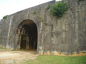
- Tay Do Castle
