The Vietnamese province Yên Bái lies in the middle of Vietnam North. It is traversed by the Red River in the northeast, and the terrain rises to the southwest. Tea grows in the lower regions, while rice is grown on terraces in the higher regions. In particular between Tú Lệ and Mù Cang Chải (the latter is also the center of the district of the same name, the western foothills of the province), the high rice terrace valleys in their scenic charm can certainly compete with the much better known in Yunnan and in Indonesia measure up. However, the most recommendable travel time in this respect is the rice harvest, which falls at the end of September / beginning of October: at this time of year, bad weather fronts from the South China Sea can still "bring" days of rain. With a little loosening up, the resulting views of "the rice terraces in the clouds" can be breathtaking.
 | |
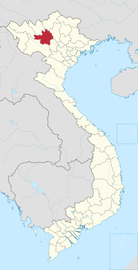
| Yên Bái Province | |
| Capital | Yên Bái |
|---|---|
| Residents | 723.500 |
| no value for residents on Wikidata: | |
| surface | 6,882.9 km² |
| another value for area on Wikidata: 6899.5 | |
| prefix | 029 |
| website | www.yenbai.gov.vn/ |
| no tourist info on Wikidata: | |
| location | |
 | |
Regions
Next to the capital Yên Bái and the district-free Nghĩa Lộ the province is divided into seven further districts: Lục Yên, Mù Cang Chải, Trạm Tấu, Trấn Yen, Văn Chấn, Văn Yên and Yên Bình
places
Other goals
background
Minorities like them live in the province Kinh, Tày, Dao and H'Mông.
language
getting there
mobility
Tourist Attractions
The rice terraces around Mù Cang Chải and in side valleys on the way from Tú Lệ to Mù Cang Chải.
activities
kitchen
nightlife
security
In the remote parts of North Vietnam in particular (including the western part of Yên Bái), it is advisable to have a flashlight (or an appropriately equipped mobile phone) with you at night: the power goes down occasionally - and with it practically all lighting - completely off for about half an hour.
