The Unstrut-Werra cycle path first follows the former Mühlhausen -reffurt railway line. The ridge of the Hainich is crossed. From the Werra there are approx. 250 meters in altitude to overcome, from Mühlhausen to Treffurt approx. 200 meters in altitude. Although already beyond the Unstrut, the route continues to Artern, where it ends at the Unstrut. The route should therefore actually be called Werra-Unstrut-Unstrut. Together with the Unstrut cycle path, there is a ring that Thuringian Basin opens up.
Route profile
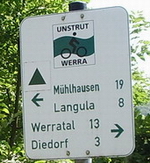
Logo of the Unstrut-Werra cycle path
- Length: 113 km
- Signposting: Intermediate signposts with logo and inscription "Unstrut - Werra", but also arrow signs conforming to standards
- Slopes: Typical slope between Treffurt and Heyerode, short slopes at the bypasses (Wendehausen - Diedorf). Mühlhausen - Treffurt: 200 m; Treffurt - Mühlhausen: 250 m; In the opposite direction away from the railway line, steeper gradients. Oberspier - Sondershausen: Demanding route with a steep incline. Sondershausen - Artern: flat
- Path condition: different: asphalt: Treffurt - junction at Heldra, Diedorf - Heyerode, Mühlhausen - Artern. Composite paving: Wendehausen - Diedorf. Side streets and farm roads: Langula - Mühlhausen. Forest path: Heyerode - Langula
- Traffic load: large sections of the route are quiet and free of traffic
- Suitable bike: Touring bike with tread tires and gearshift suitable for mountain use
- Family suitability: given with older children
- Inline suitability: Sections Diedorf - Heyerode and Sondershausen - Bad Frankenberg are suitable
background
The slightly hilly area is sparsely populated and is one of the poorest areas in Germany. The route touches the to the north Kyffhauser.
Railway lines
- The steep "Vogteier Bimmelbahn" once connected Treffurt on the Werra with Mühlhausen on the Unstrut. The single-track branch line was opened in 1911 and partially shut down again in 1952. Today 8.2 km of the former railway line is used as a cycle path.
- Behind Bollstedt, the route of the branch line of the former Mühlhausen-Ebeleben railway company is used almost entirely as a cycle path. This section was also known as the emergency cycle path.
- Sections of the former Kyffhäuserbahn are used between Bad Frankenhausen and Sondershausen.
getting there
Public transportation
The next train station is Mühlhausen (Thuringia) (Route Leinefelde - Gotha)
By bicycle
- Werratal cycle path - The Unstrut-Werra cycle path branches off at the village of Heldra (between Wanfried and Hit time) from the Werra cycle path.
- Unstrut cycle path - Branch of the route at Mühlhausen (Thuringia) or start in Artern
- Kyffhäuser cycle path - in Bad Frankenhausen
In the street
- Mühlhausen is suitable for. B. as a place of arrival by car: see Arrival in Mühlhausen in the article there.
- Sondershausen is on the BAB 38.
- Artern and Sömmerda are on the BAB 71.
Route description with sights

formerly the Normannstein stop
- The route branches off at Heldra (approx. 3 km west of the historic Hit time) from the Werra cycle path. Wendehausen (see also (Katharinenberg parish)reached. The track quality is very bad at the beginning. Alternatively, the country road can be used, which is particularly recommended if you are traveling from Mühlhausen (good asphalt and it goes gently downhill).
- Between Diedorf and Heyerode is the route already as paved "cycle track" expanded. The highest point of the route is the former Heyerode train station at 427 m. At Heyerode the cycle path leads over a viaduct of the former railway line that is well worth seeing.

The Heyerode viaduct as part of the Werra-Unstrut cycle path
- Another railway cycle path starts from Heyerode train station. The gravel path leads through the forest to the country road
- Langula.
- Next to the road you drive on a farm road to the village, which is passed on cobblestone streets. Due to the numerous one-way streets, the route varies depending on the direction of travel.
- To Oberdorla it goes on a sidewalk.
- Via Gut Weidensee you get to the Popperöder spring in Mulhouse.

Shelter in Österkörner
- The bike route now follows that Unstrut cycle path until shortly before Bollstedt. It continues on a new railway cycle path
- Dig - the river in the valley is the Notter, which flows into the Unstrut near Bollstedt.
- Grains - this is where it is Volkenroda Monastery, where inspection and contemplation are possible. The village has Germany's highest postcode with 99998.
- Schlotheim - the larger town (3700 inhabitants) is crossed on local roads, the railway line is not used.
- Rockensussra - Another section of the railway line begins at the site.
- Life - Retail and snack in a wagon (?) On the bike path. A new farm road leads to
- Oberspier - the place is passed and then the B4 is crossed. A new, hilly route to Sondershausen follows. At one point the gradient is 18%.
- Sondershausen - Already at the entrance to the village you have to turn sharply to the right into the new railway cycle path, which runs above the city, of which you only hear a little if you do not leave the route.
- To the east of the village, the railway cycle path runs largely alongside the road to two state roads.

Guard rails protect cyclists from falling into the "deep" (west of Bad Frankenhausen)
- → A junction now leads to the Barbarossa Cave.
- Bad Frankenhausen - the place must be driven through in traffic (currently no signs). You leave the place to the east on a bike path that runs alongside the road.
- → Connection to the Kyffhäuser cycle path. If you follow this junction, you can continue cycling on the Kyffhäuser cycle path towards Artern. This beautiful northern alternative route has a longer section of railway line.
- Esperstedt - the disused railway line is crossed and one crosses the Esperstedter Ried, while one the Badraer Bach, too Flood ditch called, follows on a paved bike path. Salt that was stored at a depth of 300 m was washed out, so that the landscape subsided. Especially in winter, the reed presents itself as a salty lake landscape with a corresponding flora. [1]. The village of Esperstedt is bypassed to the south. After the village there is a short section of railway line and then another good cycle path next to the flood ditch.
- Ring life - the village is crossed on cobblestones.
- Schönfeld - District of Artern an der Unstrut. There is a connection to the Unstrut cycle path
- Artern - old salt town and terminus.
trips
References to literature and maps
Digital maps
- Parts of the route OpenStreetMap (possibly speculative course)
Web links
- Discover Thuringia
- Extensive picture documentation on route www.bahntrassenradwege.de
- Route information www.bahntrassenradeln.de - exact route description; Image documentation, etc.