The Werra rises at Masserberg in the Thuringian Forest. The Werra Valley Cycle Path also starts here on the main ridge of the mountains. The route follows the river through the Werra Valley in Southwest Thuringia and North Hesse. Half-timbered villages and towns await cyclists on the varied route. Places with more than 25,000 inhabitants are not included. But there is peace, nature and large salt heaps. At Hann. Münden In southern Lower Saxony, the Werra finally merges with the Fulda to form the Weser.

Route profile

- Length: 276 km (Hessian information); 300 km (Thuringian indication)
- Signposting: The route along the middle and lower Werra (Vacha - Hörschel - Hann. Münden) is signposted with intermediate signposts. Main signposts conforming to standards are largely missing. The quality of the signs can be rated as sufficient (traffic in 2006 and 2007). On sections that start with the D route D4 parallel, there are now rectangular signs with inset logos. The Hessian signposting suffers from an abundance of old signs that do not correspond to the current course.
- Slopes: The cycle path does not always run directly on the Werra, some inclines have to be mastered. (e.g. at Tiefenort and Kloster-Veßra). Below Hörschel, however, the route is largely flat. Here there are only a few smaller hills with a maximum of 20 meters altitude (e.g. in front of Bad Sooden-Allendorf and at Blickershausen)
- Path condition: The section of the lower Werra (from Frankenroda) is well developed except for the Werra loop at Lindewerra. In the central part of Thuringia it is getting worse. Country roads without a cycle path alternate with gravel paths of different widths (sometimes so narrow that oncoming traffic can hardly pass). On the upper Werra, many asphalt paths have been created especially for cyclists. Gravel or grit are the exception.
- Traffic load: Country roads are frequent on the upper Werra (southern Thuringia). On the middle and lower Werra (Hörschel - Hann. Münden) the sections on local roads are becoming rarer. Motor traffic on these roads is generally rather low. Sections next to federal highways account for less than 5%.
- Suitable bike: The best touring bike with a 7-speed hub or a derailleur gear system suitable for mountains, as there are hills every now and then.
- Family suitability: In the area of the middle and lower Werra (Hörschel - Hann. Münden), the path is suitable for families with primary school children. The Themar - Grimmenthal route is recommended for families.
- Inline suitability: locally given, consistently no
background
More information about the river and the landscape can be found in the articles Werra Valley, Werra-Burgen-Steig Hesse and Werra-Meißner-Land.
preparation
The usual preparation for a bike tour is sufficient; no special measures are necessary for this route.
getting there
Public transportation
Arrival by train in the area of the Werra spring:
- from the north: railway line Erfurt - Saalfeld (Saale) to Rottenbach; from here with the Schwarzatalbahn (diesel multiple unit) to Katzhütte. If you want, you can also use the Oberweissbacher Bergbahn Use to Cursdorf at 678 m (free bike transport possible; a separate ticket is required for the mountain railway)
- from the north: "Werrabahn" railway line Eisenach - Ice field. Operator: Süd-Thüringen-Bahn. In Grimmenthal connection to the Erfurt Route of the STB. over Sonneberg Neuhaus can be reached on a long, cumbersome route.
- from the south: Bamberg - Coburg - Sonneberg. Here change to the Rennsteigbahn to Neuhaus am Rennweg. Advantage of this variant: The train takes you directly to the main ridge of the Thuringian Forest at 830 m.
- General variant: drive to Steinbach am Wald on the main line Saalfeld (Saale) - Bamberg. From here it is about 20 km to the Rennsteig bike path Neuhaus am Rennweg.
By bicycle
The Werra valley cycle path is well integrated into the network of long-distance cycle paths. The most important connections are:
- Hess. Long-distance cycle route R5: Eder - Fulda - Werra at Eschwege´
- Hess. Long-distance cycle route R7: From the Werra to the Lahn at Philippsthal (Werra) / Vacha
- Ulstertal cycle path at Philippsthal (Werra)
- Rhön cycle path at Philippsthal (Werra), Vacha and bad Salzungen
- Rennsteig cycle path at Hörschel and at the source of the Werra.
- Long-distance cycle route Thuringian city chain at Hörschel
- Unstrut-Rennsteig cycle path to the Thuringian Forest
- Main-Werra cycle path above Meiningen
- Unstrut-Werra cycle path of Hit time to Sondershausen
In the street


Since the Werra Valley cycle path is a route tour, it gets more complicated with this approach. Either return to the car by train or "construction" of a round trip.
Proposal 1:
- Lower Werra (section Phillipsthal - Hann. Münden)
- Fulda cycle path (section Hann.Münden - Bad Hersfeld)
- Hess. Long-distance cycle path R 7 (section Bad Hersfeld - Phillipsthal: mountainous; Alternative: use of the railway between Bebra and Gerstungen
Suggestion 2:
- A similar round results using the Rennsteig cycle path. You start in Hörschel and cycle to the source of the Werra and then you go back on the other route. However, the quality of individual sections of the Rennsteig cycle path is very poor and unsuitable for cyclists.
Route description with sights

Neuhaus am Rennweg - Hildburghausen: about 50 km


The Werra rises in Thuringian Forest. There is a lot of forest, good air and a beautiful blue sky when the sun is out. The area belongs to Southwest Thuringia. As far as Sachsenbrunn, the section runs largely on gravel forest roads or nature trails and it is partly steep downhill. Then there are many short but steep climbs (also downstream).
Route:
- km 0: Neuhaus am Rennweg (830 m above sea level)
Sights in the area of the Werraquelle / Thuringian Forest:
- - Goldisthal pumped storage power plant (2-hour tour possible; reservation up to 6 months in advance necessary; contact: Thomas Schubert (Public Relations Pumped Storage Power Plant Goldisthal) Tel .: 036781-332210; the power plant operator is Vattenfall)
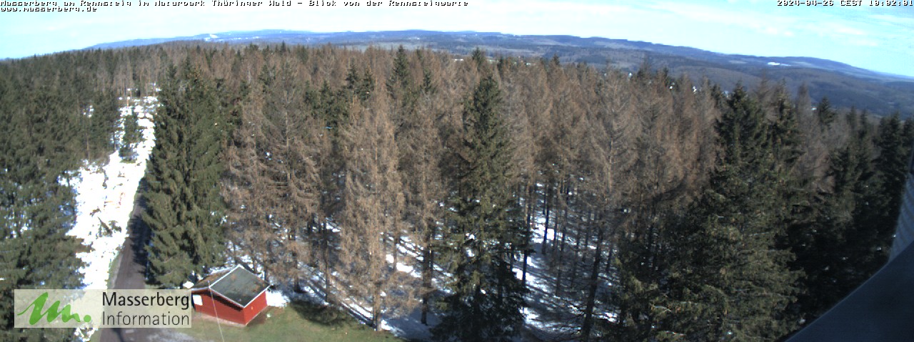
- - Masserberg with lookout tower Rennsteigwarte (Webcam)
- - Dreistromstein (watershed Weser, Elbe, Danube)
- - Bleßberg (867 m, observation tower, summit gastronomy)
- ~
 ~> From Neuhaus, it is best to cycle following the signposting Rennsteig cycle path to Siegmundsburg. Although there is officially only one source of the Werra, the Saar is regarded as the second Werra, so that in many representations the Saar source is mentioned as the second source of the Werra. "Werraquelle" is also written on the source stone. The latter is next to the federal highway 281 behind Siegmundsburg. Link to the dispute over the source of the Werra
- km 11:1 Siegmundsburg


 in der Datenbank Wikidata") (777 m above sea level) - is on the B281 and has the Saar spring (802 m above sea level). The source is one of the starting points of the official Werra Valley cycle path. However, the signage here is not in accordance with the standard. There is a restaurant and even 2 parking spaces.
(777 m above sea level) - is on the B281 and has the Saar spring (802 m above sea level). The source is one of the starting points of the official Werra Valley cycle path. However, the signage here is not in accordance with the standard. There is a restaurant and even 2 parking spaces.

- Werra spring Fehrenbach (797 m above sea level) - the Werra rises in the middle of the forest and this source is the only one that is signposted. It can only be reached via a detour, by following the Rennsteig cycle path straight ahead. Next to the spring there is an inn with a refreshment stop. In theory, this end point could also be a starting point. The common main path leads in a loop to the Werra pond (photo) and from there follows the river. It goes steeply downhill through a narrow, dark valley
- km 24: Sachsenbrunn (480 m above sea level) - here the Saar flows into the Werra. A partly asphalted farm road leads to
- km 30: Ice field - Market square with a lock. A museum is housed in the castle. The place has a train station, the first in the Werra valley. (Neuhaus is difficult to reach from here by train).
- ~ ~> Hilly country roads behind Eisfeld. About 9 km later, a good and beautiful "real" bike path.
- Veilsdorf - From the good bike path (on the edge of the forest after the village) you have a beautiful view of the valley
- km 50: Hildburghausen - City with almost 12,000 inhabitants. Detour and sparsely signposted route through the historic city center. The city is characterized by a canal that surrounds the castle park, which you can also cycle along (→ after crossing the Werra, take the next street on the left). This way you can pass the city a little faster.
- → Note: In the Thuringia cycle route planner, the route leads along the Werra and past the train station through the city. However, this alternative is not signposted on site.
Hildburghausen - Meiningen: about 37 km

Short stage so that there is time left over for sightseeing in Meiningen in the afternoon. The cycle paths in this section have been significantly improved in recent years. Now almost the entire route is paved. The area is very quiet, the valley, in which the still young Werra meanders here, is quite wide and you can breathe the aromatic mountain air. The signage is very sketchy (at least in the upstream direction). Caution: many post locks, which are often difficult to see in backlight! (Photo)
Route:


- km 0: Hildburghausen
- ~ ~> After Hildburghausen almost exclusively country road. There is a strong upward path to the monastery
- km 12.7: 1 Veßra Monastery

- ~ ~> After the place the bike path gets better again (photo).
- km 15.5: Themar - also an easily accessible train station on the bike path. Through the place there is - depending on the direction? - 2 alternative routes.
- ~ ~> This is followed by an overall good and beautiful bike path that continues to Meiningen.
- km 23.5: 2 Vachdorf has a train station (photo). The diesel railcars of the STB (Süd-Thüringen-Bahn), which accompany this section of the Werra Valley, stop here. There is also a late medieval fortified church.

- km 29.3: Einhausen - here it goes first to the right, but then soon to the left (no signpost) to another Werra bridge. The paved stone bridge from 1579 was restored at great expense.
- → behind the bridge begins the Haseltal cycle path
- km 31.1: Grimmenthal has a hub train station, which is approx. 1.5 km from the cycle path and the Werra. Trains run here on the Erfurt - Mellrichstadt and Eisenach - Neuhaus lines.
- km X: Undersize field - One Correctional institution in old walls one meets here. The original Maßfeld Castle was used as a "custody" for centuries. (Visits are possible by appointment)
- km X: Meiningen - if you want to see the place, you have to branch off over the Werra. There are no signposts for cyclists. No other place with fewer than 25,000 inhabitants has so many villas and palaces
Meiningen - bad Salzungen: 40 km
Short stage. With the detour to Schmalkalden you come to approx. 65 km. The quality of the paths is now clearly decreasing. Unpaved forest and field paths alternate with country roads. The Südthürimgenbahn also accompanies this stage on a single-track route with its railcars. The places mentioned have (almost?) All a train station.
Route:

- km X: Walldorf - A fortified church in the village, which unfortunately burned out in 2012. There is also one in the local area Sandstone cave. Then a shady, only partially paved forest path along the Werra.
- km X: Wasungen - has an entrance sign for cyclists. You pass the train station and follow the quiet country road (the main traffic runs parallel to the B19).
- → Connection to the Rhön-Rennsteig cycle path
- km X: Surge - a partially new cycle path has been built here, replacing the old "Monte Brutalo". After passing the industrial area, it goes into the Feldmark. The path meets the busy B19, which you leave after about 500 turning left. The new route is not nice, but you don't have to get off. Turn right on the B19 Mommelstein cycle path to Schmalkalden.
- Alternatively "Monte Brutalo" - you don't cycle over the small bridge, but straight ahead. On the country road after passing the railway line (barrier) turn right.
- km X: Wernshausen - junction to Rosatal cycle path
- km X: Spreads - after the town center there are some lakes. The Kiesee is a natural open-air swimming pool (entry 2 €) with a campsite. On the way, Wittgenthal offers a restaurant and Neuhof a small cafe.
- ~ ~> The path between Breitungen and Barchefeld-Immelborn runs on a low-traffic country road (K87).
- km X: bad Salzungen - Health resort with "Keltenbad".
bad Salzungen - Creuzburg at Eisenach: 72 km
Longer stage, which partly leads through the industrial region of the Kali Triangle. But there are still scenic sections.
Route:


- 2 bad Salzungen at the train station: km 0
- ~ ~> The cycle path runs between Bad Salzungen and Merkers on the right side of the Werra. On the outskirts of Tiefenort 3 There are two alternative routes, one along the Werra (closed during floods) and one over the mountain to Kieselbach. It is worth taking a detour to Krayenburg3 (steep incline) with beautiful views from the castle tower into the Werra valley. Castle with Hotel & restaurant.
- At Marker (Adventure mine; off the route at 4 ) the cycle path changes to the left side of the Werra and leads along the route of the old factory railway (railway cycle path) to Dorndorf.
- 4 Dorndorf Felda cycle path junction: km X - Bike tour hostel. The large cultural center is reminiscent of GDR times. Connection to the Feldatal cycle path in the direction of the Thuringian Rhön.
- ~ ~> Country road and cycle path accompanying the road lead to

- 5 Vacha Junction of the old Werra bridge: km X - Here you can take a detour to the small one over the historic stone arch bridge on the Werra Half-timbered old town Companies.
- ~ ~> Between Vacha and Phlippsthal the cycle path changes from Thuringia to Hesse. In Vacha or Philippsthal connection to the Ulstertal cycle path (here identical to the Rhönradweg). The Hess begins in Vacha. Long-distance cycle path R7: From the Werra to the Lahn, later towards Bad Hersfeld branches off.
- km 23.8 km: Philippsthal - The courtyard of Schloss Philippsthal will be driven through. Not much later you will notice a large, white mountain of salt, the Monte Kali. By the way, discharges of salty sewage ensure that the salinity of the river is significantly increased and that saltwater fish live here. ("eleven million cubic meters of liquid residues and up to 13 million tons of solid salt waste") [1]
- ~ ~> Route in Potash triangle: - You now drive north of the Werra to Heimboldhausen (away from the traffic noise). From here, however, the cycle route remains on more heavily traveled country roads (mostly on cycle paths) to Heringen (Werra).
- Heimboldshausen (in front Urethra via the Werra) - connection to the Solztalradweg
- km 33.3 km: Herring (Werra) - Here can Werra Kali Mining Museum be visited, which is located directly on the route.
- ~ ~> the well-known wooden walkway through the floodplain swamp close to the Werran is (again?) there. It may only be used "at your own risk" and is not signposted as a cycle path. The official route runs, sparingly signposted, on the country road to Widdershausen. This is currently under construction and can only be cycled to a limited extent. [June 2017]
- On scenic gravel roads and trails near the river, we continue past Widdershausen
- Dankmarshausen - the Waldhessen R15 leaves the Werra valley direction Bebra in the Fulda valley. To do this, you have to cross the bridge in Widdershausen, which is also a signposted alternative to the Werra Valley cycle path.


- → Behind Dankmarshausen is a detour to "Am Rhäden" wetland possible. There are several bird watching stands distributed along the route around the protected area (for information on the NSG, see www.nabu-wildeck.de).
- ~ ~> after Lower chair one arrives on a paved avenue. The place impresses with one Round church. An asphalt farm road follows
- 47.1 km: Gerstungen - Rail connection to the Eisenach - Bebra line. Partly no asphalt in the village.
- At Leek Roden: The Brandenburg - Imposing double castle ruins consisting of the remains of the east and west castle. Between April and September the castle museum is open on Sundays and public holidays from 11 (?) - 5 pm or, according to another source, 2 (- 5 pm) (10-2013). The museum with a viewing terrace is in the Bower and shows a collection on the history of the castle. Admission: € 1, children 50 cents. For more detailed information on the ruin and events in the building, see (Site of the castle association).
- Herleshausen - once again in Hessen. During the GDR era, there was the Herleshausen-Wartha border crossing here, now a large truck stop on the BAB4. The place offers a lot of half-timbered houses and some refreshment stops.
- km 65.7 km: Hörschel town center - Detour from here to Eisenach, (signposted route of the Thuringian city chain: 8.5 km
- ~ ~> In Hörschel (rail connection to the Bebra - Eisenach line) you drive on a quiet side street under the imposing viaduct of the A4 motorway. After about 1.5 km you reach the hamlet via the side road Spichra.
- Through wide fields it goes from Spichra on partly newly asphalted paths towards Creuzburg. On the way you can still get on Wilhelmsglücksbrunn Abbey Estate past (guest house with restaurant-café, but also cheese factory and farm shop). You finally reach the market square of the small town via the historic Werra bridge near Creuzburg.
- km 72.4 km: Creuzburg - Some accommodations are available for overnight stays. After moving into your room, you can take a walk to the castle of the same name, which is located above the town.
Creuzburg - Eschwege: 47 km
Between Creuzburg and Eschwege, the landscape is clearly the main actor. The Werra has cut the river valley, which is particularly varied here, partly ruggedly into the layers of shell limestone, such as B: in the Werra breakthrough below Creuzburg. In addition, nice half-timbered towns and villages such as Treffurt and Wanfried are driven through. A bicycle bus (line 200/231) operated by the NVV runs between Creuzburg and Eschwege via Treffurt and Wanfried on Saturdays, Sundays and public holidays. However, this does not go over Mihla!
Variant for day tour:
- Take the train up Hörschel (Route Bebra - Eisenach)
- Bike tour along the Werra to Eschwege: distance approx. 54 km.
- From Eschwege you can take the train back home (located on the Göttingen - Eisenach route)

route


- km 0 Creuzburg - The eponymous castle is located on a hill above the small old town.
- ~ ~> From the old Werra bridge near Creuzburg the path has been leading since 2016 in the Creuzburg-Buchenau section on the left bank of the Werra (former embankment of the Werra Valley Railway between Creuzburg and Mihla) the previous path was washed away several times by the flood near the village of Ebenau and is now impassable. A new Werra bridge and a rest area were built near Ebenau.
- From the Buchenau settlement, the route leads first on a country road, later on a railway cycle path (water-bound cover) to Mihla.
- about km 9: Mihla - Quiet village with refreshment stops behind the town exit
- ~ ~> From Mihla you cycle past the swimming pool on paved paths to Ebenshausen. On a new and beautiful railway cycle path you come to Frankenroda (refreshment stops).
- Frankenroda - also followed by a break landscape. The bike path is the only way in the valley here and is therefore very quiet. Anyone who wants to can use the Country inn Probstei-Zella stop off (also camping site).
- ~ ~> The Werra valley becomes narrow again between Frankenroda and Falken. The car-free path has a good asphalt surface.
- In Falken the valley widens again and the 504 m high Hero stone moves into the field of vision. You can reach Treffurt on traffic-free, asphalted paths (suitable for inline). This section has become very beautiful and benefits from the absence of continuous roads.
- around km 25: Hit time - Here you can take a detour to the pretty old town (refreshment stops). For a carefree tour of the city, you can find it in the community center at the tourist information lockable bicycle boxes (Key is in). There is also a shop on the bike path (supermarket on the outskirts).
- → The next place Herora can be omitted by cycling straight ahead where you otherwise branch off at right angles to the left. Later you meet the main route again.
- → Another alternative is via Big boy (large half-timbered village) on the left side of the Werra to Wanfried. The route is shorter and quieter, but the quality of the path is worse.
- ~ ~> Largely on asphalt, it goes on Wanfried. 4 km before Wanfried you might find that Half-timbered village Altenburschla for a rest. There is a lot of half-timbered construction in this award-winning village, but there are also cobblestones. The Country Hotel offers a gastronomic offer along the way.
- around km 35: Wanfried - The town has many half-timbered buildings. For a city tour, it is best to put the packed bike in one of the 5 Bicycle boxes in the courtyard from (free of charge; boxes have coin deposit locks).
- ~ ~> In Wanfried the Werra side is changed - past the old blow (the historical end point of the Werra shipping) - and it goes next to some lakes on a paved bike path to Aue. The last 6 km to Eschwege are a pleasure to drive if the wind is right. Unfortunately there is more often west than east wind.
- In front of the old town of Eschwege, a detour to the Werratalsee is recommended (access via bridge with spiral driveway; campsite and restaurants on the lake)
- around km 47: Eschwege - The district town is an attractive stage town. The old town with numerous half-timbered buildings invites you to stroll and stop for a break (cozy pedestrian zone with refreshment stops). An ascent of the Nikolaiturm is worthwhile due to the nice city view, which faces west to the Meissner enough. The tin figure cabinet is also worth seeing.
sure Bicycle parking for packed bikes: 10 bike boxes are available at the parking garage in Gebrüderstraße (almost at the tourist information).
Eschwege - Hann. Münden: 58 km
Stage map Eschwebe - Hann. MündenThis stage has with Eschwege, Bad Sooden-Allendorf, Witzenhausen and Hann. Münden to offer four historic half-timbered towns. The proximity to the major cities of Göttingen and Kassel ensures lively bicycle traffic. The route offers a lot of variety and it can be said that this is the most interesting and popular section of the whole route. The runs from Eschwege Cantus with connection to Kassel and Göttingen. In the direction of Kassel it goes through the Werra valley to Hann. Münden.
Route:
Eschwege and Hann Münden


- km 0: Eschwege-Old town
- ~ ~> The cycle path is well developed between Eschwege and Bad Sooden-Allendorf. The route is paved almost continuously. There is only an approx. 2 km long, easily drivable piece of gravel in front of Albungen. In Keinvach then a few hundred meters of cobblestone pavement.
- →tip: From 5 Jestädt you can follow the loop of the official route via Niederhone on very attractive paths directly up to 6 Albungen / Werra bridge abbreviate. You save about 2.5 km and drive completely off the main road. The near-natural gravel path with a grass cover and several extended wheel tracks is not really for multi-lane people and also not for bike teams with bicycle trailers.
- No awake - Café / bistro on the route; At the eastern exit of the village: rest area directly on the Werra with picnic furniture and a water treading basin.
- ~ ~> Now it's scenic, away from the traffic noise, on paved paths towards Bad Sooden Allendorf. Rothestein Castle greets you from above (very steep exit; Coffee shop on the castle terrace in the courtyard with an attractive valley view). Excursion gastronomy just accessible halfway in the valley. From here a moderately steep hill (30 - 35 meters above sea level) to the pretty half-timbered old town of Allendorf. Here in front of the entrance to the old town the "fountain in front of the gate" under a stately linden tree (for the folk song see also Wikipedia "At the well in front of the gate").
- km 17: Bad Sooden-Allendorf with half-timbered old town various refreshment stops; Diebensturm with a view over the historic city center; Spa park with graduation tower and salt museum in Bad Sooden on the other side of the Werra; Border Museum Schifflersgrund (lies north; approx. 2 km detour with a steep incline)
- ~ ~> From Bad Sooden-Allendorf you cycle first on the Werra and then on the cycle path alongside the road to Wahlhausen (campsite). From Wahlhausen until Lindewerra became one in 2014 completely new, 4km long, traffic-free section laid out on the former Kolonnenweg. The new route is paved and runs close to the river between Werra and the district road. Volunteers from Wahlhausen even have a new refuge on this section of the cycle path built.
- → To the variant on the left of the river: If you want, you can alternatively take a farm road from Bad Sooden-Allendorf to Lindewerra to the left of the Werra. The farm road, which is signposted as a cycle path and 95% asphalt, leads in the area of the main road over the village of Ellershausen to the Werra bridge to Lindewerra. Before Ellersausen at the underpass of the federal road two shorter stairs to the bridge over the Solgraben. After Ellershausen you reach the Werra Valley Cycle Path at Lindewerra via the "Bridge of Unity". This alternative route runs, however in the noise and exhaust gas area the busy main road.
- around km 21: Lindewerra - You can do that here on Sundays Visit the stick-maker museum). You pass a not so old Werra bridge, which was only built after reunification (hence the "bridge of unity"). Before that, there was sharp shooting here. Rest area with rain protection on the Thuringian side of the bridge.
- →Tip: lookout point "Devil's pulpit" - The rocky cliff high above Lindewerra is a popular destination. A cozy forest inn is located directly on the cliff. The rock cliff is freely accessible. As a cyclist, you can reach the vantage point from Hanstein Castle via an approx. 3 km long driveway (caution pedestrians). However, this path is very hilly and bumpy (more for the MTB than for a packed touring bike). Alternatively, you can drive up a gravel forest road from Wahlhausen. The road branches off about 500 m north of Wahlhausen from the Wahlhausen - Lindewerra road. The Werra cycle path also runs along this road. Tour tip: 2 nights in Lindwerra or Bad Sooden-Allendorf and the Teufelskanzel together with Hanstein Castle on a beautiful Day hike Explore from Lindewerra.
- ~ ~> River path below Lindewerra: In the area of the Werraschleife Lindewerra there is a nice but bad stretch of path over 3 km. The loamy earth path (partly only 1 - 1.5 m wide) is particularly muddy when it is wet. Even when dry, the track is not suitable for racing bikes. From the railway viaduct it goes back on asphalt roads to Werleshausen. Here you can drive up to Hanstein Castle (steep asphalt route) or take a walk to the Ludwigstein Castle Companies.
- around km 21: Werleshausen - after a sweaty driveway (no bike path!) you can enjoy a beautiful view from Hanstein Castle enjoy from. The imposing castle ruins are high above the Werra. The still intact one sits enthroned on the other side of the Werra Ludwigstein Castle on the mountain. The short ascent on foot from Werleshausen over the pedestrian bridge is easier here.
- ~ ~> Behind Werleshausen there are two ways to Witzenhausen from the bridge of the B 27:
- Via Wendershausen: As far as Wendershausen, about 3 km of country road must be used from the Werra bridge. Depending on the traffic time, the route is only moderately traveled, but still fast. Anyone who uses this route will pass the Zweurgenblick.
- Via Unterrieden: This route is largely free of traffic. However, the path is in the area of the B 27 and is also a bit hilly.
- km 25: Witzenhausen - Half-timbered old town with a beautiful market square; At the end of April / beginning of May, the cherry blossom here transforms the valley slopes into a sea of white blossoms; the cherry adventure trail provides information on the subject.
- ~ ~> Danger zone between Witzenhausen and Ernschwerd: From Witzenhausen, the route follows the country road as an asphalt bike path. Shortly before the village of Ernscherd there is a steep, not harmless descent with a slight curve (about 15%) down to the river. At the top of the descent, downhill cyclists are required to "dismount". Unfortunately, those responsible made it easy for themselves with this solution. Many cyclists will probably not stick to pushing off the mountain. Here, a modification of the lower, invisible curve would be the better and above all safe solution (e.g. a 1 to 1.5 m wider path with separate lanes through a line in the curve area; in the steep area a separate path for pedestrians).
- Ernschwerd itself, which has some interesting half-timbered buildings (including a magnificent building called a "half-timbered castle"), is crossed on the through town (no bike path, moderate vehicle traffic).
- You cycle on the way from Ernschwerd to Blickershausen very nice right on the water. The route along the fields is paved. It gets hilly between Blickerhausen and Oberode. For that one becomes with one Nice view rewarded in the river valley near Hedemünden. Die asphaltierten Wege verlaufen abseits des KFZ-Verkehrs. Auf einer ruhigen Straße wird nun das Wirtshaus Zell erreicht (Ausflugsgastronomie, Zeltplatz).
- Unterhalb der imposanten Werratalbrücken (Autobahn A7 und die ICE Strecke queren hier das Tal) wird es auf ca. 3 km noch einmal richtig romantisch. Das Tal verengt sich. Der Weg führt eingekeilt zwischen Bahnlinie und Werra (gut fahrbarer Schotterweg, der zum Teil allerdings nur ca. 1,5 m breit ist). Viele Bäume säumen das Flussufer und spenden viel Schatten. Achtung: In einer Senke ist ein Streckenstück im Vergleich zur restlichen Route hier hochwassergefährdet. Hier wäre es sinnvoll die Route mal hochwassersicherer auf etwa 100 m neu zu trassieren/hoher zu legen). Die genauen Pegelstände "Land unter" der Werra in bezug auf Hann Münden für diese Wegsenke sind aber nicht bekannt.
- km 45: Dreiflüssestadt Hann. Münden - Hier endet der Werra-Radweg am bekannten Weserstein, es fließen Fulda und Werra zusammen und die Weser wird geboren. In Hann. Münden sollte man unbedingt die historische Fachwerkaltstadt erkunden. Tipp: Einen gemütlichen Tourenausklang kann man auf der Tillyschanze verbringen. Vom Turm hat man einen "Eins A" Panoramablick auf die Stadt. Alternativ kann man auch einen Spaziergang auf die Weserliedanlage unternehmen (ebenfalls schöner Talblick, allerdings keine Einkehrmöglichkeit).
- ~ ~> Ach ja: Die Weser auf dem Weg zur Nordsee wartet...
Weitere Übernachtungsorte
- Wartburgstadt Eisenach - Ab Hörschel etwa 10 km Abstecher von der Route.
trips
- From Hann. Münden, "Wo Werra sich und Fulda küssen...", geht es weiter auf dem Weserradweg bis zur Nordsee.
- Kurz vor Witzenhausen, im Schatten der Ludwigsburg und der Ruine Hahnstein, biegt der Iron Curtain Trail (EuroVelo 13) in nordöstlicher Richtung ab und folgt weiter der ehemaligen innerdeutschen Grenze.
GPS-Daten
- Daten aus dem Hesse cycle route planner - man kann die Daten ab Meiningen als GPX-Datei frei herunterladen.
Literatur- und Kartenhinweise
Digitale Karten:
- Streckenverlauf ab Meinigen im Hesse cycle route planner
Bücher:
- Radreiseführer "Fulda-Werra-Rhön" , ISBN 978-3980962919 , Sonderpreis 6,90 €, 400 km lange Rundtour Werratal-Radweg - Rhön-Radweg - Fulda-Radweg · weiteres siehe Harald Wittenbrock Verlag
- Spiral-Radwanderkarte "Werratal-Radweg" 1:50.000, ISBN 3-87073-241-5 please refer Bielefelder Verlag
- Werratal-Radweg. Mit Anbindung an Fulda- und Weser-Radweg, Quadrat-Spiralo 1:50.000, BVA Bielefelder Verlag 2006, ISBN 978-3-87073-241-7
- Bikeline Radführer Werra-Radweg 1:50.000, ISBN 978-3-85000-085-7 , Esterbauer Verlag
- Günther Pöpperl: Fulda - Werra Wander- und Radtour ISBN 978-3839168639
Individual evidence
- ↑laut spiegel.de vom 27. Juli 2012
Web links
- Streckenverlauf
- Werratal Touristik e.V. - offizielle Touristikseite zum Werratal mit Infos über den Radweg, zum Wasserwandern usw.
- Werratal Radweg Tourist Information - Touristik-Informationsseite über Radwege im Werratal des Tourismus Zweckverband Eschwege-Meinhard-Wanfried
- Thüringen Tourismus: Werratal-Radweg
- zur Kunst am Werratal-Radweg im hessischen Bereich der Radroute
- Naturschutzprojekt "Lebendige Werra" - Seite mit vielen Informationen über den Fluss.
- Bahnrassenradwege.de Creuzburg - Eschwege - Bilddokumentation und Tipps