 | ||
| High Meissner | ||
| federal state | Hesse | |
|---|---|---|
| Residents | unknown | |
| no value for residents on Wikidata: | ||
| height | 753 m | |
| no tourist info on Wikidata: | ||
| location | ||
| ||

The High Meissner is a small mountain range in Hesse. Incidentally, the highest point is the Kasseler Kuppe at 754 m. In addition to the actual range of the Hohe Meißner, the article also includes the Meißner foreland east of the mountains with the municipalities of Berkatal and Meißner.
 The Hohe Meißner from the north-northwest (from the Bilstein) |
 East view from the Meißner (from the Kalbe) towards the Werra |
background

According to legend, Ms. Holle should live on the Meißner. At the Mrs. Holle-Teich one finds the kind-hearted weathermaker as a wooden figure. For detailed information about Ms. Holle, simply click on the appropriate Wikipedia article Administratively, the Hohe Meißner belongs largely to the Hausen district of the municipality Hessian Lichtenau.
getting there
By train
The next train stations on the route Bebra - Goettingen are Eschwege and Bad Sooden-Allendorf. Of Eschwege there are bus and AST connections on the Hohe Meißner.
By bus
The Hohe Meißner can be easily reached by public transport.
The Bus route 290 (Timetable) drives from Hessian Lichtenau (Connection of tram line 4) via the Hohen Meißner Eschwege, from April to October equipped with a bike rack (max. five bikes).
The Bus line 220 (Timetable) moves on the weekend of Witzenhausen above Bad Sooden-Allendorf to Vockerode, in the Meißner highlands at the foot of the Hohe Meißner, near the barefoot path. There is a connection with bus line 290, over the Hohen Meißner, to Hessisch Lichtenau.
The AST line 209.2 (Timetable) drives from Hessian Lichtenau on the Hohe Meissner, the AST line 229.1 (Timetable) of Eschwege out.
In the street
- From the west kassel: A 7 motorway to the Kassel-Ost triangle (No. 78). Then on the federal highway 7 over Hessian Lichtenau to Walburg. From here follow the signs to the Hohe Meißner via Velmeden.
- From the north Goettingen: A7 and A38 to the Friedland exit; via the B 27 to Witzenhausen; continue in the direction of Hessisch Lichtenau, stopping on the B 451 and country roads to Velmeden. From here follow the signs to the Hohe Meißner.
- From the east Eisenach: A 4 motorway to the Wommen junction (No. 37). Via the B 400 and the B 27 to Wehretal south of Eschwege. From here drive up to the Meißner via Vierbach, Gernrode and Vockerode.
- From the south Bad Hersfeld: A 4 motorway to the Bad Hersfeld junction (No. 32). Via the B 27 via Bebra to the south of Wehretal Eschwege. From here drive up to the Meißner via Vierbach, Gernrode and Vockerode.
Park
There are several free (large) parking spaces on the country road on the summit plateau. There is usually no shortage of parking spaces in the summer months. The parking spaces are designed for winter tourism, when the Meißner is visited by numerous winter sports enthusiasts from greater distances.
Only the smaller parking lot at Frau-Holle-Teich can be overloaded on nice summer days (e.g. Sundays and public holidays). Therefore, on days like this, it is best to park in the large squares on the plateau and walk around the sight. B. on the premium circular route P 1.
By bicycle
Regional
The Herkules-Wartburg cycle path (Kassel - Eisenach) leads past the Meißner in the south.
Local
The easiest way to get to the Meißner by bike is to use bus line 290 with bike transport. (see section bus)
There are currently no signposted cycle routes that lead to the summit plateau without traffic (06-2013). Using the country road is definitely the easiest way to get to the ridge.
However, the sometimes confusing streets are especially on Sundays and public holidays drive quite hard and fast. Of course, this also depends on the weather conditions. On such days, it is only advisable not to drive up the country road from Velmeden and also from Eschwege.
It is therefore advisable to use traffic-free routes uphill. You have to look for this yourself, however. The problem with this is that many forest roads run parallel to the slope. A precise map is a prerequisite for even finding the way (see also the literature section).
Mountain time trial route
Since 2008, there has been a permanently installed timing system for cyclists on the eastern approach to the Hohe Meißer. The route leads from Abterode over 7.4 km up to the Meißner (approx. 450 m altitude difference with a maximum of 26% gradient). Due to the heavy excursion traffic on nice weekends (especially Sundays and public holidays), it is advisable to drive on the road on weekdays. Then there is usually less going on.
The "valley station" of the timing system can be found in the center of Abterode, directly on the road to Meißner. Here you pull out a stamp card on which the machine prints the current time.Now it's time for the sweaty journey to the Meißner plateau. When you reach the top you stamp the card again at the "mountain station" of the facility. The stamp card is thrown into a box here. Later you can go under www.stoppomat.de see his result in the evaluation of the route. By the way, the fastest so far (04-10-2009) is professional cyclist Dirk Müller from RSV Bad Hersfeld (travel time 19:21 minutes with an average of 24.2 km / h)
The service of the timing system is free of charge.

mobility
The approx. 10 km long and up to 5 km wide ridge can easily be explored on foot in one day. At the top, the Meißner is a fairly flat plateau at an altitude of over 700 m. Some circular hiking trails are signposted.
Tourist Attractions
On the Hoher Meissner


- 1 Lookout point, 718 m, rock cliff on the eastern slope of the mountain range, beautiful east view towards Eschwege and in that Werra Valley. When visibility is good it is resin to recognize.
- Access:
- from 2 Frau-Holle cross-country ski trail parking lot or the parking spaces in the area of the Meißnerhaus or the mountain inn: via forest paths running through the forest; about 2 - 3 km one way, depending on the parking lot.
- from 3 Parking lot at the Frau-Holle-Teich: Footpath with steps; about 0.8 km; the path can be bypassed on a driveway.
- On both paths you also pass the lookout points that are located at the former open-cast lignite mine.
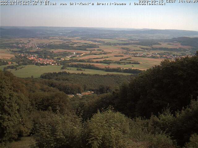
- "Schwalbenthal" lookout point 613 m - Located on the country road; beautiful view of Eschwege and to the east.
- Viewpoint NaturFreunde Meißnerhaus - From the meadows in the area of the Meißnerhaus you have a beautiful south-west view. You can see the in good visibility Kellerwald as well as the Habichtswald.
- 4 Lookout point at the former open-cast lignite mine - with a view of the huge open-cast mine in which the "Kalbesee" is located today. Those who climb up to the calf pass the lookout points.
- 5 Frau Holle pond - small, idyllic pond on the eastern slope of the mountains. By the way, it says here w: Mrs. Holle as an approx. 3 m high wooden sculpture. Access: The water is directly on the country road. A car parking space is available directly on the lake. However, it can be overcrowded on main excursion days.
- 6 Kassel hilltop - The wooded hilltop in the northern part of the ridge is the highest point in the mountain range, but it is touristy uninteresting. There is no lookout point. There is an open refuge in the forest (protection from rain). There is also a basalt quarry at the top.
- 7 Kitzkammer - A small cave on the Meißnerwesthang. The cavity in a basalt column wall is only accessible on foot. It is located approx. 1.7 km from the Viehhaus parking lot. Alternatively, you can also reach the Kitzkammer from the parking lot at the Meißnerhaus.
- The Kitzkammer is partly mentioned in the fairy tale Frau Holle. For information on this and geological background information on the Kitzkammer with pictures, see also Wikipedia article "Kitzkammer".
In the Meißner foreland
"Meißner foreland" is the name given to the hilly, partly plateau-like mountainous region between the Eschweger Kessel and the Meißner ridge.

- Hell Valley With Visitor mine "Grube Gustav" northeast near Abterode (municipality of Meißner; approx. 5 km east of the ridge). The small romantic forest valley with a stream is not only due to the 8 Visitor mountain worth a visit. A short nice walk is e.g. B. also the ascent of the 9 Bilstein cliff. starting point 10 Hiking parking lot and 11 Hikers' parking lot with refreshment stops . From both parking lots you walk only around 500 m to a maximum of 1 km to Bilstein (around 50 meters in altitude).
- The 10.5 km long premium path P2 Frankershäuser Karst or the 10 km long premium path P23 Höllental are suitable for day hikes in the Meißner foothills. (Info nature park). The routes run among others. also through the Höllental with Bilstein. Another interesting destination on this route are the Hielöcher near Frankershausen.
- 12 Hielöcher nature reserve - Anyone who leaves the Frau-Holle-Teich in the direction of Werra by car or bicycle can take an interesting walk through the "Hielöcher" sinkhole near Frankershausen. In the juniper heather it is essential to stay on the paths, because there is a risk of collapse in some areas (sinkhole area). There is parking at (at 13 Sports field in Frankershausen). There are also benches here to rest as well as several information boards. The second nature reserve, the Kripplöcher, is only accessible on guided hikes in the Geo-Nature Park.
- The 14 Meißner mountain game park with the Waldwichtelhaus is on the eastern slope of the Meißner near Germerode.
- Germerode Monastery - The monastery is located on the eastern slope of the Meissner in Germerode. The monastery church of St. Maria and Walpurga is open from April to November from 9 a.m. to 6 p.m. The facility is used as a conference venue. further information: Side of the monastery
- The 15 Hilgershäuser or Kammerbacher Höhle is located near Hilgershausen 5 km north of the Meißner. The cave is currently closed permanently (12/2019).
activities

hike
Some longer and shorter circular hiking trails are signposted on the Meißner, and the one that continues GrimmSteig over the Hohe Meissner.
- Premium path P1 Hoher Meißner The certified circular hiking trail P1, which includes all important sights (Kalbe, Frau-Holle-Teich, etc.) leads over the entire mountain. Route on Openstreetmap A route map of the 13 km long marked circular route is available as a PDF file to be found here.
- Circular route no. 6 with Mrs. Holle Teich
- Circular route no. 3 around the cattle house
- Circular route no. 7 around the Rebbes with sea stones
- Another hiking tip with an overview map is z. B. can also be found in the Regiowiki Kassel. The circular route is also 13 km long and leads from the Meißnerhaus to the former opencast mine, the Kalbe, the Frau Holle pond and over the Kasseler Kuppe. The description is here to find.
- If you want, you can also walk the 1.5 km long with your feet 16 Barefoot path massage. It is open from April to October and can be accessed free of charge. A donation of 1 euro per person is requested from the youth village on the eastern slope of the mountain.
Winter sports
If the snow conditions allow, a total of 15 km of trails are groomed ("trail fee" € 1 - donation box at the entrance to the trail). There is a 1 km trial lap. The Frau-Holle-Loipe is a 9 km long classic circular trail (can be shortened to 4 or 6 km). There is also a 5 km long skating trail ([1]). Arrival by car up to the big one 17 Frau Holle cross-country ski trail parking lot (free of charge).
- Downhill riders come to two Ski lifts on your costs. Next to the Naturfreundehaus: 18 small elevator. Near the mountain inn Hoher Meißner 19 big elevator.
- Of course there are also toboggan runs for the good old wooden toboggan. to be found here
shop
kitchen
High Meissner:
- Berggasthof Hoher Meißner
- NaturFreunde Meißnerhaus
- Wildgasthaus Zum Kupferbach in the area of the youth village
Meißner foreland:
- Schindewolf Inn in Frankershausen
- Restaurant at the Meißner mountain game park (for game park see also sights)
- Höllental restaurant in Abterode
- Landhotel Meißnerhof in Germerode

accommodation

High Meissner:
- Meissnerhaus der Naturfreunde - The house has 90 beds in single, double and multi-bed rooms. All rooms have a shower and toilet. For more information see Side of the house
- For hiking groups, school classes and leisure time: that Youth village Hoher Meißner - The group accommodation with 55 beds is located on the eastern slope of the mountains below Schwalbenthal.
Meißner foreland:
Inns and Hotels:
- Schindewolf Inn in Frankershausen
- Landhotel Meißnerhof in Germerode
Apartments:
- Host directory of the Berkatal community with apartments
- Host directory of the Meißner community with apartments
literature
- Topographical map of leisure activities Meißner - Kaufunger Wald - Südliches Leinetal 1:50000, ISBN 3-89446-318-X - The map contains the regional hiking trails and also cycle routes (as a green line); see more wwww.hvbg.hessen.de
- The Hohe Meißner - Out and about in the realm of Frau Holle, Hessian Nature Conservation Foundation, 88 bound pages, 149 ills., ISBN 978-3-921156-74-2 , Specialist publisher Dr. Fraund, sold out
- The magic bush - Fairy tales and legends from the Meißnerland, Ilse Beichhold, Wartberg Verlag 1st edition 1989, ISBN 3-925277-37-4 ; available in the antiquarian bookshop
- Journey of discovery in Meißnerland by Hanna Wallbraun, self-published
Web links
Webcam
- View from the Hoher Meissnerfrom the Schwalbenthal lookout point - camera of the Frau-Holle-Land Geo-Nature Park