
The Herkules-Wartburg cycle path is a 112 km long cycle path between the Hercules and the Wartburg of kassel above Hessian Lichtenau and Waldkappel to Eisenach. In addition, a 105 km long alternative route through the valleys of Gelster and Werra is signposted, so that between Hessian Lichtenau and Creuzburg an attractive 190 km long circuit results.
Route profile


- Length: The Herkules-Wartburg cycle path has a total length of around 215 km. The main route alone between kassel and Eisenach is about 112 km long, the alternative route alone along Gelster and Werra is around 105 km long.
- Signposting: The cycle route is in Hesse, as well as in Thuringia uniformly signposted, namely with its own logo and medium-sized intermediate signposts. However, the overall quality of the signage can only be rated as satisfactory.
- Slopes: In addition to the steep climbs up to the Hercules and to Wartburg you have to master smaller climbs in between. The two passports are also valid Hessian Lichtenau-Walburg and im Ringgau to overcome between Netra and Lüderbach.
- Path condition: For the most part, the Herkules-Wartburg cycle path runs on asphalt paths (over 80%), but also over gravel paths, so that the cycle route is not always accessible by racing bike.
- Traffic load: The traffic load is actually low, but the federal motorway 44, which will run parallel to the Herkules-Wartburg cycle path, is currently being built (see background). Therefore, soon only the section in Ringgau and the alternative route will be really attractive for cyclists-
- Suitable bike: Touring bike with a 7-speed gear hub is sufficient, but more gears are better.
- Family suitability: Most of the sections are also suitable for families with small children. For more detailed information, please refer to the route description for the individual stages.
- Inline suitability: Unfortunately, the cycle route cannot be used continuously with inline skates or racing bikes. Longer paved sections are indicated in the route description.
background


The Hercules is one of the oldest structures in Bergpark Wilhelmshöhe and was together with this in 2013 UNESCO World Heritage Site. The imposing structure has been extensively renovated in recent years, but is now usually freely accessible again. From the foot of Hercules above the cascades or from the viewing platform you have a wonderful view of the whole Kassel basin.
The Wartburg had an important meaning in the German History and has been since 1999 UNESCO World Heritage Site. She is the landmark Eisenachs and has around 350,000 visitors annually. From here you also have a very nice panoramic view of the surrounding area Thuringian Forest, be it from the castle courtyard or the higher-lying keep.
At the moment between kassel and Herleshausen the federal highway 44 built. This runs between kassel and Wehretal in close proximity to the Herkules-Wartburg-Radweg, which will probably reduce its attractiveness very much. The only point of light is that at least no traffic noise has to be endured through the many tunnels and bridges. During the construction phase, the cycle route may be diverted in some sections.
getting there

With public transport
The Herkules-Wartburg-Radweg can be reached relatively easily by public transport.
- Kassel-Wilhelmshöhe train station - The Kassel-Wilhelmshöhe train station is the long-distance train station in kassel, In addition to regional trains, almost all long-distance trains that use the high-speed line stop here Hanover-Wurzburg drive on. From Wilhelmshöhe station you can take the Tram line 3 and the bus routes 22 or 23 (Free bicycles - buses usually take 1-2 bicycles with them, as long as the operating situation allows) to Hercules drive up.
- Kassel main train station - Since the Kassel-Wilhelmshöhe train station Opened in 1991, operate on Kassel main station only regional trains and since 2005 also RegioTrams.
- Railway line Kassel - Waldkappel - The Lossetalbahn has been running the Tram line 4, which also on Kassel-Wilhelmshöhe train station holds. This also has Hessian Lichtenau its own train station, so to speak, just like Helsa and Kaufungen and other districts in the Lossetal. The trams can usually take 6-8 bicycles with them (free of charge).
- Bicycle buses in the Werra-Meißner district - In the Werra-Meißner district there are 2 bicycle buses in the summer months: The Line 200 (Hessian Lichtenau - Waldkappel - Eschwege) and the Line 290 (Hessian Lichtenau - High Meissner - Eschwege). Both ride a bicycle trailer; Groups of 4 people or more (4 bicycles) should register in advance (see timetable).
- Railway line Göttingen - Bebra - The stations on the alternative route can be found in Witzenhausen, Bad Sooden-Allendorf and Eschwege, the closest train station on the main route is in Wehretal-Reichensachsen (3 km from the Herkules-Wartburg cycle path). On the railway line, the usually runs every hour cantus transport company (KBS 613).
- Railway line Halle - Bebra - The train stations on the main route are Hörschel, Eisenach-Opelwerk, Eisenach West and Eisenach main station. The runs every hour on the railway line cantus transport company (KBS 605).
- Eisenach train station - Unofficially, too Eisenach main station In addition to regional trains, almost all long-distance trains run between Frankfurt am Main and Leipzig. Buses run from the forecourt of the station building KVG Eisenach up to Wartburg.
By bicycle
In kassel the Herkules-Wartburg-Radweg has a connection to the Hess. Long-distance cycle path R1 (Fulda cycle path) to Melsungen and Hann. Münden, in Hoheneiche on the Hess. Long-distance cycle route R5 to Eschwege and Rotenburg on the Fulda and in Creuzburg to the Werratal cycle path to Wanfried and Vacha. The latter runs between Witzenhausen and Creuzburg also together with the alternative route of the Herkules-Wartburg-Radweg. In Hörschel you have further connections to the Rennsteig cycle path to Oberhof and in Eisenach to the bike path Thuringian city chain to Gotha.
Route description
Main route: Kassel - Eisenach 112 km


1st stage: kassel - Hessian Lichtenau: 38.5 km


.jpg/250px-Documenta_12_Kassel_Germany_(1402766668).jpg)


.JPG/250px-Helsa_Mühlrad_(2).JPG)


The first stage of the Herkules-Wartburg-Radweg is between the Karlsaue and Hessian Lichtenau Identical to the older one with one exception Lossetalweg, which is marked with a black, partly also green half-timbered house together with the Herkules-Wartburg-Radweg. Otherwise you drive from Hercules all the way down to the Fulda and then downhill from there to Hessian Lichtenau the Lossetal uphill. in the Kassel basin You can find the logo of the Herkules-Wartburg-Radweg under the standard-compliant local cycle path signs, while you follow the signs Helsa then mostly found separately. For a detailed cycling map, please simply click on the POIs that will immediately direct you to the described position.
The meters in altitude are in the direction of travel kassel-Hessian Lichtenau around 370 m, in the opposite direction around 520 m.
- 1 Hercules (525 m) - The copper statue of the Greek demigod Heracles (Latin Hercules, Germanized Hercules) is the symbol of kassel and the starting point of the Herkules-Wartburg-Radweg. It was built between 1701 and 1717 based on designs by the Italian Giovanni Francesco Guerniero and is therefore one of the oldest buildings in the Bergpark Wilhelmshöhe. To be reached with the bus lines 22 and 23 (You can take your bike with you).
- ~
 ~> From the visitor center in the parking lot behind the Hercules drive around it first of all (nice view over the Kassel basin, before you go down the Schlangenweg from the bike signpost to the Cascade Restaurant follows. The Schlangenweg is not really easy to drive due to the many potholes and lateral grooves and therefore not suitable for racing bikes.
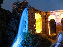
- 2 Bergpark Wilhelmshöhe (220 - 525 m) - On June 23, 2013 the Bergpark Wilhelmshöhe as UNESCO World Heritage Site recognized and with an area of 2.4 square kilometers is the largest mountain park in Europe. The Herkules-Wartburg-Radweg passes the Bergpark Wilhelmshöhe on the wide, paved municipal roads only permitted for cycling. You pass, among other things, the cascades, the Devil's Bridge with Plutogrotto, the aqueduct and Wilhelmshöhe Castle with ballroom and greenhouse.
- ~ ~> From Wilhelmshöhe Castle you cycle gently downhill on Tulpenallee before turning north-east into Ochsenallee (cobblestone pavement) before the tram terminus (half-timbered house) and the large parking lot. You will meet them behind the parking lot Discovery tour Kassel, with which you drive along above the KVG depot Wilhelmshöhe and cycle past between the reform school and the cemetery to Wahlershausen.
- 3 Bad Wilhelmshöhe (195 m) - As a cyclist on the Herkules-Wartburg-Radweg you get to know Bad Wilhelmshöhe, a district of around 11,960 inhabitants kassel, know about the old town center of the formerly independent village Wahlershausen. In addition to many old half-timbered houses, you also pass several restaurants, cross the Drusel and follow the Langen Strasse, which is partly paved with cobblestone.
- ~ ~> Under the high speed line Hanover-Wurzburg and the Main-Weser-Bahn (to Kassel-Wilhelmshöhe train station Follow the local, signposted cycle paths up Bremelbachstrasse or Heerstrasse, see map), you will pass the Federal Social Court and the Heinrich Schütz School (opposite Aschrottpark) and you will reach the Goetheanlage, which you will cycle past north on Goethestrasse.
- 4 Front west (175 m) - The district of around 15,560 inhabitants kassel was officially called West until May 9, 2010 and is characterized by a dense Wilhelminian style development. In addition to many restaurants, you will also pass the deaconess hospital and the Goethestern (square with flower island). Continue past the recently completed new section of Goethestrasse, where the tram also runs and stops.
- ~ ~> Via Nebelthaustraße and Luisenstraße you come to Straße Königstor, which you follow past several different shops (including a bicycle shop) and past the parking garage Garde-du-Corps into the city center of kassel reached.
- 5 center (165 m) - The Kasseler The city center is located in the Mitte district, which has around 3985 inhabitants. You will pass the sights of Opernplatz with the Louis Spohr monument, Friedrichsplatz with the Fridericianum and Landgrave Friedrich II monument, as well as the State Theater. The Kassel main station can be reached via the Kassel-Edersee cycle path.
- ~ ~> You drive briefly on a gravel path across Friedrichsplatz, before you drive between the documenta-Halle and Staatstheater on Du-Ry-Straße and then on the street An der Karlsaue zur Orangery drives down.
- 6 Karlsaue (140 m) - The 1.50 km² state park is located in Karlsaue Kasseler Südstadt district and is a public, originally baroque park. For example, those are worth seeing Orangery (with catering) and the Siebenbergen Island, next is the one that opened in July 2013 Auebad right on the bike path.
- ~ ~> On the Auedamm you first drive a short distance on the Hess. Long-distance cycle route R1 (Fulda cycle route)before the Fulda crosses the swimming pool bridge (starting point of the one that runs parallel to the Herkules-Wartburg cycle path Lossetalweg) and cycle on gravel paths through the Fuldaaue (also called Buga, since the grounds of the Federal Horticultural Show 1981). After crossing the federal highway 83, continue on gravel roads without inclines along the Wahlebach.
- 7 Waldau (150 m) - In the district of kassel the Herkules-Wartburg-Radweg runs mostly along es Wahlebach, so that you don't really get to see much of the district itself. Most of the houses, now called Wohnstadt Waldau, date from the 1960s and are characterized by their functional construction.
- ~ ~> Now along the other bank of the Wahlebach, past some works of art on the ARS-Natura hiking trail (marked with a white X), you come across the Discovery tour Kassel, with which you leave the Wahlebach on Lindenbergstraße and cycle north. Only run in this section Lossetalweg and Herkules-Wartburg-Radweg on different routes (see map).
- 8 Forest field (155 m) - The district of 6740 inhabitants kassel is that is the last Kasseler District that a cyclist has to pass through on the Herkules-Wartburg-Radweg. It will be driven through several residential streets; whoever wants can Discovery tour Kassel follow and a small piece of the developed as a bike path Söhrebahn take with you on your journey (see map). A little later, this cycle route runs again with the Herkules-Wartburg cycle path and the one that runs again identically here Lossetal cycle path together.
- ~ ~> Passing the tram stop Lindenberg you reach the Losse, which you follow under the federal motorway 7 back to the federal road 7. The Discovery tour Kassel By the way, branches off the Herkules-Wartburg-Radweg at the Losse and leads into the old town center of Bettenhausen.
- 9 Paper mill (160 m) - The small district of Kaufungen is about 300 meters south of the cycle route and is characterized by the large industrial area that was built in 1839 when a paper mill was built. Hence the name, although the paper mill has not existed for a long time. Next ends in the place Tram line 8, partly also the Tram line 4.
- ~ ~> Together with the Lossetalweg You cycle first on gravel, then later on asphalted paths through the fields in the Lossetal north of the two-lane federal highway 7.
- 10 Buyouts (180 m) - The district of today that has grown together with acquisitions Kaufungen is driven through on cobblestone paved residential streets directly along the Losse. The (Tram line 4).
- ~ ~> You cycle on paved roads north of the Steinertsee to the small miniature steam train system Steinertseebahn past and later a short distance along the so-called "express route", on which the RegioTram once operated.
- 11 Acquisitions (205 m) - In Oberkaufungen there is the remarkable collegiate church, which is considered to be the most important late Tonic building North Hesse applies. It used to be part of the Kaufungen Benedictine monastery, which was founded in 1017 by Empress Kunigunde. As in Niederkaufungen, there are many half-timbered houses in the village, and there are tram and bus routes 4 and 34.
- ~ ~> Oberkaufungen will be left on Leipziger Strasse; soon a paved separate footpath and bike path will run along it. After crossing the Lossetalbahn, you will pass a refuge (made of wood) and continue cycling without inclines through the Lossetal between the Lossetalbahn and Leipziger Straße.
- 12 Helsa (260 m) - The community with a total of around 5575 inhabitants Helsa is characterized by many half-timbered houses. Also worth seeing is the historic mill wheel, which is freely accessible, but to which there are also guided tours through the Historical Mill Wheel Helsa e.V. Tobe offered. There are connections between the Tram line 4 and the Bus route 210.
- ~ ~> Past the Helsa open-air swimming pool (closed since 2013), you cross under the Lossetalbahn twice on paved paths, before you take a gravel path along the edge of the forest with a view of the construction site of the federal motorway 44 to the Waldhof settlement (to Helsa-Eschenstruth; Tram stop). Eschenstruth station can be reached via Wilhelm-Ströpke-Strasse.
- 13 Eschenstruth (310 m) - The district of Helsa is located on federal highway 7 in the Lossetal and will soon become the second longest motorway tunnel Germany, the tunnel Hirschhagen of the new federal highway 44. It's wrong Tram line 4.
- ~ ~> Through the forest, or along the edge of the forest and along the Lossetalbahn, you can quickly reach Fürstenhagen on an asphalt farm road without potholes. In the place you have to go along the railway line kassel-Waldkappel Overcome two more small inclines before crossing Bundesstraße 7 (Leipziger Straße) and cycling into the town center.
- 14 Fürstenhagen (335 m) is the largest district of with a good 1990 inhabitants Hessian Lichtenau. In this place, too, you can see many old half-timbered houses, further sights are the church and the former courtroom below it, bordered with linden trees. Fürstenhagen is on the public transport with the lines 4 and 207 connected.
- ~ ~> You can quickly reach it via Schulstrasse and Fürstenhagener Strasse Hessian Lichtenau. If you want to take a shortcut in the small town, just follow the Mühlweg and not the dangling of the Herkules-Wartburg cycle path through the old town center.
- 15 Hessian Lichtenau (380 m) - The city with around 11,910 inhabitants was the venue for the 46th Hessentag in 2006 and has since had its own tram connection (originally also RegioTram connection). On the Frau-Holle circular route In 12 stations you learn interesting and informative things about Ms. Holle and her connection Hessian Lichtenau (briefly, by the way, HeLi). Two places further south, in Spangenberg-Quick luge, it starts Chattengau-Fulda cycle path. At the bus stop Hessian Lichtenau-Bourgeois House there are many connections between the tram and the regional bus routes.
2nd stage: Hessian Lichtenau - Hoheneiche: 23.5 km


The second stage of the Herkules-Wartburg cycle path through the Wehretal, which is actually beautiful in terms of landscape, is affected by the construction of the new federal motorway 44, just like parts of the first stage. It remains to be seen whether it will therefore continue to be attractive to cyclists in the future. Instead of the in Hessian Lichtenau ending Lossetalweg The route now runs from Walburg, which is also identical in terms of the route Meißner cycle tour together with the Herkules-Wartburg-Radweg. In Walburg, the alternative route branches off through Gelster and Werra Valley from. For a detailed cycling map, please simply click on the POIs that will immediately direct you to the described position.
The meters in altitude are in the direction of travel Hessian Lichtenau-Wehretal around 70 m, in the opposite direction around 260 m.
- ~ ~> On the sidewalk of Leipziger Straße you cycle first to the truck stop with its oversized rest area (first vertex of the Herkules-Wartburg-Radweg), then under the federal motorway 44, which was completed here since 2006, and later downhill on an asphalt farm road not far from state road 3299 .
- 16 Walburg (350 m) - In the district of over 740 inhabitants Hessian Lichtenau The alternative route branches off from the main route of the Herkules-Wartburg cycle path. The Walburg Railway Friends used to store several old railway wagons and more in the Walburg station. Since the association had to be dissolved in recent years, the condition of this collection in Walburg station is unfortunately not known at the moment. The Herkules-Wartburg-Radweg alternative route branches off in the village, which is described in the article Gelster cycle path is described and the bus routes operate 200, 205 and 290.
- Waldkappel: Continue downhill on a paved bike path (caution: agricultural vehicles!) You drive through the fields of the Wehretal - one of the most beautiful sections of the route. In Waldkappel: campsite, outdoor pool and observation tower on the Mäuseberg
- High oak - km 61: You reach Hoheneiche on a paved farm road along the weirs. Here the cycle path meets the R5 to Sontra or Eschwege. Wichmannshausen is reached through the Sontra valley in a southerly direction.
3rd stage: Hoheneiche - Creuzburg: 28 km
.jpg/250px-Wasserschloss_Netra_(2009).jpg)
- Wichmannshausen: From here it goes uphill along the Netra into the mountains of the Ringgaus. The nicely paved bike and farm path runs away from the road on the slope.
- Datterode: In Datterode we change to the right side of the valley, it goes a little more uphill towards Röhrda. The B7 runs in the valley.
- Röhrda: The route to Netra is still uphill.
- Netra - km 75: In Ringgau-Netra you have almost reached the 2nd summit of the cycle route. When entering the village, the view immediately falls on the old moated castle (private no access) and the massive church of the village.
- Lüderbach: The paved route leads quickly downhill to the small town of Lüderbach just before the border with Thuringia. The history of the place is closely interwoven with the former GDR border, the Americans operated an observation post there (OP India). Much older, namely from the 18th century, is the tomb pyramid of the von Capellan family on the "Kirchberg".
- Creuzburg: Route in front of the city that seems a bit improvised. The cycle path makes a large loop to cross the Werra. The old city is dominated by the castle (hotel). The cycle path leads over the Steinerne Werra Bridge past the Liborius Chapel. From here it goes along the Werra on the Werral cycle path towards Hörschel.
4th stage: Creuzburg - Eisenach: 18.5 km

- Hörschel - km 96: The connection to the Rennsteig cycle path, the high altitude cycle path of the Thuringian Forest. Far away there is one here railway station, because the regional trains on the Bebra-Eisenach line stop.
- Eisenach - The Wartburg towers high above the city
Alternative route through the Werra valley

In addition to the 112 km long main route of the Herkules-Wartburg cycle path, an approx. 105 km long alternative route through the Gelstertal and the Werra Valley signposted. It starts in Hessian Lichtenau-Walburg and runs together with the Gelster cycle path to Witzenhausen, from where they then with the Werratal cycle path above Bad Sooden-Allendorf, Eschwege, Wanfried, Hit time and Mihla to Creuzburg leads, where you finally meet again on the main route.
The route description of the Herkules-Wartburg-Radweg alternative route between Hessian Lichtenau-Walburg and Witzenhausen in Gelstertal can be found in the article Gelster cycle path and the between Witzenhausen and Creuzburg in the Werra Valley in the article Werratal cycle path, as these two cycle paths are identical to the Herkules-Wartburg cycle path alternative route.
trips
If you want, you can do the tour in Eisenach on the Long-distance cycle route Thuringian city chain To the east Erfurt or Altenburg continue.
literature
- ADFC regional map "Kassel / North Hesse" 1: 75000, 6th revised and expanded edition from 2019, ISBN 978-3870738884 , € 8.95, Bielefelder Verlag. The map shows the entire core section of the cycle route from Kassel to Eisenach. The loop over the Werra valley is also completely included.
- Spiral cycle route map "Herkules-Wartburg-Radweg" M 1: 50000, 1st edition from March 2006, ISBN 978-3870733872 , € 9.95, Bielefelder Verlag
- HR Habichtswald / Reinhardswald Nature Park - Topographic leisure map 1:50 000, ISBN 978-3-89446-319-9 , 9.50 €, published jointly by the Hessisch-Waldeckischer Gebirgs- und Heimatverein e.V. and the Hessian State Office for Soil Management and Geoinformation (2012).
- MK Meißner-Kaufunger Forest Southern Leinetal - topographic leisure map 1:50 000, ISBN 978-3-89446-318-2 , 9.50 €, published jointly by Werratal Tourismus Marketing GmbH and the Hessian State Office for Soil Management and Geoinformation (2012).