

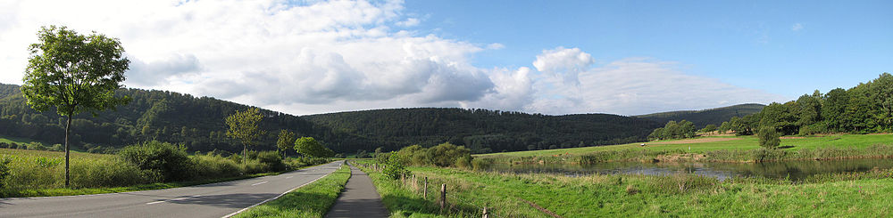
The Reinhardswald is the largest self-contained forest area with an area of over 200 km² Hessen, as well as one of the largest forest areas and one of the least populated areas Germany. Large parts of the Reinhardswald belong to the non-parish Reinhardswald estate. The wooded low mountain range is known nationwide as a place of sagas and legends, such as the fairy tales of the Brothers Grimm, but also as a popular hiking region.
Regions


- Reinhardswald manor district - The 184.16 km² manor district is the largest of the three Hessian Manor districts and includes almost the entire Reinhardswald. Although, according to the Hessian State Statistical Office, two residents live uninhabited, the owners of the Tillyschanze restaurant, in the Reinhardswald estate, a community-free area. Since the introduction of the five-digit postcodes in Germany Overlooked the residents of the manor district, the area was subsequently given the zip code "00000". The wide and sometimes coarsely graveled forest paths of the Reinhardswald are well suited for mountain bike tours and hikes, but there are only a few unpaved forest paths.
- Lower Diemel Valley - The Lower Diemeltal roughly encompasses the cities Liebenau, Trendelburg and Bad Karlshafen and is not far south of the border between North Rhine-Westphalia and Hesse. The diemel itself is between Liebenau-Haueda and Bad Karlshafen after free Pre-registration Canoeed at the Kassel Regional Council. The two cycle routes continue through the Diemel Valley Diemel cycle path and Hessian long-distance cycle route R4.
- Upper Weser Valley - The Upper Wesertal (also Upper Weser) extends between Hann. Münden and Porta Westfalica, the section along the Reinhardswald between Hann. Münden and Bad Karlshafen. While Hann. Münden and Bodenfelde in Lower Saxony lie, belong Reinhardshagen, Upper Weser and Wahlsburg to Hesse. The Weser is continuously federal waterway and therefore navigable with boats; along the left bank runs the Hessian long-distance cycle route R1 (Fulda cycle route), along the right bank of the Weser cycle path.
places


- 1 Bad Karlshafen (Low German Korlshoawen) is the northernmost city Hessen and is located in the southern Weser Uplands at the confluence of the Diemel and the Weser. Founded as an exile town, Bad Karlshafen is also shaped by the Huguenots and Waldensians, who found a new home under Landgrave Carl at the northern end of the Reinhardswald. In addition to the baroque old town, sights include the Krukenburg castle ruins, the Helmarshausen monastery and the Huguenot museum. Since 2011 the "Weser-Skywalk" has been enthroned on the Hanover cliffs high above the Weser valley.
.jpg/350px-Hafenbecken_(Bad_Karlshafen).jpg)
- 2 Fulda valley is a municipality in the Fulda valley south of the Reinhardswald and bordering on kassel. Sights are the currency museum in Rothwesten (Fritz-Erler-Anlage), the people's observatory Rothwesten on the Häusensberg and the Romanesque St. Mary's basilica and today's Protestant church in Wilhelmshausen. Above Wilhelmshausen am Reinhardswald lies the Termenei nature reserve with significant heather deposits.

- 3 Grebenstein (Low German Grebensteen) is a small town west of the Reinhardswald on the Esse. In addition to the historic half-timbered old town and the arable citizens' museum, Grebenstein Castle on the castle hill on the southern edge of the city center is particularly worth seeing. From the viewing platform on the almost completely preserved outer walls of the palace you have a beautiful view of Grebenstein and the direction Habichtswald and Reinhardswald.

- 4 Hann. Münden (short for Hannoversch Münden) is one at the confluence of the Werra and Fulda rivers Weser located small town in Southern Lower Saxony, which is known nationwide especially for the well-preserved half-timbered old town. Sights include the famous Weserstein, the market square with the Weser Renaissance town hall, the Welfenschloss from around 1560 and the historic Werra Bridge from 1250. You have beautiful views of the city center from the two lookout points Weserliedanlage and Tillyschanze with its observation tower and restaurant.

- 5 Hofgeismar is the largest city on the western edge of the Reinhardswald and was from 1821 to 1972 the district seat of the former Hofgeismar district. The Sleeping Beauty Castle is located in the city of Hofgeismar Sababurg and Beberbeck Castle from the 19th century. Other sights in the city center are the well-preserved old town, the town hall with the market square and the early classical Schönburg palace in the Gesundbrunnen park with the temple of the fountain. In 2015 Hofgeismar hosted the Hessentag for the second time since 1978.

- 6 Immenhausen is a small town southwest of the Reinhardswald. In addition to the historic half-timbered old town with the town hall, the Evangelical Church of St. George with wall paintings from the middle of the 15th century and the Immenhausen Glass Museum, in which changing exhibitions on the subject of glass art are shown, are particularly worth seeing. The two north-eastern districts of Immenhausen, Ahlberg and Holzhausen, used to be characterized by lignite mining.

- 7 Liebenau (Hesse) (Low German Life log) lies at the confluence of the warmth in the Diemel and is one of the smallest towns in Hesse. Due to the location on the bottom of a former subtropical shell limestone sea, the largest fossil site in northern Hesse is located in the quarries near the districts of Lamerden and Haueda. Several churches and museums are also worth seeing. The Liebenau train station was closed in December 2015.
_(2).JPG/320px-Bahnhof_Liebenau_(Hessen)_(2).JPG)
- 8 Upper Weser is a community on both sides of the Weser northeast of the Reinhardswald. The two districts and Waldensian villages Gottstreu and Gewissenruh are colloquially referred to as French villages and were founded in 1722 by Landgrave Karl von Hessen-Kassel for French religious refugees. The historic town centers and the yaw ferries over the Weser, as well as the miniature open-air museum Mühlenplatz, are worth seeing.

- 9 Reinhardshagen is a municipality east of the Reinhardswald in the upper Weser valley. While the two Reinhardshagener districts Vaake and Veckerhagen are on the left bank of the Weser, is the Hann. Mündenener district Hemeln on the right bank of the Weser. Veckerhagen and Hemeln are connected by a yaw ferry. Sights in Reinhardshagen are the Veckerhagen hunting lodge and the ironworks in Veckerhagen.

- 10 Trendelburg (Low German Dringelborg) is a small town in the lower Diemeltal northwest of the Reinhardswald. In the district of Gottsbüren, the holy body of Christ was allegedly found in the 14th century and laid out in the local church, which is why the last remaining place in the middle of the Reinhardswald became known as a place of pilgrimage. The pilgrimage church Gottsbüren, Burg Trendelburg, the moated castle Wülmersen, the Deiseler tunnel and the downpours are worth seeing. Between Liebenau-Haueda, Trendelburg and Bad Karlshafen the Diemel is passable with canoes.

- 11 Wahlsburg is a municipality in the extreme northeast of North Hesse northeast of the Reinhardswaldes on the left bank of the Weser between Solling, Bramwald and Reinhardswald. The most important sight is the monastery church of St. Georg and St. Maria in Lippoldsberg, which is one of the most important Romanesque buildings of the 12th century. The Gierseilfähre "Märchenfähre" connects Lippoldsberg with peace of mind, or Vorwerk.

mountains


- 1 Staufenberg (472 m) - At 472.2 m, the highest mountain in the Reinhardswald lies northwest of Veckerhagen and southeast of the cemetery. From Friedwald or Kühbacher Wiese you can reach the Staufenberghütte via graveled forest paths, from which the Staufenberg can be climbed. Another and longer ascent option leads on unpaved forest paths from Veckerhagen over the Paulistein to the Staufenberghütte, marked as ⊥ and X6 (Upland-Weserbergland-Weg). From the Staufenberg there is a view over the Reinhardswald in the direction Hofgeismar.
- 2 Gahrenberg (472 m) - At 472.1 m, the Gahrenberg is the second highest mountain in the Reinhardswald and is located northeast of Holzhausen. Mining was carried out on Gahrenberg from 1575, most recently from 1842 to 1970 in the Gahrenberg colliery. The Gahrenberg can be reached from the Roten Stock via the Alte Kohlenstraße, from Holzhausen via the Steigerpfad (⊥), from Wilhelmshausen via the Steinköhlerspfad (●) and from Vaake via the hiking route ll. The ascent to the Gahrenberg is from the Großer Stern junction, from the Gahrenberg you have a view over the Reinhardswald in the direction Immenhausen and Grebenstein. There are several refuges around the Gahrenberg.
- 3 Hahneberg (461 m) - The third highest mountain of the Reinhardswald is between Gottsbüren and Gottstreu near the Waldstraße between the state road 763 (Gottsbüren-Gieselwerder) and Landesstraße 3229 (Udenhausen-Veckerhagen). The shortest ascent is from a parking lot on Waldstraße north of the Hahneberg, other longer climbs are from Gieselwerder, Gottsbüren and Sababurg Possible via the hiking routes ⊥ and ◇. From the wooded summit of the Hahneberg there is no chance of a view, but north-east of the summit on hiking trail X14 (tribal bridge).
- 4 Ahlberg (395 m) - On the edge of the Reinhardswald east of Mariendorf and the settlement of Ahlberg lies the Ahlberg, which is known for its more than 2000-year history and its cultural and historical significance. The ascent to the summit with the ring wall takes place from the settlement Ahlberg on an unpaved forest path over the Ahlberg-Mariendorf cultural history eco path. While there is no possibility of a view on the summit of the Ahlberg itself, there is a beautiful view in the direction of the access road between Mariendorf and the Ahlberg settlement Grebenstein.
- 5 Sieburg (274 m) - The mountain Sieburg, at the same time the original namesake of the city Bad Karlshafen and the still largely unexplored fortifications with a surface area of 140 hectares Hessen, is located east of Bad Karlshafen and Helmarshausen on a mountain plateau between Diemel and Weser. The run around the Sieburg Eco path archeology Sieburg and other hiking routes, including to the Hessenkanzel viewpoint high above a bend in the Diemel river. The ascent to Sieburg takes place from Bad Karlshafen or Helmarshausen, as well as with less altitude from a parking lot on Kreisstraße 76 between Helmarshausen and Bundesstraße 80 (Bad Karlshafen-Gewissenruh).
background


There are several legends about the origin of the Reinhardswald. The best known is that of Count Reinhard, who lost all his money and property to the Bishop of Paderborn while gambling. When Count Reinhard asked the bishop for mercy, he granted him one last harvest, after which the count sowed acorns:
„About 700 years ago grain was grown (in the Reinhardswald) when grain prices were still very high and people moved from the valley villages to cut down oak trees in the forest and plow the forest floor. Count Reinhard, who owned all the land and all villages between Diemel and Weser, lived there at the same time. He was an obsessed player, but luck was rarely on his side, but mostly on that of his opponent, the Bishop of Paderborn.
When the count lost again, he suggested one last game and risked his entire county. The dice fell and he was ruined. Count Reinhard did not give up so quickly, however. Full of cunning, he asked the bishop whether he was allowed to sow and harvest one last time on his soil. The Bishop of Paderborn agreed to this.
But what did the count sow in autumn? Nothing but acorns and beechnuts. He had the villages burned down and the old farms razed to the ground. In spring the young trees stretched and it was green up and down the valley. When the bishop returned in autumn to take over his property, the cunning count led him out into the hall.
"You see, Mr. Bishop, my harvest is not ready yet, you have to be patient a little longer"“
In 1605, Wilhelm Dillich wrote in his Hessian Chronica about the use and abundance of game in the Reinhardswald:
„... in which 20,000 tame pigs a year can be made in good walt fattening years and this walt can bring in over 30,000 gold pensions and pensions in such a year at mast, item forst and holtzgett ...
But all kinds of wiltpret can be caught and shot every year, namely roth wiltpret in the 800 and schwartz wiltpret around 1,000 pieces ...“
There is also an anecdote about the forest as an administrative unit. The majority of the Reinhardswald corresponds to the boundaries of the manor district of the same name, which, as an area free of municipalities, has a special administrative status. According to official statistics, the manor district has no residents, but in fact there are two who are even registered. As the only people in Germany, they are not allowed to vote for their mayor, the Reinhardshagen forestry manager appointed by the district administrator, despite general voting rights. Your postal address is still the postcode area of the Lower Saxony city of Hann. Münden assigned. More information can be found in the Wikipedia.
getting there


By plane
In addition to the larger airports Kassel-Calden, Paderborn-Lippstadt and Hanover There are also several small airfields around the Reinhardswald. These are the 1 Hölleberg airfield![]()
![]() at Trendelburg, the 2 "Der Dingel" airfield at Hofgeismar and the 3 Uslar airfield at Uslar. Information about these airfields can be found in the respective local article.
at Trendelburg, the 2 "Der Dingel" airfield at Hofgeismar and the 3 Uslar airfield at Uslar. Information about these airfields can be found in the respective local article.
By car
The Reinhardswald, although one of the least populated areas in Germany, is easily accessible by roads. Starting points for a trip to the Reinhardswald are for example kassel, Hann. Münden and Hofgeismar. The federal roads run along the Reinhardswald ![]() (kassel-Hann. Münden),
(kassel-Hann. Münden), ![]() Wesertalstrasse (Hann. Münden-Bad Karlshafen) and
Wesertalstrasse (Hann. Münden-Bad Karlshafen) and ![]() (kassel-Hofgeismar-Bad Karlshafen).
(kassel-Hofgeismar-Bad Karlshafen).
Some roads in the Reinhardswald are only cleared and not gritted in winter for nature conservation reasons, for example the undeveloped forest road. Along the roads in the Reinhardswald there are a large number of hiking parking lots, of which circular hiking trails of various lengths open up the Reinhardswald.
Between Hann. Münden and Bad Karlshafen is included with the Wolfgang Stremmel Bridge Gieselwerder only one bridge in the Weser valley, but several yaw ferries (see section Sights).
With public transport
Several bus lines run through the Reinhardswald (see section Mobility), mostly starting from the stations of the three railway lines touching the Reinhardswald, the railway line Northeim–Ottbergen(Solling Railway) with the 4 Bad Karlshafen train station![]()
![]()
![]() , the railway line Halle (Saale)–kassel(Halle-Kasseler Bahn / Hanover Southern Railway) with the 5 Train station Hann. Münden
, the railway line Halle (Saale)–kassel(Halle-Kasseler Bahn / Hanover Southern Railway) with the 5 Train station Hann. Münden![]()
![]()
![]() and the railway line kassel–Warburg(Friedrich-Wilhelms-Nordbahn) with the 6 Hofgeismar train station.
and the railway line kassel–Warburg(Friedrich-Wilhelms-Nordbahn) with the 6 Hofgeismar train station.


The most important bus route is the Excursion bus 190 between Hann. Münden, Reinhardshagen, Sababurg and Hofgeismar. This runs every two hours and from April to October with a bike rack (max. Five bikes). Since April 2017, the northern part of the Reinhardswald and the Hessian Wesertal with the former school bus routes have also been there 192, 193 and 194 Accessible every two hours every day.
mobility
The Reinhardswald is best explored on long hiking tours. Alternatively, you can also go on bike tours on the various roads, provided you are not afraid of inclines. However, there is no area-wide cycle route signposting in the mountains. Therefore you should have a card with you if possible.
Line buses (public transport)
The following bus lines run all year round through Reinhardswald and the neighboring communities (as of 2017):
- Runs daily (Bonte Travel Service)
- Line 42: kassel <> Ihringshausen <> Wahnhausen <> Knickhagen <> Wilhelmshausen <> Hann. Münden
- Runs daily (Bonte Travel Service)
- Line 45: kassel <> Ihringshausen <> Fuldatal <> Hann. Münden
- Runs Monday to Friday on school days (Bonte travel service)
- Line 140: Hofgeismar <> Trendelburg <> Liebenau <> Warburg
- Operates daily from April to October with a bike rack (max. Five bikes) (Bonte travel service)
- Line 171: Immenhausen <> Mariendorf <> Udenhausen <> Grebenstein
- Runs Monday to Friday on school days (Bonte travel service)
- Line 173: Immenhausen <> Holzhausen <> Immenhausen
- Operates Monday to Saturday (Bonte travel agency)
- Operates daily from April to October with a bike rack (max. Five bikes) (Sallwey bus company)
- Line 181: Trendelburg <> Friedrichsfeld <> Gottsbüren
- Operates Monday to Friday (Sallwey bus company)
- Line 190: Hofgeismar <> Sababurg <> Reinhardshagen <> Hann. Münden
- Operates daily from April to October with a bike rack (max. Five bikes) (Sallwey bus company)
- Line 191: Hofgeismar <> Hombressen <> Udenhausen <> Reinhardshagen
- Operates Monday to Friday (Sallwey bus company)
- Line 192: Hofgeismar <> Sababurg <> Gottsbüren <> Gieselwerder <> Upper Weser <> Wahlsburg
- Runs daily (ARGE Sallwey Uhlendorff)
- Line 193: Bad Karlshafen <> Gieselwerder <> Faithful to God
- Runs daily (ARGE Sallwey Uhlendorff)
- Line 194: Bodenfelde <> Wahlsburg <> Upper Weser <> Gieselwerder <> Bodenfelde
- Runs daily (ARGE Sallwey Uhlendorff)
- Line 195: Hann. Münden <> Hemeln <> Bursfelde <> Upper Weser <> Gieselwerder
- Operates Monday to Saturday (Regiobus Uhlendorff)
Wildlife protection gate

In the south of the Reinhardswald there is a large "game protection gate". The 100 square kilometer game gate is surrounded by 76 km of fence. The area was fenced in as early as 1867. Today the area is partly politically controversial in the region. Here the forest has "opening times" and separate access regulations. These are posted on site at the entrances. In principle, exactly the following § 3 of the "Order regarding the wildlife sanctuary" Reinhardswald "of August 19, 2000" is posted on site at the access to the forest. Therefore, for the sake of simplicity, the regulation as a quote from the corresponding regulation:
1. In the period from March 1st to June 30th, the wildlife sanctuary may only be entered on public roads, forest roads and marked hiking trails.
2. In the period from May 1st to September 30th, the wildlife sanctuary may only be used on roads dedicated to public traffic from 9:00 pm to 7:00 am, and from October 1st to April 30th from 6:00 pm to 7:00 am to be entered.
3. The following are excluded from the right of access all year round:
- a) Areas on which forest is established or traced through planting or natural stand regeneration, up to a height of the young growth of four meters and
- b) Grazing areas and meadows.
4. It is forbidden to approach wild animals and thereby disturb wild animals.
5. It is forbidden to let dogs run free in the wildlife sanctuary.
Tourist Attractions
- Wülmersen moated castle at the Diemel
- Miniature open-air museum Mühlenplatz at Oberweser-Gieselwerder - The museum shows models of buildings on a scale of 1:25 to 1:40.
- Water uphill - The "water uphill" is a small sight near Gieselwerder in the Reinhardswald, which you can take with you along the way.
- Kartersee "wet cloudburst" - rather less well-known sight near Trendelburg. If you are interested, you can visit the crater lake as a good stopover.
Sababurg
A hundred years should sleeping Beauty slept on the Sababurg in the middle of the Reinhardswald.
The Sababurg was built on the ruins of the Zapfenburg built by the Archbishop of Mainz in 1334 and was used as a hunting lodge by the Hessian Landgrave Wilhelm II between 1490 and 1492 Reinhardswald rebuilt. In 1571 one of his successors, Landgrave Wilhelm IV, founded the Sababurg Zoo at the foot of the castle, which is now a popular excursion destination.
The Sababurg Castle is also popular. As early as 1959, part of the ruins was converted into a hotel. The moats, the eastern stair tower and parts of the circular walls with the flank towers have been preserved.
Nearby is the Reinhardswald Sababurg primeval forest. Directly below the castle is the generous and popular Sababurg zoo.
Sababurg Zoo
The Sababurg zoo is one of the oldest wildlife parks in Europe. The large 130-hectare facility nestles between oak avenues in a wide valley basin at the foot of the Sababurg. The extensive complex was laid out in 1571 and is surrounded by a high wall. Today's zoo was reopened in 1973 by the Kassel district. In 2011 the park welcomed more than 250,000 visitors. For more details on the history of the park, see the corresponding Wikipedia article.
6 Sababurg Zoo, Sababurg 1, 34369 Hofgeismar. Tel.: 49 5671 766499-0, Fax: 49 5671 766499-99, Email: [email protected]. ![]()
![]()
![]() The zoo has developed in width from a purely traditional game park in recent years. So be in the field "Children's Zoo" new animal species were shown that appeal to families in particular. B. Humboldt penguins, Barbary macaques and Tasmanian Bennett wallabies (kangaroos). There are also petting zoo. With around two dozen animal species, the area is the main focus of the facility "Wildlife Park". You can see here, among other things. European bison, wolves, wolverines, various deer species, lynxes, ibexes, Exmoor ponies, Heck cattle and horses, otters and mouflons. The area also exists "Pet Farm". Livestock breeds threatened with extinction are shown here at the "Pickers Hof". Also in the park has a Bird of prey station their seat. In the entrance area there is an extensive Zoo museum. The museum is located in a half-timbered house from 1610. There is an exhibition on the history of the zoo, horse breeding and a local history collection on the Reinhardswald region. There is also information on the subject of Brothers Grimm & Reinhardswald. gastronomy is of course also available. If you want, you can also rent one of the barbecue areas in the park.Open: Apr - Sept 8 a.m. - 7 p.m., Oct 9 a.m. - 6 p.m., Nov - Feb 10 a.m. - 4 p.m., March 9 a.m. - 5 p.m.Price: € 8, children € 4.50, family ticket € 21.
The zoo has developed in width from a purely traditional game park in recent years. So be in the field "Children's Zoo" new animal species were shown that appeal to families in particular. B. Humboldt penguins, Barbary macaques and Tasmanian Bennett wallabies (kangaroos). There are also petting zoo. With around two dozen animal species, the area is the main focus of the facility "Wildlife Park". You can see here, among other things. European bison, wolves, wolverines, various deer species, lynxes, ibexes, Exmoor ponies, Heck cattle and horses, otters and mouflons. The area also exists "Pet Farm". Livestock breeds threatened with extinction are shown here at the "Pickers Hof". Also in the park has a Bird of prey station their seat. In the entrance area there is an extensive Zoo museum. The museum is located in a half-timbered house from 1610. There is an exhibition on the history of the zoo, horse breeding and a local history collection on the Reinhardswald region. There is also information on the subject of Brothers Grimm & Reinhardswald. gastronomy is of course also available. If you want, you can also rent one of the barbecue areas in the park.Open: Apr - Sept 8 a.m. - 7 p.m., Oct 9 a.m. - 6 p.m., Nov - Feb 10 a.m. - 4 p.m., March 9 a.m. - 5 p.m.Price: € 8, children € 4.50, family ticket € 21.
Sababurg primeval forest


The well-known nature reserve with its mighty old giant trees is located about 2 km southwest of the Sababurg. In the protected area there are various old giant trees, some of which have already died and have turned into ecologically valuable deadwood biotopes. But you can also find beautiful living giant trees, some of which are more than 500 years old. At the entrance to the area you will be greeted by the "Holy Hall", a grove of mighty beeches. The most famous giant tree is probably the mighty chimney oak, which is often used to represent the Sababurg primeval forest. Other features of the area are the wide bracken corridors. In the back of the nature reserve you can also find some huge conifers.
- History: The 92.2 hectare nature reserve was placed under protection as early as 1907 as one of the first German nature reserves. Until the 19th century, today's primeval forest was used as a hut forest. In the context of this forest management, the area was forest pasture for the cattle (e.g. for pigs that ate the acorns, beechnuts and young shoots). The grazing rights were abolished in 1865. After over 100 years of protection, the area is slowly turning into a real jungle. The old, sprawling hat trees (oak and beech veterans) are slowly dying off and new trees are taking over the area. The common beech is on the advance in the protected area. The conversion process is far from over, however. In some cases, individual trees were even replanted on the eagle forest corridors, as the up to 2 m high giant farm probably largely suppressed forest regeneration.

- Tourist development: The 7 Entry into the circular hiking trails can be found on the Hofgeismar - Sababurg district road. There is also a parking lot for hikers and a bus stop opposite the entrance to the jungle Excursion bus line 190. For the long circular route (marked orange) you should plan around a good hour to two hours (depending on the photo breaks, etc.). The small round (marked yellow) can be done in 30 minutes. Incidentally, there are in the area no benches and resting places. There are a few pieces of tree trunks lying by the wayside, which are good substitutes for banks. This wood comes from maintenance measures for nature conservation reasons.
- Please observe the usual rules for entering nature reserves (do not pick flowers, plants or mushrooms, stay on the paths, do not leave any rubbish ...) so that the next visitors will also find beautiful nature. Some of the "natural sites" are cordoned off with wooden barriers. Please respect these wooden fences. The fences are in such a way that you can snap nice pictures from the fence. So there is z. B. on the triple beech such a fence. The reason was possibly the extensive, flat and compacted soil around the tree veteran. The solid ground can contribute to lasting damage to the tree. Cycling is not permitted in the protected area.
- Guides: The Rheinhardswald Nature Park offers public tours of the area. See dates here.
- Excursion destination for (hobby) photographers and learning location for painting and photography courses: With its history as "Painter reserve" Of course, the Sababurg primeval forest still attracts many creative, nature-loving people. Painting and photo schools use the jungle as a destination for painting or photo courses and photo trips. Anyone looking for appropriate offers online will quickly find what they are looking for.
Yaw ferries in the Weser Valley


The motorless yaw ferries are a nostalgic way to cross the river. The silence during the journey is unusual, as the vehicles are only propelled by the current of the river. Background information on the Gierseilfähre in general can be found in the corresponding Wikipedia article to find. The ferries downriver in detail (details in the local articles):
- 1 Veckerhagen − Hemeln ferry
- 2 Oedelsheim-Gottstreu ferry(Puss in Boots)
- 3 Lippoldsberg-Vorwerk ferry(Fairytale ferry)
- 4 Wahmbeck − Gewissenruh ferry


activities
hike
Weserberglandweg in the Reinhardswald
The 225 km long long-distance hiking trail opens up the entire Weser Uplands between Hann Münden and Porta Westfalica at the Weserr breakthrough. The first three stages from Hann Münden to Bad Karlshafen lead through the Reinhardswald. The low mountain range can be comfortably hiked on a long weekend on this 50 km long stretch of path. The stages:
- 1st stage: Hann. Münden - Reinhardshagen-Veckerhagen - 14 km with about 450 hm uphill and 400 hm downhill: In the morning there is still time for the (train) journey to Hann münden and a city tour of the "half-timbered metropolis". If you are more athletic and stay overnight in Hann münden, you can also complete 26 km to Sababurg on the first day.
- 2nd stage: Reinhardshagen-Veckerhagen - Sababurg - 13 km with about 400 hm uphill and about 250 hm downhill. Afternoon is time to visit the Sababurg Primeval Forest or the Sababurg Zoo.
- 3rd stage: Sababurg - Bad Karlshafen- 20 km with around 460 m uphill and around 670 m downhill. The stage leads via Gottsbühren with its pilgrimage church to Oberweser to the miniature open-air museum Mühlenplatz. It continues uphill again over the ridge to Helmarshausen near Bad Karlshafen. Here it is advisable to deviate from the route in the Diemeltal and from Helmarshausen via the Krukenburg castle ruins to hike to Bad Karlshafen.
- For detailed route information, see here Weserbergland tourism.
More local hiking routes
See also:Hiking routes around HofgeismarFor example "In the footsteps of mining": from Reinhardshagen (district Veckerhagen) the path leads to Gahrenberg and here to the former brown coal mine (see Hiking tip on HNA Regiowiki).See also:Eco paths North Hesse"Kulturrundwege" Eco trails: On these thematic circular hiking trails, boards provide information about the Reinhardswald cultural and natural landscape and introduce smaller sights. The leaflets for the various routes in the Reinharsdswald can be downloaded from www.eco-pfade.de can be downloaded.
Cycling
See also:Bike routes around Hofgeismar
| title | length | Start point / end point | description | picture |
|---|---|---|---|---|
| Diemel cycle path | 110 km | Usseln – Bad Karlshafen | The Diemel cycle path the Diemel follows from its source in the Rothaar Mountains on the Diemelsee, Marsberg, Warburg, Trendelburg to Bad Karlshafen. Parts of the route are both in Hesse, as well as in North Rhine-Westphaliaso that the signs are not consistently consistent. Since 2014 the Deiseler tunnel. |  |
| Fulda-Weser cycle path | 260 km | Gersfeld – Bad Karlshafen | Fulda cycle path - The Hess. Long-distance cycle route R1 follows the Fulda from its source to the Wasserkuppe above Gersfeld, Fulda, Bad Hersfeld, Bebra, Rotenburg on the Fulda, Melsungen and kassel to Hann. Münden, as well as further along the Weser until after Bad Karlshafen. The section in the Wesertal is also included Fulda-Weser cycle path called. |  |
| Weser cycle path | 491 km | Hann. Münden – Cuxhaven | The Weser cycle path runs like the Weser for the most part Lower Saxonybut in its upper section between Hann. Münden and Bad Karlshafen also a smaller section through Hesse. Unfortunately, in contrast to the rest of the Weser cycle path, this one does not have any standard-compliant, but only outdated local signs. |  |
| Fairyland cycle path | 103 km | Around the Reinhardswald | The Fairyland cycle path verläuft entlang von Diemel, Esse, Fulda und Weser einmal rund um den Reinhardswald, wobei nur der Abschnitt zwischen Hofgeismar and Fulda valley durchgehend als Märchenland-Radrundweg ausgeschildert ist. Auf dem anderen Teilstück wurde die Ausschilderung mehr in die der bereits bestehenden Radwege integriert. |  |
| Reinhardswaldradweg | 55 km | kassel – Wülmersen | The Reinhardswaldradweg führt ausgehend von kassel meist über Schotterwege in den Reinhardswald zur Sababurg and further after Wülmersen ins Diemeltal. Leider befinden sich Ausschilderung und Streckenabschnitte in einem schlechten Zustand, sodass bei einer Radtour auf der Route Karten und Mountainbikes hilfreich sein können. | .JPG/150px-Radweg_Gottsbüren_-_Wülmersen_(1).JPG) |
Wer als Urlauber die Region per Rad erkunden möchte findet passende Beherberungsbetriebe mit eigenem Radverleih im Fahrradpool Weser-Diemel.
Wasserwandern
Kanu- und Kajaktouren sind auf Weser und Diemel möglich. Auf der Diemel müssen allerdings Wehre umtragen werden.
Kanu-Schumacher mit Kanustation in Bad Karlshafen und dem Hauptsitz in Trendelburg an der Diemel verleiht Boote.
Die private Fahrt auf der Diemel im eigenen Kanu ist aus Naturschutzgründen nur nach Anmeldung erlaubt. Online-Anmeldung und weitere Infos siehe Canoe side of the Kassel Regional Council. Kanuvermieter verfügen über entsprechende Bootskontingente. Hier ist keine separate Anmeldung erforderlich.
Zur Weser siehe auch Schwerpunktartikel "Water hiking on the Weser".
climate
Der Reinhardswald liegt in der gemäßigten Klimazone, die noch sehr stark von atlantischen Westwetterlagen beeinflusst wird. Im Vergleich zum Süden von Hessen scheint daher im Reinhardswald (= nördlichster Teil von Hessen) weniger die Sonne, es ist im Vergleich zum Rhein-Main-Gebiet meist 3 bis maximal 5 Grad kälter und es fällt mehr Regen.
Umgangssprachlich wird die Region daher teilweise auch als "hessisch Sibirien" bezeichnet. Diese Umschreibung ist natürlich eine starke Überspitzung. Klimatisch gesehen besitzt der Reinhardswald ein ähnliches Klima wie die vergleichbaren anderen Mittelgebirge in seiner Umgebung (z. B. Solling).
literature
cards
- HR Habichtswald / Reinhardswald Nature Park - Topographic leisure map 1:50 000, ISBN 978-3-89446-319-9 , 9.50 €, published jointly by the Hessisch-Waldeckischer Gebirgs- und Heimatverein e.V. and the Hessian State Office for Soil Management and Geoinformation (2012).
- Rad- und Wanderkarte Reinhardswald - Maßstab 1:33 000, ISBN 978-3-86973-012-7 , 4,50 €, herausgegeben von der Kartographischen Kommunalen Verlagsgesellschaft mbH (2011). Diese Rad- und Wanderkarte ist trotz niedrigerem Maßstab nicht so genau wie die vom Hessischen Landesamt für Bodenmanagement und Geoinformation.
Bücher
- Reinhardswald und Diemel-Land - Unterwegs in Dornröschens Heimat, Stiftung hessischer Naturschutz, 88 Seiten gebunden, farbige 147 Abb., ISBN 978-3-921156-67-4 , published for € 13.50 by the specialist publisher Dr. Fraund
Web links
- Märchenland Reinhardswald - regionale Touristikseite von Liebenau, Trendelburg, Hofgeismar, Immenhausen und Grebenstein
- www.kassel-land.de - touristische Seite des Region Kassel - Land e.V. Touristik und Regionalentwicklung (hängt mit dem Landkreis Kassel zusammen). Zu dieser Tourismusregion gehört der Reinhardswald offiziell (Hinweis: Die Erlebnisregion "Kassel Land" existiert auf Wikivoyage nicht, da sie für Reisende keine zweckmäßige geografische und touristische Aufteilung hat).