
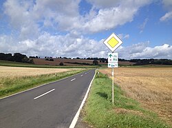
The Hessian long-distance cycle route R4 is a 414 km long cycle path between Bad Karlshafen and Hirschhorn (Neckar)that once completely Hesse crossed from north to south. It does not always follow the course of the rivers through the larger river valleys, but rather gathers in particular North Hesse, in the Vogelsberg and in Odenwald several meters in altitude, partly also on poorly navigable paths. If you have conquered the mountains, however, you will be rewarded with beautiful views.
Route profile

- Length: At 414 km, the Hessian long-distance cycle route R4 is the longest of the nine long-distance cycle routes in Hesse.
- Signposting: The complete signage corresponds to the standard of the Hessian long-distance cycle paths. As a rule, the probability of getting lost is very low.
- Slopes: The largest and longest inclines of the Hessian long-distance cycle route R4 can be found in North Hesse, in the Vogelsberg and in Odenwald. Among other things, must Ulrichstein, the highest town in Hesse be conquered.
- Path condition: For the most part, the Hessian long-distance cycle route R4 runs on asphalt paths (over 70%), but also over and over gravel paths, so that the cycle route is not always accessible by racing bike.
- Traffic load: There are stages where you almost never have to drive on county or state roads, but also stages where you have to cycle on those for longer distances. Most of the time, these roads are rarely used by cars.
- Suitable bike: Touring bike with 7-speed gear hub is sufficient, but more gears are better. At some stages it can be helpful not to ride with the thinnest bicycle tires.
- Family suitability: Most of the sections are also suitable for families with small children. For more detailed information, please refer to the route description for the individual stages.
- Inline suitability Unfortunately, the cycle route cannot be used continuously with inline skates or racing bikes. Longer paved sections are indicated in the route description.
background


sleeping Beauty is one of the most famous fairy tales by the Brothers Grimm and is said to be on the Sababurg in the Reinhardswald have played, which is popularly known as the Sleeping Beauty Castle. Although the fairy tale Sleeping Beauty appears in the name of the Hessian long-distance cycle route R4, it does not go over the Sababurg. But you can leave Trendelburg-Wülmersen on the gravelled Reinhardswald cycle path a detour to the Reinhardswald and also to Sababurg with Sleeping Beauty Castle, zoo and jungle do. The three sights are from the Bus route 190 connected to the weekend and during the Hessian holidays with a bike rack (max. 5 bikes) between Hann. Münden and Hofgeismar wrong.
The Nibelungen legend is a special one in the German and Scandinavian widespread heroic legend of the Germanic tribes, which probably originated from around 1200 in the area Passau Nibelungenlied and other medieval sources. Since the Hessian long-distance cycle route R4 in Odenwald at Hirschhorn (Neckar) ends, the Nibelungs also appear in his name. However, it plays Odenwald in the song of the Nibelungs only one role that is decisive for the further action, namely the murder of the dragon slayer Siegfried von Hagen von Tronje at a spring. Due to the fact that the exact location of this source has not been recorded, several parishes in the Odenwalds about owning the "original" Siegfriedbrunnen.
getting there

With public transport
The Hessian long-distance cycle route R4 can be reached relatively easily by public transport. Here is a list of all train routes and bicycle buses in North Hesse, with which you can arrive and depart for a bike tour on the Hessian long-distance cycle route R4.
- Ottbergen - Göttingen railway line - Since December 15, 2013, the NordWestBahn. Although the train station Bad Karlshafen still in Hesse you need a ticket from the Verkehrsverbund Süd-Niedersachsen to travel on the Sollingbahn VSN acquire. Bicycles are subject to a charge on the VSN trains (KBS 356).
- Reinhardswald bicycle buses - The bus routes run in summer 140 (Hofgeismar - Trendelburg - Warburg), 180 (Hofgeismar - Trendelburg - Bad Karlshafen) and 190 (Hofgeismar - Reinhardswald - Hann. Münden) on weekends and during the Hessian school holidays with a bike rack (max. 5 bikes). Taking bicycles with you is free (Flyer excursion bus).
- Railway line Kassel - Warburg - Railway stations and stops on this railway line on the Hessian long-distance cycle path R4 can be found in Hofgeismar and Hofgeismar-Hümme. During the RegionalExpress (RE) only in Hofgeismar stops, the RegioTram (RT) also operates in Hümme. However, you can only board the RegioTram barrier-free with your bicycles, as the RegionalExpress kassel-Hagen is served by diesel railcars of the DB class 612 with steps at the entrance (KBS 430).
- Volkmarsen - Obervellmar railway line - In addition to the RegioTram (RT), this single-track railway line runs between kassel and Wolfhagen also the RegionalExpress (RE) of the Kurhessenbahn between kassel and Korbach, but the latter, usually served by barrier-free diesel multiple units of the DB class 646, does not stop everywhere (KBS 612).
- Railway line Kassel - Naumburg - The first one has been running on this single-track railway line since 1992 Hessian Museum railway, the Hessencourrier. As a rule, once a month at the weekend you can take your bike tour on the Hessian long-distance cycle route R4 with a ride in the old steam locomotives and railway wagons of the Hessencourriers connect (Timetable).
- Railway line Wabern - Brilon Wald - Today only the sections of this railway line are left Brilon-Korbach and Bad Wildungen-Wobble in operation. The Hessian long-distance cycle route R4 runs together with the Eder cycle path between Fritzlar and Wobble parallel to the latter, which, like the other, is powered by barrier-free diesel multiple units of the DB class 646 of the Kurhessenbahn is served. The station Wobble-Zennern is now only a need stop (see timetable) (KBS 621).
- Railway line Kassel - Frankfurt am Main - In addition to the RegionalExpress (RE 30), which does not stop everywhere, run on the Main-Weser-Bahn. kassel-Frankfurt am Main the regional train stopping everywhere (R 38) kassel-Treysa and the RegionalExpress (RE 98) stopping at all stations kassel-Frankfurt am Main. Numerous train stations and stops on this railway line are located directly on the Hessian long-distance cycle route R4; last city / municipality with train station in NVV is Treysa (KBS 620).
- Railway line Giessen - Fulda - On the Vogelsbergbahn, barrier-free regional trains (RB) run by the Hessische Landesbahn (HLB); instead of NVV the railway line already belongs to the Rhein-Main-Verkehrsverbund (RMV) Since the 2011/2012 timetable change, only the train station is in Alsfeld on the Hessian long-distance cycle route R4, as the train station or stop Schwalmtal-Renzendorf was closed on December 10, 2011 due to the low number of passengers (KBS 635).
- Vogelsberg bicycle buses - Since im Vogelsberg no more railroad trains run today, there is a good network with bicycle buses of the Vogelsberger Vulkan-Express, which is operated by the Verkehrsgesellschaft Oberhessen mbH (VGO) is operated. The two bus routes run along the Hessian long-distance cycle route R4 VB-92 (Grünberg - mosquito - Ulrichstein - Hoherodskopf - Bulkheads - Laubach - Hunger) and VB-93 (Nidda - Bulkheads - Hoherodskopf) each with bicycle trailers according to the tariffs of the Rhein-Main-Verkehrsverbund (RMV) and with connection to the regional trains of the Hessische Landesbahn.
In the route description, a timetable is always linked to the course book number (KBS). Further rail routes and bicycle buses to and from the south of the Vogelsbergs are listed in the section next.
By bicycle
All with the Hess. Cycle routes tangent to long-distance cycle route R4 are listed in the route description and are therefore not all listed here again. The Hesse cycle route planner be.
Route description


1st stage: Bad Karlshafen - Hofgeismar: 29 km


The first stage of the Hessian long-distance cycle route R4 runs through the valleys of Diemel and Esse and partly on the former Carlsbahn, the oldest railway HessenThe highlight of which was the Deiseler Tunnel, the oldest railway tunnel, which was reopened for hikers and cyclists in September 2014 Hessen, is. However, the former railway line is only roughly gravel and not suitable for racing bikes, only the section of the first stage between Hümme and Hofgeismar is paved throughout. Between Bad Karlshafen and Trendelburg-Deisel runs the Monastery garden route identical to the Hessian long-distance cycle route R4, between Bad Karlshafen and Trendelburg- Comes from Diemel cycle path and throughout the Wonderland cycle path. For a detailed cycling map, please simply click on the POIs that will immediately direct you to the described position.
The meters in altitude are in the direction of travel Bad Karlshafen-Hofgeismar around 185 m, in the opposite direction around 130 m.
- 1 Bad Karlshafen (100 m) - The spa town in the far north of Hesse has about 3530 inhabitants and its own train station on the railway line Ottbergen-Goettingen (KBS 356). The also start at the train station Fulda cycle path, or the Hess. Long-distance cycle route R1; who at the beginning of his bike route has a beautiful view over Bad Karlshafen and want to have the Wesertal, can take a detour to Weser Skywalk to the Hanover cliffs do. The bus routes run 180 (with bike rack), 193 and 220, as well as the Bison line with bicycle trailer (after Warburg).
- ~
 ~> After crossing the Weser, you cycle past the harbor basin to the Marie-Durand-Schule, in front of which the railbus 971 665-5 stands and reminds you of the Carlsbahn, which had its terminus here. On the graveled Sonnenweg, the former railway line of the Carlsbahn, you then continue in a large arc away from the car traffic to Helmarshausen, where a detour up to the Krukenburg is worthwhile.
- 2 Helmarshausen (110 m) - The health resort, which has been officially recognized since 1929, is one of the oldest settlements and cities in North Hesse and has today as a district of Bad Karlshafen a good 1480 inhabitants. The biggest sights are the Benedictine monastery Helmarshausen and the Krukenburg; Helmarshausen is served by the bus route 180 (with bike rack) approached.
- ~ ~> Next, mostly on the graveled former railway line of the Carlsbahn, leisurely with the typical very low gradient of a railway line uphill, you follow the winding course of the Diemel.
- 3 Wülmersen (115 m) - In the hamlet of the small town Trendelburg there is the former Gut Wülmersen (colloquially also called Wasserschloss Wülmersen), in which there are two museums. The begins in Wülmersen Reinhardswald cycle path direction Trendelburg-Gottsbüren and to Sababurg; The bus line stops at Bundesstraße 83 180 (with bike rack).
- ~ ~> Behind Wülmersen, the gravel on the former Carlsbahn railway line is now very coarse (the worst passable section), before you reach the north portal of the Deiseler tunnel behind the railway keeper's house, in front of which the old route branches off to the west of the tunnel (towards Deisel). Those who cycle through the tunnel (closed in winter from the beginning of November to the end of March to protect the bats) should not be irritated by the darkness at first, as the lighting inside is only triggered by a motion detector when you drive into the tunnel. In addition, you should turn on your bike lights, as the lights do not illuminate the entire tunnel, but only the ground (nice effect). From the south portal, a footpath with stairs and sliding ramp (also accessible by bike) leads back to the old route of the cycle path.
- 4 Deisel (115 m) - The district of Trendelburg has around 1110 inhabitants and is a good kilometer west of the Hessian long-distance cycle route R4. He's about that Monastery garden route to reach, which branches off to the west shortly before the Deiseler tunnel and further on Borgentreich runs. The bus routes operate in the center of the village 180 (with bike rack) and 181.
- ~ ~> Behind a nature reserve you drive back over a small gravel path back to the former Carlsbahn railway line and follow this through the Diemelauen until shortly before Trendelburg, where you leave the Carlsbahn again and pass east of the elementary school and reach the old train station.
- 5 Trendelburg (120 m) - The approximately 5065 inhabitants North Hessian Small town is dominated by the remarkable Trendelburg of the same name with an observation tower from the 13th century, on which the fairy tale Rapunzel by the Brothers Grimm is said to have originated. On a headland below the castle by Diemel cycle path and Hessischer Radfernweg R4 is circled, is the Trendelburg campsite. The bus routes run 140, 180 (both with bike rack) and 181.
- ~ ~> Behind the former train station of Trendelburg The Hessian long-distance cycle route R4 and the Diemel cycle path. During the latter in a direct way Trendelburg runs out, the R4 makes a detour over the old landgrave's mill museum and cross the Diemel twice.
- 6 Come (125 m) - The small district of around 415 inhabitants Trendelburg is mainly due to the manor house from the 18th century (Stammen Castle), which has been preserved in its current form, and the former belonging to it Hofgut Stamen known, where today you can find a beer garden and canoe tours on the Diemel. The bus lines stop every hour at the federal highway 83 140 and 180 (both with bike rack).
- ~ ~> Shortly after Stammen Castle, the Hessian long-distance cycle route R4 and the Diemel cycle path and you continue cycling along the former Landgraf-Carl Canal, dead straight, first on a gravel farm road, then later beyond the municipal boundary Trendelburg/Hofgeismar on an asphalt farm road past the Hümmer Bruch nature reserve. Alternatively, you can cycle to Hümme via the former Carlsbahn railway line.
- 7 Hümme (130 m) - The formerly independent municipality is now a district of Hofgeismar with a good 1600 inhabitants. Hümme becomes one of the oldest settlements in the district Hofgeismar counted and was earlier the junction of the new railway lines to Westphalia and Weser than on March 30, 1848 with the Carlsbahn (after Bad Karlshafen) and Friedrich-Wilhelms-Nordbahn (after Grebenstein) the oldest railways Hessen were opened. Today the RegioTram ends in Hümme kassel (KBS 430) and there are bus routes 140 and 180 with bike racks.
- ~ ~> Together with the Wonderland cycle path follow the Esse, which is no longer straightened for the Landgraf-Karl Canal, on asphalt farm roads around the wooded Schöneberg. Hofgeismar can then be reached via another dead straight asphalt farm road and the former spa Hofgeismars, the Gesundbrunnen with Brunnenpark and Schönburg Castle.
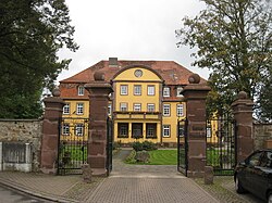
- 8 Hofgeismar (160 m) - The urban area of the small town in North Hesse has been settled for around 7000 years and is now particularly worth seeing due to the half-timbered old town with pedestrian zone. In addition to the carillon of the town hall, the Gesundbrunnen with the Schönburg Castle (formerly called Montcheri), which has housed the Evangelical Academy since 1952, is known nationwide. In addition to RegioTram and RegionalExpress (KBS 430) the bus routes 140 (Bike rack), 141, 180 (Bike rack), 185, 190 (Bike rack), 191 and 192; a new station building is currently being built across from the old one for the Hessentag 2015. In Hofgeismar branches off Fairyland cycle path to Grebenstein, Immenhausen and Hann. Münden from.
2nd stage: Hofgeismar - Wolfhagen: 37 km


The second stage of the Hess. Long-distance cycle route R4 is unfortunately characterized by many district and country roads and is therefore also suitable for racing bikes throughout. However, it is not recommended for families with small children, as the roads used are sometimes heavily traveled and cannot be bypassed without major detours (see route description). Of Liebenau- Gnomes close to Gut Bodenhausen Habichtswald-Ehlen, the cycle route is identical to the local one Warmetalweg, from Gut Bodenhausen to Wolfhagen-Little dealings with the local Kassel-Edersee cycle path. For a detailed cycling map, please simply click on the POIs that will immediately direct you to the described position.
The meters in altitude are in the direction of travel Hofgeismar-Wolfhagen around 540 m, in the opposite direction around 430 m.
- ~ ~> From the barrier-free train station Hofgeismar (KBS 430) one drives through the interesting inner city of, which is characterized by half-timbered houses Hofgeismar. If Hofgeismar is left, the Hess runs. Long-distance cycle route R4 first on asphalt farm roads up the Mittelberg (278 m). To the south there is a juniper heather on the slope.
- 1 Friedrichsdorf (285 m) itself is not traversed, the cycle route itself runs about 1 km south of the Huguenot-founded district of Hofgeismar past where the city bus from Hofgeismar (Line 185) wrong.
- ~ ~> A beautiful, shady descent through the forest on an asphalt forest path leads to the Warmetal. Shortly before Zwergen is located directly on the bike path Campsite dwarfs.
- 2 Dwarfs (160 m) - In the small district of Liebenau There are around 400 inhabitants who are nicknamed "Schröggekoken" (schröggen = to burn down). The continues to run Bus route 141 to Liebenau and Hofgeismar, in a little outdoor pool one can cool off.
- ~ ~> From Zwergen the Hess runs. Long-distance cycle route R4 identical to the local cycle route Warmetalweg. You cycle through the Warmetal along an asphalted farm road without any major inclines.
- 3 Niedermeiser (170 m) with about 785 inhabitants owns through the bus routes 130, 131, 132 and 141 good bus connections Hofgeismar (Rail connection), Grebenstein (Rail connection), Calden (Airport), Breuna and Volkmarsen (Rail connection). The village is the most populous district of Liebenau.
- ~ ~> Between Niedermeiser and Zierenberg The cycle route runs along the 3211 state road, which is particularly busy during rush hour. At the southern end of Niedermeiser, you have to negotiate a small mountain.
- 4 Obermeiser (180 m) - Although the two villages Niedermeiser and Obermeiser have the same ending, Obermeiser is already in the municipality of Calden and thus also in the tariff area KasselPlus. There are also good (and therefore cheap) bus connections from here.
- ~ ~> Behind Obermeiser, you cross under the federal highway 7 at a driveway and cycle hilly past the Berghof on the state road 3211.
- 5 Hohenborn (200 m) - The very small district of Zierenberg with only about 20 inhabitants is right next to the 3211 state road, but is not driven through.
- ~ ~> Due to the many trees on the direct roadside, the 3211 road becomes narrower, an additional danger point that cannot be avoided. Only the very narrow and beautiful Warmetal here excuses this route.
- 6 Laar (210 m) is the next place in the Warmetal, which consists of the few houses of the "Gutshof Laar", the "Old Mill", the Castle Laar with its park and has 20 residents. Escheberg Castle is also nearby, also with a park.
- ~ ~> Between Gut Laar and Zierenberg the state road 3211, in this section in a bad condition, can be bypassed without major detours. See the route description of the Warmetalweg. The Warmetal opens up again past the Strippelmann and Rangen farms.
- 7 Zierenberg (280 m) - From the train station (KBS 612; Kurhessenbahn) of the state-recognized resort with a total of 6700 inhabitants can be used with the Bus route 117 every two hours to the beautiful high plateau des Hohen Dörnbergs drive, on which there are also several restaurants. From here you have a beautiful view of the Habichtswald Nature ParkIf you are lucky you can watch some glider pilots take off and land. You can then go downhill through the Heilerbachtal back to the Warmetal to the Hess. Take the R4 long-distance cycle route. Next also owns Zierenberg a small outdoor pool and east of the city very close to the bike path is the Zierenberg campsite.
- ~ ~> Behind Zierenberg you cycle car-free on a beautiful asphalt farm road through the wide Warmetal. Shortly before Gut Bodenhausen the branches off Warmetalweg from Hess. Long-distance cycle path R4 from direction Habichtswald and Schauenburg.
- 8 Bodenhausen (310 m) - The former manor is now a group of farmsteads north of Ehlen has a beautiful small park with ponds, but the entire area is not open to the public. From the bike route, however, you can look into the courtyard; the stop on the street is no longer approached.
- ~ ~> At the next intersection you meet the local one Kassel-Edersee cycle path, who from here to Wenigenhasungen with the Hess. Long-distance cycle route R4 will run identically. First, however, you first have to drive uphill via the state road 3390 to a ridge or a small pass north of Burghasungen, the highest point of the Hess. Long-distance cycle route R4 in North Hesse.
- 9 Burghasungen (425 m) - The Zierenberger The district with around 925 inhabitants is only 1 km south of the cycle route and is well worth a detour. Among other things because of the beautiful view from Hasunger Berg, where the Hasungen Monastery once stood, as well as the Monastery museum in the center of the village. There are still good bus connections in Burghasungen kassel, Zierenberg and Wolfhagen with the bus routes 110 and 117.
- ~ ~> Behind the Sollberg hiking car park, where you can take a breather after the strenuous ascent, you can just roll downhill on the 3390 state road before leaving the 3390 state road just before Wenigenhasungen in a southerly direction.
- 10 Few hashings (300 m) is a small district of Wolfhagen, which has been part of the new city bus network of Wolfhagen (Line 111) connected. The neighboring town of Altenhasungen also has a train station on the KBS 612, which is mainly served by the RegioTram, with which you can go to the city center of kassel can drive. To do this, just follow the between the two places Kassel-Edersee cycle path.
- ~ ~> You cycle on little-traveled district roads through Wolfhager Land. These were renewed in many places in 2014 and can now be used much better, even by bike. A detour to just 1 km from the Hess is also worthwhile. Remote cycle route R4 Festberg nature reserve near Philippinenthal, a mountain ridge overgrown with limestone grass with a beautiful view.
- 11 Philippinenburg (325 m) forms together with the nearby Philippinenthal a district of Wolfhagen. The former colonies are part of the city bus network from Wolfhagen (Line 111) connected.
- ~ ~> Until Wolfhagen After all, you cycle first level, then slightly winding downhill. If you want to take a beautiful panoramic view with you beforehand, you should make a 1 km detour from the Wolfhagen district clinic to the Ofenberg tower.
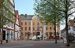
- 12 Wolfhagen (280 m) - After 63.7 km (from Bad Karlshafen is over Wolfhagen a very good stage destination in the middle of Wolfhager Land. The old town with its half-timbered houses and its cozy market square is particularly worth seeing. From the train station (KBS 612) in the north of the city you can either take the RegioTram or the faster regional express the Kurhessenbahn to kassel drive, or in the opposite direction Korbach.
3rd stage: Wolfhagen - Fritzlar: 31 km


During the second stage of the Hess. Long-distance cycle route R4 was characterized by many district and country roads, the third stage is in the first part up Naumburg-Elbenberg characterized by gravel farm roads. Between Naumburg-Altendorf and Fritzlar-Züschen you then cycle 6 km on the country road 3214, which is usually not very busy. But several sights compensate for this, such as the old half-timbered houses in the town center, as well as the Weidelsburg, the Elbenberger Türmchen and the Garvensburg Castle in the immediate vicinity of the cycle route and not to forget a beautiful typical North Hessian Landscape. Between Wolfhagen and Ippinghausen runs Kassel-Edersee cycle path with the Hess. Long-distance cycle route R4 identical, in Naumburg, the destination station of the Hessencourriers, there is a connection to the Hessencourrier cycle path. For a detailed cycling map, please simply click on the POIs that will immediately direct you to the described position.
The meters in altitude are in the direction of travel Wolfhagen-Fritzlar around 258 m and in the opposite direction around 350 m.
- ~ ~> Wolfhagen you leave the country road 3214, soon after you cycle on asphalt farm roads to a couple of emigrant farms. Instead of the fast-traveled state road 3214, racing cyclists preferred to use the less traveled and parallel district road 105 via Leckringhausen. The Hess. The long-distance cycle path runs idyllically on a gravel farm road, barely noticeable uphill along the Ofensteinwasser.
- 1 Leckringhausen (305 m) - The small district of Wolfhagen with only 50 inhabitants was originally founded by Huguenots and is 500 meters from the bike path on a hill. Bus connection to Wolfhagen and kassel (Line 110).
- ~ ~> Continue on gravel roads west along a high-voltage line, just before Ippinghausen the branches Kassel-Edersee cycle path to Waldeck-Fiegenhagen. The Hess. Long-distance cycle route R4 itself runs east of the district of Wolfhagen past.
- 2 Ippinghausen (320 m) with 1135 inhabitants is a small pass for cyclists, as from the place on the Hess. Long-distance cycle route R4 to the north or south always goes downhill. South of the place, the good bus connections to Wolfhagen and kassel (Line 110), the Weidelsburg, from whose accessible keep you have a beautiful all-round view of the Habichtswald Nature Park and that Wolfhager Land has.
- ~ ~> Behind Ippinghausen you cross the federal road 251 and drive on a gravel forest path through the Elbe valley (racing cyclists have to use the sometimes heavily used state road 3214), north of Naumburg then on paved paths through the open landscape. In between the runs Habichtswaldsteig of the Weidelsburg here is a short piece identical to the Hess. Long-distance cycle path R4 through the Elbe valley, but then leads up to the control room north of Naumburg.
- 3 Naumburg (Hesse) (280 m) - The state-approved Kneipp health resort with many half-timbered houses and a good 5230 inhabitants is the end of the railway line Hessencourriers, the first Hessian museum railway between Naumburg and kassel and a possible stage destination of the Hess. Long-distance cycle route R4. There are bus connections to Wolfhagen, kassel and Fritzlar (Lines 144, 152 and 154). Next begins in Naumburg the Hessencourrier cycle path direction Bad Emstal and after kassel.
- ~ ~> The cycle route between Naumburg and the Elberberg district with a gravel descent from a steep hill in the direction of travel, which is not unproblematic for the inexperienced Naumburg. If necessary, this hill can be bypassed via the nearby state road 3214 and county road 111.
- 4 Elbenberg (255 m) - The Naumburger District was formed from the two places Elben and Elberberg and has 1,300 inhabitants; The Elberberg tower with a beautiful view and Elberberg Castle are particularly worth seeing. The bus lines stop in Elbenberg 144, 152 and 154.
- ~ ~> Between Elbenberg and Altendorf, the cycle route leads directly over an asphalt farm road, which is also suitable for racing bikes.
- 5 Altendorf (245 m) is another district of Naumburg in the Elbe valley, in which 240 inhabitants live. As in Elbenberg, the bus routes run here 144, 152 and 154.
- ~ ~> After you have passed Altendorf, you continue cycling on the easily passable state road 3214. After 3.5 km you reach the junction to Heimarshausen.
- 6 Heimarshausen (255 m) is a good kilometer west of the Hess. Long-distance cycle route R4. Biggest attraction of the Naumburger District with 440 inhabitants is probably the octagonal church from 1835. Heimarshausen is also well connected to the regional bus network (lines 144, 152 and 154).
- ~ ~> Shortly afterwards, after a long bend in the Elbe valley, Züschen is reached via state road 3214 (about 2 km); you have left the district of Kassel and are now in the Schwalm-Eder district.
- 7 Züschen (205 m) - The formerly self-employed whale decker City in the Elbe Valley is now a district of Fritzlar. Not far from the Hess. The R4 long-distance cycle route is the Garvensburg Castle, which was built from 1894 to 1898. The Elbe is crossed on an old river bridge from the 18th century (short piece of cobblestone pavement). The bus routes operate in Züschen 154 and 514 to Naumburg, Fritzlar and Bad Wildungen.
- ~ ~> Hinter Züschen radelt man zunächst über asphaltierte Wirtschaftswege einen Bergrücken hinauf und wieder hinunter zurück in das Elbetal, bevor der Hess. Radfernweg R4 kurz vor der hier schon nur noch wenig befahrenen Landesstraße 3214 für 200 Meter über einen Wiesenweg ausgeschildert ist, was recht selten für den eigentlich hohen Standard der Hessischen Radfernwege ist. Kurz darauf hat man dann die Wahl zwischen zwei offiziellen Wegstrecken: Der Landesstraße 3214 oder einem mit groben Schotter befestigten Wirtschaftsweg am Waldrand entlang, der vor Ort als "sehr schlechter Wegezustand" ausgewiesen ist. In Wirklichkeit ist dieser angeblich sehr schlechte Wegezustand aber problemlos mit Tourenrädern passierbar.
- 8 Geismar (190 m) - Der Stadtteil von Fritzlar hat 1000 Einwohner, liegt kurz vor Fritzlar und ist mit der Linie 154 an das Busnetz angeschlossen. The Hess. Radfernweg R4 folgt der Haupstraße durch den Ort; in Geismar beginnt die circa 50 Höhenmeter starke Steigung hinauf nach Fritzlar, bzw. endet in die Gegenrichtung als schöne Abfahrt.
- ~ ~> Nachdem Geismar durchfahren wurde, überquert man vorsichtig über eine Fußgängerinsel die Landesstraße 3383 und fährt auf einem asphaltierten Fuß- und Radweg an der Landesstraße 3214 entlang bergauf am Neuen Friedhof vorbei nach Fritzlar, wo man der Geismarstraße in die kleine durch Fachwerkhäuser geprägte Innenstadt zum Marktplatz folgt.
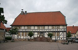
- 9 Fritzlar (220 m) ist eine der größeren Städte am Hess. Radfernweg R4. Die schöne Fachwerkaltstadt mit dem Marktplatz und dem Fritzlarer Dom St. Peter ist ein ideales Etappenziel, das auch einen Bahnhof (KBS 621; Kurhessenbahn) unten im Edertal besitzt, der circa 50 Höhenmeter tiefer gelegen als der Marktplatz liegt. Durch die um die 14.000 Einwohner große Stadt verlaufen auch der Eder cycle path and the Chattengauweg direction Gudensberg and after Baunatal.
4. Etappe: Fritzlar - Bad Zwesten: 31 km

.JPG/250px-Radweg_bei_Wabern_(Hessen).JPG)


Obwohl die Luftlinie zwischen Fritzlar and Bad Zwesten nur 11 km beträgt, beträgt die Länge des Hess. Radfernweg R4 zwischen den beiden Städten gut 31 km, da die Radroute einen Schwenker entlang der Eder nach Wobble und von dort entlang der Schwalm über Bark zurück nach Bad Zwesten makes. So verläuft der Hess. Radfernweg R4 zwischen Fritzlar and Wobble identisch mit dem Eder cycle path und zwischen Singlis und Bad Zwesten identisch mit dem Schwalm cycle path und dem Hess. Radfernweg R5 , weitestgehend autofrei und familienfreundlich. Der Abschnitt Fritzlar-Wobble ist zudem durchgehend für Rennräder geeignet. Für eine detaillierte Radwanderkarte bitte einfach auf die POI's klicken, die einen sofort an die beschriebene Position leiten.
Die Höhenmeter betragen in Fahrtrichtung Fritzlar-Bad Zwesten um die 110 m und in die Gegenrichtung rund 130 m.
- ~ ~> Vom Marktplatz in Fritzlar fährt man zunächst südlich des Fritzlarer Doms bergab zur Eder, wo man auf den Eder cycle path trifft. Zusammen dann am Bahnhof vorbei durch ein Industriegebiet, immer auf asphaltierten Wirtschaftswegen entlang der Bahnstrecke und der Kreisstraße 13 unter der Bundesautobahn 49 hindurch durch die weite Ederniederung.
- 1 Zennern (170 m) - Der Ortsteil der Gemeinde Wobble mit gut 860 Einwohnern wird nördlich tangiert und besitzt einen eigenen Bahnhof an der KBS 621 (Kurhessenbahn), sowie einen Busanschluss durch die Linien 400, 413 and 457.
- ~ ~> Nun kann man schon die Zuckerfabrik von Wobble ausmachen, auf die man nun relativ direkt zufährt über asphaltierte Wirtschaftswege und einen Plattenweg direkt an der Bahnstrecke.
- 2 Wobble (165 m) - Die 7190 Einwohner fassende Gemeinde besitzt einen größeren Bahnhof an der Eisenbahnstrecke kassel-Marburg-Frankfurt am Main (KBS 620), sowie der Nebenbahn Wobble-Fritzlar-Bad Wildungen (KBS 621), der allerdings nicht barrierefrei ausgebaut ist. Die einzelnen Bahnsteige werden nur durch Treppen verbunden. Neben mehreren Buslinien halten hier stündlich RegioTrams nach kassel and Schwalmstadt, sowie alle zwei Stunden Regional-Expresszüge nach kassel and Frankfurt am Main und InterCitys nach Karlsruhe and Hanover.
- ~ ~> Man verlässt Wobble südlich auf der Landgrafenstraße, unterquert die Bundesstraße 253 und radelt auf einem separaten asphaltierten Fuß- und Radweg neben der neben der Landesstraße 3148 entlang.
- 3 Uttershausen (170 m) mit circa 660 Einwohnern ist ein Ortsteil von Wobble und besitzt, obwohl direkt an der Main-Weser-Bahn gelegen, keinen eigenen Bahnhof oder Haltepunkt. Stattdessen verkehren die Buslinien 424, 450 and 457.
- ~ ~> Kurz hinter Uttershausen überquert man die Main-Weser-Bahn mit Hilfe einer Anrufschranke, die man über einen unbefestigten Weg erreicht. Hier kann man auch schon einmal fünf Minuten warten, bevor der zuständige Mitarbeiter der Deutschen Bahn nach einem Anruf die Schranken öffnet, da auf der Main-Weser-Bahn reger Zugverkehr herrscht. Direkt hinter der Bahnschranke trifft man dann auf den Schwalm cycle path, mit welchem man zusammen entlang der Bahnstrecke wieder die Landesstraße 3148 erreicht. Dieser folgt man für 400 Meter, alternativ kann man 200 Meter über Wiesenwege parallel zur Straße zurücklegen (als schlechte Wegstrecke ausgeschildert), bevor man in einen Schotterweg abzweigt und diesem entlang der Main-Weser-Bahn schattig folgt.
- 4 Singlis (170 m) - Der mittelgroße Stadtteil von Bark besitzt einen eigenen kleinen Bahnhof, bzw. Haltepunkt an der Main-Weser-Bahn (KBS 620). Im Ort macht die Radroute einen kleinen Schlenker, wer diesen abkürzen will folgt der Main-Weser-Straße (siehe Karte). Weiter verkehren die Buslinien 407 and 424.
- ~ ~> Südlich von Singlis trifft der Hess. Radfernweg R5 (von Homberg (Efze) auf den Hess. Radfernweg R4. Zusammen mit diesem und dem Schwalm cycle path fährt man durch Singlis hindurch und auf einem geschotterten Weg über ein paar Brücken. Wer weiter den Radwegen folgt, wird den schönen Singliser See leider nicht zu Gesicht bekommen. Dazu muss man ab Singlis ein Stück der Landesstraße 3149 folgen. Am See findet man neben Gastronomie eine Aquagolf-Anlage (nur im Sommer). Auf den Radroute radelt man weiter auf geschotterten Wegen in unmittelbarer Nähe zur Schwalm.
- 5 Gombeth (175 m) ist mit 765 Einwohnern ein weiterer Stadtteil von Bark und wird von den Buslinien 407 and 413 approached. Der Ort liegt genau zwischen den beiden großen Seen direkt an der Schwalm.
- ~ ~> Hinter Gombeth verlaufen die drei Fernradwege auf einem Schotterweg direkt oberhalb des Gombether See mit Blick auf diesen. Hinab zu dessen Ufer kann man aber leider nicht, zumindest gibt es keine öffentlichen Wege. Wer zum Bahnhof Bark (KBS 620) will, zweigt unmittelbar hinter dem Gombether See von den den ausgeschilderten Radwegen ab. Die Radwege aber überqueren zunächst die Schwalm und führen dann über asphaltierte Wirtschaftswege einen Hügel hinauf zu einer lokalen Straße. Dieser folgt man dann nach Westen und erreicht nach Unterquerung der Landesstraße 3150 den Ortseingang von Kleinenglis.
- 6 Kleinenglis (190 m) - Gut 1510 Einwohner großer Stadtteil von Bark. Sehenswert ist neben der Sankt-Michaelskirche vor allem das Kaiserkreuz an einem Kinderspielplatz in der Hundsburgstraße (siehe Karte). Es verkehren die Linien 407 and 413.
- ~ ~> Über einen asphaltierten Wirtschaftsweg erreicht man an Obstbäumen vorbei die Landesstraße 3223, die man mit einer Ampelanlage leicht überqueren kann und neben welcher sich der Naturbadesee Stockelache (mit Gastronomie) befindet. Nachdem man die Schwalm über eine Holzbrücke überquert hat weiter auf asphaltierten Wegen am Waldrand entlang.
- 7 Arnsbach (200 m) - Der 525 Einwohner große Stadtteil von Bark befindet sich 500 Meter südlich der drei Fernradwege, allerdings kommt man am Friedhof vorbei. Von Arnsbach kann man auf der lokalen Radroute 101 über Trockenerfurth zum Borkener See radeln. Der Ort wird von den Buslinien 407, 411 and 419 approached.
- ~ ~> Vom Friedhof Arnsbach muss man für 2 km die Kreisstraße 73 mit benutzen, zu welcher leider keine alternativen Wege unter der Bundesautobahn 49 hindurch in der sogenannten Schwalmpforte bestehen. Doch gerade Familien mit kleineren Kindern sollten die Straße besonders im Berufsverkehr meiden, da sie teilweise sehr eng, sowie unübersichtlich ist und schnell befahren wird. Aber wenigstens die Straßenqualität ist gut.
- 8 Kerstenhausen (190 m) - Knapp 600 Einwohner großer Stadtteil von Bark an der Bundesstraße 3. Die drei Fernradwege verlaufen durch den Ort unmittelbar an dieser entlang, zum Glück gibt es breite Bürgersteige auf welche man zur Not als Radfahrer ausweichen kann. Es verkehren die Buslinien 407 and 408.
- ~ ~> Schnurgerade verläuft der asphaltierte Wirtschaftsweg westlich von Kerstenhausen, auf welchem die drei Fernradwege ausgeschildert sind. Hinter einer Hecke radelt man dann im Zick-Zack weiter durch die Felder und kann über einen Wiesenweg einen Abstecher zu einer der Mühlen an der Schwalm machen (ausgeschildert). Schließlich sieht man Bad Zwesten vor sich liegen. Who to campsite will (bietet auch "Bed and Bike" an) folgt einfach den drei Fernradwegen, da dieser direkt an ihnen liegt.
- 9 Bad Zwesten (200 m) - Die Gemeinde mit insgesamt circa 3920 Einwohnern besitzt eine Mineralquelle, an der unter anderem der Bad Zwestener Löwensprudel abgefüllt wird. Mit der Buslinie 408 bestehen gute Busverbindungen nach Bark and Bad Wildungen mit weiteren Anschlüssen, außerdem verkehren die Schulbuslinien 407 and 411.
5. Etappe: Bad Zwesten - Ziegenhain: 24 km


Die fünfte Etappe des Hess. Radfernweg R4 verläuft von Bad Zwesten bis zum Wiesenhof bei Schwalmstadt-Allendorf an der Landsburg identisch mit dem Schwalm cycle path, sowie bis Bad Zwesten-Niederurff identisch mit dem Hess. Radfernweg R5 . Bis auf einen circa drei Kilometer langen Abschnitt auf der Landesstraße 3074 zwischen Niederurff und Bischhausen führt dieser Streckenabschnitt abseits der Straßen autofrei durch die Schwalm. Das Etappenziel dieser fünften Etappe befindet sich in Schwalmstadt-Ziegenhain, Schwalmstadt-Treysa mit seinem Bahnhof an der (KBS 620, u. a. IC und RE) ist nur über den Schwalm cycle path oder den Rotkäppchenland railway cycle path reachable. Für eine detaillierte Radwanderkarte bitte einfach auf die POI's klicken, die einen sofort an die beschriebene Position leiten.
Die Höhenmeter betragen in Fahrtrichtung Bad Zwesten-Ziegenhain um die 185 m und in Gegenrichtung rund 175 m.
- ~ ~> Vorbei am Waldcampingplatz erreicht man den Waldrand. An diesem radelt man dann erst auf einem Schotterweg, später dann auf einem Lehmweg (nur noch teilweise geschottert) entlang. Diesen teilweise sehr schlecht befahrbaren Weg mit Spurrinnen kann man alternativ nur über die Landesstraße 3074 umfahren.
- 1 Niederurff (205 m) - Der circa 420 Einwohner große Ortsteil von Bad Zwesten ist ein Knotenpunkt im hessischen Radfernwegenetz, da hier der Hess. Radfernweg R5 auf den Hess. Radfernweg R4 und den Schwalm cycle path trifft. Der Ort wird von den Buslinien 407 and 411 approached.
- ~ ~> Hinter Niederurff verlaufen der Schwalm cycle path und der Hess. Radfernweg R4 auf einer Strecke von circa 3 km auf der Landesstraße 3074. Problematisch für Kleinkinder kann der gut zehn Meter hohe Hügel sein, welchen man auf der Landesstraße 3074 überwinden muss.
- 2 Bischhausen (200 m) - Mit gut 380 Einwohnern liegt der Ortsteil der Gemeinde Neuental zwischen Gilsa und Schwalm. Der Nachbarort Zimmersrode, circa einen Kilometer vom Hess. Radfernweg R4 entfernt, besitzt einen eigenen Bahnhof, bzw. Haltepunkt an der Main-Weser-Bahn (KBS 620). In Bischhausen verkehren die Buslinien 411 and 419.
- ~ ~> An der Schwalmmühle vorbei und unter der Bundesautobahn 49 hindurch erreicht man Bischhausen-Siedlung (Abzweig Zimmersrode), um dann auf einem asphaltierten Wirtschaftsweg hinauf und entlang der Main-Weser-Bahn an einem größeren Rastplatz mit Schutzhütte vorbei nach Waltersbrück zu radeln.
- 3 Waltersbrück (200 m) - Der um die 450 Einwohner zählender Ortsteil von Neuental wird einmal von der Main-Weser-Bahn durchquert, besaß aber nie einen eigenen Bahnhof oder Haltepunkt an dieser. Es verkehren im Ort die Buslinien 411 and 419.
- ~ ~> Am kleinen Friedhof von Waltersbrück vorbei folgt man auf geschotterten Wegen dem Verlauf der Main-Weser-Bahn sowohl rechts-, als auch linksseitig unweit der Schwalm entlang.
- 4 Schlierbach (205 m) - Mit gut 335 Einwohnern liegt der kleine Ortsteil von Neuental mit eigenem Bahnhof, bzw. Haltepunkt (620) inmitten des Schwalmtals. Zusätzlich zum Bahnanschluss wird Schlierbach noch von der Linie 419 approached.
- ~ ~> Über die Straße Am Loh verlässt man steil bergauf Schlierbach und fährt dann für circa 100 Meter über einen schlecht befahrbaren geschotterten Wirtschaftsweg. An dessen Ende hat man eine schöne Aussicht zurück auf Schlierbach, bevor man nun auf einem asphaltierten Wirtschaftsweg den Bergrücken überquert und auf dessen anderer Seite hinunter zum Wiesenhof radelt. Hier trennen sich Schwalm cycle path und Hess. Radfernweg R4, während erster über Treysa und einige schlecht befahrbare Wege nach Ziegenhain führt, verläuft letzterer über Allendorf an der Landsburg mit einer kleinen Steigung durch ein Waldgebiet auf wesentlich besser befahrbaren Wegen.
- 5 Allendorf an der Landsburg (210 m) - Knapp unter 600 Einwohner großer Stadtteil von Schwalmstadt direkt an Schwalm und Main-Weser-Bahn, allerdings ohne eigenen Bahnhof oder Haltepunkt. Es verkehrt nur mit wenigen Fahrten am Tag die Linie 471.
- ~ ~> Von Allendorf an der Landsburg radelt man auf asphaltierten Wirtschaftswegen zunächst langsam bergauf, bevor man dann am ehemaligen Sonderwaffenlager nach Süden abzweigt und auf geschotterten Wirtschaftswegen ein kleines Waldgebiet durchfährt. Vorbei am Hotel & Restaurant Hof Weidelbach und dem ehemaligen Nordbahnhof von Ziegenhain erreicht man dann ein Gewerbegebiet, welches man ebenfalls durchfährt und zudem die Bundesstraße 454 überquert. Später radelt man auf dem Damm des Rückhaltebeckens am Rand von Ziegenhain entlang bis zum Schwalm cycle path.
- 6 Ziegenhain (215 m) − Die ehemalige Residenz- und Kreisstadt ist heute ein Stadtteil von Schwalmstadt mit circa 4175 Einwohnern und überregional vor allem durch die barocke Wasserfestung bekannt, welche im Dreißigjährigen Krieg die viertgrößte Befestigungsanlage in Hesse war und nicht eingenommen werden konnte. Mehrere Buslinien verkehren unter anderem nach Schwalmstadt-Treysa, wo sich ein Bahnhof der Main-Weser-Bahn (KBS 620) befindet.
6. Etappe: Ziegenhain - Alsfeld: 25 km
- → 25 km flache Strecke mit nur kurzen Steigungen entlang der Schwalm nach Alsfeld. Bis zur B 254 verläuft die Route auf Landstraßen und Wirtschaftswegen. Achtung: Die Route verläuft teilweise im Hochwasserbereich der Schwalm. Falls dies eintritt müssen parallel verlaufende Straßen genutzt werden.
- Loshausen (215 m) – Wer am Ortseingang von Loshausen an der Schwarzen Brücke nach rechts in den Bahnradweg Rotkäppchenland einbiegt, findet hier eine Holzskulptur zum Märchen vom Rotkäppchen und dem Wolf, das in einem Skulpturenprojekt der Malerkolonie Willingshausen, der ältesten Malerkolonie Europas, entstand. Ebenfalls am Ortseingang neben der Kläranlage liegt eines der drei Storchennester des Ortes, ein weiteres auf dem Schornstein der alten Molkerei in der Ortsmitte. Mit aktuell drei Nestern ist der Ort das Storchendorf in der Schwalm. In der Friedenskirche Loshausen wirkte Kurt Reuber, Schöpfer der Madonna von Stalingrad. Man will es kaum glauben, aber am Ortsende steht das Loshäuser Schloss mit einem angrenzenden Parkgelände, die heute vorwiegend für Kulturveranstaltungen und größere Open-Air-Feste wie das World Music Festival be used.
- ~ ~> Entlang des Segelflugplatzes und vorbei am alten Schwimmbad geht es weiter auf durchgehend asphaltierten Wegen durch das hier weit ausladende Tal der Schwalm. Der Schwalm-Radweg kreuzt den Bahnradweg Rotkäppchenland und führt durch das Dorf. Am Ende der Straße Zur Schwarzen Brücke biegt man auf die L 3263 nach links. Nach abermaligem Überqueren der Schwalm biegt man am Ortsende rechts auf die K 106 nach Zella ab.
- Zella (215 m) - Am Orteingang warten die Fleischerei und der Landgasthof Bechtel mit Schwälmer Spezialitäten auf. Westlich des Ortes gelegen und mit schöner Aussicht liegt die Zellaer Koppe, etwas abseits die Wippchensteine, eine frühere Kult- und Opferstätte.
- ~ ~> Am Ortsausgang von Zella haben Anwohner eine vor Regen schützende ein- und ausklappbare Sitzmöglichkeit am Ufer der Schwalm errichtet. Hier lohnt es sich durchaus eine Pause einzulegen. Es gibt Sitzgelegenheiten und einen Tisch für etwa sechs Personen. Im Feld muss man einmal links abbiegen, ansonsten kann man sich nicht verfahren.
- Salmshausen (220 m) - Wer das Geocachen zu seinen Hobbies zählt, sollte in jedem Fall das Hotel zur Einsamkeit and the Löschzug Salmshausen visit. It is worth it ..
- ~ ~> Aus dem Ort hinaus führt ein weiterer asphaltierter Wirtschaftsweg zielsicher in das nächste Dorf.
- Röllshausen (220 m) – Vor dem Ortseingang säht ein Einwohner jedes Jahr eine Vielzahl von Sonnenblumen aus, die sein Grundstück einrahmen. Östlich des Ortes liegt die etwa 1000 Jahre alte Kapelle Schönberg im Ort gleichen Namens, erbaut und weithin sichtbar gelegen auf einem steilen, terrassenartig ansteigenden Basaltkegel über dem Schwalmtal.
- ~ ~> Über die Salmshäuser Straße gelangt man in den Ort und wendet sich nach links in die Schwalmtalstraße. Auf dieser fährt man stur geradeaus und lässt sich nicht verunsichern, dass man meint, man hätte die Abfahrt verpasst. An der letzten Abzweigung, bevor man die B 254 erreicht, fährt man nach rechts in die Schrecksbacher Straße und folgt dem Straßenverlauf bis zur Bundesstraße. Beim Überqueren muss man an dieser unübersichtlichen Stelle höllisch aufpassen, dass man keines der sich schnell nähernden Fahrzeuge übersieht, deren Fahrer sich nicht unbedingt immer an die Geschwindigkeitsbeschränkungen halten. Nach Passieren der Bundesstraße schwenkt man nach rechts in den parallel zur Straße verlaufenden Radweg.
- Schrecksbach (230 m) - Mit etwa 3000 Einwohnern ist der Ort der größte in der Gemeinde gleichen Namens. Heutzutage vergessen landete in den 1960er und frühen 1970er Jahren die deutsche Beat- und Rockband The Petards eine Reihe von Hits und Die Knallfrösche waren zeitweise fast so populär wie die Beatles. Ihre ersten Konzerte gaben sie unter anderem in der noch heute existierenden Kneipe Mylord. Wer die bäuerliche Schwälmer Kultur kennenlernen will, sollte am einen kleinen Abstecher in das Dorfmuseum Holzburg do. Schrecksbach ist der südlichste am Radweg gelegene im Schwalm-Eder-Kreis. Am nördlichen Ortseingang von Schrecksbach liegt ein tegut-Supermarkt direkt an der Strecke.
- ~ ~> Im Ort hält man sich immer geradeaus. Am Ortsende biegt man rechts ab und unterquert die Brücke der B 254, um 50 Meter weiter nach links weiter zu fahren. In der Mitte des Abschnitts überquert man im Zickzack - erst rechts, dann links - die Schwalm. Am Ende des Wegs wendet man sich nach links eine kleine Steigung hinauf, oben angekommen nach rechts.
- Heidelbach (230 m) - In Heidelbach beginnt der Vogelsbergkreis. Im Ort gibt es einen Motorrad und Fahrradladen.
- ~ ~> Vor Heidelbach hat man die Möglichkeit, dem offiziellen Verlauf zu folgen oder durch Heidelbach zu fahren. Den Weg durch den Ort muss man in jedem Fall nehmen, wenn das Hochwasserrückhaltebecken Heidelbach eingestaut und der dort verlaufende Schwalm-Radweg überflutet ist. Diese Variante führt über die L 3156 und ist wegen des KFZ-Verkehrs und der kurvigen Straßenführung durchaus nicht ungefährlich. Es gibt keine Beschilderung, wenn eingestaut wurde! Wählt man dagegen die ausgewiesene Route, hat man die Gelegenheit, das wohl schlechteste Stück R4 ever zu befahren: Von Schleppern ausgefahrene Fahrspuren und verschlammte Pfützen machen das Radfahren nur für Hardcore-MTBler zum Vergnügen, alle anderen sind froh, wenn sie diese Zumutung hinter sich gelassen haben. Durchs Rückhaltebecken führt ein vor Kurzem erneuerter Weg komfortabel durchs Tal. Am Ende des Wegs biegt man hinter einer Eiche rechts ab, den Anstieg hoch und hält sich vor der L 3156 links. Im weiteren Verlauf ist der Weg abschüssig, unten vor dem Damm lenkt man scharf links.
- Münch-Leusel (240 m)
- ~ ~> Entlang des Damms, der den Ort vor dem Hochwasser des Erlenbachs schützen soll, überquert man das Gewässer nach einem Rechtsschwenk, um gleich darauf wieder links zu schwenken. Etwas abschüssig fährt man durch eine unübersichtlich Rechtskurve, hier sollte man in jedem Fall auf Gegenverkehr gefasst sein. Weiter geht es geradeaus und in einem Linksschwenk hinunter zur Schwalm, an dessen Ufer der Radweg bis in den nächsten Ort verläuft.
- Eudorf (240 m)
- ~ ~> Links des Sportplatzes fährt man in den Ort hinein. Über die Schwalmbrücke am Sportplatz vorbei hält man sich rechts, um gleich wieder links in den teilweise alleeartig wirkenden Feldweg einzubiegen. Linke Hand befinden sich Feuchtgebiete. An der Kläranlage steigt es durch ein baumbestandenes Gelände ein wenig an, bevor man ein Kleingartengelände durchquert. Bergab rollt man in die Stadt.
- Alsfeld km 171,6 auf 260 m Höhe - Aufgrund der vielen, in geschlossener Formation erhaltenen Fachwerkbauten wurde die Stadt vom Europarat zur „Europäischen Modellstadt“ erklärt. Infolgedessen wurden viele Fachwerkhäuser aufwändig restauriert. Weithin bekannt ist das town hall. Wegen des besonderen Ambientes und der vielen Einkaufsmöglichkeiten und gastronomischen Betriebe lädt die Stadt zum entspannten Bummeln ein. Ein tegut-Supermarkt liegt am nördlichen Eingang zur Stadt direkt an der Route.
- ~ ~> Die Wegführung durch die Stadt ist etwas verwinkelt. Um sich nicht zu verfahren, sollte man gut auf die Beschilderung acht geben. Im Ort gibt es mehrere Radläden.
7. Etappe: Alsfeld - Ulrichstein: 27 km

"Hoch zur Schwalmquelle" lautet die Devise auf den ersten 19 km. Nach einem Blick auf die Quelle geht es weiter auf dunklen Waldwegen.Diese Etappe ist recht kurz damit nachmittags noch Zeit für eine Tour zum Taufstein bzw. Hoherodskopf im Hohen Vogelsberg bleibt. Aber Achtung: auf den gerade mal 27 km müssen mehr als 400 Höhenmeter überwunden werden:Addierte Höhenmeter: Alsfeld - Ulrichstein 419 m · Ulrichstein - Alsfeld: 135 m, · max. Steigung: 5%
Wer sportlich ist, kann an einem Tag über den kompletten Vogelsberg unter Einbeziehung des Baptismal font and Hoherodskopf bis nach Nidda fahren (dann etwa 75 - 80 km mit etwa 700 hm).
- Scheitelpunkt vor Ulrichstein: 600 m
- Ulrichstein - gelegen auf 565 m Höhe im Vogelsberg - Von hier bietet sich ein Abstecher Richtung Baptismal font and Hoherodskopf at.
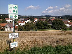
- - Fahrradbus-Anbindung vom Bahnhof Mücke-Flensungen an Wochenenden. VB-92: Hungen - Laubach - Grünberg - mosquito - Ulrichstein - Hoherodskopf, siehe Radroute Hoherodskopfsteig
8. Etappe: Ulrichstein - Nidda: 30 km


Zwischen Ulrichstein und Schotten erwarten einen mehrere Auf- und Abfahrten mit bis zu 10 % Steigung und etwa 200 verlorenen Höhenmetern.
Addierte Höhenmeter Gesamtetappe:
- Ulrichstein - Nidda: 230 hm,
- Nidda - Ullrichstein: 661 hm
Addierte Höhenmeter Teiletappen:
- Ulrichstein - Schotten: 213 hm (13,8 km), mit Abkürzung bei Petershainer Hof über Straße: 175 hm (12,9 km) ·
- Schotten - Ulrichstein: 512 hm, (Abkürzung: 471hm) und
- Schotten - Nidda: 24 hm (15,3 km),
- Nidda - Schotten: 159 hm
Zur Strecke:
- Betzenrod auf 390m Höhe - schöne Aussicht nach Süden und Südwesten
- Bulkheads auf 289m Höhe - einige schöne Fachwerkhäuser in der Altstadt, → Abzweig des Hoherodskopfsteig
- Niddastausee auf 257m Höhe
- Nidda - auf 130m Höhe
9. Etappe: Nidda - Maintal: 52,4 km
R4: Addierte Höhenmeter: Nidda - Maintal (Main): 217 hm,
R4 a: Nidda - Maintal: 53 km - 146 hm, -> Alternativradweg mit flacherer Strecke
- Florstadt
- Niddatal
- Karben
- Gronau bei Niederdorffelden · bis hierher, am Zufluss der Nidder begleitet der Hess. Radfernweg R4 die Nidda. The Nidda cycle path führt weiter nach Bad Vilbel and Frankfurt. Dieser ist ab Frankfurt-Berkersheim bis Frankfurt-Höchst als GrünGürtel-Radrundweg ausgeschildert.
- Main valley Fähre Rumpenheim · am Main cycle path zwischen Frankfurt und Hanau
10. Etappe: Maintal - Höchst: 62 km
addierte Höhenmeter: Rumpenheim (Fähre) - Höchst im Odenwald: 278 m · Bis Groß-Umstadt bleibt es flach, hinter Lengfeld geht es mit bis zu 10% Steigung aufwärts auf 326 m.
- Rumpenheim (Stadtteil von Offenbach am Main) (97 m) · Schloss → bis Mühlheim am Main auf dem Main cycle path
- Mühlheim am Main
- Heusenstamm
- Nieder-Roden bei Rodgau
- Babenhausen → Fahrradweg-Anschluss Hess. Radfernweg R8 Richtung Heidelberg (Umgehung der Steigungen im Odenwald)
- Groß-Umstadt
- Lengfeld · Bahnhof
- Otzberg - Feste Otzberg
- Höchst im Odenwald (157 m) → Fahrrad-Anschlüsse: Hess. Radfernweg R9: Vom Rhein ins Land der Nibelungen und Three-country cycle route
11. Abschnitt: Höchst - Hirschhorn: 59 km
addierte Höhenmeter: Höchst - Erbach: 103 m bei 18,7 km · Erbach - Höchst: 39 m
addierte Höhenmeter: Erbach - Hirschhorn: 705 m bei 41,6 km · Hirschhorn - Erbach: 801 m
- Michelstadt · Fachwerkaltstadt
- Erbach (Odenwald) (227 m) · Schloss
- → Bis Rothenberg führt der R 4 leicht hügelig auf meist geschotterten Waldweg in Kammlage bis Rothenberg
- Rothenberg - aussichtsreiches Dorf auf der Höhe.
- → Von Rothenberg geht es auf geschotterten Waldwegen 300 Höhenmeter teilweise steil zum Neckartal hinab. Wer gerne schnell talwärts fährt nutzt am besten ab Rothenberg die Landstraße (7 km lange Abfahrt). Die Straße wird an schönen Tagen allerdings auch gerne von Motorradfahrern genutzt, die die Kurvenfahrt bergab ebenfalls gerne genießen.
- Hirschhorn (Neckar) (122 m) - Altstadt mit Schloss
trips
By train
ab Bahnhof Bad Karlshafen
ab Bahnhof Hofgeismar
ab Bahnhof Wolfhagen
- Bahnstrecke Volkmarsen – Vellmar-Obervellmar (– kassel)
ab Bahnhof Fritzlar
- R39: (kassel –) Wobble – Bad Wildungen; Busse mit Fahrradträgern fahren während der Sommersaison ab Bad Wildungen
ab Bahnhof Wabern
- Main-Weser-Bahn: zwischen Frankfurt – kassel through the Wetterau und die Täler der Lahn, the Ohm, the Schwalm, the Eder and the Fulda above Friedberg – to water – Marburg – Kirchhain – Stadtallendorf – Treysa – Wobble
- R39: (kassel –) Wobble – Bad Wildungen (– Edersee) above Fritzlar; Busse mit Fahrradträgern fahren während der Sommersaison ab Bad Wildungen
ab Bahnhof Schwalmstadt-Treysa
- Main-Weser-Bahn: zwischen Frankfurt – kassel through the Wetterau und die Täler der Lahn, the Ohm, the Schwalm, the Eder and the Fulda above Friedberg – to water – Marburg – Kirchhain – Stadtallendorf – Treysa – Wobble
ab Bahnhof Alsfeld/Hessen
- Vogelsbergbahn: to water – Fulda from Lahn valley durch den Vogelsberg in the Rhön
ab Bahnhof Hirschhorn
- Neckartalbahn: Heidelberg – Heilbronn
- S-Bahn-Linie 1 des VRN between Homburg and Osterburken above Mannheim – Heidelberg – Mosbach
Bus mit Fahrradanhänger
- Schwalmstadt: Auf dem Bahnradweg Rotkäppchenland zwischen Schwalmstadt und Bad Hersfeld durch den Knüll und das Fuldatal/Hessischer Radfernweg R1 – auf den Fahrradträger am Bus passen maximal fünf Räder
- Vogelsberg: Komplette Broschüre zum Vulkan-Express 2012 - mit allen Fahrplänen und vielen Freizeittipps
- NaTourBusse Linien 40N...: Eberbach - Beerfelden - Erbach - Michelstadt - Eulbach - Amorbach - Miltenberg in beiden Richtungen jeweils im 2-Stunden-Takt, vom 2. April bis zum 31. Oktober 2012 an Wochenenden und Feiertagen.
By bicycle
References to literature and maps
Web links
- Hesse cycle route planner - official website of the state of Hesse. Die Route ist im Menue links unter "Themenrouten" to find.
- Streckenverlauf
- Carlsbahn-Radweg - Der Abschnitt 1 des R4 und Diemelradweg von Bad Karlshafen nach Hümme bei Bahntrassenradwege.de
- offizielle Fahrradinformationen zu R4 auf www.hessen-tourismus.de