


The one opened in 2010 Schwalm cycle path leads along the Schwalm from the source at Köddingen Alsfeld to Felsberg (Hesse). Here in the Eder lowlands the Schwalm flows into the Eder. Especially in the upper section and on to Borken, it runs close to nature over long stretches through extensive forests and small-scale villages and fields. With a length of over 100 km, it is one of the larger trails and can also score well with the signposting. From the source the cycle path often runs together with the Hessian long-distance cycle route R4: From Sleeping Beauty to the Nibelungs. You should also look at this description, where the representation runs in the opposite direction from north to south. The Ziegenhain Fortress with the Schwalm Museum and the half-timbered old towns of Alsfeld, Ziegenhain and Treysa are worth seeing. At the end of the tour Felsberg still has a few castles to offer.
New route from 2013
The route has been redesigned in some places. Borken is left out and instead the Gombether and Singliser See lakes are circled north and east on gravel roads. The quality of the path has deteriorated further, but the route has become a little quieter and you can see the Schwalm more often.
Note: there was an R20 cycle path that covered part of the Schwalm cycle path. The associated signs have largely been removed.
Route profile

- Length: 106 km
- Signposting: good to very good with standard-compliant signposts
- Slopes: hilly from the source to Alsfeld, from there, with the exception of the short incline in Schlierbach, slightly hilly to flat
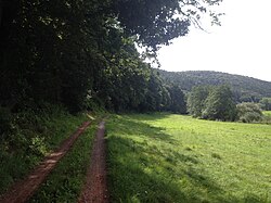
- Path condition: Quelle - Alsfeld meanwhile well prepared, split field and forest paths, Alsfeld - Treysa asphalted up to 1 km, Treysa to Gensungen many split field and forest paths; see also section Security
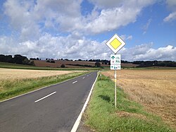
- Traffic load: The quiet sections (field and forest paths) dominate, but the sections next to federal roads, on country roads and on local roads also make up 35%.
- Suitable bike: Touring bike with tread tires and 7-gear shift, MTB
- Family suitability: partially
- Inline suitability: only in the area Schwalmstadt (Loshausen, Ziegenhain, Treysa)
background
region Schwalm.
preparation
Shops and rest stops can be found mainly in the larger towns and cities. A larger selection can be found in the detailed description of the ADFC Schwalmstadt.
getting there
By train
Railway stations and stops can be found in Felsberg-Gensungen, Wobble, Bark-Singlis, Bark, Neuental-Zimmersrode, Neuental-Schlierbach, Schwalmstadt-Treysa (all KBS 620) and Alsfeld (KBS 635).
If you want to go to the source: Individual bikes can be transported by bus from the Mücke train station (Vogelsberg train stop from Gießen via Alsfeld to Fulda) to Ulrichstein. From there you can take the R 4 to the Schwalm cycle path.
By bicycle
Connection at the source to:
In Renzendorf connection to:
- Hessian long-distance cycle route R2 from the direction of Lauterbach
In Alsfeld connection to:
- Castle route from the direction of Burg-Gemünden
- D4/Hessian long-distance cycle route R2/Antrift Valley Cycle Path from the direction of Marburg - Neustadt - Antrifttal
In Willingshausen-Loshausen connection to:
- D 4: Mittelland route/German Unity Cycle Route/Rotkäppchenland railway cycle path from the direction of Oberaula - Bad Hersfeld
In Schwalmstadt connection to:
- Schwalm-Efze-Weg R14
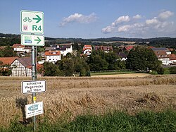
- Hessian long-distance cycle route R4
- Rotkäppchenland railway cycle path/German Unity Cycle Route from the direction of Marburg - Neustadt
In Wabern connection to:
- Hessian long-distance cycle route R4
- Eder cycle path from the direction of the Edersee
In Felsberg connection to:
By car
From Köddingen you can drive almost to the source. There is no parking space there, but there is little traffic on the route. The A 49 - from kassel coming - runs roughly parallel to the route. It currently ends in Neuental.
Route description


1st stage: Schwalmquelle - Alsfeld: 19 km
- Schwalm spring - A short walk leads to the source, which is quite overgrown in summer. First there is a 3 km long forest path with a water-bound cover. A steep, paved dirt road follows with a view of the lonely landscape.
- Storndorf - You meet him before Renzendorf Hessian long-distance cycle route R2 before Renzendorf. Anyone who has cycled upstream is heading here Volcano bike path further, it being the Basalt tour as an alternative route
- Renzendorf - The place has a train station. We continue through a green valley on good paths. In Altenburg it goes on an unpaved forest path next to the Schwalm to Alsfeld.
- → If you turn left instead of right after the steep descent, you can cycle along a country road to Alsfeld. After entering the town there is an R4 signpost. This path is better and shorter, but not an adventure.
- Alsfeld - The bike path through the village is quite complicated. If you get lost, you get to know the old half-timbered town even better.
2nd stage: Alsfeld - Treysa: 30 km
- Münch-Leusel - Behind the village, the cycle path runs in an empty reservoir, which is used for flood protection. You cycle towards the dam (photo). If the pool is full, the road from Münch-Leusel to Heidelbach must be used.
- Röllshausen - 1000-year-old chapel on the Schönberg (a basalt cone) in front of the village on the right-hand side
- Salmshausen - If you cycle straight on here instead of left, you cross a bridge and, following the narrow country road and at the end of the R17, you reach the Rotkäppchenland railway cycle path.
- Zella - Half-timbered village. Then a piece of country road up
- Loshausen - Here the Mittelland route D4 branches off to the east.
- ~
 ~> Here crosses the new one Rotkäppchenland railway cycle path the Hess. R4 long-distance cycle path and the Schwalm cycle path. If you branch off to the left, you can almost comfortably get to Treysa train station. There, where the railway cycle path ends, there is also a parking lot and behind this a paved path that leads us back to the Schwalm-Weg.
- 1 Goat grove (215 m) - The former residence and district town is now a district of Schwalmstadt with around 4175 inhabitants and well-known nationwide for the baroque water fortress, which was the fourth largest fortification in the Thirty Years' War Hesse was and could not be taken. Good bus connections in almost all directions.
- ~ ~> On the embankment of the retention basin, you drive on an asphalt path around the industrial area; later then downhill from the dam into the retention basin.
- 2 Ascherode junction (215 m) - From the 250-inhabitant district of Schwalmstadt you don't notice much because you drive past it about 300 meters north in the retention basin. There are good bus connections to all parts of the city Schwalmstadts.
- ~ ~> You cycle further on asphalt farm roads parallel to the railway line of the former Knüllwaldbahn, before you drive over another dam of the retention basin back to the Schwalm and with this you reach the stage destination under a small viaduct of the Main-Weser-Bahn.
- 3 Treysa - train station (210 m) - The largest district of Schwalmstadt was an independent town until 1970 and is now the administrative center Schwalmstadts. Who to the train station (KBS 620) or to the half-timbered old town with market square, town hall, Johannisbrunnen and the Treysa landmark, the ruins of St. Martin's Church of the Dead with a beautiful view, follow the signs for the local cycle network. Several bus lines run to the surrounding cities and communities, mostly from the station forecourt, where there are connections to local and long-distance transport.
3rd stage: Treysa - Bad Zwesten: 23 km


The third stage of the Schwalm cycle path runs between the Wiesenhof bei Schwalmstadt-Allendorf an der Landsburg and Bad Zwesten identical to the Hess. Long-distance cycle route R4, as well as between Niederurff and Bad Zwesten identical to the Hess. Long-distance cycle route R5. Probably the worst part of the Schwalm cycle path in North Hesse between Treysa and Rommershausen can alternatively be via the Hess. Long-distance cycle route R4 must be bypassed extensively via Allendorf an der Landsburg.
The meters in altitude are in the direction of travel Treysa-Bad Zwesten around 165 m, in the opposite direction around 175 m.
- ~ ~> Following the curvy course of the Schwalm you come on gravel farm roads to the Leistwiesen nature reserve near Rommershausen, which you drive around on gravel paths that are sometimes very difficult to drive, for which you almost need a mountain bike or, if necessary, have to get off and push. Theoretically, one could extend the section across the Hess. Avoid long-distance cycle route R4. Later you have to drive through a small forest area.
- 1 Rommershausen (210 m) - The biggest attraction of the district of 465 inhabitants Schwalmstadt is the Rommershausen Castle, built in the 16th century, with an adjoining park. It only runs with a few trips Line 471.
- ~ ~> Over a bridge over the Schwalm, which is only approved for pedestrians and cyclists, and a small footpath and bike path along this one reaches the neighboring village after only 400 meters.
- 2 Dittershausen (205 m) - The district of Schwalmstadt is just like Rommershausen on a bend in the river Schwalm and is served by the bus routes 460 and 471 approached.
- ~ ~> First asphalted, then gravel along the edge of a small wood to the Wiesenhof, where you get back on the Hess. Cycle route R4 meets. Then together on an asphalt farm road up a ridge, on the other side of which you have a beautiful view of Schlierbach, which you finally reach via a gravel farm road that is difficult to drive and steeply downhill via the Am Loh road.
- 3 Schlierbach - train station (205 m) - With a good 335 inhabitants is the small district of Neuental with its own train station or stop (KBS 620) in the middle of the Schwalmtal. In addition to the rail connection, Schlierbach is also used by the Line 419 approached.
- ~ ~> From Schlierbach station first right, then left on gravel farm roads along the Main-Weser Railway. Behind the Waltersbrück cemetery downhill into the village.
- 4 Waltersbrück (200 m) - The district of with around 450 inhabitants Neuental is crossed once by the Main-Weser-Bahn, but never had its own train station or stop at it. The bus routes operate in the village 411 and 419.
- ~ ~> First you cycle on a gravel farm road along the Main-Weser Railway past a larger rest area with a refuge, then on an asphalt farm road downhill to Bischhausen-Siedlung (junction Zimmerrode). You drive under the federal autobahn 49 and pass a beautiful old mill at the entrance to Bischhausen.
- 5 Bischhausen (200 m) - The district of the municipality is located with a good 380 inhabitants Neuental between Gilsa and Schwalm. The neighboring village of Zimmerrode, about one kilometer from the Schwalm cycle path, has its own train station or stop on the Main-Weser Railway (KBS 620). The bus routes operate in Bischhausen 411 and 419.
- ~ ~> Shortly after Bischhausen you cross the Gilsa and have to drive up the ten meter high hill on the road 3074. This is then followed for a length of 3 km, mostly flat west of the Schwalm.
- 6 Niederurff (205 m) - The district of Bad Zwesten is a junction in the Hessian long-distance cycle path network, because here the Hess. R5 long-distance cycle path to the Schwalm cycle path and the Hess. Cycle route R4 meets. The place is served by the bus routes 407 and 411 approached.
- ~ ~> Niederurff is left to the east; you cycle downhill and cross the Schwalm. Now the three long-distance cycle paths run on a poorly navigable unpaved path (only partially graveled) along the edge of the forest. Behind the Forest campsite you drive along the Wälzebach again briefly uphill to the outskirts of the stage destination.
- 7 Bad Zwesten (200 m) - The community with a total of around 3920 inhabitants has a mineral spring at which, among other things, the Bad Zwestener Löwensprudel is bottled. With the bus line 408 there are good bus connections Bark and Bad Wildungen with further connections, the school bus routes also run 407 and 411.
4th stage: Bad Zwesten - Felsberg: 31 km


.JPG/250px-Schwalmmündung_Altenburg_(Felsberg).JPG)

The fourth and last stage of the Schwalm cycle path is between Bad Zwesten and Singlis identical to the Hess. Long-distance cycle route R4 and the Hess. Long-distance cycle route R5. About half of the route is paved, while the other half is unfortunately only gravel and often requires more concentration when driving. In return, the stage is mostly car-free and flat, except for small climbs. You should still have a good gear shift, as it is in the open countryside of the Schwalm-Eder-Aue can often be very windy. In Felsberg-Gensungen is then connected to the Eder cycle path or the Chattengau-Fulda cycle path.
The meters in altitude are in the direction of travel Bad Zwesten-Felsberg around 90 m and in the opposite direction around 135 m.
- ~ ~> On asphalt farm roads, you usually continue straight ahead without detours, always following the course of the Schwalm. You can take a detour to one of the mills on the Schwalm via a meadow path (signposted).
- 1 Kerstenhausen (190 m) - Almost 600 inhabitants large district of Bark on the federal road 3. The three long-distance cycle paths run through the village directly along this, luckily there are wide sidewalks which you can use as a cyclist if necessary. The bus routes operate 407 and 408.
- ~ ~> From Kerstenhausen you have to use the district road 73 for 2 km to the Arnsbach cemetery, to which unfortunately there are no alternative routes under the federal motorway 49 through the so-called Schwalmpforte. But families with small children in particular should avoid the street, especially during rush hour, as it is sometimes very narrow, confusing and fast. But at least the road quality is good.
- 2 Arnsbach junction (200 m) - The district of 525 inhabitants Bark is located 500 meters south of the three long-distance cycle paths, but you will pass the cemetery. From Arnsbach you can cycle on the local cycle route 101 via Trockenerfurth to Borkener See. The place is served by the bus routes 407, 411 and 419 approached.
- ~ ~> On an asphalt footpath and bike path you drive right along the edge of the forest, before you cross the Schwalm over a wooden bridge and the Stockelache natural bathing lake (with catering) reached. With the help of a set of traffic lights, you can pass Landesstraße 3223 and continue cycling along paved farm roads past fruit trees.
- 3 Small glis (190 m) - A district of around 1500 inhabitants Bark. Is worth seeing next to Saint Michael's Church especially that Kaiserkreuz at a children's playground on Hundsburgstrasse (see map). The lines run 407 and 413.
- ~ ~> We continue on a local road under the state road 3150 briefly uphill to a hill south of Großenenglis. Here you turn south and drive with a view of Bark back to the Schwalm; who to the train station Bark (KBS 620), you have to leave the three long-distance cycle paths to the south before Gombether See (see map). These then run in a beautiful landscape on a gravel path directly above Lake Gombether with a view of it. Unfortunately, you cannot go down to the bank, at least there are no public roads.
- 4 Gombeth (175 m) is another district of with 765 inhabitants Bark and is used by the bus routes 407 and 413 approached. The place is right between the two large lakes directly on the Schwalm.
- ~ ~> From Gombeth you cycle on gravel farm roads north of the Schwalm and unfortunately you cannot see the beautiful Singliser See in the immediate vicinity. For a detour to this, you drive on the three long-distance cycle paths over a bridge over a side arm of the Schwalm and thus come to Singlis, where you have to follow state road 3149 for a part. At the lake you will find a restaurant next to restaurants Aquagolf facility (only in summer).
- 5 Singlis - train station (170 m) - The medium-sized district of Bark has its own small train station or stop on the Main-Weser-Bahn (KBS 620). In the village, the cycle route makes a small detour, if you want to shorten it, follow the Main-Weser-Straße (see map). The bus routes continue to run 407 and 424.
- ~ ~> Past Singlis train station, follow a shady gravel path along the Main-Weser-Bahn to Landesstraße 3148. Follow this for 400 meters to the north, alternatively, after 200 meters, you can take a meadow path (signposted as a bad route) drive around the remaining 200 meters. The Hess then branches off again on asphalt farm roads. R4 long-distance cycle path in front of a railroad barrier.
- 6 Uttershausen (170 m) with about 660 inhabitants is a district of Wobble, is located 500 meters west of the Schwalm cycle path on the Hess. Long-distance cycle route R4 and, although it is located directly on the Main-Weser-Bahn, does not have its own train station or stop. Instead, the bus routes run 424, 450 and 457.
- ~ ~> After you have driven another bit along the Main-Weser-Bahn, you turn east and drive straight on on paved paths over the Schwalm to a football field, where you keep left and cross the Efze and finally the next place in that Schwalm-Eder-Aue reached.
- 7 Unshausen (170 m) - In the district of Wobble around 435 people live on Bundesstrasse 254. The local Efzetalradweg R17 (from Homberg (Efze)) and there are bus routes 450 and 457.
- ~ ~> From the outskirts of Unshausen you cycle on a separate asphalt footpath and bike path that runs alongside the road for about 1.5 km along the federal roads 253 and 254, in between you can follow the Efzetalradweg (R17) Wobble to the train station (KBS 620 and KBS 621) cycle.
- 8 Harle (165 m) - The district of about 840 inhabitants Wobble is from the bus routes 442, 450 and 457 opened up. The former fortified church, built from basalt rock, whose tower was probably built as early as 1388, is worth seeing.
- ~ ~> At the exit of Harle there is another information board for the Schwalm cycle path, from which you cycle to the northeast through the fields on asphalt and gravel farm roads. Turning right and left you finally reach the last bridge of the Schwalm cycle path over the Schwalm. Shortly afterwards you cross the Rhünda and pass under the Main-Weser-Bahn (start and finish point of the Schwalmhöhenweg (S 59)) before you reach the junction to the mouth of the Schwalm via a gravel farm road along the railway line. An approximately 100 meter long meadow path leads exactly to this. Unfortunately there is no seating at the mouth of the Schwalm.
- 9 Rhünda - swallow mouth (160 m) - Altenburg is actually located, a district of around 30 inhabitants Felsberg closer to the mouth of the Schwalm, but on the other side of the bank. That's probably Rhünda (Line 442), also a district of Felsberg today the penultimate place on the Schwalm cycle path and about 500 meters away from it. The Schwalm cycle path used to run right through the village, but in recent years it has been moved to its current route between the Eder and the Main-Weser railway. The quality of the path (previously asphalt, today gravel) has deteriorated as a result.
- ~ ~> The last section of the route requires full concentration from the cyclist, as you can easily slide away on the fine gravel in the curves. In the end, however, the path is paved behind the loading point of the Main-Weser Railway and you can reach the train station without any further detours Felsberg-Gensungen.
- 10 Harle - Gensungen Gensungen (155 m) is the last place on the Schwalm cycle path. With a good 2950 inhabitants, it is the largest district of Felsberg, in addition to the Schwalm cycle path that starts or arrives here, also the Eder cycle path (to Fritzlar, or. kassel) and the Chattengau-Fulda cycle path (to Gudensberg, or. Melsungen). Several local bus routes run here alongside various regional trains (KBS 620).