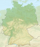
The Rothaar Mountains is a low mountain range in Hesse and North Rhine-Westphalia.

Regions

places
| location | ||
| ||

- Bad Berleburg
- Bad Fredeburg - politically belongs to the city of Schmallenberg since 1975
- Bad Laasphe - Kneipp spa and climatic health resort in the upper Lahn valley
- Brilon
- Erndtebrück
- Hallenberg
- Hilchenbach
- Kirchhundem
- Medebach - Resort located in the eastern rain shadow of the mountains
- Netphen - on the southern edge of the Rothaargebirge
- Schmallenberg
- Willingen - next to Winterberg the second large winter sports center
- Winterberg - is centrally located in the middle of the Rothaargebirge; well-known winter sports center
Other goals
Bad Wildungen, Frankenberg (Eder), Kellerwald-Edersee National Park, Edersee
background

The known Bare branches at Winterberg is not, as is often assumed, the highest mountain in the mountains. At an altitude of 843 m, this is the rather unknown Langenberg, the one to the northwest of Willingen (Upland) is to be found. Apart from an inconspicuous summit stone, there is nothing to see on the wooded elevation. There is also no lookout point there.
The highest accessible point in the Rothaargebirge is the viewing platform of the Ettelsberg Tower at an altitude of 875 m.
language
getting there
By plane
The nearest airports with scheduled flights are Paderborn-Lippstadt (approx. 60 km away) and Dortmund (95 km). However, there are no convenient public transport connections from either of the two to the Rothaargebirge.
By train
The nearest long-distance train stations are Warburg (Westf), Hagen, Marburg, Kassel-Wilhelmshöhe and Dortmund.
From Dortmund Hbf you can take the regional express line 57 to the region. This runs every hour to Meschede and Bestwig, from there it continues every two hours either to Winterberg or to Olsberg and Brilon. The drive from Dortmund to Winterberg takes, for example, 1:45 hours.
From Hagen or Warburg you can take the RE 17 every hour, which stops in Brilon Wald, Olsberg and Bestwig on the northern edge of the Rothaargebirge (a good 40 minutes from Warburg; a little over an hour from Hagen).
From the Hessian side you can take the RB 94 every two hours from Marburg to Bad Laasphe and Erndtebrück (1:25 hours) or the RB 42 from Marburg via Korbach to Willingen (just under 2 hours). Coming from Kassel, you have to change trains in Korbach or Brilon Wald and it takes a good 1½ hours to Willingen.
In the southern part of the Rothaargebirge, the regional train line 93 runs from Siegen via Erndtebrück to Bad Berleburg (a total of 1:25 hours).
By bus
Flixbus runs daily from Amsterdam via Utrecht, Arnhem Oberhausen, Essen and Dortmund to Winterberg and Willingen (Upland). The journey takes z. B. from Dortmund to Winterberg a little over two hours and costs € 18.50 if you pay on the bus, in advance from € 7.
Busverkehr Ruhr-Sieg GmbH's bus route R27 runs several times a day from Siegen via Netphen and Erndtebrück to Bad Berleburg. The entire journey takes 1:25 hours.
In the street
The Rothaar Mountains represent a noticeable gap in the German motorway network. The closest are the A 45 Dortmund – Wetzlar (exit Wilnsdorf or Dillenburg) and the A 46, which so far ends at Bestwig. The federal highways B 62 (Siegen – Bad Laasphe – Marburg), B 236 (Altena – Lennestadt – Winterberg – Münchhausen), B 251 (Kassel – Korbach – Willingen – Brilon) and B 480 (Brilon – Winterberg – Bad) run through the Rothaar Mountains themselves Berleburg – Bad Laasphe).
mobility
Tourist Attractions
- 1 Fort Fun Adventure Land amusement park in Sauerland. Incidentally, the 57 m high one belongs to the park Stacking tower. The observation tower, which stands on the 732 m high hilltop of the same name, is a landmark that can be seen from afar.
- Bruchhauser stones near Olsberg-Bruchhausen - A toll road leads to just below the up to 90 m high rock colossi. Beautiful panoramic view from the 756 m high field stone, which on clear days up to the Teutoburg Forest enough. By the way, the four largest rocks have names: they are called Feldstein, Bornstein, Ravenstein and Goldstein. The rock cliffs are made of porphyry and are up to 290 million years old. The harder porphyry of volcanic origin withstood erosion better than the surrounding softer clay slate. The overburden (deposits of a prehistoric sea from 370 million years ago) was removed over time and the harder cliffs exposed. The rock cliffs are under nature protection. Climbing is not permitted. In the nature reserve breeds, among other things. the rare peregrine falcon.
- Clemensberg - From the 839 m high elevation you have a beautiful view of the Rothaarkamm to the south. The mountain is about 10 km north of Winterberg or 5 km south of Willingen.
activities
hike
- Rothaarsteig - If you want to discover the mountains on foot, it is best to hike on the interesting ridge path. The long-distance hiking trail follows the main ridge of the Rothaargebirge. It starts in Dillenburg and ends in Brilon.
- Forest sculpture trail - 22 km long hiking trail that leads from Bad Berleburg to Schmallenberg leads.
- Red Kite High Trail - 38 km long circular hiking trail. It was inaugurated on May 1, 2014. The path only leads through the village Elsoff in the Wittgenstein district. The Christianseck grill hut is also on the way. Home page.
Winter sports
- see article Winter sports in the Rothaar Mountains
Mountain biking
- regional MTB network: Bike Arena Sauerland
- Winterberg bike park "Downhillers" in particular get their money's worth in the park. There are several downhill routes with a total length of 6 km. The chairlift transports cyclists back up the mountain. Driving technique courses are also offered. The park is located on the bobsleigh run.
Motorcycle and car tours
- The winding roads of the Rothaargebirge are particularly popular with two-wheelers. If you want, you can take the tourist route Hochsauerland high road drive on.
- A popular destination for motorcyclists is the Bagpipe
kitchen
nightlife
security
climate
literature
Web links
Webcams
- Upper Postwiese ski area near Winterberg -Landscape view