| Finnmark | |
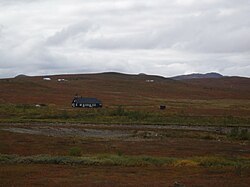 | |
Location  | |
Coat of arms and flag  | |
| State | Norway |
|---|---|
| Capital | Vadsø |
| Surface | 48,615.96 km² |
| Inhabitants | 75.207 (2014 census) |
| Institutional website | |
Finnmark (Finnmárku in Sami, Ruija in Finnish) is a county of the Northern Norway.
To know

Geographical notes
Finnmark covers an area the size of countries like Slovakia or the Denmark. Finnmark is much broader than the Belgium or gods Netherlands. Much of the county consists of the Finnmark Plateau at about 300/500 meters above sea level. The rugged coast of Finnmark stretches for about 6800 km if we also consider the insular ones (greater than that Spanish or Chilean). The municipality of Kautokeino is about 10,000 km² (4 times wider than the Luxembourg), although it has a population of less than 3,000 souls.
When to go
Finnmark is the coldest part of Norway, but the climate varies across the county. The interior has a continental climate with winter temperatures as low as -40 ° C (record -50 ° C), while summers can be hot. Karasjok for example it has an average temperature yearly of -2 ° C. The coast has cold summers and winters that aren't all that cold but windy (the open sea is ice-free in winter). The city of Vardø it has an arctic climate, even in July it has a monthly average of 9 ° C, like most of the outer coast of Finnmark.
During the summer there is a long period of midnight sun (24 hours of sunshine) and, conversely, there is a long period in winter when the sun is below the horizon (polar night or "dark period"). In High the polar night lasts from 25 November to 17 January.
Background
Finnmark's territory was largely destroyed during World War II. The eastern part of Finnmark was on the eastern and northern front between theSoviet Union and the Germany, fierce fighting took place east of the town of Kirkenes. Kirkenes has been subjected to more than 300 bombings, more than any other city in Europe (except for Valletta). When the occupying forces withdrew a Troms, have applied the strategy of scorched earth, where virtually every house, church, factory, bridge and telegraph pole was destroyed. The population was forcibly transferred to Tromsø and further south. The result was a large no-man's land about twice the size of the Belgium (Similar tactics were applied across the border in the north of the Finland). Kirkenes and Eastern Finnmark were liberated by the Soviet army in 1944, the Soviets withdrew in 1945. About 20,000 inhabitants refused to move and endured the winter in tunnels, caves and makeshift lodgings. The county was quickly rebuilt after the war, and there are hardly any buildings older than 1945.
Spoken languages
The Norwegian it is spoken by all, but in some parts of northern Finnmark Sami is the language of the majority and there is also a minority of languages Finnish. However, it is equally possible to communicate with theEnglish.
Culture and traditions
Finnmark has been the frontier of the Norway. The northernmost regions of Norway, Sweden, Finland is Russia they were largely a common space with no clear boundaries before the 19th century. So in Finnmark, along with the Sami people, there are also the Kven, people of Finnish origin. There were also close connections across the border to Finland and Russia. Trade with the Pomors of Russia also imported a local pidgin language that mixed elements of Russian is Norwegian, as well as words from English, French, Sami and other languages.
Territories and tourist destinations
Urban centers
Other destinations
- North Cape - The northernmost tourist point ofEurope.
How to get
By plane

There are direct flights from Oslo to High is Kirkenes and in summer also towards Lakselv, all served by SAS or Norwegian.
Other airports are present in Båtsfjord, Berlevåg, Hammerfest, Hasvik, Honningsvåg, Lakselv, Mehamn, Vadsø, Vardø. These however are only served by local flights from Alta, Kirkenes and Tromsø, managed by Widerøe.
By car
- The fastest from the south of Sweden to High: E4 a Luleå, then E10, 392 and 403 beyond Pajala on the border with Finland, then E8 and road 93.
- Fastest from southern Sweden a Kirkenes: E4 a Kemi (Finland), then E75 and road 971.
- The E4 is also the fastest since Oslo. A suggestion is to go through in the order E6, 3, 25, 311 pass Trysil is Särna, then 314, 83 and E14 pass Awake is Ånge to Sundsvall and the E4. A longer road but better than the E16 a Gävle.
As an alternative to one of the suggested directions, one could use the E6, a much longer but more beautiful road.
Coastal ships of the Hurtigruten company, with daily departures.
By bus
Eskelisen Lapinjat[link not working] offers bus rides from Finland to Vadsø, High is North Cape.
How to get around

By plane
Numerous local airports are located in the following cities: Alta, Båtsfjord, Berlevåg, Hammerfest, Hasvik, Honningsvåg, Kirkenes, Lakselv, Mehamn, Vadsø, Vardø. To check widerøe.no. Most flights take off from Alta, Hammerfest, Kirkenes and Vadsø, but it is possible to fly between other airports, although most flights make intermediate landings.
By car
The distances are quite long but the main roads are generally of a fairly good quality and with little traffic. Fill the tank at every opportunity, as the distance between the various petrol stations could be long.
Wide vehicles such as buses and RVs may find different narrowings on main roads. Route 98 is a shortcut to eastern Finnmark, but a bit more adventurous and closed in winter; however it is planned to improve it in 2015. Many fishing settlements are located on the peninsulas with a single road link. Minor roads are often narrow and winding.
Most Hurtigruten company ships allow a limited number of cars, so timely booking is required. This allows you to visit two peninsulas without having to travel the same road on the way back.
In some locations there are express passenger boats. For more details see the website 177finnmark.no[link previously not working].
By bus
Check the site 177finnmark.no[link previously not working] to know the routes and bus connections. The distances are quite long so the journeys will take a long time, and the frequency of the rides is low.
What see

- North Cape - It is listed as the northernmost tourist point ofEurope.
- High - Prehistoric rock carvings, a World Heritage Site ofUNESCO.
- Hamningberg - It is one of the few places in Finnmark with preserved buildings from pre-WWII age. Located in the eastern part of the Varanger Peninsula; stopping here the road is not possible to proceed further. Many of the buildings are from the 17th century. Today inhabited only during the summer. The landscape that can be seen approaching Hamningberg (a barren land, with a multitude of rocky outcrops) alone is worth the entire trip.