| Dhofar Governorate | |
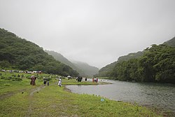 | |
Location  | |
| State | Oman |
|---|---|
| Capital | Salalah |
| Surface | 99,300 km² |
| Inhabitants | 249.729 (2010 census) |
| Institutional website | |
Dhofar Governorate (or Ẓufār, in Arabic ظفار) is a region ofOman.
To know
.JPG/220px-Tamarindus_indica_(2).JPG)
Dhofar Governorate is known to be one of the leading aromatic incense producers of all time.
It is a rugged, sparsely inhabited region that encompasses both an extremely arid desert as well as the lush and tropical wadi. The mountains of the Dhofar Governorate run parallel to the coastline, attracting the khareef (southwest monsoon) from the Indian Ocean, resulting in cool, humid summers from June to September and transforming the landscape into a green paradise. The rains do not pass through the mountains, so traveling a short distance to the northwest could easily die of thirst. The Dhofar Governorate also occupies part of the Rub 'al-Khali (empty quarter), that vast and uninhabited sea of sand that covers much of the southern Arabian peninsula.
The Dhofar has not always been united and has not always had good relations with theNorthern Oman, the most recent conflict dates back to the Dhofar War (1962-1976). The defeat of the rebels in 1976 was partly achieved through a radical reform and modernization of the state of Oman, which subsequently led to a significant improvement in relations between the two factions.
Geographical notes
The Dhofar Governorate is located in the southern part ofOman, whose territory geographically consists of coastal, mountain, flat and desert areas.
When to go

The Dhofar Governorate has a subtropical climate and together with a small portion in the north of Yemen it is directly exposed to the southeastern monsoon from mid-June to mid-September, known as Khareef. During the monsoon season and for a certain period thereafter there is a luxuriant green climate, until the vegetation loses the acquired humidity. The temporarily humid climate of Dhofar is in stark contrast to that of the nearby barren desert of the "empty quarter".
Background
Before the Omani domination, a portion of Dhofar was partially the territory of the Kathiri sultanate and subsequently largely controlled by the tribe of Al-Hakli (Qara), hence the name of the mountain range Qara. It is thought the Al-Shahri were the original inhabitants of Dhofar.
Dhofar was a large exporter of incense in ancient times, the trade of which reached as far as China.
During World War I it was fertile enough to produce food and grain for the British Army's needs during the fighting in Mesopotamia.
Here the Dhofar War was fought by the Sultan of the Armed Forces of Oman in 1965-1975 against the guerrillas of the Marxist Popular Front for the Liberation of Oman and the Persian Gulf (PFLOAG), supported by the communist Yemen of the South after the independence of that territory and several other socialist states, including the Germany East. The goal was to depose the sultan, whose forces were assisted by UK, Iran and by officials and doctors from Pakistan is India. At the end of the campaign (December 1975) the remaining PFLOAG forces surrendered.
Spoken languages
Although in recent decades many people from Arabic (predominant in the rest of Oman), the Dhofar region is traditionally home to South Arabian speaking populations of the Semitic group. Among them, the largest is the Shehri (or Jibbali) language, spoken by the mountain tribes. Jibbali refers to a number of different languages related to Amharic (spoken in Ethiopia).
Many today also learnEnglish.
Culture and traditions
The Dhofar population is made up of several distinct ethnic groups. These include the nomads Badawi (Bedouins) living in the inner deserts, i Jiballi (the highlanders) who live in the coastal mountains, and i Hadhari (citizens), who live along the coasts and in larger settlements. The Jiballi tribes share many cultural and linguistic traits with the tribes of Ethiopia ed Eritrea, and most still keep herds of cattle, camels, and goats in the same districts as they have for generations. Even the Omani of origin African they constitute an important percentage of the population; most immigrants from Zanzibar when it was once part of the maritime empire of Oman.
Suggested readings
- Wilfred Thesiger, Arab sands. First published in 1959 and considered a classic of travel literature, the book documents the author's travels throughout the Rub 'al-Khali (Empty Fourth) in 1945 and 1950, with the assistance of local tribes. (ISBN 978-8865593691).
- Ian Gardiner, In the Service of the Sultan: A First-hand Account of the Dhofar Insurgency. A brilliant and engaging memoir by a British officer who fought in this little-known war. (ISBN 978-1844154678)
- Sonallah Ibrahim, Warda (translated into Italian by Patrizia Zanelli, Ilisso). Novel by the Egyptian writer about a young guerrilla of Dhofar in the 60s-70s. (ISBN 978-8889188323)
Territories and tourist destinations


Urban centers
- Salalah - Capital and seat of the governor (or Wali) of the Dhofar region.
- Mirbat - Coastal city included in the commercial routes for the export of incense.
- Taqah - In the Mazoon al-Mashani cemetery rest loved ones linked to several sultans.
- Thumrait - Small town on the ancient caravan routes of the Arabian peninsula. Now home to an Oman Air Force base.
How to get
By plane
Most visitors fly in Salalah, which has the only commercial airport of Dhofar which operates flights to Muscat, Dubai, Sharjah, Jeddah is Doha.
By car
For the more adventurous, it is possible to drive from Muscat to Salalah in about 12 hours. From Nizwa, the new R31 road leads inland, passing through oil fields and some small settlements. An alternative coastal route heading south from Sur it will become accessible in the next few years as soon as the final stretch of the main road connecting Shuwaimiyah to Hasik is completed. There are few petrol stations along both roads, so it is advisable to refuel at every opportunity.
By bus
Public buses also travel the main road between Muscat is Salalah. For more details refer to the article on Salalah.
How to get around
By car
A rental car is required to truly explore the region. Most areas are now easily accessible by two-wheel drive, but there are still places (e.g. Shisr, some of the more remote wadis and beaches) that require a 4x4, particularly during the khareef.
What see
9.jpg/220px-Shisr_(Ubar)9.jpg)
.JPG/220px-Boswellia_sacra_in_Wadi_Dowkah_(Dhofar).JPG)
The land of incense
There are four sites collectively registered as World Heritage Sites in Oman as Land of incense.
- 1 Shisr (Ash Shisr, Ubar, Wubar, Wabar) (On the R43 road). These ruins of a fortified settlement were a stop to refresh the caravans on the incense route, discovered in 1992 with the help of satellite images. Scholars disagree that this is indeed the legendary place of Ubar o Iram of the Columns, as described in the Bible; however it has been determined that it was probably destroyed following an earthquake. The site itself is interesting, but not spectacular.
- 2 Wadi Dawkah Natural Park (On the R31 road).
 Free. This dry wadi has around 5,000 incense trees within it in an area of 9 km², the oldest of which is estimated to be over 200 years old. The sap is still collected by the Bedouin tribe of the Bait Kethir, with the individual trees owned by different clans and families. Visitors can simply park on the street and walk there.
 - 3 Al Baleed Archaeological Park, As Sultan Qaboos St (Salalah), ☎ 968 23 303577, @[email protected]. 2 OMR (includes entrance to the incense museum).
 Sat-Wed 9: 00: 14: 00 and 16: 00-20: 00, Thu-Fri 16: 00-20: 00. Vast ruins which in the 12th century were the commercial port of Zafar, visited by Marco Polo in 1285.
 - 4 Sumhuram Archaeological Park (East of Taqah, in the ancient city of Khor Rori). It flourished with the exchanges of incense and copper between the third century BC. and V A.D. It was the most important pre-Islamic settlement in the Arabian peninsula and a trade center with India, China and other Arab and other civilizations Mesopotamia.
Itineraries
Salalah - Dalkut


Dalkut is the westernmost point accessible by land, as the border with Yemen it is currently closed. Driving to Dalkut takes between 3 and 3.5 hours (one way). For a more leisurely ride, Fizayah is a good place to take a tour, or alternatively consider spending the night in Rakhyut.
- Head west from Salalah on the R47 road for about 30 km, until you reach Mughsayl(Al Maghsail / Al Mughsail). On the left there are 5 km of beautiful 1 beach with picnic facilities in the shade. During the khareef the waves often reach 2/3 m in height and the beach is closed; during the winter the water is clear and perfect for bodysurfing. A little further on there is a crossroads (always on the left) for 2 Marneef Cave with the famous marine vents of Mughsayl. The best time to appreciate them is during the khareef, because at high tide the water is channeled through small openings in the caves, creating spectacular jets of water.
- 1km after Mughsayl the road begins a spectacular ascent up the mountains, reaching 1,000m in just 8 hairpin bends and giving spectacular views over Wadi Aful. This stretch of road is sometimes referred to as 3 Furious Road.
- After climbing the switchbacks you will emerge on a plateau, with a splendid view of the cliffs that line the coast. If you are feeling brave and equipped with a 4x4, take the fork for 4 Fizayah on 6km of groomed trail along the cliff overlooking a fishing field, with some incredible views and secluded beaches. If you choose to forgo this detour, continue for a few minutes to some good picnic spots, all with good views.
- After about 30 minutes you reach a 5 checkpoint of the army. You need to bring your passport to continue. 47 km after the checkpoint, turn left following the signs for 'Matinity' and head towards Rakhyut.
- 15 km from the crossroads there are some good ones 6 pitches with a great view of the coast.
- Continue in the direction of 7 Rakhyut, a small fishing village with a nice beach for swimming, as well as the8 Abu Fawzi hotel and a restaurant nearby.
- The main road, the R47, continues on a plateau at about 1,000 m a.s.l. After about another hour you pass to the second army checkpoint.
- This is where the most fascinating part of the road begins. It winds along a descent that crosses mountains and valleys. The karst formations are impressive. This is a beautiful mountain road.
- When you reach 9 Dalkut, there are a number of restaurants where you can enjoy a simple lunch. On the beach you can see the wreck of a 10 Russian helicopter half buried in the sand, and 3km to the east is a huge fig tree known as 11 Hiroum Dheeri (the tree from far away).
Salalah - Jabal Samhan

Jabal Samhan (1,821m) is the highest point in Dhofar, and is a rewarding day trip with exceptional views. Hojari, the highest quality incense, is produced in this region. In the remote and inaccessible eastern reaches of the mountain range is the Jabal Samhan Nature Reserve, the last natural habitat for Arabian leopards (closed to the public).
- The journey begins by taking the road to Tawi Atayr from Taqah or Mirbat, with a short detour to see 12 Sumhuram is 13 Wadi Darbat, or the 14 baobab grove.
- Turn left at the fork in the village of Tawi Atayr, following the signs for Jabal Samhan. After half a kilometer you will come to an exit on the right for 15 Tawi Atayr, a huge sinkhole, 211 meters deep and known locally as the bird pit. A short paved path leads from the car park to the edge; if you want to go down further you will need a guide. The sinkhole once served as a water source for local tribes, and is a good spot for bird watching.
- 3.5 km after Tawi Atayr there is the exit for 16 Tayq cave (or Taiq). With an average depth of 800m, it is one of the largest sinkholes in the world and part of a vast network of karst caves, not yet fully explored. Along the way are a series of Jiballi dwellings, originally built with branches and grass, but now usually covered with tarps and tires.
- Continuing along the main road, after 20 km you will come to a crossroads with several excellent ones 17 panoramic points (preferably during the dry season), suitable for camping. The road ends 9 km further on.
Salalah - Hasik
For those few travelers who venture east of Salalah beyond Mirbat, the road offers wonderful views, fascinating geologies and ancient ruins. Consider a 3 hour trip in one direction only.
- From Salalah, head east on the R49 road through Taqah and Mirbat.
- From Mirbat, take the left exit for 18 Sadah (or Sadh) for another 45 minutes in an easterly direction. Sadah is best known for its fishing and diving abalones (November December). 3km east of Sadah there is a nice beach for picnics.
- The road now hugs the rocky coast until it reaches 19 Habdin, another small fishing village.
- The last hour and a half drive to Hasik is simply amazing. The road winds along the cliffs, deserted beaches and the blue of the sea. 20 Hasik itself was known in ancient times for the export of incense and nearby there are ruins of the ancient city with its port. This is a good area for spotting sea turtles and migratory birds.
- 6 km further east is the seasonal one 21 Natif waterfall (preferably during the khareef), with parking and public toilets.
- For further coastal strips and wadis, continue towards the fishing village of 22 Shuwaimiyah.
What to do

- Diving - The diving season coincides with the dry season, ie from early October until the end of May. There is a number of good dive sites offshore Salalah, as well as neighboring Mughsayl. The dive centers listed on the Salalah and Mirbat they offer organized dives at these sites. There are also some good shipwreck dive sites near the Khuriya Muriya islands, although often the only way to get there is to charter a fishing boat.
- Birdwatching - Dhofar is an important stopping point for migratory birds in autumn and spring and also a winter habitat for a number of species. The best season for birdwatching coincides with the dry season, from October to the end of May.
At the table
Dhofar is known for honey, which is harvested several times a year. There are several types of seasonal honeys, the most unique of which is "honey." frankincense", harvested in April and available in suq.
Safety

Always drive carefully outside of Salalah, as visibility may be reduced due to fog / haze, particularly during the khareef. Camels and other animals often roam the roads, so it is advisable to stay within the speed limit, even if the road is not monitored by speed cameras.
There dehydration and heatstroke are real risks especially during the dry season. Bring plenty of water and for long day trips also bring food as outside the larger cities, grocery stores are almost non-existent.
There are three venomous snakes endemic in Dhofar:
- Arabian Cobra - Lives in the mountains.
- Blow viper - It is found in dry wadis and on the plateau.
- Rostral viper - Widespread throughout the region, usually near water.
When hiking wear boots, stick to defined routes, and avoid poking through bushes or behind rocks. Bites are rare, but if they happen, seek immediate medical attention.
Other projects
 Wikipedia contains an entry concerning Dhofar Governorate
 Commons contains images or other files on Dhofar Governorate