
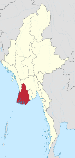
Ayeyarwady region is an administrative division of the Burma, located on the huge delta of the river of the same name east of Yangon.
To know
With a population of around 6.5 million, it ranks first in the national ranking for population density.
Fishing is practiced on a large scale with related processing industries.
Geographical notes
The Ayeyarwady region borders that of Bago to the North and with that of Yangon to the east. It overlooks the Bay of Bengal to the south and west. It is contiguous with the Rakhine state to the Northwest. It lies between the north latitudes 15 ° 40 'and 18 ° 30' and between the east longitudes 94 ° 15 'and 96 ° 15'.
The region is covered by immense forests and the production of precious wood is an important economic item. The rice fields are also very extensive so as to give this area the nickname of "granary of Burma". However, maize, sesame, sunflower and jute productions are widespread.
Background
The region was part of the Mon kingdom and then fell into Burmese hands in the 11th century AD.
Culture and traditions
The majority of the population belongs to the Bamar and Karen ethnic groups. There are small minorities of Rakhine people on the west coast. Buddhism is the most widespread religion with minorities of Christians and Muslims.
Territories and tourist destinations
The Ayeyarwady region consists of five districts: Pathein, Hinthada, Myaungmya, Maubin, and Pyapon.
Urban centers
Other destinations
- Chaungtha Beach
- Inye Lake - About 70 km northeast of Pathein with very fishy waters.
How to get
How to get around
What see
What to do
At the table
Safety
Other projects
 Wikipedia contains an entry concerning Ayeyarwady region
 Commons contains images or other files on Ayeyarwady region