The Steigerwald foreland lies in the southeast Lower Franconia and ranges from Main triangle until Steigerwald. The region is predominantly agricultural, and viticulture plays a significant role.
Regions
places

- 1 Abtswind


 in the Wikidata database") - Market town and wine-growing place on the southwestern edge of the Steigerwald with old sandstone houses in the center
- Market town and wine-growing place on the southwestern edge of the Steigerwald with old sandstone houses in the center

- 2 Gochsheim - Well-known gardeners' village, free imperial village, the Sennfelder and Gochsheim peace festivals have been included in the nationwide register of intangible cultural heritage

- 3 Sennfeld - Free Reichsdorf, center of Franconian costume, Sennfelder Seenkranz, with one of the largest natural thermal lakes in Germany


Abtswind

Gochsheim

Sennfeld


- 4 Hostage wind - is a community consisting of 15 districts. The rural community is located on the A3. The leisure area Geiselwind is well known. Also worth seeing is the Imperial oak in the Füttersee district.

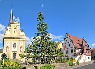
- 5 Grettstadt - known for its center with the step linden tree

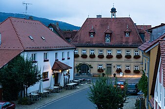
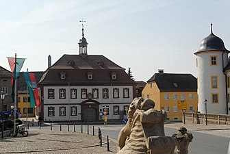
- 6 Gerolzhofen - with a well-preserved medieval old town


Hostage wind
Grettstadt

Gerolzhofen


- 7 Prichsenstadt - Franconian half-timbered houses and winding streets

- 8 Wiesenbronn - "Red Wine Island" at the foot of the Schwanberg

- 9 Wiesentheid - with castle and parish church of St. Mauritius according to plans by Balthasar Neumann


Prichsenstadt
Wiesenbronn
Wiesentheid


Other goals
- 1 Geiselwind leisure area - Nationally known amusement park with numerous rides
background
In administrative terms, the region comprises parts of the area from the districts of Kitzingen, Schweinfurt and Haßfurt and is partly part of the wine-growing region Main Franconia.
language
getting there
By plane
The closest international airport is the ![]() Nuremberg Airport (IATA: NUE)
Nuremberg Airport (IATA: NUE) ![]()
![]()
![]()

mobility
Tourist Attractions
activities
- Regular Wine festivals: see also the overview in the article Main Franconia;
- The Steigerwald Motodrom in Gerolzhofen is a Outdoor go-kart track with rental kart.
kitchen
Grapes and fruit are grown and processed into wines and brandies. In Heckenwirtschaft you can enjoy local drinks and snacks. The majority of the winemakers deliver to the Winzergemeinschaft Franken (GWF). But there are also self-marketers and vinotheques that invite you to try.
nightlife
security
climate
literature
Web links
- Landscape profile at the BfN (Federal Agency for Nature Conservation);
- Tourism Association Franconia e. V. www.frankentourismus.de;
- Franconian Wine Country Tourism Association www.fraenkisches-weinland.de ;
- Weinbauring Franken e.V .: www.weinbauring.de;
- Area wine advertising Frankenwein-Frankenland GmbH: www.frankenwein-aktuell.de;