
The polishTatra Mountains(Polish: Tatry) is located in the south of Poland in the voivodeship Lesser Poland in the district of Tatry, its capital Zakopane is. Your area of the Tatras lies in the three municipalities Kościelisko, Zakopane, Poronin and Bukowina Tatrzańska.
The main ridge of the Tatra Mountains forms the border between Poland and Slovakia. The Polish part of the Tatras covers the area north of the main ridge of the Tatras. Especially in the High Tatras it is characterized by numerous cirque lakes from the last ice age.

The highest point of the Polish Tatras is the Meeraugspitze with 2,499 m above sea level in the High Tatras. It is also the highest mountain in Poland. The highest peak of the Western Tatras in Poland is the Starorobociański Wierch with 2,176 m above sea level.
The whole area of the Tatra Mountains in Poland is established by the 1955 Tatra National Park protected. A law for the protection of the Tatras was enacted as early as 1868 and the Tatra Society was founded in 1873, which is dedicated to the preservation of the Tatras. The national park has an area of over 200 square kilometers. There are almost 300 km of designated hiking trails in it, which are used by almost three million tourists a year. It is one of the most popular of the 23 national parks in Poland.


Contrary to popular belief, the Tatra Mountains are not the southernmost mountains in Poland. The Bieszczady in the Subcarpathian Voivodeship in the south-east of Poland lie further south.
Regions

On the Polish side, the Tatras are divided into the Eastern Tatras in the east and the Western Tatras in the west. The High Tatras is part of the Eastern Tatras. Poland has not had a share in the Beler Tatras, which forms the other part of the Eastern Tatras, since 1945.
The border between the two mountain ranges runs between the peaks Swidnica and Kasprowy Wierch. The cable car from Kuźnice leads to the latter Zakopane.
The Western Tatras are made of limestone and contain various karst features, especially stalactite caves. The High Tatras are mainly made of granite and are characterized by rugged peaks and numerous karst lakes. The High Tatras towers over the Western Tatras by about 400 meters.
places

In Poland, three municipalities are part of the Tatra Mountains (from west to east):
- 1 Kościelisko In the municipality of Kościelisko there are several main valleys of the Western Tatras, the Chochołowski Brook Valley, the Lejowy Brook Valley, the Kościeliski Brook Valley and the Small Meadow Valley.
- 2 Zakopane The municipality of Zakopane has a share in both the Western Tatras and, to a lesser extent, the High Tatras. The following main valleys of the Western Tatras are located here: the Strążyska brook valley, the White brook valley, the Bystra brook valley and the Sucha Woda Gąsięnicowa brook valley.
- 3 Bukowina Tatrzańska Most of the High Tatras lies in the municipality of Bukowina Tatrzańska. Here are the most famous valleys of the Tatra Mountains, which converge at the end of the Weissbach valley: the Roztoka valley with the Five Polish Lakes valley, the Fischbach valley, which leads to the Meerauge Karsee and the Black Lake. Here is also the valley of the Waksmund brook, which is not accessible to tourists.
Other goals

There are numerous thermal springs at the foot of the Tatras. There are thermal baths in the following places:
- Bukowina Tatrzańska
 . The largest and oldest thermal bath at the foot of the Polish Tatras is located in Bukowina Tatrzańska. It is also the largest of its kind in Poland. The water is carried to the surface via a 2600 m deep shaft. The temperature in the 12 pools is between 28 and 36 degrees Celsius. It is located directly on the border to the national park not far from the town center. Within the complex there is also a sauna area with 12 saunas, a four-star hotel and a wellness spa.
- 4 Białka Tatrzańska[3] The thermal complex in Białka Tatrzańska is called Bania. In addition to the thermal bath with sauna area, the property also includes a hotel and its own ski area. Bania is about 10 km north of the thermal baths in Bukowina Tatrzańska on the S49 in the municipality of Bukowina Tatrzańska.
- 5 Szaflary[4] The thermal bath in Szaflary is directly on the S47 between Zakopane and Nowy Targ located. It is smaller than the thermal complexes in Bukowina Tatrzańska and Białka Tatrzańska.
- 6 Chochołów[5] The thermal bath in Chochołów is located west of Zakopane in the Kościelisko municipality. It is the youngest of the thermal baths at the foot of the Tatras. It opened in June 2016.
The region at the foot of the Tatra Mountains becomes the Tatra region (Polish: Podtatrze) called. The Tatras in the north extends to the Beskydy Mountains, which are divided into three mountain ranges from east to west: Pienines(Polish: Pieniny) (1,050 m above sea level), Gorce (1,310 m above sea level) and Saybuscher Beskids(Polish: Beskid żywiecki) with the massif of Babia Gora (1,725 m above sea level). The Tatra region, in turn, is also divided into three historical regions: Zips(Polish: Spisz) in the East, Podhale in the middle and Arwa(Polish: Orawa) in the West. While Podhale is entirely in Poland, it has only a small share in the Spiš and Arwa regions.
background


.jpg/220px-Schronisko_PTTK_na_Hali_Ornak_(06).jpg)


The immediate vicinity of the Tatra Mountains was uninhabited in the Middle Ages. Shepherds, sheep farmers and bands of robbers populated the valleys of the Tatra Mountains at times, mostly only in the warm season. Zakopane was founded by King in 1578 w: Stefan Bathory founded. The place was owned by the king. Bukowina Tatrzańska and Kościelisko are mentioned for the first time at the beginning of the 17th century. Tourism has developed since the 19th century. It was during this period that the first mountain huts were built in the Tatra valleys. The oldest mountain hut dedicated to tourism was the hut at Meerauge, which was put into operation in 1827. Of the original fifteen mountain huts, eight are still managed.
In the High Tatras there are three mountain huts in the Białka Valley and its side valleys
- 1 Mountain hut at the Meerauge[6] is located at 1,410 m above sea level in the valley of the Fischbach north of the lake Sea eye. It is the oldest and most famous mountain hut in the Tatras. The mountain hut on the Meerauge has 78 beds in shared rooms and collective accommodation, making it one of the largest mountain huts in the Tatras. In the mountain hut there is also a restaurant with warm cuisine, which mainly serves regional food. The mountain hut is after Stanislaw Staszic named. A hut at the Meerauge is mentioned as early as 1823. In 1827 this was expanded into a mountain hut. After several fires and new constructions, the current building was completed in 1908 and the last time it was rebuilt in 1992. The Berghütte am Meerauge has been a listed building since 1976. In 1997 Pope John Paul II stayed here. The mountain hut is operated and managed by w: en: PTTK. Five marked hiking trails lead from the mountain hut to the surrounding peaks. A paved path leads to the mountain hut at the Meerauge from the parking lot at the Lysa Polana alpine pasture, which is also used by horse-drawn carriages. Experienced mountain bikers can also travel by bike.
- 2 Mountain hut in the valley of the Five Polish Lakes[7] is located at 1,671 m above sea level in the valley of the Five Polish Lakes between the Great Polish Lake and the Small Polish Lake. The mountain hut has 67 beds in shared rooms and collective accommodation. In the mountain hut there is also a restaurant with warm cuisine, which mainly serves regional food. Huts in the Valley of the Polish Five Lakes were built as early as the 17th century when the king was king Lasislaus IV Wasa left the valley to the Nowobilski family for cultivation in 1637. Again and again new huts were built instead of older ones, the first mountain hut already in 1876 by the Polish Tatra Society. Today's mountain hut was built in 1957. It is already the fifth in the same place. The mountain hut is operated and managed by w: en: PTTK. Three marked hiking trails lead from the mountain hut to the surrounding peaks. A hiking trail leads from the mountain hut in the Roztoka Valley to the mountain hut in the Valley of the Five Polish Lakes. Not far from the hut is the highest waterfall in Poland, the Siklawa. It is also the largest waterfall in the Tatras.
- 3 Mountain hut in the Roztoka valley[8] lies at 1,031 m above sea level in the valley of the Białka. In this respect, the name is misleading, as the Roztoka Valley, a side valley of the Białka Valley, only begins above the hut. It is located on the Alte Roztoka mountain pasture, which is on the old path to the Meerauge lake. The mountain hut in the Roztoka Valley has 75 beds in shared rooms and collective accommodation. In the mountain hut there is also a restaurant with warm cuisine, which mainly serves regional food. The mountain hut is after w: Wincenty Pol named. A hut on the Alte Roztoka alpine pasture was built in 1876. The current building is from 1913. The mountain hut is operated and managed by w: en: PTTK. Three marked hiking trails lead from the mountain hut into the surrounding valleys. A hiking trail leads from the parking lot at the Lysa Polana mountain hut to the mountain hut in the Roztoka valley.
Another mountain hut in the High Tatras is located on the Gąsienicowa Alm
- 4 Murowaniec mountain hut[9] is located at 1,500 m above sea level on the Gąsienicowa Alm south of the Black Gąsienicowa Lake. It is the youngest mountain hut in the High Tatras. The Morowaniec mountain hut has 120 beds in shared rooms and collective accommodation, making it one of the largest mountain huts in the Tatras. In the mountain hut there is also a restaurant with warm cuisine, which mainly serves regional food. The mountain hut was built by the Polish army between 1921 and 1925. After a fire in 1963, the mountain hut was expanded. The mountain hut is operated and managed by w: en: PTTK. Five marked hiking trails lead from the mountain hut to the surrounding peaks. Several hiking trails lead to the Murowaniec mountain hut from the Kuznice district in Zakopane.
There are four mountain huts in the Western Tatras
- 5 Mountain hotel Kalatówki[10] is a mountain hotel. It is located at 1,200 m above sea level on the Kalatówki Alm. The mountain hotel was built to host the 1938 World Ski Championships. It has 86 beds in shared rooms and apartments and is the only mountain hotel in the area of the Tatra National Park. In the mountain hut there is also a restaurant with warm cuisine, which mainly serves regional food. The mountain hotel is operated and managed by w: en: PTTK. Two marked hiking trails lead from the mountain hotel to the surrounding peaks. Several hiking trails lead to the mountain hotel from the Kuznice district in Zakopane. Brother Albert's path is paved with cobblestones and can be used by cars. However, a permit is required to access the mountain hotel.
- 6 Mountain hut on the Kondratowa Alm[11] is located at 1,333 m above sea level on the Kondratowa Alm east of the summit of the w: Giewont. It is the smallest mountain hut in the Tatras. The mountain hut on the Kondratowa Alm has 20 beds in collective accommodation. In the mountain hut there is also a restaurant with warm cuisine, which mainly serves regional food. The original mountain hut was destroyed by an avalanche in 1913 and then rebuilt. The current building from 1947 was damaged by an avalanche in 1953. The mountain hut is operated and managed by w: en: PTTK. Two marked hiking trails lead from the mountain hut to the surrounding peaks. A hiking trail from the Kalatówki mountain hotel leads to the Murowaniec mountain hut.
- 7 Mountain hut on the Chochołowska Alm[12] lies at 1,146 m above sea level on the Chochołowska Alm at the beginning of the Chochołowska Valley. It is the largest mountain hut in the Tatras. The mountain hut on the Chochołowska Alm has 121 beds in collective accommodation. In the mountain hut there is also a restaurant with warm cuisine, which mainly serves regional food. The current building was erected in 1930-1932 by the Warsaw Ski Club, burned down by the Wehrmacht during battles with Polish resistance fighters at the end of the Second World War and rebuilt from 1951-1953. In 1983 Pope John Paul II stayed in the mountain hut. The mountain hut is operated and managed by w: en: PTTK. Five marked hiking trails lead from the mountain hut to the surrounding peaks. A hiking trail leads to the Chochołowska Mountain Hut from the parking lot at the entrance to the Chochołowska Valley.
- 8 Mountain hut on the Ornak Alm[13] lies at 1,100 m above sea level on the Ornak Alm at the beginning of the Kościeliska valley. The mountain hut on the Ornak Alm has 49 beds in shared rooms and collective accommodation. In the mountain hut there is also a restaurant with warm cuisine, which mainly serves regional food. The original mountain hut was burned down by the Wehrmacht during skirmishes with Polish resistance fighters at the end of the Second World War and rebuilt in the Zakopane style in 1947-1948. The mountain hut is operated and managed by w: en: PTTK. Three marked hiking trails lead from the mountain hut to the surrounding peaks. A hiking trail leads to the Chochołowska Mountain Hut from the parking lot at the entrance to the Kościeliska Valley. Part of the way to the Pisana Alm can also be traveled by horse-drawn carriages and, in winter, by horse-drawn sleighs. Not far from the mountain hut there is one of the few lakes in the Western Tatras, Smreczyński Lake, 1,226 m above sea level.
In the Western Tatras there were other mountain huts that no longer exist or are no longer used as mountain huts
- Mountain hut on the Pisana Alm was located at 1,020 m above sea level on the Pisana Alm in the Kościeliska valley. It was built in 1935 and served as accommodation for Polish resistance fighters during World War II. It was destroyed during battles between the Wehrmacht and the Red Army at the end of the Second World War. The mountain hut was rebuilt in 1946. She was blown up while filming Trójkąt Bermudzki in 1987.
- Mountain hut on the Młyniski Alm was located at 1,100 m above sea level on the Młyniski Alm in the Kościeliska Valley. It was built in 1910 and served as accommodation for Polish resistance fighters during World War II. It was destroyed by the Wehrmacht at the end of the Second World War. The mountain hut was no longer built.
- Mountain hut on the Starorobociańska Alm was located at 1,350 m above sea level on the Starorobociańska Alm in the Chochołowska Valley. It was built in 1938 and served as accommodation for Polish resistance fighters during World War II. It was destroyed during fighting between the Red Army and Polish resistance fighters in 1946. The mountain hut was no longer built.
- Blaszyński mountain hut was located at 1,050 m above sea level on the Chochołowska Alm. It was built in 1937 and burned down at the end of the Second World War, first by the Wehrmacht in battles with Polish resistance fighters and later, after a temporary reconstruction, by the Red Army also in battles with Polish resistance fighters. The mountain hut was rebuilt in 1946 and served tourist purposes until 1974. Today the building is used as accommodation for the employees of the Tatra National Park.
- Bukowski mountain hut was located at 1,000 m above sea level on the Huciska Alm in the Chochołowska Valley. It was built in 1938 and served as accommodation for Polish resistance fighters during World War II. It was destroyed by the Wehrmacht at the end of the Second World War. The mountain hut was no longer built.
language


The inhabitants of the communities at the foot of the Tatras speak Polish with a Goral accent. English is widely spoken and spoken by almost all the younger locals and guests. In Zakopane it is not a problem to get by with English. Other foreign languages such as German, French, Russian, Spanish are spoken by some of Zakopane's residents. Some useful Polish map and signpost reading vocabulary:
- Dolina / Dolinka - valley / small valley
- Hala - Alm
- Grań - ridge
- Kocioł - mountain basin
- Jaskinia - cave
- Przełęcz - mountain pass
- Schronisko - mountain hut
- Staw - mountain lake
- Turnia - rock face
- Wierch - summit
- Wodospad - waterfall
getting there


The area is very well developed for tourism, the road network is well developed and Zakopane is connected to the rail network. Reginal airports and sports airports are located in Nowy Targ and Poprad. The journey by plane, however, is mostly about Krakow respectively.
By car
Arriving by car from Germany is via the A4 motorway from the border crossing north of Görlitz (Ludwigsdorf / Jedrzechowice) to Krakow (approx. 400 km or 3 hours drive with good road conditions). On the southern ring road from Kraków, take the exit at the Zakopański triangle and from there take the S7 and S47 expressways Zakopane or S49 Bukowina Tatrzańska (approx. 100 km or 1.5 hours drive with good road conditions). The expressways S7 and S47 are also known colloquially as Zakopianka, as an extension of the arterial road of the same name in Krakow. The S7 and S47 are currently being extended to two lanes in both directions from Krakow to Nowy Targ with numerous new bridges and the longest tunnel in Poland.
Arriving by car from Austria takes place via the D1 motorway in Slovakia to the border crossing at Chochołów (approx. 300 km or 2.5 hours drive in good road conditions) and from there via regional road 958 to Zakopane (approx. 10 km or 10 minutes drive with good road conditions).
With the long-distance bus
You can travel by long-distance bus from Germany or Austria via Krakow. Long-distance bus companies that travel from Germany to Krakow are e.g. Sindbad, Touring, Eurolines, Flixbus. From the bus station in Krakow [14], which is located in the immediate vicinity of the main train station, buses from various providers, e.g. TatraBus, run to Zakopane at short intervals.
By train
You can also arrive by train from Germany or Austria via the main station Krakow[15]. The Polish railway company is called PKP [16]. For example, there is a night train from Vienna to Krakow. Trains also run directly to Krakow from Berlin and Dresden. Trains to Zakopane run from the main train station in Kraków, which is in close proximity to the bus station. However, the train takes significantly longer from Krakow to Zakopane than the bus. Fewer trains than buses also travel the route. It is therefore advisable to change from train to bus in Krakow.
By plane
Arriving by plane is via the airport in Krakow. Various airlines offer some connections from Germany, Austria and Switzerland there. Krakow Airport is connected to the rail network. The onward journey to Krakow Central Station can either be started by train, bus or shuttle bus. From there you can continue your journey as described above by bus or train to Zakopane.
The airport Poprad-Tatry on the Slovak side of the Tatra Mountains is not served from the German-speaking area. There are buses to Zakopane from Poprad.
mobility
.JPG/250px-2011_Kolej_linowa_na_Kasprowy_Wierch_(3).JPG)


Cable car to the Kasprowy Wierch
From the Kuźnice district (approx. 1,000 m above sea level) in Zakopane a cable car leads to the mountain Kasprowy Wierch, which is centrally located in the Tatra Mountains (approx. 2,000 m above sea level) [17]. The middle station of the cable car is located at about 1,350 m above sea level on the Myślenickie Turnie peak. Horse-drawn carriages or taxis take tourists to the lower station of the cable car in Kuźnice from the city center (approx. 900 m above sea level). The station can also be reached on foot in a short walk uphill from the city center in around 20 minutes.
Rack railway to the Gubałówka
A rack railway leads from Zakopane (approx. 900 m above sea level) to the mountain Gubałówka (approx. 1,100 m above sea level), which is north-west of Zakopane opposite the Tatra Mountains [18]. There is a ski area at the foot of the mountain. From the top there is a beautiful panoramic view of the entire Tatras. There are several gastronomy points and a summer toboggan run on the summit. The summit can also be reached by car or bicycle on a paved road. However, the Gubałówka itself no longer belongs to the Tatra Mountains. It is part of the Pogórze Spisko-Gubałowskie mountain range, which is part of the region Podhale belongs.
Chairlifts
There are several chairlifts, most of which belong to ski areas on the northern slopes of the Gubałówka massif, such as the Szymaszykowa chairlift [19] in Zakopane and the Butorowy Wierch chairlift [20] in Kościelisko. This chair life is also no longer in the Tatra Mountains, but on the opposite side of the Tatra Valley. There are also ski lifts in the Western Tatras themselves, e.g. on the slopes around Kasprowy Wierch and in the ski area at the Kalatówki mountain hotel on the alpine pasture of the same name.
Horse-drawn carriages in the Roztoka Valley
Horse-drawn carriages also run in the Roztoka mountain valley from the mountain meadow Łysa Polana or Palenica Białczańska (both approx. 1,000 m above sea level) to the Karsee Meerauge (approx. 1,400 m above sea level). The Roztoka mountain valley is located in the High Tatras and is the easternmost valley of the Polish Tatras. The path to the Karsee Meerauge is mostly paved and easy to navigate by bike. It is the most popular hiking trail in the High Tatras and can therefore be full even on a relatively sunny day.
Minibuses between the valleys
The various valleys of the Tatra Mountains are connected by the panoramic road named after Oskar Balzer. Minibuses circulate on this, bringing hikers to the respective parking lot at the starting point of the hike. The buses circulate at regular intervals and are quite inexpensive. You can also get on between the parking lots along Oskar-Balzer-Weg.
Parking spaces
There are parking spaces in all Gerbirgstäler valleys. The two largest parking lots are in the Roztoka Valley on the mountain meadows Łysa Polana and Palenica Białczańska.
On foot or by bike
If you have enough time, you can walk or cycle everywhere at the foot of the Tatra Mountains. The distances are manageable.
Tourist Attractions

.jpg/250px-Morskie_Oko_(Eye_of_the_Sea).jpg)


In the Tatra National Park there are numerous lake attractions that can be the destination of hikes. The most important ones are created by nature. They include mountain peaks, gorges, mountain meadows, mountain lakes, mountain streams, waterfalls, caves and the flora and fauna of the Tatra Mountains. Some, like chapels or summit crosses, were built by man.
mountains
High Tatras
Among the most important mountains in the High Tatras are
- 1 Meeraugspitze(Polish: Rysy) at 2,503 m above sea level, with the northern peak on the Polish side measuring 2,499 m above sea level. The Meeraugspitze is also the highest mountain in the Tatras, to which a marked hiking trail leads. It lies on the main ridge of the Tatra Mountains. It is located above the south-eastern corner of the Black Sea under the Meeraugspitze. Its east wall measures over 500 m and is a popular climbing wall. The name "Meeraugspitze" has been in use since the middle of the 19th century. The Polish name is older and refers to the crevices in its walls that look like cracks from below. The first attested ascent of the Meeraugspitze took place in 1840. Lenin as well as Marie and Pierre Curie stood on its summit. The greatest disaster in the Polish Tatras occurred on the slopes of the Meeraugspitze in 2003, when eight climbers were killed in an avalanche. A total of 50 people have already had fatal accidents on their ascent. The high number can be explained by the great popularity of the mountain with mountaineers. From the summit there is a panoramic view 100 km into the country, with good visibility you can see Kraków, 90 km away. You can see 80 other peaks of the Tatras and 13 mountain lakes. A red marked hiking trail leads to the Meeraugspitze from the mountain hut at the Meeraugsee over the Meeraugsee and the Black Lake under the Meeraugspitze. The climb takes four hours.
- 2 Big Mengsdorf peak(Polish: Mięguszowiecki Szczyt) At 2,438 m above sea level, it is the highest of the three Mengsdorf peaks. The other two are the 3 Black Mengsdorf tip(Polish: Mięguszowiecki Szczyt Czarny) with 2,410 m above sea level and the 4 Middle Mengsdorf tip(Polish: Mięguszowiecki Szczyt Pośredni) at 2,393 m above sea level. The group forms the southern rock face of the Meeraugsee basin. The Schwarze Mengsdorfer Spitze also protrudes in the basin of the Scharzen See under the Meeraugspitze. The highest rock face in the Tatras is located on its slopes and measures 900 m and is very popular with climbers. The massif was called Chalubinsky peak in the 19th century. The current name is derived from the village Mengsdorf at the foot of the Tatra Mountains. In its cracks, in the form of eternal ice, there are also remains of the Ice Age glacier that once covered the entire Białka Valley. The Große Mengsdorfer Spitze was climbed for the first time in 1877, the Middle Mengsdorfer Spitze and the Schwarze Mengsdorfer Spitze in 1903. There are no hiking trails leading to the summit of the Mengsdorfer Spitze. The ascent is considered difficult among mountaineers and is closed to ordinary tourists. However, a green marked hiking trail leads from the Black Lake under the Meeraugspitze to the Mengsdorfer Pass. The ascent takes 2.5 hours.
- 5 Déness point(Polish: Niżnie Rysy) lies at 2,430 m above sea level north of the Meeraugspitze above the Black Sea below the Meeraugspitze. Its western, steep cliff facing the lake has a height of 650 m and is now named after Franz Dénes. Previously he was called the Türkenberg. The direct translation from Polish would be Niedere Meeraugspitze. There is no hiking trail to the summit of the Dénesspitze. Mountaineers can climb the summit in a variety of ways. The first certified ascent of the main summit took place in 1905. The southern summit was not climbed until 1964.
- 6 Hinzensee tower(Polish: Hińczowa Turnia) lies at 2,377 m above sea level east of the Schwarzen Mengsdorfer Spitze above the Black Lake under the Meeraugspitze. No hiking trail leads to the summit of the Hinzensee tower. The first documented ascent of the Hinzensee tower took place in 1903.
- 7 Cubryna lies at 2,376 m above sea level west of the Hinzenseeturm above the Meeraugsee. Its summit is rugged. Hence its name, which means Krauskopf in Polish. There is no hiking trail leading to the summit of Cubryna. The first certified ascent of Cubryna took place in 1884.
- 8 Ox-back tower(Polish: Wołowa Turnia) is located at 2,373 m above sea level east of the Hinzenseeturm above the Black Lake under the Meeraugspitze in the Ochsenücken (Polish: Wołowy Grzbiet). Its top is in the shape of a pyramid. Its north face to the Black Lake under the Meeraugspitze measures 400 m. There is no hiking trail to the summit of the Ochsenrückenturm. The first documented ascent of the Hinzensee tower took place in 1905.
- 9 Frog lake tower(Polish: Żabia Turnia Mięguszowiecka) is located at 2,335 m above sea level west of the Ochsenrückenturm above the Black Lake under the Meeraugspitze in the Ochsenücken (Polish: Wołowy Grzbiet). Its north face to the Black Lake under the Meeraugspitze measures 350 m. There is no hiking trail to the summit of the Froschseeturm. The first certified ascent of the Froschseeturm took place in 1905.
- 10 Pig's head(Polish: Świnica) lies at 2,301 m above sea level on the western edge of the High Tatras. It has two peaks, which are divided by a pass that is 2,278 m above sea level. The lower peak measures 2,291 m above sea level and is not accessible for tourists. A red marked hiking trail leads to the higher peak from Kasprowy Wierch and the Zawrat Pass. The view from the peaks offers a wide panorama. A nine kilometer long ridge branches off the main ridge of the Tatra Mountains to the north of the Volossyn near the Schweinskopf. The most famous Polish via ferrata, the Orla Perć, leads over this ridge. Three valleys come together at the Schweinskopf, the valley of the Polish Five Lakes in the northeast, the Gąsienica lake valley in the northwest and the Tychatal in the south. The rock faces of the Schweinskopf tower over the valleys by 350 m. The higher peak was climbed for the first time in 1867, the lower one in 1822. 30 people died in accidents on the ascent. The name comes from the fact that the shape of the mountain is reminiscent of a pig's head.


- 11 Gemsenberg(Polish: Kozi Wierch) at 2,291 m above sea level is located east of the Schweinskopf on the via ferrata Orla Perć between the valley of the Five Polish Lakes and the Gąsienica Lake Valley. Its rock walls tower over the valleys about 250 m and are used by climbers. The name of the mountain comes from the chamois that climb it and was used by shepherds in the valleys as early as the 18th century. They also called it the Scharze Wand. The first ascent is documented for the year 1867. Shepherds and hunters from the valley of the Polish Five Lakes have probably already climbed it. Die rot markierte Orla Perć führt von dem Zawrat-Pass auf seinen Gipfel und wieder hinab zum Krzyżne-Pass. Sie darf nur in eine Richtung begangen werden. Ein schwarz markierter Wanderweg vom Schwarzen Polnischen See im Tal der Polnischen Fünf Seen führt ebenfalls zum Gemsenberg.
- 12 Simonturm(Polish: Żabi Koń) mit 2.291 m über NN Höhe befindet sich über dem Schwarzen See unter der Meeraugspitze im Ochsenrücken, dessen niedrigste Spitze er darstellt. Er ist gut sichtbar vom Meeraugsee. Er hat die Form einer Felsnadel. Sein Name im Polnische bedeutet übersetzt Froschpferd, da er die Form einer Schachfigur eines Pferdekopf hat. Im Deutschen ist er nach seinem Erstbesteiger Simon Häberlein benannt. Seine Nordwand gilt als schwierigste Kletterwand in der Tatra. Sie wurde erst 1926 bezwungen. Die Erstbesteigung über die leichtere Südwand ist für das Jahr 1905 beurkundet. Es führt kein markierter Wanderweg auf den Simonturm. Am Simonsturm kam es 1907 zum ersten tödlichen Unfall eines touristischen Bergsteigers in der Tatra.
- 13 Gąsienicowa-Turm(Polish: Gąsienicowa Turnia) mit 2.280 m über NN Höhe befindet sich über dem Gąsienicowa-Seetal und dem Tal der Polnischen Fünf Seen östlich des Schweinskopfs. Das Massiv hat mehrere Gipfel die 2.266 m über NN, 2.279 m über NN, 2.280 m über NN und 2.276 m über NN hoch sind. In seinen Wänden gibt es Kletterrouten. An seinem Südhang führt weit unterhalb der Gipfel ein rot markierter Wanderweg vom Kasprowy Wierch zur Riegelscharte. Sein Hauptgipfel wurde 1907 zum ersten Mal urkundlich nachweisbar bestiegen.
- 14 Gemsenbastei(Polish: Kozie Czuby) mit 2266 m über NN Höhe befindet sich über dem Gąsienicowa-Seetal und dem Tal der Polnischen Fünf Seen östlich des Gemsenbergs. Das Massiv hat drei Gipfel die 2.239 m über NN, 2.256 m über NN und 2.266 m über NN hoch sind. In ihren ca. 250 hochen Wänden gibt es Kletterrouten. Über die Gipfel führt die Orla Perć als ein rot markierter Wanderweg vom der Riegelscharte zum Krzyżne-Pass. Auf diesem Klettersteig sind an ihren Gipfeln bereits neun Kletterer tödlich verunglückt. Ihr Hauptgipfel wurde 1904 zum ersten Mal urkundlich nachweisbar bestiegen.
- Mittlerer Seealmturm(Polish: Niebieska Turnia) mit 2.262 m über NN Höhe befindet sich über dem Gąsienicowa-Seetal und dem Tal der Polnischen Fünf Seen östlich der Gemsenbastei. In seinen steilen Wänden gibt es Kletterrouten. In seiner Ostwand befindet sich ein 40 m hohes Mauervorsprung, der eine Herausforderung beim Klettern darstellt. Auf seinen Gipfel führt kein Wanderweg. An seinem Südhang führt weit unterhalb der Gipfel ein rot markierter Wanderweg vom Kasprowy Wierch zur Riegelscharte. Sein Hauptgipfel wurde 1907 zum ersten Mal urkundlich nachweisbar bestiegen.
- Große Froschspitze(Polish: Żabi Szczyt Wyżni) mit 2.259 m über NN Höhe befindet sich über dem Schwarzen See unter der Meeraugspitze nördlich der Meeraugspitze. Sie ist der höchste Gipfel in dem Froschgrat. Sie ist vom Schwarzen See unter den Meeraugspitze gut zu sehen, vom Meeraugsee dagegen nicht. Auf ihren Gipfel führt kein Wanderweg. In seiner Nähe verläuft jedoch der markierte Weg von dem Meeraugsee zur Meeraugspitze. Sein Gipfel wurde 1905 zum ersten Mal urkundlich nachweisbar erklommen.
- Spadowa Kopa mit 2251 m über NN Höhe befindet sich über dem Schwarzen See unter der Meeraugspitze nördlich der Dénesspitze. Auf ihren Gipfel führt kein Wanderweg. Seine Wände gelten unter Kletterern als schwer. Ihr Gipfel wurde 1909 zum ersten Mal urkundlich nachweisbar erklommen.
- Unterer Seealmturm(Polish: Zawratowa Turnia) mit 2.247 m über NN Höhe befindet sich über dem Gąsienicowa-Seetal und dem Tal der Polnischen Fünf Seen östlich des Mittleren Seealmturm. Er liegt unmittelbar an der Riegelscharte, daher rührt auch sein polnischer Name. In seiner Wand wurde 1904 eine Marienstatue aufgestellt. Auf seinen Gipfel führt kein Wanderweg. Sein Gipfel wurde 1889 zum ersten Mal urkundlich nachweisbar erklommen.
- Buchentalwarte(Polish: Buczynowa Strażnica) mit 2.242 m über NN Höhe befindet sich über dem Gąsienicowa-Seetal und dem Buchental, einem Seitental des Roztoka-Tals, östlich des Gemsenbergs. Ihre Ostwand fällt 400 m zum Tal der Polnischen Fünf Seen hinab. In ihr befinden sich zahlreiche Überhänge, die für Kletterer eine Herausforderung bilden. Auf ihren Gipfel führt kein Wanderweg. Unterhalb seines Gipfels führt die Orla Perć als ein rot markierter Wanderweg vom der Riegelscharte zum Krzyżne-Pass.
- Schwarze Wände(Polish: Czarne Ściany) mit 2.242 m über NN Höhe befindet sich über dem Gąsienicowa-Seetal und dem Buchental, einem Seitental des Roztoka-Tals, nördlich der Granatenspitzen. An ihren Westhängen führt die Orla Perć als ein rot markierter Wanderweg vom der Riegelscharte zum Krzyżne-Pass. Ein weiterer Wanderweg führt vom Gąsienicowa-Seetal herauf. Ihren Hauptgipfel erklommen Bergsteiger 1906 zum ersten Mal.
- Hintere Granatenspitze(Polish: Zadni Granat) mit 2.240 m über NN Höhe befindet sich über dem Gąsienicowa-Seetal und dem Buchental, einem Seitental des Roztoka-Tals, südlich der Schwarzen Wände. Über ihren Gipfel führt die Orla Perć als ein rot markierter Wanderweg von der Riegelscharte zum Krzyżne-Pass. Ein weiterer grün markierter Wanderweg führt vom Gąsienicowa-Eissee. Ihren Gipfel erklommen Bergsteiger urkundlich nachweislich 1867 zum ersten Mal. Sie können jedoch nicht die ersten gewesen sein, da sie auf dem Gipfel menschliche Spuren vorfanden. Seit 1989 steht auf dem Gipfel ein Gipfelkreuz.
- Mittlere Granatenspitze(Polish: Pośredni Granat) mit 2.234 m über NN Höhe befindet sich über dem Gąsienicowa-Seetal und dem Buchental, einem Seitental des Roztoka-Tals, nördlich der Hinteren Granatenspitze. Über ihren Gipfel führt die Orla Perć als ein rot markierter Wanderweg von der Riegelscharte zum Krzyżne-Pass. Der Gipfel gilt als gefährlich. Es kommt hier regelmäßig zu tödlichen Unfällen. Auf ihrem Gipfel standen Bergsteiger 1867 zum ersten Mal. Sie können jedoch nicht die ersten gewesen sein, da sie auf dem Gipfel menschliche Spuren vorfanden.
- Kupferberg(Polish: Miedziane) mit 2.233 m über NN Höhe befindet sich über dem Fischbachtal und dem Tal der Polnischen Fünf Seen westlich des Meeraugsees und südlich des Großen Polnischen Sees. Sein Ost-West verlaufender Grat misst 1.400 m. Von seinem Gipfel bietet sich ein wunderbares Panorama auf die umherliegenen Gipfel und Seen. Das berühmte 115 m lange Rundgemälde aus dem 19. Jahrhundert "Tatrapanorama" wurde von führenen polnischen Landschaftsmalern auf seinem Gipfel gemalt und 1896 in einem einer dafür errichten Rotunda in Warsaw ausgestellt. Sein Name rührt daher, dass im 18. Jahrhunder Bergläute in seinen Hängen Kupfer abgebaut haben. Hirten und Bergleute waren wohl auch schon im 17. Jahrhundert auf seinem Gipfel. Die erste urkundlich nachweisbare Besteigung fand 1832 statt. Seit 1956 ist der Berg ein striktes Naturreservat. Der Aufstieg ist nicht mehr erlaubt.
- Kleiner Gemsenberg(Polish: Mały Kozi Wierch) mit 2.228 m über NN Höhe befindet sich zwischen der Riegelscharte und dem Gemsenberg am Anfang des Klettersteigs Orla Perć zwischen dem Tal der Fünf Polnischen Seen und dem Gąsienica-Seetal. Die Erstbesteigung ist für das Jahr 1892 beurkundet. Wahrscheinlich bestiegen ihn zuvor bereits Hirten und Jäger aus dem Tal der Polnischen Fünf Seen. Bisher sind sechs Bergsteiger an seinen Hängen tödlich verunglückt.
- Äußere Granatenspitze(Polish: Skrajny Granat) mit 2.225 m über NN Höhe befindet sich über dem Gąsienicowa-Seetal und dem Buchental, einem Seitental des Roztoka-Tals, nördlich der Mittleren Granatenspitze. Über ihren Gipfel führt die Orla Perć als ein rot markierter Wanderweg von der Riegelscharte zum Krzyżne-Pass. Ein weiterer gelb markierter Wanderweg führt auf der einen Seite vom Schwarzen Gąsienica See und auf der anderen Seite vom Großen Polnischen See herauf. Ihren Gipfel erklommen Bergsteiger urkundlich nachweislich 1867 zum ersten Mal. Sie können jedoch nicht die ersten gewesen sein, da sie auf dem Gipfel menschliche Spuren vorfanden. Seit 1989 steht auf dem Gipfel ein Gipfelkreuz. Sie gilt unter Bergsteigern als gefährlich, der Ausblich ist dafür einer der schönsten auf der Orla Perć.
- Große Koszysta(Polish: Wielka Koszysta) mit 2.193 m über NN Höhe befindet sich über dem Waksmundtal und dem Pańszczyca Tal, einem Seitental des Gąsienica-Seetal, nördlich des Wołoszyn. Es handelt sich bei ihr um einen der nördlichsten Zweitausender in der Tatra und der höchste Gipfel im Rücken der Koszysta. Über ihren Gipfel führte bis 1936 die Orla Perć. In diesem Jahr wurde der Rücken der Koszysta in ein striktes Naturreservat verwandelt und die Orla Perć endet nunmehr auf dem Krzyżne-Pass. Ein weiterer Aufstieg entlang des alten Klettersteigs ist nicht mehr erlaubt. Ihren Gipfel erklommen Bergsteiger urkundlich nachweislich 1838 zum ersten Mal.
- Waksmundspitze(Polish: Waksmundzki Wierch) mit 2.186 m über NN Höhe befindet sich über dem Waksmundtal und dem Pańszczyca Tal, einem Seitental des Gąsienica-Seetal, nördlich des Wolossyn. Es handelt sich bei ihr um einen Gipfel im Rücken der Koszysta und er liegt südlich der Großen Koszysta. Über ihren Gipfel führte bis 1936 die Orla Perć. In diesem Jahr wurde der Rücken der Koszysta in ein striktes Naturreservat verwandelt und die Orla Perć endet nunmehr auf dem Krzyżne-Pass. Ein weiterer Aufstieg entlang des alten Klettersteigs ist nicht mehr erlaubt. Ihren Gipfel erklommen Bergsteiger urkundlich nachweislich 1838 zum ersten Mal.
- Großer Buchentalturm(Polish: Wielka Buczynowa Turnia) mit 2.182 m über NN Höhe befindet sich über dem Pańszczyca Tal, einem Seitental des Gąsienica-Seetal, und dem Buchental, einem Seitental des Roztoka-Tals, östlich der Granatenspitzen in der Gruppe der Buchentaler Türme. Südlich unterhalb seines Gipfels führt die Orla Perć als ein rot markierter Wanderweg von der Riegelscharte zum Krzyżne-Pass. Er ist bei Kletterern und Gemsen, die man oft an ihren 350 m hohen Steilwänden vorfindet, beliebt. Seinen Gipfel erklommen Bergsteiger urkundlich nachweislich 1902 zum ersten Mal. Er gilt unter Bergsteigern als gefährlich, mehrere Bergsteiger sind an seinen Hängen zu Tode gekommen.
- Toter Turm(Polish: Zamarła Turnia) mit 2.179 m über NN Höhe befindet sich zwischen dem Gemsenberg und dem Kleinen Gemsenberg am Anfang des Klettersteigs Orla Perć zwischen dem Tal der Fünf Polnischen Seen und dem Gąsienica-Seetal. Die Orla Perć führt nicht über seinen Gipfel sondern unterhalb von ihm auf einen Nordhängen. Seine 140 m hohe Südwand galt lange Zeit als unbezwingbar. Bis 1932 sind zahlreiche Bergsteiger bei den Versuch ums Leben gekommen. Daher auch der Name Toter Turm. Die Erstbesteigung über die Nordwand ist für das Jahr 1904 beurkundet.


- Adlerbastei(Polish: Orla Baszta) mit 2.177 m über NN Höhe befindet sich über dem Pańszczyca Tal, einem Seitental des Gąsienica-Seetal, und dem Buchental, einem Seitental des Roztoka-Tals, zwischen den Granatenspitzen und den Buchentaltürmen. Über ihren Gipfel führt die Orla Perć als ein rot markierter Wanderweg von der Riegelscharte zum Krzyżne-Pass. Der Name Orla Perć beudetet im Polnischen Adlerklettersteig. Der Klettersteig wurde 1903 angelegt und ist nach der Adlerbastei bekannt, die diesen Namen 1901 erhalten hat. Ihren Gipfel erklommen Bergsteiger urkundlich nachweislich 1902 zum ersten Mal.
- Kleiner Buchentalturm(Polish: Mała Buczynowa Turnia) mit 2.172 m über NN Höhe befindet sich über dem Pańszczyca Tal, einem Seitental des Gąsienica-Seetal, und dem Buchental, einem Seitental des Roztoka-Tals, östlich des Großen Buchentalturms und westlich des Krzyżne-Pass in der Gruppe der Buchentaler Türme. Über seinen Gipfels führt die Orla Perć als ein rot markierter Wanderweg von der Riegelscharte zum Krzyżne-Pass. Er ist bei Kletterern beliebt, in finden sich zahlreiche Hängen sind Kletterrouten. Seinen Gipfel erklommen Bergsteiger urkundlich nachweislich 1900 zum ersten Mal. Er gilt unter Bergsteigern als schwierig.
- Liptauer Grenzberg(Polish: Szpiglasowy Wierch) mit 2.172 m befindet sich oberhalb des Kupferbergjochs zwischen dem Meeraugsee und dem Großen Polnischen See. Vom Kupferbergjoch führt ein gelb markierter Wanderweg herauf. Das Kupferbergjodch ist ebenfalls mit gelb markierten Wanderwegen von dem Meeraugsee und dem Großen Polnischen See bequem zu erreichen. Er wurde bis ins 20. Jahrhundert als Dicke Spitze bezeichnet. Die Aussicht von seinem Gipfel wurde bereits im 18. Jahrhundert beschrieben. Die erste urkundlich erwähnte Besteigung erfolgte jedoch erst 1905.
- Hinterer Mönch(Polish: Zadni Mnich) ragt steil mit 2.172 m über NN Höhe über den Meeraugsee. Er ist vom See allerings nicht zu sehen, da ihn der Mönch verdeckt. Daher auch sein Name. Andere Namen, die in der Verganganheit geläufig waren, sind Zuckerberg, Mönchsfrau und Organist. Es führt kein markierter Wanderweg zum Gipfel. Kletterer können jedoch vom Tal hinter dem Mönch auf ihn steigen. Der Wanderweg entlang dem Hauptkamm der Tatra fällt unterhalb des Hintern Mönchs 30 m ab. Der Höhenunterschied wird mit Hilfe eines Kletterseils überwunden und gilt als eine der schwierigsten Stellen für Wanderer in der Tatra. Seine Erstbesteigung erfolgte 1904.
- Hinterer Kościelec liegt mit 2.162 m über NN Höhe im Gąsienica-Seetal und teilt dieses in das Schwarze Gąsienicowa-Seetal und das Grüne Gąsienicowa-Seetal. Er liegt südlich des Kościelec und nördlich des Unteren Seealmturms. Auf seinen Gipfel führt kein Wanderweg. Bei Kletterern gilt er dagegen als leicht. In seinem Südhang gibt es zahlreiche Kletterrouten. Einige Klettertouren befinden sich auch in seiner Nordwand. Seine Ersbesteigung erfolgte 1905.
- Mengsdorfer Kanzel(Polish: Kazalnica Mięguszowiecka) ist mit 2159 m über NN Höhe befindet sich im Mengsdorfer Massiv unmittelbar westlich am Schwarzen See unter der Meeraugspitze, an dessen westlicher Kesselwand sie eine 500 m hohe Felswand bildet. Sie ist bei Kletterern sehr beliebt. Die Mengsdorfer Kanzel wurde zum ersten Mal erst 1942 erklommen. Auf die Mengsdorfer Kanzel führt ein grün Markierter Wanderweg von Schwarzen See unter der Meeraugspitze sowie von dem Mengsdorfer Pass. Für den Aufstieg sind drei Stunden einzuplanen. Er gilt als einer der schwierigsten Wanderwege in der Hohen Tatra.
- Walentkowa(Polish: Walentkowy Wierch) mit 2.156 m über NN Höhe befindet sich im Hauptkamm er Tatra zwischen dem Schweinskopf und Glatten Berg über dem Tal unter dem Koło, einem Seitental des Tals der Polnischen Fünf Seen. Unterhalb des Gipfels liegt der Hintere Polnische See. Der Name soll auf den Vornamen eines Hirten namens Walek zurückgehen, der seine Ochsen an seinen Hängen weiden ließ. Auf seinen Gipfel führt kein Wanderweg. Seinen Gipfel erklommen Bergsteiger urkundlich nachweislich 1902 zum ersten Mal. Hirten dürften aber bereits westlich früher auf ihm gestanden haben.
- Großer Wolossyn(Polish: Wielki Wołoszyn) mit 2.155 m über NN Höhe befindet sich über dem Waksmundtal und dem Roztoka-Tal östlich des Krzyżne-Passes. Es handelt sich bei ihr um einen Gipfel im Rücken des Wolossyn und er liegt südlich der Großen Koszysta. Nördlich unterhalb seines Gipfels führte bis 1936 die Orla Perć. In diesem Jahr wurde der Rücken der Wolossyn in ein striktes Naturreservat verwandelt und die Orla Perć endet nunmehr auf dem Krzyżne-Pass. Ein weiterer Aufstieg entlang des alten Klettersteigs ist nicht mehr erlaubt. Seinen Gipfel erklommen Bergsteiger urkundlich nachweislich 1867 vom Krzyżne-Pass zum ersten Mal.
- Kościelec liegt mit 2.155 m über NN Höhe im Gąsienica-Seetal und teilt dieses in das Schwarze Gąsienicowa-Seetal und das Grüne Gąsienicowa-Seetal. Seine Ostwand beträgt 250 m. Sein Name rührt daher, dass die steile Pyramidenform seines Gipfels an ein gotisches Kirchendach erinnert. Kościół bedeutet im Polnischen Kirche. Er ist aus Granitgestein. Auf seinen Gipfel führt ein schwarz markierter Wanderweg von dem Karb-Pass. Von seinem Gipfel gibt es einen schönen Panoramablick in das ganze Gąsienicowa-Seetal. Es ist der einzige Punkt, von dem man alle Seen dieses Tals erblicken kann. Man kann auch alle Gipfel sehen, die teil des Klettersteigs Orla Perć sind. Er wurde zum ersten Mal 1845 erklommen. Mehrere bekannte Alpinisten sind im 20. Jahrhunderts an seinen Wänden tödlich verunglückt, so Mieczysław Karłowicz, Mieczysław Świerz und Jan Długosz.
- Mönch(Polish: Mnich) ragt steil mit 2.068 m über NN Höhe über den Meeraugsee. Seine Nordwand fällt steil 250 m zum See herab. Sie stellt eine Herausforderung für geübte Kletterer dar. Einfacher kann er über das Tal hinter dem Mönch bestiegen werden. Es führt jedoch kein markierter Wanderweg zum Gipfel. Der Mönch liegt südwestlich des Sees und hat drei Gipfel. Neben dem Höchsten gibt es noch das Mönchlein mit 2.040 m über NN und den Ministranten. In seiner Ostwand befinden sich auf ca. 1.900 m Höhe drei Höhlen, von denen der Mönchsbrunnen die größte bekannte Höhle der Hohen Tatra ist.
Westliche Tatra

Zu den wichtigsten Bergen in der Westlichen Tatra zählen
- Starorobociański Wierch mit 2.176 m über NN Höhe. Der Starorobociański Wierch ist zugleich der höchste Berg in der Westlichen Tatra auf polnischer Seite. Er liegt in dem Hauptkamm der Tatra. Er schließt das Starorobociańska Tal im Süden ab. Er tront 500 m über dem eiszeitlichen Bergkessel des Starorobociańska Tals. Sein Gipfel hat die Form einer Pyramide. Er ist bekannt für seine zahlreichen Schneelawinen. Der Panoramablick von seinem Gipfel umfasst alle Gipfel der Westlichen Tatra und viele Spitzen der Hohen Tatra. Hirten haben bereits in der frühen Neuzeit Schafe bis an seinen Gipfel weiden lassen. Bereits im 16. Jahrhundert wurde Eisenerz in seinen Hängen abgebaut. Daher rührt auch sein Name, der im Polnischen "Alte Arbeit" bedeutet. Viele Sagen und Legenden rangen sich um Räuberschätze in seinen Höhlen. Die erste urkundlich bezeugte Besteigung seines Gipfels erfolgte jedoch erst 1813, ale er vom schedischen Forscher Göran Wahlenberg vermessen wurde. Auf seinen Gipfel führen zahlreiche Wanderwege, so der rot markierte Wanderweg entlang dem Hauptkamm der Westlichen Tatra, ein Wanderweg von der Berghütte Ornak, sowie mehrere Wanderweg aus dem Chochołowka Tal.
- Czerwone Wierchy mit 2.122 m über NN Höhe.
- Wołowiec mit 2.064 m über NN Höhe.
- Twarda Kopa mit 2.026 m über NN Höhe.
- 15 Kasprowy Wierch mit 1.987 m über NN Höhe.
- 16 Giewont mit 1.894 m über NN Höhe.
- Kominiarski Wierch mit 1.829 m über NN Höhe.
Bergpässe
Zu den wichtigsten Bergpässen in der Hohen Tatra zählen
- Hinzenseescharte(Polish: Hińczowa Przełęcz) mit 2.323 m über NN Höhe. Sie ist der höchste Bergpass in der Hohen Tatra auf der polnischen Seite.
- Wildererjoch(Polish: Wrota Mięguszowiecka Przełęcz pod Chłopkiem) mit 2.307 m über NN Höhe.
- Froschseejoch(Polish: Żabia Przełęcz) mit 2.225 m über NN Höhe.
- Riegelscharte(Polish: Zawrat) mit 2.159 m über NN Höhe.
- Gemsenscharte(Polish: Kozia Przełęcz) mit 2.137 m über NN Höhe.
- Buchentalscharte(Polish: Buczynowa Przełęcz) mit 2.127 m über NN Höhe
- Krzyżne mit 2.112 m über NN Höhe
- Kupferbergjoch(Polish: Szpiglasowa Przełęcz) mit 2.110 m über NN Höhe
- Schweinskopfjoch(Polish: Świnicka Przełęcz) mit 2.051 m über NN Höhe.
- Chałubiński-Tor,(Polish: Wrota Chałubińskiego) mit 2.022 m über NN Höhe.
- Glatter Pass(Polish: Gładka Przełęcz) mit 1.994 m über NN Höhe.
- Schwarzes Joch(Polish: Czarna Ławka) mit 1.968 m über NN Höhe.
Zu den wichtigsten Bergpässen in der Westlichen Tatra zählen
- Starorobociańska Przełęcz mit 1.975 m über NN Höhe. Sie ist der höchste Bergpass in der Westlichen Tatra auf der polnischen Seite.
- Liliensattel(Polish: Liliowe) mit 1.952 m über NN Höhe sellt sie zugleich die Grenze zwischen Hoher Tatra und Westlicher Tatra dar.
- Sucha-Joch(Polish: Sucha Przełęcz) mit 1.950 m über NN Höhe
- Przełęcz pod Kopą Kondracką mit 1.863 m über NN Höhe
- Goryczkowa Przełęcz nad Zakosy mit 1.816 m über NN Höhe
- Goryczkowa Przełęcz Świńska mit 1.801 m über NN Höhe
- Kamenistasattel(Polish: Pyszniańska Przełęcz) mit 1.788 m über NN Höhe.
- Kondracka Przełęcz mit 1.725 m über NN Höhe
- Tomanowapass(Polish: Tomanowa Przełęcz) mit 1.686 m über NN Höhe
- Iwaniacka Przełęcz mit 1.459 m über NN Höhe
- Bobrowiecka Przełęcz mit 1.356 m über NN Höhe
- Roter Pass(Polish: Czerwona Przełęcz) mit 1.301 m über NN Höhe
Valleys
Zu den wichtigsten Tälern in der Hohen Tatra zählen
- Bialkatal(Polish: Dolina Białki) ist das Haupttal der Hohen Tatra. Alle anderen Täler in der Hohen Tatra münden in dem Bialkatal. Es ist das größte und längste Tal der Tatra und hat eine Länge von knapp 12 km. Der Gletscher, der das Tal in der letzten Eiszeit bedeckte, hatte eine Länge von 14 km.
- Waksmund Tal ist das erste östliche Nebental des Bialkatals. Als striktes Reservat ist es für Touristen nicht zugänglich.
- Roztoka Tal ist das zweite östliche Nebental des Bialkatals. Es ist knapp 5 km lang.
- Tal der Polnischen Fünf Seen(Polish: Dolina Pięciu Stawów Polskich) ist die Verlängerung des Roztoka Tals. Es ist knapp 4 km lang.
- Fischseetal(Polish: Dolina Rybiego Potoku) ist die südliche Abzweigung des Bialkatals. Es ist knapp 6 km lang.
- Filipkatal befindet sich östlich des Bialkatals.
Zu den wichtigsten Tälern in der Westlichen Tatra zählen
- Chochołowska Tal ist mit ca. 10 km Länge das längeste Tal in der Westlichen Tatra auf polnischer Seite.
- Kościeliska Tal hat eine Länge von ca. 9 km.
- Suchawodatal(Polish: Dolina Suchej Wody Gąsienicowej) hat eine Länge von 8 km. Entlang dem Suchawodatal führt die Grenze zwischen Hoher Tatra und Westlicher Tatra.
- Gąsienica-Seetal(Polish: Dolina Gąsienicowa) ist der obere Verlauf des Suchawodatals. Entlang dem Gąsienica-Seetal führt die Grenze zwischen Hoher Tatra und Westlicher Tatra.
- Tal der kleinen Wiese(Polish: Dolina Małej Łąki) hat eine Länge von knapp 6 km.
- Tal der Bystra hat eine Länge von ca. 6 km.
Bergwiesen
Zu den wichtigsten Bergwiesen in der Hohen Tatra, die zuvor als Almen genutzt wurden, zählen
- Hala Filipka im Filipka Tal.
- Hala Jaworzyna Rusinowa im Filipka Tal.
- Hala Kopy Sołtysie im Filipka Tal.
- Hala Morskie Oko im Fischseetal.
- Hala Pańszczyca im Pańszczyca Tal, einem Seitemtal des Suchawodatals.
- Hala Pięć Stawów im Tal der Polnischen Fünf Seen.
- Hala Roztoka im Roztoka Tal.
- Hala Toporowa am Fuß der Hohen Tatra.
- Hala Waksmundzka im Waksmund Tal.
- Hala Wołoszyńska am Hang des Wołoszyn im Waksmund Tal.
Zu den wichtigsten Almen in der Westlichen Tatra, die zuvor als Almen genutzt wurden, zählen
- Hala Białe im Biały Tal.
- Hala Chochołowska im Chochołowska Tal.
- Hala Goryczkowa im Goryczkowa Tal, einem Seitental des Tals der Bystra.
- Hala Giewont im Strążyska Tal.
- Hala Huty im Chochołowska Tal.
- Hala Iwanówka im Iwaniacka Tal, einem Seitental des Chochołowska Tals.
- Hala Jarząbcza im Jarząbcza Tal, einem Seitental des Chochołowska Tals.
- Hala Jaworzyna pod Furkaską im Chochołowska Tal.
- Hala Jaworzynka im Jaworzynka Tal, einem Seitental des Tals der Bystra.
- Hala Kalatówki im Tal der Bystra.
- Hala Kasprowa im Kasprowa Tal, einem Seitental des Tals der Bystra.
- Hala Kondratowa im Kondratowa Tal, einem Seitental des Tals der Bystra.
- Hala Kominy Dudowe im Dudowa Tal, einem Seitental des Chochołowska Tals.
- Hala Kominy Tylkowe im Lejowa Tal.
- Hala Kopieniec im Chłabowska Tal, einem Seitental des Suchawodatals.
- Hala Kopka im Lejowa Tal.
- Hala Królowa im Olczyska Tal.
- Hala Kryta im Chochołowska Tal.
- Hala Lejowa im Chochołowska Tal.
- Hala Mała Łąka im Tal der Kleinen Wiese.
- Hala Miętusia im Miętusia Tal, einem Seitental des Kościeliska Tals.
- Hala Olczysko im Olczyska Tal.
- Hala Ornak im Pyszniańska Tal, einem Seitental des Kościeliska Tals.
- Hala Pisana im Kościeliska Tal.
- Hala Pyszna im Pyszniańska Tal, einem Seitental des Kościeliska Tals.
- Hala Skupniowa im Olczyska Tal.
- Hala Smreczyny im Tomanowa Tal, einem Seitental des Kościeliska Tals.
- Hala Smytnia im Smytnia Tal, einem Seitental des Kościeliska Tals.
- Hala Starorobociańska im Starorobociańska Tal, einem Seitental des Chochołowska Tals.
- Hala Stoły im Kościeliska Tal.
- Hala Strążyska im Strążyska Tal.
- Hala Tomanowa im Tomanowa Tal, einem Seitental des Kościeliska Tals.
- Hala Trzydniówka im Chochołowska Tal.
- Hala Upłaz auf den Roten Bergen.
Mountain lakes


Hohe Tatra
Die meisten Bergseen in der Tatra befinden sich in der Hohen Tatra auf der polnischen Seite. Die Hohe Tatra ist aus Granit gebaut. Das Wasser der schmelzenden Gletscher konnte nicht versickern oder vollständig abfließen und hat sich daher in den Gletscherkaren und Bergkesseln gesammelt und dabei die zahlreichen Seen der Hohen Tatra geschaffen.
Im Tal des Fischbachs befinden sich:
- Schwarzer See unter der Meeraugspitze(Polish: Czarny Staw pod Rysami) liegt am oberen Lauf des Fischbachs auf einer Höhe von 1582 m über NN in einem Gletscherkar ca. 200 m über dem Meeraugsee. Er ist eiszeitlichen Ursprungs. Mit fast 77 m Tiefe gehört er zu den tiefsten Gewässern der Tatra und Polens. Mit mehr als 20 ha Fläche gehört er auch zu den größten Seen der Tatra. Der Schwarzer See unter der Meeraugspitze ist der südlichste See Polens. Seinen Namen verdankt er dem Schatten, den die bis zu 600 m hohen und steilen Felswände der um ihn liegenden Berge auf ihn werfen. Die Meeraugspitze überragt ihn um fast 900 Höhenmeter. Eine versuchte Fischzucht im Schwarzen See unter der Meeraugspitze scheiterte.
- 1 Meeraugsee(Polish: Morskie Oko) liegt am mittleren Lauf des Fischbachs auf einer Höhe von 1395 m über NN in einem Gletscherkar ca. 200 m unter dem Schwarzen See unter der Meeraugspitze. Er ist eiszeitlichen Ursprungs. Mit fast 52 m Tiefe gehört er zu den tiefsten Gewässern der Tatra und Polens. Mit fast 35 ha Fläche ist er der größte See der Tatra. Seine Uferlienie beträgt ca. 2.500 m. Er wurde im Jahr 1575 zum ersten Mal erwähnt. Im 17. Jahrhundert hieß der See Weißer See und später dann Fischsee, da in ihm Fische leben. Seinen heutigen Namen verdankt er einer Legende, nach der er mit der Ostsee verbunden ist. Zwischen 1637 und 1933 befand er sich im Privateigentum mehrere Adelsfamilien. Im Jahr 1902 beschäftigte ein Rechtsstreit um die Eingentumsverhältnisse das höchste Gericht der K-und-K-Monarchie. Seit demselben Jahr ist er mit Zakopane durch eine Straße verbunden. Der Mięguszowieckie Szczyty überragt die Meeraugspitze um fast 900 Höhenmeter. In den Meeraugsee fallen mehrere Bäche in Wasserfällen, der Schwarzseebach aus dem Schwarzen See unter der Meeraugspitze und der Mönchsbach der aus den Südhängen des Mönchs entspringt. Das Wasser hat eine türkis-grüne Farbe. Er entwässert im Fischbach in das untere Fischbachtal. Am Ausfluss des Fischbachs befindet sich die Berghütte am Meerauge. Sie liegt auf einer Gletschermoräne ca. 15 Höhenmeter über der Tafel des Sees. Das The Wall Street Journal erklärte ihn zu einem der fünf schönsten Seen der Welt.
- Die drei Fischteiche(Polish: Rybie Stawki) liegt am mittleren Lauf des Fischbachs ca. 200 m nach dessen Austritt aus dem Meeraugsee, nördlich von diesem. Sie nennen sich Kleines Meerauge(Polish: Małe Morskie Oko), Froschauge(Polish: Żabie Oko) and Kleines Froschauge(Polish: Małe Żabie Oko). Sie liegen auf einer Höhe von 1391 bis 1390 m über NN ca. 5 m unter der Tafel des Meeraugsees. Auch sie sind eiszeitlichen Ursprungs. Sie sind ca. 3 m tief und zwischen 0,2 und 0,02 ha groß. Sie sind von Torf, Bergkiefern und Fichten umgeben. Es führt kein Wanderweg an die Fischteiche. Man kann sie aber gut vom Wanderweg zum Meeraugesee sehen.
Im Tal hinter dem Mönch befinden sich:
- Staszyc Teich(Polish: Staw Staszyca) liegt im Tal hinter dem Mönch auf einer Höhe von 1.785 m über NN. Bei hohem Wasserstand erreicht er einen Durchmesser von über 200 m. Seine Tiefe beträgt nur wenige Meter. Er trocknet von Zeit zu Zeit bei niedrigem Wasserstand vollständig aus. Dann teilt er sich zunächst in einen Hohen Staszyc-Teich und einen Niedrigen Staszyc-Teich, obwohl beider auf derselben Höhe liegen. Er ist eiszeitlichen Ursprungs.
- Teich auf den Hügeln(Polish: Staw na Kopach) liegt im Tal hinter dem Mönch auf einer Höhe von 1.875 m über NN. Er hat einen Durchmesser von ca. 10 m. Seine Tiefe beträgt nur einen halben Meter. Trotzdem trocknet er bei niedrigem Wasserstand nicht vollständig aus. In ihm lebt eine reiche Flora und Fauna. Er ist eiszeitlichen Ursprungs. Zum Teich auf den Hügeln führt ein gelb markierter Wanderweg vom Meeraugsee.
- Die neuen Höhere Mönchsteiche(Polish: Wyżnie Mnichowe Stawki) sind kleine Teiche im Tal hinter dem Mönch auf einer Höhe von 1.833 bis 1.871 m über NN. Sie haben Durchmesser von 10 bis 45 m. Ihre Tiefe beträgt von wenigen Zentimetern bis mehrere Meter. Trotzdem trocknen sie bei niedrigem Wasserstand nur selten vollständig aus. Einige von ihnen sind durch Bäche verbunden. Aus einem der Teiche fließt bei hohem Wasserstand ein Bach ins Tal hinter dem Mönch. Sie sind eiszeitlichen Ursprungs. Zu den Höheren Mönchsteichen führt kein markierter Wanderweg. Ein nicht markierter Wanderweg führt jedoch in ihrer Nähe und sie sind von ihm aus gut zu sehen.
- Hinterer Mönchsteich(Polish: Zadni Mnichowy Stawek) ist ein kleiner Teich im Tal hinter dem Mönch auf einer Höhe von 2.070 m über NN. Er hat einen Durchmesser von 35 m. Seine Tiefe beträgt etwas mehr als einen Meter. Er ist die längere Zeit im Jahr zugefroren. Er ist der höchstgelegene See im polnischen Teil der Tatra und in ganz Polen. Er ist eiszeitlichen Ursprungs. Zum Hinteren Mönchsteich führt kein markierter Wanderweg.


Im Tal der Polnischen Fünf Seen befinden sich:
- Hinterer Polnischer See(Polish: Zadni Staw Polski) liegt im Tal unter dem Koło, einem Seitental der Polnischen Fünf Seen auf einer Höhe von 1.890 m über NN, unweit des Glatten Passes. Es ist eiszeitlich geprägt und liegt in dem höchsten Gletscherkar des Tals der Polnischen Fünf Seen. Seine Fläche beträgt 6,5 ha und seine Tiefe fast 32 m. Sein Durchmesser beträgt fast 400 m. Es entwässert meist unterirdisch in das süd-östlich gelegene Kropfauge. Im Winter kann sich eine bis zu vier Meter dicke Eisschicht auf dem Hinteren Polnischen See bilden. Zu ihm führt kein Wanderweg. Der Hintere Polnische See ist jedoch gut von dem Glatten Pass sichtbar.
- Kropfauge(Polish: Wole Oko) liegt im Tal unter dem Koło, einem Seitental der Polnischen Fünf Seen auf einer Höhe von 1.862 m über NN, unweit des Glatten Passes. Es wird vom Hinteren Polnischen See gespeist. Es entwässert meist unterirdisch in den Großen Polnischen See. Im Winter friert das Kropfauge vollständig bis zum Grund zu. Es ist der sechstgrößte See im Tal der Polnischen Fünf Seen, dessen Namen es damit widerspricht. Zu ihm führt kein Wanderweg. Das Kropfauge ist jedoch gut von dem Glatten Pass sichtbar.
- The four Szpiglasowe Teiche(Polish: Szpiglasowe Stawki) liegen im Tal der Polnischen Fünf Seen auf einer Höhe von 1.760 bis 1.775 m über NN. Sie liegen auf einer Terrasse in den Hängen des Szpiglasowy Wierch und des Miedziane. Sie entwässern in den Großen Polnischen See. Zu ihnen führt kein Wanderweg. Sie sind jedoch gut sichtbar vom gelb markierten Wanderweg vom Großen Polnischen See auf den Szpiglasowy-Pass.
- Schwarzer Polnischer See(Polish: Czarny Staw Polski) liegt im Tal der Polnischen Fünf Seen auf einer Höhe von 1.722 m über NN. Seine Fläche beträgt fast 13 ha und seine Tiefe über 50 m. Er ist eiszeitlichen Ursprungs. An seinen Ufern befindet sich Feuchtgebiete, die eine reiche Flora und Fauna ermöglichen. Er entwässert in den Großen Polnischen See. Zu ihm führt ein gelb markierter Wanderweg aus dem Roztoka-Tal.
- Vorderer Polnischer See(Polish: Przedni Staw Polski) liegt im Tal der Polnischen Fünf Seen auf einer Höhe von 1.668 m über NN. Er ist der östlichste See des Tals der Polnischen Fünf Seen. Seine Fläche beträgt fast 8 ha und seine Tiefe ca. 35 m. Er ist eiszeitlichen Ursprungs. Er entwässert in den Kleinen Polnischen See. Bäche aus den Hängen des Miedziane speisen ihn. Die Farbe seines Wassers ist türkis-grün und sehr klar. Die Sicht unter Wasser beträgt 13 m. In den Vorderen Polnischen See wurde künstlich die Forelle eingeführt. Zu ihm führen mehrere markierte Wanderwege, ein grüner und schwarzer Wanderweg von den Mickiewiczfällen im Roztoka-Tal sowie ein blauer Wanderweg vom Meeraugsee über den Zawrat-Pass. An seinen Ufern steht heute die Berghütte im Tal der Polnischen Fünf Seen.
- Kleiner Polnischer See(Polish: Mały Staw Polski) liegt im Tal der Polnischen Fünf Seen auf einer Höhe von 1.668 m über NN. Seine Fläche beträgt fast 0,2 ha und seine Tiefe ca. 2 m. Er ist eiszeitlichen Ursprungs. Er wird von dem Vorderen Polnischen See gepeist und er entwässert in den Großen Polnischen See. Im Winter friert er bis zum Grund zu. Ursprünglich stand die Berghütte im Tal der Polnischen Fünf Seen an seinen Ufern. Zu ihm führt ein blau markierter Wanderweg vom Meeraugsee über den Zawrat-Pass.
- Großer Polnischer See(Polish: Wielki Staw Polski) liegt im Tal der Polnischen Fünf Seen auf einer Höhe von 1.665 m über NN. Er ist der größte See des Tals der Polnischen Fünf Seen und der zweitgrößte in der gesamten Tatra. Seine Fläche beträgt fast 35 ha. Sein Durchmesser beträgt fast einen Kilometer und er ist damit der längste See in der Tatra. Mit über 80 m Tiefe ist er auch der tiefste See in der Tatra und einer der tiefsten in Polen. Mit 13 Millionen Kubikmetern ist er auch der wasserreichste See in der Tatra, er führt ein Drittel des gesamten Wassers aller Tatraseen. Er ist eiszeitlichen Ursprungs. Aus ihm entspringt der Roztoka-Bach, der im Siklawafall 70m über die Endmoräne des eiszeitlichen Gletscher in das Roztoka-Tal fällt und damit den höchsten Wasserfall in Polen bildet. Der Große Polnische See wird durch den Kleinen Polnischen See, die Szpiglasowe Teiche sowie dem Schwarzen Polnischen See gespeist. Daneben fließen Bäche aus den Tälern Leeren Tal und Tal unter dem Koło in ihn. Die Farbe seines Wassers ist türkis-grün und sehr klar. Die Sicht unter Wasser beträgt über 13 m. Seine Ufer sind mit Bergkiefern bewachsen. Hier steht auch die älteste erhaltene Almhütte der Tatra aus dem 17. Jahrhundert. Im Tatra-Museum ist ein Braunbär ausgestellt, der 1952 im Großen Polnischen See ertrunken ist, als das Eis unter ihm zusammenbrach. Four marked hiking trails lead to it, a green hiking trail from the Mickiewicz Falls in the Roztoka Valley, a blue hiking trail from the Meeraugsee over the Zawrat Pass, a black hiking trail to the top of Kozi Wierch and a yellow hiking trail to the Krzyżne Pass.
In the Waksmund valley are:
- The two Waksmundteiche(Polish: Waksmundzkie Stawki) are in the upper Waksmund valley at an altitude of 1,960 and 1,935 m above sea level. The Waksmundbach rises near them. They are neither explored nor measured as they are in a strict reservation. The waksmund eyes are not accessible to tourists either.
- The two Waksmouth Eyes(Polish: Waksmundzkie Oka) are in the middle Waksmund valley at an altitude of 1,790 and 1,750 m above sea level. The Waksmundbach flows through both lakes. They each have a diameter of about ten meters and a depth of half a meter. They have not been adequately researched because they are in a strict reservation. The waksmund eyes are not accessible to tourists either.
In the Białka Valley there is:
- Wołoszyński pond(Polish: Wołoszyński Stawek) is located near the mountain meadow Wołoszyń upper Waksmund valley at an altitude of 1,245 m above sea level. When the water level is low, it divides into two ponds. It can rarely dry out completely. Its diameter is a few tens of meters. It can be reached via a black-marked hiking trail from the Rusinowa Polana mountain meadow.


In the Gąsienica Lake Valley there are:
- Back Gąsienica lake(Polish: Zadni Staw Gąsienicowy) lies in the upper Gąsienica lake valley at an altitude of 1,852 m above sea level below the west wall of Kościelec. It is the highest lake in the Gąsienica lake valley and frozen over most of the year. Its area is half a hectare and its diameter is over 100 m, its depth is 8 m and it drains through several cascades into the Long Gąsienica Lake. It is not open to tourists. But it can be seen well from the top of Kościelec and from Świnicka Pass.
- Gąsienica ice lake(Polish: Zmarzły Staw Gąsienicowy) is located in the upper Gąsienica lake valley at an altitude of 1,788 m above sea level in the valley of the Kleiner Gemsensitze below the Zawrat pass. It is frozen over most of the year. Its area is half a hectare and its diameter is almost 80 m, its depth is almost 4 m and it drains through several cascades into the Black Gąsienica Lake. It can be reached via a yellow-marked hiking trail from the Kozia-Scharte.
- Long Gąsienica lake(Polish: Długi Staw Gąsienicowy) is located in the upper Gąsienica lake valley at an altitude of 1,783 m above sea level. With almost 1.6 hectares, it is the fourth largest lake in the Gąsienica lake valley. Its depth is 11 m and its diameter is over 250 m. Trout were artificially released in the 20th century. It is fed by the Back Gąsienica Lake and it drains into the Lower Red Gąsienica Pond. It can be reached via a blue-marked hiking trail from the Murowaniec mountain hut or the Zawrat pass.
- The two Red Gąsienica ponds(Polish: Czerwone Stawki Gąsienicowe) are located in the upper Gąsienica lake valley at an altitude of 1,693 and 1,695 m above sea level. Its banks are overgrown with mountain pines. They each have a diameter of about ten meters and a depth of one to two meters. The Lower Red Gąsienica Pond is fed by the Long Gąsienica Lake. They can be reached via two marked hiking trails, a blue-marked hiking trail from the Murowaniec mountain hut or the Zawrat pass and a black-marked hiking trail from the Kasprowy Wierch peak.
- Dwoiśniaczek is located in the upper Gąsienica lake valley at an altitude of 1,690 m above sea level in the immediate vicinity of Kurtkowiec. Its banks are overgrown with mountain pines. Its depth is a little more than a meter. When the water level is low, it dries up. There is no marked hiking trail to the Dwoiśniaczek. However, it can be seen well from the top of Kościelec.
- Kurtkowiec is located in the upper Gąsienica lake valley at an altitude of 1,686 m above sea level in the immediate vicinity of the Dwoiśniaczek. Its banks are overgrown with mountain pines. Its area is 1.5 hectares, its diameter about 200 m and its depth is five meters. On the lake is the highest island in the Tatra Mountains and therefore in all of Poland. Two marked hiking trails lead to the lake, a black-marked hiking trail from the Murowaniec mountain hut to the summit of Kasprowy Wierch and a blue-marked hiking trail to the Karb Pass.
- Boiler pond(Polish: Kotlinowy Stawek) is located in the upper Gąsienica Lake Valley at an altitude of 1,680 m above sea level in the immediate vicinity of the Green Gąsienica Lake. Its banks are overgrown with mountain pines. Its depth is a little more than a meter. When the water level is low, it dries up. There is no marked hiking trail to the Kesselteich. Not far from it, however, there are two marked hiking trails, a green marked hiking trail from the Murowaniec mountain hut to the Liliowe Pass and a black marked hiking trail to the Świnicka Pass.
- Green Gąsienica lake(Polish: Zielony Staw Gąsienicowy) is located in the Gąsienica lake valley at an altitude of 1,672 m above sea level. With almost four hectares, it is the largest lake in the Gąsienica lake valley. Its depth is 15 m and its diameter almost 300 m. At the end of the 19th century a mountain hut was built on its banks, which was destroyed by an avalanche in 1907. The trout was artificially introduced into it. The Sucha brook begins in the green Gąsienica lake. This is the most important flowing body of water in the Gąsienica lake valley and drains it into the Suchawoda valley. Due to numerous kars certificates, it partly flows underground. The Green Gąsienica Lake can be reached from the Świnicka Pass via a black-marked hiking trail.
- Double Gąsienica lake(Polish: Dwoisty Staw Gąsienicowy) is located in the Gąsienica lake valley at an altitude of 1,657 m above sea level. Its name comes from the fact that it is divided into two bodies of water by a headland in the middle. Both bodies of water are approx. 1 to 1.5 hectares in size and eight to ten meters deep. Their diameters are 100m and 150m, respectively. They are fed by several small brooks and drain into the Sucha brook via the brook named after them. There is no marked hiking trail leading to Double Gąsienica Lake. However, it can be seen well from the top of Little Kościelec.
- Black Gąsienica Lake(Polish: Czarny Staw Gąsienicowy) is located in the Gąsienica Lake Valley at an altitude of 1,624 m above sea level in the mountain basin of the Black Gąsienicowa Lake. With 18 hectares, it is the largest lake in the Gąsienica lake valley. A small island overgrown with mountain pines is on the lake. Its depth is 51 m and the color of its water is dark blue. Trout were artificially released in the 19th century. A 19th century mountain hut on its banks burned down in 1920 and was no longer rebuilt. It drains over the Black Gąsienica Stream. It can be reached via three marked hiking trails, a blue-marked hiking trail from the Murowaniec mountain hut or the Zawrat pass, a yellow-marked hiking trail from the Skrajny Granat peak and a black-marked hiking trail from the Kościelec peak.
- Samotniak is located in the lower Gąsienica lake valley at an altitude of 1,620 m above sea level, approx. 900 meters from the Murowaniec mountain hut. It is about half a meter deep. Its diameter is five meters. Its banks are covered with dense mountain pine forest. It has dried out most of the year now. A yellow-marked hiking trail leads to Samotniak from the Murowaniec mountain hut to the summit of Kasprowy Wierch.
- Litworowy Gąsienica lake(Polish: Litworowy Staw Gąsienicowy) is located in the Gąsienica lake valley at an altitude of 1,618 m above sea level. It is half a hectare in size and has a diameter of 120 meters. Its depth is one meter. In its vicinity there are two ponors (karst shingles in the form of swallowing holes), in which its escaping water disappears. One of them is connected to the Bystratal, 2,500 km away. Its banks are covered with a dense mountain pine forest. The trout was artificially introduced into it. It can be reached from the Świnicka Pass via a black-marked hiking trail.
- Three(Polish: Troiśniak) is located in the lower Gąsienica lake valley at an altitude of 1,612 m above sea level approx. 100 m south of the lower station of the ski lift on the Kasprowy Wierch. Its name comes from the fact that it consists of three buttocks. It is about one meter deep. Its diameter is ten meters. Its banks are covered with dense mountain pine forest. Its upper part has now dried out most of the year. A black marked hiking trail leads to the Dreise from the Świnicką Pass.
- Two(Polish: Dwoiśniak) is located in the lower Gąsienica lake valley at an altitude of 1,580 m above sea level at the lower station of the ski lift on the Kasprowy Wierch and approx. 1,000 meters from the Murowianiec mountain hut. Its name comes from the fact that it consists of two buttocks. It is about three and a half meters deep. Its diameter is ten meters. Its banks are covered with dense mountain pine forest. Its upper part has now dried out most of the year. A yellow-marked hiking trail leads to the Zweisee from the Murowaniec mountain hut to the summit of Kasprowy Wierch.
- A lake(Polish: Jedyniak) is located in the lower Gąsienica lake valley at an altitude of 1,577 m above sea level, approx. 700 meters from the Murowaniec mountain hut. Its name comes from the fact that it consists of a buttock. It is about one meter deep. Its diameter is twelve meters. Its banks are covered with dense mountain pine forest. There is no marked hiking trail to the Einsee. A yellow-marked hiking trail runs around the Einsee from the Murowaniec mountain hut to the summit of Kasprowy Wierch.
- Wet hole(Polish: Mokra Jama) is located in the lower Gąsienica lake valley at an altitude of 1,550 m above sea level, approx. 300 meters from the Murowaniec mountain hut. It is about one meter deep. Its area is one hold hectare. Its banks are covered with dense mountain pine forest. A yellow-marked hiking trail leads to Freuchten Loch from the Murowaniec mountain hut to the summit of Kasprowy Wierch.
In the Pańszczycki Valley there is:
- Red Pańszczycki Lake(Polish: Czerwony Staw Pańszczycki) is located in the Pańszczycki Valley at an altitude of 1,654 m above sea level. Its diameter is over 100 m and its depth about one meter. When the water level is low, it splits into two lakes. It can rarely dry out completely. In the 19th century it was called Green Lake. It can be reached via a yellow-marked hiking trail from the Murowaniec refuge and the Krzyżne pass.
In the Suchawoda valley are:
- Upper Toporowy Lake(Polish: Toporowy Staw Wyżni) lies in the Suchawoda valley at an altitude of 1,120 m above sea level. The lake has a diameter of 30 m and a depth of over a meter. It has a rich flora and fauna. Its banks are covered with a thick spruce forest. It is on a strict reservation. The Upper Toporowy Lake is not accessible to tourists.
- Lower Toporowy Lake(Polish: Toporowy Staw Niżni) lies in the Suchawoda valley at an altitude of 1,089 m above sea level. The lake has a diameter of almost 200 m and a depth of about six meters. It is the lowest lake in the Tatra National Park. It has the most biodiverse flora and fauna of all the lakes in the Tatra Mountains. Its banks are covered with a thick spruce forest. It is on a strict reservation. The Lower Toporowy Lake is not accessible to tourists.
Western Tatras
In the Western Tatras there are only a few mountain lakes due to their limestone and numerous karst shades. Instead, the waters of the melting glaciers have created numerous caves and other karst features.
In the Bystratal there is:
- Kasprowy pond(Polish: Kasprowy Stawek) lies in the Kasprowy valley, a side valley of the Bystra valley, at an altitude of 1,290 m above sea level below the Myślenicki rock face. The lake has a diameter of almost 20 m and a depth of about two meters. Its inflows and outflows are underground. It is densely overgrown with a spruce forest. The Kasprowy Pond is not open to tourists.
In the Kościeliska Valley there are:
- The two Gray ponds(Polish: Siwe Stawki) lie in the Pyszniańska valley, a side valley of the Kościeliska valley, at an altitude of 1,716 to 1,718 m above sea level below the east face of the Ornak. The ponds each have a diameter of approx. 30 m and a depth of approx. One to two meters. They are connected by a 30 m long stream. Its banks are densely overgrown with mountain pines. The two gray ponds are in a strict reserve and are not accessible to tourists. However, you can see them from the surrounding passes and peaks, Grauer Pass, Graue Felswand, Liliowe Felswand.
- Mountain pine eye(Polish: Kosowinowe Oczko) are located in the Pyszniańska Valley, a side valley of the Kościeliska Valley, at an altitude of 1,528 m above sea level. The lake has a diameter of about seven meters and a depth of about half a meter. Its banks are covered with a dense mountain pine forest. The mountain pine eye is located in a strict reserve and is not accessible to tourists. However, there is a hiking trail leading to the Pyszniańska pass nearby.
- Smreczyński Lake(Polish: Smreczyński Staw) are located in the lower Pyszniańska Valley, a side valley of the Kościeliska Valley, at an altitude of 1,226 m above sea level. Smreczyński Lake is the most famous lake in the Western Tatras. It is very popular among hikers. The lake has an area of about one hectare and a depth of about five meters. Its banks are covered with a dense spruce forest. The peaks of the surrounding mountains of the Western Tatras, Smreczyński Wierch (2,086 m above sea level), Kamienista (2,126 m above sea level), Błyszcz (2,158 m above sea level) and Starorobociański Wierch (2,178 m above sea level) are clearly visible. In contrast to most of the other lakes in the Tatra Mountains, Lake Smreczyński is not located in an Ice Age glacial cirque or a mountain basin, but in the middle of the forest. It has a diverse flora and fauna. Birds often brooded on its banks. The Smreczyński lake can be reached from the Ornak mountain hut via a black-marked hiking trail. The approx. One kilometer long hiking trail leads past a strict reserve. The trail ends at the lake, as further ascent into the strictly protected Pyszniańska Valley is forbidden.
In Chochołowska Zal you will find:
- The five Duda ponds(Polish: Dudowe Stawki) lie in the Starorobociańska valley, a side valley of the Chochołowska valley, at an altitude of 1,675 to 1,690 m above sea level below the west face of the Kończysty Wierch. They are divided by glacial moraines. When the water level is low, they dry out. When the water level is high, they unite to form a lake. The lakes each have a diameter of up to twelve meters. The stream that rises in them falls in several cascades into the valley, where it seeps into the karst underground. The Duda Ponds are not open to tourists. However, they are clearly visible from the surrounding peaks.
Mountain streams
Three mountain rivers leave the Tatras on the Polish side: the Black Dunajec in the west, the White Dunajec in the middle and the Białka in the east. The black and white Dunajec flow in Nowy Targ together and form the Dunajecwhich is dammed east of Nowy Targ in the Czorsztyn reservoir. The Białka also flows into these.
The Black Dunajec collects on the territory of the municipality Kościelisko the mountain streams of the western valleys of the West Tatras, in particular the Chochołowska Valley, the Lejowa Valley and the Kościeliska Valley.
The White Dunajec gathers on the territory of the municipality Zakopane the mountain streams of the eastern valleys of the Western Tatras and the western valleys of the High Tatras, especially the Small Meadow Valley, the valley behind the gate, Strążyski Valley, Spadowiec Valley, White Valley, Bystra Valley, Olczyski Valley, Suchawoda Valley and Filipka Valley.
The Białka collects on the territory of the municipality Bukowina Tatrzańska the mountain streams of the eastern valleys of the High Tatras, especially the Waksmund valley, Roztoka valley and Fischbachtal.
water falls


One of the most striking waterfalls in the High Tatras
- Siklawafall(Polish: Siklawa) at the Roztoka brook, falls on the Stawiarska wall approx. 70 meters from the valley of the Polish Five Lakes into the Roztoka valley. It is the highest waterfall in the Tatra Mountains and Poland.
- Black Sea Fall(Polish: Czarnostawiańska Siklawa) on the Schwarzseebach, which falls from the Black Lake under the Meeraugspitze into the Meeraugesee. The brook supports in several waterfalls with two striking cascades a total of almost 200 m below the ground.
- Double case(Polish: Dwoista Siklawa) Mönchbach below the Mönch falls in a double fall from the Kar Nadspady above the Meerauge into the Meeraugesee. Its height is 55 m. In winter it freezes over regularly and becomes an icefall.
- Mickiewicz cases(Polish: Wodogrzmoty Mickiewicza) at the Roztoka brook in its lower course. In three large and several smaller cascades, the stream supports a total of almost 30 m below the ground.
- Buczynowafall(Polish: Buczynowa Siklawa) at the Buczynowa brook which falls into the Roztoka brook. From the Buczynowa valley, the brook supports about 30 m in several runs along the rock face into the depths. It can be seen well from the hiking trail in the Polish Five Lakes Valley.

One of the most striking waterfalls in the Western Tatras
- Siklawica at the Strążyska brook in its upper course on the northern slope of the Giewont. The brook supports a total of 23 m below the ground in two cascades. It is the highest waterfall in the Western Tatras on the Polish side.
- Sikawka in the Kościeliska valley. The waterfall only arises after rainfall, when the stream carries water. It is about 10 m high.
caves


So far, almost 900 caves have been discovered in the Polish Tatras, the total length of which is approximately 133 km. 18 caves are over 1,000 m long and 27 caves are more than 50 m deep, the longest cave being the Big snow cave(Polish: Jaskinia Wielka Śnieżna) in the valley of the Kleine Wiese with a length of almost 24 km. With a depth of 824 m, it is also the deepest cave in the Tatra Mountains and in all of Poland. It can only be entered by speleologists.
Most of the caves are located in the limestone Western Tatras. In the granite-built High Tatras there are only 37 known caves, none of which are longer than 60 m or deeper than 30 m. Six caves in the Western Tatras can be visited by tourists.
- Lost cave(Polish: Jaskinia Mylna) has a length of 1,615 m and is located in the Kościeliska valley. It can be reached via a red marked hiking trail from the Pisana Alm
- Obłazkowa cave(Polish: Jaskinia Obłazkowa) has a length of 1,096 m and is located in the Kościeliska valley. It can be reached via a red marked hiking trail from the Pisana Alm
- Frost cave(Polish: Jaskinia Mroźna) has a length of 773 m and is located in the Kościeliska valley. It is the only cave in the Polish Tatras that is electronically illuminated and has to be paid for. It can be reached via a black-marked hiking trail from the Alte Kościeliska mountain pasture in the Kościeliska Valley
- Raptawicka cave(Polish: Raptawicka Obłazkowa) has a length of 536 m and is located in the Kościeliska valley. It can be reached via a black hiking trail from the Pisana Alm
- Hole cave(Polish: Dziura) has a length of 175 m and is located in the valley to the hole. It can be reached via a blue-marked hiking trail from Zakopane
- Dragon cave(Polish: Smocza Jama) has a length of 44 m and is located in the Kościeliska Valley in the Kraków Gorge. It can be reached via a yellow hiking trail from the Pisana Alm
flora


The flora of the Tatras can be divided into different sections according to altitude.
- 1,200–1,250 m above sea level - there are mixed forests here
- 1,250-1,500 m above sea level - here are coniferous forests and the spruce (Picea abies) dominates. The tree line runs at 1,500 m above sea level.
- 1,500-1,800 m above sea level - in the subalpine zone the mountain pine (Pinus mugo) dominates
- 1,800-2,300 m above sea level - grasses dominate the alpine zone
- over 2,300 m above sea level - around 120 plant species still grow in the rock zone
In the Tatras there are about 1,300 kinds of plants, 700 kinds of moss and 1,000 kinds of mushrooms and 900 kinds of lichens. The flora of the Tatras is similar to the flora of the Alps and other high mountains. In the Tatra, for example, there are also edelweiss (Leontopodium alpinum), the Turkish league (Lilium martagon), silver thistle (Carlina acaulis), clove root (Geum montanum), saxifrage (Saxifraga aizoides) and pasque flower (Pulsatila alpina). Whole fields of crocuses (Crocus scepusiensis Borbás), which cut their way through the snow layer in spring, can be found in the valleys of the Western Tatras.
Some of the own species that have formed in the Tatra Mountains include: Tatra carnations (Dianthus nitidus), Tatras spurs (Delphinuim oxysepalum), Tatras' herbs (Erigeron hungaricus), Tatra shrimps (Erysimum wahlenbergii), Tatra saxifrage family (Saxifraga perdraga) , Tatra runners' herbs (Cochlearia tatrae) and Tatra grasses (Poa nobilis), among others
fauna


The fauna in the Tatras is similar to the fauna in the Aplen and other high mountains. Due to the remote location of the Tatra as the only high mountain range between the Alps and the Taurus, animal species have also developed that do not otherwise appear in the world. The fauna of the Tatras can be divided into two categories: the fauna that occurs below the tree line and the fauna that occurs above the tree line.
Animals that live below the tree line include: roe deer (Capreolus capreolus), deer (Cervus elaphus), foxes (Vulpes vulpes), badgers (Meles meles), lynxes (Lynx lynx), wild cats (Felis silvestris), ermines, brown bears (Ursus arctos), wild boar (Sus scrofa), wolves (Canis lupus), eagle owl (Bubo bubo), ravens (Corvus corax), eagles (Aquila chrysaetos), buzzards (Buteo buteo), hawks (Accipiter gentilis), peregrine falcons (Falco peregrinus), kestrel (Falco tinnunculus), barn swallows (Hirundo rustica), capercaillie (Tetrao urogallus), black grouse (Lyrurus tetrix), mallards (Anas platyrhynchos), woodpeckers (Dendrocopos major), cuckoos (canvirus) , Ring thrush (Turdus torquatus), Alpine brownelles (Prunella collaris), hazel grouse (Bonasa bonasia), lesser spotted eagle (Aquila pomarina), dipper (Cinclus cinclus), black kite (Milvus migrans), red kite (Milvus milvus), white stork (Ciconia ciccheonia) (Ciconia nigra), Bachfore llen (Salmo trutta), bats (Chiroptera), adder (Vipera berus), lizards (Zootoca vivipara), salamanders (Salamandra salamandra), frogs (Rana esculenta), squirrels (Sciurus vulgaris), swallowtails (Papilio machaon), daytime swallowtails (Papilio machaon) io), among others
Animals that live above the tree line include: Tatra marmots (Marmota marmota latirostris), Tatra chamois (Rupicapra rupicapra tatrica), snow mice (Microtus nivialis mirhanreini), Tatra field mice (Microtus tatricus), mountain pipit (Anthus spinoletta), wall creepers (Tichodroma) Blue jay (Nucifraga caryocatactes). i.a.
buildings


Humans have also left their mark on the Tatras over the centuries. In some valleys, mining with associated smelters and forges was carried out from the early modern era. Traces of this can still be found in the Western Tatras. Human traces also include the entire tourist infrastructure, such as cable cars, chair lifts, ski lifts and ski jumps, as well as the weather station on Kasprowy Wierch. In addition to the alpine huts, which were built for pasture farming from the 16th century and the mountain huts, which were built for tourism from the 19th century, these are mainly buildings that serve sacred purposes, e.g. summit crosses, chapels, hermitages or monasteries .
Belongs to the most famous sacred buildings of the Tatras
- 2 Summit cross on the Giewont(Polish: Krzyż na Giewoncie) The summit cross was erected in 1901 for the 1900 birthday of Jesus by the residents of Zakopane. It is 15 m high and is at an altitude of 1,895 m above sea level, so its top is at an altitude of 1,910 m above sea level. It is a listed building. Several hiking trails from Zakopane and Strążyski Valley lead up to the top of Giewont. Every August 19th there is also a pilgrimage from Zakopane to the summit cross on Giewont.
- 3 Jaszczurówki Sacred Heart Chapel(Polish: Kaplica Najświętszego Serca Jezusa w Jaszczurówce) is located on the border of the Tatra National Park with the city of Zakopane in the Jaszczurówki district on the Oswald Balzer Panoramaweg. It was made in the Zakopane style from 1904 to 1907 Stanislaw Witkiewicz built. The land on which it stands is owned by the Tatra National Park. It can be easily reached by car from the center of Zakopane. There is a free car park across the street.
- 4 Marian shrine on Wiktorówki(Polish: Sanctuary of Maryjne na Wiktorówkach) is located near the Rusinowa Alm in the High Tatras at an altitude of 1,200 m above sea level. The Marian shrine goes back to a Marian shine from 1860. Mary is venerated here as the Queen of the Tatras. She is said to have appeared to a fourteen-year-old shepherdess who had lost her sheep on the Rusinowa Alm. At first only a picture of Mary was hung on a tree. A first chapel was built in 1902. The current chapel was built in 1936 in the Zakopane style. A blue-marked hiking trail leads to the Marian shrine on Wiktorówki from the Oskar-Balzer-Panoramaweg and from the parking lot on the Palenica Białczańska pasture,
- 5 Chapel on the Chochłowksa Alm(Polish: Kaplica na Polanie Chochołowskiej) is located on the Chochłowska Alm. It was built in 1958 in the Goralen style for the shepherds in the Chochłowska Valley. It is dedicated to John the Baptist. In 1983 Pope John Paul II held mass here. Masses are celebrated every valley at 1 p.m. A paved road leads to the chapel on the Chochłowksa Alm.
- 6 Robber's Chapel(Polish: Kapliczka zbójnicka) is located on the Kościeliska Alm in the Kościeliska Valley at an altitude of approx. 960 m above sea level. According to legend, it was built by robbers. In fact, it was donated to miners and ironworkers. Above the entrance is the word Ave Maria with two crossed hammers, the symbol of the miners. Benches and tables next to the chapel invite you to take a break. In the 19th century there was also a mine, an ironworks, an inn and a small settlement on the mountain pasture. It is consecrated to Mary. A green marked hiking trail from Kiry and the Ornak mountain hut leads to the chapel on the Chochłowksa Alm. Another black marked hiking trail leads to Zakopane.
- 7 Hermitage of the Holy Brother Albert(Polish: Pustelnia Brata Alberta) is located above the Kuźnice district of Zakopane on the path of Holy Brother Alert in the Bystra Valley. It was made in 1901 for Brother albert who lived here temporarily as an emeritus. A memorial for the Heilgen is housed in the building today. Pope John Paul II visited her in 1997. It is a listed building. A blue-marked hiking trail from Kuźnice and the mountain hut on the Kondratowa Alm leads to the hermitage of St. Brother Albert.
- 8 Albertinnen Convent on the Kalatówki Alm(Polish: Klasztor Albertynek na Kalatówkach) is located near the Hermitage of Holy Brother Albert. The monastery was founded in 1898 by Stanislaw Witkiewicz built. The reason for this was donated by Count Władysław Zamoyski. Brother Albert supervised the construction. It is a listed building. There are currently ten nuns living in the monastery. It can be reached in the same way as the Hermitage of Saint Brother Albert.
- 9 Albertine monastery on the sleeping mountain(Polish: Klasztor Albertynów na Śpiącej Górze) is located above the Albertinnenkloster on the Kalatówki Alm in the forest. It was built in 1912 under the supervision of Brother Albert. In 1926 a chapel was added. After a fire in 1977, the monastery and chapel were rebuilt until 1984. A yellow-marked hiking trail leads to the Albertanerklos on the Sleeping Mountain from the Albertinnenkloster on the Kalatówki Alm. The ascent takes about half an hour.
activities

hike
In the Tatra Mountains, hikers will find beautiful paths to the peaks, to deep stalactite caves, to clear mountain lakes and magnificent waterfalls. In the area of the national park there are almost 300 km of well-developed and marked hiking trails. Nine mountain huts and a summit restaurant invite you to take a break.
Rockclimbing

Marked trails lead to many peaks of the Tatras. Among other things, the highest mountain in Poland, the Meeraugspitze, can be climbed on a marked path. The Orla Perć is considered to be the most difficult marked summit trail in Poland. But there are also peaks in the High Tatras that no marked path leads to. These may not be climbed without the permission of the national park administration.
water sports

Bathing is prohibited in the streams and lakes of the Tatra Mountains. Not all tourists adhere to it. The streams of the Tatras drain to the north and form three rivers soon after leaving the Tatras: the Black Dunajec, the White Dunajec and the White Brook. The white Dunajec and the black Dunajec flow in Nowy Targ together and form the Dunajec. The Weißbach joins this in the Czorsztyn reservoir. The rivers are ideal for white water kayaking or rafting. All kinds of water sports can be practiced at the Czorsztyn reservoir.
Wellness
Wellness is mainly offered in the four thermal baths.
Aviation
At Nowy Targ About 20 km north of Zakopane on the S49 there is a sports airfield [21]. There you can go gliding, paragliding or parachuting.
bicycle
Mountain bikers can use several designated slopes for their sport. Rund 66 Kilometer lang ist beispielsweise die Strecke von Zakopane bis zum berühmten Bergsee Meerauge und zurück.
Winter sports

Es gibt in Zakopane mehrere Schanzen für das Skispringen. Die bekannteste ist die Große Krokiew.
Beliebt sind im Winter auch Fahrten mit Pferdeschlitten.
Ski areas
Die meisten Skigebiete der Region liegen nicht in der Tatra sondern auf den ihr vorgelagerten Bergen, so z.B in Zakopane und Kościelisko auf der Gubałówka. Weitere Skigebiete unmittelbar nördlich der Tatra befinden sich in Małe Ciche, Bukowina Tatrzańska, Białka Tatrzańska, Czarna Góra, Jurgów and Witów. Dort kann man mit einem schönen Panoramablick auf die Tatra Ski- und Snowboardfahren.
In der Höhen Tatra selbst gibt des keine Skigebiete. In der Westlichen Tatra gibt es das Skigebiet am Berg 17 Nosal (1.170 m über NN) direkt in Zakopane und das Skigebiet auf dem Kasprowy Wierch (1.987 m über NN). Auf den Kasprowy Wierch kann man von Zakopane mit der Seilbahn herauffahren. Oben gibt es zwei Skigebiete westlich und östlich des Gipfels mit mehreren Skiliften. Es besteht auch die Möglichkeit für erfahrende Ski- und Snowboardfahrer vom Kasprowy Wierch nach Zakopane ca. 1.000 Höhenmeter herunterzufahren. Die Abfahrt ist jedoch äußerst gefährtlich und sollte nur von geübten Wintersportlern unternommen werden. Ein weiteres Skigebiet in der Westlichen Tatra befindet sich bei der ca. 1.200 m über NN gelegenen Berghütte Kalatówki. Die Abfahrten hier sind leicht.
In Zakopane gibt es folgende größere Skigebiete:
- Skigebiet Kasprowy Wierch
- Skigebiet Nosal
- Skigebiet Gubałówka
- Skigebiet Polana Szymoszkowa
- Skigebiet Harenda
In Bukowina Tatrzańska gibt es folgende größere Skigebiete:
In Białka Tatrzańska gibt es folgende größere Skigebiete:
In Jurgów gibt es folgende größere Skigebiete:
In Czarna Góra gibt es folgende größere Skigebiete:
In Poronin und seinem Gemeindegebeit gibt es folgende größere Skigebiete:
- Skigebiet Małe Ciche in Małe Ciche
- Skigebiet Suche in Suche
In Kościelisko und seinem Gemeindegebeit gibt es folgende größere Skigebiete:
- Skigebiet Butorowy Wierch in Kościelisko
- Skigebiet Witów-Ski in Witów
kitchen

In der Tatra gibt es neun Berghütten, die eine warme Küche haben. Auch an der unteren und oberen Station der Seilbahn auf den Berg Kasprowy Wierch gibt es Restaurants. Auf einigen Bergwiesen, z.B. auf der 1 Rusinowa Polana, werden zudem in sogenannten Bacówkas auch regionale Spezialitäten, insbesondere geräucherter Ziegenkäse, angeboten. Weitere beliebte Käsearten aus der Tatra sind der Bunc und der Oscypek.
Beliebt ist auch Fisch aus den Gebirgsbächen der Tatra, insbesondere die Regenbogenforelle.
In den Orten am Fuße der Tatra gibt es zahlreiche Restaurants mit regionaler und internationaler Küche. Die größte Auswahl gibt es in Zakopane. Günstigere Lokalitäten findet man in den kleineren Ortschaften um Zakopane.
nightlife

Das Nachtleben findet in den Gemeinden am Fuße der Tatra statt, insbesondere in Zakopane und hier vor allem an und um die Fußgängerzone der Flaniermeile Krupówki. Zu den bekanntesten Clubs und Discos an der Krupówki zählen
- Cafe Appendix, Krupówki 6.
- Dwór Tatrzański, Krupówki 12.
- Anemon, Krupówki 38.
- Cafe & Drink Bar Legenda Nietoperza, Krupówki 53.
- Cafe Piano, Krupówki 63.
- Literatka Art Pub, Krupówki 77.
- Cafe Sanacja, Krupówki 77.
- Prestige, Krupówki 81b.
security
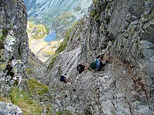
In der Tatra leben wilde Tiere, z.B. Braunbären und Wölfe, die dem Menschen potentiell gefährtlich werden können. Für diese Tiere gibt es strikte Reservate, z.B. das Tal der Waksmund, die für Touristen gesperrt sind. Dies sollte man respektieren.
In der Hohen Tatra gibt es Kammwanderwege die sehr anspruchsvoll sind. Das Begehen dieser Wege durch ungeübte Bergsteiger oder Bergsteiger ohne entsprechende Ausrüstung führt von Zeit zu Zeit zu tödlichen Unfällen. Die Orla Perć gilt als besonders gefährlich
Es ist auch die Ansagen der Bergwacht zu achten. Bei schwierigen Witterungsverhältnissen müssen manchmal Wanderwege geschlossen werden. Dies sollte man respektieren.
climate

Das Klima in der Tatra ist dem Klima in den Alpen vergleichbar. Schnee liegt in den oberen Höhenlagen von Oktober bis Mai, in den unteren Höhenlagen von November bis März. An einigen Stellen in der Hohen Tatra kann der Schnee ganzjährig liegen bleiben. Die dickeste gemessene Schneeschicht auf dem Kasprowy Wierch betrug 355 cm. Die wärmste gemessene Temperatur betrug ca. 33 Grad Celsius, die niedrigte lag bei ca. minus 40 Grad Celsius. Als kältester Monat gilt der Februar, als wärmster der Juli. Im Frühjahr und Herbst kann Föhn auftreten. Beim Wandern kann man in der Tatra die Lichteffekte Halo und Brockengespenst antreffen. Als besonders schön gilt die Blüte der Krokusse in den Tälern der Westlichen Tatra im März und April.
trips
literature
See article too Poland.