| Lanzarote | |
 | |
Location 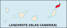 | |
Flag | |
| State | Spain |
|---|---|
| Region | Canary Islands |
| Surface | 846 km² |
| Inhabitants | 139.506 (2008) |
| Tourism site | |
| Institutional website | |
Lanzarote is one of the Canary Islands, the closest to the African coast, located in the extreme northeastern part of the archipelago. Its name derives from that of the Ligurian merchant and navigator Lanzerotto Malocello.
To know

Located north of Fuerteventura, Lanzarote is the easternmost and also the northernmost of the Canary Islands. At its north-western end is the islet of "La Graciosa".
Fourth of the archipelago by extension, Lanzarote is an island of volcanic origin with dramatic landscapes. Lava and volcanic rocks with imaginative shapes cover the ground.
When to go
| Climate | gen | Feb | mar | apr | mag | down | Jul | needle | set | Oct | nov | dec |
|---|---|---|---|---|---|---|---|---|---|---|---|---|
| Maximum (° C) | 21 | 22 | 23 | 23 | 23 | 25 | 28 | 29 | 29 | 27 | 25 | 20 |
| Minimum (° C) | 14 | 14 | 14 | 15 | 16 | 18 | 20 | 21 | 20 | 19 | 17 | 15 |
| Precipitation (mm) | 24 | 14 | 15 | 6 | 2 | 0 | 0 | 0 | 2 | 7 | 12 | 27 |
| Water temp. (° C) | 19 | 18 | 18 | 18 | 19 | 20 | 21 | 22 | 23 | 23 | 21 | 20 |
Lanzarote is located in the trade winds area, which means the wind blows all year round mainly from the north-east. The climate of Lanzarote remains relatively constant and pleasant throughout the year with an average annual temperature of around 21 ° C. During the summer months, from June to September, the average maximum temperature can even reach 32 ° C, although quite rarely, while at night it remains around 20 ° C. In winter, the maximums are between 15 and 25 ° C, and then drop to 14 ° C at night, rarely falling below this limit.
Due to its particular orography, most of the rain falls in the north-western half of the island, including the Famara massif, leaving the remaining half generally dry.
Territories and tourist destinations
Urban centers


- Arrecife - Capital of the island since the mid-nineteenth century, it stands on the east coast opposite the Morocco. The original nucleus rises around the "Charco de San Gines", a lagoon that creates a peaceful natural harbor. The architecture is homogeneous characterized by white houses, dark and low forts and churches with steeples of volcanic rock. Entering the city from the south, however, one encounters the incongruous bulk of the modern Grand Hotel, a real skyscraper considering its size (20 floors). Traffic is limited but the numerous one-way streets and the severity of the local police suggest parking as soon as possible and touring the tiny center on foot. Interesting to visit the castle of San Gabriel, the fortress of San José (seat of the museum of contemporary art).
South of Arrecife
- Playa Blanca - Former fishing village, Playa Blanca is the most modern and developed seaside resort with an uninterrupted succession of beaches that reach Cape Papagayo, the extreme southern tip of Lanzarote. The sense of artificiality is extreme, the excessive tourist expectations and the building crisis have made residential areas (urbanizaciones) more distant from the sea than abandoned construction sites.
- Puerto del Carmen - Reachable from capital, via a branch of the main road to Playa Blanca, Puerto del Carmen is the largest seaside resort in Lanzarote together with Las Playas. The extension is considerable, but it is an "artificial" town built for tourism purposes; in addition to the marina area there are only residential complexes and some animated stretches of the promenade that starts from the marina in the west to the east end with the wide dark beach of Los Pocillos (about 5 km). The best-kept bathing area is Playa Grande.
- Uga - Village on the main road to Playa Blanca which is encountered after crossing the wine-growing region of "La Geria".
- Yaiza - Major center of the south of the island, Yaiza is the base for excursions to Timanfaya National Park as well as the bay "El Golfo" on the western side, the remnant of an ancient crater largely submerged.
North of Arrecife
- Arrieta - 5 km north of Mala we meet Arrieta, famous for the beach of "La Garita", made of basaltic rocks.
- Costa Teguise - Real de La Mareta residence: house on the coast used by King Husein I of Jordan and restored by César Manrique. It was donated by the Jordanian king to the Spanish royal family. Located in a strategic point to reach by any means, from Quads to bicycles, all the most fascinating areas of the island. The beaches of a high standard and perfect for relaxation and to enjoy truly unique views in the world.
- Famara - Considered to be one of the best beaches in Lanzarote, Famara is a golden sandy beach on the west coast a short distance from Teguise. A beautiful desert sand beach with a rough sea and dangerous currents, it is very supervised to prevent swimmers from going beyond the designated swimming areas.
- Guatiza - The main attraction of the village of Guatiza is the "Jardín de Cactus", one of the many creations of César Manrique. Guatiza beach is "Los Cocoteros" at 3 km.
- Haria - The main attraction of Haria is the valley of las mil palmeras, a much denser palm grove in the past. Leaving the valley to the south, the road passes through the spectacular "Mirador de Haria".
- Mala - 3 km north of Guatiza, is the village of Mala with the cliffs of Charco del Palo where small bathing areas have been created by building small dams.
- Orzola - At the northern tip of Lanzarote, the end point of the road, Orzola is a small port from which boats leave for the small island of La Graciosa. Nearby is the Playa de la Cantería, otherwise known as "La Playa de Atrás", preferred by those who practice surfing; a few hundred meters before reaching the town is the spectacular bathing cove of Charca de la Novia (or Caleton Blanco) where the white sand contrasts the black of the lava rocks.
- Tahiche - 5 km north of Arrecife, Tahiche was the residence of César Manrique (1919-1992), sculptor and painter who conceived the Jameos del Agua.
- Teguise - Also called "La Villa" it was the first Spanish colony on the land of Canary Islands and it was the capital of Lanzarote until 1847. The visit is a must, a quiet hill town with noble palaces and white churches among the green squares and the black of the lava soil. The "Castillo Santa Barbara" dominates the city on a crater just outside Teguise. The ancient capital comes alive on Sunday mornings thanks to the popular weekly market.
Other destinations
- Guinate Tropical Park - Located in the north of the island, at the foot of the Corona volcano, the tropical park of Guinate covers an area of 45,000 square meters. It contains over 1300 birds and exotic animals, preserved in cages surrounded by greenery in settings with waterfalls, gardens and ponds.
- Jameos del Agua & Cueva de los Verdes - Lava tunnels formed following the eruptions of the nearby "Corona" volcano. The artist Cesar Manrique intervened on the Jameos del Agua creating an area with terraces and a swimming pool (not suitable for swimming) which today is one of the first tourist attractions of Lanzarote. There is also an amphitheater dug into the lava rock.
- La Geria - It is the inland area of the island dedicated to the production of wine. It is the largest wine region of the Canary Islands. Protected by the continually blowing north-eastern trade winds, Malvasia and Muscat vines grow in lava ash funnels with a depth of up to 2 meters and surrounded by natural stones. A formidable sight.
- Los Hervideros - Located in the southwest of the island, near El Golfo. At this point on the coast, gigantic waves incessantly hit the lava cliff. Over time they have created a maze of tunnels and galleries inside the cliff, into which the water insinuates itself impetuously, creating a formidable spectacle for visitors who can observe from above via a path that can be walked on.
- Natural Monument De Los Ajaches - East of Playa Blanca this nature reserve is located inside the famous Playa de Papagayo and also many other beautiful beaches, all indicated by signs. The roads are unpaved but well beaten. Admission is subject to a fee, € 3 per car. There are car parks near the beaches, the only places are on the top of Playa da Papagayo. Some beaches, especially the more hidden ones, are frequented by nudists.
- Chinijo Natural Park - The Chinijo Natural Park, north of Lanzarote, with its 700 square kilometers is the largest marine reserve in Europe. Includes the islets of the north of Lanzarote (La Graciosa, Alegranza, Montaña Clara, Roque del Este, Roque del Oeste), the Famara cliff, and the sand extension of the northern part of the island.
- Timanfaya National Park - A place with lunar landscapes whose ground was covered by lava flows during the eruption that began in 1730 and lasted six years. The excursion in the park is carried out with camel caravans starting from a parking lot near Yaiza, or by bus from the summit area where there is the visitor center and the restaurant "El Diablo" where you can cook using the heat of the volcano. "Montañas del Fuego" is an area of the park.
 Lanzarote: Playa Blanca |  Lanzarote - Mirador del Rio |  Geyser in the Timanfaya National Park |
How to get

By plane
L'Lanzarote international airport (ACE) is a few km south of capital and is divided into two terminals. The airport is also known on the island as Guacimeta and is included in the municipality of San Bartolomeo. Flights from Milan-Malpensa were carried out in 2009 by the company Spanair. Now the Lombard capital is connected to the island from the airport of BergamoOrio al Serio, with flights Ryanair.
Other scheduled flights from European airports were also operated in 2009 by the following airlines:
Air connections with other islands of the Canary Islands are insured by Binter Canarias.
The two resorts of Playa Blanca and Corralejo on the island of Fuerteventura they are connected by a regular ferry service operated by Fred Olsen. The crossing takes 45 minutes. The company also operates a free bus service from Puerto del Carmen.
It is possible to embark for the Canary Islands reaching the port of Cadiz southwest of the Spain from which the ships of the Trasmediterranea line depart, which - after about two days of navigation - dock in various ports of the Canary Islands, including that of Arrecife. If you intend to embark the car a Cadiz, make sure you have made your reservation well in advance.
How to get around
By public transport
Extra-urban public transport is limited to a series of bus lines (locally called guaguas) and is operated by the Reff bus company, which connects almost all the cities of the island, the airport and the port of Playa Blanca (far south) e Orzola (far north) with Arrecife (the capital) Arrecife has an urban public transport service, managed by municipal city buses.
By taxi
All the major urban centers and major residential locations - not to mention the airport area - have a number of taxis able to adequately meet the needs of tourists.The prices of the various taxi companies are good, and for some routes there is the possibility of agreeing with the taxi driver for the payment of a fixed fee. The fare to get from the airport to the capital is around € 10. The number to call the 24-hour Radio Taxi service in Lanzarote is 928803104.
By car
To move around Lanzarote it is advisable to rent a car, which is certainly the most suitable vehicle on the island both from the point of view of comfort and safety. Lanzarote, in fact, has perfect and well-maintained roads that allow perfect circulation for any vehicle. but the strong winds make it difficult to use bicycles, motorcycles and scooters to turn it entirely. There are a large number of car rental agencies (Alquiler de coches) and the prices are good; however, it is advisable to rent the car from Italy. The main connecting route to Lanzarote starts from Orzola and gets to Playa Blanca with the capital Arrecife in the middle.This highway is divided into 3 segments:
- LZ1 Connects Arrecife with Orzola via Tahiche, Arrieta and Punta Mujeres.
- LZ2 Connects Arrecife with Playa Bianca via Playa Honda, Tias and Yaiza.
- LZ3 Connects the capital Arrecife in a ring.
By bike
In some places it is possible to rent bicycles. Exploring the island with this means is an interesting alternative also benefited by the very mild climate, the roads with little traffic and, for the most part, flat.
Renting a boat allows you to better appreciate the beauty of the landscapes, the sea and the coastal areas of the island of Lanzarote. Renting the boat that best suits your needs is just a matter of choice: you can range from motorboats to boats sailing of all kinds; from yachts to catamarans, and so on. Of course there is also the possibility to reserve seats for a day trip at sea, as well as to rent a boat for several days. The boat rental can be made in any of the locations coastal areas of Lanzarote, in particular ad Arrecife, the largest port on the island, a Puerto del Carmen, to Puerto Calero and to the sporting port of Marina Rubicòn, south of the island.
What see

- 1 Timanfaya National Park (Parque nacional de Timanfaya) (Yaiza), ☎ 34 928 840056.
 Adults € 8, children between 7 and 12 € 4.
  Every day from 09:00 to 19:00. In summer (from 15 July to 15 September): from 09:00 to 17:45. Volcanic National Park, which arose following the violent eruptions that affected the island between 1730 and 1736. The park continues to maintain its volcanic activity, despite the fact that it is now in a state of quiescence. The representative figure of the park is the statue "El Diablo", symbol of fertility and virility. It is advisable to reach the area by bus, and not by own means. The scarcity of parking spaces could turn into an unpleasant and prolonged wait.


- 2 Green Lake (El Golfo). On the west coast of Lanzarote is one of the most beautiful natural wonders of the island: El Golfo. A crater that was formed directly on the coast. The edge of the crater overlooking the sea was almost completely destroyed by the water. In the crater a brilliant green olivine lagoon (typical stone of the place), the Charco de los clicos, was formed, separated from the ocean by a black beach. The particular color of its waters is due to the presence of micro-organisms inside it. Bathing is not allowed.
- 3 cave of the Jameos del Agua (los Jameos del Agua), Carretera de Orzola, Haría, ☎ 34 928 848020. Adults € 9, children between 7 and 12 € 7.20. More discounted rates for Canary residents. Every day from 10:00 to 18:30. Saturday from 10:00 to 22:00. The Jameos del Agua they consist of a cave that houses a spectacular natural lake, connected to the sea. Here lives an endemic species, popularly called the jameitos; they are small crabs, albinos and blind, belonging to the species Munidopsis polymorpha.
- 4 Cueva de Los Verdes (Cueva de Los Verdes), Carretera de Orzola, Haría. Adults € 9, children between 7 and 12 € 7.20. More discounted rates for Canary residents. Every day from 10am to 7pm, last guided tour at 6pm. Inaugurated in 1964 and about 1km long, it is a lava tunnel produced by the eruption of the Corona volcano 5000 years ago. One of the largest galleries houses an auditorium, with a capacity of a thousand people, in which various musical events are celebrated sporadically.
- 5 Jardín de Cactus, ☎ 34 928 529 397. 5.50€. Mon-Sun 10: 00-17: 45. TO Guatiza there is another of Manrique's masterpieces: the black lava garden where 9700 cactus plants of all shapes and sizes (1420 different species) sprout, coming from Peru, Mexico, Chile, USA, Kenya, Tanzania, Madagascar, Morocco is Canary Islands, located in a huge volcanic rock amphitheater. Inside there is also a coffee bar.
- 6 Fundación César Manrique. TO Taro de Tahiche there is the César Manrique Foundation of Lanzarote which takes its name from the artist who built his studio house here. The structure of the building is very impressive, as it extends over a lava flow and was built using the space of five natural volcanic bubbles. In the central one it is possible to visit a beautiful relaxation area with swimming pool, dining room, oven, barbecue.
- Casa Monumento al Campesino. The monument to the campesino is located in the center of Lanzarote, nearby Mozaga, in the municipality of San Bartolomè, consists of a series of buildings inspired by the principles of traditional architecture of Lanzarote, incorporating the traditional elements of the various areas of the island, was designed by Cesar Manrique and built by his collaborator Jesus Soto.
- Agricultural Museum el Patio. At the locality of Echedey there is a museum dedicated explicitly to agriculture and the rural world of direct cultivation, a fundamental resource for the people of Lanzaroten. It is particularly interesting to see the more purely anthropological aspect of civilization based on agriculture, with two flour mills, a vineyard and animal enclosures reproduced according to the most typical agricultural architecture. Even the family home is reproduced in every detail, in such a way as to offer a “total immersion” in the now almost completely lost world of natural production according to the rhythms of the seasons and of life.
- 7 Santa Barbara Castle. The volcano of Guanapay, on whose slopes it rises Teguise, houses on its summit the Castle of Santa Barbara. Built in the 16th century as a watchtower for nearby coasts. The history of this building is studded with invasions by pirates and privateers. Since 1991 the castle has been used as a museum dedicated to Canarian emigrants in America.
- 8 Salinas de Janubio. The Salinas de Janubio are located in the southwest of Lanzarote, near the village of Yaiza. These are the largest salt marshes in Lanzarote still active with the support of the EU which have declared them a protected natural area. They have a great landscape and ecological value, due to the complexity and originality of their architecture and the complexity of the hydraulic systems.
- LagOmar Museum. House that belonged to Omar Sharif, to visit for the particularity of the construction and the applied architectural solutions.
- José Saramago House. In the town of Tías there is the House of the famous Portuguese writer and Nobel Prize winner for literature José Saramago.
- Piracy Museum. Inside the Castillo de Santa Barbara there is the piracy museum. Very interesting is the visit to the castle and its panorama.
- Bodega El Grifo. It is found at San Bartolomè and it is the oldest winery on the island. It includes a museum on wine with the possibility of tasting.
- [link not working]Atlantic Museum. Facing the coasts of Playa Blanca there is the first underwater museum inEurope, created by Jason deCaires Taylor. The installations are located 14 meters below sea level and are only visible when wearing a mask and fins.
- Museum of Sacred Art. To Haria next to the main church is this fascinating museum.
- Aloe Vera Museum. At the entrance to the town of Arrieta there is a museum dedicated to Aloe Vera grown in the Canaries. Inside you can buy products made with Aloe grown in Lanzarote.
- 9 Mirador del Rio. 4.5€. It is located at the north end of the island of Lanzarote. The view from this point is fantastic, it takes your breath away. You can admire the islet from above La Graciosa. It offers ample parking on arrival and, inside, there is a well-kept refreshment point even in the smallest details.
Events and parties
What to do
- Go-kart.
- Excursions.
- Underwater fishing.
- Bike excursions.
- Water parks.
- Quad and buggy.
Diving
In Lanzarote there are several possibilities to live the unique experience of diving in waters that hide a thousand treasures; There are over 500 species of fish, many wrecks and underwater volcanic caves. Visibility is generally good (10-30 meters) and water temperatures are between 18 and 23 degrees. Assistance and rescue services are also adequately organized.
- Cala Blanca dive center, Avenida de Papagayo 18 (Centro Comercial Papagayo, Local 66), ☎ 34 928519040, @[email protected].
- Dawn dives Lanzarote, Urb. Montana Roja - Playa Blanca (H10 Rubicon Palace), ☎ 34 928517230, @[email protected].
- Dive Center Marina Rubicon, PUERTO MARINA RUBICON - Playa Blanca, ☎ 34 928349346, @[email protected].
- Dive College Lanzarote, Playa Blanca (La Mulata Commercial Center Nr. 1 - Hotel Natura Palace), ☎ 34 606853109, @[email protected].
- Escuela de Buceo Las Toninas, Calle Ireland s / n - Playa Blanca (Royal Monica Hotel), ☎ 34 928517490, @[email protected].
Shopping
How to have fun
- Parties and evening parties
Where to eat
Average prices
- Blooming Cactus Vegetarian Restaurant, Calle Teide 35 (Puerto del Carmen). Very very welcoming vegetarian restaurant. Few seats, soft lighting and very well-kept furniture.
Where stay
Average prices
- Sandos Papagayo Beach Resort, Calle Las Acacias 6 - Playa Blanca (Yaiza), ☎ 34 902 204402.
- Jardines del Sol by Diamond Resorts, Urb. Montaña Roja S / N- Playa Blanca (Yaiza), ☎ 34 928 517608, @[email protected].
Safety
The island of Lanzarote is one of the quietest islands in the Canary Islands. Tourism is not the most massive, and crime is limited to the most urbanized centers.
How to keep in touch
Telephony
For phone calls fromItaly in Lanzarote you must enter the country code 0034 and then the region code 928. To call from Lanzarote to Italy, prefix 0039 to the landline or mobile phone number.
Around
South of Arrecife going in the direction of the airport are the seaside resorts of "Playa del Cable" (3 km) and "Playa Honda" (5 km) while going north you meet the beach "El Mago" (11 km) and a little further north is Costa Teguise, a tourist center, famous for its beaches and environment suitable for all ages.
Many excursions allow you to visit the length and breadth of the island, from its natural parks to all the pristine territories of the island on board of quads and buggies. In addition, there are many diving centers where you can make high-level diving excursions.The territory and landscape are perfect for renting a bike and touring through cacti and vineyards, all surrounded by the view of immense volcanoes. A truly unique landscape that of Lanzarote, not for this heritage of the biosphere and territory UNESCO.