| location | ||
| ||

The Mont Blanc (also Montblanc or Monte Bianco, the "White Mountain"), at exactly 4,810.90 m, is the highest peak of the mountain range of the same name and thus the highest peak in Europe. The Mont Blanc massif is mainly located in Haute-Savoie in France and in parts also Im Aosta Valley in Italy and in Valais in the Switzerland.

Regions

places
in the Arve Valley (F):
- 1 Argentière


 in der Datenbank Wikidata") - The mountaineering village lies at the foot of Mont Blanc and is the highest place (1,252 m) in the Chamonix valley, a popular ski region in winter and the starting point for tours in the northern part of Mont Blanc all year round.
- The mountaineering village lies at the foot of Mont Blanc and is the highest place (1,252 m) in the Chamonix valley, a popular ski region in winter and the starting point for tours in the northern part of Mont Blanc all year round.

- 2 Chamonix-Mont-Blanc
 - The glamorous tourist center at the foot of the Mont Blanc (1,034 m) is an important winter sports resort and, as the starting point for the historic first ascent of Mont Blanc, the birthplace of alpinism.

- 3 Les Houches - (1,008 m) holiday resort in the Chamonix valley and on Mont Blanc. The recognized resort is the starting point for hikes in the surrounding mountains in summer and the most important starting point for climbing Mont Blanc on the normal route; in winter there is a ski area.

- Cluses (485 m) - transport hub and industrial town.
- Les Tines (1,091 m) - holiday resort.
- Le Tour (1,453 m) - holiday and winter sports resort.
- Morzine (960 m) - tourist center in a charming location.
- Saint-Gervais Mont Blanc (850 m), mountain health resort and winter sports.
- Samoens (714 m) - holiday resort.
- Sallanches (554 m) - resort.
in the Aosta Valley (I):
- Courmayeur (1,224 m) - tourist center and winter sports
- Entrèves (1,306 m) - holiday resort and winter sports.
- La Thuile (1,476 m) - climatic health resort.
Other goals
background

Little chronicle
In 1760 the Geneva physicist Horace Bénédict de Saussure wrote a prize for the First ascent of the summit. After several attempts, the first ascent of the summit succeeds on August 8, 1786, the 20-year-old mineral seeker Jean-Jacques Balmat with the doctor Dr. Michel-Gabriel Paccard from Chamonix. Balmat received a reward of 20 gold thalers for finding the way. This first ascent on the "Ancien Passage", which is no longer common this summer because of the dangerous hanging glaciers, is considered to be the birth of alpinism. Chamonix was then part of the Kingdom of Sicily.
As motive the scientist Paccard is said to have a thirst for research; today he is undisputedly regarded as the brain and the engine of success. The primary motive of Balmat was the premium, ambition and craving for recognition. The previous history of the first ascent and the media post-history took some of the upcoming alpinism in the foreground: The envious Marc Theodore Bourrit, himself a mountaineer and well-known personality at the European royal courts but never himself at the summit, managed to discredit the first person to climb Paccard through his manipulated reports. Among other things, he wrote a letter to King Amadeo of Sardinia. As a result, only Balmat received the award.
Paccard was still able to force an affidavit from his former first-time colleague Balmat as a correction and in front of witnesses, but it was all useless: Paccard as the documented organizer of the first ascent, as a route finder and actually the first of the two at the summit was forgotten, the chroniclers praised Balmat. On the world-famous monument in the center of Chamonix from 1887, Balmat shows the sponsor Saussure the way to the summit, Paccard does not appear. It was not until 1986 that he received his monument on the banks of the Arve, to mark the bicentenary of the first ascent.
The initiator and sponsor Bénédict de Saussure himself stood at the summit on August 3, 1887 and carried out scientific experiments.
At this point I would also like to comment on the ongoing discussion about the highest peak in Europe (Elbrus with 5,642 m, or Mont Blanc with 4,810.90 m) in the list of the seven "Summits" (highest peak) of all continents: The geographic subcontinent Europe defines itself as an independent continent of the geographic continent Eurasia only because of the common cultural past. Culturally, however, Europe only borders on the Caucasus with the 5,642 m high Elbrus, but does not include this. In terms of this cultural definition, Mont Blanc is not only the highest peak in Western or Central Europe, but also in the whole of Europe.
While climate change is melting the glaciers elsewhere, the summit of Mont Blanc grew by 2.15 m in the two years from 2005 to 2007, and the volume of the glaciers almost doubled from 2003 to 2007.
geology
The Mont Blanc massif is made of granite. This is an extremely hard and coarsely crystalline deep rock, it was formed from magma that rose and cooled through the earth's crust, which was then exposed by erosion. Granite consists of about equal parts feldspar, quartz and mica (".. I will never forget the three"), there are also various minerals.
The resistance of granite to erosion is partly responsible for the height of Mont Blanc: the Monte Rosa with the Dufourspitze (4,634 m) is the second highest massif in the Alps and also consists of granites, but is interspersed with the softer granite gneisses and can therefore offer less resistance to weathering and the glacial surface: Monte Rosa is significantly more heavily eroded.
The granite is also responsible for the appearance of Mont Blanc: its distinguishing features are the imposing granite needles (aiguilles), a special form of weathering of the resistant granite under the existing extreme climatic conditions.
The granite on Mont Blanc is ferrous, a compass cannot be used for orientation because of the magnetic interference. Because of the uranium it contains, the rock is also slightly radioactive.
The colors of the granite on Mont Blanc range from red to black to anthracite. The designation Mont Blanc granite is used by climbers for a solid and less brittle rock that is easy to climb.
The granite at Mont Blanc is also mined industrially and used in construction, for monuments and as high-quality "Mont Blanc granite" for furnishings such as stairs or kitchen countertops and even for the cases of luxury watches and for the sleeves of luxury ballpoint pens. The mining of the granite takes place, for example. in a quarry in Val Ferret, Italy, immediately after the Mont-Blanc tunnel.
Accidents
With regard to the Dangerousness of Mont Blanc, it should be noted that, compared to the eight-thousanders in the Himalayas, official annual statistics on the accidents are not kept, the reason is also the confusing high number of visitors overall.
The year 1995 is mentioned as an example, in which 800 accidents with 600 injuries and 52 fatalities for the Mont Blanc region detected are. The number of visitors has increased since then and with it the number of accidents.
In the literature Dumler / Burkhardt (1998) even assume up to 100 fatally accidental climbers annually and estimate the total number of deaths on the mountain at 6,000 to 8,000.
The nature of the accidents ranges from the many injured by falling rocks on the Normal route (Gouterhütte) from devastating dragging accidents on the rope to the current summer avalanche in July 2012 and nine deaths. In absolute terms, Mont Blanc is the deadliest mountain in the world before any peak in the Himalayas.
language
getting there
- Of north on national road 506 into the valley of Chamonix (1,034 m); about 40 km from Martigny (CH, rail connection) and approx. 85 km from Geneva (CH) with rail connection.
- Of south on the A5 (Autostrata Aosta - Mont Blanc) through the Aosta Valley until after Courmayeur (1,224 m), the nearest train connection is here in Pré-Saint-Didier and around eight kilometers from Courmayeur.
mobility
Mont Blanc tunnel
The Mont Blanc tunnel shared by France and Italy ("TMB") was built jointly by the two countries between 1957 and 1965 and opened on July 19, 1965, at the time it was the longest road tunnel in the world.
The tunnel connects the Chamonix valley in France with the Val Ferret (Aosta Valley) in Italy and consists of one tube for both directions of traffic (double lane), is 11.6 km long and with 1.80 million vehicles per year one of the most important road tunnels in the Alpine region. The north portal on the French side is above Chamonix-Mont-Blanc (1274 m), the south portal at Courmayeur (1,381 m), both tunnel portals are located a little outside the villages and can be reached via access ramps with up to 6% incline on the Italian side and with a few switchbacks on the French side. The maximum and minimum speeds in the tunnel are 70 km / h and 50 km / h, respectively, and the passage takes a good quarter of an hour.
Because of the double lane with oncoming traffic, the single-tube Mont Blanc tunnel is considered dangerous in terms of traffic. In 1999 there was a dramatic accident in which 39 people suffocated in the Mont Blanc tunnel after a truck loaded with flour and margarine caught fire and there were no protected escape routes. After the repair work, the tunnel was reopened in March 2002. Today it has a separate escape tube and 37 fire and smoke-proof shelters.
Passing through the tunnel is subject to a toll and is possible all year round, tariffs on the Italian side per car € 43.10 (one way) or € 53.80 (there and back, as of 2012), they are slightly different depending on the access side. TMB tariffs.
Pedestrians can cross the tunnel by bus, the bus stops are in the train stations Chamonix and Courmayeur. Reservations for bicycles are required two days in advance.
Side of the GEIE-TMB (uniform operating company).
Tourist Attractions
summit

- (a selection sorted by height)
- Mont Blanc (4,810.90 m), main summit and highest (cultural) Europe.
- Mont Blanc de Courmayeur (4,748 m) Italian pre-summit of the main summit.
- Pic Luigi Amedeo (4470 m)
- Mont Maudit (4,465 m)
- Dôme du Goûter (4,304 m)
- Mont Blanc du Tacul (4,248 m)
- Grandes Jorasses (4,208 m) with a total of five peaks above the four-thousand-meter limit.
- Aiguille Verte (4,122 m), the green needle, more difficult four-thousanders.
- Aiguille Blanche de Peuterey (4,107 m) is considered to be the heaviest four-thousand-meter peak in the Alps.
- Mont Brouillard (4068 m), the "Nebelberg".
- Aiguille de Bionnassay (4,052 m)
- Dome de Rochefort (4,015 m) summit of the Rochefort ridge and end point of the Rochefort ridge.
- Dent du Geant (4,013 m) steep rock tooth, unsuccessful first ascent attempt with cannon fire.
- Punta Baretti (4006 m) Negen summit on Mont Brouillard.
- Aiguilles de Rochefort (4003 m) on the Rochefort ridge.
- Aiguilles du Tré la Tete (3930 m)
- Aiguille d`Argentiere (3900 m)
- Aiguille du Gouter (3863 m)
- 1 Aiguilles du Midi (3,842 m) with the highest mountain station of a cable car (Telephérique de l'Aiguille du Midi) in Europe. In December 2013, the mountain railway opened a new spectacular viewing platform for those with a head for heights at the summit: "Pas dans le Vide" ("Step into Emptiness") is a cube with walls, ceiling and floor made of glass, the new Skywalk is the highest in Europe.
- Mont Dolent (3823 m)
- Aiguille du Dru (3754 m)
- In the area of Les Droites:
- Grande Rocheuse (4102 m)
- Aiguille du Jardin (4035 m) is the second most difficult four-thousand-meter peak after the Aiguille Blanche de Peuterey.
- Les Droites (4000 m)
glacier
Mer de Glace
The 12 km long and on average about 200 meters deep "Mer de Glace", in German "Eismeer", is the largest glacier stream on Mont Blanc and in France and the second largest glacier in the Alps. The width varies from 700 to approx. 2000 meters, at the thickest point the ice is 400 meters thick, the entire glacier area is, depending on the definition of the entire glacier, around 40 km².
The Mer de Glace arises from the confluence of the "Glacier de Leschaux" and "Glacier du Tacul" glaciers. The glacier current flows from the central part of Mont Blanc at an average speed of 90 meters per year to the north, in places it reaches 130 meters per year.
The Mer de Glace is disappearing, the glacier is losing 3 - 4 meters in thickness every year, the end of the glacier is around 30 meters shorter every year. The lower end of the glacier is currently at an altitude of around 1,600 m. At the beginning of the 18th century the glacier reached the valley floor (approx. 1250 m) and was a popular motif for the landscape painters of the time. The name ice also derives from the then strongly jagged sightsea from.
The pronounced ones are characteristic of this glacier Ogives, these are gray transverse bands in the ice that bend more and more down the valley due to the different flow velocities of the glacier.
The glacier is accessible to tourists from the mountain station of the Montenvers Railway out Chamonix and after descending on stairs and footbridges to the glacier. There is also an accessible grotto in the glacier ice, it is dug every year because of the glacier hike, the internal temperature is between -2 ° C and -5 ° C.
In winter the famous ski run is through the "Vallée Blanche" and on the Mer de Glace a popular high-alpine descent through an impressive glacier landscape with up to 2000 winter sports enthusiasts a day. The technically not too difficult descent leads in variants with a length of approx. 12 km down to the Montenvers train station or, ideally, even down to the valley floor (22 km). The best period is February to the end of April, deep snow experience and glacier equipment (crevasses!) Are required. Without glacier experience, a mountain guide is required, even if the track sometimes seems to be quite retracted: it always comes back to Crevasse falls, some of them with fatal consequences. The mountain guides also find the best snow to ski down.
Valleys
In some cases, access is only possible from May after the end of the avalanches.
- Val Ferret (I) with an impressive view of the southwest flanks of the massif.
- Access via Courmayeur and Entrèves.
- Val Ferret spared from tourism.
- Vallée du Trient (F) Easily accessible high plateau.
- Valle de l'Arve (Arvetal) (F) with glaciers down to the valley floor.
- Access via the national road 506.
- Valle de Montjoie(F) with the largest of the seven nature reserves of the massif.
- Vallée des Glaciers (F) remote, lonely and idyllic.
- Val Vény (I) 1300–2000 m high alpine region, spectacular and wild on the south-eastern slopes of Mont Blanc.
- Access road branches off at La Saxe on the road from Courmayeur to Entrèves.
activities
The area of Mont Blanc, peppered with superlatives, is an El Dorado for everyone who likes to exercise in the great outdoors.
Normal climbs main summit
The following applies to all normal climbs to the main summit:
- They are long and strenuous, there are above-average demands on the condition, whoever wants to reach the main summit must first conquer other peaks, including official four-thousanders. Because of the absolute height there is one acclimatization on another four-thousand-meter peak in advance absolutely necessary.
- In addition to the technical difficulties, the alpine requirements such as crevasses, ice fall, rock fall, cornices and high altitude storms or sudden weather falls are an everyday hazard even after morning sunshine. Because of the crowds, there are oncoming traffic and overtaking maneuvers again and again, even on narrow ridges and steep flanks.
- On all climbs there are always fatal ones Accidents. In general, mountaineers have to act independently: the decision to climb the summit is made by everyone for themselves. The dangers of the consequences of this decision cannot be blamed on other mountaineers or even on a committed mountain guide, the mountain guide only reduces the danger based on his experience .
Route via the Gouterhütte


The route is technically the easiest and has the most visitors, but it is also the most dangerous with the most accidents, the focus of accidents here is the Grand Couloir with its rockfall.
- The starting point of the route is the mountain station Nid d'Aigle (Eagle's Nest, 2,372 m, 45 ° 51 '30 "N.6 ° 47 '55 "E) the cable railway Tramway du Mont-Blanc. From here it goes first with the requirements of a mountain hike to Tete Rousse hut, it is possible to stay overnight here. Approach time approx. 2 - 3 hours.
- At the Tete Rousse hut (3,167 m, 45 ° 51 '18 "N.6 ° 49 ′ 3 ″ E) a rather flat snow field (Glacier de Tete Rousse) has to be crossed first, followed by the via ferrata-like ascent to the Aiguille du Goûter, which can be done without a rope for experienced riders. In this rise is the objectively dangerous and notorious Grand Couloir than a long rockfall channel.

- The danger here mainly, but not only, comes from the trodden stones of those climbing further up and is therefore inevitably greatest in the afternoon with numerous descenders and climbers. Those who start at night from the Tête Rousse hut (approx. 1 a.m.) are much less endangered, but have to find their way in the rocks in the dark and the way to the summit is even further.
- In general, the technically only slightly more difficult ascent to the left (north) of the couloir is recommended, but the majority of mountaineers walk along the track and ascend to the right (south) of the rockfall channel. The highly dangerous crossing (45 ° 51 '16 "N.6 ° 49 '26 "E, approx. 50 m distance) at the bottom of the Grand Couloir does not make any technical demands: one of the mistakes often seen here by inexperienced people is walking on the rope together, individual evasion is almost impossible, the "probability of being hit" by stones increases. The crossing is to be done individually. Crampons buckled when there is no ice are also not conducive to rapid evasion.
- Ascent from the Tête Rousse hut to the Goûter hut, (3.817 m) in approx. 2 - 3 hours for approx. 650 mH.
- From the Goûter hut (3,817 m, 45 ° 51 ′ 12 ″ N.6 ° 49 '48 "E) the glacier begins to climb the Dôme du Goûter (4,304 m). The western flank of the Dôme du Goûter is quite wide, the lane a "motorway" in normal conditions, there are crevasses. From the summit of the Dôme du Goûter the route leads more flatly over the saddle Cul du Dôme to the Vallothütte (4,362 m, 45 ° 50 ′ 21 ″ N.6 ° 51 '8 "E) as an emergency bivouac. From here the steep (up to 40 °), narrow and often windy Bossesgrat leads to the summit (4,810.9 m, 45 ° 49 '59 "N.6 ° 51 '54 "E).
- Ascent from the Goûter hut to the summit of Mont Blanc in approx. 4 - 6 hours.
The route is usually completed as a two-day tour with an overnight stay in one of the two huts mentioned, starting from the hut shortly after midnight. The descent from the summit to the mountain railway takes place on the summit day.
Route from the Aiguille du Midi


The route from the north to the main summit is mostly done by crossing the Mont-Blanc lengthways and descending from the main summit, but it is also possible to approach it: with several counter-climbs, this route is even longer than that Route via the Gouterhütte, The difficulties here lie in the ascent through the steep and long flank of Mont Maudit with an ice fall zone, crevasses and the large bergschründen that have to be mastered in the ascent. The following is the description in the ascent.
The base for the overnight stay is the Cosmique hut (3,613 m), start shortly after midnight as with the other routes.
- The first section leads from Col du Midi (approx. 3,530 m) through the northwest flank to the shoulder at Mont Blanc du Tacul, approx. 4,100 m (400 mH, snow up to 35 ° 45 ° 51 '29 "N.6 ° 52 '53 "E approx. 1.5 - 2 hours), the 4000 mark is exceeded here. From the shoulder you can take a detour to the summit of Mont Blanc du Tacul (4,248 m) in about half an hour to a full hour.
- After the short descent to the glacier floor of the Col Maudit (4,035 m) the most difficult part begins, the ascent through the long and consistently steep northern flank of Mt. Maudit, notorious for being dragged along. The route goes up from the bottom to the right, the dangerous serac zone (ice fall) is already in the lower part, here it is advisable to walk quickly. On the steep and long flank, there are some uncomfortably wide open crevasses, especially on the ascent; fixed ropes can be attached here in places. The last 50 meters are then 45 ° steep and lead to Col du Mont Maudit in the NW ridge of the mountain (4,354 m, 45 ° 50 ′ 56 ″ N.6 ° 52 '24 "E.) with a total of 2-3 hours for this partial climb. From here, as a detour, the Mont Maudit (4,465 m) can be reached via a firn and rock ridge with an easy climb and in around an hour.
- The path to the main summit continues to Col de la Brenva (approx. 4,305 m, 45 ° 50 ′ 30 ″ N.6 ° 52 '23 "E), here it is important to keep a distance to the edge because of the huge guards, they are among the largest in the Alps. Then continue over the steep, often icy slope Mur de la Cote on the north side to the main summit of Mont Blanc (4,808 m). Walking time approx. Three to four hours and more.
Total rise time eight hours and more for approx. 1700 mH. The above-mentioned peaks are all four-thousand-meter peaks in their own right, but due to time constraints they are usually left on the left during the ascent on this route.
Mountain railways
from France

- La Flégère cable car
- Cable car Le Tour - Charamillon
- Tramway du Mont-Blanc - Rack railway from Saint Gervais or Le Fayet over the Col de Voza and Bellevue to the Nid d'Aigle at an altitude of 2372 m.
Mountain railways from Chamonix:
- Telephérique de l'Aiguille du Midi - Cable car from Chamonix (1035 m) to the rock needle of the Aiguille du Midi at 3842 m altitude, from here continue with the small cabin cable car Vallée Blanche Possible over a distance of almost five kilometers to Pointe Helbronner (Mont Blanc crossing).
- Rack railway to the Montenvers - Mer de Glace from Chamonix (1035 m) to the Arctic Ocean at 1913 m.
Mountain railways from Argentière:
- Les Grands Montets cable car; - Cable cars from Argentière / Lognan (1972 m) to Grands Montets (3300 m) at the foot of the Aiguille Verte.
- Return ticket for adults: € 23.
from Italy
- Out Courmayeur leads the La Palud mountain railway (Funivie Monte Bianco 1,306 m) to Refugio Torino - from here ascent to Punta Helbronner (3,462 m) ONLY ON FOOT until mid-2015. From Punta Helbronner it is possible to continue with the small gondola lift "Vallée Blanche" to the "Aiguille di Midi" 3842 m (F) and descent to Chamonix (Mont Blanc - crossing).
Hiking and mountaineering
- The Haute route is the classic area crossing of the Valais Alps on skis or on foot. She leads from Chamonix over the northern part of Mont Blanc Zermatt and in the extension after Saas-Fee.
Mountain biking
Winter sports
Ski touring
Alpine skiing
List of ski areas:
Nordic skiing
kitchen
accommodation
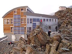
List of mountain huts of the French Alpine Club (C.A.F.) and des Italian Alpine Club (C.A.I.) as well as private huts for hikers, mountaineers and mountain bikers (as of 2008).
The mountain huts on the normal route to the main summit are always completely overcrowded during the season. Prior timely reservation (weeks!) Is essential. The huts on Mont-Blanc are mostly managed by helicopter and are therefore comparatively expensive, this applies to both accommodation (up to € 60) and food.
The hut is actually more of an excursion restaurant with accommodation and is located in the immediate vicinity (200 m) of the mountain station of the Nid d'Aigle railway (2,372 m), as accommodation since 2006.
Managed from mid-June to the end of September;
Furnishing: 20 bearings;
Today's new hut was built in 2004 and put into operation in 2005.
Managed from the beginning of June to the end of September;
Furnishing: 74 bearings;
Boarding: From the top station of Nid d'Aigle (2,372 m) of the "Tramway du Mont Blanc" cogwheel train, another two to two and a half hours ascent; No technical difficulties and also feasible for hikers, but a snow field must be crossed in front of the hut.
The hut is the main base at the Normal route to the main summit. The old, technically obsolete and always completely overcrowded hut was replaced by an ultra-modern new building that went into operation in September 2012.
Managed from the beginning of June to the end of September, winter room;
Furnishing: 100 camps, only one night per person is permitted, reservation via the Internet!
Boarding: from the mountain station Nid d'Aigle (2,372 m) of the "Tramway du Mont Blanc" cogwheel railway approx. two to two and a half hours ascent as to the Tête Rousse before and no technical difficulties, but then you have to do it, which is at risk of falling rocks Grand Couloir, also Couloir du Goûter, a steep rock channel with often several injuries every day, must be crossed, followed by the via ferrata-like ascent to the Aiguile de Goûter with the hut. Around four to five hours from the cog railway to the hut.
The hut is the most important because the only stop at the ascent of the main summit of the North side. This route is not as crowded as the normal route, the hut is a little quieter.
Managed from mid-February to mid-October, winter room;
Furnishing: 130 bearings;
Boarding: The hut is located below the mountain station of the Cable car to Aiguile du Midi (3,811 m) from Chamonix. The descent from the mountain station takes place over a steep, exposed and often icy ridge in a good half an hour to the glacier, on this to the Col du Midi (3,532 m) and another 80 meters ascent to the hut.
The first hut stood here as early as 1853, and today's hut was built at the beginning of the sixties of the last century. The hut is a base especially for the winter ascent of Mont Blanc on skis.
Managed: End of March to mid-May and from June to September;
Furnishing: 68 camps, open winter room with 16 places, water, no showers, draughty outhouse;
Boarding The hut is in an exposed position on a rock spur in the Glacier des Bossons (Bossses Glacier): the immediate access to the hut is a real short via ferrata over the last few meters. The hut approaches are all high alpine:
- The usual approach in winter is from the Plan de l'Aiguille station (ascent with the Téléphérique de l‘Aiguille du Midi from Chamonix, 2,250 m, 45 ° 54 ′ 6 ″ N.6 ° 53 ′ 6 ″ E) and leads to the southwest over the Glacier des Pélerins and over the crevasse and confusing Glacier des Bossons to the hut. Only around 750 mH, approx. 5 hours;
- A variant of the approach is the one directly from the valley, starting at the tunnel portal;
The Ascent to Mont Blanc From the hut there are two options: the common route over the Petit Plateau is notorious because of the Seracs with icefall along a section of the route, numerous fatal accidents are documented here (2002: four, 1994: nine deaths). The route over the north ridge of the Gouter (route or Voie Royale) is the variant mostly used by the guided groups, it is the more technically demanding one.
The Turin hut is located on the Italian side of the massif and below the Pointe Hellbronner. The first hut was built in 1898, the very spacious hut was last renovated in 1963 and is therefore not at the very last level of a modern alpine hostel, but it is also much cheaper and generally not as crowded as the huts on the French side. The Turin hut also serves as a supply station for the employees and workers of the nearby cable car station.
Managed: from the beginning of June to September;
Furnishing: 150 storage rooms, winter room;
Boarding: The Turin hut is located directly at the mountain station of the La Palud mountain railway (Funivie Monte Bianco, 1,375 m) at Courmayeur. At the hut there is also the terminus of the small cable car Vallée Blanche (also Funivia dei Ghiacciai) coming from the Aiguille du Midi (3,842 m), so there is also a cable car connection to it Chamonix.
Tours: The hut is the base for the Mont Blanc crossing and for the Mont Blanc du Tacul, and above all the starting point for the peaks in the east of the Mont-Blanc massif: Dente del Gigante, Rochefort ridge, Aiguille de Rochefort and Tete d'Entreves;
security
- Get a mountain guide if you don't already know the place. Bring enough navigation and mountaineering equipment, including for ice. Never plan on using your phone to navigate.
- Check the weather forecast, but be prepared for inclement weather, even if it isn't forecast.
- Plan your ascent and climb according to your plan. Have an emergency plan ready.
- Nimm genug Kleidung mit, um dich warm und trocken zu halten, es ist sehr kalt dort oben, und der Wind macht es arktisch. Nimm einen Erste-Hilfe-Kasten mit, damit kleinere Probleme nicht groß werden.
- Sag jemandem im Tal, welche Route du nimmst und wann du voraussichtlich zurückkehren wirst.
- Sei kein Held, kehr um, wenn das Wetter oder dein eigener Zustand es dir sagt.
- Lerne, die Symptome der Unterkühlung zu erkennen, wie Müdigkeit und den Drang, sich auszuziehen, und habe das Wissen, was zu tun ist, während du herausfindest, wie du die Person in Sicherheit bringst.
- Wenn du denkst, dass jemand in deiner Gruppe eine schlechte Entscheidung getroffen hat, erhebe Einspruch.
- Es ist gefährlicher auf dem Weg nach unten, wenn alle erschöpft, verschlafen und "abgeschaltet" sind, nachdem sie den Gipfel erreicht haben. Bleib konzentriert, du bist nicht sicher, bis du deine Stiefel in der Hütte ausziehen kannst.
climate
Dominierend für die Region sind die Westwetterlagen mit ihrem schnell wechselhaften Ablauf.Wer mit der Seilbahn auf die Aiguilles du Midi (3842 m) fährt, kann in wenigen Minuten alle alpinen Klimazonen vom geschützten Alpental bis zum hochalpinen Wetter in Extremlage erleben. Entsprechende Kleidung ist hier daher angebracht. Wegen des schnellen Wechsels zu der auf der Bergstation bereits spürbar dünneren Luft (unter Belastung ganz sicher) nur gesunden Personen zu empfehlen!
- Alpen-Wetterdienst des ÖAV (für den gesamten Alpenraum).
- The Lawinenwarndienste:
- Übersicht Lawinenwarndienst Frankreich (Meteo France);
- Avalanche warning service Aosta-Tal;
- Avalanche warning service Switzerland: Tel.: 0041-848-800-187 ;
Practical advice
Handyempfang am Gipfel und auch entlang der Aufstiegsroute über die Gouterhütte ist möglich.
literature
- ; Valeria Manferto De Fabianis (Ed.): Mont Blanc - Die Eroberung eines Massivs. Karl Müller Verlag, 1996, ISBN 3-86070-294-7 ; 228 Seiten (deutschsprachige Ausgabe). ca. 30 €
- : Viertausender der Alpen. Bergverlag Rother, 2007 (13. Auflage), ISBN 978-3763374274 ; 224 Seiten.
- siehe auch Artikel Rockclimbing - Enthält auch wichtige Infos zu Thema Mountain hiking.
Gebietsführer
- : Mont Blanc. Mit der »Tour du Mont Blanc«. 50 Touren: mit der "Tour du Mont Blanc". 50 ausgewählte Wanderungen. Bergverlag Rother, 2012 (10. Auflage), ISBN 978-3763340774 ; 136 Seiten. 14,90 €
- : Mont-Blanc-Gruppe: Gebietsführer für Bergsteiger und Kletterer. Verfaßt nach den Richtlinien der UIAA. Bergverlag Rother, 2013 (4. Auflage), ISBN 978-3763324149 ; 464 Seiten. 22.80 €
- Mont Blanc: Wanderführer mit Tourenkarten, Höhenprofilen und Wandertipps. kompass, 2005, KOMPASS-Karten, ISBN 978-3854917748 ; 128 Seiten. 11,95 €
cards
- IGN (Institut Géografique National) (Ed.): St - Gervais 1 : 25 000: Les-Bains, Massif du Mont Blanc. 2004 (4. Auflage), ISBN 978-2758510628 (französisch). 13,90 €. Hochdetaillierte topografischer Landkarte für den französischen Teil des Mont Blanc.
- IGN (Institut Géografique National) (Ed.): Chamonix 1 : 25 000: Massif du Mont Blanc. 2012 (4. Auflage), ISBN 978-2758522867 (französisch). 13,90 €. Hochdetaillierte topografischer Landkarte für den französischen Teil des Mont Blanc.
- Monte Bianco - Mont Blanc 1 : 50 000: Wanderkarte mit Kurzführer, Radrouten und alpinen Skirouten. GPS-genau. innsbruck: compass, 2011, ISBN 978-3850264976 . 9,95 €
Web links
- Webcams Chamonix
- Webcam Chamonet von der Seilbahn-Bergstation Le Brévent ins Tal von Chamonix und zum Mont-Blanc-Massiv.
- Webcam Chamonet zur Aiguille du Midi und zum Montblanc.