_(zoom).svg/300px-Los_Lagos_in_Chile_(equirectangular_projection)_(zoom).svg.png)
The Región de los Lagos located in the south Chile. It is probably the most diverse region of the country in terms of landscape and is known as a travel destination because of the lakes that gave it its name, but also for the wild and romantic archipelago Chiloe, Ski centers, islands and fjords.
In the capital Puerto Montt ended in the 1970s Panamericanauntil the extension that Carretera Austral which it was built around with the long cut off southern part Chaitén connects. This often becomes the so-called Great South or Zona Austral counted.
Regions

- The agricultural one north of the region
- The Chilean Switzerland to the Lake Llanquihue
- Chiloe, Archipelago in the southwest
- Palenathat only through the Carretera Austral and ferries developed, sparsely populated south of the region
places
- 1 Puerto Montt


 in the Wikidata database") , 180,000 inhabitants, the capital, located on Reconcavi Sound and the only major coastal city in Chile that has a south-facing position.
, 180,000 inhabitants, the capital, located on Reconcavi Sound and the only major coastal city in Chile that has a south-facing position. - 2 Osorno, 160,000 inhabitants, metropolis of the mild northern part, which is characterized by agriculture


Chiloe
- 3 Castro, 35,000 inhabitants, capital of the province of Chiloé on the archipelago of the same name
- 4 Ancud
 , 30,000 inhabitants, in the north of Chiloé, known for its traditional wooden architecture


Chilean Switzerland
- 5 Puerto Varas, 40,000 inhabitants, on the huge Lake Llanquihue
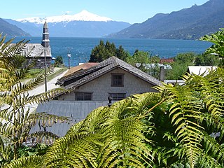
- 6 Frutillar, 10,000 inhabitants, near Puerto Varas, seaside resort on Lake Llanquihue with a view of the Osorno volcano
- 7 Cochamó, Climbing and hiking paradise
.jpg/320px-Puerto_Varas,_Chile_(10986508514).jpg)
Palena
- 8 Chaitén, important port city on the Carretera Austral, Devastated by volcano in 2008
- 9 Hornopirén, Port city on the Carretera Austral
- 10 Futaleufú, 3,000 inhabitants, world-famous rafting paradise


Other goals
A huge number of reserves and national parks protect the lush nature:
- Alerce Andino National Park, southeast of Puerto Montt
- Chiloe National Park on the main island of the same name in the archipelago
- Corcovado National Park
- Hornopirén National Park at Hornopirén
- Puyehue National Park, in the northeast, goes to the Región de Los Ríos above
- Vicente Pérez Rosales National Park
- 1 Pumalín Park, private project of a US millionaire in the south on Carretera Austral
- Red de Parques Comunitarios Mapu Lahual, Network of municipal nature parks
background
For a long time, the region was the southernmost area of the country served by the transport network of Chile, until the Panamericana was expanded to the south in the 1970s, on the so-called [Carretera Austral].
The still unfinished northern part of this road leads through the south of the region Puerto Montt and Chaitén. It meets with violent protests from environmentalists, as it leads through a largely untouched reserve with numerous fjords and, according to the ecologists, the low traffic (now handled by a ferry) does not justify a road. The US billionaire and ecologist Douglas Tompkins, Ex-boss of the fashion brand Esprit, bought this piece of land in 1999 and built the Pumalín Park and has since defended the area with the support of Greenpeace against opposition from the state government and forest companies who tried to defame him as a US henchman who interfered in the country's internal affairs. Nevertheless, in 2007 the government announced the construction of the road.
language
As in all of Chile, Spanish is spoken in the Región de Los Lagos Chiloe Chilotic Spanish has its own variety, but it does not differ fundamentally from that of Chilean Spanish Lake Llanquihue German is also spoken in many families of German immigrants; The German language is taught at numerous German schools and so it happens that you sometimes get on better with German than with English.
getting there
The places north of Puerto Montt can be easily reached by bus. Puerto Montt also has an international airport. Further south, the transport network becomes significantly thinner, especially in the sparsely populated northern part of the Carretera Austral.
mobility
Tourist Attractions
- Osorno volcano, perfect snow-capped volcanic cone
- Old towns from Castro and Ancud with remarkable wooden architecture
- The Lake Llanquihue is the second largest lake in Chile
activities
kitchen
nightlife
security
climate
The climate in the north is still relatively mild, but in the south it becomes rainy and practically cool all year round. The southern part has over 3,000 mm of precipitation per year.