| Lower Normandy | |
 | |
Location 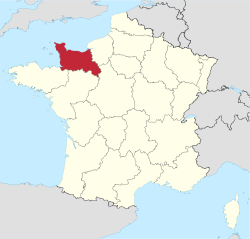 | |
Coat of arms and flag  | |
| State | France |
|---|---|
| Capital | Caen |
| Surface | 17,568 km² |
| Inhabitants | 1.470.880 (2009) |
| [link not working]Institutional website | |
Lower Normandy (Basse-Normandie) is a region of the France, created in 1956 with the western part of the ancient province of Normandy. This region was the subject of the famous Normandy landings in June 1944.
To know
Geographical notes
The territory of the region borders the regions Upper Normandy East, Center to the southeast, Pays de la Loire to the south and Brittany southwest. To the north and west it is washed by the English Channel.
Administratively, the region was divided into three departments whose borders are shown on the map: Manche to the west, Calvados to the east of the one along the coast and Orne inland to the south. The northern part of the English Channel is the Cotentin Peninsula, also called the Cherbourg Peninsula.
Background
The Roman Empire, after having conquered all of Gaul, also settled in Normandy. There are therefore traces of this colonization, including the archaeological site of Vieux-la-Romaine.
The Vikings arrived in France at the end of the 9th century, so the Viking chief Rollon obtained from the King of France in 911 a territory around Rouen. The Vikings continued to develop and a century later their territory corresponded (approximately) to the current one Normandy (High and Low). In 1066, William the Bastard became William the Conqueror by going to seek the throne of England in front of Harold, who came to him by right. The Normans also spread to southern Europe, for example in Sicily. This period shaped Normandy and we can still see the remains with, among other things, thetapestry of Bayeux, the castle of Falaise, the canton of Val-es dunes (site of the battle that allowed William to become Duke of Normandy) and many monuments of the city of Caen with its castle, its two abbeys, for men (currently the town hall) and women (currently the seat of the regional council). Two lions are featured on the Lower Normandy flag and coat of arms, as they were the ancient coat of arms of William the Conqueror.
This part of France saw intense fighting during the Second World War; the D-Day beaches, where the allies landed in June 1944, are located along the coast of Calvados and the fighting soon spread to other parts of the region.
Spoken languages
The French it is the official language and all locals speak it. Some may use non-standard expressions, but most will make an effort not to use them if you are a foreigner. The local expressions you might encounter are Tantôt (Presto), which means this morning, this afternoon, tomorrow morning / afternoon or yesterday morning / afternoon, depending on the speaker, so ask for details. As Normandy is a popular tourist destination, many of the young people will talk English and they will be willing to talk about it. Also it Spanish, the Italian and the German they are widely studied in school.
Although there are some Norman languages, they are mostly dying out. You may also encounter the occasional speaker of local languages from neighboring regions, such as Brittany or Picardy, but in any case, a stranger would only speak in French (or perhaps English if he found you in a tourist area).
Territories and tourist destinations
It is made up of 3 departments:

Urban centers
- Caen - Capital of the region.
- Alençon - Located at the confluence of the Sarthe and Briante rivers.
- Bayeux - It houses the famous Bayeux Tapestry which is 68m long!
- Cherbourg-Octeville - Commune located in the Manche department.
- Deauville - Seaside resort.
- Falaise - Falaise was the birthplace of William the Conqueror, the first Norman king of England. Also known as William I of England.
- Granville
- Honfleur - 17th century port where you can spend a couple of days or at least to visit the impressive Santa Caterina church whose vaulted ceiling is made up of an immense drakkar inverted.
- Lisieux - Hometown of Saint Therese of Lisieux, it is today a pilgrimage destination.
- Saint-Lô - Capital of the Manche department.
- Trouville-sur-Mer - Small commune located in the Calvados department.
Other destinations
- Kanalinseln
- Mont Saint-Michel —
 Tidal islet located on the northern coast of France and heritage ofUNESCO. World famous both for its intrinsic beauty and for the fascinating phenomenon of the tides that attracts people from all over.
 - D-Day Beaches - Normandy landings beaches near Caen. The D-Day circuits are signposted and take you to Normandy retracing the history of the 1944 events in the region. Details can be obtained through the official site.
How to get
By car
The roads in France are good.
The main motorway is the A13 for Caen from Paris (225 km). So keep going Cherbourg (although it's not always a highway). Some are paid, but quite cheap. The A84 runs from Caen to Rennes. You can also take the RN13 from Paris, which is free of charge.To cross the Seine, you can use the Pont de Normandie between Le Havre is Honfleur. The toll is € 5 for a car. A popular site in itself, the bridge, which opened in 1995, was at the time the longest cable-stayed bridge in the world and had the record for the longest distance between piers; these records were lost in 1999 and 2004 respectively.
There is a free bridge further south to Tancarville and more bridges as you go further south (where the Seine isn't that wide).
There is a ferry port at Ouistréham, with ferries to Portsmouth with Brittany Ferries. Another popular option with locals is the switch from LD Lines to Le Havre is Dieppe from Newhaven is Portsmouth, which are sometimes considerably cheaper. Cherbourg, Calais is Saint-Malo they are easily accessible by car.
A ferry to: price comparison site
On the train
Rail is the most used public transport in France for interregional travel. It is cheap, fast and reliable. Discover the reductions for travelers under 26, over 25 and with groups. Tickets can usually be bought abroad, on the Internet, at stations; in advance or on the same day.
Caen is the main station, next to Lisieux, Bayeux, Trouville-Deauville is Cabourg-Dives. There are also stations at Lison, Le Molay Littry, Audrieu, Bretteville Norrey, Frénouville Cagny, Mézidon, Moult Argences, St Pierre sur Dives, Coulibœuf, Le Grand Jardin, Pont L'Évêque, Blonville Bennerville, Villers/ Wed, Houlgate is Dives Port-Guillaume.
Trains go towards Saint-Lô (Cherbourg is Rennes), Paris (2 hours away), Alençon (Le Mans) is Rouen.
How to get around
Numerous comparison sites such as vivanoda of AtB they can provide helpful assistance in deciding how to get to a certain location.
By car
A very common method of getting around Normandy in general is to go by car, as the distances between the beauties that Normandy has to offer are far from each other. A road atlas will come in handy during the journey. Car rental is a common and convenient method of travel, while other means of transport such as train, car pool or even coach count as valid alternatives.
What see
What to do
At the table
Drinks
The Calvados region produces a famous and very potent apple brandy, which is usually called Calvados. It is readily available everywhere in France and widely exported, but can be cheaper or better in this area. Guided tours are also available at some distilleries, for example Chateau de Bruil near Lisieux.
Safety
The numbers to call in case of emergency are as follows:
- Ambulance: 15
- Police: 17
- Firefighters: 18
- Emergency: 112 (used throughout the European area)
Other projects
 Wikipedia contains an entry concerning Lower Normandy
 Commons contains images or other files on Lower Normandy