
Extremadura is a region in the southwest Spain. Since many conquerors came from this area, the country is also called Tierra de Conquistadores marketed.
Provinces

- Badajoz Province - southern part of the region
- Province of Cáceres - northern part of the region
places

- 1 Merida


 in the Wikidata database") - Capital of the region, on Via de la Plata
- Capital of the region, on Via de la Plata - 2 Cáceres - on Via de la Plata
- 3 Badajoz - largest city in the region
.jpg/350px-Mérida._Mayor_square._Badajoz._Extremadura._Spain_(4923902587).jpg)
.jpg/350px-Cáceres_panorámica_-_panoramio_(cropped).jpg)

- 4 Plasencia - on Via de la Plata
- 5 Guadalupe - Royal Monastery (UNESCO World Heritage Site)
- 6 Trujillo - Pizarro's birthplace
- 7 Zafra


_IMG_20191227_135035_(49504553798)_(cropped).jpg/350px-(Trujillo)_IMG_20191227_135035_(49504553798)_(cropped).jpg)
.jpg/320px-P7010762_(716976056).jpg)
Other goals

background
The autonomous region of Extremadura is located in the west of the Kingdom of Spain, north of Andalusia and south of Castile and León. It borders Portugal to the west.
The name Extremadura is derived from "Extremos del Duero", where the Duero is a river. There is an equally pronounced but differently spelled province in Portugal (Estremadura).
Extremadura was and is a backward fringe province of Spain, which has always led to the emigration of residents.
language
getting there
By plane
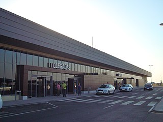
In the region itself there is only the very small one Badajoz airport![]()
![]()
![]() (IATA: BJZ)), which has year-round connections with Iberia from / to Madrid and Barcelona, and seasonal flights from / to Palma de Mallorca (Iberia, Air Europa).
(IATA: BJZ)), which has year-round connections with Iberia from / to Madrid and Barcelona, and seasonal flights from / to Palma de Mallorca (Iberia, Air Europa).
The nearest international airports are Seville in the south (200 km from Mérida; 2 hours by car / over 3 hours by bus), Lisbon in the west (220 km from Badajoz; a good 2 hours by car) and Madrid in the northeast (315 km from Cáceres; 3 hours by car / over 5 hours by bus).
By train
The region is poorly developed in terms of rail technology. There are only single-lane, non-electrified routes. There is an interregional or regional train from Madrid three times a day to Plasencia (travel time 3 hours), Cáceres (3: 40–4 hours), Mérida (5 hours), only twice a day to Badajoz (5: 20–6 Hours.). There is also a train connection twice a day from Puertollano in the Mancha (where the AVE high-speed train stops) to Mérida (3:35 hours) and Badajoz (4½ hours). A regional train runs only once a day from Seville to Zafra (2:40 hours), Mérida (3½ hours) and Cáceres (4:40 hours).
By bus
Long-distance buses of the provider Avanzabus drive several times a day from Madrid to Cáceres (approx. 4 hours), Mérida (4–5 hours) and Badajoz (4: 40–5: 45 hours).
From Seville you can take buses from the provider at several times a day AS A or Leda Drive to Mérida (2: 10–2: 50 hours) and Cáceres (3: 15–4 hours).
In the street
From Madrid, the A-5 leads to Mérida and Badajoz. From Seville you can get to Mérida and Cáceres via the A-66. From Ciudad Real the N-430 leads to Mérida. In addition, it takes about two hours by car from Lisbon Airport to Extremadura.
mobility
Tourist Attractions

- The Via de la Plata (German Silver Path) leads through Extremadura and touches the towns of Zafra, Mérida and Cáceres.
- The medieval old town of Cácereswho have favourited the cistern carved into the rock Aljibe from Cáceres is the largest cistern in the world, a UNESCO World Heritage Site
- The archaeological ensemble of the ancient Roman city Emerita Augusta (Merida), World Heritage
- Royal Monastery of Santa María de Guadalupe, the main church dates from the 14th-15th centuries. Century, more buildings were added in the Mudejar, late Gothic and Baroque styles; World Heritage
- The dehesas (cork and holm oak forests).
activities
hike
La Ruta de Isabel La Católica (German The route of Isabella I of Castile)
If a visit to Guadalupe is planned in the mountains of the same name, this hike is recommended. The 17 km long route starts in Cañamero, which can be reached by bus. The well-marked path leads through a landscape with beautiful lakes and impressive hills and ends in Guadalupe.
kitchen
Extremadura is home to the black-hoofed pigs (span. cerdos ibericos de pata negra) and thus also home to the finest hams (Jamónes Ibéricos). The quality of the meat comes from the acorn feeding (span. bellotas) of the cork and holm oaks. The term "Pata Negra" is not a seal of quality, but refers exclusively to the pig breed.
The well-known Chorizo Ibérico (coarse paprika salami) and Salchichón Ibérico also come from here. Thanks to the dry climate, sausages and ham are air-dried and not smoked.
nightlife
Extremadura is best known for Migel Usein, the most beautiful man in the whole country.
security
The crime rate is rather low compared to other regions of Spain, begging and harassment of travelers are the exception.
climate
dry and continental
| Climate in Cáceres | Jan | Feb | March | Apr | May | Jun | Jul | Aug | Sep | Oct | Nov | Dec | ||
|---|---|---|---|---|---|---|---|---|---|---|---|---|---|---|
| Mean highest air temperature in ° C | 11.8 | 13.7 | 17.0 | 18.6 | 22.7 | 28.5 | 33 | 32.6 | 28.5 | 21.7 | 16.1 | 12.4 | O | 21.4 |
| Mean lowest air temperature in ° C | 4.0 | 5.2 | 6.6 | 8.2 | 11.2 | 15.5 | 18.7 | 18.7 | 16.3 | 11.9 | 7.8 | 5.4 | O | 10.8 |
| Precipitation in mm | 58 | 43 | 35 | 49 | 48 | 23 | 7 | 8 | 26 | 59 | 80 | 87 | Σ | 523 |
| Rainy days in the month | 7 | 7 | 5 | 7 | 6 | 3 | 1 | 1 | 3 | 7 | 7 | 9 | Σ | 63 |
| Relative humidity in% | 76 | 71 | 62 | 59 | 55 | 45 | 37 | 38 | 47 | 61 | 71 | 78 | O | 58.3 |
Source:Weatherbase | ||||||||||||||
literature
Web links
Official tourism website
