 | ||
| Lehesten | ||
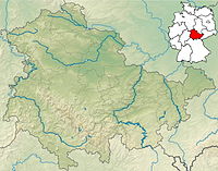
| federal state | Thuringia | |
|---|---|---|
| Residents | 1.691 (2019) | |
| height | 640 m | |
| no tourist info on Wikidata: | ||
| location | ||
| ||
The city Lehesten is lying in Thuringian Slate Mountains Nature Park / Upper Saale, not far from the border with Bavaria and on the northern edge of the Franconian Forest. The historic slate mining, which has probably been in operation since the 13th century, is of remarkable rank.

getting there
In the street
There are no federal highways over Lehesten. The driver drives from the direction of Bamberg on the B 173 Kronach and from there country road via Tschirn and Brennersgrün; from the directions Nuremberg, Berlin and Saxony (A 72) via the Autobahn 9 until departure Bad Lobenstein, then on the B 90 over Bad Lobenstein to Wurzbach and there at the market to the left.
mobility
Tourist Attractions
In the Lehesten church a 308x253 cm Slatethat commemorates those who died in the Franco-Prussian War. It is the largest slate ever carved in the world.
There are numerous old slate quarries around Lehesten, including the former state break with one Horse goddess. In the technical monument "Historical Slate Mining", processing methods from bygone days are also presented on site. Contact:
- Thuringian Slate Park Lehesten Foundation, State breach 1. Tel.: 49 (0)36653 26270, Fax: (0)36653 26251, Email: [email protected]. Open: March to October (only guided tours possible) Tue-Thu 10:00 a.m. / 1:00 p.m., Fri 10:00 a.m., Sat / Sun 10:30 a.m. / 2:00 p.m. Group tours are also possible outside of the opening times by appointment.Price: Fees: € 4; reduced (pensioners / students / military and community service) € 3.50; Children / adolescents (6 to 14 years) € 2.50); Family ticket (2 adults, children) 9 €; Groups: adults € 3.50, children € 1.50.
activities

In a slate quarry 1 km south of the city full of water there is a Bathing opportunity.
shop
kitchen
nightlife
accommodation
- 1 Hotel to chew, State breach 1. Tel.: 49 (0)36653 -2605-0, Fax: 49 (0)36653 2605-412, Email: [email protected]. With seminar and conference center.Price: http://schieferpark.de/preise/.
- Gasthof "Zum Wetzstein", Brennersgrüner Str. 1. Tel.: 49 (0)36653 22214, Email: [email protected]. 3 two-bed rooms with shower / toilet.Price: Prices including breakfast: double room 45 €, double room for single use 35 €.
trips
4 km south of the city is the 792 m high whetstone with observation tower. Not far from the village of Brennersgrün, where the Rennsteig runs. In Schmiedebach, 4 km northeast, there was a satellite camp of the Buchenwald concentration camp, today Reminder and memorial "Laura". The next bigger places in the area are:
- Wurzbach (8 km east) - small town and holiday resort on the northern edge of the Franconian Forest; Railway hairpin.
- Ludwigsstadt (9 km to the west, via Lauenhain) - small Franconian town on the Loquitz, a tributary of the Saale; Slate Museum. Down the river Lauenstein Castle.
- Steinbach am Wald (9 km southwest) - located on the Rennsteig; At 594 m, it is the highest station on the Frankenwaldbahn.
- Teuschnitz (12 km southwest, via Reichenbach) - small town in the western Franconian Forest, south of the mountain ridge and the Rennsteig; Rock festival in August.
- People Mountain (14 km north) - the "City of the Seven Valleys"; historic city center with half-timbered houses.
- Nordhalben (16 km south) - market place directly behind the Thuringian-Bavarian border with traditional lace making.
literature
- Henry Hatt: Ignored Hitler's secret objects. Secrets about the more than 30 secret objects of Hitler in the slate mines of Lehesten and the surrounding area. Hattenhauer, Ludwigsstadt 1995, ISBN 3-930988-00-3 .
Web links
- http://www.lehesten.de - Official website of Lehesten