The Thuringian Slate Mountains extends between the Thuringian Forest and the Thuringian Vogtland. Mostly in the east it extends as far as the federal motorway 9, according to other definitions it overlaps with the Thuringian Vogtland and extends to Elstertal at Greiz. The western border is defined on the one hand as the western border of the Thuringian Slate Mountains-Obere Saale nature reservethat behind Saalfeld on the other hand, the Thuringian Slate Mountains reach shortly before Ilmenau and is thus part of the Thuringian Forest. The content of this page is limited within the boundaries of the Thuringian Slate Mountains-Obere Saale Nature Park. The western part of the slate mountains can be found below High slate mountains.
places

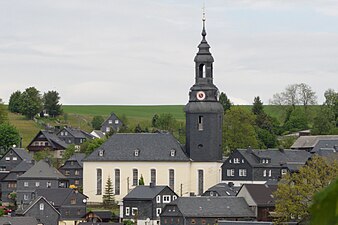
- 1 Bad Lobenstein


 in the Wikidata database") - spa town; New castle with a collection on Russian regional and coin history.
- spa town; New castle with a collection on Russian regional and coin history. - 2 Kaulsdorf - at the entrance to the Thuringian Slate Mountains. It begins below the village Saale valley.
- 3 Lehesten - small town north of the Franconian Forest; Slate quarries, one of them as a technical monument with horse peg.


Bad Lobenstein

Kaulsdorf

Lehesten


- 4 People Mountain - the "city of the seven valleys"; historic city center with half-timbered houses.
- 5 Wurzbach - Small town and resort on the northern edge of the Franconian Forest; Hairpin of the Sormitztalbahn.
- 6 Ziegenrück - very small town (less than 1000 inhabitants) between Hohenwarthe and Bleilochtalsperre.


People Mountain
Wurzbach

Ziegenrück


Other goals
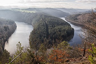
- Lead hole and Hohenwartetalsperre
- Plothen ponds - the Plothener ponds are artificially created by monks.
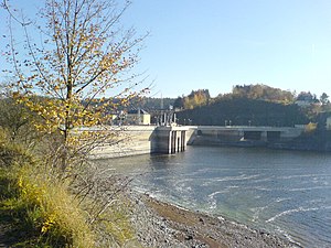
Dam of the Bleilochtalsperre
Hohenwartetalsperre
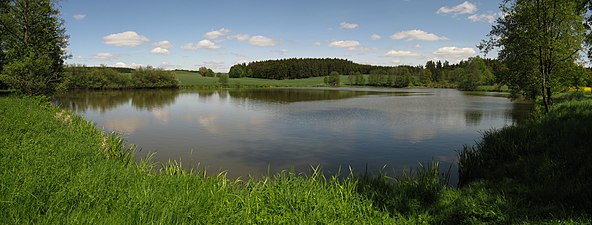
Plothen ponds


background
The Thuringian Slate Mountains / Obere Saale nature park covers an area of 800 km². The district of Saalfeld-Rudolstadt and the Saale-Orla district have a share in it.
getting there
On the eastern edge of the Thuringian Slate Mountains, the motorway runs in a north-south direction ![]() Departures are:
Departures are:
 26 Triptis - B 281 after Neustadt (Orla), Poessneck and Saalfeld.
- 27 Dittersdorf - country roads to Neustadt and Schleiz.
- 28 Schleiz - B 94 after Schleiz, Country road to Bleilochtalsperre.
- 29 Bad Lobenstein - B 90 via Bad Lobenstein in the direction of Saalfeld.
The development with the railroad has been classified as average to inadequate at the latest since operations on the "Oberlandbahn" Triptis – Unterlemnitz (–Lobenstein) were ceased in 1997. The busiest railway line is the double-track and electrified Frankenwaldbahn from Lichtenfels about the eponymous Franconian Forest to Saalfeld. In Hockeroda, a branch line branches off this main line, the Sormitztalbahn, to Bad Lobenstein and Blankenstein. Another important route runs from Gera via Triptis, Neustadt and Pößneck to Saalfeld. Saalfeld is also from the direction Jena and Erfurt connected to the rail network.
mobility
Tourist Attractions
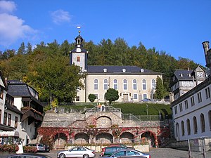
- former residence places of the Princely House of Reuss: Ebersdorf and Bad Lobenstein.
- Saalfeld fairy grottoes
- Burgk Castle on the Saale, not far from Schleiz located.
- Hydroelectric Museum at Ziegenrück
- German Gold Museum in Theuern
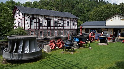
Hydroelectric museum near Ziegenrück
activities
For the cyclist the Saale long-distance cycle path at. Also:
- Winter sports
- hike
kitchen
accommodation
security
climate
trips
- Franconian Forest
- The Saale valley in the north of Saalfeld
- Thuringian Vogtland
- Thuringian Forest