

The antique Via Egnatia led by Durres (Albania) about Thessaloniki (Greece) after Istanbul (Turkey).
background
The Via Egnatia was a Roman road that served as the eastern continuation of the Via Appia between Rome and Istanbul (Constantinople, Byzantium), the two great metropolises of the late ancient Roman Empire.
If you want to move along the Via Egnatia today, you do so mainly because of the impressive landscapes in areas that are not overcrowded by tourists, the typical localities that are not shaped by tourism and, last but not least, to try the different dishes and wines that are there along the over 1000 km to discover. But you don't have to do without bathing pleasures along the way, as they are in Greece Asprovalta, Kavala and Alexandroupolis on the coast with excellent beaches. The Via Egnatia is also part of the Pilgrimage to Jerusalem and the Silk road.
The period between 146 and 120 BC The military road built in BC was named after Gnaeus Egnatius, proconsul of Macedonia. He had commissioned the building. Macedonian royal roads were partially included in the construction. The ancient road ran through the current one Albania, North Macedonia, Greece and Turkey. Starting point was Durres on the Albanian Adriatic. A southern branch started in Apollonia (at today's Fier), which at that time was also an important port city. in the Shkumbin Valley the two branches came together again at first. In the area of the Lake Ohrid there were again two routes, which are not far from Heraclea Lynchestis (today Bitola) met. Then the route went south on Thessaloniki to, from there it went east again to Istanbul.
At the beginning of the imperial era, stations were built along the road at regular intervals, about every 15 km horse changing stations (mutationes) and approximately every 40 km service areas (mansiones), initially mainly for the state postal and courier service. They were later expanded and then used by travelers and traders who then traveled from one rest stop to the next in one day, which consisted of stables and parking spaces, as well as dining and guest rooms. The larger rest stops also included workshops and comfortable rest houses (praetoria) with bathrooms (balnea). In the vicinity of heavily frequented "mansiones", vici (settlements) with other craft businesses and larger bathing facilities, some of which developed into cities that still exist today (Thessaloniki), or went under again (Philippi, Anastasiopolis).
.jpg/220px-The_Via_Egnatia,_Philippi_(7272908636).jpg)

The road was used by the Apostle Paul on his second missionary trip when he was traveling from Philippi to Thessaloniki (Acts 16-17). She also played a crucial role in several important moments in Roman history: the armies of Julius Caesar and Pompey marched along the Via Egnatia during the Civil War of Caesar, and later the legions during the civil war between Mark Antony and Octavian and those of Cassius and Brutus who met for the Battle of Philippi. Milestones found show that Emperor Trajan carried out extensive road repairs before his campaign against the Parthians. In the 5th century AD, however, the road was largely no longer used and maintained due to political instability in the region. A 5th century historian noted that the western parts of the Via Egnatia were in such poor condition that travelers could hardly travel on it, with economic consequences for the towns along the road.
It did not lose its important strategic and economic importance even after the fall of the Roman Empire. The Via Egnatia was also one of the most important roads in Byzantine times. Crusaders and Ottoman conquerors also used this route. The route changed partially in Byzantine times. In later years the Via Egnatia was revived as the key road of the Eastern Roman Empire. Procopius (Prokopios of Caesarea was a late antique Greek or early Byzantine historian of the 6th century AD. He is considered the last great historian of antiquity) reports on repairs made by the Eastern Roman emperor Justinian I from the 6th century, as the road has now fallen into disrepair was practically unusable even in rainy weather. Almost all of the Byzantine overland trade with Western Europe went along the Via Egnatia. During the Crusades, armies traveling east by land followed the road to Constantinople before reaching Asia Minor. This land route also played an important role during the Ottoman period, known as "sol kol" ("left arm", from Constantinople's point of view), with "orta kol" being the "middle arm" Via Militaris is connected to Central Europe via the central parts of the Balkans and "sağ kol", "right arm", the road to Crimea along the Black Sea, which Via Pontica.
Exact maps of the Via Egnatia are not available, as the route has changed over the millennia and its remains were destroyed in the 20th century by land development for agriculture. Further in the Greek part of Thrace, many remains of the Via Egnatia have been uncovered. There the route is known more precisely. Only short sections of the old Via Egnatia have been preserved, especially in Albania and partly in Greece.
preparation
The preparations naturally depend on whether you really want to hike the route, ride a bike or just drive in a motorhome. In Albania and North Macedonia it leads through mountainous landscapes with the typical rapid weather changes and low temperatures, while in Greece and Turkey it runs through flat land, where sun and heat can be a challenge for hikers. Hikers usually walk the route in 2 stages. 1) Durres to Thessaloniki, 2) Thessaloniki to Istanbul. To prepare for a hike, we recommend the travel guide and app of the Via Egnatia Foundation and the Facebook group Via Egnatia (see web links). The European long-distance footpath E6 leads in large parts along the Via Egnatia.
getting there

Flight:The easiest way to get here is via the international airport from Tirana in Albania, 30 km from Durres away, you want to explore the Via Egnatia from west to east. Otherwise the airport of Thessaloniki if you only want to visit the Greek part of the route, or Istanbul for the Turkish part.
Ship:Those who want to travel by car or mobile home can do so by ferry from Italy (Ancona, Bari, Brindisi, Trieste) to Durres.
Driving / hiking / let's go / ...
If you want to travel with a rental car, you should note that almost no rental companies allow you to cross the border into another country!
Albania
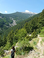
For hikers, the wild mountain landscapes in Albania are a highlight of the entire Via Egnatia. The bad road conditions in Albania are likely to spoil the enjoyment of the landscape a little for the car or motorhome driver. In general, one should be aware that Albania has only enjoyed modest tourism in the last few years, after decades of bitter poverty and almost exclusively on the coasts. Those who are traveling inland often have to make do with less luxurious accommodations and restaurants and expect communication difficulties.


.jpg/400px-The_Via_Egnatia_near_Peqin,_Albania_(38889212724).jpg)
.jpg/400px-The_Via_Egnatia_near_Peqin,_Albania_(39597460551).jpg)


Durres - Peqin
Of Durres (Dyrrachiium) the road ran first along the coast, then inland following the valley of the Shkumbin River to Peqin (Claudiana), where she meets that of Fier (Appolonia) coming branch of the Via Egnatia united.
- 1 Durres
 (Dıraç).

 in der Datenbank Wikidata") (Durrësi; Dyrrachium, Dyrrhachium; Epídamnos) is the most important port city in Albania with a very eventful history due to its strategic location. Today it attracts many tourists. Worth seeing churches, mosques, museums, Roman monuments, such as the amphitheater, city wall and also the beaches, the night life, the shopping possibilities contribute to the attractiveness of the city.
(Durrësi; Dyrrachium, Dyrrhachium; Epídamnos) is the most important port city in Albania with a very eventful history due to its strategic location. Today it attracts many tourists. Worth seeing churches, mosques, museums, Roman monuments, such as the amphitheater, city wall and also the beaches, the night life, the shopping possibilities contribute to the attractiveness of the city.

- 2 Fier.
 a few kilometers east of the modern city of Fier extends the Apollonia Archaeological Park. The beautifully situated archaeological site is Unesco heritage and the most important archaeological site in Albania. So far, only a small part of the entire ancient city has been excavated, dating from the 8th and 7th centuries BC. BC dates. The museum in the nearby church is also well worth seeing.
.jpg/350px-Parku_qendror_qyteti_i_Fierit(Central_park_City_of_Fier).jpg)
- 3 Peqin (Peklin).The city is located in the valley of the Shkumbin River northeast of the Myzeqe plain between Durrës and Elbasan on the main connecting route between these places, both today and in Roman times. Numerous ancient remains have been found a few kilometers east of Peqin. It is believed that there is the ancient Clodiana was where the two branches of the Via Egnatia from Durrës and Apollonia joined. The first written mention of Peqin comes from 1431. Back then as Biklenet referred to, this was a very small place. In the 16th century, the Ottomans built a fortification here to protect the coast and trade routes. As a suburb of the castle, Peqin developed rapidly. In terms of tourism, the place doesn't really have much to offer.

Peqin - Elbasan - Perrenjas
From Peqin, the now unified branches of the Via Egnatia continued to follow Scampis, today's Elbasan and on to Prrenjas to today's limit North Macedonia at the 1 Lake Ohrid![]()
![]()
![]() . Remnants of the ancient road are still partially preserved in the Polis Mountains high above the Shkumbin Valley. Here the road ran for long stretches not in the Shkumbin river valley, but high up on the southern mountain slope. In some places near the Albanian city of Librazhd you can still see or guess the ancient course.
. Remnants of the ancient road are still partially preserved in the Polis Mountains high above the Shkumbin Valley. Here the road ran for long stretches not in the Shkumbin river valley, but high up on the southern mountain slope. In some places near the Albanian city of Librazhd you can still see or guess the ancient course.

- 4 Elbasan.lies in a wide valley at around 150 m above sea level. A. A few kilometers to the east, the Shkumbin River emerges from its rock valley and has enabled productive agriculture here throughout history. In the north and south of the city rise up to 1000 meters and 1800 meters high mountains. Elbasan has a continental climate with warm and dry summers and cold winters with high levels of precipitation. Because of its central traffic location, from north to south and east to west, it is sometimes called Albania's belly button. The castle is right in the center of the city. Only two old walls remain, but the area is filled with old houses, cobblestone streets, and excellent restaurants.

- 2 Polis mountains..In the Polis Mountains on the southern slopes of the Shkumbin Valley, remains of the ancient pavement can still be found. Between Xibraka and Qukës, a hiking trail follows the ancient Via Egnatia. Part of the route has now been developed as a roadway, and part of it is only passable on foot.
- 5 Perrenjas.is the last larger place before the border without tourist interest.

North Macedonia
The western part of North Macedonia is an area of picturesque mountains, lakes, forests and fields that is nestled between the Povardarie region and Albania and is home to most of North Macedonia's attractions.


_in_Struga.JPG/400px-Crn_Drim_(Црн_Дрим,_Drini_i_Zi)_in_Struga.JPG)
.jpg/400px-Struga_-_panoramio_(12).jpg)
.jpg/400px-Lake_Ohrid_(14691988660).jpg)
.jpg/400px-Lake_Ohrid,_Macedonia_(43550221532).jpg)
.jpg/400px-Lake_Ohrid,_Macedonia_(43550134072).jpg)
.jpg/400px-Lake_Ohrid,_Macedonia_(41789358230).jpg)


.jpg/400px-St._Demetrius_Church_(Bitola).jpg)

.jpg/346px-Hajdar_Kadi_Mosque_(Bitola).jpg)

Struga - Ohrid - Bitola
The Via Egnatia ran along Lake Ohrid Radožda and Struga continue after Heraclea Lyncestis near today's Bitola and crossed today's border to the south of it Greece.
- 6 Radožda.Today's main road to the north after the border does not follow Via Egnatia, it went to the village of Radožda, where a piece of the original road can also be seen. The one is still worth seeing here St Mihail Cave Church from the 14th century, built in a natural cave and decorated with frescoes. A little further north are two 2 other churches worth seeing, that 3 St. Atanasie Cave Church and the 4 Kalishta Pechersk Lavra. Both are worth a visit.

- 7 Struga.in ancient times the city was considered Enchalon known. The name Struga was first used in a document in the 11th century, but it dates back to the 7th century. The Byzantine travel writer Ana Komnina visited Struga in the 11th century and called it "City of 100 Bridges". While nearby Ohrid has always been a cultural and religious center, Struga played the role of the region's commercial center. It still is, and a visit to market day and a stroll through the old bazaar can be fun.
.jpg/350px-Aerial_view_of_Struga,_Lake_Ohrid_&_Black_Drin_(7).jpg)
- 8 Ohrid.With ancient churches and balconies adorned with flowers in the old town on the hillside and beach life on the lakeshore, Ohrid is something like the "Macedonian Riviera". It was declared a World Heritage Site by UNESCO in 1980 and is located between mountains up to 2,800 m high and Lake Ohrid and is not only a place of historical importance, but also of exceptional natural beauty. Ohrid is the jewel in North Macedonia. Archaeological finds indicate that Ohrid is one of the oldest settlements in Europe. The city is first mentioned in Greek documents from 353 BC. Mentioned when they were as Lychnidos or "City of Light". It was not renamed Ohrid until 879 AD. The city as we know it today was mainly built between the 7th and 19th centuries. During the Byzantine period, Ohrid became an important cultural and economic center, serving as the episcopal center of the Orthodox Church and as the site of the first Slavic university. At the beginning of the 11th century, Ohrid briefly became the capital of the kingdom ruled by Tsar Samuel, whose fortress still dominates the city today and much more make Ohrid a place that you should definitely visit.

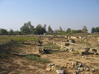
- 9 Bitola.has the atmosphere of an old northern European city, as it was the seat of consuls from many countries in the 19th century. This brought European culture with it and influenced the local aristocracy who lived in European fashion and built their homes in neoclassical style. Bitola is a worthwhile place to visit with its beautiful mix of Ottoman architecture and the romantic architecture of the 19th century. The Pelister National Park is nearby, as is the ancient city of Heraklea. As 5 Heraclea Lyncestis it was an important settlement from the Hellenistic period to the Middle Ages. It was made in the middle of the 4th century BC. Founded by Philip II of Macedonia and named after the Greek demigod Heracles, whom Philip considered his ancestor. As an important strategic point, it became a prosperous city. The Romans conquered this part of Macedonia in 148 BC. And destroyed the political power of the city. The prosperity continued mainly through the Roman Via Egnatia street that passed near the city. Heraclea has several monuments from Roman times, including a portico, thermal baths (baths), an amphitheater and several basilicas, as well as some mosques, churches and especially the Old Bazaar (Стара чаршија). Bitola's old bazaar is the city's historic commercial center. It is north of the Dragor River, across from the clock tower and Magnolia Square. Examples of traditional Turkish architecture can be found in the narrow streets, including important religious and cultural buildings. A visit to the ancient site of Heraclea Lyncestis, which is a little south of the city, is a must.


Greece
The way through Greece leads through Macedonia and Thrace. True, northern Greece is with the exception of Chalkidiki much less touristy than the islands or the south, but much better developed than Albania or North Macedonia, especially along the coast.

.jpg/400px-Ancient_Edessa_(6974724556).jpg)
.jpg/400px-La_cascata_-_panoramio_(2).jpg)


.jpg/400px-Ασπροβάλτα_-_panoramio_(26).jpg)


,_Pangeo,_Greece.jpg/400px-Monastery_Analipsi_(Ιερά_Μονή_Αναλύψεως_του_Κυρίου),_Pangeo,_Greece.jpg)

.jpg/400px-Philippi_(7273015222).jpg)


Florina - Edessa - Thessaloniki
The landscape around Florina is mountainous and only flatter from Edessa onwards. In the further course to the Turkish border, only one more mountain range has to be overcome before Alexandroupolis.
- 10 Florina.Due to the altitude, the weather in Florina is quite unstable throughout the season, especially in winter. It is the city with the most snowfalls in Greece, from December to March. In winter the temperature is mostly below zero degrees Celsius. The city is easy to explore on foot. There are no special sights, but it is worthwhile to walk along the Sakouleva river in summer or to sit in one of the street cafes by the river.

- 11 Edessa.is known for its impressive waterfall, which is one of the "must see" sights on the route. You can even walk under the waterfall, which makes it all the more impressive. Otherwise, the city on the mountain has a lot to offer. The ruins of the ancient city are located in the valley and are also worth seeing, as is the monastery complex right next door. The thermal spa town of Aridea, 30 km to the north, should not be missed. In the outdoor pool there is a warm and a cold waterfall next to each other.

- 6 Pella (Macedonia).had its heyday in ancient times when it was the capital of Macedonia. At that time the most important kings of the country ruled, Philip II and after him his son Alexander the Great. 168 BC Pella was conquered by the Romans, a few years later an earthquake destroyed the city. In the Middle Ages the city was named after the holy apostle Agii Apostoli. Since 1926 the place bears the name Pella again, and this emblematic name also bears the political region. The site is not very impressive, but because of its history it is one of the "must see" places. The very famous and impressive site is located 60 km southwest of Pella Vergina. It is worth deviating from the route from the direct route to Thessaloniki.

- 12 Thessaloniki.is the second largest city in Greece. The city is the cultural center and capital of the region Macedonia. Thessaloniki also has a lot to offer in terms of sights. Its buildings from early Christian and Byzantine times have been a UNESCO World Heritage Site since 1988. You should plan at least 2 nights here, as in addition to the culture and the many shopping opportunities there is also a very lively nightlife. Located southeast of Thessaloniki Chalkidiki, one of the main tourist centers in Greece with countless beautiful beaches in a particularly beautiful landscape and also the monastic republic Athos. Anyone interested in the worldwide unique spiritual life of the monks and the exceptionally beautiful monastery complexes can apply for a visa in Thessaloniki. However, entry is forbidden for women.

Thessaloniki - Amphipolis - Philippi - Kavala
The following stretch of the Via Egnatia led through scenic, partly mountainous areas, south along the lakes Koronia and Volvi until it came to Asprovalta, a popular seaside resort, ran back along the sea to Amhipolis. From Amphipolis the route led north along the Roman times Pangeo-Mountain massifs to Philippi. In Byzantine times, the southern bypass of the Pangeon was preferred, which is where the motorway runs today. At that time Philippi was no longer necessarily the goal, but directly Kavala.
- 7 Asprovalta castle ruins. The fortress was most likely a station on Via Egnatia called Pennana. The station must have been used long after the Romans, possibly long after the Ottoman conquest.
- 8 Amphipolis (Amfipolis). The formerly important city was founded as an Athenian colony in 438/437 BC. BC because of its strategic location, near the fertile Strymon Valley and the Pangeo gold mines. The numerous finds from the excavations are in the Archaeological Museum of Amfipolis and the Archaeological Museum of Kavala. As in most archaeological sites, former temples were built over with churches, so that you can see mostly the foundation walls of basilicas on the excavation field. In the immediate vicinity there are still several ruins of towers from Byzantine times. Before reaching Amphipolis, there is the Lion of Amphipolis, a very beautiful grave monument from the 4th century BC. BC that in honor of the Admiral Laomedon, who came from the island of Lesbos, was built.

- 9 Pangeo.At almost 2000 m, the Pangeon mountain range is the highest mountain near Kavala, with picturesque mountain villages, a multitude of picturesque monasteries that are well worth seeing and impressive vegetation. At the foot, the vegetation begins with the typical Mediterranean maquis (low, stunted hard-leaved plants) and then slowly, with increasing height, turns into a dense deciduous forest and further above finally into a coniferous forest and then reaches the tree line. From then on only grasses and herbaceous plants grow (including the Greek mountain tea).

- 10 Philippi.The archaeological site of Philippi is the most important archaeological site in Northern Greece with characteristic monuments of the Hellenistic, Roman and early Christian times. Their story began in 360/359 B.C. when colonists from the island of Thasos founded the city. In addition to its important role as a station on the Via Egnatia, it became known through the apostle Paul, who wrote the letters of the Philippians from the Bible here while he was in prison. The first Christian congregation arose in Philippi and the first Christian baptism in Europe was carried out here by the Apostle Paul.


- 13 Kavala. is one of the most beautiful cities in Greece with a picturesque old town, a castle, an aqueduct, the harbor and the marina, the promenade with many cafes and restaurants and also beautiful beaches. Before Kavala are the best preserved pieces of Via Egnatia in Greece.

Kavala - Anastasiopolis - Mosynopolis - Mesimvria - Traianoupolis
The route goes through plains to Alexandroupolis, where you have to cross a chain of hills.
- 11 Akontisma (Akondisma)..From Kavala the route leads along the coast to the place Nea Karvali, at the end of which the Akontisma station was located. The ruins of the old castle have been preserved. Founded in the 6th century BC. on the site of today's very attractive hotel village as a colony of Thasos and Paros because of their interest in precious metals from the hinterland and as a distribution center for goods from the islands, such as honey, olives, fish, wine, cheese, pottery, wood products. Later it became a military base for the Macedonian kings and Romans. Due to its location on Via Egnatia, Akondisma gained importance as a trading center. With the decline of overland trade in favor of sea trade, Akondisma also lost its importance and continued to exist as an agricultural settlement. During the Ottoman period (from 1350 AD) and the establishment of a resting place for traders from and to Istanbul, the place recovered until it was finally completely destroyed by bombing in the First World War. Today there is a very attractive hotel complex in the style of an old village below the former fortress walls. As the facility is located directly on the main road, a short tour is worthwhile. You go uphill through the hotel complex, past a chapel and follow the path to the hill. Only the remains of a fortress wall can be seen here, but the view makes up for the short walk.

- 12 Petropigi. After another 10 km past the ruins of the ancient city Pistyros (please refer Nestos) one reached the next station, Petropigi, which was still in ruins. This fortified station on Via Egnatia dates from the late Byzantine period (13th-14th centuries) with some changes from the early Turkish period, when it was used as a 'caravanseray' up to around the 16th century. Some of the fortress walls have been preserved. The inside of the castle ruins is completely overgrown with bushes.
- 13 Lithohori station. The remains of the horse changing station from Roman times were discovered during the construction of the motorway. The excavation is covered. You cannot enter it, but you can take a look.
- 14 Topiros. After another 20 km past the nature reserve Nestos one reaches Topiros. The current municipality of Topeiros owes its name to a town that existed during the Roman era on the Via Egnatia, in the same area where the municipality is located today. Few remnants of the ancient city of Topeiros with ruins from Byzantine times are somewhat hidden and overgrown by vegetation are between the main road and the Nestos river. Topiros was founded in the 1st century AD as a station on the Roman Via Egnatias. The city had its own coins, which testifies to its wealth and importance. With the division of the Roman Empire into East and West, Topeiros belonged to the Eastern Empire and forms its western border. In 549 AD, the city was conquered by the Slavs, who completely destroyed it. Two years later, Justinian I rebuilt it and surrounded it with stronger walls. It was finally destroyed in 812 by the Bulgarian Tsar "Croumo".

_at_Lithohori,_Kavala_2.jpg/350px-Roman_horse_changing_stations_(mutationes)_at_Lithohori,_Kavala_2.jpg)
- 15 Abdera.was south of the Via Egnatia, but was connected to it as a port. It was an important ancient Thracian port city and home to the philosophers Democritus and Protagoras. But it lost its importance in the late Roman times. The city was on the important shipping route to the Black Sea: The Roman Empire obtained part of its grain from what is now Ukraine. On the other hand, the Thracian hinterland contributed to the prosperity of the colonists and the city of Abdera with fertile arable and pasture land, rich forest in the valleys of the Nestos and its tributaries, waters rich in fish and precious metal deposits in the mountains. Today there are some must-see ruins and an archaeological museum in the modern village of Avdira. Right next to the excavation site on the hill are the ruins of a Byzantine castle. In addition, the nearby beaches are among the best in the region.
- 16 Anastasiopolis.(Peritherion): About 30 km further to the east, past the very worth seeing Nestos-Canyon and the beautiful city Xanthi one reaches Anastasiopolis. Today the impressive ruins lie in a forest overgrown by vegetation. A "lost place" that is not easy to find, but definitely worth a visit for that very reason. There is a "must see" monastery near the sea Porto Lagos (please refer Xanthi). If you follow the road in the direction of Komotini, you will pass recently uncovered sections of the Via Egnatia near Iasmos.

- 17 Mosynopolis.(Μοσυνόπολις, Maximianopolis, Mosinopol) 20 km further east was another well-known station, Maximianopolis, just before the city, which is well worth seeing Komotini. The ruins of a Byzantine city, in which the Via Egnatia and a junction to the north to the fortress and Stanimaka Via Militaris are an archaeological site located 7 kilometers west of Komotini south of the village of Miskos. In the area was the ancient city of Paxoula. The ruins of a temple from the 11th to 13th centuries, part of the wall, a tomb of Maximianopolis and early Christian tombs of Mosynopolis have been excavated in the archaeological site. Finds from archaeological excavations are kept in the Archaeological Museum of Komotini.


In the further course of Via Egnatia in an easterly direction from Komotini there are no known stations (only at 19 Mesti a piece of the old road was found and uncovered), only again in a southerly direction on the coast are further stations found.
- 20 Mesimvria..was a colony of the inhabitants of the island of Samothraki, built at the end of the 7th century BC. The city flourished in the 5th and 4th centuries BC. BC, but began to lose importance during the time of Macedonian and later Roman rule, as the construction of roads in the hinterland reduced the importance of the coastal city. The remains of the fortress wall with the towers, private houses, a road network, public buildings, a sanctuary of Demeter and a temple of Apollo were found on the excavation site. The most important monuments of the excavation site are: The Sanctuary of Demeter. Inside the building, silver, gold, silver-plated and gilded panels with relief representations were found, all of which were associated with the Demeter cult. Dated to the 4th century BC. The archaic temple of Apollo. It was part of a larger building complex (35 x 45 m) with a central paved courtyard surrounded by a stoa. Many ceramic fragments with incised inscriptions were found inside the temple from the 6th and 5th centuries BC. Found.

- 21 Traianoupoli.Further east along the very beautiful coast, past the port city Alexandroupolis the last known station in Greece is Traianopolis. The city was founded by the Roman emperor Trajan (r. 98–117) and was famous for its baths in Roman times. In the 4th century it became the capital and metropolis of the Thracian Roman province of Rhodope. Despite its eventful history, the city remained the metropolis of the ecclesiastical province of Rhodope until its decline in the 14th century. The area was destroyed by Bulgarian raids in 1322 and by Turkish troops in 1329/30. You can see ruins of former bathing facilities and parts of the city wall. You can combine a tour with a visit to the modern baths, because the place is still a health resort today. About 1.5 km after the entrance to Traianopolis to the east, a piece of Via Egnatia was exposed, directly parallel to the main road. The old road crossed the Hebrus (now Evros / Meriç), perhaps the most important river on the route, probably on an artificial ford in the village of Taşlısavak (Turkish for "paved sluice"). Remnants of the intersection are reportedly still on the site. However, this is a restricted military area as it is on the border of the two countries. The modern E90 motorway crosses the river on a half Greek, half Turkish bridge about 12 km upstream (north).

Turkey
As with many other Roman roads in the country, Via Egnatia (or at least parts of it) remained in operation well into the 1960s when a new nationwide network of motorways was built and the old roads were removed. It is believed that the Turkish part of the route from İpsala via the Marmara region to Tekirdag and then along the coast to Istanbul. Because of the enormous construction activity along the entire Marmara region, especially on the coast, there are hardly any witnesses to the Via Egnatia and its former stations. A lot here, regardless of the history, must have been built over. The name of some stations is known, but not the exact location, so that you cannot visit them either. The entire coastal region is strongly characterized by tourism and on weekends with a lot of traffic from the weekend vacationers from Istanbul.

.jpg/400px-Enez_Kalesi_-_panoramio_(26).jpg)


- 14 Ipsala.(6,000 inhabitants) is located east of the border crossing between Turkey and Greece. The lowlands around the city, abundantly irrigated by the Meriç River, produce about half of Turkey's total rice production. In the vicinity of Ipsala was Kypsela (Cypsela, Kypsela, Κυψέλα Κύψελα), an ancient Greek city on the Hebrus River in ancient Thrace, which was once an important place on the Via Egnatia and of which nothing can be seen today.
- 15 Edirne (Adrianople).

 About 30 km north of Ipsala is Edirne, a "must see" city that is particularly known for its famous mosque. It was not on Via Egnatia, but it was connected to it. Edirne was the main hub to the equally important Via Militaris, which connected Constantinople to Singidunum, the modern Serbian capital Belgrade, and further to Central Europe. There is also evidence that in earlier stages the road may follow the Evro Valley north to Adrianople and then south-east to the Marmara Coast in Perinthus. The area around Edirne is one of the most fiercely contested places in Europe thanks to its strategic location on the main roads towards Istanbul, the Bosporus and on to Asia. There have been no fewer than 16 major battles and sieges in this area since the days of ancient Greece. Edirne's previous name is Adrianople (Hadrianopolis), d. H. "City of Hadrian", named after the Roman emperor who founded the city on the site of the Thracian village of Uskudama.

- 16 Enez.is a small town on the Aegean Sea, near the Maritsa / Evros River (Meriç in Turkish, Evros in Greek), which flows into the sea here. Her old name was Ainos or Aenus. Because of its strategic location, it has had a very eventful history. Ainos is already mentioned in Homer and Herodotus. Der Ort wurde als eine aiolische Kolonie von Mytilene und Kyme im 7. Jahrhundert v. Chr. gegründet. Die Stadt wurde durch Handel und Landwirtschaft wohlhabend und zahlte als Mitglied des 1. Attisch-delischen Seebundes hohe Abgaben. Ainos kämpfte im Peloponnesischen Krieg auf der Seite Athens und wurde 375 v. Chr. Mitglied im 2. Attischen Seebund. Von 341 bis 185 v. Chr. gehörte Ainos zum Reich der Attaliden von Pergamon, die Ainos mit ihrem ganzen Reich den Römern vererbten. In der Spätantike war der Ort Bischofssitz und Hauptstadt der kleinen Provinz Rhodope. Kaiser Justinian I. ließ die Mauern der Stadt zu einer Festung ausbauen. An Stelle der antiken Akropolis steht eine mittelalterliche Burg der genuesischen Familie der Gattilusio, die die Stadt von 1376 bis zur Besetzung durch den osmanischen Sultan Mehmed II. im Jahr 1456 als Genueser Kolonie beherrschte. Die Ruinen der Burg und eine kurze Strecke einer Römerstraße, die freigelegt wurde, sind heute eine Attraktion der Stadt. Sie lag nicht direkt an der Via Egnatia, war aber eng mit dieser als einer der wichtigsten Hafenstädte der Region verbunden, bis seine Bucht von der Mariza verschlammt wurde und so der Hafen seine Funktion verlor.
- 22 Aprus (Apros).oder Apros, Apri, Aproi, war eine Stadt des antiken Thrakien und später eine römische Stadt an der Via Egnatia. Die Stadt wurde Mitte des 1. Jahrhunderts n. Chr. als Colonia Claudia Aprensis, wahrscheinlich im Zuge der Annexion Thrakiens unter Kaisers Claudius neu gegründet und war für pensionierte Angehörige des römischen Militärs gedacht. Im 4. Jahrhundert war Aprus die Hauptstadt der Region südwestlich von Heraclea, der Hauptstadt der Provinz. Die Stadt wurde in Theodosiopolis' umbenannt zu Ehren von Theodosius II., Kaiser von 401 bis 450, oder von Theodosius I (347–395). Nach der Einnahme von Konstantinopel während des Vierten Kreuzzugs machte das lateinische Imperium Theodore Branas (von Geoffroi de Villehardouin Li Vernas genannt) zum Herrscher von Aprus. Im Jahr 1206 zerstörte der Zar Kaloyan aus Bulgarien die Stadt, Branas baute sie jedoch wieder auf. In der Schlacht bei Apros im Juli 1305 vernichtete die katalanische Kompanie die byzantinische kaiserliche Armee unter Michael IX Palaiologos. Zu sehen ist heute nichts mehr davon, abgesehen von einigen spärlichen Festungsruinen in der Nähe des modernen Dorfes Kermeyan. Einige Funde sind im archäologischen Museum des nahe gelegenen Tekirdağ ausgestellt. Die moderne Autobahn umgeht das Dorf mehrere Kilometer südlich.
- 17 Tekirdag (Tekirdağ).

 wurde zuerst von Thrakern als "Byzanthe" gegründet. Der erste Standort von Byzanthe war das heutige Barbaros, ein Dorf 9 km südwestlich von Tekirdağ. Es wurde dann von Griechen von der ägäischen Insel Samos besiedelt. Nach der Spaltung des römischen Reiches in zwei Teile blieb Tekirdağ in byzantinischer Hand und im 14. Jahrhundert von osmanischen Türken erobert, die der Stadt den Namen "Rodosçuk" gaben. Der Name wurde mehrfach geändert und erst seit 1927 bekam die Stadt ihren heutigen Namen. Sie ist heute eine moderne Stadt mit einer schönen weitläufigen Uferpromenade, aber ohne herausragende Sehenswürdigkeiten. Die Gegend ist für ihren Weinanbau bekannt und einige Weingüter lohnen den Besuch.

- 23 Perinthus.Marmara Ereğlisi ist eine Küstenstadt 40 km östlich von Tekirdağ an der Autobahn nach Istanbul. Dies ist der Ort des antiken Perinthos, einer weiteren Station entlang der Via Egnatia. Perinthos, wohl eine thrakische Siedlung, wurde 654 v. Chr. oder 599 v. Chr. von Samos aus kolonisiert und später in Herakleia umbenannt. Die antike Stadt kann in kleinen Teilen heute noch besichtigt werden. Am Marktplatz in der Unterstadt befindet sich ein Freiluftmuseum mit Fundstücken darunter ein paar original Meilensteine der Egnatia. In der Stadt gibt es Ausgrabungen mit Mosaiken. Auf dem Hügel der ehemaligen Akropolis finden sich noch nicht ausgegrabene antike Bauwerke und Säulen. Weitere Fundstücke kann man im Museum von Tekirdağ besichtigen.

- 24 Silivri.das antike griechische Selymbria or Selybria, verdankte seine historische Bedeutung dem natürlichen Hafen und der Lage an den wichtigsten Handelsstraßen. Heute ist de Ort ein Vorort von Istanbul. In Silivri begann die byzantinische Mauer des Anastasios I. (491–518 n. Chr.), die äußerste Verteidigungslinie von Konstantinopel, die die gesamte Halbinsel überquerte und an deren Ende sich das Schwarze Meer befand. Teile der Mauer sind erhalten. Die in Silivri vor dem Ersten Weltkrieg noch sichtbaren Reste der byzantinischen Bischofskirche von Selymbria, sind inzwischen abgetragen worden und verschwunden. Nur eine antike unterirdische Zisterne unter der Kirche existiert immer noch und für Besuche geöffnet ist.

- 25 Caenophrurium.Im alten ursprünglichem Verlauf der Route ging es landeinwärts nach Heraclea Perinthus in Richtung Caenophrurium, einer römische Siedlung zwischen Byzantium und Heraclea Perinthus. Es erscheint in spätrömischen und frühen byzantinischen Berichten. Caenophrurium wird als "Hochburg der Caeni", einem thrakischen Stamm, übersetzt. Berühmtheit erlangte es durch den Mord im Jahr 275 AD an Kaiser Aurelian (Lucius Domitius Aurelianus, römischer Kaiser von 270 bis 275 AD). Inmitten seiner Planungen für einen Feldzug gegen die Sassaniden in der Nähe von Caenophrurium in Thrakien wurde er erstochen. Als Hintermann für die Tat ist sein Privatsekretär Eros überliefert, der angeblich wegen der aurelianischen Korruptionsbekämpfung keinen anderen Ausweg mehr sah. Hier überquerte die Route ein Tor der anastasischen Mauer, von der einige gut erhaltene Abschnitte im Wald im Norden zu sehen sind. Die genaue Lage ist nicht wirklich bekannt. Man vermutet sie bei Sinekli und Kurfallı, zwei modernen Dörfern in der Nähe, die als wahrscheinliche Standorte angesehen werden. Es gibt keine (bekannten) Überreste zu besichtigen.
- 26 Melantias.(Melantiada, Melentiana, Melitias oder Melitiada) war eine Siedlung an der Via Egnatia in römischer und byzantinischer Zeit in der Nähe der Stadt Konstantinopel. Das Dorf lag an der Straße zwischen Athyra (heute Büyükçekmece) und Rhegion (heute Küçükçekmece) einer weiteren Station an der Via Egnatia. Es gibt keine Überreste zu sehen, da sich heute hier der dicht bebaute Vorort Yarımburgaz von Istanbul befindet. Die Yarımburgaz-Höhle, die älteste Siedlung (aus der Altsteinzeit) im Großraum Istanbul, befindet sich in der Nähe und ist einen Besuch wert.
- 27 Hebdomon (Bakırköy).Wörtlich "siebte", wie es auf der siebten Meile von Konstantinopel war, war Hebdomon die erste größere Siedlung auf der Route in Richtung Westen. Mit Ausnahme einer Zisterne aus byzantinischer Zeit mit dem Namen "Fil Damı" gibt es keine Überreste, da es sich heute um den ziemlich geschäftigen Vorort von Istanbul Bakırköy handelt.
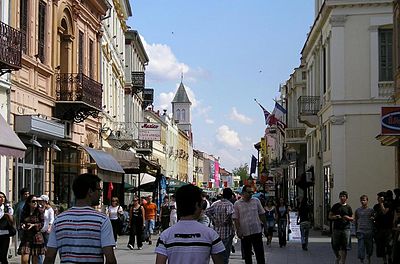
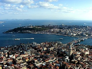
- 18 Istanbul.Endpunkt der Via Egnatia und das Highlight aller Städte entlang der Route. Nur für eine Besichtigung der wichtigsten Sehenswürdigkeiten muß man schon mehrere Tage einplanen.
security
siehe entsprechende Länderartikel; Albania, North Macedonia, Greece, Turkey
trips


.jpg/400px-Скрково,_Муса_и_Голема_Грива_на_Баба_(Пелистер).jpg)


_(8709942456).jpg/400px-Troy_(and_a_trojan_horse)_(8709942456).jpg)
Etwas Abseits der Route der Via Egnatia liegen einige sehr bekannte Sehenswürdigkeiten oder Landschaften
Albanien:
- 19 Gjirokastër.Eine weitere UNESCO-Stadt im Süden ist für seine einzigartige osmanische Architektur bekannt. Auf dem Hügel in der Mitte der Stadt befindet sich eine große Burg, die seit Generationen als Gefängnis diente. Im Inneren befinden sich jetzt ein Militärmuseum und eine Kunstgalerie. Gjirokastër ist auch der Geburtsort des ehemaligen kommunistischen Führers Enver Hoxha sowie des international bekanntesten Autors Albaniens, Ismail Kadare. Ihre Häuser dienen heute als Museen.

- 20 Berat.Sie gilt als eine der ältesten Städte Albaniens und ist ein neues Mitglied der UNESCO-Liste des Weltkulturerbes. Berat ist wegen seiner einzigartigen osmanisch-albanischen Architektur seit langem als "Stadt der 1001 Fenster" bekannt. Es hat eine gut erhaltene Burg, in der die Bewohner noch immer in den Schutzmauern leben.

- 1 Shebenik-Jabllanicë National Park.Es ist einer der neuesten Nationalparks Albaniens und wurde 2008 gegründet. Der Park befindet sich im nordöstlichen Teil des Distrikts Librazhd und verläuft entlang der Grenze zu Nordmakedonien.Das Gelände des Parks besteht hauptsächlich aus Gebirgsvorland, die zu Bergen führen, die über 2.200 Meter hoch sind. Der Park beherbergt eine Reihe seltener und endemischer Pflanzen- und Tierarten. Buche, Eiche, Tanne und andere Kiefern dominieren die bewaldeten Teile des Parks. Es gibt auch eine Reihe von Wiesen und Weiden. Der Braunbär, der graue Wolf und die eurasische Luchs sind hier beheimatet. Die meisten Straßen rund um das Parkgelände sind unbefestigte Straßen, einige erfordern einen Allradantrieb. Weiterhin gibt es 4 markierte Wanderwege, die den Park durchqueren. Karten für die Wanderwege im Park erhält man kostenlos beim Infopunkt in Fushe Studen oder bei der Forstdirektion Librazhd in der Nähe des Bahnhofs.

Nordmazedonien:
- 2 Galičica National Park.Schöner Gebirgspark zwischen dem Ohrid und Prespa Seen.
- 3 Mavrovo National Park.:Touristisch wird der Nationalpark zum Wandern, Radfahren und Skifahren genutzt; es gibt Hotels, Ferienhäuser und Skilifte. Wanderwege sind nur vereinzelt markiert. Sehenswert sind unter anderem der Wasserfall Duf nahe Bituše, das Dorf Galičnik sowie das Kloster Jovan Bigorski.
- 4 Pelister National Park.:Der gebirgige Park ist eines der führenden touristischen Gebiete des Landes und ein bekanntes Skigebiet. Von Berg Pelister aus kann man das Pelagonia-Tal, den Prespasee, die Berge Nidže, Galičica, Jakupica und die Stadt Bitola sehen. Der Pelister ist einer der südlichsten Berge des Balkans, der einen alpinen Charakter hat und auch bekannt für seine zwei Bergseen, die Pelister's Eyes genannt werden. Der Große See liegt 2.218 Meter über dem Meeresspiegel, während der Kleine See 2.180 Meter hoch ist. Hier entspringen viele Flüsse.
- 21 Brajčino.malerisches Dorf in den Bergen, direkt am östlichen Ufer des Prespasees.


Greece:


- 30 Chalkidiki.Ein Haupttouristenziel in Griechenland wegen schöner Strände und beeindruckender Landschaft.


- 5 Rhodope Mountains.Dünn besiedelte Gebirgslandschaft mit erstaunlichen Naturphänomenen und viele Kultstätten der antiken Thraker.
- 6 Nestos (Nestos Delta National Park and Vistonida-Ismarida Lakes)..Flußlandschaft von außergewöhnlicher Schönheit und großem Vogelreichtum, vor allem zur Zeit der Vogelwanderung.
- 7 Dadia-Lefkimi-Soufli Forest National Park (Dadia Lefkimi Souflion National Park). Es ist eines der ersten Gebiete in Griechenland, das als geschützt deklariert wurde, da hier viele Arten von Flora und Fauna aus Europa und in Asien nebeneinander existieren. Das Landschaftsmosaik aus Kiefern- und Eichenwäldern, unterbrochen von Lichtungen, Weiden und Feldern, ist der ideale Lebensraum für Greifvögel. Der Nationalpark beherbergt drei der vier Geierarten Europas (den Schwarzen Geier, den Gänsegeier und den ägyptischen Geier), während hier die einzige Brutpopulation schwarzer Geier auf dem Balkan beheimatet ist.


Türkei:
.jpg/320px-Walls_of_Troy_(2).jpg)
literature
- Auf den Spuren der antiken VIA EGNATIA - Vom Weströmischen ins Oströmische Reich: Ein historischer Reiseführer durch den südlichen Balkan: Albanien – Mazedonien – Griechenland – Türkei (Deutsch), A.Gutsche, 2015
- Via Egnatia on Foot - a journey into history, Attekum & de Bruin, Part I from Durrës to Thessaloniki, 2017, Via Egnatia Foundation