
The Via Militaris or Via diagonalis was an ancient Roman road link from Italy on the Balkans to Istanbul (Byzantium).
background

The Via Militaris or Via diagonalis was an ancient Roman road link from Italy via the Balkans to Asia Minor and the Middle East. For almost four centuries it was one of the most important military axes that held the Roman Empire together and was used for the rapid relocation of the Roman legions. From 1600 the Via Militaris was also called Via Traiana designated. It was created at the time of Emperor Nero (37–68) and Emperor Trajan. (53–117) in addition to Via Egnatia, the forerunner of the Via Militaris. However, the Via Egnatia, which was connected to the Via Appia after a ferry connection between Egnatia in Apulia and Dyrrachium (today Durrës in Albania), represented a more direct and shorter connection between Rome and Byzantium than the Via Militaris. However, the ferry connection did not allow the rapid transfer of large units with heavy equipment and their entourage.
It was a long time Via Militaris the only mainland route between Orient and Occident. During the crusades, the Ottoman sieges of Vienna, the raids of the Huns and Avars, as well as the migrations of the Goths and Slavs, it played a role in world history.
In the 3rd and 4th centuries there were 31 fortified places and 43 stations (mansio) along the 670 Roman miles (= 993 km from Belgrade) long Via Militaris. Usually one traveled from mansio to mansio, so their distance was roughly a “day's journey”. There were also fortresses (castellum) or individual towers (turres) on military roads, numerous horse changing stations (mutatio), where horses and wagons were changed during the day, and inns (taberna) in many places.
With the division of the empire in 395, the imperial residence was created in Constantinople and after the collapse of the Roman Empire in the course of the Great Migration, Constantinople remained as the only capital of the empire reduced to its eastern half, which is now also known as the Byzantine Empire. With the relocation of the capital of the Roman Empire to Constantinople, the geostrategic importance of the Balkans and its military roads also increased. It now moved to the center of the empire "shifted" to the east and became the hinterland of the new center. The Balkans became vital as a defensive zone for the Byzantine Empire, especially against the frequent barbarian incursions into the Balkans in the 4th to 7th centuries.
Even in the Middle Ages, the Via Militaris remained an important east-west connection and was used by the crusader armies who advanced overland towards Palestine. [17] In the first (1096-1099), second (1147-1149) and third crusade (1189-1192), the crusader armies marched along the Via Militaris.
After the conquest of Constantinople in 1453, the Via Militaris continued to be used by the Ottomans as the "Great Military Road". The Ottomans built forts (palanka) to protect the military roads.
Today is the Via Militaris expired and can only be identified precisely in a few places. Nevertheless, it is still worth driving along the former Roman road today, as it leads past many spectacular nature reserves and the most interesting cities in the Balkans. As part of a Balkans- Round trip you can either use the Via Egnatia take the return route through Greece and Albania, or along the Via Pontica and Via Istrum along the Black Sea and the Danube. Interestingly, the route of the Via Militaris largely corresponds to the route of the former Simplon Orient Expresswho also drove from Paris via Trieste, Ljubljana, Zagreb, Belgrade and Sofia to Istanbul. Also part of the Pligeroute from Jerusalem way is equal.
preparation
Because of the many border crossings, it is important to find out about customs and traffic regulations in advance if you are traveling with your own vehicle. A few basic knowledge of the Cyrillic script makes a lot of things easier on site, since not all signs are always available in Latin script, especially away from the main roads.
getting there
- Car / mobile home: It is recommended to drive this tour with your own car. Because of the many border crossings, it is very problematic with a rental car, as few landlords allow border crossings.
- Bus / train: Alternatively, you can take the train to the capital cities and from there drive a rental car to the nature parks outside. Easily accessible by train from German-speaking countries (especially Austria) are z. B. Trieste (3 hours from Villach; 7–8 hours from Vienna or Munich) and Ljubljana (1:40 hours from Villach; 3½ hours from Graz; a good 6 hours from Vienna or Munich). From Munich you can also take the night train to Ljubljana or Zagreb drive.
Drive / let's go / ...


.jpg/400px-Beograd_2013_-_panoramio_(34).jpg)

.jpg/400px-Viminacium,_Moesia_Superior,_Serbia_(42035096342).jpg)


.JPG/400px-BurmalıCamiEdirne_(3).JPG)
.JPG/400px-AliPaşaÇarşısıEdirne_(2).JPG)


Today's route along the Via Militaris from Trieste to Istanbul is approx. 1600 km long and leads through diverse landscapes, countries and cities. It is precisely this diversity of cultures over a relatively short distance that makes the trip a special experience. For the way back one can then take the path along the likewise culturally rich Via Egnatia choose.
Italy
The Via Militaris begins "officially" in Belgrade and branched out from there in different directions. Roman troops and traders from the heartland around Rome had to choose the route shown here.
- 1 Trieste


 in the Wikidata database") (in the ancient Tergeste - Trieste is a good starting point for the journey along the Via Militaris. The flourishing port city belonged to the Austrian Habsburg monarchy for centuries. This is reflected in the typical Austro-Hungarian architecture and a rich cultural heritage at the intersection of the Mediterranean, Italian and Slavic (Slovenian / Croatian) as well as the German-Austrian cultural area.
(in the ancient Tergeste - Trieste is a good starting point for the journey along the Via Militaris. The flourishing port city belonged to the Austrian Habsburg monarchy for centuries. This is reflected in the typical Austro-Hungarian architecture and a rich cultural heritage at the intersection of the Mediterranean, Italian and Slavic (Slovenian / Croatian) as well as the German-Austrian cultural area.
.jpg/350px-Trieste_(28766391880).jpg)
You can continue your journey from Trieste to Ljubljana with the express bus (journey time 1:40 hours) or with a slow train (a good 2½ hours). The latter also stops in Divača (on the edge of the Škocjan Caves Nature Park) and Postojna on the way.
Slovenia
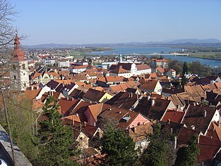
The way through Slovenia is comparatively short (230 km). Ljubljana is worth a stay here and also the very impressive ones Skocjan Caves, a UNESCO World Heritage Site, and the Caves of Postojna. Part of the route is identical to that Amber Road.
- 2 Ljubljana (the ancient Emona) - The university city of Ljubljana is the capital and largest city of Slovenia. Ljubljana has a beautiful old town on the banks of the Ljubljanica river, lined with numerous cafes with outdoor terraces, many green spaces and numerous museums.

From Ljubljana to Zagreb there is a direct train connection several times a day (travel time approx. 2:20 hours).
Croatia
The route through Croatia is approx. 300 km long and leads through unspectacular landscapes, partly along the border Bosnia and Herzegovina. Visiting Zagreb is the highlight of the route.
- 3 Zagreb - Zagreb impresses with its Austro-Hungarian architecture from the 18th and 19th centuries. In the upper town are the Gothic cathedral of Zagreb with two towers and the St. Mark's Church from the 13th century with a colorful tiled roof. The pedestrian zone Tkalčićeva with its many cozy street cafes is nearby. In the lower town, it is worth visiting the main square, Ban Jelačić, as well as the shops, museums and parks.
- 4 Sisak
 - was here in Roman times Siscia, one of the largest and most important cities in the province of Pannonia.


There is a train connection from Zagreb to Belgrade (one train during the day, one at night; travel time 6½ hours). The trains also stop in Sremska Mitrovica, but not in Sisak.
Serbia
The route along the "Autoput" over 5 Sremska Mitrovica![]()
![]()
![]()
![]() , the ancient Sirmium (Administrative center of the Roman province of Pannonia) offers few interesting landscapes. But if you leave the autobahn, you get to some interesting nature reserves (see excursions). The numerous branches off the main route are also of tourist interest.
, the ancient Sirmium (Administrative center of the Roman province of Pannonia) offers few interesting landscapes. But if you leave the autobahn, you get to some interesting nature reserves (see excursions). The numerous branches off the main route are also of tourist interest.

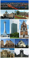
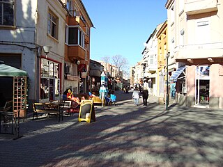
- 6 Belgrade., the ancient Singidunum was a legion camp and, strictly speaking, the Via Militaris does not begin until Singidunum. Taurunum, today a suburb of Belgrade (Zemun) was a station in front of Singidunum, from which no remains are preserved. The city's landmark is the imposing fortress at the confluence of the Danube and Sava rivers. The fortress clearly shows the strategic importance the city had for the Roman, Byzantine, Ottoman, Serbian and Austrian empires.
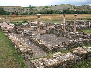
- 7 Požarevac (Roman: Viminatium) - one of the best preserved Roman cities and legionary camps, sometimes referred to as the “Pompeii of Serbia”. The mausoleum of the Roman emperor Hostilian is also located in the former urban area. Viminatium occupies an important and exceptional position in the family of archaeological sites from the Roman Empire, namely it is not only one of the largest and best preserved Roman cities, but also the only legionary camp and Roman city next to Carnuntum in Austria that is not under a modern city. There is also a on his field Mammoth Park.
- 8 Niš (Roman: Naissus) - worth seeing city with many testimonies from the Roman period.


From Belgrade there is a daily train connection via Niš to Sofia (travel time Belgrade – Niš 4½ hours, Niš – Sofia 5½ hours).
Bulgaria.png/40px-Flag_of_Bulgaria_(bordered).png)

The route along the motorway is quite monotonous. It is therefore advisable to go on excursions. Plovdiv is relatively central to some of the really impressive sights in the city Rhodope Mountains to explore or head south to the beaches of northern Greece if you want to avoid Turkey.
- 9 Sofia.(Serdica) - The capital of the country is definitely worth seeing. The Aleksander Nevski Cathedral is one of the most famous buildings.
.jpg/301px-Russian_church_(37591925970).jpg)
- 10 Plovdiv.(Philippopolis) - is the second largest city in Bulgaria and has a picturesque old town with remains from ancient times. It is also a good location to see some of the best attractions in the world Rhodope Mountains to visit. The Thracian is also interesting Maltepe burial mound near Plovdiv (near the village of Manole). It is the largest of its kind in Europe with a height of more than 24 meters.

- 1 Castra Rubra.or Castra Rubis was a Roman fortress or road station on Via Militaris and is probably the best preserved of its kind. The fortress is difficult to find as there are no signs. Only the fact that it is listed on Google Maps helps in the search. Next to Castra rubra (800 m further east; 41 ° 55 ′ 53 ″ N, 26 ° 6 ′ 6 ″ E), a short (10 to 20 m long), very well preserved section of the Via Militaris was exposed. In the municipality of Charmanli, other relatively well-preserved sections of the Via Militaris can be found near the villages of Braniza (Bulgarian Браница) and Ovtscharowo (Bulgarian Овчарово).

A night train runs from Sofia via Plovdiv and Edirne to Halkalı (suburb of Istanbul).
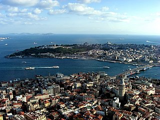
Turkey
The route along the motorway is not a feast for the eyes here either, but rather monotonous landscapes. But bathing joys beckon in the numerous, but also overcrowded bathing resorts along the Marmara Sea. In the Turkish part of the Via Militaris, the cities are the attractions.
- 11 Edirne (Једрене).

 (Hadrianopolis) - very worth seeing city because of the famous mosque and the bazaar.
 - 12 Lüleburgaz.(Arcadiopolis) - a place with a great history but no real sights.

.JPG/320px-Lüleburgaz_2013_(1).JPG)
Branches from the main path
Slovenia
Coming from the north over Graz, Maribor led a junction across the lovely small town * 14 Ptuj![]()
![]()
![]()
![]() (Roman name Poetovio or Pectovium) on Via Militaris.
(Roman name Poetovio or Pectovium) on Via Militaris.
Croatia
A junction of the Via Militaris led over to the north 15 Vinkovci![]()
![]()
![]() - the ancient Cibalae with its baroque architecture that it got during the Habsburg monarchy and 16 Osijek
- the ancient Cibalae with its baroque architecture that it got during the Habsburg monarchy and 16 Osijek![]()
![]()
![]()
![]() - the ancient Mursa, today a city well worth seeing with finds from the Roman era, especially in the district of the Lower Town to the east, directly on the Drau.
- the ancient Mursa, today a city well worth seeing with finds from the Roman era, especially in the district of the Lower Town to the east, directly on the Drau.


Serbia
- In the north of Belgrade the way branched northwards Budapest or in the direction of Italy on the route described here Trieste.
- Between Belgrade and Viminatium the Via Militaris shared a stretch of the route with the Danube-Path. 1) You could go north along the Danube Aquincum (at today's Budapest), Brigetio (today Komárom) and Carnuntum (between Bratislava and Vienna), the then capital of the province Pannonia, until after Vindobona (today's Vienna) to travel. 2) In a southerly direction one got over the Via Istrum to the Danube Delta and to Via Pontica. The Via Pontica was an ancient Roman road link on the western shore of the Black Sea and connected the Bosphorus in the south with the Danube in the north. The route along the Danube and the Black Sea is also an interesting alternative to the classic route for tourists. The Black Sea with its bathing joys, the well-known coastal towns and the diverse river landscapes along the Danube are even more interesting than the way to Bulgaria via Bulgaria Istanbul.
- Also for Via Egnatia there is a junction from Serbia North Macedonia. Of Niš (Naissus) about the ancient city 17 Stobi to 18 Thessaloniki in Greece along the river Axios (Vardar).

Bulgaria
From Bulgaria there are several branches to the south Via Egnatia and the ancient port cities, mostly along river valleys. Today these branches are interesting if you don't want to go to Turkey, but rather to the wonderful beaches of northernGreece.
- Sofia (Serdica) – 19 Kyustendil (Pautalia) - Thessaloniki along the Strimonas river.
- 2 Bona mansio (Lissae) - 3 Nicopolis ad Nestum (near Gotse Delchev) - 4 Philippi along the river Nestos.
- Plovdiv (Phillipopolis) - 20 Asenovgrad (Stanimaka) - 21 Komotini


security
See country articles: Italy, Slovenia, Croatia, Serbia, Bulgaria, Turkey
trips


.jpg/400px-Škocjan_Caves_(6).jpg)
.jpg/400px-Postojna_Cave_(18341372181).jpg)
.jpg/400px-Nationalpark_Triglav_(Triglavski_narodni_park).jpg)
.jpg/400px-Triglav_National_Park_(cropped).jpg)
.jpg/400px-Samobor_-_panoramio_(2).jpg)


.JPG/400px-Zasavica_(2).JPG)


.jpg/400px-ÇilingozNaturePark_(4).jpg)
Italy
- 1 Natural Reserve of Doberdò Lakes and Pietrarossa.The special thing about this nature reserve is one of the few karst lakes in Europe with rich fauna and flora, wetlands and swamp meadows.

- 2 Isonzo river delta..The Riserva Naturale Regionale della Foce dell'Isonzo Isola della Cona is a wetland with very rich bird life.
Slovenia
- 6 Postojna.The Adelsberg Grottoes are stalactite caves that are very worth seeing.Feature: without flash.
- 3 Kozjanski Park.The Kozjansko Regional Park is a mosaic of the Posavje pre-Alpine mountain range and the hills and plains along the Sotla River.


Croatia
- 5 Žumberak Nature Park and the Samobor Mountains (Жумберак (планина)).Beautiful mountain landscape between the Save and its tributaries Krka and Kupa.
- 6 Papuk Nature Park (Парк природе Папук).The nature park has been a protected area since 1999 and is located in the Papuk mountain range of the same name and was established to preserve the nature characteristic of Central Slavonia.


.jpg/350px-Plitvice_Lakes_National_Park_(2).jpg)
Serbia
- 8 Fruška Gora National Park (Национални парк Фрушка гора).The Fruška Gora is a small mountain range on the right bank of the Danube south of Novi Sad in the Serbian province of Vojvodina; the smaller western part is in Croatia. It stretches for 80 kilometers in an east-west direction. The park is known for its diverse flora and fauna, including over 700 species of medicinal herbs and many endangered and endangered animal species.

- 9 Special Nature Reserve Zasavica. The Zasavica is a bog in the Mačva region, west-central Serbia. With Obedska bara and Carska Bara one of the largest nature reserves and one of the last authentically preserved wetlands in Serbia.
- 10 Nature Reserve Obedska bara.Obedska bara is a nature reserve in the Vojvodina province of Serbia. It is a swamp and forest area that extends along the Save about 30 km west of Belgrade over an area of 175,000 hectares. It is also one of the oldest nature reserves in Serbia, it was founded in 1874. There are over 220 species of birds, 50 species of mammals, 13 species of aquatic animals, 11 species of amphibians, 16 species of fish, 180 species of mushrooms and some species of moss. This nature reserve is therefore the leader in biodiversity in the Pannonian Basin. Because of these natural treasures, Obedska bara is also internationally recognized and has also been nominated for the list of UNESCO World Natural Heritage.

- 11 Banat sand desert (Делиблатска пешчара).The Banat Sand Desert (after the Banat landscape, Serbian Банатски песак) is a nature reserve with inland dunes. The dune landscape extends over an area of 30,000 hectares between the Danube and the border with Romania. It represents a desert-like phenomenon with an orography, flora and fauna unique in Europe. The dunes sometimes reach heights of more than 200. At the beginning of the 19th century the sandy desert was cultivated with acacias and other plants. Today more than half of the landscape is planted.

- 12 Lazar's Canyon.Lazar's Canyon or Lazar's Gorge is about 10 kilometers from Bor. This is the deepest and longest canyon in Eastern Serbia. Due to its steep rocky cliffs, the canyon has not yet been fully explored. The canyon is famous for its numerous caves and pits.

- 7 Gamzigrad (Гамзиград).About 10 km southwest of Zaječar there is a ruin site in the eastern Serbian town of Gamzigrad. The buildings date from the 3rd and 4th centuries, here the Roman Emperor Galerius built a retirement home. He gave her the name "Felix Romuliana" in memory of his mother Romula.


- 14 Nature Park Stara Planina (Стара планина). In the Balkan Mountains, Bulgarian and Serbian Stara Planina (Cyrillic Стара планина), on whose territory a national park, four nature parks (Sinite Kamani, Balgarka, Wratschanski Balkan and Stara Planina) as well as several nature reserves and protected areas have been established to protect flora and fauna. The Balkan Peninsula was named after the mountains.

- 8 Poganovo monastery (Манастир Поганово).Very photogenic monastery worth seeing.

Bulgaria
- 9 Belogradchik fortress.The fortress, also known as Kaleto, is an ancient fortress on the northern slopes of the Balkan Mountains near the northwestern Bulgarian city of Belogradchik and is the city's main cultural and historical tourist attraction which, along with the Belogradchik rocks, is the main stream of tourists to the region attracts. It is one of the best preserved strongholds in Bulgaria and a cultural monument of national importance.

- 10 Gate of Trajan (Трајанова врата).The Gate of Trajan or Trajan's Gate (Bulgarian: Траянови врата, Trayanovi vrata) is a historic mountain pass near Ihtiman, It was named after the Roman Emperor Trajan, on whose orders a fortress named Stipon was built on the hill above the pass was established as a symbolic border between the provinces of Thrace and Macedonia.

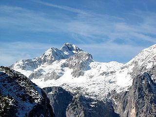
- 15 Rila National Park (Национални парк Рила).The mountain park is located in the mountains of the same name in southwest Bulgaria and borders the Rila Monastery Nature Park in the west. The highest point in the park is Mount Musala at 2,925 meters, which is also the highest peak of the Rila Mountains and the Balkan Peninsula.

- 11 Rila monasteries (Рилски манастир).It was founded in the 10th century and is the most important and largest monastery in Bulgaria. It is part of the UNESCO World Heritage.

- 16 Central Balkan National Park (Национални парк Централни Балкан).Mountain park of over 2000m with interesting waterfalls, rock formations and fauna and flora.

- 12 Valley of roses (Долина ружа).This region used to be known for the production of natural rose oil. Because of the high price of around 1000 euros / l, the natural oil was increasingly being replaced by synthetic oil, so that the production of natural oil has declined sharply. If you are in the area of Kazanlak is on the way, a detour is worthwhile, even if the oil production and the rose festival are increasingly just a tourist attraction.


- 14 Thracian tomb of Kazanlak (Трачка гробница у Казанлаку).The tomb is part of a large Thracian necropolis. Both the burial chamber and the vestibule are decorated with wall paintings, which, among other things, depict a Thracian couple at a funeral party. The Thracian tomb of Kazanlak dates back to the 4th century BC. BC and is the best preserved work of art from the time of the Thracians in Bulgaria. In 1979 it was added to the UNESCO World Heritage List.


- 18 Rhodope Mountains (Родопи).exceptionally beautiful and lonely mountain landscape with many religious sites of the ancient Thracians.
- 15 Mezek fortress (Mezek Fortress).The imposing Byzantine fortress is the best preserved medieval fortress in the Rhodope Mountains.
- 16 Kurgan from Alexandrovo (Тракијска гробница Александрово).Burial mound from the 4th century BC. The interior is decorated with well-preserved frescoes.
- 17 Thracian tomb at Mezek (Thracian tomb near Mezek).Interesting tombs of the ancient Thracians.


Turkey
- 18 Sultan Bayezid Complex (Bayezid II Külliye Health Museum).Award-winning museum (UNESCO & European Museum Awards) of the Ottoman Medical School. Famous for caring for mental illness through music and relaxing by water.
- 19 Cilingoz Nature Park (Çilingoz Nature Park).-The region was declared a nature reserve in 2005 because of its rich flora and fauna. The nature park is a combination of beach, forest, lake and reeds.

.jpg/350px-ÇilingozNaturePark_(3).jpg)