Driving around Norway takes you to places outside the cities and where public transport is limited or infrequent. This is a good way to travel if you are interested in seeing Norway's natural sceneries. Traffic is safe, speed is modest and most roads have little traffic. Drivers should allow plenty of time for the drive and for frequent sightseeing stops. Long distances, particularly in the south-north direction and through the complicated fjord landscape, means that driving takes time. A drive for instance along the full extent of road E6, Norway's main road, takes about a full week.
Understand


Norway's top attractions are outside the main cities, where public transport is limited. A self-drive allows visitors the flexibility to stop at will, to visit less crowded places, to change plans and to visit remote scenic roads with limited or no public transport. The ever changing rugged landscape, Norway's top attraction, is best experienced by moving around at a leisurely pace. Natural sights are in general not limited to specific places. While some towns are widely known as cruise ports, other areas are equally nice. Most roads offer a good or excellent view of the surrounding landscape through the car windows. There are few motorways and most roads are ordinary two-lane undivided where one can easily pull over for a break. During summer there is almost 24 hour daylight anywhere, and in the north the sun never sets, allowing visitors to do sightseeing drives at any time.
Norway is wider than Britain and has about the same area as Germany, but distances between north and south are much longer. Finnmark, Norway's northernmost area, is wider than Denmark and the drive through Finnmark is longer than London to Glasgow. E6, Norway's main road, is more than 2600 km and the longest road within a single country in Europe except Russia. During an ordinary vacation in Norway there is usually time only to drive around a section of Norway.
As in most of Europe, Norway has right hand driving. Most cars in Norway did traditionally have manual ("stick-shift") transmission. After 2015 there has been a relatively rapid transition to electrical cars and cars with computerized driver support and automatic transmission. As of 2020 virtually all new cars have automatic transmission. About 10 % of all cars in 2020 runs on battery. Rental companies may still allocate a manual transmission car unless you specifically ask for an automatic when you make a reservation. Most roads are two-lane undivided, and there is a limited motorway network around Oslo. General speed limit is 80 km/h and speed is often slower due to road conditions.
A car will get you to remote corners without railway and with limited public transport, but there is generally no need for a car inside main cities. Parking is a challenge in main cities, and can be expensive. Norway offers a range of scenic drives and the road authorities have selected a number of national tourist routes that are particularly recommended. Along these routes facilities are installed to make the trip more enjoyable and practical for visitors.

Petrol (gasoline) is heavily taxed and therefore expensive. Norway uses the metric system and Celsius (miles, gallon and Fahrenheit are unknown). There are some toll roads, particularly when entering main cities. Tolls are generally a fraction of the total cost of going around by car.
Driving is generally easy as traffic is calm, and most drivers are disciplined and law abiding, although moderate speeding is common on highways. However, some city centres (such as Bergen and Oslo) may be confusing to navigate for the first time visitor due to many one-way streets. Traffic is rarely heavy, mostly during 'rush hour' around Oslo (roads E18 and E6), as well as Friday afternoon out of Oslo, around Easter holiday. Outside cities traffic is often light even on main roads. In some popular destinations such as Geiranger there can still be much traffic for the narrow roads during day time.
In some parts of Norway, the next gas station might be more than 100 km away; a small village doesn't always have a gas station even if it is remotely located. Fill up the tank in time and consider bringing a jerry can when travelling in the sparsely populated northernmost areas.
Norway has a long winter season and many roads are covered by ice or hard snow for months, while traffic runs largely uninterrupted. Along several main roads temperatures can drop to -20 °C or -30 °C. Visitors entering Norway by car between October and late April should be prepared. Visitors should not underestimate the difficulties of driving in winter. Each winter main roads are blocked for hours by foreign drivers without adequate skills and equipment to drive on snow and ice. Each winter police and road authorities deny access to Norwegian roads for a large number of foreign drivers who are not prepared.
Norwegian roads have varying quality. The main roads are the European highways indicated with an "E" in front of the number. For instance E6 is the main north-south corridor from Sweden via Oslo to Kirkenes in the very east of Northern Norway; see also E6 through Sweden and Norway. European highways connect cities, regions and countries. E18 connects Kristiansand and towns in South Norway to Oslo and Sweden. E16 connects Bergen to Oslo (via Flåm and Voss), road 7 is an alternate route to Bergen (via Hardangervidda). E39 is the coastal main road from Kristiansand via Stavanger, Bergen and Ålesund to Trondheim. The E-roads are excellent for navigation. Other main roads (national highways, "riksvei") have low one- or two-digit numbers, the most important of these are indicated with white digits on green background (as opposed to black on white for most highways). Note however that the importance of the road does not indicate quality: even the E's may have narrow and slow sections. Most of Norway's motorways are on E6 and E18, but the E6 has less than 10 % motorway, while the E18 has almost 50 % motorway stretches.
Asphalt cover on Norwegian roads is usually coarse and doesn't get very slippery when wet as can be experienced in some other countries. Note however that studded winter tyres tend to eat asphalt during the winter, leaving deep tracks (or furrows). This can make the car sideways unstable, particularly in high speed, and if filled with water tyres may float on the water making the car difficult to control (as if driving on ice or snow). When driving downhill on steep mountain roads, it is best to use a low gear and let the engine control the speed. Brakes can overheat causing the brake fluid to boil.

- Common mistakes include
- Driving with your headlights off during daylight hours (headlight is mandatory)
- Driving too close to the car ahead (minimum 3 seconds, more in winter)
- Slowing down excessively in tunnels
- Underestimating distances and driving time
- Trying to cover too much in limited time
- Overheating brakes on long descents
- Rushing from point to point (drives offer ever-changing scenery)
Distances
Visitors frequently underestimate distances and driving time in the Norwegian landscape. For many parts of Norway visitors should not expect to do more than 60 km/h on average (one minute per kilometre). Some online map services and satellite navigation (GPS) tend to underestimate driving times (while kilometres are accurate). Time for ferry crossings, breaks and photo sessions should be added to the approximate times suggested here. Key distances by car:
| To-From | Key road | Kilometres | Time needed | Notes |
|---|---|---|---|---|
| Oslo–Nordkapp | 2200 | 35 hours net ≈ 1 week incl sleeping | Ferry | |
| Oslo–Bodø | 1200 | 20 hours net 3 days incl sleeping | ||
| Oslo–Bergen | 500 | 8 hours | ||
| Oslo–Kristiansand | 320 | 4 hours | ||
| Oslo–Stavanger | 540 | 8 hours | ||
| Oslo–Trondheim | 500 | 8 hours | ||
| Trondheim–Bodø | 700 | 12 hours | ||
| Oslo–Geiranger | 450 | 7 hours | ||
| Oslo–Flåm | 350 | 5 hours | ||
| Bodø–Tromsø | 600 | 10 hours | Ferry | |
| Bodø–Nordkapp | 1050 | 16 hours (2 days) | Ferry | |
| Bergen–Geiranger | 400 | 7 hours | Ferries | |
| Bergen–Flåm | 170 | 3 hours | ||
| Bergen–Kristiansand | 470 | 8 hours | Ferry | |
| Ålesund–Trondheim | 300 | 6 hours | Ferries |
Winter closure
Some mountain passes, including popular roads around Geiranger are totally closed during winter (typically November to May). Other mountain roads may be closed for shorter periods (several days or only one night) during bad weather. Roads are typically closed only for the mountain pass itself (between permanent settlements). Closing time may vary notably depending on weather and snow remaining from winter.
| Road | Section | Months closed (normal) |
|---|---|---|
| Skarsvåg–Nordkapp (North Cape) | October–April (occasionally opened anyway) | |
| Gaularfjell | December–May | |
| Road 51 | Valdresflya | December–April |
| Road 55 | Sognefjell | November–May |
| Road 63 | Geiranger–Langvatn | November–May |
| Road 63 | Trollstigen | October–May |
| Road 243 | Aurland–Lærdal (Aurland mt pass) | November–June |
| Road 252 | Tyin–Eidsbugarden | October–June |
| Road 258 | Gamle Strynefjellsveg (old Strynefjell road) | October–June |
| Road 337 | Brokke–Suleskard (Agder) | November–May |
| Road 341 | Smelror–Hamningsberg | November–May |
| Road 355 | Melfjellet | November–May |
| Road 520 | Hellandsbygd–Røldal | November–June |
| Road 886 | Vintervollen–Grense Jacobselv (Jarfjordfjellet) | November–May |
Ferries


There are now well over 100 ferry crossings on public roads in Norway. These car ferries are an integral part of the road system such the ferry crossing is included in the road number and roads lead to the dock. Ferry docks are often located in remote areas at the point of shortest possible crossing. Car ferries are operated by private companies on behalf of the national road authority. Prices are administered by the Department of transport and might be 50–300 kr for a car, depending of route length, but double or more for a motor home. Car ferries on main roads depart 2 or 3 times every hour at day time, less frequent late in the evening. Some important ferries run through the night, others operate until 23:00 or 24:00 (11 PM or midnight). Crossings usually take 10–30 minutes only. Booking is generally not possible for private vehicles, nor is it needed. Cars arrive at the dock and wait in line on a first-come-first-serve basis. Ferries usually have enough capacity to take all waiting cars, on rare occasions travelers have to wait for the next departure. Travelers are well advised to add time for ferries in planning. Ferry crossings typically appear on maps as dotted lines across fjords. Ferries can in general not be avoided or can be avoided only through (extremely) long detours. For the leisure traveler ferries add to the experience as calm breaks and pleasant trips across the fjords. Most ferries run in sheltered waters and are not affected by ocean waves. Ferries often have a cafeteria on board serving coffee and snacks, and in some cases full dinners.
Roads

Road network classifications:
- E-roads. Roads numbered as part of the International E-road network, no national number in addition, signs are white on green:

- National roads. Other main roads ("green roads") in addition to E-roads, signs white on green:

- Numbered roads. Regional numbered roads (shown on road signs), signs black on white:

- Other roads. Regional and local roads.
Note that this system does not necessarily indicate the quality of the road itself, there is no prefix or numbering system for motorways. Numbers are primarily for navigation, and outside cities navigation by numbers is more reliable than satellite navigation (GPS) and online map services as these occasionally suggest silly routes. The E6 for instance is constructed as a real motorway only some kilometers north and south of Oslo, further north it is a semi-motorway, then it changes to ordinary two-lane undivided. Visitors should trust the road number more than satellite navigation (GPS). East-west E-roads have even numbers (for instance E10), while north-south E-roads have odd numbers (for instance E39). The E6, Norway's main road south-north is an exception to this rule. Note also that road numbers may overlap such that a stretch of road may for instance be both E134 and road 13.
.svg/180px-Map_E6_(Norway).svg.png)
.svg/180px-Map_E39_(Norway).svg.png)
Visitors should be aware of mountain passes as the road can be steep (and narrow) or exposed to bad weather (and occasionally closed for some hours or a couple of days in winter). Snow may fall on mountain passes even in late April or late September. On rare occasions snow and frost can be encountered at the highest passes even in summer. If temperatures are below 10 °C at sea level, temperatures can be around or below 0 °C at 1500 meters.
Important roads
Visitors should know about a handful of key roads for planning and navigation. The E6 is clearly the most important as it runs 2600 km from the southern to the northern end of Norway. E6 varies considerably in quality and traffic, from 4 or 6 lane high speed road around Oslo to ordinary two-lane undivided in remote areas (sometimes narrow). E6 runs through 10 of 19 counties. North of Trondheim it is the only main road south-north, in some areas in fact the only road such that traffic has to be diverted through Sweden/Finland when closed. North of Oslo (to Hamar) the E6 has been notably upgraded until year 2015 and from through Gudbrandsdalen upgrade is in process (per 2015). Still the E6 also serves local traffic between Ringebu and Trondheim.
The E39 is the western fjords main road as it runs all around the western part from Kristiansand to Trondheim. This is a very complex road with highly varying quality (mostly two-lane undivided), some 100 tunnels, floating bridges and 8 ferries crossing several of Norway's iconic fjords - still the shortest between Stavanger-Bergen-Ålesund. Only short stretches of narrow road remains between Sognefjord and Førde, and these are expected to be upgraded in a few years (per 2016). This road has long scenic stretches, although alternative routes are even more scenic. Between Skei and Byrkjelo there is no practical alternative route except through road 55 (into East Norway). Some of the alternative routes (roads 51, 55 and 63) are closed in winter until April or May.
The E18 is the east-west arterie through Oslo and other population centres in the East/South. Constructed mostly as wide and fast motorway except in Oslo eastern suburbs where the E6 is faster. Intersects twice with the E6.
| Route | Description | Notable mt passes | Ferries | Quality and Traffic | Scenic | Alternative route |
|---|---|---|---|---|---|---|
| Norway's main road and a key reference for driving in Norway. From Halden at the Swedish border to Kirkenes at the Russian border, a total of 2628 km (and some 500 km in Sweden). | Dovre, Saltfjellet(some exposed to rough weather in winter) | 1 ferry | Motorway Halden to Hamar. Congestion near or inside Oslo at rush hour and weekends. | Several scenic stretches. | ||
| Main road east-west. Swedish border at Ørje through Oslo to Kristiansand. | (none) | Congestion common near Oslo and Oslo-Kristiansand, particularly at weekends and afternoon. Motorways around Oslo and near Kristiansand. | Scenic stretches | |||
| The West Norway main road, 1300 km through fjord country. Kristiansand-Stavanger-Bergen-Ålesund-Trondheim. | Mostly low passes such as Romarheimsdalen | Eight ferry crossings (more than any other road in Europe) | Norway's most complex road. Little motorway, some narrow and slow. Congestion occasionally around Stavanger and around Bergen. | Long scenic stretches through fjord areas. | ||
| Haukeli-Haugesund road from East Norway | Haukeli (occasionally closed in winter). | (none) | Notable traffic at periods, mostly moderate. | Scenic stretches. | ||
| Dombås-Romsdal-Ålesund road. Main road into Møre og Romsdal county. | (none) | Moderate traffic, no motorway | Through monumental valleys and along great fjords. | |||
| Hedmark/Østerdalen road. | (none) | Slightly shorter alternative to E6 north-south (Oslo-Trondheim). | Views of a large river and large hills, but less scenic than E6 | |||
| Fastest and shortest road Oslo–Bergen. | Hardangervidda mountain plateau (often closed in winter) | (none) | Ordinary road, in periods fairly much traffic, especially near Oslo | Very scenic, mountain plateau, steep valleys, fjords views | ||
| The "inner" parallel to E39. | Vikafjell (exposed in winter), Gaularfjell (closed in winter) | 2 ferries | Low or moderate traffic. Two lane undivided. Partly narrow or steep. | Scenic drive along iconic fjords, waterfalls and glaciers. Several mountain passes. | ||
| Ottadalen-Nordfjord road. Connects E6 (Gudbrandsdalen) to Nordfjord region. | Strynefjell (occasionally closed in winter) | (none) | Low or moderate traffic. Two lane undivided. | Scenic drive through great valleys, passed alpine mountains and along lovely lakes and fjords. | ||
| Lofoten road. From the border through Narvik to Å i Lofoten. | At the border to Sweden | (none) | Scenic drive. |

Oslo-Bergen
The trip from Oslo to Bergen takes between seven and nine hours, depending on the route, the driving conditions and stops along the drive. Be prepared to add some hours driving time in the winter - and remember that the daylight will be scarce for many months. All routes Oslo to Bergen run through mountain passes. It might be a good idea to use two days on the tour in the winter if you're not accustomed to these conditions. A 12 or even 14 hour drive on icy, dark roads in bad weather is not very nice. Keep in mind that many roads in Norway are often of narrow and slow due to relatively low traffic and difficult weather conditions. The most direct roads between Oslo and Bergen run through difficult yet scenic landscapes and are often affected by rough weather November through April.

| Name (mountain pass) | Itinerary | Description | Notes | Sights & Scenic | Distance |
|---|---|---|---|---|---|
| Filefjell mountain pass. | The official main road through Filefjell mountain pass. Arm of E16 connects to E18 at Sandvika. Main continues via Oslo airport to Gävle, Sweden. | Reliable in winter as it is less prone to be closed on short notice due to weather conditions – compared with the other mountain crossings. Mostly light traffic. E16 is a long, but easy drive, a bit slow through the villages of Valdres. Countless tunnels (including the worlds longest) from Laerdal to Bergen. Between Lærdal and Flåm, through Lærdalstunnelen, at 24.5 km the longest road tunnel in the world, separated into 6-km bits by large caverns, in which tunnel-lagged drivers can pull over and rest. | Scenic drive with iconic fjords, waterfalls, mountains and lakes, as well as cultural heritage (stave churches). Through romantic Valdres and wild Sognefjord area to Voss and Bergen. | 513 km | |
| Hemsedal mountain pass | Alternative to the E16 above, some long hills, Lærdal to Bergen same as E16. | Preferred by truckers. Occasionally closed in winter if strong wind (blizzard). | Through scenic Hemsedal with the winter sport resort. | 474 km | |
| Hol-Aurland route | Through the great Hallingdal valley, then along lakes and through long tunnels until the steep descent to Aurland where it joins the E16. | Partly wild, steep and narrow, few or no trucks. Some times closed in winter. | Scenic. Joins E16 at Flåm. | ||
| Hardangervidda route. | Across Hardangervidda plataeu and through Hallingdal valley. | Via Hardanger bridge (toll). Note: Toll 600 NOK (per 2015) for vehicles over 3500 kg. Main route if E16 Voss-Flåm is closed. Some trucks use this route. Traffic mostly during tourist season (summer vacation). Route 7 Hallingdal-Hønefoss notably improved around 2014. | Very scenic drive with iconic fjords, waterfalls, mountains and lakes. Often closed during winter during blizzards. | 455 km | |
| Haukeli mountain pass | Thrugh the rugged and romantic landscape of Telemark. | Includes ferry crossing at Gjermundshamn-Årsnes. Alternative crossings at Jondal-Tørrvikbygd and at Kvanndal-Utne. | Scenic drive passed glaciers and lakes, waterfalls and fjords. | 510 km |
Bergen-Trondheim
The Bergen-Trondheim either go along the coast with five time consuming ferries to catch, or through mountain passes.
| Name (mountain pass) | Itinerary | Description | Notes | Sights & Scenic | Distance |
|---|---|---|---|---|---|
| Coastal road | E39 | Ålesund-Kristiansund | This route mainly follows the coast, and crosses several fjords with five ferry crossings. The ferries are tolled and time consuming as they not only are slow, but include a waiting time and embark/disembark time. The route also has the most traffic, which is local traffic as Norwegian travelers Bergen-Trondheim would prefer another route. | The fjord around Stryn is scenic. The Sognefjord is 1260 m deep under the ferry. | 696 km |
| Strynefjell | E39-15-E6 | Stryn-Otta | This route has one ferry and is probably the fastest, at least outside summer time. | The fjord around Stryn is scenic. A detour to Geiranger is very scenic. The Sognefjord is 1260 m deep under the ferry. | 698 km |
| Sognefjell | E39-55-15-E6 | Sogndal-Otta | This route has one ferry and is the shortest. It includes the route 55 which is a demanding mountain road which is closed in winter. | The Sognefjord with arms are scenic. The Sognefjell mountain is also. | 652 km |
Old and new roads
Many roads in Norway run through rocky or mountainous terrain. When a new section of road is built (often through a tunnel) at a difficult point or to avoid avalanches, the old road is often abandoned, left to pedestrians or used as a local road. The old section of the road often gives a more interesting scenery, and the old road engineering itself is often impressive or interesting. The Tokagjelet stretch of road 7 is one such road that can be visited. Famous Stalheimskleiva on road E16 gives an excellent panorama and is exciting to drive. Visitors are often not aware of these as they rush along the fast road.

Vehicle and gear

On public roads there is no need for anything special in summer. In winter, a four-wheel drive may be useful to pull up the last snowy road, but is generally not needed on public roads. In winter, Norwegian cars use Nordic quality winter tyres (studded tyres are permitted from November 1). Chains are generally not used by ordinary cars and usually not allowed by rental companies. Satellite navigation (GPS) can be useful in cities and around Oslo, but navigation by road number is more reliable. GPS and online map services sometimes make silly choices.
Manual transmission is regarded as standard in Norway. If you prefer to rent a car with automatic transmission, make sure to order one at the rental company. If you live in Europe, consider bringing your own, but if you arrive during winter (November–April), be aware that winter tyres are necessary, do not under any circumstance try to drive without, even if you don't expect snow or ice. Winter tyres must have a minimum of 3 mm deep grooves. Cars heavier than 3500 kg (Vehicle group M1, N1 from 3500 Kg) are required to bring snow chains during winter and whenever snow or ice can be expected, a minimum of 5 mm tread pattern depth is recommended for trucks and heavy cars. Diesel and other liquids must also withstand the low temperatures that can be encountered in winter.
Norway has more electrical plug-in cars than most other countries. Fully electric cars are indicated with an "EL" or "EK" on their license plate.
By motorhome / campervan
Several companies hire motorhomes that are "fully equipped" (beds, small kitchen, fridge, shower, toilet, heating, etc.) and as a rough indication they cost about what one might spend on a reasonable hire car and reasonable accommodation – but allow a lot more flexibility.
It is common to park overnight on rest areas although on many it is illegal. Look for parkings that are specifically designed for campervans. Don't park on any field or open patch along the road as land is generally private. The right to walk in forests and sleep in a tent ("every man's right") are not valid for vehicle driving and sleeping in motorhomes.
There are hundreds of camp grounds that cater to motorhomes (and caravans, or camping with tents – some have huts to rent), and these are well signposted. All have basic facilities (electricity, toilets, hot showers (pay per minute), mostly-flat ground), and some are more equipped (buy fresh food, hire boats, communal kitchens, tourist info, etc.).
Some are of the "industrial" variety (hundreds of vans, spotless facilities, very straight paths, gravel, not grass, keypads to enter, lots of strict rules, right beside the highway), and others are more... loose - occasional visitors, honor system for payment, idyllic surroundings, lots of grass and space. It's impossible to tell from the signs, so a drive-by might be necessary to see if the campground suits your mood and preferences.
As a rough guide (August 2011), a night in a campground with electricity costs around 200kr, but ranges from 120 to 300 kr. Showers are usually 10 kr for 4 minutes.
There are many rest stops on all major and many minor roads, and there's a fantastic system of National Tourist Routes with particularly spectacular rest stops (and facilities). Most of the rest stops have a toilet and picnic table.
Be aware that many campervans have relatively small engines and will be slower than other vehicles on the many Norwegian hills. Slow or oversized vehicles are obliged to pull over to let faster vehicles pass – this rule must be applied with some flexibility; check your mirror and pull over if a line of faster cars is gathering and they are otherwise not able to overtake.
Note that the ferry prices are for motorhomes usually more than double those for cars. For large motorhomes over 3½ tonnes, the road tolls are also more than double.
Costs
Renting a car is expensive, so visitors should consider for how many days and what part of the trip a car is needed. A compact car with a moderate engine is often much cheaper than a heavy SUV with a big engine. There is no need for a big 4 wheel drive as driving outside public roads is illegal.

Day rates for the vehicle itself are usually the main expense; the price of petrol is a less important issue. Compact cars with modest engines are the most fuel efficient. Car ferries are an additional cost, and unavoidable on several roads (particularly in the western fjords and parts of Northern Norway). Most ferry crossings are relatively short (10–25 minutes) and rates on ferries are moderate compared to the overall cost of renting a car – notable exceptions are the special tourist ferries Gudvangen–Kaupanger and Geiranger–Hellesylt. There are several toll roads in Norway, but most tolls are moderate, for instance 25 kr for entering Bergen, a notable exception is the 150 kr for the new Hardanger bridge on road 13/road 7.
Scenic drives
Norway offers a large number of scenic drives and virtually every road (particularly in West Norway, in the mountains and in North Norway) is scenic. Some of these have been named National Tourist Routes and are particularly recommended.
National tourist routes
National Tourist Routes are eighteen highways in Norway designated for their picturesque scenery and tourist-friendly infrastructure, such as rest stops and viewpoints. These routes cover in total 1,850 kilometers (1,150 mi) and are located along the West Coast, in the Western Fjords, in Northern Norway and in the mountains of Southern Norway. Two routes constitute part of the International E-road network: E10 through Lofoten and E75 through Varanger. Mountain pass roads, such as Sognefjellsvegen, Valdresflye and Trollstigen, are closed during winter. Some sections are narrow and/or steep, drivers are adviced to plan ahead and use a low gear downhill.
| Name | Road number(s) | Impression | Notes |
|---|---|---|---|
| Geiranger-Trollstigen | Road 63 | During high season the traffic load is high at noon (11 to 14 o'clock), traffic jams occur, try to drive early morning or evening. Highest point 1000 meters. Closed until mid May. | |
| Hardangervidda |  | Exposed to wind and cold weather. Snow and frost possible in May and September. | |
| Hardanger | Classical drive around Hardangerfjord | ||
| Gaularfjellet | Roads 613 and 610 | Balestrand to Jølster | |
| Aurlandsfjellet | Road 5627 | "Snow road" Aurland-Lærdal, closed in winter | |
| Sognefjellet | Road 55 | Highest point 1400 meters, closed in winter. | |
| Rondane | Frya to Folldal | ||
| Helgelandskysten (Helgeland coast) | Road 17 | 630 km 6 ferries, coast of southern Nordland | |
| Lofoten | 230 km from Raftsundet strait to Å village | ||
| Varanger | 160 km from Varangerbotn (at E6) to Hamningberg, Finnmark, includes easternmost point of Norway, road 341 is closed in winter |
Other scenic routes
Other routes with significant scenic stretches:
| Route | Itinerary | Impression |
|---|---|---|
| Lillehammer-Oppdalpart of E6 | ||
| Fagernes-Lærdal-Flåm-Voss |  | |
| Aurland-Hol |  | |
| Sogndal-Førde | ||
| Byrkjelo-Sykkylven | ||
| Hellesylt-Ørsta |  | |
| Lillehammer-Åndalsnes-Ålesund |  | |
| Notodden-Haugesund | ||
| Kristiansand-Trondheim through West Norway |
Corniches
Many roads run along Norway's endless coastline and countless lakes. Because of the rugged landscape there are often long corniche drives with great panoramas, similar to the roads along the French and Italian Riviera.
Some notable corniches
| Road | Itinerary | Impression |
|---|---|---|
| 650 | Sjøholt-Valldal | |
| 60 | Utvik-Stranda | |
| 79 | Eidfjord-Norheimsund (national tourist route) | |
| 13 | Odda-Eidfjord | |
| E16 | Bergen-Voss |
Hairpin roads

Norway has some notable hairpin roads, particularly around the inner part of west Norways fjords around Åndalsnes-Geiranger-Stryn.
- Trollstigen (road 63) - perhaps the most iconic hairpin road, grand surroundings
- Geiranger road (road 63) - less striking design, but more turns than Trollstigen
- Ørnevegen (Eagles road, also 63)
- Lysebotn road at iconic Lysefjord, a striking and airy road, 27 hairpins
- Tindevegen Årdal-Turtagrø (private, toll)
- Øvre Årdal - Tyin (road 53), one of the airiest
- Strynefjell mountain pass (old road, no 258)
- Måbødalen at Vøringsfossen waterfall (road 7), this stretch even has a tunnel with 360 degrees
- Sognefjellet (road 55 Skjolden-Lom), Norways highest road, climbs from sea level to 1400 meters
- Stalheimskleiva (detour from E16, old road at Stalheim between Voss and Gudvangen), very tight bends and very steep
- Gaularfjell (road 13 Balestrand-Førde)
Stay safe
Driving standards are relatively well-maintained in Norway, with the traffic being (statistically) among the safest in the world. Fatality rates have been steadily falling for 50 years, 2020 had the lowest number of traffic-related deaths since second world war despite ten-fold traffic. There are many winding and narrow mountain roads in Norway, and wild animals and winter weather demand attention from the driver, but there are relatively few accidents even under difficult conditions.

Regulations are strictly enforced (notably drinking, speeding and risky overtaking) and speed limits are modest to maintain safe traffic. Speed limits are fine tuned to conditions, so there is always a reason for the chosen speed limit and this is one of the key reasons for the safe traffic in Norway. A restrained driving style is the norm in Norway.
Winter
- See also: Winter driving
Driving a car in winter conditions may be a real challenge without proper training and experience, this particularly applies to mountain passes all over Norway as well as other roads in Northern Norway. The golden rule for driving on snow, ice and slush: don't rush. Braking distance increases dramatically, increase distance to the car in front of you from the standard 3 seconds to a 5–6 seconds or more. Inexperienced drivers should drive very carefully until they get used to the conditions and the car; experienced drivers always "feel" the contact between tires and road. Powerful acceleration or hard braking quickly tells you how slippery the road is. Do a "brake test" frequently to get precise information on the road surface.

Several main roads such as E6, E16, road 7 and E134 run through mountain passes or other places exposed to wind/snow. During winter (October–April) drivers should plan well and get specific information for critical stretches of road included in the trip. A handful of mountain roads are frequently closed temporarily during bad weather, and the authorities routinely issue road information on radio, TV and the internet; call ☏175, 47 815 48 99 for details, given in Norwegian only on the internet map page.
Convoy driving During blizzards on some roads you are only allowed to drive in a line behind a heavy snowplow, convoy driving, a method called kolonnekjøring in Norwegian. Drivers are then obliged to wait at a gate or sign until the snowplough arrives. Always obtain specific information about mountain roads the day and hours before going. Don't hesitate to ask locals or call the numbers above for last minute information. News reports routinely mention where convoy driving is in operation with road number and name of mountain pass (or other stretch) as key information. There are waiting points with gates and signs at either side of the mountain pass.  "Stop. Wait for snow plough". Convoy driving waiting point on road 7. There are precise rules for convoy driving that must be followed:
|
Some main roads, such as E6, E16 and road 3, also pass through the coldest areas in Norway, these are often much colder (often 10–20 °C, even 30 °C colder) than departure and destination points – drivers should make sure that the car is prepared for very low temperatures (for instance filling up the right diesel quality). Always bring enough clothes and food, always calculate plenty of time. Be prepared to cancel or postpone trips in winter.
Appropriate tires are required on winter roads – the driver is responsible for having the right tires for the conditions, do not try to drive with poor tires. Nordic type winter tires (studded or un-studded) are strongly recommended; these are much better fitted to Norwegian winter conditions than general winter tires. During winter (after November 1) tires of any type are by law required to have a minimum of 3 mm tread depth, while in summer 1.6 mm is legal. Heavy vehicles (over 3,500 kg) must bring chains in winter and minimum tread depth is 5 mm.
Tunnels

Norway's roads have many tunnels, some very long. Tunnels are generally very safe places to drive. In case of fire or smoke in the tunnel note the following: Use the emergency phones inside the tunnel (rather than your mobile phone) as this will inform traffic control exactly where you are. In case of fire, use the fire extinguisher inside the tunnel as this will alert traffic control and the fire brigade.
Never enter a tunnel if there is a red light. All tunnels have names that can be used to inform the police and fire brigades. Keep radio on inside tunnels as traffic control can send emergency messages. Long tunnels have signs indicating distance to exit in either direction. People inside the tunnel are expected to try to get out of the tunnel on their own. In case of fire or accident traffic control should be notified immediately via emergency telephones inside the tunnel. Use fire extinguisher to kill small fires and leave if not possible.
In case of fire in a one-way tunnel:
- Do not turn the car around; this is extremely dangerous.
- Leave the car with emergency lights on.
- Go to the nearest emergency exit.
In case of fire in a two-way tunnel (traffic in both directions):
- If possible, turn the car around, drive out and alert oncoming traffic.
- If it is difficult or dangerous to turn around, leave the car with emergency lights on and walk to the exit.
- Walk in the opposite direction as the smoke.
Animals
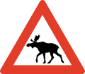
Roads are generally not fenced and animals may stray onto all sorts of roads. You need to look out for deer and moose - a moose collision in particular is very dangerous as these are tall and heavy animals. In the north you will also have to watch out for reindeer.
Moose/elk ("elg") and red deer can run onto the highway particularly at dusk and dawn so take extra care if driving at those times, particularly through forest. Red deer can also jump onto the highway without warning, particularly in Western Norway during late autumn and winter, special "crossing points" have been constructed several places, be aware. Reindeer may happen to walk on the road in Northern Norway. Note the warning signs. The elk, the most dangerous animal on the roads, is most active at full moon, after heavy snow fall and at dusk/dawn.Be extra careful to wild animals on the roads under these circumstances:
- Dusk/dawn.
- Springtime (as moose reject last year's calves and give birth to new ones).
- Edge of forests.
- Bridges across streams.
- Full moon
Several roads pass through pastures with grazing livestock and there may not be any fence to the road. Sheep, cows and goats may stroll on the road. A cattle grid ("ferist") or warning sign typically marks the start of such areas.
Road conditions

Norwegian roads have varying quality. All public roads have asphalt and are generally well maintained, but some popular roads are narrow, with many curves and steep hills. The main roads are the European highways indicated with an "E" in front of the number. For instance E6 is the main north-south corridor from Sweden via Oslo to Kirkenes in the very east of Northern Norway. European highways connect cities, regions and countries. The E-roads are excellent for navigation. Other main roads (national highways, "riksvei") have low one- or two-digit numbers. Note however that the importance of the road does not indicate quality: even the E's may have narrow and slow sections. The E6 is only partly designed and constructed as motorway. Road qualities indicated by signs or markings:
| Signs | Markings | Notes |
|---|---|---|
| Motorway or controlled-access highway (also known as A-class motorway). Grade-separeted crossings, wide shoulder and mechanical median barrier. Speed limit 80, 90, 100 or 110 kmh. Some stretches around Oslo and main cities only. | ||
| Semi-motorway or two-lane expressway (previously B-class motorway), speed limit 80 or 90 kmh. | ||
| Two-lane undivided is the standard road quality, narrow or no shoulder. Indicated with a median strip (centre line), sometimes with rumble strip. | ||
| Warning signs and/or no center line indicates a road narrower than two full lanes. |
Driving a car in winter conditions may be a real challenge without proper training and experience, this particularly applies to mountain passes all over Norway as well as other roads in Northern Norway. The golden rule for driving on snow, ice and slush: don't rush. Authorities routinely issue road information on radio, TV and internet. Always obtain specific information about mountain roads the day and hours before going. Don't hesitate to ask locals or call ☏ 47 815 48 991, 175 for last minute information. Always bring enough clothes and food, always calculate plenty of time. Be prepared to cancel or postpone trips in winter.

Some mountain passes, including popular roads around Geiranger are totally closed during winter (typically Nov-May). On the highest mountain passes, such as Sognefjell (road 55), winter conditions can occasionally occur in May and September. Some exposed mountain passes can be closed for some hours or days in winter during strong wind.
Convoy driving ("kolonnekjøring") can also be used. When convoy driving is in effect vehicles have to wait for the snow plow and then drive in a line (convoy) behind the snow plow through the mountain pass or other difficult section. Convoy driving is slow and waiting times can be several hours. Convoy driving procedure:
- Make sure to a have full thank of fuel, there are no petrol stations on convoy stretches
- Bring rope, flashlight and shovel
- Bring food and warm drink
- Bring winter clothes and shoes
- Flash the emergency light when the convoy starts moving
- Keep close to the car ahead
- Stay in the convoy, keep a steady speed
- Don't leave the convoy or try to turn back
- Stay in the car if the convoy halts
- Don't stray from the car if you to stop
Tunnels

Any driving in Norway is not complete without tunnels. There are thousands of them, and they are fascinating to those unfamiliar with them. Most of the tunnels are in Western Norway and Nordland county. The longest is 24 km, but 1–3 km is more common. Road E16 has over 60 tunnels, covering 15% of the entire road. E6 has over 80 tunnels, E39 has over 100 tunnels.
Almost all are lit with "street" lighting, but may be narrower than the regular roads. Driving out from a tunnel, over a bridge spanning a deep gorge, back into a tunnel, then down a 12% gradient is something to be remembered. Some tunnels, particularly underwater tunnels, are relatively steep. Tunnels are generally safe and Norwegian drivers keep the same speed in tunnels as in the open, the main challenge is adapting to the darker tunnel during bright sunshine. Temperatures inside tunnels are usually different than outside, causing ice taps to form on road surface and in ceiling; condense on car windows may also be a problem. Animals may seek shelter inside tunnels. Length of tunnel is indicated at the entrance and for the longer tunnels kilometers to exit is also indicated inside the tunnel. Each tunnel has a name and drivers should use the name to inform the police in case of emergency.
Note that overtaking in a tunnel is dangerous and forbidden in many tunnels.
Rules and regulations

Rules and road signs are generally the same as in the rest of Europe. Virtually all signs use standardised symbols (pictograms), explanatory text in plain Norwegian used occasionally as supplement. Foreign visitors should be aware that police controls are common and that fines are very high. Traffic enforcement cameras are common. Jail sentence and suspension of licence is used for the most serious offences.
Right of way
- Traffic from right hand has right of way (unless signs or lights). You must yield to traffic from any road to your right, except from separate areas such as parking lots, market square, pedestrian zone, and petrol stations.
- Turning vehicles must yield to pedestrians and bicycles that proceed straight ahead on road or shoulder.
 Traffic on roads with the standard "Yellow Diamond" sign has the right of way. This is widely used for main roads. Traffic from connecting roads will then see the give-way (yield) or stop sign.
 Universal give way (yield) sign.
 Give way for vehicles located within a roundabout.
 Buses have right of way when leaving a bus stop where the speed limit is 60 km/h or less.
 Trains, trams and light rail have right of way even from the left hand side.
- Traffic downhill is expected to yield to traffic uphill if road is too narrow for two cars (important in winter).
 Pedestrians have the right of way at all marked crossings with no traffic lights. You are required to stop even if the pedestrian is not yet in the crossing, only showing intention to cross. You may be severely fined and your driver's licence may be suspended if you don't. This rule is strictly enforced.
 Emergency service vehicles with flashing blue light (red light not used) has absolute right of way. Note: Emergency light is blue, silent response very common (no siren).
 Right turn on red is illegal even if road is clear.
- Opposing traffic must if necessary slow down or pull over on the right hand side (particularly applies to narrow mountain roads).
- Funeral processions have the right of way. People are required to yield, and not interfere or cause an obstruction.
Use of equipment
- Headlights are mandatory even during daylight. If you drive without lights you may find other drivers flashing their headlights at you to inform you.
- An EN standard hazard waistcoat is required in the vehicle, reachable from the driver's seat.
- Using a mobile phone when driving is forbidden.
- Wearing a seat belt is mandatory, also in back seats.
- Winter tires must have a minimum depth of tread of 3 mm. Cars (Vehicle group M1) heavier than 7500 kg (Vehicle group N1 over 3500 Kg) are required to carry snow chains during winter and whenever snow or ice can be expected. A minimum of 5 mm depth of tread is recommended for trucks and heavy cars.
- Using a vehicle's horn is considered impolite and may result in a fine unless used for an emergency.
Speed limits

 The general speed limit is 80 km/h in the countryside/on highways. Because 80 is the default speed limit, the 80-sign is rarely used and 80 is instead implied.
 50 km/h in urban/built-up areas, usually indicated with signs.
- Other speed limits are always indicated with signs; for instance, speed limits on motorways (controlled-access highway). The motorway sign does not imply any particular speed limit.
- Note that there are no specific rules for change of speed limit (as in some other countries) when driving conditions change. The driver is by law required to adjust speed downward to a safe level in, for instance, fog, heavy rain, or snow.
- Norway has some of the highest speeding fines in the world, including confiscating your driver's license and/or jail time (even for foreigners). There are speeding cameras frequently on major roads, and it's not uncommon for unmarked police cars to pull you over. It is highly recommended to use your car's cruise control system to stay at the speed limit.
- Vehicles pulling trailers, and vehicles over 3,500 kg, must not drive faster than 80 km/h ( except motorhomes up to 7500 Kg that can follow the speed limit up to 110 Kmh ), even on motorways with a higher speed limit.
- Speed limits are fine-tuned to conditions for maximum safety, so be aware that speed limits may adjusted slightly for a few kilometers only. For instance some good two-lane undivided roads in sparsely populated areas may have 70 kmh speed limit because of moose hazard or frequent icing.
- The highest speed limit is 110 kmh and used only on short stretches of the best motorways.
Accidents
- Every person is by law obliged to help and assist at site of accident, even if not involved or guilty.
- Call the police (emergency 112) if persons are injured or killed. Police should also be contacted if animals are injured or killed.
- If no persons are harmed, police should not be called, but drivers involved should resolve the situation themselves (exchange full contact information).
Other
- Don't drink and drive. Your blood alcohol concentration must not exceed 0.2 ‰. One small beer can be enough. This rule is strictly enforced and violators risk a huge fine, a long (or even indefinite) suspension of the driver's licence, and prison time.
- New law from 2013: If you take medications (opiates, benzodiazepines or other narcotics) you are NOT allowed to drive unless you are taking them every day (long-term) for at least 14 days. Even if you have prescription you are not allow to drive if you use them “now and then”. All police checkpoints now check you for drugs as well as alcohol and they have their own “limit table” that if you are over “0,002%” you will go to jail and get your license confiscated (Even with prescription which only says “when needed”). Tourists should be very aware of this, so if you need to take a e.g painkiller you must wait until ALL of the drug has leaved your system.
- On typical Norwegian two-lane road with a narrow shoulder, overtaking is only allowed on long straightaways with plenty of visibility. Drivers are not expected to use the shoulder to facilitate overtaking. Overtake only if really necessary; consider alternatives like taking a short break.
- Overtaking is generally forbidden at crossroads.
- Off-roading is generally forbidden. Motor vehicles must stay on public roads.
 Where a road is not wide enough for two cars to meet, blue signs with a large M indicate passing points (M for "meeting" point).
Signs and markings

Roundabout

Yield (give way)

Stop (and give way)

Crossroad on priority road

Give way to oncoming traffic

Oncoming traffic must give way

No Entry

Speed limit (km/h)

Right turn mandatory


While road markings are informative, they are often covered by snow and ice in winter. Unlike other European countries, in Norway yellow lines separate opposing traffic, and white lines separate traffic in the same direction. In general yellow lines should be on your left hand side, while white lines should be on your right hand side. Caution: Yellow lines on your right hand side means you are heading in the wrong direction!
| Marking | Description | Purpose | Notes |
|---|---|---|---|
| Yellow line, Double line | Lane divider for opposing traffic | Crossing illegal | |
| Yellow line, continuous | Lane divider for opposing traffic | Crossing illegal | |
| Yellow line, long dashes, short gaps (warning line or hazard warning line) | Lane divider for opposing traffic | Crossing (overtaking) legal, but risky | |
| Yellow line, short dashes, long gaps (Lane line) | Lane divider for opposing traffic | Crossing legal (good visibility) | |
| Combined line (hazard warning line and lane line) | Regular overtaking hazardous | Observe the line closest to you | |
| Combined line (continuous line and lane line) | Lane divider for opposing traffic | Crossing illegal | |
| (no median/lane marking).These road have punctuated edge lines. | Road too narrow for lane marking | Caution, slow down for opposing traffic | |
| White line, short dashes, long gaps | Lane divider for traffic in same direction (motorways) | Crossing legal, low risk | |
| White line thick, dash and gaps same | Lane divider for special purpose lane (notably bus lane) | Driving in bus and taxi lanes and in high-occupancy vehicle lanes is only permitted as indicated by official traffic signs. Motorcycles, mopeds, bicycles or marked emergency vehicles may also use such lanes. | |
| Hatched area, yellow or white | Used to separate and guide the traffic instead of traffic islands. | It is forbidden to drive on hatched areas |
Parking

Parking is generally forbidden if speed limit is over 60 km/h. Parking in inner city is often difficult and usually strictly regulated or expensive. Within downtown Bergen parking is generally forbidden except on parking meters or within parking facilities. Parking on meters in Oslo and Bergen is relatively expensive. Electric cars can park for free on parking meters in public streets (applies to all of Norway), while "hybrid" cars including "plug-in hybrids" must pay (as of 2016). "Mot avgift" means that there is a fee for parking. While parking on public streets in Oslo is generally allowed, gradually fewer places are available as streets are redesigned. Illegally parked cars will be fined and in some cases towed at the expense of owner (clamps are not used). Note the use of parking zones where sign applies until invalidated (unlike the basic rule that signs are in force until next cross road).
Tolls
![]() There are toll roads in Norway; most of these are part of AutoPass (automatic number plate recognition). Visitors in their own car can register their numberplate for the duration of their visit only, pre-buy kr. 300 worth of tolls, and directly debit their (European) bank account or credit card for top ups. Any un-used funds are returned within 90 days. For rental cars, follow the rental company procedure. Occasionally, it may be necessary to stop and pay for tolls (notably on the small number of private roads), but most are automated (numberplate is photographed while driving under a gantry over the road).
There are toll roads in Norway; most of these are part of AutoPass (automatic number plate recognition). Visitors in their own car can register their numberplate for the duration of their visit only, pre-buy kr. 300 worth of tolls, and directly debit their (European) bank account or credit card for top ups. Any un-used funds are returned within 90 days. For rental cars, follow the rental company procedure. Occasionally, it may be necessary to stop and pay for tolls (notably on the small number of private roads), but most are automated (numberplate is photographed while driving under a gantry over the road).
Motorhomes up to 7500 Kg has the same toll charge as a car under 3500 Kg on roads using Autopass.
Glossary
- For more information on Norwegian glossary, see the Norwegian phrasebook article.
_(36359101261).jpg/220px-Hardangerfjorfd_in_a_Nutshell_(42)_(36359101261).jpg)


- anleggsarbeid
- road works/construction ahead
- beiteområde
- grazing livestock
- bensin
- petrol
- bomvei/bompenger
- toll road/toll
- dekk
- tire/tires
- diesel
- diesel
- fotgjengere
- pedestrians
- gate
- street
- gjelder ikke buss
- does not apply to buses
- gjelder høyre felt
- applies to right hand lane
- venstre
- left
- gågate
- pedestrian zone
- høyre/høgre
- right hand (side)
- km/t
- kilometers per hour
- kjettinger
- chains
- kjør forsiktig
- drive carefully
- kjørelys
- headlights
- kolonnekjøring
- convoy driving
- lys
- light
- vent på brøytebil
- wait for snowplow (snow removal vehicle)
- kuldeport
- tunnel closed with gate to keep frost out
- lengde
- length
- olje
- oil
- omkjøring
- diversion, detour
- over 1 time
- more than 1 hour
- opphøyd gangfelt
- raised pedestrian crossing
- piggdekk
- studded tires
- stengt
- closed
- stopp ved rød blink
- stop if red light signal
- særlig stor elgfare
- extraordinary moose hazard
- strekningsmåling
- speed camera for stretch of road
- telehiv, teleskade
- frost bulges, frost heaves, frost cracks
- tele
- frost in ground
- trekkrok
- tow bar, tow hitch, tow hook
- ulykke
- accident
- vei/veg
- road
- vegen
- the road
- ventetid
- waiting time
- vinterdekk
- winter tires, snow tires (same thing)
Itineraries
