 | WARNING: Due to the outbreak of the infectious disease COVID-19 (see coronavirus pandemic), caused by the virus SARS-CoV-2, also known as coronavirus, there are travel restrictions worldwide. It is therefore of great importance to follow the advice of the official bodies of Belgium and Netherlands to be consulted frequently. These travel restrictions can include travel restrictions, closure of hotels and restaurants, quarantine measures, being allowed to be on the street for no reason and more, and can be implemented with immediate effect. Of course, in your own interest and that of others, you must immediately and strictly follow government instructions. |

 | |
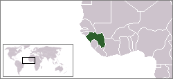
| Location | |
 | |
| Flag | |
 | |
| Short | |
| Capital | Conakry |
| Government | Republic |
| Coin | Guinea franc(GNF) |
| Surface | total: 245,857 km2 water: 0 km2 country: 245,857 km2 |
| Population | 9,690,222 (July 2006) |
| Language | French (official), each ethnic group has its own language |
| Religion | Muslim 85%, Christian 8%, Indigenous Religion 7% |
| Call code | 224 |
| Internet TLD | .gn |
| Time zone | UTC |
guinea is a country in West Africa.
Info
Guinea (former French Guinea, also called Guinea/Conakry) is constitutionally a presidential republic in West Africa, located on the Gulf of Guinea (Atlantic Ocean) between Guinea-Bissau and Sierra Leone. Six hours flight from Paris and New York. The President is General Lasane Conte.
For centuries the country was very closed off from the outside world but slowly but surely it is opening its doors to the rest of the world. Guinea, which means "woman", is seen as a country with many secret rituals and a rich culture. Guinea is the "Garden of West Africa" bordering inland on the Ivory Coast, Liberia, Mali and Senegal. The border with Côte d'Ivoire is 610 km long, with Guinea-Bissau 386 km, with Liberia 563 km, with Mali 858 km, with Senegal 330 km, with Sierra Leone 652 km and the coast is 320 km long. The surface of Guinea is 245,857 square kilometers and it is therefore about 7 times the size of the Netherlands. The country is divided into four 'supra-regions', which correspond to the main geographical and ethnic areas: Guinea-Maritime, Moyenne-Guinea, Haute-Guinea and Guinea-Forestière. The regions are again subdivided into 29 provinces. Local people's councils and village heads form the basis of government in the villages. Guinea is the wettest country in West Africa in terms of climate (4m water per year) and is one of the largest economic markets in western Africa.
History
In the 10th century, the Soussou and Malinké settled in Guinea. The area of present-day northern Guinea (Upper Guinea) was under the control of successive African empires from the 10th to the 19th century (Ghana from the 10th and 11th centuries, Mali from the 11th to the 14th century and Songhay from the 14th to the 19th century ). Around 1350, the Arab world traveler Ibn Battuta traveled along the Niger. There he saw a performance of the Sunjata epic by 'griots', West African bards. European traders had been active along the coast since the 15th century, but did not settle in this area until the late 17th century. In the 18th century there was a kingdom of Genni along the banks of the Niger, which is reflected in Berber documents from that time. The main pre-colonial state in the territory of present-day Guinea was founded by the Muslim Fulani in the highlands of Fouta Djalon after they won the Holy War of 1725 and drove the Soussou to the coastal region. Slavery followed when the Portuguese set foot in West Africa in the 15th century (led by Pedro da Cintra). Around 1460 Da Cintra called the area Cap de Sagres and later Guinea.
In 1881, the emir of the Fulani accepted French rule in Fouta Djalon. Between 1881 and 1886 agreements were concluded with the English, Portuguese and Germans (The Scramble of Africa) whereby the borders were fixed. Guinea was first administratively part of Senegal, but in 1890 it became a separate colony, first called Rivière du Sud, later called Guinée française. In 1895 the colony became part of the Governorate General of French West Africa. When the De Gaulle government converted the French colonial empire into a community of autonomous states in 1958 and organized referendums on it, Guinea was the only state to declare itself in favor of immediate and complete independence. Sekou Touré became the first president of the Republic of Guinea. In 1984 Sekou Touré died suddenly and the political system he built collapsed. Before a successor could be chosen, a military coup took place under the leadership of the Comité Militaire de Redressement National (CMRN). The leader of this committee, Lansana Conté, became the president of the "Second Republic" and remains so to this day.
climate
Geography
Guinea is a diverse country with mountains, forests and long, winding rivers.
Population
Guinea has 27 ethnic groups and the largest are the Fula/Foula (Fulani) (approx. 40%), living in the highlands of Central Guinea, the Malinké (approx. 26%) in Upper Guinea, the Soussou (approx. 11%) in the coastal area and the Kissi (about 6.5%) in the forests. 57% of the population is under 21 years of age. In the period 1958-1984, approximately 2 million Guineans sought a place of residence in neighboring countries for economic reasons. Although the migration to the city is increasing, only 30% live in the cities. A close family bond is very important to most people in Guinea. A typical rural family consists of at least three generations and relatives living at home. Together they manage pieces of land that everyone needs to eat. The family structure is formed by a man who lives with one or more women in a compound or village. Guineans are friendly and mainly distinguish themselves (from their neighboring countries) by an unprecedented zest for work. Approx. 85% of the population is Muslim. (Sunnis) and about 10% Christian (predominantly Roman Catholic); the remainder (approx. 5%) is animist.
Art & Culture
Guinea is home to a wealth of African cultures. The north and east were once part of the great Mandingo Empire, while many villages and forests of the south have preserved pre-Islamic cultures.
The family plays a fundamental role in the community and has a major influence on the choice of a spouse. Many girls get married before their 20s. Tradition has it that a future husband offers ten kola nuts to his future bride's family to propose to her. The bride's father breaks the nuts as a sign of approval and then offers cloth, jewelry, or livestock to the betrothed and his family. Muslims are allowed to have up to four wives, provided he can meet his maintenance obligations. Kola nuts are bitter-tasting nuts that play an important role in rituals and traditions. The kola nut contains 25% caffeine. As a result, it is a natural product that provides excellent services to perform long-term efforts without using food or drink.
Traditional medicine is still widespread in Guinea, but also voodoo and fetish. Although animism only accounts for 5% of the religion, most Guineans still adhere to the traditions surrounding this nature religion in which spirit and ancestor worship are the most important. An animist believes in the existence of good and evil spirits, who can live in trees, animals and utensils. The spirits must be kept on friendly terms by regular sacrifices, rituals, ritual dances and taboo rules. Animism permeates the whole lives of its adherents.
Holidays
Regions
Guinea is officially divided into three scenic zones, but actually there are four, because Guinea Forest is an area in itself.

| Lower Guinea Is an area consisting of a low coastal plain intersected by many small rivers with a tropical climate, tropical vegetation and a maximum altitude of 1800 m (Kakoulima). The coastal plain consists mainly of swampy mangrove areas. |
| Central Guinea Consists of the barren Fouta Djalon highland with an altitude of 600 to 1,500 meters. Moyenne Guinea is also called - just like the massif there - Fouta Djallon. Etymologically, this means 'the land of the Peuls (Fouta) and Diallonkés (Djallon)'. On the west side of the massif, east of Boké, north of Fria, Boffa and Dubréka, and south of Télimélé, there is a transition area between Peuls and Soussous, while east of the massif there is an overlap with the Malinkés in Dinguiraye and dabola. Other ethnic groups in Moyenne Guinea are the Badiarankés, Coniaguis and Bassaris in the prefecture of Koundara, respectively in the region of Badiar, and in the sous-prefectures of Youkounkoun and Guingan, the Tyapi in Gaoual, a minority group Diakankés mainly in Touba, small groups Sarakolés as Linsan Saran and Manda Saran in Lélouma, and finally the Limbas in the southern zone of Mamou on the border with Sierra Leone. |
| High Guinea Consists of plains with savanna vegetation where the heights of the Fouta Djalon merge into vast plains with savanna climate and sparse savanna vegetation. Haute Guinea is mainly populated by the Malinkés. They live together with other ethnic groups. The Diallonkés live in the northern regions of Dinguiraye and Siguiri on the border with Mali, but also west of Faranah prefecture and in enclaves in Kouroussa. The Peuls Ouassoulounkés (a mixture of Peuls and Malinkés) are mainly found in Mandiana. The Kourankos are concentrated in Kouroussa and Faranah. The Koniankés inhabit the prefecture of Kérouané. A transition area between Malinkés and Peuls is located in the west of Haute Guinea. |
| Guinea Forest Is a dense forest/rainforest located in southwestern Guinea on the borders with Liberia and the Ivory Coast. Mainly Mandingos live here and it is a trading center between the surrounding countries. Many fetish (medicine men) live in this area, who know the traditional art of healing. Without chemical applications, they are able to extract products from nature that can successfully treat malaria, yellow fever, typhoid and other diseases. Many secrets of Africa are hidden in this beautiful nature reserve. |
Towns
In addition to the capital, the following major cities can be found: Guéckédou (350,000 pop), Boké (300,000 pop), N'Zérékoré (300,000 pop), Macenta (280,000 pop), Kindia (280,000 pop), Kankan (270,000 pop). inhabitants), Labé (250,000 inhabits), Mamou and Labe (250,000 inhabits each).
- Conakry - (2 million inhabitants) is the capital of Guinea;
- Dalaba - Dalaba has been an important tourist destination since colonial times and is nestled in the Fouta Djalon. It has a charming community and the fresh air has an average temperature of 10 degrees Celsius. The colonial atmosphere of a bygone era still hangs here.
- dubreka - 42 km from Conakry on the road between Coyah and Fria is Dubreka and Mont Kakoulima with Boudabom, "the dog that smokes" - a striking ridge that looks like the silhouette of a dog's head. A sculptor could not have done a better job. Often there is a thick fog around the top and then it seems as if smoke comes from the mouth of the dog's head, hence the name.
- faranah was a small village that first balandougou was called. Faranah owes its development to Sékou Touré, who was born in nearby Sidakoré. He built an airport, a post office, an inn and a house of his own. His residence later became a museum with gifts he received from world leaders. There are wide boulevards, a conference center, a large mosque and an impressive villa, which now serves as a hotel. The large lively market takes place on Mondays. Faranah is 150 km away from the source of the Niger River. The place is located 420 km east of Conakry. Faranah is also the region where the Niger originates, one of Africa's largest rivers. The source of the Niger was discovered in January 1909 by French explorer A. Chevalier. The source is hidden in the dense forest near the border with Sierra Leone, half an hour's walk from a dirt road at Kbikoro, between Kissidougou and Forokonia. Legend has it that the Somono fishermen, who live on the banks of the Niger, threw their newborn children into the water of the river and if they survived, they were real Somono, who are able to grab a crocodile by the tail. , to tie up and tow on the bank. Therefore, the crocodiles here would still be afraid of humans. The nearby Upper Niger Natural Park is 6,470 km2 in size and 34 km long.
- Gueckédou is located in Guinea Forestière near the borders of Sierra Leone and Liberia and is an important center of trade. The Wednesday market is huge, with traders from all over Guinea, Sierra Leone, Liberia, Ivory Coast and Mali. You can buy everything here in all kinds of currencies, the market is also unique because there is the only functioning public toilet in Guinea. Outside the market, the city offers little, but there are some affordable hotels. Guinea Forestiere is a highland area in the rainforest where pre-Islamic tribes still live. Guéckédou is located about 700km south-east of Conakry. The road is completely asphalted.
- Can can is the second city of Guinea and is the spiritual center of the once powerful people of the Malinké, also called Mandingo. Even the Malinké from Senegal and Gambia see the city as a kind of capital and often have family living there. For centuries Kankan has been an important and influential city surrounded by high walls. It is located in Milo, a tributary of the Niger River. Kankan was a crossing point for caravans from the southern forests to the northern savannas. The Mandingos of the Manika-Mori people most likely founded Kankan in the 17th century. It used to be the capital of the ancient Mali Empire; now it is quiet. The main places of the city are the open market with its arched gallery, the covered market and the Grande Mosquée. The caretaker of this mosque will show you around for a small fee. Opposite the mosque is a small workshop where statues are made. The old presidential palace, overlooking the river Milo, is also worth a visit. Kankan is 500km from Conakry.
- kindia is known for the weavers who make the characteristic strips of textile. Behind the railway station you can visit their workshops. Nearby is the center where indigo is produced. The clothing market is the largest in Guinea. The Bridal Veil Falls (La Voile de la Mariée) is Kindia's main attraction, 14km outside the city, but it is only worth seeing during the rainy season, when there is enough water. There is a small restaurant nearby where you can get a simple meal for US$6 and you can rent one of the 10 bungalows. Kindia is 140 km from Conakry and can be reached by an asphalt road. On the way from Kindia to Dalaba is the small town of Pita from where you can find the Chutes de Kinkon, the waterfalls that are definitely worth a visit. On the way you pass numerous villages in the hills. The Kinkon Falls are both above and below a hydroelectric power station. Both waterfalls are attractions on hiking trips through the surrounding villages and hills. Kindia is also the (fruit) garden of Guinea and the country's only fruit-drying company is located there. Manioc and potato leaf (quinquiliba), processed mango, papaya and pineapple. Abroad, Kindia is best known for its bauxite industry. The city is located at the foot of Mount Gangan on the southern border of the Fouta Djalon. Kindia is a small town with a Catholic church in the center and many old colonial houses. Besides the hotel "Flamboyants Hotel" there is a good restaurant "Ma Maison" (French Catalan cuisine). A trip from Conakry via Coyah and Mamou is a trip through beautiful nature and an experience in itself. In 1925 Professor Calmette founded the Pasteur Institute 6 km outside Kindia where studies are now conducted on infectious diseases such as leprosy, typhus, influenza and measles.
- N'Zérékoré is located in southwest Guinea Guinea Forest is the residential area of the Guerze or kpele, the manon, Konon and Malinke (Mandingo) peoples. The first three nations are Catholic. N'Zérékoré is the second largest city in Guinea. In the museum near the stadium, 3,200 art objects are on display and is a must for visitors. The source of the N'Zele (N'Zali) river, which runs behind the prison, does not make an impressive impression. Yet she is the source of a persistent legend. A seriously ill fighter drank from the well and immediately got better. He later founded N'Zérékoré and according to many, his ghost still haunts. The well has since been a place of pilgrimage for the sick and disabled. N'Zérékoré is the French translation of N'Zalikole, which many say means "near my medicine" or "on the banks of the river".
Other destinations
The relatively untouched nature is Guinea's biggest tourist attraction, where enthusiasts can fully enjoy themselves. Crossing the old highlands and over modern asphalt roads you can reach the dense forests in the southeast of the country. Despite a large and varied wildlife population, Guinea has no national parks. Wildlife is abundant in the Fouta Djalon between the Tinkisso River and the Mali border, as well as in the well-known Mount Nimba Nature Reserve, three quarters of which is located in Guinea (and further into Liberia and Ivory Coast). Here are many kinds of animals: monkeys, divers, hyenas, crocodiles, hippos, elephants, monitor lizards, warthogs and panthers. Another jewel in the tourist crown is the fascinating Malinke music that can be heard literally everywhere. It is a rousing rhythmic style that provides inspiration to many African and Western musicians, including the famous Les Ballets Africains, Guinean cultural and musical ambassadors who travel the world promoting Guinea's art, music and culture.
- Alcatraz Island is located northwest of Boke, 300 kilometers from Conakry at the îles Tristao et Capken. The island is a breeding ground for one of the largest seabird colonies in West Africa.
- Badiar National Park is the extension of Niokolokoba on the border with Senegal. The park (38,200 ha) is located in Koundara Prefecture, and has an abundance of game.
- It Belle Air Beach Bee Cape Verga is the most beautiful sandy beach of Guinea, near Tanene, the birth/residence of President Conté. Cape Verga is halfway between Boffa and Boke and is best reached by 4-wheel drive. There you can stay overnight in a beautiful hut for a reasonable price and buy meals from the local population at fair prices. The nearest location to stock up on provisions is Kakadie which is 5 kilometers from the beach.
- Near Carafir is the hydroelectric dam (75MW) that supplies power to Lower and Central Guinea. Via Route National No. 1 you can get to the dam, where a lot of game lives in a beautiful nature. The reservoir contains a lot of fish and is an attraction for anglers.
Arrive
Passport & Visa Info
Visas are issued by the Embassy of Guinea in Brussels. The Visa Service can help: http://visumdienst.com/?location=visuminformatie&land=guinea
By plane
By train
By car
By bus
By boat
Travel around
By plane
By train
By car
By bus
By boat
Language
money matters
Cost
To buy
Food
History
Going out
stay overnight
To learn
To work
Safety
Health
respect
Contact
For further information about Guinea you can visit the website of the Consulate in the Netherlands at:Consulate Guinea in the Netherlands
Leave
| Countries in Africa | ||||||||||||
|---|---|---|---|---|---|---|---|---|---|---|---|---|
|
| Destinations | ||||||||
|---|---|---|---|---|---|---|---|---|
|
![]()