
Inn near Oberaudorf, Wendelstein group on the left, Chiemgau Alps on the right
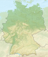
The Upper Bavarian Lower Inn Valley ranges from the Tyrolean Limit at Kiefersfelden until after Rosenheim
Regions
places
Sorted downstream.
- Kiefersfelden (490 m), holiday resort at the foot of the Kaiser Mountains;
- Oberaudorf (480 m), climatic health resort and winter sports;
- Flintsbach am Inn (479 m), holiday resort with the Falkenstein castle ruins;
- Brannenburg (509 m), tourism, winter sports and the oldest cogwheel railway in Bavaria (on the Wendelstein);
- Nussdorf am Inn (465 m), holiday resort and awarded as one of the most beautiful villages in Europe.
Other goals
background
The valley of the Inns separates here those on the east side Chiemgau Alps from the west side Wendelstein group.
On the south side upstream the closes Tyrolean part of Lower Inn Valley at.
language
getting there
| location | ||
| ||
- The main artery through the region is the Inntal motorway 93Rosenheim - Kiefersfelden;
- The Railway line of Munich about Rosenheim and innsbruck to Verona, Railway stations are in Pfaundorf (Inn), Raubling, Brannenburg, Flintsbach, Oberaudorf, Kiefersfelden and Kufstein.
mobility
Tourist Attractions
activities
Winter sports
- On the subject To ski see in the article Winter sports in Germany;
kitchen
nightlife
security
climate
literature
- : Paths in the Inn Valley: An anthropospelaeological excursion guide to the caves of the lower Inn Valley between Rosenheim and Kufstein. Books on Demand GmbH, 2005, ISBN 978-3833428111 ; 172 pages.
- : Inntal legends - legends and stories from the Inntal between the Kaiser Mountains and the Wasserburg. Meissner pressure, 1988 (2nd edition); 195 pages.