 | ||
| Wittlich | ||
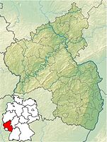
| federal state | Rhineland-Palatinate | |
|---|---|---|
| Residents | 18.995 (2019) | |
| height | 160 m | |
| no tourist info on Wikidata: | ||
| location | ||
| ||

Wittlich is a city in Rhineland-Palatinate in the Eifel, in the vicinity of the Moselle valley.
background
- Closest major city is trier.
- Neighboring communities are: In the Moselle valley: Urzig, Zeltingen-Rachtig, Bernkastel-Kues, Readers, Mülheim; in the valley of the Lieser: plates, Altrich, Minority, Plein; in other sub-regions of the Eifel: Bausendorf, River Creek, Greimerath, Hasborn, Hupperath, Mountain hamlet, Three, Hetzerath
getting there
By plane
Airports are located in:
- Rooster (45 km away; 1 hour journey by train and bus via Bullay)
- Luxembourg (80 km, 1 1/2 hours by train)
- Frankfurt (150 km; 2 1/2 hours)
By train
Wittlich has an RE breakpoint. The 1 Wittlich train station is located 3 km southeast of the city center in the Wengerohr district, at the Wittlich Mitte motorway exit (A1). There are, among other things, direct connections to Luxembourg, Koblenz, Saarbrücken, Pearl. From Wittlich main station there is bus service to the city center (8 minutes travel time, buses run less on Sundays).
By bus
There are bus connections to Bitburg (Bus route 403, 1 1/2 hours travel time), to Down (Bus line 300, 1 hour, with bicycles) via Manderscheid, to Bernkastel-Kues (Bus line 300, 3/4 hour, with bicycles), to trier above Shut up. Reservations are recommended for regional cyclists (bus with bicycle transport); it costs an additional € 1.50 for every 5 bicycles.
In the street
The highway ![]() leads directly past Wittlich. The city can be reached in less than 2 km from the exit of the same name.
leads directly past Wittlich. The city can be reached in less than 2 km from the exit of the same name.
By bus
The 2 Long-distance bus stop Wittlich from Flixbus is located on Rudolf-Diesel-Strasse.
By bicycle
- Maare-Moselle cycle path - on the former railway line from Down to Moselle to Bernkastel-Kues
to the foot
- Readers' path - of Down above Manderscheid according to Wittlich
By boat
- The Moselle is 8 km away. It is navigable for barges and pleasure craft.
mobility
Tourist Attractions
Buildings
- the old town hall on the market square
activities
shop
kitchen
Cheap
medium
Upscale
nightlife
- discotheque Binsfeld cabin
accommodation
Cheap
- Hotel Schneck, Trierer Strasse 52, 54516 Wittlich. Tel.: 49 (0)6571 27556, Fax: 49 (0)6571 27557, Email: [email protected].
medium
- Hotel Well, Marktplatz 5, 54516 Wittlich. Tel.: 49 (0)6571 91190, Fax: 49 (0)6571 911950, Email: [email protected].
- Hotel Wittlicher Hof, Trierer Strasse 29, 54516 Wittlich. Tel.: 49 (0)6571 9777-0, Fax: 49 (0)6571 9777-77, Email: [email protected].
- Hotel Maarium, Meerbachstrasse 50, 54531 Meerfeld. Tel.: 49 (0)6572 4426, Fax: 49 (0)6572 2449, Email: [email protected]. (approx. 23 km from Wittlich).
Upscale
- Hotel Vulcano Lindenhof, Am Mundwald, 54516 Wittlich. Tel.: 49 (0)6571 692-0, Fax: 49 (0)6571 692-502, Email: [email protected].
Learn
Work
security
health
- St. Elisabeth Hospital, Koblenzer Str. 91, 54516 Wittlich. Tel.: 49 (0)6571 15-0, Fax: 49 (0)6571 15-3 99 90.
- Various general practitioners and specialists
Practical advice
trips
- Within walking distance are:
- The following can be reached by bike:
- Can be reached by public transport, also combined with walking and cycling:
- In the valley of the Lieser: Down (Possibly take the bus one way), Mühlheim (Moselle) via Lieser (bus connection from Mühlheim with a change; Lieser is less well served). The Lieser hiking trail is not suitable for cyclists; However, there is a separate cycle path on an abandoned railway line.
- trier (Train and bus connections)
- Koblenz (Train)
literature
Web links
- http://www.wittlich.de - Official website of Wittlich
- saeubrenner.wittlich.de Website of the Wittlich Säubrennerkirmes
- eventum.wittlich.de Website of the multi-purpose hall EVENTUM Wittlich
- stadtbuecherei.wittlich.de Website of the Wittlich city library