
The cycle path Lovely Taubertal leads from Rothenburg ob der Tauber above Creglingen, Weikersheim and Bad Mergentheim to Wertheim on the Main river. The route goes through many of the charming cities and places with diverse attractions. The path itself is largely free of traffic. The Taubertal is a wine-growing region and there are several exquisite wineries along the way.
For a number of years there has also been an approx. 150 km long cycle path "Sportive", which runs parallel to the "classic" over the hills and valleys of the Taubertal from Rothenburg to Wertheim.
Sections of the cycle path are part of the “Mainfränkischer Radachters” and D-Route 9 in the Germany cycle network.
Route profile
- Length: 102 km · ascent: 260 m. Descent: 545 m · lowest point: 138 m, highest point: 424 m
- Signposting: overall still good with a few gaps. Larger, white intermediate signposts with green inscription: "Liebliches Taubertal - Der Klassiker". In the Rothenburg area in particular, there are no "classic" signs.
- Slopes: In the section from Rothenburg to Creglingen, the cycle path leaves the bottom of the valley a few times and climbs up the side slopes in a somewhat more challenging manner; Even in the section between Gamburg and Bronnbach Abbey, there are occasional small inclines to overcome. However, the individual inclines rarely cover more than 30 - 40 meters in altitude - only the Rothenburger Steige will force some experienced cyclists to dismount when they go up the river.
- Path condition: almost completely paved
- Traffic load: largely free of traffic outside of town. On summer weekends a lot of bike traffic on a not so wide stretch.
- Suitable bike: Wheel with a hub gear with 7 gears
- Family suitability: The route is also suitable for children and older drivers.
- Inline suitability: Hardly, as it is rarely really flat. Maybe south of TBB.
Elevation profile
While "a few small gradients" are written repeatedly, e.g. with Outdooractive, [1] it is discussed in more detail here: "Especially on the first section to Creglingen the valley of the Tauber is so narrow that next to the river and country road there is hardly any space for a cycle path in the valley Incline - uphill, and only to lose the height again soon. Unfortunately, this means that the game repeats itself several times. " [2] For the route shortly before Wertheim he writes: "Now the seriousness of life begins again, that is to say, like on the still young Tauber, there are still a few inclines to be mastered on the last kilometers to the confluence. (...)"[3] According to the traffic sign, one of these inclines has at least 10%. With a conventional (i.e. non-electrified) bike and full camping luggage, this can no longer be viewed as a "slight incline".[4]
Here, too, the description says: "The Taubertal Cycle Path between Rothenburg and Creglingen and between Hochheim and Wertheim is particularly varied. Here, rapid descents and corresponding climbs make good fitness requirements." [5]
background

The “Liebliches Taubertal” cycle path with a length of approx. 100 km has existed for around 25 years. At 131 km, the Tauber River is significantly longer than the cycle route. The region is also called Tauberfranken known.
preparation
In practically every locality there is "Bed and Bike"-Accommodation. Several youth hostels, spread all over the Taubertal, offer inexpensive overnight accommodation. Numerous hotels, inns and guest houses as well as private accommodations have adapted to cycle tourism over the years.
Accommodation can be found in the local articles.
camping
It is advisable - as described in many tour descriptions - to drive the tour in three stages:
- 1st stage of the day - Rothenburg o.d.T. to Weikersheim
- 2nd day stage - Weikersheim via Bad Mergentheim to Tauberbischofsheim
- 3rd day stage - Tauberbischofsheim to Wertheim
As a "tent hiker" you are faced with a problem: In Tauberbischofsheim there is (as of October 2018) no possibility of camping. There is a church campground, but it can only be booked for whole groups and only in connection with the youth center. [6]
Unfortunately, there is also on the entire route - unlike on the one Altmuehl - no free tent sites.
Here is the list of campsites:
The two campsites are right next to each other in Detwang. Detwang is only about 1.5 km as the crow flies from Rothenburg, but is located directly on the Tauber. Since Rothenburg is on top of the mountain, there are 100 meters of altitude to be overcome on this route, which is quite challenging by bike.
- Tauber idyll (Detwang 28, approx. 10 to 15 minutes walking time (uphill) to the old town of Rothenburg, Tel .: 09861-3177, E-Mail: [email protected]): quiet, almost direct on the banks of the Tauber (the bike path is still in between), good facilities, no individually separated parking spaces, all parking spaces are overgrown with grass, attention: when it rains, some places are very muddy; open one week before Easter until the end of October
- Dove romance (Detwang 39, Tel .: 09861/6191, E-Mail: [email protected]). The site has its own tent field, there is a small open hut with a fireplace.
- Creglingen: romantic street (Münster, approx. 3 km south of Creglingen, Tel .: 07933-20289, E-Mail: [email protected]): open 15.3. - November 15
- Weikersheim:Camping Schwabenmühle - Weikersheimer Straße 21, 97990 Weikersheim, GPS: N 49 ° 27’28 ”E 9 ° 55’34”, Tel. 49 (0) 7934 992223, email: [email protected]. The campsite is located in the OT Laudenbach, a few km away from the bike path, accessible via a beautiful, uneven bike path. The place also has "barrels" in which you can comfortably stay overnight.
- Bad Mergentheim: Willinger Tal (approx. 3 km from the center of Bad Mergentheim (uphill), well signposted, approx. 1 km must be covered on the relatively busy main road, Tel .: 07931-2177, E-Mail: [email protected] ): the campsite is quiet and well equipped
- Wertheim:Azur-Camping Wertheim (Wertheim-Besteheid, approx. 1 km down the Main, An den Christwiesen 35, Tel .: 9342/83111, email: [email protected]): open 1.4. - 31.10. Camping barrels are also available here, but so-called "biker lodges" are also available. [7]
getting there
By train
One can from Wurzburg from via Steinach (change required) to Rothenburg drive.
- If you want to go from the end of the cycle path (Wertheim) to Rothenburg drive, you can go to Lauda drive, have to change there, and then drive to Wurzburg. There you have to change again and you drive via Steinach (change) to Rothenburg.
- or one drives from Wertheim free of charge with the Taubertal Railway to Weikersheim. From there it goes on cycle path to Rothenburg (approx. 35 km). There are (from May to October) also a "Radl-Bus" from Weikersheim to Rothenburg.
- With the Taubertal Railway but you can also from Wertheim free to change until after Schrozberg drive (3 or more people: Baden-Württemberg ticket, bikes free). From there it goes on Castle bike path to Rothenburg (20 km, well signposted). The first 1 to 2 km uphill (not steep), then flat, the last 5 to 6 km afterwards Rothenburg it's pleasantly downhill. The first part of the path are well-paved forest paths, the second part are tiny little roads that are rarely used.
- If you want to go back without your bike, for example just to catch up with your car, the better alternative is to take the 977 bus from Wertheim to "Neue Uni Würzburg" to the Würzburg bus station (located right next to the main train station). (Attention: The bus drivers sometimes don't know that this is the fastest connection to Rothenburg.) From there by train to Steinach, change there to Rothenburg. The travel time is then just a little over 2 hours. However, the bus sometimes only runs every two hours. [8]
Bicycle bus
The Taubertal Railwaywith bike transport from Weikersheim to Wertheim (and vice versa), as well as the touring bus (with bike transport) from Frankfurt to the Alps or to Munich in summer, make planning even longer journeys by bike easier.
By bicycle
Other cycle routes to and from Rothenburg:
- Castle road cycle path
- Kneipp cycle path
- Aischtal cycle path
- Wheel butterfly
- Romantic Road cycle path
- Tauber-Jagst-Weg
- Altmühlradweg
In the street
- Highway
 , Departure "Rothenburg ob der Tauber"
Route description with sights

Politically, the route starts in Bavaria, but after about 40 km it crosses the border Baden-Wuerttemberg.
Rothenburg ob der Tauber - Weikersheim (40 km)
- ~
 ~> The route starts at the train station without any signposting (website information). There is a free car park right next to the train station. (As of 2018). Opposite is a Kaufland department store. To the city center it goes left and then right. One arrives in the historical town center. From there you drive steeply downhill into the Taubertal, where the first cycle signs appear. The bike path now accompanies us almost unnoticed romantic street. The valley is narrow and will remain so.
 - Detwang · 1 km · Romanesque church with a Riemenschneider altar. The building can be viewed as a "cycle path church". (As of 2018: visits only in the afternoons from 2 p.m.)
- Bedding · 7 km

Rothenburg: Markus Tower. View from Rödergasse]

Tauber cycle path with polluted willows between Tauberscheckenbach and Bettwar


- Tauberscheckenbach
- Tauberzell · 12 km
- ~ ~> In the bypass of Tauberzell there is a sporty hillside with 20 to 25 meters of altitude with an estimated 10% gradient. As a reward, there is a small view of Tauberzell upstairs. Another sporty hill - this time with an altitude of 40 to 50 meters - can be found between Tauberzell and Archshofen. With 30 to 32 degrees Celsius, headwind and a bicycle without electric assistance - but with luggage - you have to pedal well here ...
- Archshofen 16 km
- ~ ~> Between Archshofen and Creglingen there is a third, also sporty hill with around 40 meters of altitude. Especially those who drive up the Tauber will feel the steep driveway from the direction of Creglingen.
- Creglingen 21 km (medieval town center, Lindlein tower museum, Jewish museum; flax breaker hut museum (in Creglingen-Burgstall); 1 km in the direction of Münster on the road: Herrgottskirche with Riemenschneider altar, thimble museum)
- Honor 28 km (Location page)
- ~ ~> Whoever goes down the Tauber, can take the Gaubahnradweg near Bieberehren in the direction of the valley Main cycle path / Wurzburg leave. The Gaubahn cycle path swings nicely from the Tauber to the Main with moderate, typical railway cycle path gradients of 2% to a maximum of 4%. From the Tauber around 100 meters in altitude have to be overcome. Down to the Main Ochsenfurt you then roll about 150 meters in altitude. The route is complete asphalted. If the route from Rothenburg ob der Tauber to Würzburg is too long as a sporty day stage with around 80 to 100 km, you can do so in the nice country town Aub Move into quarters once at the height.
- Röttingen 32 km (medieval town center, town wall with towers, Brattenstein Castle, sundial path, wayside shrine) - further cycle paths: Gaubahnradweg, Maintauberfränkischen Radachter
- Tauberrettersheim 35 km (stone bridge by Balthasar Neumann - master builder of the Würzburg residence) Detour: A planet path leads to the left to the Karlsberg (with observatory). The Bavarian state border will soon follow.
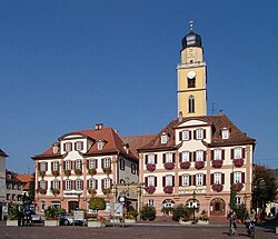
- Weikersheim 40 km (medieval old town, Weikersheim Castle with baroque garden with many statues, alchemy exhibition, Tauberland village museum, forest museum, observatory, game reserve; Hohenloher Residenzenweg, Main-Tauber-Fränkischer-Rad-Achter, Swabian Wine Route)

Weikersheim - Tauberbischofsheim (36 km)

- Markelsheim 48 km
- Igersheim 51 km
- Bad Mergentheim 55 km (historic city center, Teutonic Order Castle with Teutonic Order Museum, Deutschmeistermuseum, Münsterschatz, Ottmar-Mergenthaler memorial, Stuppacher Madonna, castle and spa gardens, wildlife park, wine trail)
- Edelfingen 59 km
- Unterbalbach 61 km
- Lauda-Koenigshofen 66 km (medieval old town, local history museum (Rathausstraße 25, Lauda district, Tel .: 09343 / 501-146, email: [email protected]; guild / handicraft rooms), town fortifications)
- Tauberbischofsheim 76 km (historic old town, market square at the town hall, Kurmainzisches Schloss with Tauberfränkisches Landschaftsmuseum, Türmersturm, St. Martin Church, Liobakirche, Bonifatiuskirche)
Tauberbischofsheim - Wertheim (32 km)
- Tauberbischofsheim
- Hochhausen (Tauber) - 81 km - train stop
- Werbach 82 km (Pilgrimage Church of Liebfrauenbrunn)
- Gamburg 90 km (with the Gamburg Castle (Private), but with guided tours in the castle and garden on weekends, and the Eulschirbenmühle a castle-like mill from the Renaissance, and with the Turrets, the last remnant of the village fortifications / Krappentor. )
- Bronnbach 99 km Monastery with monastery church (1151) and Romanesque-Gothic cloister Bronnbach Monastery
- Reicholzheim 102 km
- Wertheim · 110 km · Wertheim Castle rises to the right before the village. In addition, the cyclist can expect a historic old town with city walls and many architectural monuments (Kittsteintor, collegiate church, court (today town hall), angel fountain, Kilian's chapel, Marienkapelle, Spitzer tower, glass museum, county museum in the old town hall). The Kilian's Chapel, probably one of the most beautiful Gothic chapels in Germany [9], was not open to the public at least in October 2018.
trips
- Main cycle path - from and to Wertheim
- D-Route 9: Weser Alps - the deaf farther following
- Altmühlweg and Altmühltal cycle path
GPS data
- Route profile with GPS data and Google Earth KMZ file in Bike tour wiki
References to literature and maps
Digital maps
- Tauber bike path on OpenSteetMap The bike path is almost completely drawn on the map (just zoom in strongly).
- Map of the Liebliches Taubertal im Bike tour wiki with Google Maps as a map basis
Books and paper cards
- Bikeline bike tour guide "Liebliches Taubertal" - Complete route guide in spiral binding with route maps and directions, town and city maps as well as an accommodation directory. ISBN 978-3850001571 ; 92 pages (format 22.2 x 11.4 x 0.6 cm); Price: € 10.90; published by Verlag Esterbauer
- ADFC regional map of Würzburg / Franconian wine country, scale 1: 75,000 - The Liebliches Taubertal cycle path is also included at the bottom of the map. With the map you can plan beautiful round trips along the Tauber and Main. ISBN 978-3-87073-290-5 , Price: € 6.80
Web links
- Tourist community "Liebliches Taubertal" - official regional website: "Radeln"
- Lovely Taubertal cycle path - BW tourism marketing
- Very detailed description with detailed elevation profiles on Radkompass.de
- Detailed description on Fahrrad-Tour.de
- Very detailed description on Velo-Touring.de
- Bike path on Outdooractive
- Westfrankenbahn timetables (as the Tauberbahn timetable)