
Location map Pará in Brazil
Pará is the second largest state Brazil and is located in the north of the country. While the east is densely populated, the west is a scarcely developed rainforest wilderness, which is being pushed back more and more by deforestation.
Regions

Map of Pará
places
- 1 Belém


 in the Wikidata database") , 1.5 million inhabitants, a lively port city at the mouth of the Amazon with a well-preserved colonial center. Also known for its carnival.
, 1.5 million inhabitants, a lively port city at the mouth of the Amazon with a well-preserved colonial center. Also known for its carnival. - 2 Alenquer
- 3 Algodoal

- 4 Altamira in the south, 100,000 inhabitants, the largest municipality in the country in terms of area
- 5 Alter do Chão
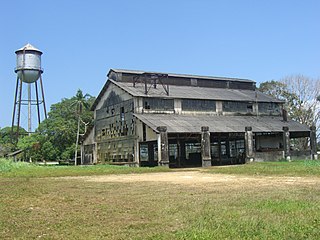
- 6 Belterra - Henry Ford moved his rubber growing project here after failing in Fordlândia
- 7 Capanema
- 8 Castanhal
- 9 Fordlandia - Here Henry Ford tried to grow rubber.
- 10 Itaituba, 60,000 inhabitants, in the central west, starting point for the Amazônia National Park
- 11 Marabá, 200,000 inhabitants, modern metropolis of agricultural industry and agriculture in the south of the state
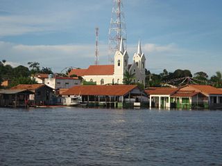
- 12 Monte Alegre - known for some ancient rock paintings nearby
- 13 Ourilândia do Norte
- 14 Parauapebas
- 15 Salinópolis (also as Salinas known), beach resort approx. 300 km from Belém.
- 16 Santarém, 300,000 inhabitants, baroque port city on the Amazon, with interesting lakes and river landscapes in the area.
- 17 Tucuruí, 100,000 inhabitants


Other goals
- 1 Amazônia National Park, protected rainforest area in the west of the state


background
language
getting there
mobility
Tourist Attractions
activities
kitchen
nightlife
security
climate
literature
Web links
- http://www.pa.gov.br/ - Official website of Pará
