
Map of Roraima in Brazil
Roraima is the northernmost state Brazil, it borders in the north Venezuela and Guyana and in the south Amazon and Pará.
For travelers crossing South America by car, the state is important as a communication axis between Brazil and the Caribbean coast, as the only paved connection is via the capital Boa Vista.
Regions

Map of Roraima
places
- 1 Boa Vista (Roraima)

 in the travel guide Wikivoyage in another language")
 in the encyclopedia Wikipedia")
 in the media directory Wikimedia Commons")
 (Q181056) in the Wikidata database") , 260,000 inhabitants, a planned city from the 1940s with a circular cityscape
, 260,000 inhabitants, a planned city from the 1940s with a circular cityscape - 2 Rorainópolis, Population 30,000, in the southeast, a rapidly growing city that emerged from an agricultural colony in 1970.
- 3 Alto Alegre, 20,000 inhabitants, in the northwest
- 4 Caracaraí, 20,000 inhabitants, in the south
- 5 Bonfim, 15,000 inhabitants, is home to a fortress from the colonial era.
- 6 Pacaraima, 10,000 inhabitants, starting point for the Pedra Pintada and nature reserves.
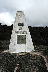
- 7 Uiramutã, 7,000 inhabitants, starting point for the mountain landscape around the Monte Roraima, 2,700 m high on the border with Guyana.


Other goals
- Pedra Pintada, curious archaeological site: a painted, solid granite block, on which ceramic artifacts have also been found. Located in the parish Pacaraima.
background
language
getting there
mobility
Tourist Attractions
activities
kitchen
nightlife
security
climate
literature
Web links
- http://www.portal.rr.gov.br/ - Official website of Roraima
