
Map of Rio de Janeiro (state) in Brazil
The state Rio de Janeiro lies in the southeast Brazil on the Atlantic. It is one of the richest, most densely populated and economically important states in Brazil and at the same time a popular travel destination because of the picturesque capital of the same name and numerous beautiful beaches.
Regions
&groups=Maske,Track,Aktivitaet,Anderes,Anreise,Ausgehen,Aussicht,Besiedelt,Fehler,Gebiet,Kaufen,Kueche,Sehenswert,Unterkunft,aquamarinblau,cosmos,gold,hellgruen,orange,pflaumenblau,rot,silber,violett)
Map of Rio de Janeiro (state)
- Its capital is located in the tourist center of the state Rio de Janeiro.
- The stretch of coast to the east is called Costa do Sol (Sun Coast), it extends from Niterói above Maricá, Saquarema and Cabo Frio to Búcios. The hinterland of this holiday area is also known as the "Região dos Lagos" (lake area) because of its (salt) lakes.
- West of Rio is a stretch of coast that is also known as the Costa Verde (green coast), it extends to Ilhabela at the gates of São Paulo.
places
- 1 Rio de Janeiro


 in the Wikidata database") , 13 million inhabitants, the second largest city in Brazil, with probably the most famous beaches on earth and a colorful carnival
, 13 million inhabitants, the second largest city in Brazil, with probably the most famous beaches on earth and a colorful carnival - 2 Campos dos Goytacazes
 , 500,000 inhabitants, city in the northeast of the state on the Atlantic Ocean with some colonial buildings.
 - 3 Petrópolis, 400,000 inhabitants, largest city inland, located at an altitude of 850 m
- 4 Nova Friburgo, 200,000 inhabitants, city founded by Swiss immigrants inland
- 5 Cabo Frio, With 6 Buzios, one of the most famous beach resorts in Brazil, luxury resort where Brigitte Bardot stayed
- 7 Angra dos Reis, approx. 200,000 inhabitants
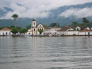
- 8 Paraty, historic coastal town and world heritage site
- 9 Macaé, The country's petroleum capital
- 10 Teresópolis, Agriculture and vegetable growing in Vale dos Gourmets, (Valley of Gourmets)


Other goals
National parks:
- 1 Restinga de Jurubatiba National Park - The park covers a coastal area in the northeast of the state
- 2 Serra dos Órgãos National Park - The Organ pipe mountains is near the city of Teresópolis. There are climbing routes with the highest levels of difficulty in the park.
- 3 Tijuca National Park - The small national park was created in 1961, it is located on the territory of the city Rio de Janeiro. The striking point is that Corcovado with the statue of Cristo Redentor.
- 4 Serra da Bocaina - the park is located on a mountain range that connects the states of São Paulo and Rio de Janeiro.
- 5 Itatiaia National Park - The national park was created in 1937, it is located in the area of the states of Minas Gerais and Rio de Janeiro. The highest point is that Pico das Agulhas Negras with an altitude of 2791 m.


background
In the state of Rio de Janeiro

The Sugar Loaf


.jpg/300px-Armação_de_Buzios_-_panoramio_(7).jpg)
language
getting there
By plane
International airports are:
- In Rio de Janeiro: Rio de Janeiro / Galeão Airport - Antonio Carlos Jobim(IATA: GIG)
- In Campos dos Goytacazes: Bartolomeu Lisandro Airport(IATA: CAW)
- In Cabo Frio: Cabo Frio Airport(IATA: CFB)
- In Buzios:Umberto Modiano airfield(IATA: BZC)
.jpg/320px-Torre_de_controle_Rio_de_Janeiro_(Galeao).jpg)

By boat
Popular destinations for cruise ships are
mobility
Tourist Attractions
activities
kitchen
nightlife
security
climate
literature
Web links
- http://www.rj.gov.br/ - Official website of Rio de Janeiro
