E8 is a 1,410 km (880 mi) European route through Finland and Norway, from Turku in south-western Finland to Tromsø in the Arctic of Norway. Along the route you see most of the Finnish landscape types, except for the larger lakes and deep forests, and some of what is typical for Norway.
Understand
The route goes along the west coast of Finland, through the mostly flat Ostrobothnia and Western Oulu regions, by the Swedish border along the Torne river and its tributaries in Finnish Lapland, continuing along the border through remote fell landscapes, through a mountain pass in Norway and the last stretch along the Norwegian fjords to Tromsø, which although not very big is one of the main Arctic cities globally.
There are archipelagos all along the coast, the extensive Archipelago Sea in the south until Uusikaupunki, the World Heritage Kvarken by Vaasa, and at least some islands nearly everywhere. The sea and the archipelagos have been important for the population along the coast, and you should probably make some sidetrips there, although the modern route mostly goes a little more inland. Some minor roads close to the coast are suggested below, but taking a boat tour farther out could certainly be worthwhile.
Most of the coast is traditionally regarded part of Ostrobothnia, but there is one official region carrying the name. It is a mostly Swedish speaking area. All of Ostrobothnia is characterized by large plains traversed by rivers. By the coast there are large fields, farther north large mires dominate. There is also much forest, as everywhere in Finland.
The route along the coast has been historically important. Until the 1960s the route was mostly along roads traditionally used by foot and horse. As the route was straightened, stretches of the old route remain as local roads, which may be your best option if you travel by bike or otherwise want to explore the countryside.
The first stretch of the old route is part of the historic Great Post Route (see King's Road) leading from Stockholm to Turku. Farther north it provided access by land when the sea was frozen (thus impassable for ships), possibly all the way around the Gulf of Bothnia already in medieval times, driveable by carriage from the 1550s to Korsholm (Vaasa), to Tornio by the 1750s. It worked as postal route all the way from Stockholm from 1644. It is marketed as the tourist route Pohjanlahden rantatie. To the northern inland most transport was traditionally by rivers.
The valley of Tornionjoki and Muonionjoki are in Finnish Lapland, in the reindeer husbandry area, with wilderness not far from the road, but still with villages quite regularly and few fells visible. Recreational fishing is big here. The road continues along the border river but the environment becomes more wild, and before entering Norway there are not only the rounded fells typical for Finland, but also some more alpine landscapes. In Norway you have the fells and fjords that make that country famous.
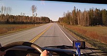
There are a few stretches of motorway; mostly the road is undivided two-lane. It is paved and generally in good condition.
In Finland the roads used are also signposted by their national numbers (mostly national roads 8 and 21), and by street names in some environments, and these are usually better known locally; along national road 8 Kasitie/Riksåttan ("road eight"/"national eight") is used colloquially. Addresses are given with the "street" name whether signposted or not. The E8 sign is however used throughout.
Prepare

- See also: Tips for road trips
The road goes mostly through countryside, but until Muonio in the Torne/Muonionjoki river valley, there are towns and villages not too far apart, including the main cities of the west coast of Finland. After that however, you drive through Arctic wilderness, with the few "major" villages having just over a hundred inhabitants, until you reach the fjords. The mountain pass in Norway after Kilpisjärvi has traffic restrictions in winter, so that you may have to wait for a snow plow and drive in the line after it.
Make sure you check advice for winter driving and cold weather if driving through the remote areas any time but July–August. Temperatures will not be severe but in winter, but occasional snowfall and freezing nights are possible all year along the highest stretch. Check weather forecasts. Also make sure you have enough fuel, and anything you need in case of having to wait for help after a breakdown.
You might want to hike up a fell or even make an overnight hike to a wilderness hut. To find your way back through the fell birch forest a compass may be needed (and a map is useful for finding a good route). For the open wilderness huts you need own hiking mattresses, sleeping bags, matches, cutlery etc. – and anything that may be needed in foul weather above the treeline, if that's where you venture. For other types of cabins own linen may be needed, or a way to save some euros. Binoculars can be useful for bird watching and for views from lookout towers and fells.
Mosquitoes are common in the Finnish countryside, and some parts of this itinerary are among those with hordes of them from sometimes in June through July. They carry no diseases, but their bites are itchy and trying to avoid them can spoil your experience. Have suitable clothes and insect repellent.
Finland and Norway are both part of the Schengen Area and the Nordic passport union (as is Sweden, for sidetrips), so border control formalities are next to non-extant. Norway is not in the EU, so you should still declare some items, and pets need some documents and treatments, which you should take care of well in advance.
Get in

Turku is quite well-connected. The most common option is to take a ferry from Sweden. Air connections are somewhat sparse, but the well connected Helsinki Airport is a 2½-hr drive away.
There is another ferry halfway up the Finnish coast, to Vaasa, and in the Tornio/Muonionjoki river valley there are several border crossings from Sweden (except at Tornio these are from very sparsely inhabited areas). The last border crossing, in Karesuvanto, is at the northernmost village of any size in Sweden.
There are connecting roads from the east all along the road. Between Oulu and Kemi it shares tarmac with E 75. Cars can be taken to Oulu or Kolari on some trains from Helsinki. The main railroad to the north follows the coast between Kokkola and Kemi and a branch continues to Kolari. While there is no railroad along the southern part of the coast, most of the bigger towns have rail connections inland.
At the northern end the tarmac is shared with E6, the main road of Norway ("Eseksen"), between Skibotn and Nordkjosbotn 80 km from Tromsø. Tromsø has an airport, which is the hub for air transport in Northern Norway, with daily connections to Oslo and some international flights. Tromsø is also on the Hurtigruten ferry line along the Norwegian coast.
For dramatic effect, the route is best taken from south to north, with the landscapes becoming increasingly exotic for people from southern more densely populated regions. This direction also mostly avoids your having the sun in your eyes while driving.
Drive

Turku to Pori
The route starts in 1 Turku with Koulukatu in the west part of the centre leading under the railway, to north-west by Naantalin pikatie. It soon forks away from the Naantali road as Rauman valtatie leading by Raisio toward Rauma, Pori and Vaasa. You could also take the older route: start from the cathedral, drive Aninkaistenkatu by the bus station, continue by Satakunnantie to Raisio and take the E8 motorway from there. After leaving Turku and Raisio the landscape is rural, with forest and flat fields. 20 km of the first stretch is motorway. In Nousiainen it becomes two-lane. Until Liminka near Oulu 500 km farther, E8 is also known as National Road 8, colloquially Kasitie/Riksåttan.
The medieval 1 Nousiainen Church is at the location of the first bishop seat of Finland, moved to Turku in 1229. It is part of the pilgrimage route from the place where Henrik, the first bishop, regarded patron saint of Finland, was murdered according to the legend, to the cathedral in Turku.

Some distance from Turku, in 2 Mynämäki ![]() , is the old crossroads of the Great Post Route (see King's Road) leading from Stockholm to Turku over the Sea of Åland and via Åland, the archipelago, Kustavi and Mynämäki. Mynämäki is in the inland of Finland Proper (although the municipality does reach the sea).
, is the old crossroads of the Great Post Route (see King's Road) leading from Stockholm to Turku over the Sea of Åland and via Åland, the archipelago, Kustavi and Mynämäki. Mynämäki is in the inland of Finland Proper (although the municipality does reach the sea).
The last town in Finland Proper is 3 Laitila, with a crossroads to Kalanti and 1 Uusikaupunki, with cruises to the 2 Bothnian Sea National Park.

Soon after the regional border to Satakunta, the road passes 4 Rauma. It is an old port city with its wooden old town a UNESCO World Heritage site. In Finland, Rauma is also known for its peculiar dialect, with lots of Swedish loans. It was one of the first Finnish dialect to get literature, by Hj. Nortamo, who wrote several books in this tongue around 1900. Cruises to the lighthouse islands of Kylmäpihlaja and Kuuskajaskari in the Bothnian Sea National Park.
The next city is 5 Pori, with its neighbour Ulvila one of the first chartered towns in Finland. Pori itself is the regional seat, an industrial town most known for its excellent Yyteri beach and the Pori Jazz festival (with jazz nowadays in a lesser role). It also has some interesting architecture and a national urban park. There is a bird watching tower at the bay Preiviikinlahti close to Yyteri. Pori has train connection to Tampere, which is on the main railway.
Pori to Kokkola
Already around Pori there are place names with obviously Swedish origin, such as Noormarkku ("Nordmark"). After the regional border to Ostrobothnia, most countryside has only a small minority of Finnish-speakers and the regional seat Vaasa (Vasa) and tiny Kaskinen (Kaskö) are the only towns with Finnish majority. Half of Finland's Swedish-speaking population lives here, and most speak their local dialects at home and with fellow dialect speakers.
The village and rapids of 2 Lankoski (Långfors) in Merikarvia (Sastmola) is a popular rest spot. They are a nationally important cultural milieu, witnessing late 19th century small-scale industrialisation. There is a café with meals, geared towards charter coaches and lorry drivers, with long hours year round, and a smaller café: Köffi and Kahvimylly.
Some 45 km from Pori you drive through Lappfjärd with crossroads to 3 Kristinestad, the southernmost Ostrobothnian town. It is a nice small town by the sea, with a large wooden old town and the motto The Good Life. After Kristinestad the road is often a straight line over plains, with just minor hills.
If you like smaller roads, you could drive along the coast from Kristinestad, starting with 1 road 6620 (Skrattnäsvägen toward Pjelax), then road 6761 (Kristinestadsvägen) towards Närpes.
Some 20 km from Lappfjärd is the crossroads to Kaskinen (Kaskö), Finland's smallest town, with less than 1,300 inhabitants, chartered in 1785. As in most traditionally Swedish towns in Finland, people moving in from Finnish Finland to work in the industries have made the majority Finnish.
The next town (5 km from E8) is Finland's tomato capital 4 Närpes, with the most archaic dialect around, unintelligible also for most Swedish speakers. Like elsewhere, people know standard Swedish and English. The need for workers in the greenhouses has made Närpes multicultural, an example of successful immigrant integration.
In you drive via Närpes centre, you can take road 673 (Strandvägen) via 5 Korsnäs ![]() and 6 Malax
and 6 Malax ![]() to Vaasa. E8 is straighter and faster.
to Vaasa. E8 is straighter and faster.

After Malax the road enters 6 Vaasa (Vasa), the seat of the region. Off the coast is the Kvarken Archipelago, a UNESCO World Heritage together with Höga kusten ("the high coast") on the Swedish side. The glacial rebound makes the land rise, which combined with the shallowness of the sea makes new ground appear year by year.
E12 and the Blue Highway from Mo i Rana on the Atlantic coast lead by ferry from Umeå over the Gulf of Bothnia to Vaasa, the former continuing to Helsinki, the latter to Petrozavodsk and Pudozh in Russian Karelia. Vaasa also has train connections via Seinäjoki.
The road passes 7 Maxmo ![]() , where you could take a sidetrip through the archipelago and back at Kaitsor, and leads through 7 Oravais
, where you could take a sidetrip through the archipelago and back at Kaitsor, and leads through 7 Oravais ![]() . The Battle of Oravais was the bloodiest of the 1808–1809 war. The Fänrik Ståls center, signposted "Furirbostället", has a museum on the time (limited hours) and guided tours of the battlefield (for groups). Also in Oravais (before the crossroads to the centre), at the café Fjärdens kaffestuga, is a view to the sea, perhaps the only one you get without detours.
. The Battle of Oravais was the bloodiest of the 1808–1809 war. The Fänrik Ståls center, signposted "Furirbostället", has a museum on the time (limited hours) and guided tours of the battlefield (for groups). Also in Oravais (before the crossroads to the centre), at the café Fjärdens kaffestuga, is a view to the sea, perhaps the only one you get without detours.
The next town is 8 Nykarleby ![]() , with the junction in Ytterjeppo, with the river Lappo å. You could take road 749 (Jakobstadsvägen) from Nykarleby or drive via 8 Bennäs in Pedersöre, with the train station of the pretty town Jakobstad.
, with the junction in Ytterjeppo, with the river Lappo å. You could take road 749 (Jakobstadsvägen) from Nykarleby or drive via 8 Bennäs in Pedersöre, with the train station of the pretty town Jakobstad.

Among the industry in 9 Jakobstad is Nautor's Swan, building luxury sailing yachts. There is a nice wooden district, Skata, a former sailors' and workers' district. The botanic park Skolparken is also nice.
In 10 Larsmo ![]() Nautor's offspring Baltic Yachts also builds luxury sailing yachts, but with somewhat less emphasis on sailing than Nautor's. Larsmo is a small rural archipelago municipality, nearly monolingually Swedish. The Læstadian religious revival movement, which is important in most of northern Finland and Sweden, is especially strong here. Larsmo can be visited as a sidetrip from Jakobstad, perhaps driving over the main island directly to Kokkola ("Road of Seven Bridges").
Nautor's offspring Baltic Yachts also builds luxury sailing yachts, but with somewhat less emphasis on sailing than Nautor's. Larsmo is a small rural archipelago municipality, nearly monolingually Swedish. The Læstadian religious revival movement, which is important in most of northern Finland and Sweden, is especially strong here. Larsmo can be visited as a sidetrip from Jakobstad, perhaps driving over the main island directly to Kokkola ("Road of Seven Bridges").
The E8 continues on the mainland via rural 9 Kronoby ![]() .
.
10 Kokkola (Karleby) is the last town of the Swedish-speaking Ostrobothnia and already part of Central Ostrobothnia. It is the largest town after Vaasa and until Oulu.
Kokkola to Oulu
11 Lohtaja, the first town after Kokkola, is still in Central Ostrobothnia, but soon after, the road crosses into Northern Ostrobothnia. In 12 Himanka ![]() the road crosses the Lestijoki river, one of the more notable of the many rivers flowing into the Bay of Bothnia in the region. In addition to the rivers, the region is, like many parts of Finland, known for its mires.
the road crosses the Lestijoki river, one of the more notable of the many rivers flowing into the Bay of Bothnia in the region. In addition to the rivers, the region is, like many parts of Finland, known for its mires.
Halfway from Himanka towards Kalajoki you pass Rahja. The 11 Rahja archipelago can be explored by canoe or by boat, one more good place to see the effects of the ice age and glacial rebound, and old fishing bases. Pick bilberry, lingonberry and buckthorn berries. In spring and autumn there is an abundance of migrating birds.
Just before 13 Kalajoki, the road passes near what is probably the most famous beach in Northern Finland; 12 Kalajoen hiekkasärkät. In Kalajoki, the road crosses a river with the same name, and you can check out the old town Plassi.
14 Pyhäjoki, the following town, also sits next to a river by the same name. The river is split into a delta, with an island in the middle. The following city, 15 Raahe, was founded by Per Brahe, Swedish Governor General of Finland in the 17th century, and its Swedish name is indeed Brahestad (lit. "Brahe city"). Raahe is known for its large Rautaruukki steel plant, but also has a nice wooden old town. Traditionally it is known for shipping, with the largest merchant fleet in Finland 1867–1875, and it still is one of Finland's main ports.
After Raahe, the road turns inland (or rather the land bulges outward into the sea). In the village of 16 Revonlahti, Siikajoki river, another quite wide river is crossed. Just after passing the centre of 17 Liminka E8 merges with national road 4 (E75) coming in from Jyväskylä and all the way from Helsinki. At that point, the road turns into motorway leading you into Oulu.
In Kempele, halfway from Liminka, is a crossroads to Oulunsalo and 13 Hailuoto, the largest island of the Bothnian Bay. There is a free ferry or a 9-km ice road (in late winter). Sights include the Marjaniemi lighthouse, the villages and the unique nature, charachterised by sand and the glacial rebound: dunes, pine forest, mires, and wet meadows.

18 Oulu is the fourth most-populous metropolitan area of Finland. Nowadays it is a high tech city, with the main university of Northern Finland and an important Nokia subsidiary. IRC was invented here. It is also the town with most bicycling in Finland, despite its northern location.
Oulu to Muonio
The hinterland of Northern Ostrobothnia was reached by the big rivers, and timber and tar could be brought from the endless forests. Tar shipping was a big business for Oulu, one of Finnish towns providing tar for the fleets of the British Empire and other western countries in the age of sail. Kemijoki, with its mouth in Kemi, is the longest river in Finland, with its sources near Urho Kekkonen National Park.
Between Oulu and Kemi you enter the Lapland region, although little changes in the landscape (and indeed, Ostrobothnia as a non-administrative region continues far inland). Also the reindeer husbandry area begins, including most ground outside the few cities. Look out for reindeer, pass them carefully, and call 112 if you might have hurt one. Here in "the south" most people in the reindeer husbandry are Finns, while there is a Sámi de facto near monopoly on it farther north.
In Tornio you enter the Tornionjoki river valley, and later the valley of Tornionjoki's tributary Muonionjoki, the rivers marking the border to Sweden. Until somewhere past Muonio the valleys are quite densely populated by Lapland standards, although the villages are mostly small.
The next town after Oulu, 19 Ii, has a nice wooden old town (Hamina, "the port"). It became the centre of a huge parish and an important centre of commerce in the medieval times. In the 18th century Ii was a forerunner in industrialisation. Now it is a small town. Here the latitude is halfway between that of the southernmost and northernmost points of Finland, and likewise the longitude is halfway between that of the westernmost and easternmost points.

Simojoki, flowing through 20 Simo, is one of only a few rivers that have retained their original breeding Baltic Sea salmon population. Fishing is the main reason for tourists to come here. There are also two villages, Simonkylä and Simoniemi, that survived the Lapland War during World War II, and by Simonkylä a stretch of museum road. They are nationally important cultural scenic views. The landscape is flat as in most of Northern Ostrobothnia (though you just passed the border to Lapland), with large mires. You might want to visit the 14 Martimoaapa-Lumiaapa-Penikat Mire Reserve (a sidetrip of some 2×35 km). By the coast there are wind mills.
Next the road transforms into motorway and soon you enter 21 Kemi, an industrial town with airport, in winter also ice breaker cruises and a hotel made of ice (visits possible). In its hinterland Keminmaa E75 forks off and after a while you reach Tornio, where the motorway ends.
22 Tornio and Haparanda are twin towns, with the hardly noticeable country border at a fork of the river Tornionjoki (Swedish: Torne älv). The town Tornio, oldest in Lapland, became part of the Russian Empire 1809 and Sweden built a market town on their shore. Now they are a prime example of cross-border cooperation, with commuting for work and shopping in both directions and shared police patrols. Also on the Swedish side Finnish is commonly spoken – the 1809 border was not a linguistic one. The border closures caused by the immigration crises 2015 and the Covid-19 pandemic 2020 hit hard. E4, running by most of the Swedish east coast, ends here, at E8.
The tower of the Alatornio church is part of the Struve Geodetic Arc. Also Aavasaksa a bit ahead is such a point by the road. There are a few more of the points reasonably near the road on the Swedish side.
E8 follows national road 21 upstream. You are going to follow Tornionjoki and its tributaries for some 500 kilometres (300 mi) along the border to Sweden. This is one of the longest stretches of river without dams in all of Europe. The road along the river is called the "Aurora Borealis Route". There are no more northern lights here than elsewhere in Finnish Lapland, but you are indeed approaching regions where they are common in the dark seasons.
There are roads on both sides of the river most of the time, on the Swedish side national road 99 to Karesuando, E8 on the Finnish side. Bridges connect the countries in every municipality, and many villages have one half in Sweden and one in Finland, separated by the border since Finland became part of the Russian Empire in 1809. The Nordic Passport Union and later the Schengen Area have made passing the border quite easy for locals, Nordic citizens, and now close to anybody.

The 3 Kukkolankoski rapids 13 km upstream from Tornio are a popular resting spot (with a camping site on the Swedish side). The next bridge is at Swedish 15 Övertorneå, just after Finnish 23 Ylitornio parish village (yli=över), but conveniently at the fell 4 Aavasaksa ![]() , the main sight around. It is the southernmost point where midnight sun can be seen in Finland, and was therefore an important destination before road travel was possible in Lapland. Its top is one of the points on the Struve Geodetic Arc and provides magnificent views. The Russian emperor planned a visit, and facilities built for the occasion remain, with service for tourists.
, the main sight around. It is the southernmost point where midnight sun can be seen in Finland, and was therefore an important destination before road travel was possible in Lapland. Its top is one of the points on the Struve Geodetic Arc and provides magnificent views. The Russian emperor planned a visit, and facilities built for the occasion remain, with service for tourists.
The next municipality is 24 Pello. In the village of 5 Juoksenki, 25 km after the Aavasaksa bridge, you cross the Arctic Circle. In theory this is where you start to see the midnight sun in Midsummer and the polar night before Christmas. In practice it is more complicated, but around Midsummer the sun is indeed above the horizon at midnight, unless obscured by fells or forest.
A Frenchman, Pierre de Maupertuis, determined the shape of the Earth by making measurements in the Tornionjoki valley 1736–1737, a century before Struve. The northernmost point he used was 6 Kittisvaara close to the modern centre of Pello.

Some 20 km to east-southeast is the 16 Miekojärvi lake area, suitable for boating, canoeing and hiking.
Some 4 km after Pello the road 21/E8 makes a slight shortcut to Kolari away from the river. In between Tornionjoki ceeses being the border river, and you will be following its tributary Muonionjoki (Sámi: Rádjeeatnu, "border river") instead. If you want to follow the river, you have to take the local road along its shore.
25 Kolari has the northernmost passenger train station in Finland. In the spring ski season there are daily overnight trains from the south, taking also cars from some stations. 35 km to the north-east is the Pallas-Yllästunturi National Park, the most popular national park of Finland, and the ski resorts Äkäslompolo and Ylläsjärvi.
Next is 26 Muonio. From here the park is 20 km to the east, 10 km more for the 17 Pallastunturi Visitor Centre. The road (and coaches) from the Kittilä airport and Rovaniemi farther away also come in through the park. As in most places in Lapland, it is easy to find tourist businesses offering fishing trips and whitewater sports.
Muonio to Kilpisjärvi
Make sure you have enough fuel and anything else you might need. Karesuvanto is 100 kilometres (60 mi) away and Kilpisjärvi 100 km more. From here to Kilpisjärvi the road is sometimes called Neljän tuulen tie ("the road of four winds"). The official name is Kilpisjärventie.
After leaving Muonio centre you pass the villages of Yli-Muonio, Kätkäsuvanto and Sonkamuotka. The village Yli-Muonio survived the Lapland War (during World War II), and is thus a rare example of pre-war village architecture of Finnish Lapland.
After Sonkamuotka you enter Enontekiö (Sámi: Eanodat; "river maker") and the Sámi native region. Here Northern Sámi is an official language, spoken by some 10% of the population.
In winter snowmobiles are in wide use, essential to be able to look after reindeer while living in a permanent house, and also useful for fishing and general getting around where roads are few. Before the snowmobiles, people with large herds had to move with the reindeer. Not all Sámi (and few Finns) had large herds though. Large scale reindeer husbandry came with the Northern Sámi, who now dominate in Finland (and is the largest Sámi group overall). There is an extensive network of snowmobile routes (and "tracks") covering most of Finland; the Victoria Route along the river, named after the Swedish crown princess, goes all the way to the three border mark by Kilpisjärvi, as a cross-border cooperation.
On the next 17 km there is just the tiny village of Äijäjoki. The following, 27 Palojoensuu ![]() (Bálojohnjálbmi) with some 100 inhabitants, had a church 1827–1856, and later a boarding school (later used as community centre and tourist lodging). Here is the crossroads to Hetta (with the Enontekiö airport) and farther to Kautokeino in the Norwegian Finnmark. That route is also one for Nordkapp.
(Bálojohnjálbmi) with some 100 inhabitants, had a church 1827–1856, and later a boarding school (later used as community centre and tourist lodging). Here is the crossroads to Hetta (with the Enontekiö airport) and farther to Kautokeino in the Norwegian Finnmark. That route is also one for Nordkapp.

18 Hetta is the administrative centre of Enontekiö and one place to meet Sámi culture, and a trailhead for the Pallas–Ylläs hiking route through Pallas-Yllästunturi National Park (which you have followed at some distance since Kolari), and a starting point for visiting Pöyrisjärvi (Bievrrašjávri) or Pulju Wilderness Area. Behind Pulju is Lemmenjoki National Park, the largest in Finland. The theme continues. Enontekiö has the second lowest population density in Finland, with less than 2,000 people on more than 8,000 km2 (3,100 sq mi), so there is indeed room for wilderness.
The next village of some size is 28 Karesuvanto (Gárasavvon), with the northernmost border crossing from Sweden. The village's namesake Karesuando is across the river, with more services and the house of Lars Leevi Laestadius as vicar. The Leastadian revival movement still has great influence in the northern parts of Finland and Sweden (do you remember Larsmo in Ostrobothnia?). Here you could also make a sidetrip to the 19 Tarvantovaara (Darvvatvárri) Wilderness Area. In that wilderness, close to the Norwegian border, Stuorrahanoaivi was on the Struve Geodetic Arc. Tynnyrilaki of the Pingisvaara fells, on the Swedish side 30 km before Karesuando, was the previous one.
4 km after Karesuvanto, you arrive in the Lätäseno-Hietajoki Mire Protection Area. 3 km farther, at the upper end of the Mannakoski rapids, there is a ¼-km nature path, a shelter and a bird observation tower by the road. Still 2 km farther, at the tiny village 29 Markkina (Boaresmárkan), Könkämäeno (Geaggáneatnu) and Lätäseno (Leahttáseatnu) join to form the Muonio river you have been following. Markkina was a market place (whence the name) and with the church of a large parish since early 17th century. When the Russian Empire had conquered Finland 1809, the parish was split and the church was moved to Palojoensuu. There is a memorial at the church site. The graveyard and a pine used for votive offerings remain.
8 km after Markkina, there is a renovated German World War II fortification camp, 7 Järämä Sturmbock-Stellung, with museum and café. It was part of a network of such camps, built to protect the harbours of the Arctic Ocean during the Lapland War. The camp is dug partly into the bedrock. No real battles were ever fought here. The environment is the Järämä recreational forest. The border for pine forest is at the east end of it, with a lonely pine at Luspa/Luspi, 2.5 km farther along the road, probably the last one you will see in Finland. Farther on all forest will be fell birch. You will also see more and more impressive fells.
26 km after the fortification you pass 8 Pättikkä (Beattet), where the Sámi poet and artist Nils-Aslak Valkeapää, important for the reestablishing of Sámi proud from the 1960s onward, lived much of his life. The village has just a few houses. ½ km downstream is one of the worst rapids of Könkämäeno for paddling at high waters: Pättikkäkoski (Beattetguoika).

For the rest of your journey to Kilpisjärvi the Käsivarsi Wilderness Area will be a few kilometres to your right. There are several points where you could start a hike, with some 10 km to the nearest open wilderness hut, where you can overnight for free (with own hiking mattress and sleeping bag). The terrain is often quite easy, but in the wilderness area you are far from any help if getting lost or taken by surprise by foul weather.
18 km after Pättikkä you reach an information post and a ⅓-km nature trail to the palsa bogs of 9 Iitto. Also this is a suitable entry point for the wilderness area, with the 1 Ropi Open Wilderness Hut 8 km away, and a 718 m peak of the Látnjavárit fells at its border just 3.5 km away. A compass should be enough to climb it safely, unless you hurt your legs (but a map is needed to find a short route to the highest peaks).
6 km after Iitto, a 2-km road with a barrier leads to windmills at the top of the 735-m Lámmasoaivi. Stay clear if there might be ice on the rotors, otherwise you should be able to enjoy the views.
17 km farther is the lake Peerajärvi (Bearajávri) with a cottage village. Just after the crossroads is also a road to Keinovuopio, the northernmost year-round inhabited place in Sweden. It cannot be reached directly from the Swedish road network, and also from Finland only by foot or over the ice in winter. The pedestrian cable bridge is not an official border crossing, but who cares!

6 km after Peera the road reaches 10 Muotkatakka (Muotkkádat), the highest point of the Finnish public road network, above the treeline at 565 m, between 700-m Leutsuvaara (Leavževárri) and Laassavaara (Lássávárri). There is a rest spot and a memorial of the Lapland War.
When you have past the saddle, you have a view to Ala-Kilpisjärvi (Vuolle-Gilbbesjávri, "lower lake Kilpis"). In the other end of the lake starts the village 30 Kilpisjärvi. Here are hotels, cottages, restaurants and grocery stores, a metropolis with a hundred inhabitants. If you come in season you certainly want to visit the Kilpisjärvi Nature Centre. A trip up the longest stairs of Finland, to the top of Saana, also is among the "musts". There are also a couple of other nature trails.
As a day trip, complete the third "must": take a cruise over Kilpisjärvi to the 20 Three Border Point ![]() of Finland, Norway and Sweden (a less romantic concrete block by the shore of a small lake) and return through the Malla Strict Nature Reserve along a marked trail – or the other way round, or as a return cruise; the hike from the ferry is 3 km, through the reserve 11–18 km, plus 2 km to the ferry harbour. It is possible to stay the night nearby in an open wilderness hut before returning (with own mattress and sleeping bag, or own linen if you reserved a bed in the adjacent locked cabin).
of Finland, Norway and Sweden (a less romantic concrete block by the shore of a small lake) and return through the Malla Strict Nature Reserve along a marked trail – or the other way round, or as a return cruise; the hike from the ferry is 3 km, through the reserve 11–18 km, plus 2 km to the ferry harbour. It is possible to stay the night nearby in an open wilderness hut before returning (with own mattress and sleeping bag, or own linen if you reserved a bed in the adjacent locked cabin).
If a day trip is not enough, make it a week: the route to the highest point of Finland, at 21 Halti ![]() (Háldičohkka), is a very popular 2×55-km trek. There are open wilderness huts and also the possibility to reserve beds in some huts (the latter with mattresses and pillows, still use own linen), but in foul weather the area is demanding, mostly above the treeline, with no shelter except the huts, and few landmarks in reduced visibility.
(Háldičohkka), is a very popular 2×55-km trek. There are open wilderness huts and also the possibility to reserve beds in some huts (the latter with mattresses and pillows, still use own linen), but in foul weather the area is demanding, mostly above the treeline, with no shelter except the huts, and few landmarks in reduced visibility.
Kilpisjärvi to Skibotn

The customs is at the Finnish side, after the village and the Malla trail, 4 km before the border. Norway is part of Schengen and the EES, but not of the EU, so some items may need customs clearance, and e.g. for pets, restrictions apply. This county of Norway is Troms (since 2020: Troms and Finnmark).
The road starts descending, but the mountain pass on the Norwegian side is still often closed in bad weather, and driving in winter may be restricted to following a snowplow in line. Since 2018 there is an "intelligent road" experiment, with sensors along the road (the experiment involves the stretch all the way from Kolari, but this is the most demanding leg).
When you reach E6, Tromsø is to the left, but you could take a sidetrip to the Skibotn village to the right.
31 Skibotn (Ivgobahta/Yykeänperä) is on the shore of the fjord Lyngen, some 100 kilometres (60 mi) from the open sea, surrounded by large mountains. It used to be an important meeting place between Norwegians, Sámi and Kven (and Finnish) people, with a yearly market.
The village has an astrophysical observatory, especially for northern lights, well away from city light pollution, a chapel from 1895 and the home of Nils-Aslak Valkeapää for another part of his life (cf Pättikkä/Beattet). The home is a museum in summer, residence for Sámi artists or researchers of Sámi culture in winter. The chapel, seating many more than the inhabitants of the village, is used for large Læstadian gatherings.
Skibotn to Tromsø

E8 shares the road with E6 southwest along the fjord through a very Norwegian landscape with fells, then the road goes inland, before arriving in the village of 32 Nordkjosbotn ![]() . Here the two road numbers part, and E8 turns north, following the shore of Balsfjorden, with an inland part, before you see 33 Tromsø on an island across the fjord. To go to the central parts of the city, turn off at Ishavskatedralen (Arctic Sea cathedral), and cross the fjord on the bridge Tromsøbrua. E8 will cross the fjord in a tunnel further north and end at a roundabout on the island north of the city centre.
. Here the two road numbers part, and E8 turns north, following the shore of Balsfjorden, with an inland part, before you see 33 Tromsø on an island across the fjord. To go to the central parts of the city, turn off at Ishavskatedralen (Arctic Sea cathedral), and cross the fjord on the bridge Tromsøbrua. E8 will cross the fjord in a tunnel further north and end at a roundabout on the island north of the city centre.
Other than by car
There are coaches along the road, see Matkahuolto for timetables. Checking services between nearby towns may turn up many more connections than searches for longer legs. In the remote area between Muonio and Skibotn, there is a coach only once or twice a day, and the only service between Kilpisjärvi and E6 drives in summer only. For that part you might want to check Eskelisen Lapinlinjat, although they may direct you to the Matkahuolto web site. Also in Norway services may be sparse. As the coaches might not combine well at transfers and don't have long breaks suitable for sightseeing, plan your itinerary well.
Between Kokkola and Kolari, long-distance trains can be useful.
For biking, the E8 itself is not very nice, straight through the landscape as it goes, with a quite narrow shoulder and traffic passing in 80 or 100 km/h. On the few motorway stretches biking is forbidden. However, there are parallel more quiet and less straight roads for much of the distance, going through the villages and towns instead of passing by. There are also bikeways along E8 (or nearby) at some legs.
You will probably want to skip most of the parts where you would have to bike along the E8 itself. A few bicycles can usually be taken on the coach with no problems (in the luggage department, no need to fold or pack it). Having a bike allows you to make sidetrips quite far from the main road, where coaches or buses are sparse or absent.
Up north, you won't have any parallel roads, but traffic is sparse and should not really be a problem, although you should not forget about it when taking a break – always stay off the road unless keeping a good lookout. Distances are huge. Don't expect there to be lodgings in the villages unless you have arranged it. A tent and a camping stove are probably a good idea.
In Norway you still have few bikeways or parallel roads, and the shoulders may be even narrower than in the south. Check what to expect. Information on the EuroVelo "Atlantic Coast Route" may have hints.
Eat and drink
There are restaurants and cafés in the towns, and at some nice locations elsewhere. Outside towns, your main options are fuel stations, some of which are open around the clock. Between Muonio and Kilpisjärvi your only options may be a Hetta as a sidetrip, and Karesuvanto (and Karesuando across the border), unless some cottage entrepreneur serves meals.
Sleep
Hotels and similar accommodation is as a rule available in cities and bigger towns; sometimes but not always in smaller towns. Cottages may be a nice alternative – and the only lodging outside towns – but as they seldom are at the road (and not always available for single nights), check and book in advance. There are some campsites along the road, and wilderness camping is an option in rural areas (see Right to access in the Nordic countries).
Stay safe

The road is well-maintained. Through Ostrobothnia, especially between Kristinestad and Vaasa, the road is quite straight, with a risk of losing concentration. After Muonio risks associated with remoteness and possibly cold weather may be relevant.
Animal collisions are a danger all along the road. There are elk (moose), in the south also white-tailed deer and roe deer and in the north (in Lapland and Troms), also reindeer. A collision with an elk can easily be lethal, the others are generally survivable. If the animal might have been hurt, call 112 to get local hunters or reindeer handlers trace it.
There are warning signs for elk and deer, which should be taken seriously, especially at dusk and dawn, even if they feel to be in effect most of the time. The animals often hang around at the forest edge, to suddenly cross the road. You have to be very alert to see them in time. The reindeer are easier to spot, but drive carefully until you are sure you have past all the herd, with some marginal. If an animal takes you by surprise, try to steer behind it, to let it escape forward – they may try anyway.
Note daylight hours. In midwinter in the north dawn turns into dusk without the sun rising, while the midnight sun shines in summer. In the south there is no polar night, but days are short in winter and nights light in the summer. If driving north to south in winter, the sun will shine in your eyes most of the time it is above the horizon from Muonio onward. Bring good sunglasses and have windscreen and wipers in good condition.
Go next
In the northern end, you can in addition to Tromsø explore the fjords, islands and mountains of Troms, or travel along the E6 (Norway's main highway) or Hurtigruten (the coastal ferry) east or south. The scenic archipelago of Lofoten is a bit south, whereas the region of Finnmark is to the east, and about 500 km from Skibotn along E6 and E69 is Nordkapp, the northernmost point in Europe (probably in the world) easily reachable by car.
If you've driven to the southern end, you've arrived in Turku, Finland's oldest city and third largest urban area with historic and modern attractions. Also here you have the option of exploring an archipelago – the Archipelago Sea – for example following the Archipelago Trail, or you can take the ferry to Åland and Sweden. Heading east, there are two historical routes to follow; the King's Road along the southern coast and the Hämeen Härkätie to Hämeenlinna.