 | ||
| Issigau | ||
| federal state | Bavaria | |
|---|---|---|
| Residents | 1.011 (2019) | |
| height | 524 m | |
| no tourist info on Wikidata: | ||
| location | ||
| ||

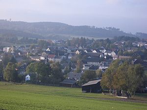
Issigau is a municipality in the district court in Upper Franconia in Eastern Franconian Forest.

Map of Issigau
background
Issigau consists of the following districts:
|
|
getting there
By plane
The closest international airport is the Nuremberg Airport.
By train
The next train station is in demand stop Höllenthal.
By bus
From Hof Central Station by bus 6347
In the street
Issigau is via the federal motorway ![]() Berlin – Munich reachable. The junction is
Berlin – Munich reachable. The junction is ![]() 31 Berg / Bad Steben. From there the road then leads over mountain to Issigau,
31 Berg / Bad Steben. From there the road then leads over mountain to Issigau,
mobility
Tourist Attractions
activities
Hiking and cycling are possible in the area.
shop
kitchen
- 1 Hirschsprung Inn, Eichenstein 18, 95188 Issigau, Germany. Tel.: 49 9288 1732. Open: Fri to Mon and Wed 11 am–8pm.
nightlife
Most likely to be found in the neighboring Bad Steben a night life.
accommodation
health
The nearest hospitals are in Hof and Naila.
trips
In the west is that Franconian Forest in the east that Hofer Land, the town court is not far.
literature
Web links
- http://www.issigau.de - Official website of Issigau
- selbitztal.de - Selbitztal holiday region - Döbraberg in the Franconian Forest Nature Park
