
The Hell Valley is a protected valley of the river Selbitz im Eastern Franconian Forest on the border to Thuringia, at the foot of the city Lichtenberg.
background
 |
&groups=Maske,Track,Aktivitaet,Anderes,Anreise,Ausgehen,Aussicht,Besiedelt,Fehler,Gebiet,Kaufen,Kueche,Sehenswert,Unterkunft,aquamarinblau,cosmos,gold,hellgruen,orange,pflaumenblau,rot,silber,violett)
The river Selbitz rises near Wüstenselbitz, a district of Helmbrechts at 605 m above sea level and flows into the Saxon Saale after about 40 kilometers Blankenstein at about 400 meters above sea level. In the Höllental alone, at the end of his journey, there is a difference in altitude of around 50 meters over a distance of 3.5 km. This gradient is also used to generate energy. Höllental lies on the former inner-German border, along which there is the nature conservation project Green ribbon.
At the entrance to the Höllental, near the village of Hölle, there are several Sauerbrunnen whose water goes under the name Hell fizz being marketed.
history
From the end of the Second World War until the reunification in 1989, the valley lay directly on the inner German border, which was not passable there. The Höllentalbahn (route Blankenstein / Saale <-> Naila <-> Hof) drove through the valley. With the division of Germany during the Cold War, the railway line was interrupted on the inner-German border in Blankenstein in 1945 (for information see Wikipedia).
The Höllental was designated as a nature reserve in 1997 with an area of 160 hectares. In addition, the Höllental, together with the Muschwitztal, is an FFH area of the European Union.
landscape
The narrow valley was created by the Selbitz river, which flows into the Saxon Saale shortly after the Höllental. The slopes are covered with mixed forest and there are isolated groups of rocks.
Flora and fauna
Most of the valley is forested. You can find beech, linden, oak and other deciduous trees mixed with conifers such as spruce.
geology
Typical is the diabase rock and the exposure of fossil pillow lava on one flank. Diabase is the old basalt of the Franconian Forest. Incandescent magma penetrated upwards in the age of the earth and solidified into a fine-grained volcanic rock. The rock is a mixture of soda lime feldspar and pyroxene. While young volcanic rocks with this composition are called basalt, the older ones from ancient times are called diabase. Today the hard rock is mined in quarries in the vicinity of the Höllental near Marxgrün and Berg. It is used as an aggregate for concrete production and road construction.
getting there
By train
Rail traffic on the Höllentalbahn, which once connected Upper Franconia with East Thuringia (Triptis – Lobenstein – Lichtenberg – Naila) has been discontinued. The 1 Höllenthal stop is a demand stop on the Hof – Bad Steben line, which is run every hour by the company agilis is served. The journey from Hof Hbf takes 35 minutes, from Naila 9 minutes, from Bad Steben 4 minutes. In Hof you can change from Gera, Zwickau, Plauen, Nuremberg, Bayreuth, Regensburg, Weiden i. d. Obpf., Marktredwitz, Lichtenfels, Kulmbach possible.
On the Thuringian side you can 2 Blankenstein (Saale) train station every two hours with the Erfurt Railway out Saalfeld (travel time 1:10 hours), four times a day from Gera (2:10 hours). In Saalfeld it is also possible to change from Jena, Erfurt or Leipzig.
In the street
There are various parking spaces for hikers:
3 parking spot
4 Hasenhügel car park for hikers
By bus
Line 6349 of the Regionalbus Ostbayern (RBO) is also known as the "Hell Valley Line". It connects Naila with Lichtenberg and Issigau six times on weekdays (twice on Saturdays). She holds, inter alia. at the Blechschmidtenhammer train station, at the Friedrich-Wilhelm-Stollen and at the Hölle junction (between Marxgrün and Lichtenberg).
By bicycle
The Selbitz cycle path leads from Wüstenselbitz over Helmbrechts and Schauenstein through the Höllental and ends in Blechschmidtenhammer.
At Blankenstein he leads Saale cycle path over and starts the Rennsteig cycle path
mobility
Höllentalstraße runs along the western bank next to the Selbitz; it is closed to car traffic and suitable for pedestrians, wheelchair users and cyclists.
The Röhrensteig runs on the other side of the Selbitz directly on the water supply pipeline of the power plant. There is an obstacle to overcome and there is a descent at the power station, so the path is only suitable for hikers.
A large number of hiking trails run along the slopes.
Tourist Attractions


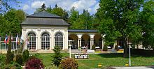
- The 1 Information center


 in the Wikidata database") of the Franconian Forest Nature Park in the former Lichtenberg train station at the valley exit
of the Franconian Forest Nature Park in the former Lichtenberg train station at the valley exit

- The 1 Selbitzmühle at the valley exit at Blechschmidtenhammer
Viewpoints
- The peak of the rock 2 Hirschsprung offers a good view over the valley. On a rock, a few meters below, stands the landmark of Hell Valley, a life-size, jumping deer carved out of wood. According to legend, deer cornered several times tried to save themselves by jumping.
- The lookout point 1 King David is located near the Hirschsprung high above the valley,
- The 19 meter high 3 Wiedeturm with a viewing platform at a height of 5 meters is 549 m above sea level on the Wolfstein. NN and was built in 1903. He is only a few hundred meters away from where there is Rennsteig and the Frankenweg and the Franconian mountain path to meet.
Bridges
- The 4 Jungfernsteg and the 5 Teufelssteg lead over the Selbitz.
railroad
The railway line from Marxgrün to Blankenstein used to run through the Höllental, and that too Höllentalbahn was called. Remains of the railway line can still be seen today.
- Pulpit tunnel
- Railway bridge at the power station
- Kesselfelstunnel
Mining
- Show mine 6 Friedrich Wilhelm Stollen. The only visitor mine in the Franconian Forest Nature Park. The tours last around 90 minutes and sturdy shoes and warm clothing are recommended. The tunnel was started by Alexander von Humboldt in 1793. From 1792 to 1795, Humboldt was commissioned by the Prussian sovereign to get mining in the Franconian Forest and Fichtel Mountains going again.Open: from the end of March to the end of October: on Saturdays, Sundays and public holidays there are guided tours at 11 a.m., 1 p.m. and 3 p.m., during the Bavarian summer holidays also on Tuesdays.Price: Adults pay € 4, schoolchildren € 3.50.

- The Rebecca studs is an abandoned mine tunnel. It was once a part of the Friedensgrubener Ganges which reached from Lichtenberg over the Selbitz and Issigbach valleys to Griesbach. Copper and iron ore were still being dug around 1800. Today the tunnel is no longer accessible, only the entrance area can be seen.
Hydroelectric power plant
- Weir dams the water for the power plant. Leaves, branches and other debris are removed from the water of the Selbitz in the inlet building by two computer systems.
- A fish ladder gives migrating fish the opportunity to overcome the weir step. 80 liters of water per second constantly flow over the stairs.
- On the 1855 meter long, dug Pipeline There is a hiking trail with an inside diameter of 1.7 meters. The pipeline has a gradient of 35 meters from the reservoir to the turbine. The pipeline was first built in 1888 on the steep rocky slope without machines. Today it consists of concrete pipes for a length of 1300 meters and the last meters before the water tower are GRP pipes inserted into the old iron pipes. The flange connections of the iron pipes can still be seen clearly on the hiking trail.
- From Water tower At the end of the pipeline, a pressure line then leads over the Selbitz to the turbines. The main task of the open top water tower is to absorb the large kinetic energy of the water flowing in the pipeline when the turbines are switched off. During this process, the water level in the water tower rises by several meters. This increase reduces the kinetic energy and protects the pipeline from excessive pressure.
- The power plant supplied the Rosenthal paper mill in Blankenstein, Thuringia with electricity from 1933 to 1953. In the power plant there is a small one with 1 cbm per second and a large Francis turbine with 2 cbm per second. They are connected to a generator via a shaft, which converts the kinetic energy into electricity. The maximum power is 900 kW. Today the power plant supplies its electricity to the public grid. Around 3.5 million kilowatt hours are generated per year, which can supply around 1,000 households with electricity.
- On Sundays in warm seasons, with sufficient water flow, there is a 36 m higher for walkers Water fountain. When the sun shines between 3 p.m. and 4 p.m., a rainbow can often be seen.
activities


hike
Around 30 kilometers of hiking trails are marked on the slopes of the Hell Valley.
- The Geology and mining adventure trail is a circular route with a length of 7 kilometers and 13 stations
- Small hike from the place hell off, with almost 8 kilometers and a duration of about 2.5 hours. Exact description of the tour on rearindia.de
- Hike from Blankenstein off, with 11 kilometers and 455 meters of altitude and a duration of about 3 hours. Exact description of the tour on planetoutdoor.de
- The 520 kilometer long Frankenweg starts at Untereichenstein on the Franconian side of the Saale opposite Blankenstein and leads on its first kilometers through the Höllental.
Trails of the Franconian Forest Association in Höllental:
| Path no. | Circular hiking trail | Main starting point | Length in km | description |
|---|---|---|---|---|
| US 11 | Röhrensteig | Blechschmidtenhammer | 7,5 | |
| US 12 | Pulpit Way | Blechschmidtenhammer | 9,0 | |
| US 13 | Rosenthal way | Blechschmidtenhammer | 7,0 | |
| US 14 | Rock path | Blechschmidtenhammer | 5,5 | |
| US 21 | King David circular route | Issigau | 10,5 | |
| US 53 | Drachenfels-Weg | Blechschmidtenhammer | 4,0 | |
| US 54 | Schlossberg-Weg | Blechschmidtenhammer | 5,0 |
To go biking
The Selbitz cycle path leads on the valley road through the Höllental and ends in Blechschmidtenhammer.
Suspension bridge
The longest Suspension bridges the world are stretched across the Hell Valley. Two bridges are being built, the 387-meter-long Lohbachtalbrücke and the 1,030-meter-long Höllentalbrücke. The work should be completed by 2021. If you want to visit the valley in its original state without the tourist crowds, you should hurry up.
kitchen
- 1 Friedrich Wilhelm Stollen Inn, Friedrich-Wilhelm-Stollen 1, 95192 Lichtenberg. Tel.: 49 9288 216.
 Inn with home-style cooking and homemade cakes. The specialty is the homemade apple juice, which you can also take with you. When the weather is nice, the beer garden is open. There are also overnight accommodations.Open: Fri to Tue from 8.30 a.m., mid-January and mid-November are 2 weeks of company holiday.
.JPG/220px-Friedrich-Wilhelm-Stollen_Gasthof_(2).JPG) The inn | .JPG/220px-Friedrich-Wilhelm-Stollen_Gasthof_(1).JPG) The playground |  Ribs with dumplings |

- 2 Blechschmiedenhammer inn and guesthouse, Blechschmidtenhammer 2, 95192 Lichtenberg. Tel.: 49(0)9288 487. Inn with home-style cooking, beer garden with children's playground.
- 3 Hirschsprung Inn, Eichenstein 18, 95188 Issigau, Germany. Tel.: 49 9288 1732. Open: Fri to Mon and Wed 11 am–8pm.
accommodation
- 1 Pension Blechschmiedenhammer, Blechschmidtenhammer 2, 95192 Lichtenberg. Tel.: 49(0)9288 487. Inn with over 100 years of family tradition and 9 guest rooms with shower / toilet and some with TV.Price: single room with breakfast € 33, double room € 60.
- 2 Selbitzmühle, Selbitzmühle 1, 95192 Lichtenberg, Germany. Tel.: 49(0)9288 6516. Apartment with 4 beds.Price: from 33 - 40 €.
- 3 Lichtenberg campsite, Seestrasse 161a Lichtenberg. Tel.: 49 9288 6870. Open: all year round.
Practical advice
The information center is located in the disused Lichtenberg train station near Blechschmidtenhammer.
security
On some hiking trails you need a certain surefootedness. Particular caution is required in the morning, as the dew often makes the treads slippery and of course in winter, when icy paths are to be expected.
trips
Immediately border the Höllental:
- Lichtenberg - towers over the Höllental with its castle
- Blankenstein - on the other side of the Saale in Thuringia
- Issigau
Places in the area are:
- Bad Steben (4 km) - with thermal baths and casino
- Naila (6 km)
- Bad Lobenstein (10 km)
- Mödlareuth (17 km) - Village divided during the Cold War. An open-air museum reminds of the special history.
Besides, they are Hofer Land and the Thuringian Forest not far.
literature
- Fritsch map publisher (Ed.): No. 103 BAD STEBEN - Selbitztal - Döbraberg, scale 1: 35,000. ISBN 978-3-86116-103-5 . Hiking map with tourist information
Web links
- selbitztal.de - a holiday region in the Franconian Forest Nature Park
