 | |
| Yamagata Prefecture | |
| Capital | Yamagata |
|---|---|
| Residents | 1.060.158 (2021) |
| surface | 9,323.34 km² |
| website | www.pref.yamagata.jp/ |
| no tourist info on Wikidata: | |
| location | |
 | |
Yamagata(Japanese: 山形 県, Yamagata-ken) is a prefecture in the region Tōhoku, Japan.
Regions
Yamagata Prefecture is located in the northwest of the island Honshu. In the west that educates Japanese sea the border that are neighboring prefectures Akita, Miyagi, Fukushina and Niigata.
places
- 1 Yamagata(山形), Administrative seat of the prefecture
- 2 Higashine
- 3 Kaminoyama
- 4 Murayama
- 5 Nagai
- 6 Nan’yō
- 7 Obanazawa
- 8 Sagae
- 9 Sakata
- 10 Shinjō
- 11 Tendo
- 12 Tsuruoka
- 13 Yonezawa
Other goals
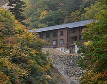
Ubayu hot springs
background
Fruit production plays an important role in the prefecture. She is known for growing apples, pears, grapes and especially cherries.
language
getting there
mobility
Tourist Attractions
activities

Yamagata cherries
kitchen
nightlife
security
climate
trips
literature
Web links
- https://www.pref.yamagata.jp/ (Yes) - Yamagata Prefecture Official Website
