
The Cayo District located in Belize
Regions
This area has always played a key regional role. As early as the early Maya times, the Belize River developed into one of the most important trade routes. Early Mayan metropolises like El Mirador or Tikal found your gateway to the Caribbean here. So it is not surprising that one Maya ruin can be found next to the other on this route. If Cahal bad luck around the birth of Christ or Tipu in the 16th century. Someone was always checking these routes. The Western Highway still runs parallel to this today and connects in this way Guatemala With Belize City. All larger towns can be found here. The country has been ruled from here again since 1961.
There are numerous tributaries around the Belize River that make the land fertile and biodiverse in a tropical atmosphere. In addition to a good livelihood, this is of course the best prerequisite for sustainable ecotourism. But the Cayo District offers even more. Who dares a little in the south will not regret it. The Maya Mountains are located here and the terrain rises to almost 1000 meters. There is plenty of room here for cave systems and waterfalls. Settlements are rarely found here. But that wasn't always the case. Between 300 AD and AD 900 Due to the abundance of wood here deep in the south, a metropolis like the region has never seen it before and since blossomed: Caracol. With 140,000 inhabitants, there has never been a bigger city and the Caana is still the largest building in all of Belize. If you go to the deepest south of the district, you will cross another specialty. The Mountain Pine Ridge Forest Reserve is a huge coniferous forest area, which also has beautiful waterfalls and caves.
places
In the Cayo District are with San Ignacio & Belmopan two important & somewhat larger towns. But even here the little ones can sometimes keep up with tourism.
- Benque Viejo del Carmen - Last place before the border
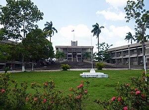
- Belmopan - Capital of Belize
- Bullet Tree Falls - Small jungle village and starting point for expeditions to El Pilar
- San Antonio
- San Ignacio - Central tourist hub and district capital
- Santa Elena - neighboring city of San Ignacio
- Spanish lookout - Mennonite stronghold in the Cayo District
Other goals


National parks, Mayan ruins and caves. If you don't necessarily want to go to the Caribbean, this is perhaps the best place to find what you're looking for in Belize.
Of course there are also Mayan ruins to visit here. Accessible to tourists and recommended are:
- Cahal bad luck - One of the oldest Mayan sites in the region
- Caracol - The largest city that ever existed on the soil of Belize
- El Pilar (Belize) - Here several gardens in the old Mayan style were laid out again
- Pacbitun - Very old Mayan city, best to explore on horseback.
- Pook’s Hill - Mayan site with a lodge
- Xunantunich - The impressive El Castillo can already be seen from the Western Highway and is always a popular postcard motif
Furthermore, Belize can also offer a lot here with pure nature in the form of protected areas:
- Blue Hole National Park - Right on the Hummingbird Highway with a picnic area and cave.
- Five Blues Lake National Park - Beautiful lake in the rainforest that sometimes disappears for reasons that have not yet been clarified.
- Guanacaste National Park - The smallest national park in Belize, good for bird watching
- Mountain Pine Ridge Forest Reserve - There are several waterfalls and caves to be found in this area, which is over 200 square kilometers
- Sibun Forest Reserve - This is where "Mosquito Coast" was filmed with Harrison Ford.
- Tapir Mountain Nature Reserve - Fantastic rain forest reserve with numerous caves
Especially here in the region, the combination of rock and underground rivers has formed one or the other spectacular cave:
- Actun Tunichil Muknal - Probably the most famous cave in Belize with numerous Maya finds
- Che Chem Ha - Discovered by accident with a chamber 75 meters high and 50 meters in diameter
background
The earliest settlements emerged on the Belize River around 1500 BC. Already in the pre-Classical period around the birth of Christ, the first kingdoms emerged here, such as in Cahal bad luck. In the classical period, numerous smaller and larger cities grew up on the Belize River, which were either part of various alliances Tikal or with Calakmul stood. But the one in the Maya Mountains was decisive Caracol into the story that with Calakmul was allied. This defeated the enemy Tikal and ruled the surrounding cities as a regional center for centuries. At the end of the Classical Period (700 to 900 AD), all the big cities here were abandoned in the chaos of war. But also during this time a great dry period seemed to have plagued the people. The offerings up to human sacrifice from this time, which the gods were supposed to send to rain, can still be found in caves like Actun Tunichil Muknal visit. But even after this period, the Belize River remained the decisive trade route, so that after a few years the Maya city of Tipú emerged here. From the 16th century onwards, many attempts at Christianization began, all of which were in vain. During this phase, a small European settlement was formed exactly at this location, but it was originally called El Cayo, as it was like being on an island in the middle of the Maya kingdom. In 1638 a real revolt broke out against the Spaniards, so that they had to leave the region. In 1707 they came back with military support and most of the Maya population was deported to Guatemala by the Spaniards. But the Spaniards shouldn't have much of this area because more and more British lumberjacks settled here. In 1787, San Ignacio was first mentioned on a map. In 1930 the highway from Belize City to San Ignacio was built, and so this region could suddenly be reached in a day trip from the coast. The canoe race "La Ruta Maya" is still a reminder of the times when everything was transported across the Macal River. Today less wood is extracted here because a lot of agriculture has settled. The good connection between Belize City and Guatemala and the multitude of sights in and around San Ignacio lead to a rapid influx of tourists. The infrastructure in San Ignacio (Belize) has now adapted to this. In addition, in 1970 Belmopan the new capital of Belize was created in the middle of the rainforest but protected from hurricanes. This goes back to Hurricane Hattie, which largely destroyed Belize City and left a country without a capital. The founding of this city also brought some political power back to the district.
climate
The climate here is a little more humid than in the classic Yucatan. But the amounts of rain are comparatively low compared to the south. Most of the rain falls in the rainy season between June and November. It is mostly dry between February and May.
| Jan | Feb | March | Apr | May | Jun | Jul | Aug | Sep | Oct | Nov | Dec | |||
|---|---|---|---|---|---|---|---|---|---|---|---|---|---|---|
| Mean highest air temperature in ° C | 28 | 29 | 31 | 33 | 34 | 32 | 32 | 32 | 32 | 31 | 29 | 28 | O | 30.9 |
| Mean lowest air temperature in ° C | 18 | 18 | 19 | 20 | 21 | 22 | 22 | 22 | 22 | 21 | 20 | 19 | O | 20.3 |
| Precipitation in mm | 120 | 80 | 50 | 50 | 80 | 300 | 280 | 220 | 250 | 210 | 200 | 180 | Σ | 2020 |
language
The official language here is English. As a rule, everyone understands and speaks this. But here, too, it is a matter of a multi-cultural society. Therefore, languages such as Spanish or Mopan are often spoken alongside.
getting there
The district's traffic axis is the Western Highway. The central cities are also located here San Ignacio (Belize) and Belmopan. Almost all buses stop here and drive from here to the entire country and Guatemala. There are several landing strips in the Cayo District that can be reached on a charter flight.
mobility
The main means of transport is the car, especially if you want to drive to destinations off the Western and Hummingbird highways, you cannot avoid a car. It should be noted that many roads are more like an off-road slope and should only be driven on with an off-road vehicle.
Everything on the Western and Hummingbird Highway can usually be reached by bus. You can also see a lot of bicycles on these two streets. The Western Highway in particular is very popular with cyclists of all kinds.
The Cayo District is also home to some of the most exciting trekking routes in Belize. For example, ends in Caracol the Maya Divide Trail and that Mountain Pine Ridge Forest Reserve is the starting point of a trekking route into the Sibun Forest Reserve.
Tourist Attractions
- nature - In this district, rainforest and coniferous forest alternate. In the mountains there are waterfalls and caves. A wide ideal field for animal observation.
- Mayan ruins - Here you will find the most spectacular Mayan ruins from the Classical Period in Belize. Near the El Peten The really big metropolises with 100,000 inhabitants and more were found here.
- caves - Numerous caves characterize the district. And these are spectacular. in the Chiquibul National Park the longest cave system can be found in Central America
- water falls - The highest waterfall in Central America can also be found here. But it is by far not the prettiest.
activities
- Nature observation - In this district you can find with the Guanacaste National Park the smallest national park and with the Chiquibul National Park the largest national park in Belize. But that is by far not all that the animal lover leaves nothing to be desired. Many overnight accommodations right in the heart of nature complete the offer
- Discover - Especially the Mayan ruins of the classical period and the numerous caves are particularly impressive here and are looking for their equal worldwide in terms of their mass. Whether Mayan ruins like Caracol and Xunantunich or caves like Actun Tunichil Muknal and the Chiquibul Cave System invite you to discover.
- Swimming - The rivers here in the district have created numerous bathing opportunities in a paradisiacal setting. The best known are e.g. Rio On Pools in the Mountain Pine Ridge Forest Reserve
- boat trip - Of course you can also go canoeing on the rivers. For example, from San Ignacio (Belize) drive along the Macal River.
- hike - Whether the small circular hiking trail through the Guanacaste National Park or the multi-day hike through the Mountain Pine Ridge Forest Reserve followed by a canoe trip through the Sibun Forest Reserve. No wish is left unfulfilled here.
- Cycle - The Western Highway in particular is popular with racing cyclists. But here you will also often meet individual travelers who have made one or two stops on their trekking bike on the way to Guatemala insert.
kitchen
The restaurants are usually simple and only differentiate between fish, chicken or meat, but this does not reduce the quality as a rule. On the contrary, especially in small towns, real delicacies are served here at good prices. Marie Sharp's Habanero Pepper Sauce is not missing on any table in Belize. This extremely hot sauce has eloquent names such as "No Wimps Allowed" (roughly "forbidden for wimps") or "Beware" (caution). In San Ignacio (Belize) there is a little more variety.
nightlife
The nightlife here is rather spartan. Only in San Ignacio (Belize) there are a few options. If you really want to let it rip, you should head to San Pedro (Belize) or Belize City hit.
security
The crime rate is negligibly low, especially in the smaller towns. Nevertheless, when crossing the border and in San Ignacio keep an eye out for tricksters.
There are also crocodiles and poisonous snakes here, so careless handling is certainly not appropriate. But in view of the fact that humans are not on the menu of these animals, careful behavior appropriate to the rainforest and appropriate clothing should guarantee sufficient protection. The "most dangerous" here are almost the mosquitoes, so mosquito repellent should not be dispensed with. Dengue fever, which is occasionally transmitted by mosquitoes, cannot be prevented by vaccination. However, other diseases can be prevented:
- A malaria stand-by preparation should be carried at least in case of an emergency.
- A typhoid vaccination should be carried out beforehand.
- The hepatitis A, B, tetanus and rabies vaccination should be refreshed.
These medical notices have been carefully researched, but they are made no guarantee. A conversation with the person responsible Family doctor or one travel medicine or tropical medicine advice center is recommended in case of health problems or uncertainties. Also note: Note on health issues |